Everest Base Camp Trek 2015
•
0 likes•91 views

Powerpoint presentation of my trek to Everest Base Camp.

Recommended
More Related Content
Similar to Everest Base Camp Trek 2015
Similar to Everest Base Camp Trek 2015 (20)
Recently uploaded
Recently uploaded (20)
Everest Base Camp Trek 2015
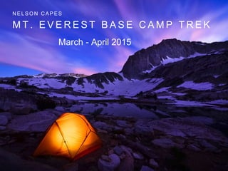
- 1. M T . E V E R E S T B A S E C A M P T R E K N E L S O N C A P E S March - April 2015
- 2. K A T H M A N D U T O L U K L A 2 8 4 0 M E T E R S
- 4. Lukla was about 35 minutes flight time from Kathmandu. Ordinarily, one lands on the runway with a twin-engine Otter or similar short-takeoff-and-landing airplane. The runway is billed as the “most dangerous in the world” because there is a vertical cliff at each end, and the runway slopes up about 15 degrees. Planes land upslope and takeoff downslope. However, with our helicopter we were much safer. The runway at the Lukla airport can be seen in the middle of the next frame just to the right of the magnetic compass on the center strut of the windscreen. The next photo after that is a telephoto of the runway.
- 7. • Landing at Lukla
- 8. L U K L A T O N A M C H E B A Z A A R 3 4 4 0 M E T E R S
- 9. – On March 29, 2015 we left Phakding at 8:00 AM for one of the most difficult days: the hike to Namche Bazar. Namche is the capitol of the Sherpa people. It lies in a bowl on a mountain side at 11,286 feet. Thus we had about 2000 vertical feet to hike, over a distance of 4 km (about 2 miles) as the crow flies. This sounds rather easy, but it is definitely not! The trail is quite rough, with many steps with high (10 to 12 inch) risers. The trail is used both by trekkers and by livestock herders
- 12. • Entrance to Everest National Park
- 13. • Hillary Bridges over Dudh Kosi (“Milk River”)
- 14. • Crossing the bridge
- 15. – After the bridge, we started climbing the “Namche Headwall,” so christened by one of our trekkers. It is a very steep climb with many switchbacks and steps. Near the end of the climb, Lopsang, our sirdar (lead sherpa) offered to carry my backpack, and I was happy to oblige him. I arrived at our hotel in Namche after a total of 8 hours and 45 minutes of hiking from Phakding. When one enters Namche, one passes through an ornate gate and then climbs further up to the center of the town.
- 16. F I R S T V I E W O F E V E R E S T
- 18. • Namche Bazaar
- 22. N A M C H E T O T E N G B O C H E
- 24. • A M A D A B L A M 2 2 , 3 4 9 F T .
- 25. – “Ama Dablam is a mountain in the Himalaya range of eastern Nepal. The main peak is 6,812 metres (22,349 ft), the lower western peak is 6,170 metres (20,243 ft). Ama Dablam means “Mother’s necklace”; the long ridges on each side like the arms of a mother (ama) protecting her child, and the hanging glacier thought of as the dablam, the traditional double- pendant containing pictures of the gods, worn by Sherpa women.[3] For several days, Ama Dablam dominates the eastern sky for anyone trekking to Mount Everest basecamp. Ama Dablam was first climbed on 13 March 1961 by Mike Gill (NZ), Barry Bishop (USA), Mike Ward (UK) and Wally Romanes (NZ) via the Southwest Ridge. They were well-acclimatised to altitude, having wintered over at 5800 metres near the base of the peak as part of the Silver Hut Scientific Expedition of 1960-61, led by Sir Edmund Hillary.[4]”
- 30. E V E R E S T , L H O T S E , N U P T S E
- 31. – Proceeding further along the trail, we came around a bend and suddenly, there was Everest, Nuptse, Lhotse, and Ama Dablam! Everest can just be seen peeking over the ridge of Nuptse, with a cloud of snow blowing off it. The summit of Everest is in the Jet Stream, which causes this plume of snow. Everest is 29,028 feet high. Lhotse is the fourth highest mountain in the world (27,940 feet). The second and third highest mountains are K2 and Kangchenjunga. K2 is in Pakistan, not Nepal.
- 33. T E N G B O C H E 3 8 0 0 M E T E R S
- 36. Our last day in Tengboche was pretty dull, the only “excitement” being my first shower since day 1 at Namche, taken in a cinderblock basement with a cow “mooing” outside; and at night the dogs who sleep all day barking all night. Several people who had “Nepal tummy” since eating cold salami appetizer at Namche were still under the weather.
- 37. T E N G B O C H E T O P H E R I C H E 4 4 4 0 M E T E R S
- 38. – April 3, 2015 saw our team on the trail from Tengboche to Pheriche. The hike began with a very slippery downhill slope into the rhododendron forest. The trail had a thin layer of ice on it, making the going very treacherous. After walking through the rhododendron forest, we descended to the Dudh Kosi again to cross yet another suspension bridge.
- 41. – After that, we headed out on the trail to Pheriche. We arrived in Pheriche in the middle of a blinding snowstorm on a slippery, muddy trail about 2 feet wide over a 500 foot drop. The next picture isn’t mine because there was no way I was going to take a photo under those circumstances.
- 43. – • Pheriche lies at an altitude of almost 14,000 feet. It has a couple of “hotels” and many cheap shanties that one could stay in if you were really monetarily distressed. Our hotel was the Himilaya Hotel. This was by far the most primitive and dirtiest of any tea house so far. My room was even colder than usual, and one of the two toilets was so disgusting that it’s unmentionable. It gets so cold at night that the pipes freeze and the toilet can only be flushed by taking a dipper of water from a nearby barrel. • It was at Pheriche that I first noticed that I was getting bronchitis. There is a high-altitude medical clinic here that services trekkers and climbers with acute mountain sickness (AMS). We had a lecture by one of the doctors with a group of trekkers and climbers from other expeditions. April 4 was a free day in Pheriche. I have to confess that I don’t remember very much about it. By this time, my bronchitis was really getting pretty bad. Apparently, we did an acclimatization hike above Pheriche, because I am in the next photo (blue parka, middle
- 45. P H E R I C H E T O L O B U C H E B A S E C A M P 4 8 1 5 M E T E R S
- 46. – April 5 saw the team hiking from Pheriche to Lobuche. From Pheriche, the trail lies along a very stony valley and streams where it’s quite difficult footing. Then we climbed up a trail ascending high above the valley with views back toward Pheriche.
- 50. – Finally, we reached a ridge where we could look down on the IMG Lobuche Base Camp, well below us at the bottom of a snowslope. You can see a yellow parka on the right of the photo. Lobuche Peak towers above the base camp. Our climbers would use this as a practice climb within a few days.
- 52. – The snowslope was actually a lot steeper than it looks, and very slippery. You can see the trail on the lower ground on the left, with the trail to base camp branching off to the right. I and my fellow trekkers did not have crampons or even mini-spikes, so this was quite treacherous. Fortunately, Lopsang directed each of the Sherpas to take hold of each trekker and guide them down so that they didn’t slip and reach base camp in an unexpected and unpleasant way!
- 53. – After an unnerving plod down this slope, we finally reached Lobuche base camp (about 16,000 feet) where I collapsed into my tent, totally exhausted. My tent is the one with the open flap on the left of the photo. As you can see, the Sherpas had done a great job of clearing away the snow and building tent platforms, but the snow was still 12 to 18 inches deep with a hard crust that you broke through when walking to the dining tent or the toilet tents–that’s right, toilet tents! I had no sooner closed the tent vents to keep out the cold air and crawled into my sleeping bag, then the dinner gong rang. With a groan, I struggled out of the bag and tottered to the dining tent.
- 55. – After dinner in the cold dining tent, I donned my headlamp and walked back to my tent. My “zero degree” sleeping bag beckoned. I slid into it fully clothed and tried to get some sleep. It didn’t work. Cheyne-Stokes respiration is a very frightening experience, and is due to the body not getting enough oxygen. You wake up with a feeling that you have stopped breathing (which is actually the case), resulting in the need to gasp for air. For me, this seemed to happen every couple of minutes all night long. On top of that, my “zero degree” sleeping bag was anything but. I had on just about every piece of clothing and still could not get warm. As if all this wasn’t enough, I had been taking Diamox since Kathmandu in order to try to avoid altitude sickness. One of the side effects of this drug is that it is a diuretic, i.e., it causes you to urinate frequently. Fortunately, I had a pee bottle with me i the tent. If I had had to crawl out of the sleeping bag, put on boots, and stumble to the toilet tent through the snow every hour – well, it would have been even more unpleasant. The result was that I got almost no sleep after a very exhausting day on the trail. I was also suffering from what I thought was severe bronchitis. It apparently was something worse.
- 56. – On the morning of April 6, after an extremely unpleasant night, I decided that I could not face two more nights of Cheyne-Stokes respiration at Lobuche, followed by three nights 1700 feet higher at Everest Base Camp. I had also heard reports about how difficult the trail was, passing through Gorak Shep, a collection of uninsulated concrete block buildings with corrugated steel roofs. This trail is also very treacherous hiking, with round rocks that invite spraining an ankle. To this point, I had had to watch every step, and this, too, adds to the exhaustion. So with great sadness but not reluctance, i asked our trekking company base camp manager to request an evacuation helicopter by satellite phone.
- 58. E V E R E S T B A S E C A M P 5 3 3 4 M E T E R S