The Magic City: Plans for Treasure Island 1939-2014

A review of utopian themes in planning that stood in stark contrast to the harsh economic hardships wrought by the Great Depression. In 1936 and 1937, San Francisco completed two large infrastructure projects: the Golden Gate and Bay Bridges. The public works projects were important economic drivers to a city hard hit by the Great Depression. The bridges' completion were feted with the Pageant of the Pacific -- an optimistic exposition held on man-made Treasure Island symbolizing the City's perseverance over hardship and as conscious occupant of a community of cities along the Asian-Pacific rim. War and military use stood in contrast to the expo's utopian origins until planning for San Francisco's most sustainable neighborhood was publicly introduced in the first part of the 2000s.

Recommended
More Related Content
Similar to The Magic City: Plans for Treasure Island 1939-2014
Similar to The Magic City: Plans for Treasure Island 1939-2014 (20)
Recently uploaded
Recently uploaded (20)
The Magic City: Plans for Treasure Island 1939-2014
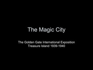
- 1. The Magic City The Golden Gate International Exposition Treasure Island 1939-1940
- 2. “Cities envision themselves. Cities think and dream. In a model of civil polity, cities envision themselves through the dreams and speculations of their individual inhabitants.” -Kevin Starr, Visionary San Francisco
- 3. Metaphors • Boston (Puritan) • New York (Money, Taste) • Savannah (18th c. utopia; benign, rational) • Atlanta, Omaha (depots; railroad cities) • Chicago (crossroad, brawny, industrial) • Los Angeles (city of dreams) • San Francisco (the urban metaphor itself) – “Heroic act of self determination in defiance of topography and distance from other urban centers”
- 20. The Golden Gate International Exposition
- 21. Bay Bridge under construction at Yerba Buena Island in 1935
- 22. The Key System operated on the lower deck of the Bay Bridge, which provided an East Bay rail link to San Francisco’s Transbay Terminal
- 23. Federal, State, Local Participation • Federal • State • Local • New Deal, WPA • Tidelands Legislation • Advisory Planning Committee; PUC
- 24. Site Selection • Golden Gate Park – Beautiful setting, landscaping and programming challenges, potential environmental damage eliminated from serious consideration • China Basin, Candle Stick Point – Available land, rail and auto accessibility, but aesthetics of industrial area raised serious doubts • Lake Merced – Auto accessibility, grading and filling for building sites was a constraint, fog and weather were seen as detriments to visitor mood, site bore no relation to bridges.
- 25. Yerba Buena Shoals • 735 acres of shallow bay area north of Yerba Buena Island • 1 ¾ miles from the Ferry Building and ¾ mile from Key System mole on EBay side • Unusual setting, climatic conditions, sight lines, accessibility by bus, train, ferry and automobile • Reuse of Treasure Island as a future airport all factored into decision to create the Island
- 26. Atlantis Rises
- 27. Construction • Army Corps of Engineers dredged materials (3mill yd3/mo) from Bay over 18 mo period to raise an island from a depth of -2 to -26ft below sea level to 13 feet above mean low water. • 5,520 ft long x 3,400 ft wide (400acres) • Soil desalinization to allow for future vegetation • Water pipes under the lower deck of Bay Bridge supplied fresh water to Treasure Island • $18,937,000 construction budget (1936); $281million (est 2008)
- 28. Pageant of the Pacific
- 29. Expo Design Framework • Over a million square feet of exposition space • Modern design idiom with mingling of Oriental, Cambodian and Mayan styles • Prefabricated building construction, assembled onsite • No single focal point in expo grounds, area laid out with treelined avenues & streets, subdivided into blocks just as a “city of ideal, advanced planning” • Buildings were 65-85 feet tall and sited to take advantage of natural light and block winds
- 30. Attractions • Portals of the Pacific • Tower of the Sun • Cavalcade of the Golden West • International Pavilion • Hall of Western States • California Counties Pavilion • Avenue of the Palms • Lake of Nations
- 33. Themes The exposition celebrated the ascendancy of California and San Francisco as economic, political and cultural forces in the increasingly important Pacific region. • Magic, Atlantis – Lighting • The Helping Hand of Uncle Sam • Unity – Pan American Unity (Diego Rivera mural) • Peace – “The Peacemakers” diorama (Bruton) • Religious Tolerance • Man vs Nature – Conquering the West by water, Conquering the West by land
- 39. • Expo had a two year run, extended the second year to raise additional revenues • 17 million visitors • Not a financial success • Treasure Island was transferred to the Navy shortly after the exposition closed and used as a naval station
- 43. “We’re always looking to build the ideal city, but tussling with messiness along the way.” -Charles Fracchia, SF Museum & Historical Society
- 53. Thank you.
Editor's Notes
- SF was an unlikely place to establish a city and its founding and growth was guided by early visionaries. The natural setting was at the time a wind-swept, treeless peninsula. Jasper O’Farrell laid out SF’s grid as we know it today in 1847 when SF was a US territory, known as Yerba Buena. SF was still a frontier town when it set aside Golden Gate Park. The Palace Hotel was constructed before its hundreds of rooms could be filled. Surveys for water resources were conducted 50 years before construction could commence. Oakland would have been a more logical location for the US’s only urban hold on the Pacific Rim given that it was the terminus of the Transcontinental Railroad and the fulfillment of Manifest Destiny. The idea of linking the E Bay by bridge was promoted by the City’s homegrown Emperor Norton already in the 1870s.
- Now, the focus of this discussion is on the development of Treasure Island in the late 1930s. But, more generally, it is important to understand a little bit of the larger context.
- The Gilded Ages ends and the Great Depression becomes the new economic reality. When FDR was inaugurated president in 1933, unemployment was about 25%. The image is by Miguel Covarrubias, an artist who painted many of the murals and dioramas at the exposition.
- The famous photo of Dust Bowl migrants by Dorothea Lang. The Dust Bowl was an ecological dystopia that ravaged the American and Canadian prairies from 1930 to 1936. The ensuing exodus was the largest migration in US history within a short period of time. By 1940, 2.5 million people had moved out of the Plains states; of those 200,000 settled in California….The following images were taken by government-sponsored photographers who were hired as part of a Works Progress Administration program to document the living conditions around the country at the time. Most of the following images were taken on Kodachrome Film, which was the first commercially produced color film available in the late 1930s.
- New York was undeniably the American metropolis. It had served early on as the gateway to America, with Ellis Island the primary point of entry for immigrants from all over the world.
- This is an image of the Capitol Building in Washington DC, symbolic of the extensive and comprehensive role the government began to play in the lives of Americans as part of the New Deal.
- However, DC was still very much a Southern city, especially for African Americans.
- Chicago was the country’s transportation, food, and manufacturing center
- New Orleans was the largest city in the South - not Atlanta
- Jim Crow laws were a fact of life for residents of the Ninth Ward
- San Francisco had been eclipsed by Los Angeles in size, but it remained the most important port and financial center on the West Coast
- Nearly half of all Americans still lived on farms and in small towns.
- The Farmall Tractor had revolutionized farming, but mechanization remained limited. Additionally, nearly 90 percent of urban dwellers had electricity by the 1930s, only ten percent of rural dwellers did. The Roosevelt Administration established the Rural Electric Administration that was based on the notion that affordable electricity would improve the standard of living and the economic competitiveness of the family farm and act to slow urban migration.
- By this time Industrialization had matured. The Machine Age was upon the US and the industrialized world. Fordism and Taylorism allowed for mass-produced products to newly established consumer markets. Steam power gave way to coal power and increasingly the country’s electric grid was built out.
- However, industrial progress did not necessarily equate to social progress or a betterment of living conditions for America’s workers. This is an image of mining families in Pennsylvania and the decrepit company housing they inhabited.
- In the 1930s commercial aviation took flight. Pan Am was the first commercial airliner to establish international mail and passenger services to the Caribbean and South America on flying boats or “Clipper Ships.”
- And on the cusp of modernity, Americans still clung nostalgically to rural myths -- not the reality of the poverty that most rural Americans endured during the Depression. In 1939 they saw it all in color for the very first time. Amidst simultaneous progress and economic crisis, new inventions and social and labor tensions, the magical city of OZ was still somewhere beyond the yellow brick road.
- The Golden Gate International Exposition was intended to celebrate the completion of the Bay and Golden Gate Bridges. While bridges were envisioned across the bay already as early as the 19th century, the fever of bridge-mindedness swept the city in the 1920s as the automobile began to play an increasingly important role in city building. Bridges were synonymous with future growth and prosperity; their construction was driven by local boosterism to compete with Southern California; they were viewed as an end to SF’s isolationism by providing connectivity to a growing regional metropolis; and they represented a progress and victory over economic difficulty of the Depression.
- The Bay Bridge was designed by Charles H Purcell. Construction began in 1933 and the bridge opened in on November 12, 1936. The construction was unprecedented for the time – foundations were laid in bedrock 200 feet below the bay surface, the span was the longest in the world. A year later, in 1937, the Golden Gate Bridge opened.
- Today, the Bay Bridge carries some 270,000 vehicles a day. At the time, two rail tracks were built on the south side of the lower deck for electric commuter trains of the Southern Pacific, Key System and Sacramento railroad, though train service did not begin until late 1938. Rail serviced ended in the spring of 1958. In retrospect, the past may hold the solution to the area’s current mobility problems. According to a 2006 Texas Institute of Transportation study, California has five of its cities or regions on the top 12 list of US places that have the worst traffic congestion. Annual traffic delay per driver is 47hrs per year. Delays account for an estimated waste of 2.3 billion gallons of fuel annually and an opportunity cost of lost economic output and productivity.
- Note the two airplane hangers on the south edge of the island
- Diego Rivera’s PanAmerican Unity Mural
- Covarrubias mural depicting the distribution of the world’s flora and fauna
- The Statue PACIFICA representing unity of the Pacific Peoples
- The 400-ft-tall Tower of the Sun. Crowning the tower was a phoenix representing SF’s resiliency and rebuilding after the 1906 earthquake
- Arch of Triumph and Reflection Pond
- Japanese Americans attending the Expo, illustrative of the Expo’s international flavor and theme of Pacific Unity
- The dream of Peace and Unity was quashed when Japan attacked Pearl Harbor on December 7, 1941 which catapulted America into World War II. This dystopian image of an annihilated Hiroshima, decimated by an atomic bomb, stands in stark contrast to the utopian vision promoted at the Magic City.
- Treasure Island today.