1. Sussex
Collina
Pascobac
Apohaqui
Riverbank
Searsville
Roachville
Lower
Cove
Wards
Creek
Drurys
Cove
Parleeville
Ryan
Corner
Berwick
McGregor
Brook
Belleisle
Creek
Upper
Belleisle
Case
Settlement
Mount
Middleton
Irish
Settlement
Lower
Millstream
Mercer
Settlement
Mud
Lake
M
illB
rook
PascobacB
rook
Bell
Brook
M
cNair B rook
Shar pe Bro
ok
RouseB
ro
ok
Henderson
B
ro ok
Lester Brook
D
uncanBrook
DobsonBrook
McGregor Brook
SharpeBrook
Millstream
River
IrishSettlementBrook
Kennebecasis River
SmithsCreek
McGregorBr
ook
Kenne becasis River
Trout C re ek
WardsCreek
MusquashBrook
Kennebecasis River
M
illstream
River
PascobacBrook
SnyderBrook
Route
870
Sunset
Road
ManitobaRoad
Douglas
Road
Anderson
Road
Albert
Road
Lester Road
SharpsMillRoad
Morgan
Road
SearsRoad
Wheeler Rd.
IrishSettlementRoad
M
cAuley
Raod
Route890
HarmerRoad
LowerCoveStreet
Foley Road
ErbSettlementRoa
DruryCoveRoad
BustardRoad
McGregorRoad
FitzgeraldRoad
HazelHillRoad
Old Drury Cove Road
FennellRoad
MarbleRoad
Sharps
Lane
ShortcutRoad
Milk Boa
rd
RoadDairyDaleRo
ad
Creighton
Drive
BridgeSt.
George S t.
Lynlee
R
oad
W
ardsCreekRoad
Marshall Hill Road
Route880
Route121
St George St.
Oneill Road
QuirkRoad
Belleisle
Road
Marven Road
Route 875
Creek Road
Riverview East Road
McGregor
Road
MountMiddletonRoad
Mount Middleton
Road
Route880
Route
10
WilliamsRoad
ValleyviewRoad
Farmview Road
Route 875
ScotchSettlementRoad
Oneill Road
Meadow Lane
Leonard
Road
FowlerRoad
Route875
AitonRoad
Watson Road
CumberlandRoad
SnyderRoad
Main Street
McLe
odRoad
W ilson Roa
d
R
iv
ervi
ew
EastRoad
Appartment Road
Roachville Road
Roachville
Road
Main Street
Jones
Memorial
Park Road
EvergreenRoad
Monahan
Road
R
oute 870
WardsCreekRoad
Arnold
Road
Everett
Road
Wildwood
Road
Martin Rd.
Joanne Rd.
Myles Ave.Kevin Rd.
Myles Crt
Route880
Morrow
Road
PearsonvilleRoad
Route87
0
Collina Road
Carsonville Road
Parlee
ville
Ro
ad
To w n o f S u s s e xTo w n o f S u s s e x
StudholmParish
StudholmParish
S p r i n g f i e l d
P a r i s h
S p r i n g f i e l d
P a r i s h
VillageofNorton
VillageofNorton
S t u d h
o l m
P
a r i s h
S t u d h o l m
P
a r i s h
S
u
s s e x
P a r i s h
S
u
s s e x
P a r i s h
S t u d h o l m
P a r i s h
S t u d h o l m
P a r i s h
1
4
3
6
5
8
2
21
20
19
12
22
9
7
18
13
16
17
11
14
10
15
23
27
24
25
26
28
295
132
131
129
125
293
294
130
126
124
29
128
127
30
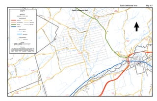
Lower Millstream Area Map A-3
Legend
1:50,000
0 1 20.5
Km
These Maps were computer-generated by Gerald Legacy and
are based upon three separate land grant maps- Maps#129, 130
and 140 which are available for Viewing at the Land Registry
Office, Service New Brunswick, Hampton NB.
Sources:
Collector
On/Off Ramp
Arterial Railroad
Highway
Municipal
Local
Road Network
Parish Limits
Boundaries
Land Settlement
Land Grant200
Hydro Features
Waterbody
Rivers
Land Settlement Map
Trinity
Anglican
Church
Madras
Institution