2. sibelius-mongolia.org www.facebook.com/SIBELIUs
eOsphere in Mongolia
eOsphere first came to work in Mongolia in 2007
In 2007 Dominic Flach installed the satellite ground
receiving station which you can see on the roof of the
NAMEM building
We hope we will work together for many more years
eOsphere кампани нь анх 2007 онд Монголд
ажиллахаар ирсэн
2007 онд Доминик Флах нь хиймэл дагуулын
газрын хүлээн авах станцыг суурилуулсан бөгөөд
үүнийг ЦУОШГ-ын барилгын дээвэр дээрээс харж
болно
Бид олон жилийн турш хамт ажиллана гэж найдаж
байна
3. sibelius-mongolia.org www.facebook.com/SIBELIUs
SIBELIUs overview
СИБЭЛИУс-н тойм
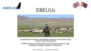
The SIBELIUs project began in 2018 and is supported
by the UK Space Agency
The aim of the SIBELIUs project is to work in
partnership with Mongolian institutions to help build
greater resilience for herding communities using
satellite earth observation
SIBELIUs төсөл нь 2018 онд эхэлсэн бөгөөд Их
Британийн сансрын агентлагийн дэмжлэгтэйгээр
хэрэгжиж байна
SIBELIU-ийн төслийн зорилго нь хиймэл дагуулын
ажиглалтын мэдээллийг ашиглан малчны
нийгэмлэгт илүү тэсвэртэй байдлыг бий болгоход
туслах зорилгоор Монголын байгууллагуудтай
хамтран ажиллах явдал юм
https://www.spacefordevelopment.org/
4. sibelius-mongolia.org www.facebook.com/SIBELIUs
The Mongolian Data Cube
Монголын Дата Куб
The Mongolian Data Cube is at the heart of the SIBELIUs processing system
The Mongolian Data Cube is an efficient way of storing large volumes of data so that it
can be accessed easily by users
Open Data Cubes were originally pioneered by Digital Earth Australia in 2013, with the
Australian Data Cube.
Recent years have seen several Data Cubes deployed in many countries worldwide
When it is safe to travel again, we will bring the Mongolian Data Cube to IRIMHE,
NAMEM
СИБЭЛИУс-г боловсруулах системийн гол цөм нь Монгол Дата Куб/Өгөгдлийн Шоо
юм
Монгол Дата Куб/Өгөгдлийн Шоо нь их хэмжээний өгөгдлийг хадгалах үр дүнтэй
арга бөгөөд ингэснээр хэрэглэгчид хялбархан нэвтрэх боломжтой болно
Нээлттэй өгөгдлийн шоог анх 2013 онд Тоон Дэлхий Австрали болон Австралийн
Дата Куб-н хамт анх үүсгэн байгуулж байжээ
Сүүлийн жилүүдэд олон улс оронд хэд хэдэн Дата Куб байрлуулсан байна
Айлчилж очиход аюулгүй бол бид Монголын дата кубыг ЦУОШГ-ийн УЦУОСМХ-д
авчрах болно
5. sibelius-mongolia.org www.facebook.com/SIBELIUs
The Satellites
Хиймэл дагуулууд
Historical and current
Satellites:
▪ Sentinel-2, Landsat-8 (five years)
▪ MODIS & VIIRS (10 years)
Түүх болон одоо
Хиймэл дагуулууд:
▪ Sentinel-2, Landsat-8 (5 жил)
▪ MODIS & VIIRS (10 жил) Landsat 8
Sentinel 2 MODIS
VIIRS
6. sibelius-mongolia.org www.facebook.com/SIBELIUs
The Visualisation Website
Визуал вэбсайт
The Visualisation Website provides a simple way to
access useful information and products in the
Mongolian Data Cube
Anyone can access the Website
It is available in English and Mongolian
Дүрсжүүлэлтийн вэбсайт нь Монгол дата куб
дотор хэрэгтэй мэдээлэл, бүтээгдэхүүнийг олж
авах энгийн аргыг санал болгодог
Хүн бүр вэбсайтад нэвтрэх боломжтой
Англи, монгол хэл дээр ашиглах боломжтой
7. sibelius-mongolia.org www.facebook.com/SIBELIUs
Government and other Institutions
Засгийн газар болон бусад байгууллагууд
MOFALI Mongolian Reinsurance
Inter Aimag Otor Reserve Group
WWF Land Management Agency
We hope the Mongolian Data Cube
and the Visualisation Website will
allow government institutions to
access information from satellite data
more easily
Монгол Дата Куб, Дүрсжүүлэх
вэбсайт нь засгийн газрын
байгууллагуудад хиймэл дагуулын
өгөгдлөөс мэдээлэл авах боломжийг
илүү хялбар болгоно гэж бид
найдаж байна
8. sibelius-mongolia.org www.facebook.com/SIBELIUs
Local officials in the countryside
Хөдөө орон нутаг дах албан тушаалтнууд
We hope the Mongolian Data Cube and the Visualisation
Website will allow local officials in the countryside to access
information from satellite data more easily
With better information about local conditions it will be
possible to make better livestock management decisions
It will be possible to see earlier if dzud conditions are
developing
Монгол Дата Куб болон Дүрсжүүлэх вэбсайт нь хөдөө
орон нутгийн албан тушаалтнуудад хиймэл дагуулын
мэдээнээс мэдээллийг илүү хялбархан авах боломжийг
олгоно гэж найдаж байна
Орон нутгийн нөхцөл байдлын талаар илүү сайн
мэдээлэлтэй болсноор малын менежментэд илүү сайн
шийдвэр гаргах боломжтой болно
Зудын нөхцөл байдал үүсч байгаа эсэхийг эрт илрүүлэх
боломжтой болно
9. sibelius-mongolia.org www.facebook.com/SIBELIUs
Getting satellite derived products on TV
• NAMEM staff are
regularly showing
SIBELIUs satellite
derived environmental
products on TV
• Mongolian National
Broadcast (MNB)
• Particularly about
pasture and snow,
derived from satellite
data
10. sibelius-mongolia.org www.facebook.com/SIBELIUs
This photograph was taken from
Batbuyan Batjav’s drone in the
Kherlenbayan Ulaan bag in the
Delgerkhaan soum in the Khentii
aimag and shows a small
settlement consisting of two gers
and associated shelters
Drone photograph
Date taken: 17/10/2018
Lat: 44.3430
Lon: 56.5039
Altitude: 1,214 metres
Question: can we see these
structures using satellite data?
Spatial resolution
11. sibelius-mongolia.org www.facebook.com/SIBELIUs
Question: Can we see these structures using satellite data?
Answer: Yes we can.
17/10/2018, Lat: 45.6528, Lon: 48.5884, Altitude: 1,410.85m
Acquired: 17/10/2018, 03:47:29 UTC
Batbuyan Batjav’s drone photograph
1,214 metres
Sentinel-2 satellite RGB composite image
786 km
• The 2 white dots are the
gers
• The darker regions are the
shelters and their
surrounding areas
• The drone position is
indicated by the yellow pin
13. sibelius-mongolia.org www.facebook.com/SIBELIUs
Could satellite data be useful for your
work or research?
• We have focussed on serving stakeholders supporting the herding
community
• But, there are many other applications in Mongolia where satellite
derived environmental information could be useful
• Please let us know if you have any thoughts
▪ Climate
▪ Conservation
▪ Urban
14. sibelius-mongolia.org www.facebook.com/SIBELIUs
Climate change in Mongolia
• Climate change is a driving factor of dzuds
• More frequent drought periods,
punctuated by concentrated bursts of
heavy rain, plus winter storms and extreme
temperatures
• Before 2000, there were approximately 20
extreme events per year, but since 2000,
this number has doubled to 40 events per
year
• Since 1940, the average yearly temperature
in Mongolia has increased by at ~ 1.8°C
▪ Reducing pasture biomass
▪ (Plus livestock numbers have increased)
• The Gobi desert is predicted to expand
northwards at approximately 6–7 km / year
Temperature anomalies for frost
days over Mongolia
Temperature anomalies for
summer days over Mongolia
Source https://doi.org/10.1016/j.wace.2014.11.003
15. sibelius-mongolia.org www.facebook.com/SIBELIUs
Supporting conservation work for the
endangered Mongolian saiga antelope
• We provided WWF with information
about pasture conditions, derived from
satellite data, in a range of sites where
they plan to try to reintroduce saiga
populations
Light green areas show the regions where the Mongolian saiga antelope is currently
living. The dark green areas indicate the regions being evaluated to assess their
suitability for saiga reintroduction