

Recommended
More Related Content
What's hot
What's hot (20)
Similar to 0 gi sday2017-opening_20171115
Similar to 0 gi sday2017-opening_20171115 (13)
More from GeoMedeelel
More from GeoMedeelel (20)
0 gi sday2017-opening_20171115
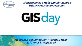
- 1. Мэдээлэл Технологийн Үндэсний Парк 2017 оны 11 сарын 15 Монголын гео-мэдээллийн холбоо http://www.geomedeelel.mn
- 2. Холбооны бүтэц УДИРДАХ ЗӨВЛӨЛ /9/ ГҮЙЦЭТГЭХ АЛБА /2/ Гүйцэтгэх захирал Нарийн бичгийн дарга Гишүүд ХЯНАЛТЫН ЗӨВЛӨЛ /3/ Ажлын хэсгүүд Эскпертийн зөвлөл*
- 3. АЖЛЫН ХЭСГҮҮД Фотограметр ба зайнаас тандан судлал • Б.Баяртунгалаг (ШУТИС) • Н.Элбэгжаргал (УЦУОШГ) Газарзүй мэдээллийн систем • Э.Баярмаа (ШУТИС-ГУУИС) Байршил тогтоогч хиймэл дагуулын систем, хэмжил зүй, зураглал • Ж.Сэргээхдэмбэрэл (Бэйспоинт ХХК) • Д.Эрдэнэзул (Геофизикийн судалгааны төв)
- 4. ҮЙЛ АЖИЛЛАГААСалбарынхөгжүүлэлт Мэдлэг түгээх Гео-семинар Geoseminar Гео-уулзалт Geomeeting ГМС-ийн өдөр GISday Гео-сургалт Geotraining Гео-чуулган Geoforum
- 5. ГАДААД ХАРИЛЦАА,ХАМТЫН АЖИЛЛАГАА Америк АНЭУ МОНГОЛ Тайвань БНХАУ Өмнөд Солонгос Филиппин Чех Финлянд Энэтхэг Австрали
- 6. БҮТЭЭЛҮҮД A. 2015: L. Zolzaya, D. Oyuntsetseg, J. Alimaa and L. Ochirkhuyag. Modeling of Terminology Database in Field of Geodesy and Geographic Information System, Proceedings of FOSS4G 2015 Conference, September 14-19, 2015, Seoul, Korea. B. 2016: Nasanbat, Elbegjargal. and Lkhamjav, Ochirkhuyag. Wildfire Risk Map in The Eastern Steppe of Mongolia using Spatial Multi-criteria Analysis, Int. Arch. Photogramm. Remote Sens. Spatial Inf. Sci., XLI-B1, 469-473, doi:10.5194/isprs-archives- XLI-B1- 469-2016, 2016. A. 2016: A.Tungalag, R. Tsolmon, L. Ochirkhuyag, and J. Oyunjargal. Using Satellite Data for Environmental Impact Analysis in Economic Growth: The Case of Mongolia, Int. Arch. Photogramm. Remote Sens. Spatial Inf. Sci., XLI-B8, 805-811, doi:10.5194/isprs- archives-XLI- B8-805- 2016, 2016. B. 2017: Nandin-Erdene Geserbaatar, Elbegjargal Nasanbat and Ochirkhuyag Lkhamjav. THE IMPACT OF FOREST FIRE ON FOREST COVER TYPES IN MONGOLIA – submitted, waiting
- 7. ХАМТРАГЧ БАЙГУУЛЛАГУУД PieSAT LLC, PRC МОНГОЛ УЛСЫН ИХ СУРГУУЛЬ
- 8. Холбоо барих Цахим хуудаснууд: http://www.geomedeelel.mn http://groups.google.com/group/geo-meeting Социал хуудас: https://www.facebook.com/geomedeelel/ https://twitter.com/GeoMedeelel /@GeoMedeelel/ Эсвэл Цахим шуудангууд: info@geomedeelel.mn, chair@geomedeelel.mn, mongeoinfo@gmail.com geo-meeting@googlegroups.com
- 11. Дэмжигч байгууллагууд Хамтран зохион байгуулагчид
- 12. БАЯРЛАЛАА
Editor's Notes
- Esri Corporate Template-Light v3 16:9 version – October 7, 2014 See http://arczone/resources/presentations.cfm for sample slides and icons