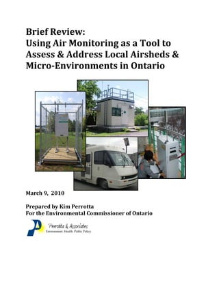
SlideShare a Scribd company logo
1 of 66
Download to read offline
Brief Review:
Using Air Monitoring as a Tool to
Assess & Address Local Airsheds &
Micro-Environments in Ontario
March 9, 2010
Prepared by Kim Perrotta
For the Environmental Commissioner of Ontario
Page 2
Executive Summary
This report examines when, where and how air monitoring is currently being used in Ontario as a
tool to assess and address local airsheds and/or micro-environments, and when, where and how it
could or should be used as a tool to assess air quality impacts and protect human health. This
report is based largely on key informant interviews conducted with:
Staff in the in the Air Monitoring & Reporting Section of the Ontario Ministry of the
Environment (MOE);
Staff in the MOE regional offices that conducted the Clarkson Airshed Study and the
Hamilton Road Dust Study;
Staff in the three Ontario municipalities that are assessing their local airsheds with
airshed modelling and monitoring tools;
Participants in industry-led and partnership-led air monitoring projects; and
Staff in six public health units that are active on air quality issues about when, where and
how air monitoring can or should be used as a tool to assess and address air quality in
local airsheds and/or micro-environments.
Among public health units and municipalities that are active on air quality issues, there is a great
deal of interest in understanding how air quality varies across a local community. While they see
a great deal of value in air monitoring as a tool for assessing local airsheds and micro-
environments, they see it as an expensive tool that must be used in a complementary way with air
modelling tools. They would however, like to see air monitoring used to:
Validate and calibrate air modelling tools that can be used to assess various policies and
decisions related to land use planning and transportation planning;
Inform and support specific land use and transportation planning policies;
Assess land use planning applications such as those related to the placement of daycare
facilities or schools relative to commercial operations such as trucking depots;
Measure background air levels to be used to evaluate the cumulative air quality impacts
associated with proposed projects and facilities;
Confirm air levels predicted with air modelling for proposed projects or facilities after
projects are completed and/or facilities are operating; and
Page 3
Inform purchasing policies within municipalities.
The public health units and municipalities interviewed did not envision a network of many air
monitors sited in multiple locations for long periods in their communities. Rather, with a few
exceptions, they envisioned air monitoring equipment being used for limited periods to inform
processes related to certificates of approval, environmental assessments, land use planning
decisions, municipal purchasing policies, and policy development.
There is no consensus among the parties interviewed about who should be responsible for air
monitoring that is directed at local airsheds as a whole or at micro-environments that are not
related to point sources. As a rule, the MOE does not get involved in the assessment of local
airsheds in a comprehensive way because the MOE does not see itself having regulatory
authority or jurisdiction for many of the emission sources within a community. On the other
hand, as a rule, staff within public health units and municipalities do not see themselves having
the expertise or the resources to undertake assessments of their local airsheds. In addition, many
do not feel that this is the responsibility of local governments. A number believe that this is the
responsibility of the Province as the government body that has responsibility for compliance
with Canada Wide Standards and the expertise, resources and authority to act on air quality.
All of the public health staff interviewed indicated that they thought that the MOE should be
taking a greater role in this type of work because of its technical expertise and resources. From
comments offered, it appears that the Province may need to recognize that: the MOE air quality
expertise is needed to assess and address air quality in a cumulative way; and the MOE needs to
move beyond its focus on point source to include mobile and area sources as well as point
sources. Judging by the comments of staff within public health units, and by the studies that are
being directed at local airsheds and micro-environments by those interviewed, emissions
associated with vehicles and traffic corridors are considered a very high priority.
When it comes to the urban airshed, there appears to be a trinity of interests and expertise that
need to be united on this issue: public health departments have responsibility for protecting the
health of citizens within their communities; planning departments within regional and local
municipalities have responsibility for long-range and current planning decisions within their
jurisdictions; and the MOE has expertise in the assessment and management of air quality issues,
legislative authority for air quality issues related to point sources, and legislative authority for the
environmental assessment processes that are applied to major projects including those applied to
the transportation sector.
Page 4
It is recommended that the MOE:
1. Provide technical support and financial resources to public health departments and/or
municipalities that are seeking to assess air quality across their airsheds to inform land
use and transportation planning processes giving priority to those municipalities that:
a. Are expected to grow rapidly over the next 20 years;
b. Have, or are expected to achieve, high population densities; and
c. Have stressed airsheds because of transboundary air pollution and/or local emission
sources.
2. Work with public health units and/or municipalities to identify, coordinate, and conduct
air monitoring studies that assess micro-environments of common concern, such as
traffic corridors, for the purpose of informing land use and transportation planning
decisions and policy development at both a provincial and local level.
3. Provide technical support and resources to those public health units and/or
municipalities that are doing air monitoring and/or air modelling studies to assess
micro-environments that are of common concern to public health units and/or
municipalities.
4. Actively work with public health units and/or municipalities to build an understanding
of the air monitoring and modelling tools, technologies, and strategies that can be used
to assess local airsheds and micro-environments, along with their strengths, limitations,
and applications.
5. Conduct research on policies and protocols that can be used to address both regional and
local air quality issues through the land use and transportation planning processes that
are conducted by local, regional and provincial levels of government.
Page 5
Table of Contents
Executive Summary P. 2
Table of Contents P. 5
Glossary of Terms P. 6
I Introduction P. 7
.
II Province’s Role in Air Monitoring P. 9
A Air Monitoring & Reporting Section
B Regional Offices
III Ministry-Led Local Air Monitoring Projects P.14
A Clarkson Airshed Study
B Hamilton Road Dust Study
IV Municipality-Led Local Air Monitoring Programs/Projects P.19
A City of Toronto – Toronto Environmental Office (TEO)
B Halton Region -- Health Department
C City of Ottawa – Community and Sustainability Services
V Industry-Led Local Air Monitoring Programs/Projects P.36
A Hamilton Air Monitoring Network (HAMN)
VI Partnership-Led Local Air Monitoring Programs/Project P.38
A Sudbury Soils Study
B Hamilton Mobile Monitoring Study
VII Public Health Perspective - Air Monitoring as an
Assessment Tool for Local Airsheds P.43
A Halton Region Health Department
B Peel Health
C Sudbury & District Health Unit
D Toronto Public Health
E Region of Waterloo Public Health
F York Region Public Health Branch
VIII Discussion & Recommendations P.58
References P.63
Page 6
Glossary of Terms
CalEPA California Environmental Protection Agency
CARB California Air Resources Board
CO Carbon monoxide
EMRB Environmental Monitoring & Reporting
EPA Environmental Protection Agency
GTA Greater Toronto Area
HAMN Hamilton Air Monitoring Network
LIDAR Light Detection and Ranging
PHUs Public health units
MOE Ontario Ministry of the Environment
MHLTC Ontario Ministry of Health and Long-Term Care
NCR National Capital Region
NAPS National Air Pollutant Surveillance
NPRI National Pollutant Release Inventory
NRCan Natural Resources Canada
NOx Nitrogen oxides
NO2 Nitrogen dioxide
NO Nitrogen oxide
OAHPP Ontario Agency for Health Protection and Promotion
PM10 Coarse particulate matter
PM2.5 Fine particulate matter
SO2 Sulphur dioxide
TAGA Trace Atmospheric Gas Analyzer
TEO Toronto Environmental Office
TPH Toronto Public Health
TSP Total Suspended Particulates
TRS Total Reduced Sulphur
VOCs Volatile Organic Compounds
Common Air Pollutants The term used in the public health sector to describe the five air
pollutants that have been associated with adverse health effects at
elevated levels; includes ozone, PM2.5, NO2, SO2, and CO. PM10
may be included in this list as well.
Criteria Air Pollutants The six air pollutants commonly monitored by the MOE at its AQI
air monitoring stations; includes ozone, PM2.5, NO2, SO2, CO and
TRS. PM10 used to be included in this list.
Page 7
I Introduction
Background
Air pollution in Ontario is responsible for a significant burden of illness and death. In 2004,
researchers from Health Canada and Environment Canada estimated that the five common air
pollutants contribute to approximately 2,900 non-traumatic deaths each year in four Ontario
Cities – Windsor, Hamilton, Toronto, and Ottawa. They attributed one third of those deaths to
acute health impacts associated with the mix of air pollutants and two thirds to the chronic health
impacts associated with fine particulate matter (PM2.5) alone. They concluded that air pollution
in Ontario cities is responsible for between 7% and 10% of all non-traumatic deaths (Judek,
2004).
In June 2005, the Ontario Medical Association estimated that air pollution in Ontario contributes
to approximately 5,900 non-traumatic deaths, 16,800 hospital admissions, and 59,700 emergency
room visits each year (OMA, 2005). While studies clearly demonstrate that everyone can be
adversely affected by air pollution, they also demonstrate that children, the elderly, and those
with pre-existing health conditions such as heart conditions, asthma, and diabetes are particularly
sensitive to air pollution (OMA, 2005; WHO-Europe, 2004; CARB, 2004; WHO-Europe, 2005).
While Air Quality Index (AQI) readings provide an indicator of air quality for the community as
a whole, they do not reflect the range of air levels that can occur across a community because of
the cumulative impacts of local emission sources, transboundary emission sources, and
background air levels. Air monitoring studies directed at linear or mobile sources such as traffic
corridors, point sources such as industrial facilities, and area sources such as train stations,
indicate that air quality can vary substantially across a community in response to local emission
sources (CARB, 2005).
Health studies directed at high volume traffic corridors have demonstrated that these variations
in air quality can have a substantial impact on human health. Many studies conducted in
countries around the world have demonstrated increased risks from a broad array of health
impacts among individuals who live in close proximity to high volume traffic corridors (Brugge
et al, 2007; Boothe and Shendell, 2008). It is clear that traffic-related air pollution aggravates
asthma, and there is a substantive body of evidence which suggests that it causes the onset of
childhood asthma, non-asthma respiratory symptoms, impaired lung function, and increases the
total deaths, cardiovascular deaths, and cardiovascular disease in a community (HEI, 2010).
With this growing awareness of the increased health risks that can be associated with localized
air quality impacts, a number of public health units, municipalities, and citizens in Ontario have
demonstrated an interest in having their local airsheds assessed and managed with regard to the
Page 8
cumulative impacts of multiple emission sources. This report provides a brief review of some of
the ways in which air monitoring has been, or could be, used as a tool to assess and address local
airsheds and micro-environments in Ontario.
Terms of Reference
Using key informant interviews, this report attempts to identify:
How air monitoring is being used to assess local airsheds or micro-environments in
Ontario;
Why those air monitoring programs/projects are being conducted;
What emission sources, air pollutants, and circumstances are being assessed;
What strategies are being employed to assess local airsheds and micro-environments;
How air monitoring results are being used; and
If further work, research and/or resources are needed in this field.
Methodology
The project was based largely on key informant interviews with some reference to reports
prepared by the individuals/organizations interviewed. Interviews were conducted with:
Staff in the Air Monitoring & Reporting Section of the Environmental Monitoring &
Reporting Branch of the Ontario Ministry of the Environment (MOE);
Two of the Regional Offices of the Operations Division of the MOE; the one responsible
for the Clarkson Airshed Study and the one responsible for the Hamilton Road Dust
Study;
Staff in the City of Toronto, Halton Region, and the City of Ottawa who are leading the
air monitoring programs/projects directed at their respective municipal airsheds;
The Administrator of the Hamilton Air Monitoring Network (HAMN); a network funded
and run by a partnership of industries under the MOE Source Emissions Program;
One of the partners in the Sudbury Soils Study;
The consultant who conducted the Hamilton Mobile Air Monitoring Study; and
Environmental health staff in six public health units that are actively working on air
quality issues; four from the Greater Toronto Area (GTA) and two from outside the GTA,
one from southern Ontario and one from northern Ontario.
Outside of Scope
This report does not capture all of the air monitoring projects being directed at local airsheds
and/or micro-environments within the province. An attempt has been made, however, to provide
a good sample of the type of air monitoring projects that are being conducted by different
organizations across the province. The scope of the project does not include:
Page 9
Air monitoring projects being conducted by Federal agencies or academics;
Air monitoring programs directed at compliance although there is some limited
discussion of compliance-driven programs and projects;
The review of reports beyond those which pertain to the air monitoring programs or
projects highlighted in sections III, IV, V and VI; or
Air modelling or airshed modelling projects except those that are related to the air
monitoring programs/projects being discussed.
Defining Local Airsheds & Micro-environments
For the purposes of this paper, the phrase “local airshed” is being applied to air quality across a
local or regional municipality or across a substantial portion of a community, while the phrase
“micro-environment” is being applied to air quality around a smaller area such as the border of a
traffic corridor or the area surrounding a single point or area source.
Defining Air Modelling & Airshed Modelling
For the purposes of this paper, the phrase “air modelling” is used for air dispersion models that
are directed at a single source such as an industrial facility or a traffic corridor, while the phrase
“airshed modelling” is used for computer models that capture a number of different emissions
sources within a local airshed.
II Ministry of the Environment’s Role in Air Monitoring
A Environmental Monitoring & Reporting Branch (EMRB)
Air Monitoring & Reporting Section
The Air Monitoring & Reporting Section of the Environmental Monitoring & Reporting Branch
(EMRB) of the Ontario Ministry of the Environment (MOE) is responsible for air quality
monitoring directed at the regional scale. It is responsible for ambient air monitoring to assess
“background” conditions representative of rural and urban settings, including transboundary
assessments. It operates a network of air monitors that are used to measure ambient air quality
across the province, manages the Air Quality Index (AQI) communication system including the
issuance of Smog Advisories, and prepares the province’s annual state of air quality report
(MOE EMRB, 2009).
Page 10
Air Quality Index (AQI)
The AQI air monitoring network is composed of 40 air monitoring stations that are located
across the province. These stations continuously measure a combination of the six criteria air
contaminants – ozone, fine particulate matter (PM2.5), nitrogen dioxide (NO2), sulphur dioxide
(SO2), and carbon monoxide (CO), and total reduced sulphur (TRS). At a minimum, ozone and
PM2.5 are measured at each site. These air pollutants are monitored because they are common
air pollutants that have been clearly associated with adverse effects on humans and the
environment at high levels (MOE Website, 2009; MOE Central, 2009).
The AQI air monitoring stations provide up to
six indicators of ambient air quality that can be
tracked over time. They are also used to produce
AQI readings for each location. The AQI is a
single indicator of air quality that is used to
communicate the quality of the air to the public.
The AQI readings are reported hourly to the
public and to the news media via an Integrated
Voice Response system and through the ministry
website (www.airqualityontario.com). This air monitoring data are also used to issue smog
advisories (MOE Website, 2009; MOE EMRB, 2009). (Graphic from MOE at
www.airqualityontario.com.)
The location of the AQI air monitoring stations is typically based on population (i.e. usually in
communities with greater than 100,000 people). The AQI air monitoring stations are intended to
measure ambient air quality and are used to support the issuance of smog advisories when
elevated AQI levels are forecast to occur. This means that they are intentionally sited in areas
that will not be heavily influenced by local emission sources such as large industrial facilities or
highways. These stations are not intended to characterize local emissions sources; nor are they
intended to be indicators of personal exposures (MOE EMRB, 2009).
Air Quality Health Index (AQHI)
The Air Quality Health Index (AQHI) is a new single indicator for air quality that has been
developed over many years by a collaborative process led by the federal government. Within
Ontario, this new index is currently being piloted in the Greater Toronto Area (GTA) and in the
National Capital Region (NCR) in a project led by Environment Canada. The EMRB is
supporting this project by providing air monitoring data, AQHI forecasting, and technical advice
(MOE EMRB, 2009).
Page 11
To date, monitoring for the AQHI is being done from the same locations and with the same air
monitoring equipment that is used for the AQI in the GTA and the NCR. At present, it is not
clear when the AQHI system will be rolled out across Canada or the province or if it will become
the system that replaces the existing AQI and smog advisory system.
To date, the pilot project has demonstrated that the AQHI system tends to be more sensitive for
urban centres where health impacts are dominated by air levels of NO2, while the AQI system
tends to be more sensitive for rural areas where health impacts tend to be dominated by air levels
of ozone and PM2.5 and transboundary impacts.
Pending the completion of additional analyses in
2010 and 2011, decisions will have to be made
about how to move forward with the AQHI and
the AQI (MOE EMRB, 2009).
The MOE and Environment Canada recognize
that ultimately, there has to be one
communication system for air quality indices so
the public is not confused, but the direction
forward has not yet been resolved. In the
meantime, discussions are underway about how
“alerts” or advisories could potentially be issued
with the AQHI system. Studies are also underway
to examine the applicability of the AQHI to rural
areas (MOE, EMRB, 2009). (Photo from MOE website at
www.airqualityontario.com/history/station.cfm)
EMRB Studies Directed at Local Airsheds
As a rule, when the EMRB conducts an air monitoring study that is directed at a local airshed, it
is to determine if the ambient air quality in a particular community is adequately represented by
existing AQI air monitoring stations. These studies tend to be conducted in response to requests
from public health departments, municipalities, and/or communities. When these studies are
completed, the reports are posted on the MOE website. In some cases, they are summarized in
the MOE annual report on air quality. Some examples of special studies recently conducted
include:
The “York Region Air Quality Study” was conducted to address concerns expressed by
the public health unit that the Newmarket air monitoring station may not adequately
represent air quality in the more heavily populated southern part of the Region. The
study found that the AQI readings at the Newmarket and Toronto North air monitoring
Page 12
stations accurately reflect ambient air levels of ozone and PM2.5 in the southern part of
York Region. However, it found that for traffic-related pollutants, such as NO2, air levels
in southern York Region (i.e. in Markham and Vaughan) are better represented by the
Toronto North air monitoring station than by the Newmarket station;
The “Timmins Air Quality Study” was conducted to address concerns expressed by the
Medical Officer of Health that air quality in Timmins is not adequately covered by
existing AQI stations. The MOE also wanted to determine the extent to which air levels
of ozone and PM2.5 remain elevated in northern Ontario; and
The “Georgian Bay Air Quality Study” that was conducted in response to concerns
expressed by the Georgian Bay Cottagers Association about exposures of families in
“cottage country” during summer months when air levels of ozone and PM2.5 are elevated
due to the impact of transboundary air flows. (MOE EMRB, 2009).
EMRB Supports Local Airshed Studies
As a rule, air quality studies directed at local airsheds and/or micro-environments for purposes
unrelated to ambient air quality monitoring tend to be handled by the Technical Support Offices
within each of the seven MOE Regional Offices that are part of the Operations Division within
the MOE. The EMRB will however provide technical advice or air monitoring support to the
Regional Offices to the extent that resources allow it. It has three mobile air monitoring units
that can be deployed; one is equipped primarily for the criteria air contaminants and two are
equipped with Trace Atmospheric Gas Analyzers (TAGA) that are capable of monitoring
“almost any air pollutant” at trace levels in near-real time. These mobile units are used to
monitor air pollutants that the Regional Offices are not equipped to handle. They are also used
to respond to spills and fires (MOE EMRB, 2009).
EMRB Supports Other Agencies
The EMRB will also provide technical advice and/or air monitoring support or data to support
special studies that are being conducted by other agencies. For example:
It provided data and air monitoring support with its mobile air monitoring units for the
“Detroit River International Crossing Air Quality Assessment” that is being conducted by
Environment Canada and Health Canada in the City of Windsor;
It provided technical advice and air monitoring support with its mobile units to the City
of Ottawa when Ottawa was conducting a pilot project to test a satellite-based air
monitoring technology; and
Page 13
It audited the ambient air monitoring station and the two portable air monitoring
instruments that are being used for air monitoring in Halton Region (MOE EMRB,
2009).
National Air Pollutant Surveillance (NAPS)
The EMRB represents the MOE on the National Air Pollutant Surveillance (NAPS) Program, a
federal-provincial body that cooperates, shares information, and exchanges data and equipment
on air monitoring for air toxics, acid deposition, and the criteria air contaminants. This Branch is
actually responsible for air monitoring that is reported under the NAPS Program for Ontario
(MOE EMRB, 2009).
B Role of the MOE Regional Offices
Local-Scale Air Quality Compliance
The MOE Regional Offices are responsible for local-scale air quality compliance issues. This
typically relates to large point sources of emissions such as industrial facilities or electrical
generating stations. It also includes complaints related to odours and dust (MOE, Central,
2009).
The MOE Regional Offices have the capacity to monitor detectable levels of metals, particulate
matter (Total Suspended Particulate, PM10 and PM 2.5), volatile organic compounds (VOCs),
Polycyclic Aromatic Hydrocarbons (PAHs), Total Reduced Sulphur (TRS) compounds and some
criteria air pollutants (e.g. SO2, NOx). They do not however have the technology to monitor
trace-level organic pollutants. When Regional Offices have a compliance issue that requires
specialized air monitoring to identify unknown contaminants, perform open scans, or to assess
contaminants which are not part of the normal suite of testing capability, a request is made to the
Air Monitoring & Reporting Section of the EMBR for a special monitoring survey of the
impacted area using the TAGA mobile unit. These requests are typically received, assessed, and
prioritized on an annual basis (MOE West Central, 2009).
Typically, the drivers for air monitoring studies directed at localized areas are:
Community complaints and/or concerns about odour or a local emission source;
Concerns or questions identified by Environmental Officers during inspections;
Questions about unusual readings picked up by fixed air monitoring stations; and
The need to apportion contribution of different emission sources to local air quality for
the purpose of identifying and driving abatement (MOE West Central, 2010).
Page 14
These air monitoring studies are used to assess health concerns, respond to community
complaints, identify important emissions sources, and support enforcement and abatement (MOE
West Central, 2010). Most of the Regional Offices air monitoring studies are directed at
emission sources for which they have responsibility and authority, which tend to be point sources
such as industrial facilities, waste management sites, quarries, and electrical generating stations.
In some instances, the MOE staff have identified concerns about non-point sources, such as road
dust, when investigating the sources for elevated air levels detected by air monitors directed at
point sources (MOE West Central, 2010).
On-going Air Monitoring of Point Sources
With a few exceptions, the MOE Regional Offices no longer own, operate or maintain the fixed
station air monitoring equipment that is used for on-going air monitoring of point sources in
Ontario. Responsibility for these monitoring programs was transferred to the organizations
responsible for the point sources under a program called “Source Emissions Monitoring” in May
2003. Under this program, the organizations (i.e. industrial facilities, generating stations,
etcetera) required to monitor air quality on an on-going basis, because of the volume of their
emissions or their potential to negatively impact human health or the environment, are
responsible for funding, operating, and maintaining the air monitoring equipment. Under this
program, the MOE Regional Offices continue to have direct access to real-time data, receive
regular reports on air monitoring results, and audit the air monitoring programs (MOE West
Central, 2010).
When the fixed stations were transferred, MOE Regional Offices enhanced their capability to
undertake flexible air monitoring studies by purchasing more portable equipment that can be
used to identify air emissions and support compliance and air emission reduction activities
(MOE West Central, 2010).
III Ministry-Led Local Air Monitoring Projects
While the MOE Regional Offices direct a number of air monitoring projects at local airsheds or
micro-environments each year, these projects are seldom directed at the assessment of all
emission sources within an airshed or at micro-environments impacted by non-point sources.
This section of the report will examine two exceptions to this rule; the Clarkson Airshed Study
and the Hamilton Road Dust Study.
Page 15
A Clarkson Airshed Study
Background
The Clarkson Airshed Study is a four part study undertaken by the MOE Central Region Office
in the Clarkson area bounded by the Queen Elizabeth Way (QEW) on the north, Winston
Churchill Boulevard on the west, Southdown Road on the east, and Lake Ontario to the south.
This is an area in which residential and commercial developments have encroached on a heavy
industrialized area that includes a cement plant that is still there today and a petroleum refinery
that was recently shut down (MOE Central, 2009).
The study was initiated around 2000 in response to numerous complaints from residents about air
quality and historical air monitoring data which suggested that levels of air pollutants may be
elevated in the area. The objectives for this study were to: identify emission sectors; assess air
quality in this localized area; determine the background concentration of targeted air pollutants;
and estimate the contribution of different sectors (i.e. industrial, residential, and transportation
sectors) to air pollution in the local airshed (MOE Central, 2009).
The first part of the study was the identification of major sources of emissions in the area,
including the top 10 industrial emitters of the air pollutants to be targeted, and the siting of the
air monitoring equipment. This part of the study involved the creation of an air emissions
inventory and air dispersion modelling (MOE Central, 2009).
Phase II – Air Monitoring the Local Airshed
The second part, conducted over a 22 month period between June 2003 and April 2005, was an
air monitoring study conducted at six locations within and around the bounded area that targeted
TSP, PM10, PM2.5, NO2/NO/NOx, and volatile organic compounds (VOCs). This phase of the
study found that, over the 22 months:
Air levels of PM2.5 exceeded the 24-hour Canada Wide Standard (CWS) of 30 µg/m3
at
four of the six monitoring sites on a number of occasions;
Air levels of PM10 exceeded the 24-hour MOE interim air standard on a number of
occasions;
Elevated levels of PM2.5 and PM10 appeared to be due largely to transportation-related
emissions, industry emissions, and transboundary sources, with local industries
contributing as much as 25% of the PM2.5 in the air;
Page 16
Emissions from the transportation sector were found to be a significant source of
NO2/NO and PM2.5;
During rush hour, air levels of NO upwind of the highway were 11 ppb compared to NO
levels of 58.6 ppb monitored downwind of the QEW;
Air dispersion modelling,
applied to the air
monitoring results,
estimated that air levels of
NO would drop by 40 to
45% within 100 metres of
the QEW; by 65 to 70%
within 200 metres of the
highway; and by 75 to
80% within 300 metres of
the highway;
Concentrations of VOCs in the area were similar to those in other industrial areas in the
province such as Hamilton, and appear to be the result of industrial emissions (Ontario
Government, 2006). (Photos from Ontario Government, 2006)
Phase III – Airshed Modelling
The third phase of the Clarkson Airshed Study was an air modelling exercise conducted to fine-
tune the estimated contribution of different sectors to air quality within the area. The 22 major
industrial emitters were asked to model their emissions, and then their results, along with
emission estimates for the transportation sector, the residential sector, and miscellaneous sources
which included transboundary contributions, were fed into a larger airshed model that used the
CALMET/CALPUFF dispersion modelling system. This was done for PM10, PM2.5, NOx and
VOCs for 2004 (MOE, Central, 2009; Ontario Government, 2008).
This phase of the study found that the transportation sector was the most significant contributor
to air levels of contaminants within the Clarkson airshed area. It estimated that:
The transportation sector accounted for about 50 to 70% of the total measured values
for PM10, PM2.5 and NOx;
The industrial sector accounted for about 25 to 35% of the total measured values for
PM10, PM 2.5 and NOx;
Page 17
The miscellaneous sources accounted for about 40% of the measured VOC
contaminant concentrations;
Transboundary air pollution or long-range sources outside of Clarkson accounted for
about 15 to 60% of the measured values; and
The Lakeview Generating Station and the Petro Canada Refinery in Oakville
accounted for less than 1% to 6% of all contaminant concentrations in the area
respectively (Ontario Government, 2008).
Phase IV – On-going Monitoring
The fourth phase, which began in 2007 and continues today, includes on-going air monitoring of
the local airshed with two air monitoring sites funded by the major industrial emitters within the
area. These air monitors will be used to follow trends in air quality over time as the MOE and
the major industrial emitters collaborate on a voluntary basis to “go beyond” compliance
requirements to reduce emissions, and improve air quality, within the area (MOE Central, 2009;
Ontario Government, 2008).
General Comments
While concerns have been expressed about the Clarkson Airshed Study by residents concerned
about air quality in the area, the MOE stands behind their technical findings, but acknowledges
that they could have provided more engaging public outreach, which is now a ministry best
management practice to address a community’s environmental concerns. (MOE Central, 2009).
B Hamilton Road Dust Study
Background
In 2004, a study conducted by the Hamilton Air Monitoring Network (discussed below)
demonstrated that in one location in the industrial area of Hamilton where PM levels were
consistently elevated, the most dominant source of PM was road dust re-entrained by truck
traffic from Strathearne Avenue. In 2006, the MOE conducted an air monitoring study, in
collaboration with the City of Hamilton, to compare the impact of different street cleaning
technologies and protocols on air levels of PM in the area (MOE Central West, 2006).
Air Monitoring – Assessing Approaches to Street Cleaning
The three types of street cleaners compared were:
An older mechanical street cleaner that uses brushes to lift and convey dirt to a hopper;
Page 18
A newer closed-loop regenerative air system street cleaner that uses a high velocity jet of
air to loosen air from the pavement along with a vacuum to capture the particles; and
The newest non-regenerative vacuum system,
similar to the regenerative system, that does
not include the forced air feature. This
technology is termed “PM10-compliant”
because it is suppose to capture and retain the
particles that are less than 10 microns in size
(MOE West Central, 2009). (Photo from
MOE West Central, 2006)
The three types of equipment were evaluated over 3-
week time frames from May to September 2005 with
the following cleaning cycles:
the mechanical street cleaner was used twice daily for 8 days;
the regenerative street cleaner was used once daily, or missed due to mechanical
problems, for 8 or 15 days, and then twice daily for 7 of 15 days; and
the non-regenerative street cleaner was used once daily in tandem with a mechanical
cleaner for 1.5 weeks, and once daily by itself for 1.5 weeks.
Hourly air levels of PM10 were collected for these periods and compared after correcting for
background air levels of PM10, rainfall, and wind direction (MOE West Central, 2006).
It was found that the non-regenerative street cleaner had a positive impact on air levels of PM10
in the Strathearne area when used alone once daily. The other types of street cleaning
equipment, and the non-regenerative street cleaner when used in tandem with the mechanical
street cleaner, were found to be ineffective at improving air quality in the area. The MOE
attributed these findings to dust re-entrainment caused by their cleaning action and inefficient
capture of the resulting emissions (MOE West Central, 2006).
This air monitoring study was used to inform and support purchasing decisions and street
cleaning protocols within the City of Hamilton.
Page 19
IV Municipality-Led Local Air Monitoring Programs
Based on the interviews conducted, it appears that there are three municipalities in the province
leading programs or projects directed at assessing their local airsheds: The City of Toronto,
Halton Region, and the City of Ottawa.
A City of Toronto
Background
In the early 1990s, Toronto staff, formerly in the Technical Services Section of the Works and
Emergency Services Department and now in the Toronto Environmental Office (TEO) in the
Deputy City Manager’s Office (Cluster B), began the process of assessing air quality in
Toronto's airshed. At the time, the MOE was operating five AQI air monitoring stations in what
is today the amalgamated City of Toronto. The MOE stations were sited in North York,
Scarborough, the south end of Etobicoke, the north end of Etobicoke, and downtown Toronto
(TEO, 2009).
While the MOE monitors provided an indicator of ambient air quality at those sites in the City,
they could not provide information about the quality of air in between those stations. Therefore,
they could not be used to adequately address community concerns about air quality in
neighbourhoods that were located in close proximity to local emission sources. Nor could they
predict how air quality would be impacted by beneficial or adverse changes in City policies or
changes in land use or development (TEO, 2009).
In essence, the City opted for the cheaper and the more City-useful modelling option as its
starting point, and subsequently verified the results by comparing them against the data from the
MOE AQI air monitoring stations, and by undertaking specific air monitoring projects where
warranted. Air modelling is especially useful for the City as it indicates “what comes from
where and when” (TEO, 2009).
Airshed Modelling – Common Air Pollutants
Toronto staff decided that the best way to address questions about air quality across Toronto was
to undertake local airshed modelling. This approach had commonly been used in the United
States but had been applied to individual States or to very large regions rather than to just one
City. Toronto staff pushed the modelling envelope by making it work for finer resolution scales
than previously attempted and by using real “bottom-up” local data instead of federal “top-
down” estimates (TEO, 2009).
Page 20
Toronto staff began the process of building a Toronto-specific airshed model using all available
known emissions data, and by using data needed to estimate relevant emissions such as traffic
count data and engine emissions standards. They also modified federal estimates of fugitive and
area emissions. The collection and use of federally collected meteorological data across southern
Ontario was also essential. After evaluating several modelling options, Toronto staff decided to
use the CALMET/CALPUFF model suite that was developed by a private research corporation
under contract to the California Air Resources Board (CARB) in the late 1980’s. This suite was
later adopted by the U.S. Environmental Protection Agency (EPA) and the MOE among others
(TEO, 2009).
Until very recently, the City of Toronto’s airshed modelling work was used to estimate annual air
levels of the standard criteria air contaminants - PM10, PM2.5, NO2, SO2, CO and VOCs - at a 2
kilometre resolution for the entire City. Ozone has been estimated also but from satellite data.
The airshed model was developed so that the air quality impacts associated with the four
different sectors - point sources such as industrial facilities, area sources such as commercial and
residential buildings, mobile sources such as cars, trucks and trains, and biogenic sources such as
trees and gardens - could be viewed separately and in combination (TEO, 2009).
Air Monitoring - Validating & Fine-tuning Airshed Modelling Results
With this approach to the assessment of the local airshed, air monitoring is used and conducted
to validate and fine-tune airshed modelling results and to answer questions about micro-
environments. Toronto’s airshed model has benefited from the fact that the MOE operated five
AQI air monitoring stations in Toronto in the past and four today. The long-term air monitoring
results from these stations has been used extensively to validate and fine-tune Toronto's airshed
model (TEO, 2009).
Toronto has also directed several air monitoring projects at an air quality concern that only
became apparent through its airshed modelling program. At the first stage in this process, air
monitoring was directed at validating and fine-tuning the results of its airshed modelling. Once
those results confirmed that there was a true air quality concern, air monitoring was used to
investigate the problem in more detail, to examine several policy options, and to support
expenditures associated with the selected policy option (TEO, 2009).
Early on in that process, airshed modelling results indicated that air levels of PM10 at ground
level were elevated. They were much higher than one might expect given the readings at the
MOE AQI air monitoring stations in Toronto. And they were high enough to warrant concern
from a health perspective (TEO, 2009).
Page 21
Detailed analysis of the airshed modelling results indicated that road dust1
and dust from the
construction sector were the significant contributors to these contaminant concentration levels.
The assumptions used to derive the emission estimates used for those two sources of PM10 were
examined to determine if they were valid (TEO, 2009).
For the construction sector, it was decided that the assumption - that PM10 emissions can be
estimated from the number of
building permits and number of
construction workers living in
Toronto – had to be adjusted
because:
Workers identified for
Toronto could also be
working throughout the
GTA;
So much of the
downtown construction
foundation work is
below the water table
and “soil dust” rarely
escapes such damp
conditions; and
So much construction work in
Toronto is well above grade in tall towers where dust can blow further afield more readily (TEO,
2009). (Graphic of early airshed modelling results for PM10 for Toronto provided by C.
Morgan.)
Modelling and analysis indicated however that the City had significant exceedances from road
dust alone without including dust from construction sources. Given the City’s responsibility for
street cleaning, further analysis focused on the road dust source of PM10 and PM2.5. This
analysis included air monitoring along City streets to validate the accuracy of the airshed
modelling results (TEO, 2009).
1
Road dust can include: dust from adjacent properties; fine particles from tires, brakes and the road surface;
pollutants released from tailpipes; and fugitive and stack emissions from local emission sources.
Page 22
Mobile Air Monitoring - Assessing Air Levels along Traffic Corridors
Mobile monitoring was conducted in the downtown core using combinations of mobile Dust
Trac air monitors that measured PM10 and PM2.5 separately. Initially, the monitoring was
conducted during daylight hours along a figure 8 route through and around the downtown core:
Inside a car with the windows up to assess how drivers were impacted in centre lanes;
Outside the car at the air intake level of a cyclist to assess how cyclists were impacted in
curb side lanes; and
Above the seat of a wheelchair that was rolled along the sidewalk to assess how
pedestrians were impacted.
The purpose of the study was to validate and fine-tune the airshed modelling results for PM10 and
PM2.5 from road dust and tailpipes respectively, and to determine the air levels of PM10 and
PM2.5 in the breathing zones of drivers and passengers in vehicles, cyclists, and pedestrians in the
downtown core (TEO, 2009).
This air study confirmed for Toronto staff that air levels of PM10 estimated with the airshed
model were accurate. It confirmed that air levels of PM10 along traffic corridors in downtown
Toronto were much higher than air levels of PM10 reported at the MOE air monitoring stations in
Toronto. It demonstrated that concentrations of PM10 exhibit very strong local differences unlike
the gaseous air pollutants. It also demonstrated that air levels of PM2.5, which are thought to be
influenced less by local emission sources, can vary quite substantially in response to traffic
movement and local geographical characteristics. This study also confirmed that air levels of
PM10 and PM2.5 along roadways are problematic from a health perspective. This data has not
been fully published in any City report to date (TEO, 2009).
Toronto staff conducted a second air monitoring study a year later. This one utilized the same air
monitoring equipment but this time, data were collected from different locations across Toronto
and limited to monitoring “for cyclists in the curb lane” as these results were found to typify the
variations seen for cars and sidewalks as well. This study was conducted to determine if PM10
levels along traffic corridors present a health concern outside of the downtown core and to
evaluate overnight variations. It confirmed for Toronto staff that air levels of PM10 are elevated
in traffic corridors across the City of Toronto. This data has not been captured in a report (TEO,
2009).
Page 23
Air Monitoring - Assessing the Contribution of Road Dust
Having confirmed that air levels of PM10 along roadways were elevated, Toronto staff wanted to
confirm that traffic movements and municipal street-cleaning activities were a significant
contributor to those air levels as indicated by its airshed modelling and mobile monitoring.
A study was conducted and included several parts. For all parts, air monitoring equipment for
PM10 and PM2.5 was used in combination with a Light Detection And Ranging (LIDAR) device
that uses light frequencies to detect and measure very small particles, to both monitor and
illustrate how particles are “lifted” off the road and re-entrained into the air. The monitoring was
done first for cars on the roadway and then for different types of street cleaning equipment on the
road (TEO, 2009; Morgan & Stevanovic-Briatico, 2007).
Air monitors and LIDAR
equipment were set up adjacent to
different stretches along a
roadway while several different
types of street cleaning
equipment were operated along
the different stretches. The types
of street cleaners ranged from the
traditional mechanical street
cleaner that use spinning brushes
and a conveyor belt to remove
debris and dirt from the road, to
modern regenerative sweepers
that use vacuums, cyclones, and
PM10 and PM2.5 specific filters to
capture dirt from the road.
(Graphics of LIDAR monitoring
results drawn from Morgan &
Stevanovic-Briatico, 2007).
In all instances, air levels of PM10
were measured and two-
dimensional measurements were
collected with the LIDAR
equipment through time. This
study demonstrated with air
Page 24
monitoring results and two-dimensional visual depictions through time that road dust can have a
significant impact on air levels along roadways, and that there are significant differences in the
air levels of PM10 generated along roadways by different types of street cleaning equipment. The
graphic depictions of PM10 in suspension before and after traditional and regenerative street
cleaners passed over the road were instrumental in encouraging the City to purchase a fleet of
newer and more efficient street cleaners (TEO, 2009; Morgan & Stevonovic-Briatico, 2007).
Air Monitoring - Assessing Equipment & Informing Purchasing Policies
Once it was demonstrated that road dust and street cleaning practices can have a significant
impact on air levels of PM10 and PM2.5 along traffic corridors, Toronto staff investigated the
different types of street cleaning equipment that could be purchased by the City. When they
were unsatisfied with the information available on the performance of the available equipment,
they decided to conduct an air monitoring study that would evaluate the different types of
equipment in terms of:
Their ability to capture PM10 and PM2.5 from the road surface; and
The amount of PM10 and PM2.5 that is re-entrained into the air when the equipment is
used (TEO, 2009; Morgan & Stevonovic-Briatico, 2007).
The study was conducted inside a large municipal storage warehouse in Toronto. A controlled
amount of dust was spread on the floor of the building and then each type of street cleaner was
run through the building.
Air monitoring equipment was used inside the
building to measure air levels of PM10 during the
run for each type of equipment. In addition, at the
end of each run, the dust remaining on the floor was
collected and measured to determine the capture
efficiency of the different types of equipment.
This study was used by Toronto staff to justify
spending about $5 million more when purchasing
about 50 new street cleaners for the City
(TEO,2009; Morgan, & Stevanovic-Briatico, 2007).
(Photo of street cleaner from Toronto website at
www.toronto.ca/transportation/environment/index.htm#clean)
Page 25
Toronto - Future Priorities
In Toronto, there is now a fairly good picture of air quality across the City in terms of the
common air pollutants. Among the five common air pollutants, the two most significant issues
in the City are with year-round and city-wide concentrations of NO2 and PM10. PM2.5 is also a
concern with elevated peaks in concentrations that occur on occasion, most of which are
associated with smog episodes (TEO, 2009).
For NO2, the local emission sources of concern are natural gas-burning furnaces in homes and
commercial establishments, industrial processes, and vehicle emissions. For PM10, the local
emission source of greatest concern is road dust; this is particularly true for establishments in
close proximity to major roads. The contribution of the construction industry to PM10 and of
wood burning to PM2.5 in Toronto is not known with similar certainty and warrants further
evaluation. (TEO, 2009).
From an assessment perspective, the future priorities for Toronto will be to assess:
The volatile organic compounds (VOCs) and air toxics of particular concern to the public
health department;
Micro-environments such as traffic corridors that present very direct exposures for
people;
Understanding air levels of PM10 and PM2.5 that can vary enormously from one location
to another, especially along urban corridors and in urban canyons; and
Figuring out how to address cumulative air quality impacts when assessing Certificates of
Approval and land use and transportation planning decisions (TEO, 2009).
Airshed Modelling - Air Toxics
Currently, a local air quality modelling project is ongoing that has been developed in partnership
with Toronto Public Health (TPH) to address questions about air levels for a variety of air toxics
in a particular neighbourhood (i.e. South Riverdale – Leslieville and the Beach).
This modelling project will assess the individual and cumulative contribution of all contaminant
sources and substances impacting the neighbourhood, including all local sources and all
transboundary contributions. The project will estimate air levels for about 30 substances,
including the common air pollutants and all of the substances that are captured in Toronto's new
“Reporting, Disclosure and Innovation By-law” at a 1 kilometre resolution using the
Page 26
CALMET/CALPUFF model plus the CMAC model for improved chemistry (TEO 2009; TPH
2009).
This project will include emissions from all potential sources including mobile sources, small
area and point sources such as dry cleaners and autobody shops, as well as large local and
transboundary point sources that are included in the National Pollutant Release Inventory (NPRI)
and the American Toxic Release Inventory (TEO, 2009; TPH, 2009).
This project will also estimate air levels of these 30 substances for the entire City from
transboundary emission sources located in adjacent municipalities, southern Ontario and the
United States. While this phase of the project focuses on local air quality in a neighbourhood,
the background air levels estimated for the entire City will be used if and when modelling is
conducted in future for other neighourhoods (TEO , 2009, TPH, 2009). Toronto Public Health
staff hope to use the estimates to characterize the potential health impact of air pollution across
South Riverdale - Leslieville and the Beach. Methods for doing this include comparing air levels
for each of the air pollutants against health-based benchmarks for each (TPH, 2009).
General Comments
Toronto staff have concluded that, given the very considerable expense associated with air
monitoring, airshed modelling has to be one of the tools used to assess and address questions
respecting local airsheds and micro-environments. Airshed modelling can be used to answer
questions that air monitoring cannot address, while air monitoring can be used to confirm
answers to questions that modelling raises. Airshed modelling is particularly useful for
estimating the impacts of different land uses, transportation and policy options before decisions
are made. It can also be used to estimate the contribution of different sources and sectors to
local air quality; something which can inform policy development, education, and land use and
transportation planning. However, airshed modelling is only as good as the emission estimates
and assumptions that it employs, so it must be complemented with air monitoring to validate and
fine-tune assumptions and results (TEO, 2009).
Toronto staff caution that it must be remembered that air monitoring can also produce results that
are not representative of reality if instruments are not deployed in the correct locations. This is
particularly true for PM10 because air levels can vary significantly from one location to another
and from one height to another. Air quality modelling and air quality monitoring, and “informed
thinking”, must all go hand in hand when undertaking meaningful air quality analyses (TEO,
2009).
Page 27
B Halton Region
Background
Early in 2007, Halton Regional Council considered three staff reports that laid the ground work
for its commitment to assess its local airshed. One of these reports was a major policy paper
that examined the ways in which the built environment and development patterns can impact on
air quality (Halton, 2007a). The second report summarized the findings of the MOE Clarkson
Airshed Study Part II report which demonstrated the significant impact that local emission
sources such as highways and industrial facilities can have on local air quality, and the
importance of characterizing air quality across the community (Halton, 2007b). The third report
explained the steps taken by staff to secure external funding for an air monitoring program for
Halton Region, and their inability to secure that funding (Halton, 2007c). On the basis of these
three reports, Regional Council instructed staff to identify the resources needed to establish an
expanded Regional air quality program that included air monitoring and air modelling (Halton,
2007d).
In June of 2007, Halton Regional Council adopted a 5-part program that included airshed
modelling, stationary air monitoring, portable air monitoring, policy development directed at the
land use planning process, and a health promotion program directed at air quality and climate
change (Halton, 2007d).
Airshed Modelling for the Region
Regional Council approved the development of a Halton-specific airshed model that would
included detailed emissions data for the industrial, transportation, commercial, residential, and
agricultural sectors, and biogenic sources. This model would be developed for the five common
air pollutants (i.e. ozone, PM2.5, NO2, SO2and CO) at a 2 kilometre resolution using the
CALMET/CALPUFF model adopted by the U.S. EPA. It was decided that the work would be
done by an external consultant contracted by the Health Department but the emission inputs and
outputs would be the property of the Region. Staff proposed that the model could be used to:
Characterize air quality across the Region;
Demonstrate the contribution of different sectors to air quality across the Region;
Inform the broad land use and transportation planning processes;
Identify how a new major point source, such as a new generating station, might
contribute to air quality across the community;
Page 28
Inform the review of certificates of approval by providing better information about
background air levels across the community; and
Inform public education and social marketing (Halton, 2007d).
The airshed modelling program, which began in July 2007, is managed by the Health
Department, with advice and support provided by a Project Advisory Committee that includes
staff from Transportation Planning, Long-Range Planning, Current Planning, Technology
Services, and GIS staff situated in the Public Works Department and within each of the local
municipalities within the Region (Halton 2007d; Halton, 2008a).
This air modelling work is being done by an external consultant that has worked closely with the
City of Toronto. The first draft of the baseline report, which was completed in December 2008,
was reviewed by the Air Monitoring & Reporting Section of the MOE, and by an external peer
reviewer early, and health staff in 2009. The final version of the baseline report is expected to be
brought forward to Regional Council in the spring of 2010. It should provide an estimate of air
levels of the five common air pollutants across the Region. It will include a series of maps
illustrating air levels for each of the five common air pollutants for all sources together including
transboundary air pollution, and for each of the four sectors separately (i.e. transportation,
industrial, residential/commercial, and agriculture and biogenic sources) (Halton, 2008a; Halton,
2010).
Stationary Air Monitoring
Halton Regional Council approved the
establishment of a stationary air monitoring
station capable of monitoring the five common
air pollutants (i.e. ozone, PM2.5, NO2, SO2and
CO) on a continuous basis in the Town of
Milton. There are two MOE air monitoring
stations in Halton Region but they are both
located in the south end of the Region in
Oakville and Burlington. Concerns have been
expressed by residents in the Town of Milton
about how air quality in the Town will be
affected by the steep growth being experienced
in this community. Population and employment
in Milton are expected to triple between 2006
and 2031 (Halton 2007d; Halton, 2010). (Photo from Halton website at
http://www.halton.ca/cms/One.aspx?portalId=8310&pageId=13712)
Page 29
It was proposed by staff that the stationary air monitor in Milton could be used to:
Provide indicators of ambient air quality in the north end of the Region that can be
followed over time as the Town grows;
Produce an Air Quality Health Index (AQHI) reading for residents in the north end of
Halton; and
Validate and fine-tune the Region’s airshed model (Halton 2007d).
The Milton Air Monitoring Station has been established and running since August 2008.
It was audited by the MOE in the summer of 2008 and more recently in December 2009. AQHI
readings generated from that station have been reported through the Region’s website since the
fall of 2008. The real-time air monitoring results for the five common air pollutants are also
reported on a continuous basis through the Region’s website at http:
//www.webaps.halton.ca/forms/AQHI_for_milton.cfm (Halton 2008b; Halton 2010).
Staff will be preparing an annual air monitoring report to
Council that provides a summary of the readings at its
Milton site with comparisons to readings at the two MOE
sites in the Region starting in the spring of 2010 (Halton
2010).
Portable Air Monitoring
In June and July 2007, Regional Council also authorized the
Health Department to purchase two Airpointer® portable air
monitors that are equipped to monitor four common air
pollutants each. These instruments are compact, relatively
light-weight, capable of matching the detection limits and
accuracy achieved with the air monitoring equipment used
by the MOE. They come in their own weather-proof and
climate controlled housing so they do not need to be housed
in trailers or buildings like traditional equipment. Also, they
can run on low voltage electrical lines so an electrician is not needed to connect them (Halton,
2007d; Halton 2007e). (Photo from Halton website at
http://www.halton.ca/cms/One.aspx?portalId=8310&pageId=13712)
It was proposed by staff that this equipment would be used to validate airshed modelling,
monitor background air levels to support corporate proposals, conduct studies that support land
Page 30
use planning decisions and policy development (Halton, 2007d). To date, the portable air
monitors have been used:
To validate and fine-tune estimated background air levels coming into the Region on its
western and southwestern boundaries for the Region’s airshed model;
To validate airshed modelling results for Georgetown;
To monitor background air levels at the Halton Waste Management site as requested by Council
when it considered the “Energy from Waste Business Case” report in June 2007; and
To conduct a traffic corridor study along a secondary highway to support separation distances
recommended by the Health Department for inclusion in the Regional Official Plan Amendment
38 (ROPA 38) (Halton, 2007d; Halton 2008b; Halton 2010).
The Regional Official Plan Amendment 38 (ROPA 38) that was passed by Regional Council in
December 2010 requires that the Region develop Air Quality Impact Assessment Guidelines and
Land Use Compatibility Guidelines that address adverse effects of air pollution as well as noise,
vibration and odour, and Healthy Community Guidelines. The portable air monitors will be used
to inform the development of those Guidelines and/or to support the requirements in them
(Halton, 2010).
Traffic Corridor Air Monitoring Study
The traffic corridor air monitoring study was conducted to support a recommendation made by
the Health Department in its policy paper on air quality and land use compatibility to the ROPA
38 process to establish separation distances between secondary highways and sensitive land uses
such as residences:
“For the protection of human health and sensitive receptors, sensitive land uses not be
located closer than 30 metres to roads with greater than 30,000 vehicles/day annual
average based on ultimate planned capacity. Exceptions to the guidance are
condominiums and mixed-use buildings, which could locate closer than 30 metres
provided appropriate controls are incorporated into the building design to protect air
quality for the occupants” (Halton, 2009).
The traffic corridor air monitoring study was conducted with the Region’s two portable air
monitors which have been upgraded so they can both monitor all five of the common air
pollutants (i.e. ozone, PM2.5, NO2/NO, SO2, and CO). The two monitors were established
downwind of Dundas Road, which has a traffic density greater than 30,000 vehicles per day.
One monitor was sited at ground level 30 meters from the road, while the second monitor was
sited:
Page 31
30 meters from the road at ground level for approximately one week;
10 meters from the road at ground level for approximately two weeks;
60 metres from the road at ground level for approximately two weeks;.
10 meters from the road 30 feet above the ground for approximately two weeks.
The air monitoring results have since been analysed and a report on the study will be taken to
Regional Council early in 2010 (Halton, 2010).
Future Priorities
In the future, Health Department staff plan on conducting a second traffic corridor study; this
time on a corridor with an average of more than 100,000 vehicles per day (i.e. on the 401 or the
QEW) to support another recommendation made to the ROPA 38 process by the Health
Department in its policy paper on air quality and compatible land uses (Halton, 2009; Halton,
2010).
The micro-environments that may be targeted in the future include:
Quarries which continue to be a source of community concern in Halton Region;
Drive-throughs with the idea of informing land use policy about conditions that should
apply to them. For example, whether there are minimum separation distances that are
needed between drive-throughs and sensitive land uses such as daycares;
Daycares with the idea of informing land use policy about conditions that should apply to
them. For example, whether they should be allowed in industrial areas or adjacent to rail
lines (Halton, 2010).
Costs for Air Monitoring & Air Modelling
It cost the Region $286,000 to purchase the two portable air monitors and all of the equipment
for the stationary air monitoring station in Milton. This includes the equipment needed to store,
transfer, and process air monitoring data. The Region is currently paying $76,000 per year to an
air monitoring firm to install, operate and maintain its stationary air monitoring station and to
relocate, operate and maintain its two portable air monitors. For this fee, the firm also manages
the Region’s air monitoring data, generates the AQHI on an on-going basis, and ensures that the
AQHI readings and continuous air monitoring data are current for uploading on the Region’s
website on a 24-hour basis. The Region also has a budget of $50,000 per year for the
development of its Halton-specific airshed model (Halton 2008a).
Page 32
C City of Ottawa
Background
When the Air Quality and Climate Change Management plan was produced for the City of
Ottawa, it was noted that there was only one MOE AQI air monitoring station to provide
indicators for air quality for the National Capital Region which covers 2,700 square kilometres.
This note led to a request for a second MOE AQI air monitoring station for Ottawa, which was
granted. But it also led to the development of a pilot project that aimed to provide a better spatial
picture of air quality across the area (Ottawa, 2010).
Assessing the Local Airshed with Satellite-Technology
In February 2007, the City of Ottawa
submitted a proposal to
GeoConnections, a Natural Resources
Canada (NRCan) Program, to
characterize air quality across the
National Capital Region using satellite
data as well as air monitoring data
collected with mobile units (Ottawa,
2009). (Graphic from Urquizo, 2009)
Data was collected from the Cities of
Gatineau and Ottawa beginning in July
2007 and continued for one year.
Information used to generate the maps
included data from four NAPS sites,
rotating mobile monitoring units set up
at eight sites, satellite data, local
meteorology, geographic
characteristics, as well as local
information on transportation and
stationary emission sources. An external consultant was hired by the City to integrate the data,
and using air quality dispersion models, to refine the satellite maps to a one kilometre resolution.
This project focused on the four common air pollutants (i.e. ozone, PM2.5, NO2/NO/ NOx, and
CO) (Ottawa, 2009; Urquizo, 2008).
Page 33
A total of 8,760 maps were produced for each of the air pollutants for the year of monitoring;
one map for each hour of the year. The maps and data collected confirmed many already known
facts about air quality in the Ottawa area, and provided new insights. They demonstrated that:
Most of the time, air quality within Ottawa is within the Canada Wide Standards and
World Health Organization standards for the four air pollutants;
Air quality within Ottawa is affected by local sources as well as by transboundary sources
from the Ohio Valley, southern Ontario, and Montreal;
Poor air quality can be experienced in winter as well as in summer months;
Air standards are exceeded along major roadways and at intersections during certain
meteorological conditions;
Elevated levels of PM2.5 are more
frequent in downtown Ottawa than
in other parts of the area;
On the days in which air levels of
PM2.5 exceeded air standards, air
pollution originated from Montreal
in one instance, from the Ohio
Valley in two instances, and was
locally produced in another
instance;
Air levels of NO2 were most
pronounced along highway 417(Ottawa, 2009). (Photo provided by N. Urquizo)
Costs for the Project
This pilot project, which was led by the Air and Energy team of the Environmental Sustainability
Division of the Community Sustainability Department within Ottawa, cost about $340,000 with
GeoConnections providing $149,000 in funding and Ottawa’s Public Health Department
providing $20,000 in funding. In-kind funding was provided by the following agencies:
Transport Canada provided its mobile lab for a full year, which rotated among eight sites
in the Ottawa/Gatineau area;
Environment Canada participated for five weeks by providing a mobile lab and also
analyzed 90 passive samplers;
Page 34
MOE sent two mobile units for a total of 32 weeks; and Ottawa International Airport
provided air traffic data and financially supported the purchase of a roadside monitor
(Airpointer®) (Ottawa, 2008).
Informing Policy Development & Public Education
For the City of Ottawa, the ultimate purpose for the maps generated is to inform policy
development in order to protect public health. While the pilot project was only for one year, City
staff hope to use the maps:
As a baseline for environmental assessments;
For education purposes (e.g. support promotion of walking, cycling and public transit);
To inform land use planning processes (e.g. community design, land use compatibility);
To inform transportation planning (e.g. Transportation Master Plan); and
To support corporate projects such as the Fleet Emissions Reduction Strategy (Ottawa,
2009; Ottawa, 2010).
The pilot project was of interest to other agencies because it allowed the testing and calibration
of the new satellite-based monitoring technology and
provides data to support research in the air quality field
(Ottawa, 2009; Ottawa, 2010).
Portable Air Monitors
In 2009, Ottawa City Council authorized staff to move to a
second phase in its project by approving the purchase of a
second Airpointers® equipped with modules to monitor
ozone, PM2.5, and NO2/NO/ NOx for a cost of $90,000
(Ottawa, 2010). (Photo provided by N. Urquizo)
The two monitors will be used to acquire street level air
pollution data to refine the sattlelite monitoring
technology. A European Space Agency sponsored
project will use these data, and incorporate health risk
assessment modelling, to demonstrate the health effects of
pollution from traffic corridors. The resulting tool would
translate pollution levels into real health impacts both in monetary terms and in terms of
morbidity and mortality (Ottawa, 2010).
Page 35
Currently one of the new Airpointers® is monitoring air quality along King Edward, a major
commuter route in Ottawa, for a year. The City is attempting to reduce that road by a lane in
order to create greater separation distances and to encourage pedestrian access. Air quality is
being measured in response to neighbourhood concerns about the impact of construction and
lane reduction on air quality in an area that is already considered “taxed” from an air pollution
perspective. Staff want to know how these lane changes will impact air quality and whether air
quality results will provide a justification for this type of action in other situations (Ottawa, 2010;
Ottawa, 2009).
Future Priorities
Staff hope to refine the air monitoring maps by combining roadside air monitoring results with
air modelling. They are working with the European Space Agency (ESA) on a project that
combines air modelling along traffic corridors with the air monitoring results from the pilot
project. The next steps will be to use more detailed transportation data and more detailed health
data in the mapping process. If funding permits, staff plan to incorporate wood burning, as one
more local emission source that contributes to pollution, into the mapping process (Ottawa,
2010).
As mentioned earlier, one element of this project is the incorporation of health risks into the
maps using an AQHI-approach. The air pollution readings will be fed into an equation that
weights the health impacts into one health-weighted reading that can be shown in a spatial map.
City staff are hoping that this approach will make it easier to communicate the monitoring results
to the public (Ottawa, 2010)
General Comments
Within the City of Ottawa, staff have worked closely with their public health colleagues who
have been designated as the communication portal for issues related to public health. Public
health staff also have a mandate to assess and address health risks associated with air quality
under the updated Public Health Standards of Ontario (Ottawa, 2010).
The City of Ottawa has benefited from a great deal of support and expertise from other levels of
government. They feel that this support has been necessary and appropriate because agencies
such as the MOE and Environment Canada have the air monitoring expertise and capacity to do
this work while municipalities do not. On the other hand, they believe that municipalities must
have meaningful involvement in this work because they have responsibility for policy
development as it relates to the urban environment (Ottawa, 2010).
Page 36
V Industry-Led Air Monitoring Programs/Projects
According to MOE staff, there are several industry-led air monitoring programs in the province
that have been established under the MOE Source Emissions Program. The Hamilton Air
Monitoring Network (HAMN), which is the industry-funded organization that conducts source
emissions monitoring in the City of Hamilton, has been selected as an example. The focus of
this examination of HAMN is on the air studies that were not directed at source emissions.
A Hamilton Air Monitoring Network (HAMN)
Background
For many years, the MOE and EC were responsible for air monitoring directed at ambient air
quality and at point sources such as industrial facilities in the Hamilton area. While the MOE
maintains responsibility for
monitoring ambient air quality in
Hamilton, in May 2003,
responsibility for point source air
monitoring was transferred to the
Hamilton Air Monitoring
Network (HAMN Website, 2010).
The HAMN is an industry-funded
non-profit organization. It has 22
industry members that contribute
towards the operation and
maintenance of the air monitoring
network used to assess air quality
in the industrial airshed of
Hamilton (HAMN Website, 2010). (Graphic from HAMN Website.)
HAMN has three Directors who are staff from three of the industrial members. It is supported by
an Administrator, a consultant who coordinates meetings, manages the network, and prepares
reports. It is also supported by a consulting firm that installs, maintains, and operates the air
monitoring equipment (HAMN, 2009).
HAMN is run by two committees: a Steering Committee that addresses administrative issues
such as funding; and a Technical Committee that address technical issues associated with the
monitoring equipment and strategies. The Steering Committee is composed of six
representatives from the industrial partners, one staff person from the MOE, the Administrator,
Page 37
and a Chair, who also chairs the multi-stakeholder Clean Air Hamilton partnership. The
Technical Committee is composed of two staff from the MOE, two staff from the consulting firm
that operates the air monitoring equipment, and the Administrator (HAMN, 2009; HAMN
Website, 2010).
Two staff from the MOE Regional Office participate in the HAMN committee meetings and
work with HAMN members to ensure that the MOE priorities respecting air quality are
addressed. The MOE staff audit the collection and analysis of air monitoring results to ensure
that quality of the data. The MOE staff also follow-up with industrial partners when air
monitoring results identify the need for action (HAMN, 2009).
Source Emissions Monitoring
The primary role of HAMN is to do “source emissions monitoring”; air monitoring that is
directed at the emissions associated with the 22 industrial partners. While the air monitoring
network does provide information that can be used to evaluate compliance with air standards and
Certificates of Approval, the program is also directed at assessing the air quality of the entire
local airshed of the industrial core in downtown Hamilton (HAMN, 2009).
Real-time air monitoring results are used to indicate when immediate action is needed by one or
more of the industrial partners to reduce emissions within the airshed. Air monitoring results are
also used to identify the sources of air emissions and to identify when long-term actions are
needed by one or more of the industrial partners to improve air quality within the local airshed
(HAMN, 2009).
HAMN conducts air monitoring
upwind and downwind of emission
sources for SO2, TRS, NO2, PM10,
Total Suspended Particulates (TSP),
38 VOCs, and PAHs such as
benzo(a)pyrene (BaP). Continuous
monitors are used as well as filter-
based monitors that require analysis
in a lab. A real-time telemetry
system has been established to
ensure that the industrial partners get
air monitoring results that pertain to
their operations on an instanteous
basis (HAMN, 2009).
Page 38
In June 2009, HAMN also made its real-time air monitoring results available to the public
through its website at www.HAMNair.ca (HAMN, 2009). (Graphic from HAMN website at
www.hamnair.ca/hamilton-air-monitoring-network.aspx)
Costs of Overall Program
In 2008, it was reported that HAMN owns assets, such as air monitoring equipment, worth
$500,000, and has an annual operating budget of $400,000 per year (HAMN, 2009b).
Air Monitoring Directed at Road Dust
HAMN has conducted special studies to address concerns identified by the air monitoring or by
the MOE. For example, in 2004, it directed a study at “road dust” along one of the main roads in
the industrial area because filter-based air monitors along that road continually had elevated
levels of PM. For a five month period, two instruments capable of monitoring PM on a real-time
basis were installed along Strathearn Road along with meteorological equipment so that wind
direction and air levels of PM could be correlated on an hourly basis. This study demonstrated
that elevated air levels of PM were associated with increased truck traffic along Strathearn
(HAMN, 2009).
This study led to the establishment of a Special Committee with HAMN members, City of
Hamilton staff, and the MOE, that worked to reduce air levels of PM in the industrial area that
were associated with fugitive dust and track-out from industrial properties. A fugitive dust plan
was developed that included enforcement of dust control by-laws by the City of Hamilton, work
with property owners by the MOE, better control of fugitive dust emissions by property owners,
and improved street cleaning by the City. Air levels of PM have been significantly reduced in
the Strathearne area since these measures were implemented (HAMN, 2009).
VI Partnership-Led Local Air Monitoring Projects
Two partnership-led local air monitoring projects that are well known to the MOE staff
interviewed for this report are the City of Greater Sudbury Airshed Study conducted as part of a
comprehensive risk assessment for the Sudbury Soils Study and the Hamilton Mobile Air
Monitoring Study directed by the Clean Air Hamilton partnership.
A City of Greater Sudbury Airshed Study
Background
Page 39
A community-based human health and ecological risk assessment, costing in excess of $17
million, was conducted for the Sudbury area between 2001 and 2009. The overall study area
covered about 40,000 square kilometers (Sudbury, 2009). This study was initiated in 2001 when
the MOE released a report that indicated that the concentrations of nickel, cobalt, copper and
arsenic in the soil in some areas of Sudbury exceeded the generic MOE soil quality guidelines.
Under Ontario legislation, these elevated soil levels triggered the need for more detailed study.
Therefore, the MOE made two recommendations: that a more detailed soil study be undertaken
to fill data gaps; and that a human health and ecological risk assessment be undertaken (Sudbury
Soils Study, 2009).
Sudbury Soils Study
Both Vale Inco (formerly Inco Ltd.) and Xstrata Nickel (formerly Falconbridge Ltd.) voluntarily
accepted the recommendations and began working together to establish what is commonly
referred to as “The Sudbury Soils Study”. The mining companies partnered with the MOE, the
Sudbury & District Health Unit, the City of Greater Sudbury, and Health Canada First Nations
and Inuit Health Branch, to form a Technical Committee to oversee the study. A Public
Advisory Committee was also established to help address questions and concerns about the
potential impacts of elevated metal levels on the local environment and human health (Sudbury
Soils Study, 2009).
A comprehensive soil sampling and analysis program was undertaken in 2001 by the MOE and
the mining companies. Approximately 8,400 soil samples were collected from urban and remote
areas and analyzed for 20 inorganic parameters. In addition, an extensive survey of metal levels
in local vegetable gardens, commercial produce such as blueberries, local livestock, fish from
local lakes, drinking water from private and surface supplies, was conducted. Local First Nation
people living in one of the communities of interest in the study area also participated in the
survey. The final chemicals of concern established by the technical committee were nickel,
cobalt, copper, lead, arsenic and selenium (Sudbury Soils Study, 2009: Sudbury, 2009).
A regional air quality monitoring network was also established to measure levels of metals in the
air people breathe. The metals considered were those originating from on-going smelter
emissions. These results were used to model inhalation exposure pathways for the human health
risk assessment (Sudbury Soils Study, 2009; Sudbury, 2009).
Air Monitoring for Risk Assessment
The air monitoring portion of this project was conducted over a one year period from October,
2003 to September, 2004. It covered approximately 3,200 square kilometres. Sampling was
directed at TSP, PM2.5, and PM10. Approximately 1,200 air samples were collected from ten air
Page 40
monitoring sites using a six-day sampling schedule in accordance with the NAPS air monitoring
protocol. The samples were used to estimate the levels of the chemicals of concern inhaled by
the residents of the Greater Sudbury area. Two existing MOE air monitoring sites were used,
along with seven new sites within the Greater Sudbury area, and one site installed upwind from
industrial areas to monitor background air levels. All of the air data collected was used to inform
the Sudbury area human health and ecological risk assessments (Sudbury, 2009).
The consortium of consulting firms known as the SARA Group (Sudbury Area Risk Assessment
Group) retained by the Technical Committee completed the study in 2009. The results were
shared with the public through an extensive community consultation process which included
numerous dissemination strategies. This human health risk assessment has been completed and
concluded that:
There is little risk of any predicted health effects on the Sudbury area due to the metals of
concern;
There are no unacceptable risks associated with arsenic, copper, cobalt and selenium
emissions;
The risks calculated for typical exposures to lead were within acceptable benchmarks for
the protection of human health;
Some health risks were predicted for young children in Copper Cliff, Coniston,
Falconbridge, and Sudbury Centre as a result of lead emissions;
Lead dust levels were similar to other older urban communities in Ontario;
A minimal risk of respiratory inflammation from lifetime exposures (70 years) may be
associated with airborne nickel in Copper Cliff and the western portion of Sudbury
Centre; and
Using conservative assumptions and approaches, it is unlikely that any respiratory
cancers will result from nickel exposures over a 70 year lifespan (Sudbury, 2009).
Air monitoring continues in Sudbury today. There is one MOE AQI air monitoring station and
there are also 17 sulphur dioxide monitors run by Vale INCO and XSTRATA under MOE
oversight. Seven monitors are also focused on metals, PM10/PM2.5, and TSP. This monitoring is
conducted as part of the alternative standards process requirement under Regulation 419
(Sudbury, 2009).
Page 41
B Hamilton Mobile Air Monitoring Study
Background
Clean Air Hamilton is a multi-stakeholder group “committed to improving citizens' health and
quality of life through communication and promotion of realistic, science-based decision-making
and sustainable practices”. Members include: representatives from industry; staff from
Environment Canada, the MOE West Central Regional Office, and several departments within
the City of Hamilton; several citizens; and a few academics from McMaster University (CAH,
Website, 2010).
Mobile Air Monitoring Project
Between 2004 and 2009, a mobile air monitoring project was undertaken by an external
consultant for Clean Air Hamilton, the City of Hamilton, the MOE and Environment Canada
with financial and/or in-kind support from each of these organizations. Estimated costs,
including in-kind support, have averaged about $40,000 per year (CAH, 2009).
In all phases of the work, air monitoring work
was conducted using an MOE mobile unit
equipped with the consultant’s and MOE’s
instruments to monitor SO2, NO2/NO, PM10,
PM2.5 and ultra-fine particles on a continuous
basis. In each case, Global Positioning
Satellite (GPS) detector equipment was added
to the mobile unit. This allowed air
monitoring results to be correlated with GPS
results so that air levels can be shown on a
map of the City (CAH, 2009). (Photo
provided by D. Corr)
In the first phase of the work, mobile air monitoring was conducted in residential
neighbourhoods, along roadways, and downwind of industries in Hamilton. Sampling periods of
1 minute were used. The monitoring was later extended to the GTA. These air monitoring
results, taken over about 50 days overall, can provide a spatial picture of air quality across a
large area at ground-level. The results from this phase have been used to validate and fine-tune
air models being developed by researchers at McMaster University. They have also provided
Clean Air Hamilton with a picture, transient though it may be, of how air quality can vary across
the community from one neighbourhood to another and from one traffic corridor to another. In
particular, this phase of the project demonstrated that high volume roadways and intersections
Page 42
can be associated with elevated levels of air pollutants. The highest levels of air pollutants were
measured on highways near heavy trucks (CAH, 2009).
As part of the project, the mobile air monitoring unit was also used to conduct transects of the
City during weather inversions. During weather inversions, locally emitted air pollutants hover
over the City because of stagnant air conditions. In this case, the mobile monitoring
demonstrated how inversions can produce elevated air levels across the City downwind of the
major emission sources within the City (CAH, 2008).
In different phases of the project, the mobile air monitoring unit has been used to:
Monitor air quality in
neighbourhoods, both
normal residential
neighbourhoods and those
identified by air
modelling as “hot spots”,
to validate and fine-tune
air modelling results;
Help identify the
properties contributing to
the road dust responsible
for elevated air levels of
PM monitored near
Strathearne Avenue;
Evaluate the success of enhanced street cleaning, track-out reduction, and enforcement
steps taken to address road dust in areas of the City with elevated air levels of PM; and
Monitor air levels near several drive-through facilities in the City of Hamilton (CAH,
2008). (Graphic provided by D. Corr)
###
#
#
##
#
#
##
#
# #
###########
##
#
#
#
#
##
###
##
#
#
#
#####
#
#
##
##
#
#
##
#
#
#
#
#
#
#######
#
###
#
#
#######
#
#
#
#
######
#
#
##
#
##
#######
##
#
#
#
#
##
#
#########
#
# #
#
#
#
##
#
#
######
#
#
##################################
#
#
#
#
#
#
#
##
##
#
##
#######
#
##
##
########
##
#
#
#
#
#
##########
#
##########
#
#
#
#
#
##
#
#
#
#
##############
#
#
#
#
##
#
#
#
#
## #
#
##
#
#
#
##
#
#
#
#
#
##
#
###
#
#
##
#
##
#
##
####
#
### #
#
#
No
December 8, 2005
1 0 1 2 Kilometers
Wind
NO ppb
Residential
Sample
Page 43
VII Public Health Perspective - Air Monitoring as an
Assessment Tool for Local Airsheds
Staff in six public health units that are actively engaged in air quality issues were interviewed
about: air monitoring studies conducted in their communities; their involvement in those studies;
the circumstances and/or micro-environments that might benefit from air monitoring; and their
views about who should be responsible for air monitoring under different circumstances. Four of
the six public health units cover portions of the GTA and two were from outside the GTA, one
from southern Ontario and one from northern Ontario.
A Halton Region Health Department
Air Monitoring Needs
Staff in Halton Health can see air monitoring and air modelling being used in a complementary
way to assess a variety of different micro-environments to serve different purposes and
processes. They can see air monitoring being used to:
2. Assess background air levels for an area in which a large point source such as an
incinerator or an electrical generating facility has been proposed. In this case, the
background air levels could be added to the air levels predicted for the proposed facility
with air modelling, to estimate the cumulative impact of the proposal on the airshed, to
inform decision-making;
3. Assess a “hot spot” identified by airshed modelling to determine if the elevated air levels
are accurate or if the emissions or assumptions applied to the airshed model require
adjusting;
4. Assess air quality surrounding small area sources such as drive-throughs or traffic
corridors to inform policy development for land use planning processes;
5. Assess air quality around a new large point sources after the facility has been built and is
operating, to validate air modelling results that were used to secure the Certificate of
Approval (Halton, 2010).
In many of the cases identified above, Halton Health staff see the air monitoring studies being
temporary studies that are conducted to answer a question. There are a few instances where they
feel that it would be necessary to continue air monitoring on a long-term basis. One of those
instances applies to AQI/AQHI stations that are tracking trends in ambient air quality over time.
They also believe that it may be appropriate to have air monitoring conducted on an-going basis
Page 44
as a condition of a Certificate of Approval for point sources that have the potential to adversely
impact human health because of the volume or toxicity of their emissions (Halton, 2010).
Air Pollutants of Concern
The common air pollutants - ozone, PM2.5 and NO2 - continue to be a high priority because they
are frequently present at levels that present adverse health impacts.
Assessing Local Airsheds – Roles and Responsibilities
Halton Health staff believe that responsibility for air monitoring varies depending on the
circumstances. Responsibility for air monitoring, when required, should rest with:
The proponent when assessing a project proposal, whether the proponent is the Region or
a private corporation;
The developer when a development is proposed in close proximity to a large point source
or highway; and
The owner or operator of a facility for compliance purposes (Halton, 2010).
Halton Region’s new ROPA 38 will require developers to conduct air quality assessments in
some situations as part of the land use application process. The conditions and requirements are
to be clarified in implementation guidelines to be developed by the Region.
When it comes to responsibility for assessing the local airshed to inform land use planning
processes, it is less clear who is responsible. In the absence of another level of government
acting, Halton Region has assumed this responsibility because staff believed that the information
was needed to manage the growth that is expected in the Region over the next 20 years. The
population in Halton Region is expected to grow from 375,000 in 2001 to 780,000 in 2031
(Halton, 2007a). However, Health staff note that it could be argued that the Province has a role
to play because of its responsibility for air quality issues, transportation planning at a provincial
level, and the regulation of point sources. They also note that it could also be argued that there is
a role for the Federal government which has responsibility for transboundary air pollution, rail
lines, airports and ports (Halton, 2010).
Halton Health staff believe that there is a need for greater collaboration between all levels of
government. The MOE has the expertise in air monitoring and air modelling; municipalities
have responsibility for land use planning processes at a local level, and public health has
responsibility for ensuring the health of residents in the community at a population level. They
believe that the MOE should play a role in “knowledge transfer”; that it should help public health
Page 45
units and municipalities to understand what tools are available for assessing local airsheds and
micro-environments and how and when they can be employed (Halton, 2010).
Halton Health staff believe that, at a local level, there is a need for public health staff to be
involved because they understand the health issues; they know the questions that need to be
answered and the data needed to answer those questions. Planning staff have to be involved as
well because they manage the processes that guide the development patterns within the
community (Halton, 2010).
B Peel Health
Local Air Monitoring Needs
Peel Health staff believe that the two AQI air monitoring stations in Peel Region provide a good
indicator of ambient air quality in the areas in which they are situated. However, Peel Health
staff note that AQI stations do not characterize air quality across the Region; They do not
provide information about exposures in the breathing zones of residents; They cannot be used to
address concerns about exposures in neighbourhoods that are adjacent to emission sources; Nor
can they be used to inform land use planning processes (Peel, 2009).
Peel Health staff do not believe that these gaps in information can be filled with air monitoring
alone; it would be prohibitively expensive. They believe that airshed modelling should be used
to provide a picture of air quality across the Region with air monitoring being used to validate
the airshed modelling and to support policy development. For example, they can see air
monitoring being used to support separation distances needed to protect sensitive land uses such
as daycares and schools (Peel, 2009).
Peel Health staff believe that airshed modelling should be used to derive an overall picture of air
quality across the community, while air monitoring should be used to support land use planning
policies such as placement of sensitive land uses or separation distances for emission sources
such as highways and industrial facilities.
In Peel Region, the public health and planning departments are trying to address air quality
issues through the Official Plan and associated land use planning process. ROPA 21, the
amendment to the Region of Peel Official Plan that deals with air quality, was approved by
Regional Council in November 2009. It includes policies related to monitoring and modelling
air quality to accurately establish local air emissions in Peel Region. ROPA 21 contains policies
related to the development of tools, in consultation with the area municipalities, that could be
used to assess the air quality implications of development applications and projects that may be
insignificant by themselves, but which could cumulatively have a significant impact on air
quality (Peel, 2009).
Page 46
Local Air Monitoring Studies Conducted
Within Peel Region, the airport is an area of particular concern because of the cumulative impact
of emissions from the airport, airport-related activities such as trucking, and nearby roads. The
Clarkson area is also a concern because of the cumulative impacts of the industrial area, the
QEW, and the transboundary air pollution that comes across the Lake. Highways are also a
major concern in Peel Region. The health literature demonstrates that exposures and health risks
are elevated along highways and Peel Region is home to several 400 series highways (i.e. the
401, 407, 410, 427, and the QEW) (Peel, 2009).
Several air monitoring projects have been directed at local airsheds or micro-environments by
different organizations within Peel Region. The Clarkson Airshed Study, conducted by the MOE
Central Region office, was directed at the southwestern corner of Peel Region. This area, which
is bounded by Lake Ontario on one side, includes a number of large industrial emitters, the
heavily travelled QEW highway, with adjacent residential neighbourhoods. This study, which is
described earlier in this report, included air monitoring and air modelling components. The
public health department was not consulted in the design of the study or in the interpretation of
the study results, but has been heavily involved in the Clarkson Airshed Advisory Committee
that was established following the release of the phase II report of the study (Peel, 2009).
An air monitoring study was directed at Caledon Village and Bolton in the Town of Caledon by
the MOE Air Monitoring & Reporting Section to determine if the existing AQI stations
adequately reflect ambient air quality in these two communities. The community was concerned
about air quality in Caledon because of the aggregate industry and the fact that Bolton was in a
valley which might trap pollutants. Using its mobile units, the MOE monitored for PM in
Caledon and PM and NOx in Bolton and concluded that ambient air quality in both communities
was similar to air quality in Newmarket (Peel,2009).
A major air monitoring study was conducted for the airshed surrounding the Pearson
International Airport. This study, conducted by consultants, was directed at the criteria air
contaminants and a number of VOCs. Air monitoring was conducted on a continuous basis on a
number of sites on and around the airport as part of a risk assessment for the property. The
public health department had an advisory capacity in the study, but did not influence its design or
the interpretation of the results (Peel, 2009).
An electricity generating company conducted air monitoring in the Clarkson airshed for one year
in 2000/2001 at the request of the public health department and the community to establish
background levels of air pollutants in the community. It added these background air levels to
those estimated for its proposed facility, when conducting the air quality assessment to support
its Certificate of Approval for the area (Peel, 2009).
eco-air-monitoring-as-a-tool

More Related Content

Similar to eco-air-monitoring-as-a-tool

tph-agenda-for-action-on-air
tph-agenda-for-action-on-airtph-agenda-for-action-on-air
tph-agenda-for-action-on-airKim Perrotta
 
Outdoor air quality and health: Evidence to action - Karen Exley
Outdoor air quality and health: Evidence to action - Karen ExleyOutdoor air quality and health: Evidence to action - Karen Exley
Outdoor air quality and health: Evidence to action - Karen ExleyIES / IAQM
 
Air quality and the public's health - Professor Paul Cosford
Air quality and the public's health - Professor Paul CosfordAir quality and the public's health - Professor Paul Cosford
Air quality and the public's health - Professor Paul CosfordIES / IAQM
 
clasp-software-summary-final-april-2013
clasp-software-summary-final-april-2013clasp-software-summary-final-april-2013
clasp-software-summary-final-april-2013Kim Perrotta
 
Q1 final quarterly report from tvaqca
Q1 final quarterly report from tvaqcaQ1 final quarterly report from tvaqca
Q1 final quarterly report from tvaqcaKim Christensen
 
Access to Environmental Information in Thailand
Access to Environmental Information in ThailandAccess to Environmental Information in Thailand
Access to Environmental Information in ThailandThe Access Initiative
 
FUNDING FOR ENVIRONMENTAL RESEARCH AND DEVELOPMENT BY THE THE U.S. DEPARTM...
FUNDING FOR  ENVIRONMENTAL RESEARCH AND DEVELOPMENT  BY THE  THE U.S. DEPARTM...FUNDING FOR  ENVIRONMENTAL RESEARCH AND DEVELOPMENT  BY THE  THE U.S. DEPARTM...
FUNDING FOR ENVIRONMENTAL RESEARCH AND DEVELOPMENT BY THE THE U.S. DEPARTM...Lyle Birkey
 
EIA_Chapter 1.pptx
EIA_Chapter 1.pptxEIA_Chapter 1.pptx
EIA_Chapter 1.pptxtesfaye88
 
Constructed truth about media- Moral Panic Marx (Conflict vs Con
Constructed truth about media- Moral Panic Marx (Conflict vs ConConstructed truth about media- Moral Panic Marx (Conflict vs Con
Constructed truth about media- Moral Panic Marx (Conflict vs ConAlleneMcclendon878
 
Strategy of control of urban air pollution
Strategy of control of urban air pollutionStrategy of control of urban air pollution
Strategy of control of urban air pollutionECRD2015
 
Strategy of control of urban air pollution
Strategy of control of urban air pollution Strategy of control of urban air pollution
Strategy of control of urban air pollution ECRD IN
 
South africaprojectprojectproposal20151102
South africaprojectprojectproposal20151102South africaprojectprojectproposal20151102
South africaprojectprojectproposal20151102Patrícia Pereira
 
15020243019_NiharicaOgale_Final_Report
15020243019_NiharicaOgale_Final_Report15020243019_NiharicaOgale_Final_Report
15020243019_NiharicaOgale_Final_ReportNiharica Ogale
 
Environment impact assessment study
Environment impact assessment studyEnvironment impact assessment study
Environment impact assessment studyArvind Kumar
 
RCAP 2015 Survey Report
RCAP 2015 Survey ReportRCAP 2015 Survey Report
RCAP 2015 Survey ReportAriel Moger
 
Planning and Design for Fire and Smoke Incidents in Underground Passenger Rai...
Planning and Design for Fire and Smoke Incidents in Underground Passenger Rai...Planning and Design for Fire and Smoke Incidents in Underground Passenger Rai...
Planning and Design for Fire and Smoke Incidents in Underground Passenger Rai...dheerajdorlikar
 

Similar to eco-air-monitoring-as-a-tool (20)

tph-agenda-for-action-on-air
tph-agenda-for-action-on-airtph-agenda-for-action-on-air
tph-agenda-for-action-on-air
 
Outdoor air quality and health: Evidence to action - Karen Exley
Outdoor air quality and health: Evidence to action - Karen ExleyOutdoor air quality and health: Evidence to action - Karen Exley
Outdoor air quality and health: Evidence to action - Karen Exley
 
Air quality and the public's health - Professor Paul Cosford
Air quality and the public's health - Professor Paul CosfordAir quality and the public's health - Professor Paul Cosford
Air quality and the public's health - Professor Paul Cosford
 
clasp-software-summary-final-april-2013
clasp-software-summary-final-april-2013clasp-software-summary-final-april-2013
clasp-software-summary-final-april-2013
 
Q1 final quarterly report from tvaqca
Q1 final quarterly report from tvaqcaQ1 final quarterly report from tvaqca
Q1 final quarterly report from tvaqca
 
Environmental management
Environmental managementEnvironmental management
Environmental management
 
Analysisof outreachinthe radonindoor air prog0001 1
Analysisof outreachinthe radonindoor air prog0001 1Analysisof outreachinthe radonindoor air prog0001 1
Analysisof outreachinthe radonindoor air prog0001 1
 
Access to Environmental Information in Thailand
Access to Environmental Information in ThailandAccess to Environmental Information in Thailand
Access to Environmental Information in Thailand
 
FUNDING FOR ENVIRONMENTAL RESEARCH AND DEVELOPMENT BY THE THE U.S. DEPARTM...
FUNDING FOR  ENVIRONMENTAL RESEARCH AND DEVELOPMENT  BY THE  THE U.S. DEPARTM...FUNDING FOR  ENVIRONMENTAL RESEARCH AND DEVELOPMENT  BY THE  THE U.S. DEPARTM...
FUNDING FOR ENVIRONMENTAL RESEARCH AND DEVELOPMENT BY THE THE U.S. DEPARTM...
 
Guidance notoneia (1)
Guidance notoneia (1)Guidance notoneia (1)
Guidance notoneia (1)
 
EIA_Chapter 1.pptx
EIA_Chapter 1.pptxEIA_Chapter 1.pptx
EIA_Chapter 1.pptx
 
Constructed truth about media- Moral Panic Marx (Conflict vs Con
Constructed truth about media- Moral Panic Marx (Conflict vs ConConstructed truth about media- Moral Panic Marx (Conflict vs Con
Constructed truth about media- Moral Panic Marx (Conflict vs Con
 
Strategy of control of urban air pollution
Strategy of control of urban air pollutionStrategy of control of urban air pollution
Strategy of control of urban air pollution
 
Strategy of control of urban air pollution
Strategy of control of urban air pollution Strategy of control of urban air pollution
Strategy of control of urban air pollution
 
South africaprojectprojectproposal20151102
South africaprojectprojectproposal20151102South africaprojectprojectproposal20151102
South africaprojectprojectproposal20151102
 
15020243019_NiharicaOgale_Final_Report
15020243019_NiharicaOgale_Final_Report15020243019_NiharicaOgale_Final_Report
15020243019_NiharicaOgale_Final_Report
 
Environment impact assessment study
Environment impact assessment studyEnvironment impact assessment study
Environment impact assessment study
 
RCAP 2015 Survey Report
RCAP 2015 Survey ReportRCAP 2015 Survey Report
RCAP 2015 Survey Report
 
PHS Sanitation and Hygiene.pptx
PHS Sanitation and Hygiene.pptxPHS Sanitation and Hygiene.pptx
PHS Sanitation and Hygiene.pptx
 
Planning and Design for Fire and Smoke Incidents in Underground Passenger Rai...
Planning and Design for Fire and Smoke Incidents in Underground Passenger Rai...Planning and Design for Fire and Smoke Incidents in Underground Passenger Rai...
Planning and Design for Fire and Smoke Incidents in Underground Passenger Rai...
 

More from Kim Perrotta

opha-school-buses-air-pollution-childrens-health1
opha-school-buses-air-pollution-childrens-health1opha-school-buses-air-pollution-childrens-health1
opha-school-buses-air-pollution-childrens-health1Kim Perrotta
 
cap-regional-models-for-addressing-air-quality
cap-regional-models-for-addressing-air-qualitycap-regional-models-for-addressing-air-quality
cap-regional-models-for-addressing-air-qualityKim Perrotta
 
hamilton-pesticides-on-private-property-policy-review
hamilton-pesticides-on-private-property-policy-reviewhamilton-pesticides-on-private-property-policy-review
hamilton-pesticides-on-private-property-policy-reviewKim Perrotta
 
factsheet-operators-sept-28-2010
factsheet-operators-sept-28-2010factsheet-operators-sept-28-2010
factsheet-operators-sept-28-2010Kim Perrotta
 
cap-opha-school-bus-follow-up-report1
cap-opha-school-bus-follow-up-report1cap-opha-school-bus-follow-up-report1
cap-opha-school-bus-follow-up-report1Kim Perrotta
 
tph-ontarios-electricity-sector
tph-ontarios-electricity-sectortph-ontarios-electricity-sector
tph-ontarios-electricity-sectorKim Perrotta
 
tph-traffic-health-impacts
tph-traffic-health-impactstph-traffic-health-impacts
tph-traffic-health-impactsKim Perrotta
 
tph-ten-carcinogens-report
tph-ten-carcinogens-reporttph-ten-carcinogens-report
tph-ten-carcinogens-reportKim Perrotta
 
opha-cap-alternative-fuels-municipal-purchasing
opha-cap-alternative-fuels-municipal-purchasingopha-cap-alternative-fuels-municipal-purchasing
opha-cap-alternative-fuels-municipal-purchasingKim Perrotta
 
PHLUP-Background-COVER-2012
PHLUP-Background-COVER-2012PHLUP-Background-COVER-2012
PHLUP-Background-COVER-2012Kim Perrotta
 
HCBD-CIP-HSF-July 2014
HCBD-CIP-HSF-July 2014HCBD-CIP-HSF-July 2014
HCBD-CIP-HSF-July 2014Kim Perrotta
 
TPH-walkable city- 2012
TPH-walkable city- 2012TPH-walkable city- 2012
TPH-walkable city- 2012Kim Perrotta
 

More from Kim Perrotta (14)

opha-school-buses-air-pollution-childrens-health1
opha-school-buses-air-pollution-childrens-health1opha-school-buses-air-pollution-childrens-health1
opha-school-buses-air-pollution-childrens-health1
 
hc-eeac-jun09
hc-eeac-jun09hc-eeac-jun09
hc-eeac-jun09
 
cap-regional-models-for-addressing-air-quality
cap-regional-models-for-addressing-air-qualitycap-regional-models-for-addressing-air-quality
cap-regional-models-for-addressing-air-quality
 
hamilton-pesticides-on-private-property-policy-review
hamilton-pesticides-on-private-property-policy-reviewhamilton-pesticides-on-private-property-policy-review
hamilton-pesticides-on-private-property-policy-review
 
factsheet-operators-sept-28-2010
factsheet-operators-sept-28-2010factsheet-operators-sept-28-2010
factsheet-operators-sept-28-2010
 
cap-opha-school-bus-follow-up-report1
cap-opha-school-bus-follow-up-report1cap-opha-school-bus-follow-up-report1
cap-opha-school-bus-follow-up-report1
 
tph-ontarios-electricity-sector
tph-ontarios-electricity-sectortph-ontarios-electricity-sector
tph-ontarios-electricity-sector
 
tph-traffic-health-impacts
tph-traffic-health-impactstph-traffic-health-impacts
tph-traffic-health-impacts
 
tph-ten-carcinogens-report
tph-ten-carcinogens-reporttph-ten-carcinogens-report
tph-ten-carcinogens-report
 
opha-cap-alternative-fuels-municipal-purchasing
opha-cap-alternative-fuels-municipal-purchasingopha-cap-alternative-fuels-municipal-purchasing
opha-cap-alternative-fuels-municipal-purchasing
 
opha-beyond-coal
opha-beyond-coalopha-beyond-coal
opha-beyond-coal
 
PHLUP-Background-COVER-2012
PHLUP-Background-COVER-2012PHLUP-Background-COVER-2012
PHLUP-Background-COVER-2012
 
HCBD-CIP-HSF-July 2014
HCBD-CIP-HSF-July 2014HCBD-CIP-HSF-July 2014
HCBD-CIP-HSF-July 2014
 
TPH-walkable city- 2012
TPH-walkable city- 2012TPH-walkable city- 2012
TPH-walkable city- 2012
 

eco-air-monitoring-as-a-tool

  • 1. Brief Review: Using Air Monitoring as a Tool to Assess & Address Local Airsheds & Micro-Environments in Ontario March 9, 2010 Prepared by Kim Perrotta For the Environmental Commissioner of Ontario
  • 2. Page 2 Executive Summary This report examines when, where and how air monitoring is currently being used in Ontario as a tool to assess and address local airsheds and/or micro-environments, and when, where and how it could or should be used as a tool to assess air quality impacts and protect human health. This report is based largely on key informant interviews conducted with: Staff in the in the Air Monitoring & Reporting Section of the Ontario Ministry of the Environment (MOE); Staff in the MOE regional offices that conducted the Clarkson Airshed Study and the Hamilton Road Dust Study; Staff in the three Ontario municipalities that are assessing their local airsheds with airshed modelling and monitoring tools; Participants in industry-led and partnership-led air monitoring projects; and Staff in six public health units that are active on air quality issues about when, where and how air monitoring can or should be used as a tool to assess and address air quality in local airsheds and/or micro-environments. Among public health units and municipalities that are active on air quality issues, there is a great deal of interest in understanding how air quality varies across a local community. While they see a great deal of value in air monitoring as a tool for assessing local airsheds and micro- environments, they see it as an expensive tool that must be used in a complementary way with air modelling tools. They would however, like to see air monitoring used to: Validate and calibrate air modelling tools that can be used to assess various policies and decisions related to land use planning and transportation planning; Inform and support specific land use and transportation planning policies; Assess land use planning applications such as those related to the placement of daycare facilities or schools relative to commercial operations such as trucking depots; Measure background air levels to be used to evaluate the cumulative air quality impacts associated with proposed projects and facilities; Confirm air levels predicted with air modelling for proposed projects or facilities after projects are completed and/or facilities are operating; and
  • 3. Page 3 Inform purchasing policies within municipalities. The public health units and municipalities interviewed did not envision a network of many air monitors sited in multiple locations for long periods in their communities. Rather, with a few exceptions, they envisioned air monitoring equipment being used for limited periods to inform processes related to certificates of approval, environmental assessments, land use planning decisions, municipal purchasing policies, and policy development. There is no consensus among the parties interviewed about who should be responsible for air monitoring that is directed at local airsheds as a whole or at micro-environments that are not related to point sources. As a rule, the MOE does not get involved in the assessment of local airsheds in a comprehensive way because the MOE does not see itself having regulatory authority or jurisdiction for many of the emission sources within a community. On the other hand, as a rule, staff within public health units and municipalities do not see themselves having the expertise or the resources to undertake assessments of their local airsheds. In addition, many do not feel that this is the responsibility of local governments. A number believe that this is the responsibility of the Province as the government body that has responsibility for compliance with Canada Wide Standards and the expertise, resources and authority to act on air quality. All of the public health staff interviewed indicated that they thought that the MOE should be taking a greater role in this type of work because of its technical expertise and resources. From comments offered, it appears that the Province may need to recognize that: the MOE air quality expertise is needed to assess and address air quality in a cumulative way; and the MOE needs to move beyond its focus on point source to include mobile and area sources as well as point sources. Judging by the comments of staff within public health units, and by the studies that are being directed at local airsheds and micro-environments by those interviewed, emissions associated with vehicles and traffic corridors are considered a very high priority. When it comes to the urban airshed, there appears to be a trinity of interests and expertise that need to be united on this issue: public health departments have responsibility for protecting the health of citizens within their communities; planning departments within regional and local municipalities have responsibility for long-range and current planning decisions within their jurisdictions; and the MOE has expertise in the assessment and management of air quality issues, legislative authority for air quality issues related to point sources, and legislative authority for the environmental assessment processes that are applied to major projects including those applied to the transportation sector.
  • 4. Page 4 It is recommended that the MOE: 1. Provide technical support and financial resources to public health departments and/or municipalities that are seeking to assess air quality across their airsheds to inform land use and transportation planning processes giving priority to those municipalities that: a. Are expected to grow rapidly over the next 20 years; b. Have, or are expected to achieve, high population densities; and c. Have stressed airsheds because of transboundary air pollution and/or local emission sources. 2. Work with public health units and/or municipalities to identify, coordinate, and conduct air monitoring studies that assess micro-environments of common concern, such as traffic corridors, for the purpose of informing land use and transportation planning decisions and policy development at both a provincial and local level. 3. Provide technical support and resources to those public health units and/or municipalities that are doing air monitoring and/or air modelling studies to assess micro-environments that are of common concern to public health units and/or municipalities. 4. Actively work with public health units and/or municipalities to build an understanding of the air monitoring and modelling tools, technologies, and strategies that can be used to assess local airsheds and micro-environments, along with their strengths, limitations, and applications. 5. Conduct research on policies and protocols that can be used to address both regional and local air quality issues through the land use and transportation planning processes that are conducted by local, regional and provincial levels of government.
  • 5. Page 5 Table of Contents Executive Summary P. 2 Table of Contents P. 5 Glossary of Terms P. 6 I Introduction P. 7 . II Province’s Role in Air Monitoring P. 9 A Air Monitoring & Reporting Section B Regional Offices III Ministry-Led Local Air Monitoring Projects P.14 A Clarkson Airshed Study B Hamilton Road Dust Study IV Municipality-Led Local Air Monitoring Programs/Projects P.19 A City of Toronto – Toronto Environmental Office (TEO) B Halton Region -- Health Department C City of Ottawa – Community and Sustainability Services V Industry-Led Local Air Monitoring Programs/Projects P.36 A Hamilton Air Monitoring Network (HAMN) VI Partnership-Led Local Air Monitoring Programs/Project P.38 A Sudbury Soils Study B Hamilton Mobile Monitoring Study VII Public Health Perspective - Air Monitoring as an Assessment Tool for Local Airsheds P.43 A Halton Region Health Department B Peel Health C Sudbury & District Health Unit D Toronto Public Health E Region of Waterloo Public Health F York Region Public Health Branch VIII Discussion & Recommendations P.58 References P.63
  • 6. Page 6 Glossary of Terms CalEPA California Environmental Protection Agency CARB California Air Resources Board CO Carbon monoxide EMRB Environmental Monitoring & Reporting EPA Environmental Protection Agency GTA Greater Toronto Area HAMN Hamilton Air Monitoring Network LIDAR Light Detection and Ranging PHUs Public health units MOE Ontario Ministry of the Environment MHLTC Ontario Ministry of Health and Long-Term Care NCR National Capital Region NAPS National Air Pollutant Surveillance NPRI National Pollutant Release Inventory NRCan Natural Resources Canada NOx Nitrogen oxides NO2 Nitrogen dioxide NO Nitrogen oxide OAHPP Ontario Agency for Health Protection and Promotion PM10 Coarse particulate matter PM2.5 Fine particulate matter SO2 Sulphur dioxide TAGA Trace Atmospheric Gas Analyzer TEO Toronto Environmental Office TPH Toronto Public Health TSP Total Suspended Particulates TRS Total Reduced Sulphur VOCs Volatile Organic Compounds Common Air Pollutants The term used in the public health sector to describe the five air pollutants that have been associated with adverse health effects at elevated levels; includes ozone, PM2.5, NO2, SO2, and CO. PM10 may be included in this list as well. Criteria Air Pollutants The six air pollutants commonly monitored by the MOE at its AQI air monitoring stations; includes ozone, PM2.5, NO2, SO2, CO and TRS. PM10 used to be included in this list.
  • 7. Page 7 I Introduction Background Air pollution in Ontario is responsible for a significant burden of illness and death. In 2004, researchers from Health Canada and Environment Canada estimated that the five common air pollutants contribute to approximately 2,900 non-traumatic deaths each year in four Ontario Cities – Windsor, Hamilton, Toronto, and Ottawa. They attributed one third of those deaths to acute health impacts associated with the mix of air pollutants and two thirds to the chronic health impacts associated with fine particulate matter (PM2.5) alone. They concluded that air pollution in Ontario cities is responsible for between 7% and 10% of all non-traumatic deaths (Judek, 2004). In June 2005, the Ontario Medical Association estimated that air pollution in Ontario contributes to approximately 5,900 non-traumatic deaths, 16,800 hospital admissions, and 59,700 emergency room visits each year (OMA, 2005). While studies clearly demonstrate that everyone can be adversely affected by air pollution, they also demonstrate that children, the elderly, and those with pre-existing health conditions such as heart conditions, asthma, and diabetes are particularly sensitive to air pollution (OMA, 2005; WHO-Europe, 2004; CARB, 2004; WHO-Europe, 2005). While Air Quality Index (AQI) readings provide an indicator of air quality for the community as a whole, they do not reflect the range of air levels that can occur across a community because of the cumulative impacts of local emission sources, transboundary emission sources, and background air levels. Air monitoring studies directed at linear or mobile sources such as traffic corridors, point sources such as industrial facilities, and area sources such as train stations, indicate that air quality can vary substantially across a community in response to local emission sources (CARB, 2005). Health studies directed at high volume traffic corridors have demonstrated that these variations in air quality can have a substantial impact on human health. Many studies conducted in countries around the world have demonstrated increased risks from a broad array of health impacts among individuals who live in close proximity to high volume traffic corridors (Brugge et al, 2007; Boothe and Shendell, 2008). It is clear that traffic-related air pollution aggravates asthma, and there is a substantive body of evidence which suggests that it causes the onset of childhood asthma, non-asthma respiratory symptoms, impaired lung function, and increases the total deaths, cardiovascular deaths, and cardiovascular disease in a community (HEI, 2010). With this growing awareness of the increased health risks that can be associated with localized air quality impacts, a number of public health units, municipalities, and citizens in Ontario have demonstrated an interest in having their local airsheds assessed and managed with regard to the
  • 8. Page 8 cumulative impacts of multiple emission sources. This report provides a brief review of some of the ways in which air monitoring has been, or could be, used as a tool to assess and address local airsheds and micro-environments in Ontario. Terms of Reference Using key informant interviews, this report attempts to identify: How air monitoring is being used to assess local airsheds or micro-environments in Ontario; Why those air monitoring programs/projects are being conducted; What emission sources, air pollutants, and circumstances are being assessed; What strategies are being employed to assess local airsheds and micro-environments; How air monitoring results are being used; and If further work, research and/or resources are needed in this field. Methodology The project was based largely on key informant interviews with some reference to reports prepared by the individuals/organizations interviewed. Interviews were conducted with: Staff in the Air Monitoring & Reporting Section of the Environmental Monitoring & Reporting Branch of the Ontario Ministry of the Environment (MOE); Two of the Regional Offices of the Operations Division of the MOE; the one responsible for the Clarkson Airshed Study and the one responsible for the Hamilton Road Dust Study; Staff in the City of Toronto, Halton Region, and the City of Ottawa who are leading the air monitoring programs/projects directed at their respective municipal airsheds; The Administrator of the Hamilton Air Monitoring Network (HAMN); a network funded and run by a partnership of industries under the MOE Source Emissions Program; One of the partners in the Sudbury Soils Study; The consultant who conducted the Hamilton Mobile Air Monitoring Study; and Environmental health staff in six public health units that are actively working on air quality issues; four from the Greater Toronto Area (GTA) and two from outside the GTA, one from southern Ontario and one from northern Ontario. Outside of Scope This report does not capture all of the air monitoring projects being directed at local airsheds and/or micro-environments within the province. An attempt has been made, however, to provide a good sample of the type of air monitoring projects that are being conducted by different organizations across the province. The scope of the project does not include:
  • 9. Page 9 Air monitoring projects being conducted by Federal agencies or academics; Air monitoring programs directed at compliance although there is some limited discussion of compliance-driven programs and projects; The review of reports beyond those which pertain to the air monitoring programs or projects highlighted in sections III, IV, V and VI; or Air modelling or airshed modelling projects except those that are related to the air monitoring programs/projects being discussed. Defining Local Airsheds & Micro-environments For the purposes of this paper, the phrase “local airshed” is being applied to air quality across a local or regional municipality or across a substantial portion of a community, while the phrase “micro-environment” is being applied to air quality around a smaller area such as the border of a traffic corridor or the area surrounding a single point or area source. Defining Air Modelling & Airshed Modelling For the purposes of this paper, the phrase “air modelling” is used for air dispersion models that are directed at a single source such as an industrial facility or a traffic corridor, while the phrase “airshed modelling” is used for computer models that capture a number of different emissions sources within a local airshed. II Ministry of the Environment’s Role in Air Monitoring A Environmental Monitoring & Reporting Branch (EMRB) Air Monitoring & Reporting Section The Air Monitoring & Reporting Section of the Environmental Monitoring & Reporting Branch (EMRB) of the Ontario Ministry of the Environment (MOE) is responsible for air quality monitoring directed at the regional scale. It is responsible for ambient air monitoring to assess “background” conditions representative of rural and urban settings, including transboundary assessments. It operates a network of air monitors that are used to measure ambient air quality across the province, manages the Air Quality Index (AQI) communication system including the issuance of Smog Advisories, and prepares the province’s annual state of air quality report (MOE EMRB, 2009).
  • 10. Page 10 Air Quality Index (AQI) The AQI air monitoring network is composed of 40 air monitoring stations that are located across the province. These stations continuously measure a combination of the six criteria air contaminants – ozone, fine particulate matter (PM2.5), nitrogen dioxide (NO2), sulphur dioxide (SO2), and carbon monoxide (CO), and total reduced sulphur (TRS). At a minimum, ozone and PM2.5 are measured at each site. These air pollutants are monitored because they are common air pollutants that have been clearly associated with adverse effects on humans and the environment at high levels (MOE Website, 2009; MOE Central, 2009). The AQI air monitoring stations provide up to six indicators of ambient air quality that can be tracked over time. They are also used to produce AQI readings for each location. The AQI is a single indicator of air quality that is used to communicate the quality of the air to the public. The AQI readings are reported hourly to the public and to the news media via an Integrated Voice Response system and through the ministry website (www.airqualityontario.com). This air monitoring data are also used to issue smog advisories (MOE Website, 2009; MOE EMRB, 2009). (Graphic from MOE at www.airqualityontario.com.) The location of the AQI air monitoring stations is typically based on population (i.e. usually in communities with greater than 100,000 people). The AQI air monitoring stations are intended to measure ambient air quality and are used to support the issuance of smog advisories when elevated AQI levels are forecast to occur. This means that they are intentionally sited in areas that will not be heavily influenced by local emission sources such as large industrial facilities or highways. These stations are not intended to characterize local emissions sources; nor are they intended to be indicators of personal exposures (MOE EMRB, 2009). Air Quality Health Index (AQHI) The Air Quality Health Index (AQHI) is a new single indicator for air quality that has been developed over many years by a collaborative process led by the federal government. Within Ontario, this new index is currently being piloted in the Greater Toronto Area (GTA) and in the National Capital Region (NCR) in a project led by Environment Canada. The EMRB is supporting this project by providing air monitoring data, AQHI forecasting, and technical advice (MOE EMRB, 2009).
  • 11. Page 11 To date, monitoring for the AQHI is being done from the same locations and with the same air monitoring equipment that is used for the AQI in the GTA and the NCR. At present, it is not clear when the AQHI system will be rolled out across Canada or the province or if it will become the system that replaces the existing AQI and smog advisory system. To date, the pilot project has demonstrated that the AQHI system tends to be more sensitive for urban centres where health impacts are dominated by air levels of NO2, while the AQI system tends to be more sensitive for rural areas where health impacts tend to be dominated by air levels of ozone and PM2.5 and transboundary impacts. Pending the completion of additional analyses in 2010 and 2011, decisions will have to be made about how to move forward with the AQHI and the AQI (MOE EMRB, 2009). The MOE and Environment Canada recognize that ultimately, there has to be one communication system for air quality indices so the public is not confused, but the direction forward has not yet been resolved. In the meantime, discussions are underway about how “alerts” or advisories could potentially be issued with the AQHI system. Studies are also underway to examine the applicability of the AQHI to rural areas (MOE, EMRB, 2009). (Photo from MOE website at www.airqualityontario.com/history/station.cfm) EMRB Studies Directed at Local Airsheds As a rule, when the EMRB conducts an air monitoring study that is directed at a local airshed, it is to determine if the ambient air quality in a particular community is adequately represented by existing AQI air monitoring stations. These studies tend to be conducted in response to requests from public health departments, municipalities, and/or communities. When these studies are completed, the reports are posted on the MOE website. In some cases, they are summarized in the MOE annual report on air quality. Some examples of special studies recently conducted include: The “York Region Air Quality Study” was conducted to address concerns expressed by the public health unit that the Newmarket air monitoring station may not adequately represent air quality in the more heavily populated southern part of the Region. The study found that the AQI readings at the Newmarket and Toronto North air monitoring
  • 12. Page 12 stations accurately reflect ambient air levels of ozone and PM2.5 in the southern part of York Region. However, it found that for traffic-related pollutants, such as NO2, air levels in southern York Region (i.e. in Markham and Vaughan) are better represented by the Toronto North air monitoring station than by the Newmarket station; The “Timmins Air Quality Study” was conducted to address concerns expressed by the Medical Officer of Health that air quality in Timmins is not adequately covered by existing AQI stations. The MOE also wanted to determine the extent to which air levels of ozone and PM2.5 remain elevated in northern Ontario; and The “Georgian Bay Air Quality Study” that was conducted in response to concerns expressed by the Georgian Bay Cottagers Association about exposures of families in “cottage country” during summer months when air levels of ozone and PM2.5 are elevated due to the impact of transboundary air flows. (MOE EMRB, 2009). EMRB Supports Local Airshed Studies As a rule, air quality studies directed at local airsheds and/or micro-environments for purposes unrelated to ambient air quality monitoring tend to be handled by the Technical Support Offices within each of the seven MOE Regional Offices that are part of the Operations Division within the MOE. The EMRB will however provide technical advice or air monitoring support to the Regional Offices to the extent that resources allow it. It has three mobile air monitoring units that can be deployed; one is equipped primarily for the criteria air contaminants and two are equipped with Trace Atmospheric Gas Analyzers (TAGA) that are capable of monitoring “almost any air pollutant” at trace levels in near-real time. These mobile units are used to monitor air pollutants that the Regional Offices are not equipped to handle. They are also used to respond to spills and fires (MOE EMRB, 2009). EMRB Supports Other Agencies The EMRB will also provide technical advice and/or air monitoring support or data to support special studies that are being conducted by other agencies. For example: It provided data and air monitoring support with its mobile air monitoring units for the “Detroit River International Crossing Air Quality Assessment” that is being conducted by Environment Canada and Health Canada in the City of Windsor; It provided technical advice and air monitoring support with its mobile units to the City of Ottawa when Ottawa was conducting a pilot project to test a satellite-based air monitoring technology; and
  • 13. Page 13 It audited the ambient air monitoring station and the two portable air monitoring instruments that are being used for air monitoring in Halton Region (MOE EMRB, 2009). National Air Pollutant Surveillance (NAPS) The EMRB represents the MOE on the National Air Pollutant Surveillance (NAPS) Program, a federal-provincial body that cooperates, shares information, and exchanges data and equipment on air monitoring for air toxics, acid deposition, and the criteria air contaminants. This Branch is actually responsible for air monitoring that is reported under the NAPS Program for Ontario (MOE EMRB, 2009). B Role of the MOE Regional Offices Local-Scale Air Quality Compliance The MOE Regional Offices are responsible for local-scale air quality compliance issues. This typically relates to large point sources of emissions such as industrial facilities or electrical generating stations. It also includes complaints related to odours and dust (MOE, Central, 2009). The MOE Regional Offices have the capacity to monitor detectable levels of metals, particulate matter (Total Suspended Particulate, PM10 and PM 2.5), volatile organic compounds (VOCs), Polycyclic Aromatic Hydrocarbons (PAHs), Total Reduced Sulphur (TRS) compounds and some criteria air pollutants (e.g. SO2, NOx). They do not however have the technology to monitor trace-level organic pollutants. When Regional Offices have a compliance issue that requires specialized air monitoring to identify unknown contaminants, perform open scans, or to assess contaminants which are not part of the normal suite of testing capability, a request is made to the Air Monitoring & Reporting Section of the EMBR for a special monitoring survey of the impacted area using the TAGA mobile unit. These requests are typically received, assessed, and prioritized on an annual basis (MOE West Central, 2009). Typically, the drivers for air monitoring studies directed at localized areas are: Community complaints and/or concerns about odour or a local emission source; Concerns or questions identified by Environmental Officers during inspections; Questions about unusual readings picked up by fixed air monitoring stations; and The need to apportion contribution of different emission sources to local air quality for the purpose of identifying and driving abatement (MOE West Central, 2010).
  • 14. Page 14 These air monitoring studies are used to assess health concerns, respond to community complaints, identify important emissions sources, and support enforcement and abatement (MOE West Central, 2010). Most of the Regional Offices air monitoring studies are directed at emission sources for which they have responsibility and authority, which tend to be point sources such as industrial facilities, waste management sites, quarries, and electrical generating stations. In some instances, the MOE staff have identified concerns about non-point sources, such as road dust, when investigating the sources for elevated air levels detected by air monitors directed at point sources (MOE West Central, 2010). On-going Air Monitoring of Point Sources With a few exceptions, the MOE Regional Offices no longer own, operate or maintain the fixed station air monitoring equipment that is used for on-going air monitoring of point sources in Ontario. Responsibility for these monitoring programs was transferred to the organizations responsible for the point sources under a program called “Source Emissions Monitoring” in May 2003. Under this program, the organizations (i.e. industrial facilities, generating stations, etcetera) required to monitor air quality on an on-going basis, because of the volume of their emissions or their potential to negatively impact human health or the environment, are responsible for funding, operating, and maintaining the air monitoring equipment. Under this program, the MOE Regional Offices continue to have direct access to real-time data, receive regular reports on air monitoring results, and audit the air monitoring programs (MOE West Central, 2010). When the fixed stations were transferred, MOE Regional Offices enhanced their capability to undertake flexible air monitoring studies by purchasing more portable equipment that can be used to identify air emissions and support compliance and air emission reduction activities (MOE West Central, 2010). III Ministry-Led Local Air Monitoring Projects While the MOE Regional Offices direct a number of air monitoring projects at local airsheds or micro-environments each year, these projects are seldom directed at the assessment of all emission sources within an airshed or at micro-environments impacted by non-point sources. This section of the report will examine two exceptions to this rule; the Clarkson Airshed Study and the Hamilton Road Dust Study.
  • 15. Page 15 A Clarkson Airshed Study Background The Clarkson Airshed Study is a four part study undertaken by the MOE Central Region Office in the Clarkson area bounded by the Queen Elizabeth Way (QEW) on the north, Winston Churchill Boulevard on the west, Southdown Road on the east, and Lake Ontario to the south. This is an area in which residential and commercial developments have encroached on a heavy industrialized area that includes a cement plant that is still there today and a petroleum refinery that was recently shut down (MOE Central, 2009). The study was initiated around 2000 in response to numerous complaints from residents about air quality and historical air monitoring data which suggested that levels of air pollutants may be elevated in the area. The objectives for this study were to: identify emission sectors; assess air quality in this localized area; determine the background concentration of targeted air pollutants; and estimate the contribution of different sectors (i.e. industrial, residential, and transportation sectors) to air pollution in the local airshed (MOE Central, 2009). The first part of the study was the identification of major sources of emissions in the area, including the top 10 industrial emitters of the air pollutants to be targeted, and the siting of the air monitoring equipment. This part of the study involved the creation of an air emissions inventory and air dispersion modelling (MOE Central, 2009). Phase II – Air Monitoring the Local Airshed The second part, conducted over a 22 month period between June 2003 and April 2005, was an air monitoring study conducted at six locations within and around the bounded area that targeted TSP, PM10, PM2.5, NO2/NO/NOx, and volatile organic compounds (VOCs). This phase of the study found that, over the 22 months: Air levels of PM2.5 exceeded the 24-hour Canada Wide Standard (CWS) of 30 µg/m3 at four of the six monitoring sites on a number of occasions; Air levels of PM10 exceeded the 24-hour MOE interim air standard on a number of occasions; Elevated levels of PM2.5 and PM10 appeared to be due largely to transportation-related emissions, industry emissions, and transboundary sources, with local industries contributing as much as 25% of the PM2.5 in the air;
  • 16. Page 16 Emissions from the transportation sector were found to be a significant source of NO2/NO and PM2.5; During rush hour, air levels of NO upwind of the highway were 11 ppb compared to NO levels of 58.6 ppb monitored downwind of the QEW; Air dispersion modelling, applied to the air monitoring results, estimated that air levels of NO would drop by 40 to 45% within 100 metres of the QEW; by 65 to 70% within 200 metres of the highway; and by 75 to 80% within 300 metres of the highway; Concentrations of VOCs in the area were similar to those in other industrial areas in the province such as Hamilton, and appear to be the result of industrial emissions (Ontario Government, 2006). (Photos from Ontario Government, 2006) Phase III – Airshed Modelling The third phase of the Clarkson Airshed Study was an air modelling exercise conducted to fine- tune the estimated contribution of different sectors to air quality within the area. The 22 major industrial emitters were asked to model their emissions, and then their results, along with emission estimates for the transportation sector, the residential sector, and miscellaneous sources which included transboundary contributions, were fed into a larger airshed model that used the CALMET/CALPUFF dispersion modelling system. This was done for PM10, PM2.5, NOx and VOCs for 2004 (MOE, Central, 2009; Ontario Government, 2008). This phase of the study found that the transportation sector was the most significant contributor to air levels of contaminants within the Clarkson airshed area. It estimated that: The transportation sector accounted for about 50 to 70% of the total measured values for PM10, PM2.5 and NOx; The industrial sector accounted for about 25 to 35% of the total measured values for PM10, PM 2.5 and NOx;
  • 17. Page 17 The miscellaneous sources accounted for about 40% of the measured VOC contaminant concentrations; Transboundary air pollution or long-range sources outside of Clarkson accounted for about 15 to 60% of the measured values; and The Lakeview Generating Station and the Petro Canada Refinery in Oakville accounted for less than 1% to 6% of all contaminant concentrations in the area respectively (Ontario Government, 2008). Phase IV – On-going Monitoring The fourth phase, which began in 2007 and continues today, includes on-going air monitoring of the local airshed with two air monitoring sites funded by the major industrial emitters within the area. These air monitors will be used to follow trends in air quality over time as the MOE and the major industrial emitters collaborate on a voluntary basis to “go beyond” compliance requirements to reduce emissions, and improve air quality, within the area (MOE Central, 2009; Ontario Government, 2008). General Comments While concerns have been expressed about the Clarkson Airshed Study by residents concerned about air quality in the area, the MOE stands behind their technical findings, but acknowledges that they could have provided more engaging public outreach, which is now a ministry best management practice to address a community’s environmental concerns. (MOE Central, 2009). B Hamilton Road Dust Study Background In 2004, a study conducted by the Hamilton Air Monitoring Network (discussed below) demonstrated that in one location in the industrial area of Hamilton where PM levels were consistently elevated, the most dominant source of PM was road dust re-entrained by truck traffic from Strathearne Avenue. In 2006, the MOE conducted an air monitoring study, in collaboration with the City of Hamilton, to compare the impact of different street cleaning technologies and protocols on air levels of PM in the area (MOE Central West, 2006). Air Monitoring – Assessing Approaches to Street Cleaning The three types of street cleaners compared were: An older mechanical street cleaner that uses brushes to lift and convey dirt to a hopper;
  • 18. Page 18 A newer closed-loop regenerative air system street cleaner that uses a high velocity jet of air to loosen air from the pavement along with a vacuum to capture the particles; and The newest non-regenerative vacuum system, similar to the regenerative system, that does not include the forced air feature. This technology is termed “PM10-compliant” because it is suppose to capture and retain the particles that are less than 10 microns in size (MOE West Central, 2009). (Photo from MOE West Central, 2006) The three types of equipment were evaluated over 3- week time frames from May to September 2005 with the following cleaning cycles: the mechanical street cleaner was used twice daily for 8 days; the regenerative street cleaner was used once daily, or missed due to mechanical problems, for 8 or 15 days, and then twice daily for 7 of 15 days; and the non-regenerative street cleaner was used once daily in tandem with a mechanical cleaner for 1.5 weeks, and once daily by itself for 1.5 weeks. Hourly air levels of PM10 were collected for these periods and compared after correcting for background air levels of PM10, rainfall, and wind direction (MOE West Central, 2006). It was found that the non-regenerative street cleaner had a positive impact on air levels of PM10 in the Strathearne area when used alone once daily. The other types of street cleaning equipment, and the non-regenerative street cleaner when used in tandem with the mechanical street cleaner, were found to be ineffective at improving air quality in the area. The MOE attributed these findings to dust re-entrainment caused by their cleaning action and inefficient capture of the resulting emissions (MOE West Central, 2006). This air monitoring study was used to inform and support purchasing decisions and street cleaning protocols within the City of Hamilton.
  • 19. Page 19 IV Municipality-Led Local Air Monitoring Programs Based on the interviews conducted, it appears that there are three municipalities in the province leading programs or projects directed at assessing their local airsheds: The City of Toronto, Halton Region, and the City of Ottawa. A City of Toronto Background In the early 1990s, Toronto staff, formerly in the Technical Services Section of the Works and Emergency Services Department and now in the Toronto Environmental Office (TEO) in the Deputy City Manager’s Office (Cluster B), began the process of assessing air quality in Toronto's airshed. At the time, the MOE was operating five AQI air monitoring stations in what is today the amalgamated City of Toronto. The MOE stations were sited in North York, Scarborough, the south end of Etobicoke, the north end of Etobicoke, and downtown Toronto (TEO, 2009). While the MOE monitors provided an indicator of ambient air quality at those sites in the City, they could not provide information about the quality of air in between those stations. Therefore, they could not be used to adequately address community concerns about air quality in neighbourhoods that were located in close proximity to local emission sources. Nor could they predict how air quality would be impacted by beneficial or adverse changes in City policies or changes in land use or development (TEO, 2009). In essence, the City opted for the cheaper and the more City-useful modelling option as its starting point, and subsequently verified the results by comparing them against the data from the MOE AQI air monitoring stations, and by undertaking specific air monitoring projects where warranted. Air modelling is especially useful for the City as it indicates “what comes from where and when” (TEO, 2009). Airshed Modelling – Common Air Pollutants Toronto staff decided that the best way to address questions about air quality across Toronto was to undertake local airshed modelling. This approach had commonly been used in the United States but had been applied to individual States or to very large regions rather than to just one City. Toronto staff pushed the modelling envelope by making it work for finer resolution scales than previously attempted and by using real “bottom-up” local data instead of federal “top- down” estimates (TEO, 2009).
  • 20. Page 20 Toronto staff began the process of building a Toronto-specific airshed model using all available known emissions data, and by using data needed to estimate relevant emissions such as traffic count data and engine emissions standards. They also modified federal estimates of fugitive and area emissions. The collection and use of federally collected meteorological data across southern Ontario was also essential. After evaluating several modelling options, Toronto staff decided to use the CALMET/CALPUFF model suite that was developed by a private research corporation under contract to the California Air Resources Board (CARB) in the late 1980’s. This suite was later adopted by the U.S. Environmental Protection Agency (EPA) and the MOE among others (TEO, 2009). Until very recently, the City of Toronto’s airshed modelling work was used to estimate annual air levels of the standard criteria air contaminants - PM10, PM2.5, NO2, SO2, CO and VOCs - at a 2 kilometre resolution for the entire City. Ozone has been estimated also but from satellite data. The airshed model was developed so that the air quality impacts associated with the four different sectors - point sources such as industrial facilities, area sources such as commercial and residential buildings, mobile sources such as cars, trucks and trains, and biogenic sources such as trees and gardens - could be viewed separately and in combination (TEO, 2009). Air Monitoring - Validating & Fine-tuning Airshed Modelling Results With this approach to the assessment of the local airshed, air monitoring is used and conducted to validate and fine-tune airshed modelling results and to answer questions about micro- environments. Toronto’s airshed model has benefited from the fact that the MOE operated five AQI air monitoring stations in Toronto in the past and four today. The long-term air monitoring results from these stations has been used extensively to validate and fine-tune Toronto's airshed model (TEO, 2009). Toronto has also directed several air monitoring projects at an air quality concern that only became apparent through its airshed modelling program. At the first stage in this process, air monitoring was directed at validating and fine-tuning the results of its airshed modelling. Once those results confirmed that there was a true air quality concern, air monitoring was used to investigate the problem in more detail, to examine several policy options, and to support expenditures associated with the selected policy option (TEO, 2009). Early on in that process, airshed modelling results indicated that air levels of PM10 at ground level were elevated. They were much higher than one might expect given the readings at the MOE AQI air monitoring stations in Toronto. And they were high enough to warrant concern from a health perspective (TEO, 2009).
  • 21. Page 21 Detailed analysis of the airshed modelling results indicated that road dust1 and dust from the construction sector were the significant contributors to these contaminant concentration levels. The assumptions used to derive the emission estimates used for those two sources of PM10 were examined to determine if they were valid (TEO, 2009). For the construction sector, it was decided that the assumption - that PM10 emissions can be estimated from the number of building permits and number of construction workers living in Toronto – had to be adjusted because: Workers identified for Toronto could also be working throughout the GTA; So much of the downtown construction foundation work is below the water table and “soil dust” rarely escapes such damp conditions; and So much construction work in Toronto is well above grade in tall towers where dust can blow further afield more readily (TEO, 2009). (Graphic of early airshed modelling results for PM10 for Toronto provided by C. Morgan.) Modelling and analysis indicated however that the City had significant exceedances from road dust alone without including dust from construction sources. Given the City’s responsibility for street cleaning, further analysis focused on the road dust source of PM10 and PM2.5. This analysis included air monitoring along City streets to validate the accuracy of the airshed modelling results (TEO, 2009). 1 Road dust can include: dust from adjacent properties; fine particles from tires, brakes and the road surface; pollutants released from tailpipes; and fugitive and stack emissions from local emission sources.
  • 22. Page 22 Mobile Air Monitoring - Assessing Air Levels along Traffic Corridors Mobile monitoring was conducted in the downtown core using combinations of mobile Dust Trac air monitors that measured PM10 and PM2.5 separately. Initially, the monitoring was conducted during daylight hours along a figure 8 route through and around the downtown core: Inside a car with the windows up to assess how drivers were impacted in centre lanes; Outside the car at the air intake level of a cyclist to assess how cyclists were impacted in curb side lanes; and Above the seat of a wheelchair that was rolled along the sidewalk to assess how pedestrians were impacted. The purpose of the study was to validate and fine-tune the airshed modelling results for PM10 and PM2.5 from road dust and tailpipes respectively, and to determine the air levels of PM10 and PM2.5 in the breathing zones of drivers and passengers in vehicles, cyclists, and pedestrians in the downtown core (TEO, 2009). This air study confirmed for Toronto staff that air levels of PM10 estimated with the airshed model were accurate. It confirmed that air levels of PM10 along traffic corridors in downtown Toronto were much higher than air levels of PM10 reported at the MOE air monitoring stations in Toronto. It demonstrated that concentrations of PM10 exhibit very strong local differences unlike the gaseous air pollutants. It also demonstrated that air levels of PM2.5, which are thought to be influenced less by local emission sources, can vary quite substantially in response to traffic movement and local geographical characteristics. This study also confirmed that air levels of PM10 and PM2.5 along roadways are problematic from a health perspective. This data has not been fully published in any City report to date (TEO, 2009). Toronto staff conducted a second air monitoring study a year later. This one utilized the same air monitoring equipment but this time, data were collected from different locations across Toronto and limited to monitoring “for cyclists in the curb lane” as these results were found to typify the variations seen for cars and sidewalks as well. This study was conducted to determine if PM10 levels along traffic corridors present a health concern outside of the downtown core and to evaluate overnight variations. It confirmed for Toronto staff that air levels of PM10 are elevated in traffic corridors across the City of Toronto. This data has not been captured in a report (TEO, 2009).
  • 23. Page 23 Air Monitoring - Assessing the Contribution of Road Dust Having confirmed that air levels of PM10 along roadways were elevated, Toronto staff wanted to confirm that traffic movements and municipal street-cleaning activities were a significant contributor to those air levels as indicated by its airshed modelling and mobile monitoring. A study was conducted and included several parts. For all parts, air monitoring equipment for PM10 and PM2.5 was used in combination with a Light Detection And Ranging (LIDAR) device that uses light frequencies to detect and measure very small particles, to both monitor and illustrate how particles are “lifted” off the road and re-entrained into the air. The monitoring was done first for cars on the roadway and then for different types of street cleaning equipment on the road (TEO, 2009; Morgan & Stevanovic-Briatico, 2007). Air monitors and LIDAR equipment were set up adjacent to different stretches along a roadway while several different types of street cleaning equipment were operated along the different stretches. The types of street cleaners ranged from the traditional mechanical street cleaner that use spinning brushes and a conveyor belt to remove debris and dirt from the road, to modern regenerative sweepers that use vacuums, cyclones, and PM10 and PM2.5 specific filters to capture dirt from the road. (Graphics of LIDAR monitoring results drawn from Morgan & Stevanovic-Briatico, 2007). In all instances, air levels of PM10 were measured and two- dimensional measurements were collected with the LIDAR equipment through time. This study demonstrated with air
  • 24. Page 24 monitoring results and two-dimensional visual depictions through time that road dust can have a significant impact on air levels along roadways, and that there are significant differences in the air levels of PM10 generated along roadways by different types of street cleaning equipment. The graphic depictions of PM10 in suspension before and after traditional and regenerative street cleaners passed over the road were instrumental in encouraging the City to purchase a fleet of newer and more efficient street cleaners (TEO, 2009; Morgan & Stevonovic-Briatico, 2007). Air Monitoring - Assessing Equipment & Informing Purchasing Policies Once it was demonstrated that road dust and street cleaning practices can have a significant impact on air levels of PM10 and PM2.5 along traffic corridors, Toronto staff investigated the different types of street cleaning equipment that could be purchased by the City. When they were unsatisfied with the information available on the performance of the available equipment, they decided to conduct an air monitoring study that would evaluate the different types of equipment in terms of: Their ability to capture PM10 and PM2.5 from the road surface; and The amount of PM10 and PM2.5 that is re-entrained into the air when the equipment is used (TEO, 2009; Morgan & Stevonovic-Briatico, 2007). The study was conducted inside a large municipal storage warehouse in Toronto. A controlled amount of dust was spread on the floor of the building and then each type of street cleaner was run through the building. Air monitoring equipment was used inside the building to measure air levels of PM10 during the run for each type of equipment. In addition, at the end of each run, the dust remaining on the floor was collected and measured to determine the capture efficiency of the different types of equipment. This study was used by Toronto staff to justify spending about $5 million more when purchasing about 50 new street cleaners for the City (TEO,2009; Morgan, & Stevanovic-Briatico, 2007). (Photo of street cleaner from Toronto website at www.toronto.ca/transportation/environment/index.htm#clean)
  • 25. Page 25 Toronto - Future Priorities In Toronto, there is now a fairly good picture of air quality across the City in terms of the common air pollutants. Among the five common air pollutants, the two most significant issues in the City are with year-round and city-wide concentrations of NO2 and PM10. PM2.5 is also a concern with elevated peaks in concentrations that occur on occasion, most of which are associated with smog episodes (TEO, 2009). For NO2, the local emission sources of concern are natural gas-burning furnaces in homes and commercial establishments, industrial processes, and vehicle emissions. For PM10, the local emission source of greatest concern is road dust; this is particularly true for establishments in close proximity to major roads. The contribution of the construction industry to PM10 and of wood burning to PM2.5 in Toronto is not known with similar certainty and warrants further evaluation. (TEO, 2009). From an assessment perspective, the future priorities for Toronto will be to assess: The volatile organic compounds (VOCs) and air toxics of particular concern to the public health department; Micro-environments such as traffic corridors that present very direct exposures for people; Understanding air levels of PM10 and PM2.5 that can vary enormously from one location to another, especially along urban corridors and in urban canyons; and Figuring out how to address cumulative air quality impacts when assessing Certificates of Approval and land use and transportation planning decisions (TEO, 2009). Airshed Modelling - Air Toxics Currently, a local air quality modelling project is ongoing that has been developed in partnership with Toronto Public Health (TPH) to address questions about air levels for a variety of air toxics in a particular neighbourhood (i.e. South Riverdale – Leslieville and the Beach). This modelling project will assess the individual and cumulative contribution of all contaminant sources and substances impacting the neighbourhood, including all local sources and all transboundary contributions. The project will estimate air levels for about 30 substances, including the common air pollutants and all of the substances that are captured in Toronto's new “Reporting, Disclosure and Innovation By-law” at a 1 kilometre resolution using the
  • 26. Page 26 CALMET/CALPUFF model plus the CMAC model for improved chemistry (TEO 2009; TPH 2009). This project will include emissions from all potential sources including mobile sources, small area and point sources such as dry cleaners and autobody shops, as well as large local and transboundary point sources that are included in the National Pollutant Release Inventory (NPRI) and the American Toxic Release Inventory (TEO, 2009; TPH, 2009). This project will also estimate air levels of these 30 substances for the entire City from transboundary emission sources located in adjacent municipalities, southern Ontario and the United States. While this phase of the project focuses on local air quality in a neighbourhood, the background air levels estimated for the entire City will be used if and when modelling is conducted in future for other neighourhoods (TEO , 2009, TPH, 2009). Toronto Public Health staff hope to use the estimates to characterize the potential health impact of air pollution across South Riverdale - Leslieville and the Beach. Methods for doing this include comparing air levels for each of the air pollutants against health-based benchmarks for each (TPH, 2009). General Comments Toronto staff have concluded that, given the very considerable expense associated with air monitoring, airshed modelling has to be one of the tools used to assess and address questions respecting local airsheds and micro-environments. Airshed modelling can be used to answer questions that air monitoring cannot address, while air monitoring can be used to confirm answers to questions that modelling raises. Airshed modelling is particularly useful for estimating the impacts of different land uses, transportation and policy options before decisions are made. It can also be used to estimate the contribution of different sources and sectors to local air quality; something which can inform policy development, education, and land use and transportation planning. However, airshed modelling is only as good as the emission estimates and assumptions that it employs, so it must be complemented with air monitoring to validate and fine-tune assumptions and results (TEO, 2009). Toronto staff caution that it must be remembered that air monitoring can also produce results that are not representative of reality if instruments are not deployed in the correct locations. This is particularly true for PM10 because air levels can vary significantly from one location to another and from one height to another. Air quality modelling and air quality monitoring, and “informed thinking”, must all go hand in hand when undertaking meaningful air quality analyses (TEO, 2009).
  • 27. Page 27 B Halton Region Background Early in 2007, Halton Regional Council considered three staff reports that laid the ground work for its commitment to assess its local airshed. One of these reports was a major policy paper that examined the ways in which the built environment and development patterns can impact on air quality (Halton, 2007a). The second report summarized the findings of the MOE Clarkson Airshed Study Part II report which demonstrated the significant impact that local emission sources such as highways and industrial facilities can have on local air quality, and the importance of characterizing air quality across the community (Halton, 2007b). The third report explained the steps taken by staff to secure external funding for an air monitoring program for Halton Region, and their inability to secure that funding (Halton, 2007c). On the basis of these three reports, Regional Council instructed staff to identify the resources needed to establish an expanded Regional air quality program that included air monitoring and air modelling (Halton, 2007d). In June of 2007, Halton Regional Council adopted a 5-part program that included airshed modelling, stationary air monitoring, portable air monitoring, policy development directed at the land use planning process, and a health promotion program directed at air quality and climate change (Halton, 2007d). Airshed Modelling for the Region Regional Council approved the development of a Halton-specific airshed model that would included detailed emissions data for the industrial, transportation, commercial, residential, and agricultural sectors, and biogenic sources. This model would be developed for the five common air pollutants (i.e. ozone, PM2.5, NO2, SO2and CO) at a 2 kilometre resolution using the CALMET/CALPUFF model adopted by the U.S. EPA. It was decided that the work would be done by an external consultant contracted by the Health Department but the emission inputs and outputs would be the property of the Region. Staff proposed that the model could be used to: Characterize air quality across the Region; Demonstrate the contribution of different sectors to air quality across the Region; Inform the broad land use and transportation planning processes; Identify how a new major point source, such as a new generating station, might contribute to air quality across the community;
  • 28. Page 28 Inform the review of certificates of approval by providing better information about background air levels across the community; and Inform public education and social marketing (Halton, 2007d). The airshed modelling program, which began in July 2007, is managed by the Health Department, with advice and support provided by a Project Advisory Committee that includes staff from Transportation Planning, Long-Range Planning, Current Planning, Technology Services, and GIS staff situated in the Public Works Department and within each of the local municipalities within the Region (Halton 2007d; Halton, 2008a). This air modelling work is being done by an external consultant that has worked closely with the City of Toronto. The first draft of the baseline report, which was completed in December 2008, was reviewed by the Air Monitoring & Reporting Section of the MOE, and by an external peer reviewer early, and health staff in 2009. The final version of the baseline report is expected to be brought forward to Regional Council in the spring of 2010. It should provide an estimate of air levels of the five common air pollutants across the Region. It will include a series of maps illustrating air levels for each of the five common air pollutants for all sources together including transboundary air pollution, and for each of the four sectors separately (i.e. transportation, industrial, residential/commercial, and agriculture and biogenic sources) (Halton, 2008a; Halton, 2010). Stationary Air Monitoring Halton Regional Council approved the establishment of a stationary air monitoring station capable of monitoring the five common air pollutants (i.e. ozone, PM2.5, NO2, SO2and CO) on a continuous basis in the Town of Milton. There are two MOE air monitoring stations in Halton Region but they are both located in the south end of the Region in Oakville and Burlington. Concerns have been expressed by residents in the Town of Milton about how air quality in the Town will be affected by the steep growth being experienced in this community. Population and employment in Milton are expected to triple between 2006 and 2031 (Halton 2007d; Halton, 2010). (Photo from Halton website at http://www.halton.ca/cms/One.aspx?portalId=8310&pageId=13712)
  • 29. Page 29 It was proposed by staff that the stationary air monitor in Milton could be used to: Provide indicators of ambient air quality in the north end of the Region that can be followed over time as the Town grows; Produce an Air Quality Health Index (AQHI) reading for residents in the north end of Halton; and Validate and fine-tune the Region’s airshed model (Halton 2007d). The Milton Air Monitoring Station has been established and running since August 2008. It was audited by the MOE in the summer of 2008 and more recently in December 2009. AQHI readings generated from that station have been reported through the Region’s website since the fall of 2008. The real-time air monitoring results for the five common air pollutants are also reported on a continuous basis through the Region’s website at http: //www.webaps.halton.ca/forms/AQHI_for_milton.cfm (Halton 2008b; Halton 2010). Staff will be preparing an annual air monitoring report to Council that provides a summary of the readings at its Milton site with comparisons to readings at the two MOE sites in the Region starting in the spring of 2010 (Halton 2010). Portable Air Monitoring In June and July 2007, Regional Council also authorized the Health Department to purchase two Airpointer® portable air monitors that are equipped to monitor four common air pollutants each. These instruments are compact, relatively light-weight, capable of matching the detection limits and accuracy achieved with the air monitoring equipment used by the MOE. They come in their own weather-proof and climate controlled housing so they do not need to be housed in trailers or buildings like traditional equipment. Also, they can run on low voltage electrical lines so an electrician is not needed to connect them (Halton, 2007d; Halton 2007e). (Photo from Halton website at http://www.halton.ca/cms/One.aspx?portalId=8310&pageId=13712) It was proposed by staff that this equipment would be used to validate airshed modelling, monitor background air levels to support corporate proposals, conduct studies that support land
  • 30. Page 30 use planning decisions and policy development (Halton, 2007d). To date, the portable air monitors have been used: To validate and fine-tune estimated background air levels coming into the Region on its western and southwestern boundaries for the Region’s airshed model; To validate airshed modelling results for Georgetown; To monitor background air levels at the Halton Waste Management site as requested by Council when it considered the “Energy from Waste Business Case” report in June 2007; and To conduct a traffic corridor study along a secondary highway to support separation distances recommended by the Health Department for inclusion in the Regional Official Plan Amendment 38 (ROPA 38) (Halton, 2007d; Halton 2008b; Halton 2010). The Regional Official Plan Amendment 38 (ROPA 38) that was passed by Regional Council in December 2010 requires that the Region develop Air Quality Impact Assessment Guidelines and Land Use Compatibility Guidelines that address adverse effects of air pollution as well as noise, vibration and odour, and Healthy Community Guidelines. The portable air monitors will be used to inform the development of those Guidelines and/or to support the requirements in them (Halton, 2010). Traffic Corridor Air Monitoring Study The traffic corridor air monitoring study was conducted to support a recommendation made by the Health Department in its policy paper on air quality and land use compatibility to the ROPA 38 process to establish separation distances between secondary highways and sensitive land uses such as residences: “For the protection of human health and sensitive receptors, sensitive land uses not be located closer than 30 metres to roads with greater than 30,000 vehicles/day annual average based on ultimate planned capacity. Exceptions to the guidance are condominiums and mixed-use buildings, which could locate closer than 30 metres provided appropriate controls are incorporated into the building design to protect air quality for the occupants” (Halton, 2009). The traffic corridor air monitoring study was conducted with the Region’s two portable air monitors which have been upgraded so they can both monitor all five of the common air pollutants (i.e. ozone, PM2.5, NO2/NO, SO2, and CO). The two monitors were established downwind of Dundas Road, which has a traffic density greater than 30,000 vehicles per day. One monitor was sited at ground level 30 meters from the road, while the second monitor was sited:
  • 31. Page 31 30 meters from the road at ground level for approximately one week; 10 meters from the road at ground level for approximately two weeks; 60 metres from the road at ground level for approximately two weeks;. 10 meters from the road 30 feet above the ground for approximately two weeks. The air monitoring results have since been analysed and a report on the study will be taken to Regional Council early in 2010 (Halton, 2010). Future Priorities In the future, Health Department staff plan on conducting a second traffic corridor study; this time on a corridor with an average of more than 100,000 vehicles per day (i.e. on the 401 or the QEW) to support another recommendation made to the ROPA 38 process by the Health Department in its policy paper on air quality and compatible land uses (Halton, 2009; Halton, 2010). The micro-environments that may be targeted in the future include: Quarries which continue to be a source of community concern in Halton Region; Drive-throughs with the idea of informing land use policy about conditions that should apply to them. For example, whether there are minimum separation distances that are needed between drive-throughs and sensitive land uses such as daycares; Daycares with the idea of informing land use policy about conditions that should apply to them. For example, whether they should be allowed in industrial areas or adjacent to rail lines (Halton, 2010). Costs for Air Monitoring & Air Modelling It cost the Region $286,000 to purchase the two portable air monitors and all of the equipment for the stationary air monitoring station in Milton. This includes the equipment needed to store, transfer, and process air monitoring data. The Region is currently paying $76,000 per year to an air monitoring firm to install, operate and maintain its stationary air monitoring station and to relocate, operate and maintain its two portable air monitors. For this fee, the firm also manages the Region’s air monitoring data, generates the AQHI on an on-going basis, and ensures that the AQHI readings and continuous air monitoring data are current for uploading on the Region’s website on a 24-hour basis. The Region also has a budget of $50,000 per year for the development of its Halton-specific airshed model (Halton 2008a).
  • 32. Page 32 C City of Ottawa Background When the Air Quality and Climate Change Management plan was produced for the City of Ottawa, it was noted that there was only one MOE AQI air monitoring station to provide indicators for air quality for the National Capital Region which covers 2,700 square kilometres. This note led to a request for a second MOE AQI air monitoring station for Ottawa, which was granted. But it also led to the development of a pilot project that aimed to provide a better spatial picture of air quality across the area (Ottawa, 2010). Assessing the Local Airshed with Satellite-Technology In February 2007, the City of Ottawa submitted a proposal to GeoConnections, a Natural Resources Canada (NRCan) Program, to characterize air quality across the National Capital Region using satellite data as well as air monitoring data collected with mobile units (Ottawa, 2009). (Graphic from Urquizo, 2009) Data was collected from the Cities of Gatineau and Ottawa beginning in July 2007 and continued for one year. Information used to generate the maps included data from four NAPS sites, rotating mobile monitoring units set up at eight sites, satellite data, local meteorology, geographic characteristics, as well as local information on transportation and stationary emission sources. An external consultant was hired by the City to integrate the data, and using air quality dispersion models, to refine the satellite maps to a one kilometre resolution. This project focused on the four common air pollutants (i.e. ozone, PM2.5, NO2/NO/ NOx, and CO) (Ottawa, 2009; Urquizo, 2008).
  • 33. Page 33 A total of 8,760 maps were produced for each of the air pollutants for the year of monitoring; one map for each hour of the year. The maps and data collected confirmed many already known facts about air quality in the Ottawa area, and provided new insights. They demonstrated that: Most of the time, air quality within Ottawa is within the Canada Wide Standards and World Health Organization standards for the four air pollutants; Air quality within Ottawa is affected by local sources as well as by transboundary sources from the Ohio Valley, southern Ontario, and Montreal; Poor air quality can be experienced in winter as well as in summer months; Air standards are exceeded along major roadways and at intersections during certain meteorological conditions; Elevated levels of PM2.5 are more frequent in downtown Ottawa than in other parts of the area; On the days in which air levels of PM2.5 exceeded air standards, air pollution originated from Montreal in one instance, from the Ohio Valley in two instances, and was locally produced in another instance; Air levels of NO2 were most pronounced along highway 417(Ottawa, 2009). (Photo provided by N. Urquizo) Costs for the Project This pilot project, which was led by the Air and Energy team of the Environmental Sustainability Division of the Community Sustainability Department within Ottawa, cost about $340,000 with GeoConnections providing $149,000 in funding and Ottawa’s Public Health Department providing $20,000 in funding. In-kind funding was provided by the following agencies: Transport Canada provided its mobile lab for a full year, which rotated among eight sites in the Ottawa/Gatineau area; Environment Canada participated for five weeks by providing a mobile lab and also analyzed 90 passive samplers;
  • 34. Page 34 MOE sent two mobile units for a total of 32 weeks; and Ottawa International Airport provided air traffic data and financially supported the purchase of a roadside monitor (Airpointer®) (Ottawa, 2008). Informing Policy Development & Public Education For the City of Ottawa, the ultimate purpose for the maps generated is to inform policy development in order to protect public health. While the pilot project was only for one year, City staff hope to use the maps: As a baseline for environmental assessments; For education purposes (e.g. support promotion of walking, cycling and public transit); To inform land use planning processes (e.g. community design, land use compatibility); To inform transportation planning (e.g. Transportation Master Plan); and To support corporate projects such as the Fleet Emissions Reduction Strategy (Ottawa, 2009; Ottawa, 2010). The pilot project was of interest to other agencies because it allowed the testing and calibration of the new satellite-based monitoring technology and provides data to support research in the air quality field (Ottawa, 2009; Ottawa, 2010). Portable Air Monitors In 2009, Ottawa City Council authorized staff to move to a second phase in its project by approving the purchase of a second Airpointers® equipped with modules to monitor ozone, PM2.5, and NO2/NO/ NOx for a cost of $90,000 (Ottawa, 2010). (Photo provided by N. Urquizo) The two monitors will be used to acquire street level air pollution data to refine the sattlelite monitoring technology. A European Space Agency sponsored project will use these data, and incorporate health risk assessment modelling, to demonstrate the health effects of pollution from traffic corridors. The resulting tool would translate pollution levels into real health impacts both in monetary terms and in terms of morbidity and mortality (Ottawa, 2010).
  • 35. Page 35 Currently one of the new Airpointers® is monitoring air quality along King Edward, a major commuter route in Ottawa, for a year. The City is attempting to reduce that road by a lane in order to create greater separation distances and to encourage pedestrian access. Air quality is being measured in response to neighbourhood concerns about the impact of construction and lane reduction on air quality in an area that is already considered “taxed” from an air pollution perspective. Staff want to know how these lane changes will impact air quality and whether air quality results will provide a justification for this type of action in other situations (Ottawa, 2010; Ottawa, 2009). Future Priorities Staff hope to refine the air monitoring maps by combining roadside air monitoring results with air modelling. They are working with the European Space Agency (ESA) on a project that combines air modelling along traffic corridors with the air monitoring results from the pilot project. The next steps will be to use more detailed transportation data and more detailed health data in the mapping process. If funding permits, staff plan to incorporate wood burning, as one more local emission source that contributes to pollution, into the mapping process (Ottawa, 2010). As mentioned earlier, one element of this project is the incorporation of health risks into the maps using an AQHI-approach. The air pollution readings will be fed into an equation that weights the health impacts into one health-weighted reading that can be shown in a spatial map. City staff are hoping that this approach will make it easier to communicate the monitoring results to the public (Ottawa, 2010) General Comments Within the City of Ottawa, staff have worked closely with their public health colleagues who have been designated as the communication portal for issues related to public health. Public health staff also have a mandate to assess and address health risks associated with air quality under the updated Public Health Standards of Ontario (Ottawa, 2010). The City of Ottawa has benefited from a great deal of support and expertise from other levels of government. They feel that this support has been necessary and appropriate because agencies such as the MOE and Environment Canada have the air monitoring expertise and capacity to do this work while municipalities do not. On the other hand, they believe that municipalities must have meaningful involvement in this work because they have responsibility for policy development as it relates to the urban environment (Ottawa, 2010).
  • 36. Page 36 V Industry-Led Air Monitoring Programs/Projects According to MOE staff, there are several industry-led air monitoring programs in the province that have been established under the MOE Source Emissions Program. The Hamilton Air Monitoring Network (HAMN), which is the industry-funded organization that conducts source emissions monitoring in the City of Hamilton, has been selected as an example. The focus of this examination of HAMN is on the air studies that were not directed at source emissions. A Hamilton Air Monitoring Network (HAMN) Background For many years, the MOE and EC were responsible for air monitoring directed at ambient air quality and at point sources such as industrial facilities in the Hamilton area. While the MOE maintains responsibility for monitoring ambient air quality in Hamilton, in May 2003, responsibility for point source air monitoring was transferred to the Hamilton Air Monitoring Network (HAMN Website, 2010). The HAMN is an industry-funded non-profit organization. It has 22 industry members that contribute towards the operation and maintenance of the air monitoring network used to assess air quality in the industrial airshed of Hamilton (HAMN Website, 2010). (Graphic from HAMN Website.) HAMN has three Directors who are staff from three of the industrial members. It is supported by an Administrator, a consultant who coordinates meetings, manages the network, and prepares reports. It is also supported by a consulting firm that installs, maintains, and operates the air monitoring equipment (HAMN, 2009). HAMN is run by two committees: a Steering Committee that addresses administrative issues such as funding; and a Technical Committee that address technical issues associated with the monitoring equipment and strategies. The Steering Committee is composed of six representatives from the industrial partners, one staff person from the MOE, the Administrator,
  • 37. Page 37 and a Chair, who also chairs the multi-stakeholder Clean Air Hamilton partnership. The Technical Committee is composed of two staff from the MOE, two staff from the consulting firm that operates the air monitoring equipment, and the Administrator (HAMN, 2009; HAMN Website, 2010). Two staff from the MOE Regional Office participate in the HAMN committee meetings and work with HAMN members to ensure that the MOE priorities respecting air quality are addressed. The MOE staff audit the collection and analysis of air monitoring results to ensure that quality of the data. The MOE staff also follow-up with industrial partners when air monitoring results identify the need for action (HAMN, 2009). Source Emissions Monitoring The primary role of HAMN is to do “source emissions monitoring”; air monitoring that is directed at the emissions associated with the 22 industrial partners. While the air monitoring network does provide information that can be used to evaluate compliance with air standards and Certificates of Approval, the program is also directed at assessing the air quality of the entire local airshed of the industrial core in downtown Hamilton (HAMN, 2009). Real-time air monitoring results are used to indicate when immediate action is needed by one or more of the industrial partners to reduce emissions within the airshed. Air monitoring results are also used to identify the sources of air emissions and to identify when long-term actions are needed by one or more of the industrial partners to improve air quality within the local airshed (HAMN, 2009). HAMN conducts air monitoring upwind and downwind of emission sources for SO2, TRS, NO2, PM10, Total Suspended Particulates (TSP), 38 VOCs, and PAHs such as benzo(a)pyrene (BaP). Continuous monitors are used as well as filter- based monitors that require analysis in a lab. A real-time telemetry system has been established to ensure that the industrial partners get air monitoring results that pertain to their operations on an instanteous basis (HAMN, 2009).
  • 38. Page 38 In June 2009, HAMN also made its real-time air monitoring results available to the public through its website at www.HAMNair.ca (HAMN, 2009). (Graphic from HAMN website at www.hamnair.ca/hamilton-air-monitoring-network.aspx) Costs of Overall Program In 2008, it was reported that HAMN owns assets, such as air monitoring equipment, worth $500,000, and has an annual operating budget of $400,000 per year (HAMN, 2009b). Air Monitoring Directed at Road Dust HAMN has conducted special studies to address concerns identified by the air monitoring or by the MOE. For example, in 2004, it directed a study at “road dust” along one of the main roads in the industrial area because filter-based air monitors along that road continually had elevated levels of PM. For a five month period, two instruments capable of monitoring PM on a real-time basis were installed along Strathearn Road along with meteorological equipment so that wind direction and air levels of PM could be correlated on an hourly basis. This study demonstrated that elevated air levels of PM were associated with increased truck traffic along Strathearn (HAMN, 2009). This study led to the establishment of a Special Committee with HAMN members, City of Hamilton staff, and the MOE, that worked to reduce air levels of PM in the industrial area that were associated with fugitive dust and track-out from industrial properties. A fugitive dust plan was developed that included enforcement of dust control by-laws by the City of Hamilton, work with property owners by the MOE, better control of fugitive dust emissions by property owners, and improved street cleaning by the City. Air levels of PM have been significantly reduced in the Strathearne area since these measures were implemented (HAMN, 2009). VI Partnership-Led Local Air Monitoring Projects Two partnership-led local air monitoring projects that are well known to the MOE staff interviewed for this report are the City of Greater Sudbury Airshed Study conducted as part of a comprehensive risk assessment for the Sudbury Soils Study and the Hamilton Mobile Air Monitoring Study directed by the Clean Air Hamilton partnership. A City of Greater Sudbury Airshed Study Background
  • 39. Page 39 A community-based human health and ecological risk assessment, costing in excess of $17 million, was conducted for the Sudbury area between 2001 and 2009. The overall study area covered about 40,000 square kilometers (Sudbury, 2009). This study was initiated in 2001 when the MOE released a report that indicated that the concentrations of nickel, cobalt, copper and arsenic in the soil in some areas of Sudbury exceeded the generic MOE soil quality guidelines. Under Ontario legislation, these elevated soil levels triggered the need for more detailed study. Therefore, the MOE made two recommendations: that a more detailed soil study be undertaken to fill data gaps; and that a human health and ecological risk assessment be undertaken (Sudbury Soils Study, 2009). Sudbury Soils Study Both Vale Inco (formerly Inco Ltd.) and Xstrata Nickel (formerly Falconbridge Ltd.) voluntarily accepted the recommendations and began working together to establish what is commonly referred to as “The Sudbury Soils Study”. The mining companies partnered with the MOE, the Sudbury & District Health Unit, the City of Greater Sudbury, and Health Canada First Nations and Inuit Health Branch, to form a Technical Committee to oversee the study. A Public Advisory Committee was also established to help address questions and concerns about the potential impacts of elevated metal levels on the local environment and human health (Sudbury Soils Study, 2009). A comprehensive soil sampling and analysis program was undertaken in 2001 by the MOE and the mining companies. Approximately 8,400 soil samples were collected from urban and remote areas and analyzed for 20 inorganic parameters. In addition, an extensive survey of metal levels in local vegetable gardens, commercial produce such as blueberries, local livestock, fish from local lakes, drinking water from private and surface supplies, was conducted. Local First Nation people living in one of the communities of interest in the study area also participated in the survey. The final chemicals of concern established by the technical committee were nickel, cobalt, copper, lead, arsenic and selenium (Sudbury Soils Study, 2009: Sudbury, 2009). A regional air quality monitoring network was also established to measure levels of metals in the air people breathe. The metals considered were those originating from on-going smelter emissions. These results were used to model inhalation exposure pathways for the human health risk assessment (Sudbury Soils Study, 2009; Sudbury, 2009). Air Monitoring for Risk Assessment The air monitoring portion of this project was conducted over a one year period from October, 2003 to September, 2004. It covered approximately 3,200 square kilometres. Sampling was directed at TSP, PM2.5, and PM10. Approximately 1,200 air samples were collected from ten air
  • 40. Page 40 monitoring sites using a six-day sampling schedule in accordance with the NAPS air monitoring protocol. The samples were used to estimate the levels of the chemicals of concern inhaled by the residents of the Greater Sudbury area. Two existing MOE air monitoring sites were used, along with seven new sites within the Greater Sudbury area, and one site installed upwind from industrial areas to monitor background air levels. All of the air data collected was used to inform the Sudbury area human health and ecological risk assessments (Sudbury, 2009). The consortium of consulting firms known as the SARA Group (Sudbury Area Risk Assessment Group) retained by the Technical Committee completed the study in 2009. The results were shared with the public through an extensive community consultation process which included numerous dissemination strategies. This human health risk assessment has been completed and concluded that: There is little risk of any predicted health effects on the Sudbury area due to the metals of concern; There are no unacceptable risks associated with arsenic, copper, cobalt and selenium emissions; The risks calculated for typical exposures to lead were within acceptable benchmarks for the protection of human health; Some health risks were predicted for young children in Copper Cliff, Coniston, Falconbridge, and Sudbury Centre as a result of lead emissions; Lead dust levels were similar to other older urban communities in Ontario; A minimal risk of respiratory inflammation from lifetime exposures (70 years) may be associated with airborne nickel in Copper Cliff and the western portion of Sudbury Centre; and Using conservative assumptions and approaches, it is unlikely that any respiratory cancers will result from nickel exposures over a 70 year lifespan (Sudbury, 2009). Air monitoring continues in Sudbury today. There is one MOE AQI air monitoring station and there are also 17 sulphur dioxide monitors run by Vale INCO and XSTRATA under MOE oversight. Seven monitors are also focused on metals, PM10/PM2.5, and TSP. This monitoring is conducted as part of the alternative standards process requirement under Regulation 419 (Sudbury, 2009).
  • 41. Page 41 B Hamilton Mobile Air Monitoring Study Background Clean Air Hamilton is a multi-stakeholder group “committed to improving citizens' health and quality of life through communication and promotion of realistic, science-based decision-making and sustainable practices”. Members include: representatives from industry; staff from Environment Canada, the MOE West Central Regional Office, and several departments within the City of Hamilton; several citizens; and a few academics from McMaster University (CAH, Website, 2010). Mobile Air Monitoring Project Between 2004 and 2009, a mobile air monitoring project was undertaken by an external consultant for Clean Air Hamilton, the City of Hamilton, the MOE and Environment Canada with financial and/or in-kind support from each of these organizations. Estimated costs, including in-kind support, have averaged about $40,000 per year (CAH, 2009). In all phases of the work, air monitoring work was conducted using an MOE mobile unit equipped with the consultant’s and MOE’s instruments to monitor SO2, NO2/NO, PM10, PM2.5 and ultra-fine particles on a continuous basis. In each case, Global Positioning Satellite (GPS) detector equipment was added to the mobile unit. This allowed air monitoring results to be correlated with GPS results so that air levels can be shown on a map of the City (CAH, 2009). (Photo provided by D. Corr) In the first phase of the work, mobile air monitoring was conducted in residential neighbourhoods, along roadways, and downwind of industries in Hamilton. Sampling periods of 1 minute were used. The monitoring was later extended to the GTA. These air monitoring results, taken over about 50 days overall, can provide a spatial picture of air quality across a large area at ground-level. The results from this phase have been used to validate and fine-tune air models being developed by researchers at McMaster University. They have also provided Clean Air Hamilton with a picture, transient though it may be, of how air quality can vary across the community from one neighbourhood to another and from one traffic corridor to another. In particular, this phase of the project demonstrated that high volume roadways and intersections
  • 42. Page 42 can be associated with elevated levels of air pollutants. The highest levels of air pollutants were measured on highways near heavy trucks (CAH, 2009). As part of the project, the mobile air monitoring unit was also used to conduct transects of the City during weather inversions. During weather inversions, locally emitted air pollutants hover over the City because of stagnant air conditions. In this case, the mobile monitoring demonstrated how inversions can produce elevated air levels across the City downwind of the major emission sources within the City (CAH, 2008). In different phases of the project, the mobile air monitoring unit has been used to: Monitor air quality in neighbourhoods, both normal residential neighbourhoods and those identified by air modelling as “hot spots”, to validate and fine-tune air modelling results; Help identify the properties contributing to the road dust responsible for elevated air levels of PM monitored near Strathearne Avenue; Evaluate the success of enhanced street cleaning, track-out reduction, and enforcement steps taken to address road dust in areas of the City with elevated air levels of PM; and Monitor air levels near several drive-through facilities in the City of Hamilton (CAH, 2008). (Graphic provided by D. Corr) ### # # ## # # ## # # # ########### ## # # # # ## ### ## # # # ##### # # ## ## # # ## # # # # # # ####### # ### # # ####### # # # # ###### # # ## # ## ####### ## # # # # ## # ######### # # # # # # ## # # ###### # # ################################## # # # # # # # ## ## # ## ####### # ## ## ######## ## # # # # # ########## # ########## # # # # # ## # # # # ############## # # # # ## # # # # ## # # ## # # # ## # # # # # ## # ### # # ## # ## # ## #### # ### # # # No December 8, 2005 1 0 1 2 Kilometers Wind NO ppb Residential Sample
  • 43. Page 43 VII Public Health Perspective - Air Monitoring as an Assessment Tool for Local Airsheds Staff in six public health units that are actively engaged in air quality issues were interviewed about: air monitoring studies conducted in their communities; their involvement in those studies; the circumstances and/or micro-environments that might benefit from air monitoring; and their views about who should be responsible for air monitoring under different circumstances. Four of the six public health units cover portions of the GTA and two were from outside the GTA, one from southern Ontario and one from northern Ontario. A Halton Region Health Department Air Monitoring Needs Staff in Halton Health can see air monitoring and air modelling being used in a complementary way to assess a variety of different micro-environments to serve different purposes and processes. They can see air monitoring being used to: 2. Assess background air levels for an area in which a large point source such as an incinerator or an electrical generating facility has been proposed. In this case, the background air levels could be added to the air levels predicted for the proposed facility with air modelling, to estimate the cumulative impact of the proposal on the airshed, to inform decision-making; 3. Assess a “hot spot” identified by airshed modelling to determine if the elevated air levels are accurate or if the emissions or assumptions applied to the airshed model require adjusting; 4. Assess air quality surrounding small area sources such as drive-throughs or traffic corridors to inform policy development for land use planning processes; 5. Assess air quality around a new large point sources after the facility has been built and is operating, to validate air modelling results that were used to secure the Certificate of Approval (Halton, 2010). In many of the cases identified above, Halton Health staff see the air monitoring studies being temporary studies that are conducted to answer a question. There are a few instances where they feel that it would be necessary to continue air monitoring on a long-term basis. One of those instances applies to AQI/AQHI stations that are tracking trends in ambient air quality over time. They also believe that it may be appropriate to have air monitoring conducted on an-going basis
  • 44. Page 44 as a condition of a Certificate of Approval for point sources that have the potential to adversely impact human health because of the volume or toxicity of their emissions (Halton, 2010). Air Pollutants of Concern The common air pollutants - ozone, PM2.5 and NO2 - continue to be a high priority because they are frequently present at levels that present adverse health impacts. Assessing Local Airsheds – Roles and Responsibilities Halton Health staff believe that responsibility for air monitoring varies depending on the circumstances. Responsibility for air monitoring, when required, should rest with: The proponent when assessing a project proposal, whether the proponent is the Region or a private corporation; The developer when a development is proposed in close proximity to a large point source or highway; and The owner or operator of a facility for compliance purposes (Halton, 2010). Halton Region’s new ROPA 38 will require developers to conduct air quality assessments in some situations as part of the land use application process. The conditions and requirements are to be clarified in implementation guidelines to be developed by the Region. When it comes to responsibility for assessing the local airshed to inform land use planning processes, it is less clear who is responsible. In the absence of another level of government acting, Halton Region has assumed this responsibility because staff believed that the information was needed to manage the growth that is expected in the Region over the next 20 years. The population in Halton Region is expected to grow from 375,000 in 2001 to 780,000 in 2031 (Halton, 2007a). However, Health staff note that it could be argued that the Province has a role to play because of its responsibility for air quality issues, transportation planning at a provincial level, and the regulation of point sources. They also note that it could also be argued that there is a role for the Federal government which has responsibility for transboundary air pollution, rail lines, airports and ports (Halton, 2010). Halton Health staff believe that there is a need for greater collaboration between all levels of government. The MOE has the expertise in air monitoring and air modelling; municipalities have responsibility for land use planning processes at a local level, and public health has responsibility for ensuring the health of residents in the community at a population level. They believe that the MOE should play a role in “knowledge transfer”; that it should help public health
  • 45. Page 45 units and municipalities to understand what tools are available for assessing local airsheds and micro-environments and how and when they can be employed (Halton, 2010). Halton Health staff believe that, at a local level, there is a need for public health staff to be involved because they understand the health issues; they know the questions that need to be answered and the data needed to answer those questions. Planning staff have to be involved as well because they manage the processes that guide the development patterns within the community (Halton, 2010). B Peel Health Local Air Monitoring Needs Peel Health staff believe that the two AQI air monitoring stations in Peel Region provide a good indicator of ambient air quality in the areas in which they are situated. However, Peel Health staff note that AQI stations do not characterize air quality across the Region; They do not provide information about exposures in the breathing zones of residents; They cannot be used to address concerns about exposures in neighbourhoods that are adjacent to emission sources; Nor can they be used to inform land use planning processes (Peel, 2009). Peel Health staff do not believe that these gaps in information can be filled with air monitoring alone; it would be prohibitively expensive. They believe that airshed modelling should be used to provide a picture of air quality across the Region with air monitoring being used to validate the airshed modelling and to support policy development. For example, they can see air monitoring being used to support separation distances needed to protect sensitive land uses such as daycares and schools (Peel, 2009). Peel Health staff believe that airshed modelling should be used to derive an overall picture of air quality across the community, while air monitoring should be used to support land use planning policies such as placement of sensitive land uses or separation distances for emission sources such as highways and industrial facilities. In Peel Region, the public health and planning departments are trying to address air quality issues through the Official Plan and associated land use planning process. ROPA 21, the amendment to the Region of Peel Official Plan that deals with air quality, was approved by Regional Council in November 2009. It includes policies related to monitoring and modelling air quality to accurately establish local air emissions in Peel Region. ROPA 21 contains policies related to the development of tools, in consultation with the area municipalities, that could be used to assess the air quality implications of development applications and projects that may be insignificant by themselves, but which could cumulatively have a significant impact on air quality (Peel, 2009).
  • 46. Page 46 Local Air Monitoring Studies Conducted Within Peel Region, the airport is an area of particular concern because of the cumulative impact of emissions from the airport, airport-related activities such as trucking, and nearby roads. The Clarkson area is also a concern because of the cumulative impacts of the industrial area, the QEW, and the transboundary air pollution that comes across the Lake. Highways are also a major concern in Peel Region. The health literature demonstrates that exposures and health risks are elevated along highways and Peel Region is home to several 400 series highways (i.e. the 401, 407, 410, 427, and the QEW) (Peel, 2009). Several air monitoring projects have been directed at local airsheds or micro-environments by different organizations within Peel Region. The Clarkson Airshed Study, conducted by the MOE Central Region office, was directed at the southwestern corner of Peel Region. This area, which is bounded by Lake Ontario on one side, includes a number of large industrial emitters, the heavily travelled QEW highway, with adjacent residential neighbourhoods. This study, which is described earlier in this report, included air monitoring and air modelling components. The public health department was not consulted in the design of the study or in the interpretation of the study results, but has been heavily involved in the Clarkson Airshed Advisory Committee that was established following the release of the phase II report of the study (Peel, 2009). An air monitoring study was directed at Caledon Village and Bolton in the Town of Caledon by the MOE Air Monitoring & Reporting Section to determine if the existing AQI stations adequately reflect ambient air quality in these two communities. The community was concerned about air quality in Caledon because of the aggregate industry and the fact that Bolton was in a valley which might trap pollutants. Using its mobile units, the MOE monitored for PM in Caledon and PM and NOx in Bolton and concluded that ambient air quality in both communities was similar to air quality in Newmarket (Peel,2009). A major air monitoring study was conducted for the airshed surrounding the Pearson International Airport. This study, conducted by consultants, was directed at the criteria air contaminants and a number of VOCs. Air monitoring was conducted on a continuous basis on a number of sites on and around the airport as part of a risk assessment for the property. The public health department had an advisory capacity in the study, but did not influence its design or the interpretation of the results (Peel, 2009). An electricity generating company conducted air monitoring in the Clarkson airshed for one year in 2000/2001 at the request of the public health department and the community to establish background levels of air pollutants in the community. It added these background air levels to those estimated for its proposed facility, when conducting the air quality assessment to support its Certificate of Approval for the area (Peel, 2009).