SlideShare a Scribd company logo
1 of 25
Preparation of a tool for automatic detection of dead trees
in selected forests in Luxembourg using remote sensing
(RS4DeadTrees 1.0)
Technical and legal aspects of flying a drone (UAV)
Karolina Zięba-Kulawik1, Konrad Skoczylas1, Piotr Wężyk2
Luxembourg Institute of Socio-Economic Research (LISER)
1Luxembourg Institute of Socio-Economic Research, 2Faculty of Forestry University of Agriculture in Krakow
6/15/2023 Seed Grant - ccEXPAR 2
FOREST DIEBACK 2.0?!
Introduction - Dead trees as a burning topic for decision-makers,
politicians and local communities
Based on European monitoring plots, an estimated 27%
of forest trees were moderately, severely defoliated,
or dead (State of Europe’s Forests, 2020).
Photo: K. Zięba-Kulawik
6/15/2023 Seed Grant - ccEXPAR 3
Causes: extreme droughts and heat waves, widespread
bark beetle outbreaks and a wider occurrence of forest
fires.
Forest map of Europe based on remote sensing and forest
inventory statistics (European Forest Institute; EFI).
227 mln ha
Photo: M. Ratajczak
Photo: K. Zięba-Kulawik
Introduction - Situation of trees in Luxembourg's forests
The results of the 2022 phytosanitary inventory Luxembourg's forests
Source: Administration de la nature et des forêts: „Les résultats de l’inventaire
phytosanitaire 2021 des forêts du Luxembourg”.
Photo: K. Skoczylas
According to studies carried out in Luxembourg by The
Nature and Forest Agency on the state of the forests, it
was estimated that around 61% of trees in 2022 were
significantly damaged, heavily damaged, or dead. The
inventory was conducted on only 1200 trees by five
forest experts using traditional methods.
All species combined, during the summer of 2022:
 15.40% of the trees show no damage (class: 0),
 22.90% of the trees are slightly damaged (class: 1),
 61.70% of the trees are seriously damaged
(generally dying) or dead trees (class: 2, 3 and 4).
6/15/2023 Seed Grant - ccEXPAR 4
Traditional forest inventory
Mobile Reporter/ www.lessentiel.lu
A falling tree injures a child's head in Diekirch (Luxembourg):
Introduction - Remote sensing technologies in forests monitoring
Unmanned Aerial Vehicle (UAV)
Satellite imagery Aerial images and LiDAR
6/15/2023 Seed Grant - ccEXPAR
PLANETSCOPE (3 m)
LANDSAT 8 (30 m)
Whirlwind path in the Tuchola Forest.
Fot. Kacper Kowalski / FORUM.
Satellite Systems for Environmental Monitoring
LiDAR point cloud
Orthophoto RGB, CIR
6/15/2023 Seed Grant - ccEXPAR 6
The main goals of the project
 development of an algorithm for the semi-automatic detection of
standing dead trees (SDT) based on aerial remote sensing data;
 assessment of the risk posed by dead trees standing near of routes
for a selected municipality in Luxembourg;
 creation of maps with the location of dead trees to help manage
these areas.
Additional objectives:
 testing of point clouds to extract selected tree parameters, which can
help estimate the volume of lost trees;
 Investigating to what extent dead stands influence land surface
temperature changes and the formation of local forest heat islands.
RS4DeadTrees 1.0
Source: Zieba-Kulawik /LandCover, CBK (PL), ESA; 2017.
Study area - municipality of Bourscheid
6/15/2023 Seed Grant - ccEXPAR 7
Forests (50%)
Roads/trails (280 km)
Photo: K. Zięba-Kulawik
Data - RGB and CIR aerial images (ortophotomaps 2021; 10cm)
10.07.2023 Seed Grant - ccEXPAR 8
RGB CIR
Dead
trees
10.07.2023 Seed Grant - ccEXPAR 9
Airborne Laser Scanning (ALS) point cloud height models
LiDAR 2019 - nationwide data coverage
LiDAR 2019 - Color point by RGB
Cross section - color point by class
LiDAR 2019
LiDAR 2017
DSM
DTM
DSM - Digital
Surface Model
DTM - Digital
Terrain Model
H = 28,14 m
point cloud converted into voxels
ALS - color points by class
Sensor Type
Hasselblad 4/3" CMOS Sensor;
3-Axis Gimbal with Dual Cameras
20MP 5.1K Wide-Angle
12MP Telephoto with 28x Hybrid Zoom
Sensor Resolution Effective: 20 Megapixel (5280 x 3956)
Min/Max Aperture f/2.8 - f/11
ISO Sensitivity
Video: 100 to 6400
Photo: 100 to 6400
6/15/2023 Seed Grant - ccEXPAR 10
UAV - DJI MAVIC-3 CINE
Maximum Takeoff Weight 899 g
Maximum Horizontal Speed
11.2 mph / 5 m/s (C Mode)
33.6 mph / 15 m/s (N Mode)
47.0 mph / 21 m/s (S Mode)
Maximum Ascent Speed 17.9 mph / 8 m/s
Maximum Descent Speed 13.4 mph / 6 m/s
Flight Ceiling 3.7 Miles / 6000 m
Maximum Flight Time 46 Minutes
Maximum Hover Time 40 Minutes
Platform
Camera
Methods – Geographic Object-Based Image Analysis (GEOBIA)
eCognition algorithms using machine learning
CIR orthophoto
GEOBIA
segmentation
and classification
Layer with dead trees
Export of results
Dead trees layer
in GIS environment
Dead trees GEOBIA workflow
examples of segmentation
GEOBIA Step 1 - Segmentation
eCognition software - Rule-set
6/15/2023 Seed Grant - ccEXPAR 12
Segmentation:
- input layers:
three orthophoto bands:
infrared, red and green,
- algorithm: multiresolution
Segmentation with parameters:
Scale=7, Shape=0.2, Compactness=0.7,
- merging of adjacent segments
with spectral difference DN<10.
GEOBIA Step 2 - Classification
6/15/2023 Seed Grant - ccEXPAR 13
Classification:
- mean value in the infrared
channel: SP>=40 and SP<=150,
- average value in red channel:
SC>=80 and SC<=175,
- NDVI vegetation index<0.
Export of results
to GIS environment
NIR
red
green
Drone and camera images to assess classification accuracy
6/15/2023 Seed Grant - ccEXPAR 14
Verification of results in the field –
„Ground truth”
150 photos (drone) + 60 photos (camera)
Accuracy Assesment - stratified random points
260 points randomly distributed within each class (proportional to its relative area)
6/15/2023 Seed Grant - ccEXPAR 15
Accuracy
Assesment
points:
50 points:
photos from
drone
50 points:
photos from
camera
160 points:
randomly
distributed
=
260 points
6/15/2023 Seed Grant - ccEXPAR 16
Results - Classification of dead-tree regions
The confusion matrix for the classification results (1 – dead trees,
0 – other) for the verification dataset (no. of pixels).
79 4 83
10 167 177
89 171 260
94,61%
0,88
88,7% 95,1%
dead trees
detected
dead trees
not
detected
Example where several dead trees were not detected
by the algorithm:
Overall accuracy - what proportion of all reference locations have been correctly mapped.
User's accuracy - how often the class on the map will actually be present on the ground.
Results - maps with locations of dead trees in Bourscheid
6/15/2023 Seed Grant - ccEXPAR 17
Sections of municipalities Dead trees [ha]
Michelau 7,6
Lipperscheid 7,5
Bourscheid 6,8
Kehmen et Scheidel 3,3
Welscheid 5,1
Schlindermanderscheid 6,3
SUM 36,6 ha
Dead trees area =
36.6 ha
(10% of coniferous
trees in the
municipality)
6/15/2023 Seed Grant - ccEXPAR 18
Results - trails with the highest risk
Dangerous paths where dead trees may fall (marked in red).
In the municipality of Bourscheid, 56 kilometres of
trails have been designated at risk due to the
possible fall of dead trees (20% of all trails: roads,
cycle routes and footpaths in the municipality).
6/15/2023 Seed Grant - ccEXPAR 19
Results - trails with the risk (tree height + buffer 10m)
85 km of trails at risk of falling trees (30% of the trails in the municipality)
Future of the project?
"Let'z Forest" mobile application + Citizen Science
- Free mobile application with map of dead trees in Luxembourg and danger areas on the trail;
- Topographic and satellite map and trail layer for online and offline use;
- Info about the current position (GPS coordinates), which can be quickly sent by SMS, e-mail.
6/15/2023 Seed Grant - ccEXPAR 20
Volume estimation of dead trees - preliminary results
3D point cloud
6/15/2023 Seed Grant - ccEXPAR 21
point cloud Voxel 50cm =
150m3
Same place in 2019 and 2021 –
significant progression of tree dieback noted on orthophotomaps
2019 2021
2022
Volume of voxels – tree no. 1
Example tree
No. 1
Based on voxels
created on the 2019
ALS point cloud, the
volume of the group
of dead trees was
estimated at
11 253 m3.
Group of dead trees on MLS 2022 point cloud
6/15/2023 Seed Grant - ccEXPAR 22
Land Surface Temperature (LANDSAT-8; 30m)
Do areas with dead trees affect the growth of heat islands?
Highlights
Currently there are no solutions available for the generation of maps with
dead trees in Luxembourg
• We developed and evaluated tree inventory methods of detecting dead
trees.
• We evaluate the potential dead tree risk assessment to communication
routes movement.
• We evaluated remote sensing contribution to the potential risk
assessment.
• We provide needed and sophisticated data for forest and tourism
management.
6/15/2023 Seed Grant - ccEXPAR 23
RS4DeadTrees 1.0
6/15/2023 Seed Grant - ccEXPAR 24
FNR Science Image Competition: „Dead trees” awarded
Thank you!
Seed Grant - ccEXPAR

More Related Content

Similar to RS4DeadTrees_Zieba-Kulawik_Skoczylas

Satellite eyes observe our world: An intro to remote sensing
Satellite eyes observe our world: An intro to remote sensingSatellite eyes observe our world: An intro to remote sensing
Satellite eyes observe our world: An intro to remote sensingDr. Harald Schernthanner
 
The GRASS GIS software (with QGIS) - GIS Seminar
The GRASS GIS software (with QGIS) - GIS SeminarThe GRASS GIS software (with QGIS) - GIS Seminar
The GRASS GIS software (with QGIS) - GIS SeminarMarkus Neteler
 
Soluzioni space-based per la sostenibilità
Soluzioni space-based per la sostenibilitàSoluzioni space-based per la sostenibilità
Soluzioni space-based per la sostenibilitàMariaBrovelli1
 
Multi spectral imaging
Multi spectral imagingMulti spectral imaging
Multi spectral imagingAalaa Khattab
 
A city to national-scale inverse modeling system to assess the potential of s...
A city to national-scale inverse modeling system to assess the potential of s...A city to national-scale inverse modeling system to assess the potential of s...
A city to national-scale inverse modeling system to assess the potential of s...Integrated Carbon Observation System (ICOS)
 
3rd Technical Meeting - WP2
3rd Technical Meeting - WP23rd Technical Meeting - WP2
3rd Technical Meeting - WP2SLOPE Project
 
Ecosystem assessment and accounting in the context of SDG 15 Hans Dufourmont EEA
Ecosystem assessment and accounting in the context of SDG 15 Hans Dufourmont EEAEcosystem assessment and accounting in the context of SDG 15 Hans Dufourmont EEA
Ecosystem assessment and accounting in the context of SDG 15 Hans Dufourmont EEAThe European GNSS Agency (GSA)
 
Generating Training Data from Noisy Measrements
Generating Training Data from Noisy MeasrementsGenerating Training Data from Noisy Measrements
Generating Training Data from Noisy MeasrementsLouisa Diggs
 
5.3 Produits & Services en Observation de la Terre au service de la coopérati...
5.3 Produits & Services en Observation de la Terre au service de la coopérati...5.3 Produits & Services en Observation de la Terre au service de la coopérati...
5.3 Produits & Services en Observation de la Terre au service de la coopérati...grisicap
 
Total station and its application to civil engineering
Total station and its application to civil engineeringTotal station and its application to civil engineering
Total station and its application to civil engineeringTushar Dholakia
 
Assessing the Accuracy of Digital Surface Models Derived from Optical Imagery...
Assessing the Accuracy of Digital Surface Models Derived from Optical Imagery...Assessing the Accuracy of Digital Surface Models Derived from Optical Imagery...
Assessing the Accuracy of Digital Surface Models Derived from Optical Imagery...Salvatore Manfreda
 
Gis Applications Presentation
Gis Applications PresentationGis Applications Presentation
Gis Applications PresentationIdua Olunwa
 
SATCEN and the Copernicus Service for Support to External Action
SATCEN and the Copernicus Service for Support to External ActionSATCEN and the Copernicus Service for Support to External Action
SATCEN and the Copernicus Service for Support to External ActionThe European GNSS Agency (GSA)
 
SC2 Workshop 2: Big Data Europe Project
SC2 Workshop 2: Big Data Europe ProjectSC2 Workshop 2: Big Data Europe Project
SC2 Workshop 2: Big Data Europe ProjectBigData_Europe
 
An Analytical Analysis of Path Loss Models for Mobile Cellular Wireless Commu...
An Analytical Analysis of Path Loss Models for Mobile Cellular Wireless Commu...An Analytical Analysis of Path Loss Models for Mobile Cellular Wireless Commu...
An Analytical Analysis of Path Loss Models for Mobile Cellular Wireless Commu...IJCI JOURNAL
 
AN ANALYTICAL ANALYSIS OF PATH LOSS MODELS FOR MOBILE CELLULAR WIRELESS COMMU...
AN ANALYTICAL ANALYSIS OF PATH LOSS MODELS FOR MOBILE CELLULAR WIRELESS COMMU...AN ANALYTICAL ANALYSIS OF PATH LOSS MODELS FOR MOBILE CELLULAR WIRELESS COMMU...
AN ANALYTICAL ANALYSIS OF PATH LOSS MODELS FOR MOBILE CELLULAR WIRELESS COMMU...IJCI JOURNAL
 

Similar to RS4DeadTrees_Zieba-Kulawik_Skoczylas (20)

Satellite eyes observe our world: An intro to remote sensing
Satellite eyes observe our world: An intro to remote sensingSatellite eyes observe our world: An intro to remote sensing
Satellite eyes observe our world: An intro to remote sensing
 
Sensor Robotics.ppt
Sensor Robotics.pptSensor Robotics.ppt
Sensor Robotics.ppt
 
The GRASS GIS software (with QGIS) - GIS Seminar
The GRASS GIS software (with QGIS) - GIS SeminarThe GRASS GIS software (with QGIS) - GIS Seminar
The GRASS GIS software (with QGIS) - GIS Seminar
 
Soluzioni space-based per la sostenibilità
Soluzioni space-based per la sostenibilitàSoluzioni space-based per la sostenibilità
Soluzioni space-based per la sostenibilità
 
Multi spectral imaging
Multi spectral imagingMulti spectral imaging
Multi spectral imaging
 
A city to national-scale inverse modeling system to assess the potential of s...
A city to national-scale inverse modeling system to assess the potential of s...A city to national-scale inverse modeling system to assess the potential of s...
A city to national-scale inverse modeling system to assess the potential of s...
 
3rd Technical Meeting - WP2
3rd Technical Meeting - WP23rd Technical Meeting - WP2
3rd Technical Meeting - WP2
 
Ecosystem assessment and accounting in the context of SDG 15 Hans Dufourmont EEA
Ecosystem assessment and accounting in the context of SDG 15 Hans Dufourmont EEAEcosystem assessment and accounting in the context of SDG 15 Hans Dufourmont EEA
Ecosystem assessment and accounting in the context of SDG 15 Hans Dufourmont EEA
 
Generating Training Data from Noisy Measrements
Generating Training Data from Noisy MeasrementsGenerating Training Data from Noisy Measrements
Generating Training Data from Noisy Measrements
 
5.3 Produits & Services en Observation de la Terre au service de la coopérati...
5.3 Produits & Services en Observation de la Terre au service de la coopérati...5.3 Produits & Services en Observation de la Terre au service de la coopérati...
5.3 Produits & Services en Observation de la Terre au service de la coopérati...
 
Mapping Near Real-Time Vegetation Extent and Loss
Mapping Near Real-Time  Vegetation Extent and LossMapping Near Real-Time  Vegetation Extent and Loss
Mapping Near Real-Time Vegetation Extent and Loss
 
Total station and its application to civil engineering
Total station and its application to civil engineeringTotal station and its application to civil engineering
Total station and its application to civil engineering
 
Assessing the Accuracy of Digital Surface Models Derived from Optical Imagery...
Assessing the Accuracy of Digital Surface Models Derived from Optical Imagery...Assessing the Accuracy of Digital Surface Models Derived from Optical Imagery...
Assessing the Accuracy of Digital Surface Models Derived from Optical Imagery...
 
Gis Applications Presentation
Gis Applications PresentationGis Applications Presentation
Gis Applications Presentation
 
SATCEN and the Copernicus Service for Support to External Action
SATCEN and the Copernicus Service for Support to External ActionSATCEN and the Copernicus Service for Support to External Action
SATCEN and the Copernicus Service for Support to External Action
 
DRONES IN HYDROLOGY
DRONES IN HYDROLOGYDRONES IN HYDROLOGY
DRONES IN HYDROLOGY
 
Copernicus Status
Copernicus Status Copernicus Status
Copernicus Status
 
SC2 Workshop 2: Big Data Europe Project
SC2 Workshop 2: Big Data Europe ProjectSC2 Workshop 2: Big Data Europe Project
SC2 Workshop 2: Big Data Europe Project
 
An Analytical Analysis of Path Loss Models for Mobile Cellular Wireless Commu...
An Analytical Analysis of Path Loss Models for Mobile Cellular Wireless Commu...An Analytical Analysis of Path Loss Models for Mobile Cellular Wireless Commu...
An Analytical Analysis of Path Loss Models for Mobile Cellular Wireless Commu...
 
AN ANALYTICAL ANALYSIS OF PATH LOSS MODELS FOR MOBILE CELLULAR WIRELESS COMMU...
AN ANALYTICAL ANALYSIS OF PATH LOSS MODELS FOR MOBILE CELLULAR WIRELESS COMMU...AN ANALYTICAL ANALYSIS OF PATH LOSS MODELS FOR MOBILE CELLULAR WIRELESS COMMU...
AN ANALYTICAL ANALYSIS OF PATH LOSS MODELS FOR MOBILE CELLULAR WIRELESS COMMU...
 

Recently uploaded

(NANDITA) Hadapsar Call Girls Just Call 7001035870 [ Cash on Delivery ] Pune ...
(NANDITA) Hadapsar Call Girls Just Call 7001035870 [ Cash on Delivery ] Pune ...(NANDITA) Hadapsar Call Girls Just Call 7001035870 [ Cash on Delivery ] Pune ...
(NANDITA) Hadapsar Call Girls Just Call 7001035870 [ Cash on Delivery ] Pune ...ranjana rawat
 
Soil pollution causes effects remedial measures
Soil pollution causes effects remedial measuresSoil pollution causes effects remedial measures
Soil pollution causes effects remedial measuresvasubhanot1234
 
Hi FI Call Girl Ahmedabad 7397865700 Independent Call Girls
Hi FI Call Girl Ahmedabad 7397865700 Independent Call GirlsHi FI Call Girl Ahmedabad 7397865700 Independent Call Girls
Hi FI Call Girl Ahmedabad 7397865700 Independent Call Girlsssuser7cb4ff
 
Call Girls Ahmedabad 7397865700 Ridhima Hire Me Full Night
Call Girls Ahmedabad 7397865700 Ridhima Hire Me Full NightCall Girls Ahmedabad 7397865700 Ridhima Hire Me Full Night
Call Girls Ahmedabad 7397865700 Ridhima Hire Me Full Nightssuser7cb4ff
 
Mumbai Call Girls, 💞 Prity 9892124323, Navi Mumbai Call girls
Mumbai Call Girls, 💞  Prity 9892124323, Navi Mumbai Call girlsMumbai Call Girls, 💞  Prity 9892124323, Navi Mumbai Call girls
Mumbai Call Girls, 💞 Prity 9892124323, Navi Mumbai Call girlsPooja Nehwal
 
Sustainable Clothing Strategies and Challenges
Sustainable Clothing Strategies and ChallengesSustainable Clothing Strategies and Challenges
Sustainable Clothing Strategies and ChallengesDr. Salem Baidas
 
VIP Call Girls Service Bandlaguda Hyderabad Call +91-8250192130
VIP Call Girls Service Bandlaguda Hyderabad Call +91-8250192130VIP Call Girls Service Bandlaguda Hyderabad Call +91-8250192130
VIP Call Girls Service Bandlaguda Hyderabad Call +91-8250192130Suhani Kapoor
 
Air pollution soli pollution water pollution noise pollution land pollution
Air pollution soli pollution water pollution noise pollution land pollutionAir pollution soli pollution water pollution noise pollution land pollution
Air pollution soli pollution water pollution noise pollution land pollutionrgxv72jrgc
 
VIP Call Girls Mahadevpur Colony ( Hyderabad ) Phone 8250192130 | ₹5k To 25k ...
VIP Call Girls Mahadevpur Colony ( Hyderabad ) Phone 8250192130 | ₹5k To 25k ...VIP Call Girls Mahadevpur Colony ( Hyderabad ) Phone 8250192130 | ₹5k To 25k ...
VIP Call Girls Mahadevpur Colony ( Hyderabad ) Phone 8250192130 | ₹5k To 25k ...Suhani Kapoor
 
VIP Call Girls Service Chaitanyapuri Hyderabad Call +91-8250192130
VIP Call Girls Service Chaitanyapuri Hyderabad Call +91-8250192130VIP Call Girls Service Chaitanyapuri Hyderabad Call +91-8250192130
VIP Call Girls Service Chaitanyapuri Hyderabad Call +91-8250192130Suhani Kapoor
 
Spiders by Slidesgo - an introduction to arachnids
Spiders by Slidesgo - an introduction to arachnidsSpiders by Slidesgo - an introduction to arachnids
Spiders by Slidesgo - an introduction to arachnidsprasan26
 
(PARI) Viman Nagar Call Girls Just Call 7001035870 [ Cash on Delivery ] Pune ...
(PARI) Viman Nagar Call Girls Just Call 7001035870 [ Cash on Delivery ] Pune ...(PARI) Viman Nagar Call Girls Just Call 7001035870 [ Cash on Delivery ] Pune ...
(PARI) Viman Nagar Call Girls Just Call 7001035870 [ Cash on Delivery ] Pune ...ranjana rawat
 
ENVIRONMENTAL LAW ppt on laws of environmental law
ENVIRONMENTAL LAW ppt on laws of environmental lawENVIRONMENTAL LAW ppt on laws of environmental law
ENVIRONMENTAL LAW ppt on laws of environmental lawnitinraj1000000
 
(ANAYA) Call Girls Hadapsar ( 7001035870 ) HI-Fi Pune Escorts Service
(ANAYA) Call Girls Hadapsar ( 7001035870 ) HI-Fi Pune Escorts Service(ANAYA) Call Girls Hadapsar ( 7001035870 ) HI-Fi Pune Escorts Service
(ANAYA) Call Girls Hadapsar ( 7001035870 ) HI-Fi Pune Escorts Serviceranjana rawat
 
Environmental Management System - ISO 14001:2015-
Environmental Management System      - ISO 14001:2015-Environmental Management System      - ISO 14001:2015-
Environmental Management System - ISO 14001:2015-Kawther MEKNI
 

Recently uploaded (20)

Gandhi Nagar (Delhi) 9953330565 Escorts, Call Girls Services
Gandhi Nagar (Delhi) 9953330565 Escorts, Call Girls ServicesGandhi Nagar (Delhi) 9953330565 Escorts, Call Girls Services
Gandhi Nagar (Delhi) 9953330565 Escorts, Call Girls Services
 
(NANDITA) Hadapsar Call Girls Just Call 7001035870 [ Cash on Delivery ] Pune ...
(NANDITA) Hadapsar Call Girls Just Call 7001035870 [ Cash on Delivery ] Pune ...(NANDITA) Hadapsar Call Girls Just Call 7001035870 [ Cash on Delivery ] Pune ...
(NANDITA) Hadapsar Call Girls Just Call 7001035870 [ Cash on Delivery ] Pune ...
 
Soil pollution causes effects remedial measures
Soil pollution causes effects remedial measuresSoil pollution causes effects remedial measures
Soil pollution causes effects remedial measures
 
Escort Service Call Girls In Shakti Nagar, 99530°56974 Delhi NCR
Escort Service Call Girls In Shakti Nagar, 99530°56974 Delhi NCREscort Service Call Girls In Shakti Nagar, 99530°56974 Delhi NCR
Escort Service Call Girls In Shakti Nagar, 99530°56974 Delhi NCR
 
Hi FI Call Girl Ahmedabad 7397865700 Independent Call Girls
Hi FI Call Girl Ahmedabad 7397865700 Independent Call GirlsHi FI Call Girl Ahmedabad 7397865700 Independent Call Girls
Hi FI Call Girl Ahmedabad 7397865700 Independent Call Girls
 
Call Girls Ahmedabad 7397865700 Ridhima Hire Me Full Night
Call Girls Ahmedabad 7397865700 Ridhima Hire Me Full NightCall Girls Ahmedabad 7397865700 Ridhima Hire Me Full Night
Call Girls Ahmedabad 7397865700 Ridhima Hire Me Full Night
 
Mumbai Call Girls, 💞 Prity 9892124323, Navi Mumbai Call girls
Mumbai Call Girls, 💞  Prity 9892124323, Navi Mumbai Call girlsMumbai Call Girls, 💞  Prity 9892124323, Navi Mumbai Call girls
Mumbai Call Girls, 💞 Prity 9892124323, Navi Mumbai Call girls
 
Sustainable Clothing Strategies and Challenges
Sustainable Clothing Strategies and ChallengesSustainable Clothing Strategies and Challenges
Sustainable Clothing Strategies and Challenges
 
FULL ENJOY Call Girls In kashmiri gate (Delhi) Call Us 9953056974
FULL ENJOY Call Girls In  kashmiri gate (Delhi) Call Us 9953056974FULL ENJOY Call Girls In  kashmiri gate (Delhi) Call Us 9953056974
FULL ENJOY Call Girls In kashmiri gate (Delhi) Call Us 9953056974
 
VIP Call Girls Service Bandlaguda Hyderabad Call +91-8250192130
VIP Call Girls Service Bandlaguda Hyderabad Call +91-8250192130VIP Call Girls Service Bandlaguda Hyderabad Call +91-8250192130
VIP Call Girls Service Bandlaguda Hyderabad Call +91-8250192130
 
Air pollution soli pollution water pollution noise pollution land pollution
Air pollution soli pollution water pollution noise pollution land pollutionAir pollution soli pollution water pollution noise pollution land pollution
Air pollution soli pollution water pollution noise pollution land pollution
 
VIP Call Girls Mahadevpur Colony ( Hyderabad ) Phone 8250192130 | ₹5k To 25k ...
VIP Call Girls Mahadevpur Colony ( Hyderabad ) Phone 8250192130 | ₹5k To 25k ...VIP Call Girls Mahadevpur Colony ( Hyderabad ) Phone 8250192130 | ₹5k To 25k ...
VIP Call Girls Mahadevpur Colony ( Hyderabad ) Phone 8250192130 | ₹5k To 25k ...
 
VIP Call Girls Service Chaitanyapuri Hyderabad Call +91-8250192130
VIP Call Girls Service Chaitanyapuri Hyderabad Call +91-8250192130VIP Call Girls Service Chaitanyapuri Hyderabad Call +91-8250192130
VIP Call Girls Service Chaitanyapuri Hyderabad Call +91-8250192130
 
Spiders by Slidesgo - an introduction to arachnids
Spiders by Slidesgo - an introduction to arachnidsSpiders by Slidesgo - an introduction to arachnids
Spiders by Slidesgo - an introduction to arachnids
 
Model Call Girl in Rajiv Chowk Delhi reach out to us at 🔝9953056974🔝
Model Call Girl in Rajiv Chowk Delhi reach out to us at 🔝9953056974🔝Model Call Girl in Rajiv Chowk Delhi reach out to us at 🔝9953056974🔝
Model Call Girl in Rajiv Chowk Delhi reach out to us at 🔝9953056974🔝
 
(PARI) Viman Nagar Call Girls Just Call 7001035870 [ Cash on Delivery ] Pune ...
(PARI) Viman Nagar Call Girls Just Call 7001035870 [ Cash on Delivery ] Pune ...(PARI) Viman Nagar Call Girls Just Call 7001035870 [ Cash on Delivery ] Pune ...
(PARI) Viman Nagar Call Girls Just Call 7001035870 [ Cash on Delivery ] Pune ...
 
ENVIRONMENTAL LAW ppt on laws of environmental law
ENVIRONMENTAL LAW ppt on laws of environmental lawENVIRONMENTAL LAW ppt on laws of environmental law
ENVIRONMENTAL LAW ppt on laws of environmental law
 
(ANAYA) Call Girls Hadapsar ( 7001035870 ) HI-Fi Pune Escorts Service
(ANAYA) Call Girls Hadapsar ( 7001035870 ) HI-Fi Pune Escorts Service(ANAYA) Call Girls Hadapsar ( 7001035870 ) HI-Fi Pune Escorts Service
(ANAYA) Call Girls Hadapsar ( 7001035870 ) HI-Fi Pune Escorts Service
 
Environmental Management System - ISO 14001:2015-
Environmental Management System      - ISO 14001:2015-Environmental Management System      - ISO 14001:2015-
Environmental Management System - ISO 14001:2015-
 
Sustainable Packaging
Sustainable PackagingSustainable Packaging
Sustainable Packaging
 

RS4DeadTrees_Zieba-Kulawik_Skoczylas

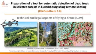
  • 1. Preparation of a tool for automatic detection of dead trees in selected forests in Luxembourg using remote sensing (RS4DeadTrees 1.0) Technical and legal aspects of flying a drone (UAV) Karolina Zięba-Kulawik1, Konrad Skoczylas1, Piotr Wężyk2 Luxembourg Institute of Socio-Economic Research (LISER) 1Luxembourg Institute of Socio-Economic Research, 2Faculty of Forestry University of Agriculture in Krakow
  • 2. 6/15/2023 Seed Grant - ccEXPAR 2 FOREST DIEBACK 2.0?!
  • 3. Introduction - Dead trees as a burning topic for decision-makers, politicians and local communities Based on European monitoring plots, an estimated 27% of forest trees were moderately, severely defoliated, or dead (State of Europe’s Forests, 2020). Photo: K. Zięba-Kulawik 6/15/2023 Seed Grant - ccEXPAR 3 Causes: extreme droughts and heat waves, widespread bark beetle outbreaks and a wider occurrence of forest fires. Forest map of Europe based on remote sensing and forest inventory statistics (European Forest Institute; EFI). 227 mln ha Photo: M. Ratajczak Photo: K. Zięba-Kulawik
  • 4. Introduction - Situation of trees in Luxembourg's forests The results of the 2022 phytosanitary inventory Luxembourg's forests Source: Administration de la nature et des forêts: „Les résultats de l’inventaire phytosanitaire 2021 des forêts du Luxembourg”. Photo: K. Skoczylas According to studies carried out in Luxembourg by The Nature and Forest Agency on the state of the forests, it was estimated that around 61% of trees in 2022 were significantly damaged, heavily damaged, or dead. The inventory was conducted on only 1200 trees by five forest experts using traditional methods. All species combined, during the summer of 2022:  15.40% of the trees show no damage (class: 0),  22.90% of the trees are slightly damaged (class: 1),  61.70% of the trees are seriously damaged (generally dying) or dead trees (class: 2, 3 and 4). 6/15/2023 Seed Grant - ccEXPAR 4 Traditional forest inventory Mobile Reporter/ www.lessentiel.lu A falling tree injures a child's head in Diekirch (Luxembourg):
  • 5. Introduction - Remote sensing technologies in forests monitoring Unmanned Aerial Vehicle (UAV) Satellite imagery Aerial images and LiDAR 6/15/2023 Seed Grant - ccEXPAR PLANETSCOPE (3 m) LANDSAT 8 (30 m) Whirlwind path in the Tuchola Forest. Fot. Kacper Kowalski / FORUM. Satellite Systems for Environmental Monitoring LiDAR point cloud Orthophoto RGB, CIR
  • 6. 6/15/2023 Seed Grant - ccEXPAR 6 The main goals of the project  development of an algorithm for the semi-automatic detection of standing dead trees (SDT) based on aerial remote sensing data;  assessment of the risk posed by dead trees standing near of routes for a selected municipality in Luxembourg;  creation of maps with the location of dead trees to help manage these areas. Additional objectives:  testing of point clouds to extract selected tree parameters, which can help estimate the volume of lost trees;  Investigating to what extent dead stands influence land surface temperature changes and the formation of local forest heat islands. RS4DeadTrees 1.0
  • 7. Source: Zieba-Kulawik /LandCover, CBK (PL), ESA; 2017. Study area - municipality of Bourscheid 6/15/2023 Seed Grant - ccEXPAR 7 Forests (50%) Roads/trails (280 km) Photo: K. Zięba-Kulawik
  • 8. Data - RGB and CIR aerial images (ortophotomaps 2021; 10cm) 10.07.2023 Seed Grant - ccEXPAR 8 RGB CIR Dead trees
  • 9. 10.07.2023 Seed Grant - ccEXPAR 9 Airborne Laser Scanning (ALS) point cloud height models LiDAR 2019 - nationwide data coverage LiDAR 2019 - Color point by RGB Cross section - color point by class LiDAR 2019 LiDAR 2017 DSM DTM DSM - Digital Surface Model DTM - Digital Terrain Model H = 28,14 m point cloud converted into voxels ALS - color points by class
  • 10. Sensor Type Hasselblad 4/3" CMOS Sensor; 3-Axis Gimbal with Dual Cameras 20MP 5.1K Wide-Angle 12MP Telephoto with 28x Hybrid Zoom Sensor Resolution Effective: 20 Megapixel (5280 x 3956) Min/Max Aperture f/2.8 - f/11 ISO Sensitivity Video: 100 to 6400 Photo: 100 to 6400 6/15/2023 Seed Grant - ccEXPAR 10 UAV - DJI MAVIC-3 CINE Maximum Takeoff Weight 899 g Maximum Horizontal Speed 11.2 mph / 5 m/s (C Mode) 33.6 mph / 15 m/s (N Mode) 47.0 mph / 21 m/s (S Mode) Maximum Ascent Speed 17.9 mph / 8 m/s Maximum Descent Speed 13.4 mph / 6 m/s Flight Ceiling 3.7 Miles / 6000 m Maximum Flight Time 46 Minutes Maximum Hover Time 40 Minutes Platform Camera
  • 11. Methods – Geographic Object-Based Image Analysis (GEOBIA) eCognition algorithms using machine learning CIR orthophoto GEOBIA segmentation and classification Layer with dead trees Export of results Dead trees layer in GIS environment Dead trees GEOBIA workflow
  • 12. examples of segmentation GEOBIA Step 1 - Segmentation eCognition software - Rule-set 6/15/2023 Seed Grant - ccEXPAR 12 Segmentation: - input layers: three orthophoto bands: infrared, red and green, - algorithm: multiresolution Segmentation with parameters: Scale=7, Shape=0.2, Compactness=0.7, - merging of adjacent segments with spectral difference DN<10.
  • 13. GEOBIA Step 2 - Classification 6/15/2023 Seed Grant - ccEXPAR 13 Classification: - mean value in the infrared channel: SP>=40 and SP<=150, - average value in red channel: SC>=80 and SC<=175, - NDVI vegetation index<0. Export of results to GIS environment NIR red green
  • 14. Drone and camera images to assess classification accuracy 6/15/2023 Seed Grant - ccEXPAR 14 Verification of results in the field – „Ground truth” 150 photos (drone) + 60 photos (camera)
  • 15. Accuracy Assesment - stratified random points 260 points randomly distributed within each class (proportional to its relative area) 6/15/2023 Seed Grant - ccEXPAR 15 Accuracy Assesment points: 50 points: photos from drone 50 points: photos from camera 160 points: randomly distributed = 260 points
  • 16. 6/15/2023 Seed Grant - ccEXPAR 16 Results - Classification of dead-tree regions The confusion matrix for the classification results (1 – dead trees, 0 – other) for the verification dataset (no. of pixels). 79 4 83 10 167 177 89 171 260 94,61% 0,88 88,7% 95,1% dead trees detected dead trees not detected Example where several dead trees were not detected by the algorithm: Overall accuracy - what proportion of all reference locations have been correctly mapped. User's accuracy - how often the class on the map will actually be present on the ground.
  • 17. Results - maps with locations of dead trees in Bourscheid 6/15/2023 Seed Grant - ccEXPAR 17 Sections of municipalities Dead trees [ha] Michelau 7,6 Lipperscheid 7,5 Bourscheid 6,8 Kehmen et Scheidel 3,3 Welscheid 5,1 Schlindermanderscheid 6,3 SUM 36,6 ha Dead trees area = 36.6 ha (10% of coniferous trees in the municipality)
  • 18. 6/15/2023 Seed Grant - ccEXPAR 18 Results - trails with the highest risk Dangerous paths where dead trees may fall (marked in red). In the municipality of Bourscheid, 56 kilometres of trails have been designated at risk due to the possible fall of dead trees (20% of all trails: roads, cycle routes and footpaths in the municipality).
  • 19. 6/15/2023 Seed Grant - ccEXPAR 19 Results - trails with the risk (tree height + buffer 10m) 85 km of trails at risk of falling trees (30% of the trails in the municipality)
  • 20. Future of the project? "Let'z Forest" mobile application + Citizen Science - Free mobile application with map of dead trees in Luxembourg and danger areas on the trail; - Topographic and satellite map and trail layer for online and offline use; - Info about the current position (GPS coordinates), which can be quickly sent by SMS, e-mail. 6/15/2023 Seed Grant - ccEXPAR 20
  • 21. Volume estimation of dead trees - preliminary results 3D point cloud 6/15/2023 Seed Grant - ccEXPAR 21 point cloud Voxel 50cm = 150m3 Same place in 2019 and 2021 – significant progression of tree dieback noted on orthophotomaps 2019 2021 2022 Volume of voxels – tree no. 1 Example tree No. 1 Based on voxels created on the 2019 ALS point cloud, the volume of the group of dead trees was estimated at 11 253 m3. Group of dead trees on MLS 2022 point cloud
  • 22. 6/15/2023 Seed Grant - ccEXPAR 22 Land Surface Temperature (LANDSAT-8; 30m) Do areas with dead trees affect the growth of heat islands?
  • 23. Highlights Currently there are no solutions available for the generation of maps with dead trees in Luxembourg • We developed and evaluated tree inventory methods of detecting dead trees. • We evaluate the potential dead tree risk assessment to communication routes movement. • We evaluated remote sensing contribution to the potential risk assessment. • We provide needed and sophisticated data for forest and tourism management. 6/15/2023 Seed Grant - ccEXPAR 23 RS4DeadTrees 1.0
  • 24. 6/15/2023 Seed Grant - ccEXPAR 24 FNR Science Image Competition: „Dead trees” awarded