SlideShare a Scribd company logo
1 of 2
Download to read offline
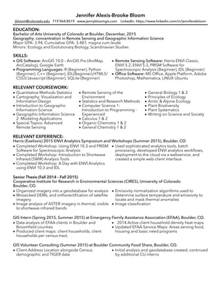
Jennifer Alexis-Brooke Bloom
jbloom@colorado.edu 719.964.8519 www.jennybloomgis.com LinkedIn: https://www.linkedin.com/in/jenniferabloom
EDUCATION:
Bachelor of Arts University of Colorado at Boulder, December, 2015
Geography: concentration in Remote Sensing and Geographic Information Science
Major GPA: 3.94, Cumulative GPA: 3.487, magna cum laude
Minors: Ecology and Evolutionary Biology, Scandinavian Studies
SKILLS:

• GIS Software: ArcGIS 10.0 – ArcGIS Pro (ArcMap,
ArcCatalog), Google Earth
• Programming Languages: R (Beginner), Python
(Beginner), C++ (Beginner), IDL(Beginner),HTML5/
CSS3/Javascript (Beginner), SQLite (Beginner)
• Remote Sensing Software: Harris ENVI Classic,
ENVI 5.2, ENVI 5.3, PRISM Software for
Spectroscopic Analysis (Beginner), IDL (Beginner)
• Office Software: MS Office, Apple Platform, Adobe
Photoshop, Mathematica, LINUX Ubuntu

RELEVANT COURSEWORK:

• Quantitative Methods Statistics
• Cartography: Visualization and
Information Design
• Introduction to Geographic
Information Science
• Geographic Information Science
2: Modeling Applications
• Special Topics: Advanced
Remote Sensing
• Remote Sensing of the
Environment
• Statistics and Research Methods
• Computer Science 1:
Introduction to Programming -
Experienced
• Calculus 1 & 2
• Organic Chemistry 1 & 2
• General Chemistry 1 & 2
• General Biology 1 & 2
• Principles of Ecology
• Arctic & Alpine Ecology
• Plant Biodiversity
• Plant Systematics
• Writing on Science and Society

RELEVANT EXPERIENCE:
Harris (Exelisvis) 2015 ENVI Analytics Symposium and Workshops (Summer 2015), Boulder, CO

• Completed Workshop: Using ENVI 10.3 and PRISM
Software for Spectroscopic Analysis
• Completed Workshop: Introduction to Shortwave
Infrared (SWIR) Analysis Tools
• Completed Workshop: A Day with ENVI Analytics
using ENVI 10.3 and IDL
• Used sophisticated analytics tools, batch
processing, developed ENVI analytics workflows,
deployment to the cloud via a webservice, and
created a simple web client interface.

Senior Thesis (Fall 2014 - Fall 2015)
Cooperative Institute for Research in Environmental Sciences (CIRES), University of Colorado
Boulder, CO.

• Organized imagery into a geodatabase for analysis
• Mosaicked DEMs, and orthorectification of satellite
imagery
• Image analysis of ASTER imagery in thermal, visible
to shortwave infrared bands
• Emissivity normalization algorithms used to
determine surface temperature and emissivity to
locate and mask thermal anomalies
• Image classification

GIS Intern (Spring 2015, Summer 2015) at Emergency Family Assistance Association (EFAA), Boulder, CO.

• Data analysis of EFAA clients in Boulder and
Broomfield counties
• Produced client maps: client households, client
households per census tract,
• 2014 Active client household density heat maps.
• Updated EFAA Service Maps: Areas serving food,
housing and basic need programs

GIS Volunteer Consulting (Summer 2015) at Boulder Community Food Share, Boulder, CO.

• Client Address Location alongside Census
demographic and TIGER data
• Initial analysis and geodatabase created, continued
by additional CU interns

Jennifer Alexis-Brooke Bloom
Cartography Lab Undergraduate TA (Spring 2014, Fall 2014), Department of Geography, University of
Colorado Boulder, CO

• Teaching assistant for cartography labs of over 20
persons for 2 semesters
• Taught peers geodatabase organization and
mapping using ArcGIS software
• Provided help to students in cartographic and
analytic design for thematic and reference maps,
including dasymetric, choropleth, isopleth,
topographic and natural disaster mapping.

ACTIVITIES AND PROJECTS:
Computer Science Python Project (Fall 2015)
• Image analysis of 365 Passive Microwave imagery of Greenland for 2007
• Pixel classification of melted pixels, counted to determine total area melt
Computer Science C++ Project (Fall 2015)
• Parsing Twitter data for sentiment analysis
• Used IFTTT recipe to gather twitter data, parsed to search for keywords indicating approval or disapproval
of specific hashtags
• Statistical means determined for tweets showing approval or disapproval
Continuing Education (Fall 2015 - Present)
• Web Development: Currently learning CSS3, Javascript, and HTML5 to develop and design websites and
webmaps
• Database Management: Codecademy tutorials in SQL.
HONORS:
• Geography Departmental Honors (magna cum laude) for completing undergraduate thesis
• Von Dreden Stacey Undergraduate Research Fellowship
• CU Complete Scholarship
• Dean's List 6 semesters (3.75 or higher)
• Published in The Honors Journal for Creative Nonfiction

More Related Content

Similar to Jennifer Bloom GIS Analyst CU Grad

Esri Platform - Preparing Your Students For Careers in Geospatial - Addy Pope
Esri Platform - Preparing Your Students For Careers in Geospatial - Addy PopeEsri Platform - Preparing Your Students For Careers in Geospatial - Addy Pope
Esri Platform - Preparing Your Students For Careers in Geospatial - Addy PopeEsri Ireland
 
Mapping the Human Environment
Mapping the Human EnvironmentMapping the Human Environment
Mapping the Human EnvironmentJohn Reiser
 
GIS Day at BCC 2012
GIS Day at BCC 2012GIS Day at BCC 2012
GIS Day at BCC 2012John Reiser
 
IGIS Workshop - Introduction to ArcGIS Pro - Apr 2022 - Presentation.pdf
IGIS Workshop - Introduction to ArcGIS Pro - Apr 2022 - Presentation.pdfIGIS Workshop - Introduction to ArcGIS Pro - Apr 2022 - Presentation.pdf
IGIS Workshop - Introduction to ArcGIS Pro - Apr 2022 - Presentation.pdfnoureddinebassa1
 
Andrew_Noske_-_Resume_1_page_(web_version)
Andrew_Noske_-_Resume_1_page_(web_version)Andrew_Noske_-_Resume_1_page_(web_version)
Andrew_Noske_-_Resume_1_page_(web_version)Andrew Noske
 
2015 FOSS4G Track: Getting Started with FOSS4G: The Newbie’s Perspective by M...
2015 FOSS4G Track: Getting Started with FOSS4G: The Newbie’s Perspective by M...2015 FOSS4G Track: Getting Started with FOSS4G: The Newbie’s Perspective by M...
2015 FOSS4G Track: Getting Started with FOSS4G: The Newbie’s Perspective by M...GIS in the Rockies
 
NEON Education
NEON EducationNEON Education
NEON Educationjjparnell
 
Xiaoxin_Resume_combined_NCL
Xiaoxin_Resume_combined_NCLXiaoxin_Resume_combined_NCL
Xiaoxin_Resume_combined_NCLXiaoxin Ren
 
shiva kumar -GIS& Remote sensing
shiva kumar -GIS& Remote sensingshiva kumar -GIS& Remote sensing
shiva kumar -GIS& Remote sensingShiva Kumar
 
Kaushik shakkari internship - resume
Kaushik shakkari   internship - resumeKaushik shakkari   internship - resume
Kaushik shakkari internship - resumeKaushik Shakkari
 
Training Non-GIS Experts in the Use of Geospatial Tools & Technologies at Sta...
Training Non-GIS Experts in the Use of Geospatial Tools & Technologies at Sta...Training Non-GIS Experts in the Use of Geospatial Tools & Technologies at Sta...
Training Non-GIS Experts in the Use of Geospatial Tools & Technologies at Sta...JISC GECO
 
Classroom Pilot-Testing for GETSI NON-Authors Presentation
Classroom Pilot-Testing for GETSI NON-Authors Presentation Classroom Pilot-Testing for GETSI NON-Authors Presentation
Classroom Pilot-Testing for GETSI NON-Authors Presentation SERC at Carleton College
 
Brandon Barnett_Resume2015_Web
Brandon Barnett_Resume2015_WebBrandon Barnett_Resume2015_Web
Brandon Barnett_Resume2015_WebBrandon Barnett
 

Similar to Jennifer Bloom GIS Analyst CU Grad (20)

Esri Platform - Preparing Your Students For Careers in Geospatial - Addy Pope
Esri Platform - Preparing Your Students For Careers in Geospatial - Addy PopeEsri Platform - Preparing Your Students For Careers in Geospatial - Addy Pope
Esri Platform - Preparing Your Students For Careers in Geospatial - Addy Pope
 
Mapping the Human Environment
Mapping the Human EnvironmentMapping the Human Environment
Mapping the Human Environment
 
GIS Day at BCC 2012
GIS Day at BCC 2012GIS Day at BCC 2012
GIS Day at BCC 2012
 
Eric_Lu
Eric_LuEric_Lu
Eric_Lu
 
IGIS Workshop - Introduction to ArcGIS Pro - Apr 2022 - Presentation.pdf
IGIS Workshop - Introduction to ArcGIS Pro - Apr 2022 - Presentation.pdfIGIS Workshop - Introduction to ArcGIS Pro - Apr 2022 - Presentation.pdf
IGIS Workshop - Introduction to ArcGIS Pro - Apr 2022 - Presentation.pdf
 
Andrew_Noske_-_Resume_1_page_(web_version)
Andrew_Noske_-_Resume_1_page_(web_version)Andrew_Noske_-_Resume_1_page_(web_version)
Andrew_Noske_-_Resume_1_page_(web_version)
 
2015 FOSS4G Track: Getting Started with FOSS4G: The Newbie’s Perspective by M...
2015 FOSS4G Track: Getting Started with FOSS4G: The Newbie’s Perspective by M...2015 FOSS4G Track: Getting Started with FOSS4G: The Newbie’s Perspective by M...
2015 FOSS4G Track: Getting Started with FOSS4G: The Newbie’s Perspective by M...
 
ResumeS15
ResumeS15ResumeS15
ResumeS15
 
NEON Education
NEON EducationNEON Education
NEON Education
 
Xiaoxin_Resume_combined_NCL
Xiaoxin_Resume_combined_NCLXiaoxin_Resume_combined_NCL
Xiaoxin_Resume_combined_NCL
 
shiva kumar -GIS& Remote sensing
shiva kumar -GIS& Remote sensingshiva kumar -GIS& Remote sensing
shiva kumar -GIS& Remote sensing
 
Kaushik shakkari internship - resume
Kaushik shakkari   internship - resumeKaushik shakkari   internship - resume
Kaushik shakkari internship - resume
 
IMIA Chiang Spatial Computing - 2016
IMIA Chiang Spatial Computing - 2016IMIA Chiang Spatial Computing - 2016
IMIA Chiang Spatial Computing - 2016
 
Training Non-GIS Experts in the Use of Geospatial Tools & Technologies at Sta...
Training Non-GIS Experts in the Use of Geospatial Tools & Technologies at Sta...Training Non-GIS Experts in the Use of Geospatial Tools & Technologies at Sta...
Training Non-GIS Experts in the Use of Geospatial Tools & Technologies at Sta...
 
Classroom Pilot-Testing for GETSI NON-Authors Presentation
Classroom Pilot-Testing for GETSI NON-Authors Presentation Classroom Pilot-Testing for GETSI NON-Authors Presentation
Classroom Pilot-Testing for GETSI NON-Authors Presentation
 
Certificate of Competence in GIS
Certificate of Competence in GISCertificate of Competence in GIS
Certificate of Competence in GIS
 
RESUME
RESUMERESUME
RESUME
 
Deus GIS Portfolio
Deus GIS PortfolioDeus GIS Portfolio
Deus GIS Portfolio
 
Brandon Barnett_Resume2015_Web
Brandon Barnett_Resume2015_WebBrandon Barnett_Resume2015_Web
Brandon Barnett_Resume2015_Web
 
RESUME_VIDHYA_MOHANDAS
RESUME_VIDHYA_MOHANDASRESUME_VIDHYA_MOHANDAS
RESUME_VIDHYA_MOHANDAS
 

Jennifer Bloom GIS Analyst CU Grad

  • 1. Jennifer Alexis-Brooke Bloom jbloom@colorado.edu 719.964.8519 www.jennybloomgis.com LinkedIn: https://www.linkedin.com/in/jenniferabloom EDUCATION: Bachelor of Arts University of Colorado at Boulder, December, 2015 Geography: concentration in Remote Sensing and Geographic Information Science Major GPA: 3.94, Cumulative GPA: 3.487, magna cum laude Minors: Ecology and Evolutionary Biology, Scandinavian Studies SKILLS:
 • GIS Software: ArcGIS 10.0 – ArcGIS Pro (ArcMap, ArcCatalog), Google Earth • Programming Languages: R (Beginner), Python (Beginner), C++ (Beginner), IDL(Beginner),HTML5/ CSS3/Javascript (Beginner), SQLite (Beginner) • Remote Sensing Software: Harris ENVI Classic, ENVI 5.2, ENVI 5.3, PRISM Software for Spectroscopic Analysis (Beginner), IDL (Beginner) • Office Software: MS Office, Apple Platform, Adobe Photoshop, Mathematica, LINUX Ubuntu
 RELEVANT COURSEWORK:
 • Quantitative Methods Statistics • Cartography: Visualization and Information Design • Introduction to Geographic Information Science • Geographic Information Science 2: Modeling Applications • Special Topics: Advanced Remote Sensing • Remote Sensing of the Environment • Statistics and Research Methods • Computer Science 1: Introduction to Programming - Experienced • Calculus 1 & 2 • Organic Chemistry 1 & 2 • General Chemistry 1 & 2 • General Biology 1 & 2 • Principles of Ecology • Arctic & Alpine Ecology • Plant Biodiversity • Plant Systematics • Writing on Science and Society
 RELEVANT EXPERIENCE: Harris (Exelisvis) 2015 ENVI Analytics Symposium and Workshops (Summer 2015), Boulder, CO
 • Completed Workshop: Using ENVI 10.3 and PRISM Software for Spectroscopic Analysis • Completed Workshop: Introduction to Shortwave Infrared (SWIR) Analysis Tools • Completed Workshop: A Day with ENVI Analytics using ENVI 10.3 and IDL • Used sophisticated analytics tools, batch processing, developed ENVI analytics workflows, deployment to the cloud via a webservice, and created a simple web client interface.
 Senior Thesis (Fall 2014 - Fall 2015) Cooperative Institute for Research in Environmental Sciences (CIRES), University of Colorado Boulder, CO.
 • Organized imagery into a geodatabase for analysis • Mosaicked DEMs, and orthorectification of satellite imagery • Image analysis of ASTER imagery in thermal, visible to shortwave infrared bands • Emissivity normalization algorithms used to determine surface temperature and emissivity to locate and mask thermal anomalies • Image classification
 GIS Intern (Spring 2015, Summer 2015) at Emergency Family Assistance Association (EFAA), Boulder, CO.
 • Data analysis of EFAA clients in Boulder and Broomfield counties • Produced client maps: client households, client households per census tract, • 2014 Active client household density heat maps. • Updated EFAA Service Maps: Areas serving food, housing and basic need programs
 GIS Volunteer Consulting (Summer 2015) at Boulder Community Food Share, Boulder, CO.
 • Client Address Location alongside Census demographic and TIGER data • Initial analysis and geodatabase created, continued by additional CU interns

  • 2. Jennifer Alexis-Brooke Bloom Cartography Lab Undergraduate TA (Spring 2014, Fall 2014), Department of Geography, University of Colorado Boulder, CO
 • Teaching assistant for cartography labs of over 20 persons for 2 semesters • Taught peers geodatabase organization and mapping using ArcGIS software • Provided help to students in cartographic and analytic design for thematic and reference maps, including dasymetric, choropleth, isopleth, topographic and natural disaster mapping.
 ACTIVITIES AND PROJECTS: Computer Science Python Project (Fall 2015) • Image analysis of 365 Passive Microwave imagery of Greenland for 2007 • Pixel classification of melted pixels, counted to determine total area melt Computer Science C++ Project (Fall 2015) • Parsing Twitter data for sentiment analysis • Used IFTTT recipe to gather twitter data, parsed to search for keywords indicating approval or disapproval of specific hashtags • Statistical means determined for tweets showing approval or disapproval Continuing Education (Fall 2015 - Present) • Web Development: Currently learning CSS3, Javascript, and HTML5 to develop and design websites and webmaps • Database Management: Codecademy tutorials in SQL. HONORS: • Geography Departmental Honors (magna cum laude) for completing undergraduate thesis • Von Dreden Stacey Undergraduate Research Fellowship • CU Complete Scholarship • Dean's List 6 semesters (3.75 or higher) • Published in The Honors Journal for Creative Nonfiction