1. 1
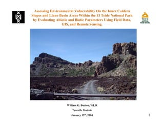
Assessing Environmental Vulnerability On the Inner Caldera
Slopes and Llano Basin Areas Within the El Teide National Park
by Evaluating Abiotic and Biotic Parameters Using Field Data,
GIS, and Remote Sensing.
William G. Burton, WLO
Tenerife Module
January 15th
, 2004
2. 2
Tenerife Module Mission Statement
Universiteit van Amsterdam
Assessing Environmental Vulnerability On the Inner Caldera Slopes and
Llano Basin Areas Within the El Teide National Park by Evaluating
Abiotic and Biotic Parameters Using Field Data, GIS, and Remote Sensing.
Goal: Enhance master’s students’ knowledge and experience in
‘Natural Resource Management and Sustainability’ by applying
theoretical knowledge of Physical Geography and the related
disciplines of Ecology, Environmental Sciences, and Human
Geography to environmental problems encountered in the field.
Central Course Theme: Assessment of the Vulnerability of selected
geo-ecosystems on the island of Tenerife, integrating the master’s
students’ knowledge to foster sustainable management practices of
natural resources.
3. 3
Research Proposal
Universiteit van Amsterdam
Evaluate Environmental Risks: Natural & Manmade
Tools: Field Authenticated GIS & Remote Sensing
Goal: Evaluation of Environmental Hazards
Selected Study Area: Inner Caldera Slopes, Llanos within the caldera
of the Teide-Pico Viejo Complex Volcano
Research Question: Can these analysis be successful and applicable to
the larger scale ecosystem mosaics?
Assessing Environmental Vulnerability On the Inner Caldera Slopes and
Llano Basin Areas Within the El Teide National Park by Evaluating
Abiotic and Biotic Parameters Using Field Data, GIS, and Remote Sensing.
4. 4
Tenerife & Study Area Background
Universiteit van Amsterdam
Assessing Environmental Vulnerability On the Inner Caldera Slopes and
Llano Basin Areas Within the El Teide National Park by Evaluating
Abiotic and Biotic Parameters Using Field Data, GIS, and Remote Sensing.
Climate: Northwesterly trade-winds bring rain to north, rain
shadow to the south. Llano High Mountain Scrub.
Geology & Hydrology: Miocene subsequent serial volcanic
eruptions & flows; massive slides create layered topography and
perched aquifers. Study Area dominated by Canadas Edifice.
Soils: Volcanic island of variable relief, varied climate. Older
Oxisols, Andisols to lithic Inceptisols. “Buried soils”. Llano
Arenosols (lithic fluvents).
5. 5Universiteit van Amsterdam
Nacional Parque & Llano Del Cedro Study Area
Assessing Environmental Vulnerability On the Inner Caldera Slopes and
Llano Basin Areas Within the El Teide National Park by Evaluating
Abiotic and Biotic Parameters Using Field Data, GIS, and Remote Sensing.
6. 6Universiteit van Amsterdam
Methodology
1. Preliminary Work
2. Field Work
3. GIS Model
Assessing Environmental Vulnerability On the Inner Caldera Slopes and
Llano Basin Areas Within the El Teide National Park by Evaluating
Abiotic and Biotic Parameters Using Field Data, GIS, and Remote Sensing.
7. 7
1. Fauna & Flora Spatial Characteristics
2. Llano Area Close-up Map
3. ERDAS Classified Image
Assessing Environmental Vulnerability On the Inner Caldera Slopes and
Llano Basin Areas Within the El Teide National Park by Evaluating
Abiotic and Biotic Parameters Using Field Data, GIS, and Remote Sensing.
Methodology: Maps & Analysis
Universiteit van Amsterdam
8. 8Universiteit van Amsterdam
Assessing Environmental Vulnerability On the Inner Caldera Slopes and
Llano Basin Areas Within the El Teide National Park by Evaluating
Abiotic and Biotic Parameters Using Field Data, GIS, and Remote Sensing.
Analysis: Landslide Hazards Scoring Variables
Total Score = (Rise/Run Score - Roughness Score- Vegetation Score -
Shoulder or Dike Score + Cliffs Score + Boulders Score + Sinuosity
Score)
•Rise/Run scores scale of 1 to 3.
•Roughness Score, scale of 0 to 3.
•Vegetation Score, scale 0 to 3.
•Cliff Scores ran from 0 to 2.
•Boulder Scores ranged from 0 to 2.
•Sinuosity Scores ranged from 1 to 3 and were determined by dividing
length of the estimated slide length, in meters, by the area of the slides
runout, in square meters, and then multiplied by 100.
9. 9
Assessing Environmental Vulnerability On the Inner Caldera Slopes and
Llano Basin Areas Within the El Teide National Park by Evaluating
Abiotic and Biotic Parameters Using Field Data, GIS, and Remote Sensing.
Analysis and Results: Landslide Scoring Table
Universiteit van Amsterdam
Dangerous17.502.002.000.000.500.002.000.882.002.90
Dangerous136.002.002.000.000.003.003.001.372.002.71
Dangerous96.001.002.000.001.001.002.000.853.003.72
Dangerous125.502.002.001.000.503.003.001.203.004.15
Unstable104.502.002.000.000.502.001.000.672.002.95
Unstable23.002.001.000.002.001.001.000.652.002.41
Moderate111.002.002.001.002.002.001.000.701.001.85
Moderate81.001.000.001.001.001.002.000.771.001.74
Stable30.001.001.000.003.001.001.000.451.001.92
Stable6-1.001.000.001.003.001.002.000.711.001.35
Stable5-1.000.001.001.003.001.002.000.751.001.40
Stable4-1.000.001.001.001.002.001.000.681.001.54
Stable7-2.000.000.001.002.001.001.000.641.001.33
StabilitySlide#Total_ScoreBouldersCliffsDikesVegetationRoughnessR/R ScoreRise/RunS_scoreSinuosity
10. 10
Assessing Environmental Vulnerability On the Inner Caldera Slopes and
Llano Basin Areas Within the El Teide National Park by Evaluating
Abiotic and Biotic Parameters Using Field Data, GIS, and Remote Sensing.
Analysis and Results: Sinuosity Breaks
Universiteit van Amsterdam
Sinousity
0.00
1.00
2.00
3.00
4.00
5.00
7 4 5 6 3 8 11 2 10 12 9 13 1
Slide Number
Sinousity
Sinuosity Score
11. 11
Assessing Environmental Vulnerability On the Inner Caldera Slopes and
Llano Basin Areas Within the El Teide National Park by Evaluating
Abiotic and Biotic Parameters Using Field Data, GIS, and Remote Sensing.
Analysis and Results: Landslide Hazards Breaks
Universiteit van Amsterdam
Total_Score
-3.00
-1.00
1.00
3.00
5.00
7.00
7 4 5 6 3 8 11 2 10 12 9 13 1
Slide Number
SlideScore
Total_Score
12. 12
Summary
Universiteit van Amsterdam
Evaluate Environmental Risks: Natural & Manmade
Study Area: Inner Caldera Slopes, Llanos within the caldera of the Teide-
Pico Viejo Complex Volcano
Tools: Field Authenticated GIS & Remote Sensing
Results: Field work, constructed GIS database, remote sensing imagery
delineated hazards and new spatial relationships within llanos and caldera
that is scalable to the Canarian Archipelago and world.
Assessing Environmental Vulnerability On the Inner Caldera Slopes and
Llano Basin Areas Within the El Teide National Park by Evaluating
Abiotic and Biotic Parameters Using Field Data, GIS, and Remote Sensing.
13. 13
Burroughs, P.A. and McDonnell, A., 1998, Principles of Geographical
Information Systems, Oxford: Oxford University Press.
Butler, J., 1992, Ecotourism: Its Changing Face and Evolving Philosophy,
Department of Forestry, University of Alberta, Canada.
Bramwell, D., Bramwell, Z., 2nd Edition 2001, Wild Flowers of the Canary
Islands, Editorial Rueda SL, Alcorcon, Espana.
Bryant, 1991, Natural Hazards, Cambridge University Press, Cambridge UK.
Cahill, et al, September 1994, Research Notes: Generation, Characterization, and
Transport of Owens Lake Dust, California Environmental Protection Agency, UC
Davis, http://www.arb.ca.gov/research/resnotes/notes/94-15.htm.
Canarian Network, 1998, Teide National Park (T-0), Regional Department of the
Environment, Canary Islands Autonomous
Government, http://www.gobcan.es/medioambiente/eng/biodiversidad/ceplam/are
asprotegidas/tenerife/t0.htm.
Assessing Environmental Vulnerability On the Inner Caldera Slopes and
Llano Basin Areas Within the El Teide National Park by Evaluating
Abiotic and Biotic Parameters Using Field Data, GIS, and Remote Sensing.
Universiteit van Amsterdam
References
14. 14
References
•IBID, 1998, Ecosystems, Regional Department of the Environment, Canary
Islands Autonomous Government,
http://www.gobcan.es/medioambiente/eng/biodiversidad/ceplam/vidasilvestre/ecos
ist.html.
Dorren, L., September 2002, Mountain Geo-ecosystems: GIS Modelling of
Rockfall and Protection Forest Structure, CIP-Gegevens Koninklijke Bibliotheek,
Den Haag.
Easterbrook, D., 2nd Edition, 1999, Surface Processes And Landforms, Prentice-
Hall, New Jersey.
Kunkel, G. Editor, 1976, Biogeography And Ecology In The Canary Islands, Dr.
W. Junk b.v. The Hague.
Lopez, M., Gomez, J., Alvarez, J., 2001, The Teide national Park Visitors’ Guide,
Paseo de la Castellana, 121. 28046 Madrid.
Luengo, J., 2003, Vertebrates introduced into the Canary Islands: a threat to
biodiversity, http://www.gobcan.es/medioambiente/eng/revista/1999/12/48/.
Morales, G. & Gonzalez, R., 2000, Gran Atlas Tematico De Canarias, Editorial
Interinsular Canarias S.A., Tenerife.
Assessing Environmental Vulnerability On the Inner Caldera Slopes and
Llano Basin Areas Within the El Teide National Park by Evaluating
Abiotic and Biotic Parameters Using Field Data, GIS, and Remote Sensing.
Universiteit van Amsterdam
15. 15
Parque Nacional de Teide, 2003, Personal Communication, Emilio Calzadilla 5 4th
floor, 38002, Santa Cruz de Tenerife, pnteide@telelines.es.
Riera, L., 1989, Avance: Bases Para El Planeamiento Hidrologico, PHI, Plan
Hidrologico Insular De Tenerife, Cabildo Insular de Tenerife Seccion de
Planificacion Hidraulica.
Van Boxel, J, PhD., 2003, Climate change and the Climates of Tenerife and
Southeast Spain, Lecture Communication, Universiteit van Amsterdam,
Amsterdam.
Van Mourik, J., PhD., 2003, Soil Classification: Fieldwork preparation for Spain,
Lecture Communication, Universiteit van Amsterdam, Amsterdam.
Whatcom Division of Emergency Management, 2003, Whatcom County Natural
Hazard Identification And Vulnerability Analysis,
http://www.co.whatcom.wa.us/dem/pdf/natural_hazards.pdf.
Wood, P. editor, May 2003, Second International Conference on Efficient Use
and Management of Urban Water Supplies: New Culture in Tenerife, Demand
Management Bulletin, Supplement to Number 59, http://www.environment-
agency.gov.uk/commondata/105385/bulletin59tenerife_527009.pdf.
References
Assessing Environmental Vulnerability On the Inner Caldera Slopes and
Llano Basin Areas Within the El Teide National Park by Evaluating
Abiotic and Biotic Parameters Using Field Data, GIS, and Remote Sensing.
Universiteit van Amsterdam
16. 16Universiteit van Amsterdam
Assessing Environmental Vulnerability On the Inner Caldera Slopes and
Llano Basin Areas Within the El Teide National Park by Evaluating
Abiotic and Biotic Parameters Using Field Data, GIS, and Remote Sensing.