
Recommended
More Related Content
Viewers also liked
Viewers also liked (10)
Recently uploaded
Recently uploaded (20)
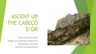
Ascent Up the cabeçó D'Or
- 1. ASCENT UP THE CABEÇÓ D’OR MARTA ARAGONÉS PÉREZ RAMÓN JACK MARTÍNEZ WOOLHOUSE KEVIN DESCALS BELTRÁN ANTONIO CASTAÑO ROMERO
- 2. Cabeçó d’Or Region: L Álacantí Town : Busot Responsable organization : Colla muntanyenca de Busot Start line: Pla del cabeçó “cruce a derecha antes de llegar a la curva” de las Cuevas del Canelobre” Finish: Mismo sitio o fin en la carretera de las cuevas Route: 12,6 km Estimated time: 4 horas Difficulty: Media Cartography: Villajoyosa 29-33 (847)1:50000
- 3. HOW TO GET THERE The path starts 3 kilometers away from Busot using the CV-776 road, following the Jijona road in direction to the Caves of Canelobre. The route starts in the Pla de la Gralla near to the Caves of Canelobre where theres a parking on the curve of the road. We have to go in through that path and once we leave our vehicle there we start the route.
- 4. ROUTE We find ourselves with a dirt path wich we have to follow, during the whole route we will see a two parallel line white and yellow that indicate us the correct way so we dont get lost.
- 5. ROUTE First fork to the right After the start we find ourselves with the first fork and we pick the right hand side.
- 6. ROUTE Second Fork: Straight on. Another straight path where we find little tracks but we musnt divert from the main one we have to keep on straight.
- 7. ROUTE Third fork : Right When the path ends we get to a intersection and we pick the right path.
- 8. ROUTE Fourth fork : Right Now we will find a difficult intersection where there is four different, we will follow the markers that are on the first path on the right.
- 9. ROUTE Fork 5: Up In this one we find that the path isnt marked but we have to go up the hill.
- 10. ROUTE Rest zone: On the left Here two paths come together we have to take the left one.
- 11. ROUTE 6th Fork: Left We find ourselves with a fork with 3 possibilitys, we pick the left lane.
- 12. ROUTE Last ascent (Climbing) This last part is a bit hard as we have to climb a litte instead of walking like on the rest of the route.
- 13. ROUTE The Top
- 14. ROUTE DESCENT DOWN THE PREDRERA As an alternative route for going down we can go down the pedrera because is much more fun and we can also cut time.
- 15. THANK YOU VERY MUCH