SlideShare a Scribd company logo
1 of 4
Download to read offline
FARO Laser Scanner Focus3D
X 330
Features, Benefits
& Technical Specifications
How the Focus3D
X 330 Works
The technology behind the Focus3D
X 330 is simple. First, the laser scanner emits a laser
beam from a rotating mirror out towards the area being scanned. Then the unit
distributes the laser beam at a vertical range of 300° and a horizontal range of 360°.
The laser beam is then reflected back to the scanner by objects in its path. The
distance to the objects defining an area is calculated as well as their relative vertical
and horizontal angles. The data is captured and transmitted via WLAN for calculating
precise 3D renderings.
Focus3D
X 330
The Perfect Instrument for 3D Documentation and Land Surveying
Building on the success of the Focus3D
, the new Focus3D
X 330 surpasses previous models in functionality and performance.
With a range almost three times greater than previous models, the Focus3D
X 330 can scan objects up to 330 meters away
and in direct sunlight. With its integrated GPS receiver, the laser scanner is able to correlate individual scans in post-
processing making it ideal for surveying based applications.
In addition, the Focus3D
X 330 scan quality has been increased and noise has been reduced, providing precise three
dimensional models in a photo-realistic style. These advances in performance did not come at the expense of safety as the
Focus3D
X 330 includes a Class 1 “eye safe” laser.
With its increased range and scan quality, the Focus3D
X 330 considerably reduces the effort involved in measuring and post-
processing. The 3D scan data can easily be imported into all commonly used software solutions for accident reconstruction,
architecture, civil engineering, construction, forensics, industrial manufacturing and land surveying. Distance dimensions,
area and volume calculations, analysis and inspection tasks and documentation can thus be carried out quickly, precisely
and reliably.
Extended Scanning - 330m Range
The Focus3D
X 330 can scan objects up to 330 meters
away. Large buildings, land-site excavations and
vast terrains can be surveyed with fewer scans, thus
resulting in quicker project scanning completion.
Easy Positioning - Integrated GPS Receiver
With its integrated GPS receiver, the laser
scanner is able to correlate individual scans in
post-processing making it ideal for surveying
based applications.
Outdoor Scanning Capability
The Focus3D
X 330 now is able to perform fast and
highly precise scanning in direct sunlight.
Low Noise Performance
The Focus3D
X 330 delivers extraordinary scan data
quality with very low noise.
Compass
An electronic compass is included within the unit to
associate directional data to your scans and
facilitate the auto-registration process.
Height Sensor (Altimeter)
Each scan includes height information which can
be used to scan different floor levels in a building.
The data can then be used to differentiate the
floors.
Dual Axis Compensator
To minimize the number of targets needed, the dual
axis compensator enables every scan to have
integrated level information.
WLAN (WiFi)
WLAN remote control allows starting, stopping,
viewing or downloading of scans at a distance.
Features of the Focus3D
X 330
Focus3D
X 330
Benefits to the End User
• 330m scanning range reduces the number of
scans per project
• Portability allows user to scan complex
objects and environments
• GPS receiver helps correlate individual scans
during post-processing
• Touch-screen interface makes the scanner
easy for anyone to use
Benefits to the Company
• Provides long term investment for future
projects
• Dedicated users can act as general scanning
providers within organization
• Real world environments are preserved in a
virtual 3D world
• Unsurpassed cost-value proposition make
every scanning project economical
Performance Specifications
Ranging Unit
Unambiguity Interval: By 122 to 488 Kpts/sec at 614m; by 976 Kpts/sec at 307m
Range Focus3D X 330: 0.6m - 330m indoor or outdoor with upright incidence to a 90% reflective surface
Measurement Speed (pts/sec): 122,000 / 244,000 / 488,000 / 976,000
Ranging Error1
: ±2mm
Color Unit
Resolution: Up to 70 megapixel color
Dynamic Color Feature: Automatic adaption of brightness
Parallax: Co-axial design
Deflection Unit
Vertical Field of View (vertical/horizontal): 300° / 360°
Step Size (vertical/horizontal): 0.009° (40,960 3D-Pixel on 360°) / 0.009° (40,960 3D-Pixel on 360°)
Max. Vertical Scan Speed: 5,820rpm or 97Hz
Laser (Optical Transmitter)
Laser Class: Laser class 1
Wavelength: 1550nm
Beam Divergence: Typical 0.19mrad (0.011°) (1/e, halfangle)
Beam Diameter at Exit: Typical 2.25mm (1/e)
Data Handling and Control
Data Storage: SD, SDHC™, SDXC™; 32GB card included
Scanner Control: Via touch-screen display and WLAN
New WLAN Access: Remote control, scan visualization are possible
on mobile devices with Flash®
Multi-Sensor
Dual Axis Compensator: Levels each scan with an accuracy of 0.015° and a range of ±5°
Height Sensor: Via an electronic barometer the height relative to a fixed point can be detected
and added to a scan
Compass: Electronic compass gives the scan an orientation. A calibration feature is included.
GPS: Integrated GPS receiver
Ranging noise2
@ 90% refl.
@ 10% refl.
@10m
0.3mm
0.4mm
@25m
0.3mm
0.5mm
@10m - noise compressed3
0.15mm
0.20mm
@25m - noise compressed4
0.15mm
0.25mm
Hardware Specifications
Power Supply Voltage: 19V (external supply), 14.4V (internal battery)	 Cable Connector: Located in scanner mount
Power Consumption: 40W and 80W (while battery charges)		 Weight: 5.2kg
Battery Life: 4.5 hours						Size: 240 x 200 x 100mm
Ambient Temperature: 5° - 40°C					Maintenance Calibration: Annual
Humidity: Non-condensing						
1
Ranging error is defined as a systematic measurement error at around 10m and 25m, one sigma. 2
Ranging noise is defined as
a standard deviation of values about the best-fit plane for measurement speed of 122,000 points/sec. 3
A noise-compression
algorithm may be activated thereby compressing raw data noise by a factor of 2 or 4. Subject to change without prior notice.
4
Ferromagnetic objects can disturb the earth magnetic field and lead to inaccurate measurements.
© 2013 FARO | FARO and the FARO Logo are registered trademarks of FARO Technologies Inc. SFDC_04MKT_0357 Created: 10/10/13
FARO Focus3D
X 330
www.faro.com/focus
For more information call 800.736.0234
or visit www.faro.com/focus

More Related Content

What's hot

Topcon gm 100 gm-101 gm-102 gm-103 gm-105
Topcon gm 100 gm-101 gm-102 gm-103 gm-105Topcon gm 100 gm-101 gm-102 gm-103 gm-105
Topcon gm 100 gm-101 gm-102 gm-103 gm-105Rega Surveyor
 
Indoor localization using wifi fingerprinting
Indoor localization using wifi fingerprintingIndoor localization using wifi fingerprinting
Indoor localization using wifi fingerprintingChaitali Bose Roy
 
Brosur Total Station Topcon gm 50 gm-52 gm-55
Brosur Total Station Topcon gm 50 gm-52 gm-55Brosur Total Station Topcon gm 50 gm-52 gm-55
Brosur Total Station Topcon gm 50 gm-52 gm-55Rega Surveyor
 

What's hot (6)

Indoor positioning system
Indoor positioning systemIndoor positioning system
Indoor positioning system
 
Topcon gm 100 gm-101 gm-102 gm-103 gm-105
Topcon gm 100 gm-101 gm-102 gm-103 gm-105Topcon gm 100 gm-101 gm-102 gm-103 gm-105
Topcon gm 100 gm-101 gm-102 gm-103 gm-105
 
cEs e 105
cEs e 105cEs e 105
cEs e 105
 
tSokkia cx series
tSokkia cx seriestSokkia cx series
tSokkia cx series
 
Indoor localization using wifi fingerprinting
Indoor localization using wifi fingerprintingIndoor localization using wifi fingerprinting
Indoor localization using wifi fingerprinting
 
Brosur Total Station Topcon gm 50 gm-52 gm-55
Brosur Total Station Topcon gm 50 gm-52 gm-55Brosur Total Station Topcon gm 50 gm-52 gm-55
Brosur Total Station Topcon gm 50 gm-52 gm-55
 

Viewers also liked

Kapanowski FINAL_Lean Assessment
Kapanowski FINAL_Lean AssessmentKapanowski FINAL_Lean Assessment
Kapanowski FINAL_Lean AssessmentGary Kapanowski
 
No More Dark Clouds: A Privacy Preserving Framework for the Cloud
No More Dark Clouds: A Privacy Preserving Framework for the CloudNo More Dark Clouds: A Privacy Preserving Framework for the Cloud
No More Dark Clouds: A Privacy Preserving Framework for the CloudPaaSword EU Project
 
State of the Social Service Workforce 2015 Report LR
State of the Social Service Workforce 2015 Report LRState of the Social Service Workforce 2015 Report LR
State of the Social Service Workforce 2015 Report LRNicole Brown
 
new pamphlet revision 8 page layout
new pamphlet revision 8 page layoutnew pamphlet revision 8 page layout
new pamphlet revision 8 page layoutBrandi Jorgensen
 
Energía solar - definiciones y terminología
Energía solar - definiciones y terminologíaEnergía solar - definiciones y terminología
Energía solar - definiciones y terminologíaBrad Pitt
 
No More Dark Clouds With PaaSword - An Innovative Security By Design Framework
No More Dark Clouds With PaaSword - An Innovative Security By Design FrameworkNo More Dark Clouds With PaaSword - An Innovative Security By Design Framework
No More Dark Clouds With PaaSword - An Innovative Security By Design FrameworkPaaSword EU Project
 
2013 enhancing graduates’ employability skills-malaysia
2013 enhancing graduates’ employability skills-malaysia2013 enhancing graduates’ employability skills-malaysia
2013 enhancing graduates’ employability skills-malaysiarazalibmuda
 
TRC Summer Research Award_Final Report
TRC Summer Research Award_Final ReportTRC Summer Research Award_Final Report
TRC Summer Research Award_Final ReportLev McCarthy
 
Acucut Presentation.rev1
Acucut Presentation.rev1Acucut Presentation.rev1
Acucut Presentation.rev1Ajit Shah
 
PaaSword - Context-aware Access Control
PaaSword - Context-aware Access ControlPaaSword - Context-aware Access Control
PaaSword - Context-aware Access ControlPaaSword EU Project
 
Conducting Bicycle Counts_McCarthy
Conducting Bicycle Counts_McCarthyConducting Bicycle Counts_McCarthy
Conducting Bicycle Counts_McCarthyLev McCarthy
 
UKRAINE CRISIS TIMELINE - updated 28 Aug 2014
UKRAINE CRISIS TIMELINE - updated 28 Aug 2014UKRAINE CRISIS TIMELINE - updated 28 Aug 2014
UKRAINE CRISIS TIMELINE - updated 28 Aug 2014Samip Shrestha
 
HELLEN WANGUI GATHOGO-cv 2015 CONFIDENTIAL
HELLEN WANGUI GATHOGO-cv 2015 CONFIDENTIALHELLEN WANGUI GATHOGO-cv 2015 CONFIDENTIAL
HELLEN WANGUI GATHOGO-cv 2015 CONFIDENTIALHellen Gathogo
 

Viewers also liked (20)

Kapanowski FINAL_Lean Assessment
Kapanowski FINAL_Lean AssessmentKapanowski FINAL_Lean Assessment
Kapanowski FINAL_Lean Assessment
 
No More Dark Clouds: A Privacy Preserving Framework for the Cloud
No More Dark Clouds: A Privacy Preserving Framework for the CloudNo More Dark Clouds: A Privacy Preserving Framework for the Cloud
No More Dark Clouds: A Privacy Preserving Framework for the Cloud
 
State of the Social Service Workforce 2015 Report LR
State of the Social Service Workforce 2015 Report LRState of the Social Service Workforce 2015 Report LR
State of the Social Service Workforce 2015 Report LR
 
new pamphlet revision 8 page layout
new pamphlet revision 8 page layoutnew pamphlet revision 8 page layout
new pamphlet revision 8 page layout
 
Energía solar - definiciones y terminología
Energía solar - definiciones y terminologíaEnergía solar - definiciones y terminología
Energía solar - definiciones y terminología
 
No More Dark Clouds With PaaSword - An Innovative Security By Design Framework
No More Dark Clouds With PaaSword - An Innovative Security By Design FrameworkNo More Dark Clouds With PaaSword - An Innovative Security By Design Framework
No More Dark Clouds With PaaSword - An Innovative Security By Design Framework
 
2013 enhancing graduates’ employability skills-malaysia
2013 enhancing graduates’ employability skills-malaysia2013 enhancing graduates’ employability skills-malaysia
2013 enhancing graduates’ employability skills-malaysia
 
TRC Summer Research Award_Final Report
TRC Summer Research Award_Final ReportTRC Summer Research Award_Final Report
TRC Summer Research Award_Final Report
 
PaaSword - Technology Baseline
PaaSword - Technology BaselinePaaSword - Technology Baseline
PaaSword - Technology Baseline
 
Acucut Presentation.rev1
Acucut Presentation.rev1Acucut Presentation.rev1
Acucut Presentation.rev1
 
PaaSword - Context-aware Access Control
PaaSword - Context-aware Access ControlPaaSword - Context-aware Access Control
PaaSword - Context-aware Access Control
 
Conducting Bicycle Counts_McCarthy
Conducting Bicycle Counts_McCarthyConducting Bicycle Counts_McCarthy
Conducting Bicycle Counts_McCarthy
 
Mike Faris
Mike FarisMike Faris
Mike Faris
 
Kapanowski FINAL_CIPL
Kapanowski FINAL_CIPLKapanowski FINAL_CIPL
Kapanowski FINAL_CIPL
 
4 fequipo03
4 fequipo034 fequipo03
4 fequipo03
 
Goa Country
Goa CountryGoa Country
Goa Country
 
UKRAINE CRISIS TIMELINE - updated 28 Aug 2014
UKRAINE CRISIS TIMELINE - updated 28 Aug 2014UKRAINE CRISIS TIMELINE - updated 28 Aug 2014
UKRAINE CRISIS TIMELINE - updated 28 Aug 2014
 
HELLEN WANGUI GATHOGO-cv 2015 CONFIDENTIAL
HELLEN WANGUI GATHOGO-cv 2015 CONFIDENTIALHELLEN WANGUI GATHOGO-cv 2015 CONFIDENTIAL
HELLEN WANGUI GATHOGO-cv 2015 CONFIDENTIAL
 
sujata
sujatasujata
sujata
 
Concerto di primavera
Concerto di primaveraConcerto di primavera
Concerto di primavera
 

Similar to FARO Laser Scanner Focus3D X 330 Features & Specs

Long Distance Thermal Infrared Camera IR Thermal Camera MWIR/LWIR Thermal Inf...
Long Distance Thermal Infrared Camera IR Thermal Camera MWIR/LWIR Thermal Inf...Long Distance Thermal Infrared Camera IR Thermal Camera MWIR/LWIR Thermal Inf...
Long Distance Thermal Infrared Camera IR Thermal Camera MWIR/LWIR Thermal Inf...Tim Troxel
 
Long Range IR Laser Camera EO/IR PTZ surveillance LWIR Uncooled Thermal In...
Long Range IR Laser Camera   EO/IR PTZ surveillance  LWIR Uncooled Thermal In...Long Range IR Laser Camera   EO/IR PTZ surveillance  LWIR Uncooled Thermal In...
Long Range IR Laser Camera EO/IR PTZ surveillance LWIR Uncooled Thermal In...Tim Troxel
 
Long Distance Laser IR Camera + MWIR/LWIR Thermal Infrared IR Night Vision Ca...
Long Distance Laser IR Camera + MWIR/LWIR Thermal Infrared IR Night Vision Ca...Long Distance Laser IR Camera + MWIR/LWIR Thermal Infrared IR Night Vision Ca...
Long Distance Laser IR Camera + MWIR/LWIR Thermal Infrared IR Night Vision Ca...Tim Troxel
 
Spectra 082119953499
Spectra 082119953499Spectra 082119953499
Spectra 082119953499Budi anto
 
082119953499 Brosur spectra
082119953499 Brosur spectra082119953499 Brosur spectra
082119953499 Brosur spectraBudi anto
 
Brosur spectra 082119953499
Brosur spectra 082119953499Brosur spectra 082119953499
Brosur spectra 082119953499Budi anto
 
Brosur spectra Call 082119953499
Brosur spectra Call 082119953499Brosur spectra Call 082119953499
Brosur spectra Call 082119953499Budi anto
 
Anti UAV ADDS Automatic Drone Defense System Jammer RF Radar PTZ Auto Trac...
 Anti UAV  ADDS Automatic Drone Defense System Jammer RF Radar PTZ  Auto Trac... Anti UAV  ADDS Automatic Drone Defense System Jammer RF Radar PTZ  Auto Trac...
Anti UAV ADDS Automatic Drone Defense System Jammer RF Radar PTZ Auto Trac...Tim Troxel
 
Dualis Object Recognition Application Brochure
Dualis Object Recognition Application BrochureDualis Object Recognition Application Brochure
Dualis Object Recognition Application Brochureifm electronic gmbh
 
22UPH101_Unit-1_3D Profiling.pdf
22UPH101_Unit-1_3D Profiling.pdf22UPH101_Unit-1_3D Profiling.pdf
22UPH101_Unit-1_3D Profiling.pdfKishors41
 
Brosur focus 35
Brosur focus 35Brosur focus 35
Brosur focus 35Budi anto
 
Brosure Laser 3D Scanning Systems Leica HDS Swiss Jogja
Brosure Laser 3D Scanning Systems Leica HDS Swiss JogjaBrosure Laser 3D Scanning Systems Leica HDS Swiss Jogja
Brosure Laser 3D Scanning Systems Leica HDS Swiss JogjaMurabet, MRT
 
Total Station Topcon Gm 55 Reflectorles 500m 2" Acuration
Total Station Topcon Gm 55 Reflectorles 500m 2" AcurationTotal Station Topcon Gm 55 Reflectorles 500m 2" Acuration
Total Station Topcon Gm 55 Reflectorles 500m 2" AcurationSaepulloh
 
Gm 50 to-pbasic_e
Gm 50 to-pbasic_eGm 50 to-pbasic_e
Gm 50 to-pbasic_eredi salman
 
Guia para Leitores Datalogic
Guia para Leitores DatalogicGuia para Leitores Datalogic
Guia para Leitores DatalogicScanSource Brasil
 
My cool new Slideshow!
My cool new Slideshow!My cool new Slideshow!
My cool new Slideshow!netzwelt12345
 

Similar to FARO Laser Scanner Focus3D X 330 Features & Specs (20)

Long Distance Thermal Infrared Camera IR Thermal Camera MWIR/LWIR Thermal Inf...
Long Distance Thermal Infrared Camera IR Thermal Camera MWIR/LWIR Thermal Inf...Long Distance Thermal Infrared Camera IR Thermal Camera MWIR/LWIR Thermal Inf...
Long Distance Thermal Infrared Camera IR Thermal Camera MWIR/LWIR Thermal Inf...
 
Long Range IR Laser Camera EO/IR PTZ surveillance LWIR Uncooled Thermal In...
Long Range IR Laser Camera   EO/IR PTZ surveillance  LWIR Uncooled Thermal In...Long Range IR Laser Camera   EO/IR PTZ surveillance  LWIR Uncooled Thermal In...
Long Range IR Laser Camera EO/IR PTZ surveillance LWIR Uncooled Thermal In...
 
Long Distance Laser IR Camera + MWIR/LWIR Thermal Infrared IR Night Vision Ca...
Long Distance Laser IR Camera + MWIR/LWIR Thermal Infrared IR Night Vision Ca...Long Distance Laser IR Camera + MWIR/LWIR Thermal Infrared IR Night Vision Ca...
Long Distance Laser IR Camera + MWIR/LWIR Thermal Infrared IR Night Vision Ca...
 
Spectra 082119953499
Spectra 082119953499Spectra 082119953499
Spectra 082119953499
 
082119953499 Brosur spectra
082119953499 Brosur spectra082119953499 Brosur spectra
082119953499 Brosur spectra
 
Brosur spectra 082119953499
Brosur spectra 082119953499Brosur spectra 082119953499
Brosur spectra 082119953499
 
Brosur spectra Call 082119953499
Brosur spectra Call 082119953499Brosur spectra Call 082119953499
Brosur spectra Call 082119953499
 
Anti UAV ADDS Automatic Drone Defense System Jammer RF Radar PTZ Auto Trac...
 Anti UAV  ADDS Automatic Drone Defense System Jammer RF Radar PTZ  Auto Trac... Anti UAV  ADDS Automatic Drone Defense System Jammer RF Radar PTZ  Auto Trac...
Anti UAV ADDS Automatic Drone Defense System Jammer RF Radar PTZ Auto Trac...
 
Dualis Object Recognition Application Brochure
Dualis Object Recognition Application BrochureDualis Object Recognition Application Brochure
Dualis Object Recognition Application Brochure
 
22UPH101_Unit-1_3D Profiling.pdf
22UPH101_Unit-1_3D Profiling.pdf22UPH101_Unit-1_3D Profiling.pdf
22UPH101_Unit-1_3D Profiling.pdf
 
Brosur focus 35
Brosur focus 35Brosur focus 35
Brosur focus 35
 
Brosure Laser 3D Scanning Systems Leica HDS Swiss Jogja
Brosure Laser 3D Scanning Systems Leica HDS Swiss JogjaBrosure Laser 3D Scanning Systems Leica HDS Swiss Jogja
Brosure Laser 3D Scanning Systems Leica HDS Swiss Jogja
 
Total Station Topcon Gm 55 Reflectorles 500m 2" Acuration
Total Station Topcon Gm 55 Reflectorles 500m 2" AcurationTotal Station Topcon Gm 55 Reflectorles 500m 2" Acuration
Total Station Topcon Gm 55 Reflectorles 500m 2" Acuration
 
Gm 50 to-pbasic_e
Gm 50 to-pbasic_eGm 50 to-pbasic_e
Gm 50 to-pbasic_e
 
Homeland Security Solutions
Homeland Security SolutionsHomeland Security Solutions
Homeland Security Solutions
 
Guia para Leitores Datalogic
Guia para Leitores DatalogicGuia para Leitores Datalogic
Guia para Leitores Datalogic
 
EN_3DLS_Oil_Gas_Offshore
EN_3DLS_Oil_Gas_OffshoreEN_3DLS_Oil_Gas_Offshore
EN_3DLS_Oil_Gas_Offshore
 
Robot
RobotRobot
Robot
 
Test Presentation
Test PresentationTest Presentation
Test Presentation
 
My cool new Slideshow!
My cool new Slideshow!My cool new Slideshow!
My cool new Slideshow!
 

FARO Laser Scanner Focus3D X 330 Features & Specs

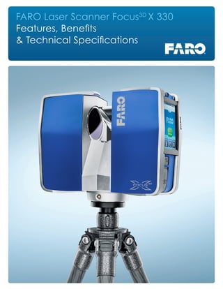
  • 1. FARO Laser Scanner Focus3D X 330 Features, Benefits & Technical Specifications
  • 2. How the Focus3D X 330 Works The technology behind the Focus3D X 330 is simple. First, the laser scanner emits a laser beam from a rotating mirror out towards the area being scanned. Then the unit distributes the laser beam at a vertical range of 300° and a horizontal range of 360°. The laser beam is then reflected back to the scanner by objects in its path. The distance to the objects defining an area is calculated as well as their relative vertical and horizontal angles. The data is captured and transmitted via WLAN for calculating precise 3D renderings. Focus3D X 330 The Perfect Instrument for 3D Documentation and Land Surveying Building on the success of the Focus3D , the new Focus3D X 330 surpasses previous models in functionality and performance. With a range almost three times greater than previous models, the Focus3D X 330 can scan objects up to 330 meters away and in direct sunlight. With its integrated GPS receiver, the laser scanner is able to correlate individual scans in post- processing making it ideal for surveying based applications. In addition, the Focus3D X 330 scan quality has been increased and noise has been reduced, providing precise three dimensional models in a photo-realistic style. These advances in performance did not come at the expense of safety as the Focus3D X 330 includes a Class 1 “eye safe” laser. With its increased range and scan quality, the Focus3D X 330 considerably reduces the effort involved in measuring and post- processing. The 3D scan data can easily be imported into all commonly used software solutions for accident reconstruction, architecture, civil engineering, construction, forensics, industrial manufacturing and land surveying. Distance dimensions, area and volume calculations, analysis and inspection tasks and documentation can thus be carried out quickly, precisely and reliably.
  • 3. Extended Scanning - 330m Range The Focus3D X 330 can scan objects up to 330 meters away. Large buildings, land-site excavations and vast terrains can be surveyed with fewer scans, thus resulting in quicker project scanning completion. Easy Positioning - Integrated GPS Receiver With its integrated GPS receiver, the laser scanner is able to correlate individual scans in post-processing making it ideal for surveying based applications. Outdoor Scanning Capability The Focus3D X 330 now is able to perform fast and highly precise scanning in direct sunlight. Low Noise Performance The Focus3D X 330 delivers extraordinary scan data quality with very low noise. Compass An electronic compass is included within the unit to associate directional data to your scans and facilitate the auto-registration process. Height Sensor (Altimeter) Each scan includes height information which can be used to scan different floor levels in a building. The data can then be used to differentiate the floors. Dual Axis Compensator To minimize the number of targets needed, the dual axis compensator enables every scan to have integrated level information. WLAN (WiFi) WLAN remote control allows starting, stopping, viewing or downloading of scans at a distance. Features of the Focus3D X 330 Focus3D X 330 Benefits to the End User • 330m scanning range reduces the number of scans per project • Portability allows user to scan complex objects and environments • GPS receiver helps correlate individual scans during post-processing • Touch-screen interface makes the scanner easy for anyone to use Benefits to the Company • Provides long term investment for future projects • Dedicated users can act as general scanning providers within organization • Real world environments are preserved in a virtual 3D world • Unsurpassed cost-value proposition make every scanning project economical
  • 4. Performance Specifications Ranging Unit Unambiguity Interval: By 122 to 488 Kpts/sec at 614m; by 976 Kpts/sec at 307m Range Focus3D X 330: 0.6m - 330m indoor or outdoor with upright incidence to a 90% reflective surface Measurement Speed (pts/sec): 122,000 / 244,000 / 488,000 / 976,000 Ranging Error1 : ±2mm Color Unit Resolution: Up to 70 megapixel color Dynamic Color Feature: Automatic adaption of brightness Parallax: Co-axial design Deflection Unit Vertical Field of View (vertical/horizontal): 300° / 360° Step Size (vertical/horizontal): 0.009° (40,960 3D-Pixel on 360°) / 0.009° (40,960 3D-Pixel on 360°) Max. Vertical Scan Speed: 5,820rpm or 97Hz Laser (Optical Transmitter) Laser Class: Laser class 1 Wavelength: 1550nm Beam Divergence: Typical 0.19mrad (0.011°) (1/e, halfangle) Beam Diameter at Exit: Typical 2.25mm (1/e) Data Handling and Control Data Storage: SD, SDHC™, SDXC™; 32GB card included Scanner Control: Via touch-screen display and WLAN New WLAN Access: Remote control, scan visualization are possible on mobile devices with Flash® Multi-Sensor Dual Axis Compensator: Levels each scan with an accuracy of 0.015° and a range of ±5° Height Sensor: Via an electronic barometer the height relative to a fixed point can be detected and added to a scan Compass: Electronic compass gives the scan an orientation. A calibration feature is included. GPS: Integrated GPS receiver Ranging noise2 @ 90% refl. @ 10% refl. @10m 0.3mm 0.4mm @25m 0.3mm 0.5mm @10m - noise compressed3 0.15mm 0.20mm @25m - noise compressed4 0.15mm 0.25mm Hardware Specifications Power Supply Voltage: 19V (external supply), 14.4V (internal battery) Cable Connector: Located in scanner mount Power Consumption: 40W and 80W (while battery charges) Weight: 5.2kg Battery Life: 4.5 hours Size: 240 x 200 x 100mm Ambient Temperature: 5° - 40°C Maintenance Calibration: Annual Humidity: Non-condensing 1 Ranging error is defined as a systematic measurement error at around 10m and 25m, one sigma. 2 Ranging noise is defined as a standard deviation of values about the best-fit plane for measurement speed of 122,000 points/sec. 3 A noise-compression algorithm may be activated thereby compressing raw data noise by a factor of 2 or 4. Subject to change without prior notice. 4 Ferromagnetic objects can disturb the earth magnetic field and lead to inaccurate measurements. © 2013 FARO | FARO and the FARO Logo are registered trademarks of FARO Technologies Inc. SFDC_04MKT_0357 Created: 10/10/13 FARO Focus3D X 330 www.faro.com/focus For more information call 800.736.0234 or visit www.faro.com/focus