2. I
Earlier experiences paved my views on how human have contributed to environmental deterioration. Two
of these experiences taught me lessons about how humans affect nature and life as a whole. In the early
90’s I used to explore the areas surrounding the Bronx Kill, a South Bronx waterbody. I observe the lack of
wildlife and the ever increasing dumping of garbage and oil. After a couple of years the waterbody
contaminated from the dumping of garbage and car parts. Fishermen could not eat the fish because of this
contamination. Also, as a Research Assistant at the Smithsonian Institution Conservation Research Center I
took pictures of endangered wildlife and saw the efforts of scientist to preserve endangered habitat’. On a
sunny day wile taking a picture of the endangered Mongolian Horse, I thought deeply as to what I should
learn and what my career path could be. These insight set me on a path to understand urban environments,
learn about cultures, and explore solutions to environmental and social problems.
I pursue a Bachelor of Science degree in Environmental Studies to understand the root causes of urban
water contamination and air pollution. At the SUNY College of Environmental Science and Forestry or SUNY
ESF, I learned to examine complex problems using ecological systems principles and to look at places as
systems, natural and social systems. Ever since graduating from SUNY ESF, I have been on a journey to find
how I can contribute to the progress of humanity and how I can assist my peers in preserving natural
resources. The following pages embody some of the skills I have developed at SUNY ESF, Hunter College, my
internships, and jobs.
Urban Planning
I believe in using planning techniques to conserve and preserve natural resources. Read and observe to find
holistic perspective methods. Just knowing that urban areas are human-dominated ecosystems leads to
understanding on how urban environments are affecting the use of natural resources.
Geographic Information Systems or GIS
Ever since graduating from SUNY ESF, I have been involved in GIS related projects. It all started at the
Smithsonian Institution National Zoological Park Conservation Research Center, where I was a Research
Assistant. At the Research Center, I assisted staff in teaching environmental professionals about the use of
GIS for conservation purposes. I also learned from observing endangered animals, such as the Presbyterian
Oryx and the Mongolian Horse, that solutions start at the urban level and there is a need to do research to
preserve habitats.
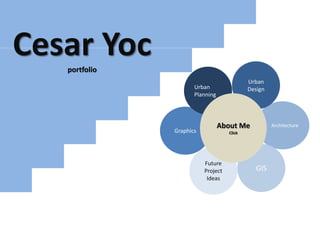
Cesar Yoc
About Me
Urban
Design
Architecture
GIS
Graphics
Design Ideas
Urban
Planning
Table of
Contents
3. II
Table of Contents
Project
•East of the Hub (EoH)
•Pocahontas Line Greenway (PLG)
•Capstone Seminar (FPC)
Project
•East of the Hub (EoH)
•Pocahontas Line Greenway (PLG)
•Roberto Clemente Square (RCS)
Project
•East of the Hub (EoH)
•Capstone Seminar (FPC)
•176th St. Garden (Garden)
Project
•Green Infrastructure Plan (GIP)
•Jamaica Bay (JB)
•Other
Project
•Osborne Association Video (OAV)
•Osborne Newsletter , Energy Efficiency PPT (Media)
Project
•Bronx-Energy Analysis (BEA)
•Energy, culture, and Economic Development (ECEC)
•Bronx Sustainability Institute
Urban Design
This is a list of projects, design
ideas, and published maps and
reports.
Urban Planning
Architecture
GIS
Media
Design Ideas
1 - 2
3 - 4
5-6
Page
7 - 8
9 - 10
11-12
13 – 14
15 - 16
17-18
19 – 20
21
22
23
24, 25, 26
27– 28
29-30
4. Urban Planning
East of the Hub- A vision for Community Development
and Sustainable Design
About Me Urban Design Architecture GIS Media Design Ideas
EoH b
PLG a
PLG b
FPC a
FPC b
Table of
Contents
This is a panoramic view looking from Westchester Avenue. There are a couple parking lots
surrounding the area. Also, there is an adjacent site for which an RFP for development has been
submitted by EDC.
EoH a
East of the Hub project uses a multi-disciplinary approach to plan neighborhoods. I use this
approach to design three vacant lots according to zoning and adjacent uses.
The project boundary is situated adjacent to the HUB-Third Avenue Business Improvement
District. The Hub is a transportation and commercial hub for South Bronx residents. So, all
the components are there to propose a vision with multimodal transportation options and
green building design.
1
5. East of the Hub- A vision for Community Development
and Sustainable Design
PLG a
PLG b
FPC a
FPC b
EoH a
EoH b
Urban Planning Urban Design Architecture GIS Media Design Ideas
Table of
Contents
About Me
I toured the site and observed any religious and educational institutions surrounding
the vacant lots. The neighborhood has churches, schools, and commercial spaces.
What it lacks is an open space to accommodate the diverse groups that work in the
neighborhood. I had noticed that there were no areas to sit and read or do school
work. The area lacks any commercial and residential stability. People just do not stay
in the area for too long. Residents are there temporarily, they go to buy at the Hub
or just attend classes are the nearby schools.
The neighborhood has a Bronx Landmark, The Bronx Borough Courthouse (image
above), that has not been in used for over 30 years. There are a couple of junior high
schools and a high school. Nearby there are two colleges, Hostos Community
College and Boricua College.
2
6. EoH b
PLG b
FPC a
FPC b
EoH a
PLG a
Urban Planning Urban Design Architecture GIS Media Design Ideas
Table of
Contents
About Me
In 2004, I took a Sustainable Development course at
Hunter College. The course requirement was to do a
study of a neighborhood and to propose solutions to
any problems.
Growing up in Millbrook Houses I have observed the
bike paths that where painted throughout the
neighborhood. The bike paths were unsafe for
bicyclist because parked cars took most of the bike
lane space. For my course assignment I proposed to
do a study of bike lane use. After walking the bike
lanes my study partner and I noticed an abandoned
freight train line and changed the proposal to the
conversion of this freight train line into a greenway.
I named the Greenway the Pocahontas Line
Greenway. I did research on the freight train line and
found that the owner (Gouverneur Morris) was a
direct descendant of Pocahontas and he nicknamed
the Line Old Pokey after Pocahontas.
3
7. EoH b
FPC a
FPC b
EoH a
PLG a
PLG b
Urban Planning Urban Design Architecture GIS Media Design Ideas
Table of
Contents
About Me
The course professor asked the students to identify any educational institutions and
surrounding structures. I designed a map to identify any surrounding structures and
thought of the possible uses of the space.
The right image is a sketch of a railroad museum. The rail carts run using a solar powered
generator. The carts have sits and windows were people can look at the exhibits outside
the cart.
Pocahontas Line Greenway
4
8. EoH b
PLG b
FPC b
EoH a
PLG a
FPC a
Urban Planning Urban Design Architecture GIS Media Design Ideas
Table of
Contents
About Me
I did not write a thesis for the graduate program. Instead I completed a Capstone Seminar.
The participating students had to find a client and do a community developments project
for them. We found a client, The First Presbyterian Church in Jamaica, Queens. The church
leaders asked us to do a feasibility study for a vacant lot they have purchase adjacent to
the church. My task was to work with the architecture group to design a thirteen floor
building according to the allowable zoning. Above is the proposed building mass.
5
First Presbyterian Church of Jamaica, Queens Project
9. EoH b
PLG b
FPC a
FPC b
EoH a
PLG a
Urban Planning Urban Design Architecture GIS Media Design Ideas
Table of
Contents
About Me
I sketched the church properties current use. I sketched a building using Google
SketchUp of the proposed building according to the zoning allowed. In our zoning
analysis we merge zoning from adjacent lots to increase floor area for the new
building and have more air rights.
6
First Presbyterian Church of Jamaica, Queens Project
10. EoH b
PLG a
PLG b
RCS a
RCS b
EoH a
I designed the area according to the zoning
limitations and neighborhood needs. The
neighborhood lacks open space and communal
spaces.
The lots have trees to improve the air of the area and to
promote environmental health.
Urban Planning
East of the Hub- A vision for Community Development
and Sustainable Design
The pavers and green spaces promote recreational uses and
diversity of uses. This helps in reducing safety concerns.
Urban Design Architecture GIS Media Design Ideas
Table of
Contents
About Me
7
11. EoH b
PLG a
PLG b
RCS a
RCS b
EoH a
Urban Planning Architecture GIS Media Design Ideas
Table of
Contents
Urban DesignAbout Me
One of the goals of the design is to reduce traffic by having
single car lanes. With the width reduction of the car lane
the floor area of the lot increases. The lane uses pervious
pavers to reduce storm-water flow.
Plazas and roads promote environmental health and
alternative transportation options. The required parking
spaces are below ground to reduce traffic .
8
East of the Hub- A vision for Community Development
and Sustainable Design
12. EoH b
PLG a
PLG b
RCS a
RCS b
EoH a
Urban Planning Architecture GIS Media Design Ideas
Table of
Contents
Urban DesignAbout Me
The greenway is designed according to bike lane design guidelines. This greenway
promotes environmental health by planting flowers, trees, and other recreational
amenities.
9
Pocahontas Line Greenway
13. EoH b
PLG a
PLG b
RCS a
RCS b
EoH a
Urban Planning Architecture GIS Media Design Ideas
Table of
Contents
Urban DesignAbout Me
Promote community unity and multi-use by designing a plaza. The idea is to have a
recreational space with a TV screen to show movies at night. The image to the right is an
idea to renovate the tunnel..
10
Pocahontas Line Greenway
14. EoH b
PLG a
PLG b
RCS a
RCS b
EoH a
Urban Planning Architecture GIS Media Design Ideas
Table of
Contents
Urban DesignAbout Me
As an intern at the office of Congressman
Jose E. Serrano I was meeting staff from
the South Bronx Overall Community
Development Corporation or SOBRO. The
staff told me their ideas about a triangular
space in the Third Avenue Business
Improvement District.
I took pictures of the area to identify its
potential use. This is an image of the
triangle before its new design.
11
Roberto Clemente Square
15. EoH b
PLG a
PLG b
RCS a
RCS b
EoH a
Urban Planning Architecture GIS Media Design Ideas
Table of
Contents
Urban DesignAbout Me
After observing the roads and pedestrians, I sketch my ideas of potential uses. The above
design uses a tower to help with bus dispatching and has a seating area for passengers
before their board the bus. Since this is the Hub I design a monument signifying hope and
progress.
Monument pointing
North to mean progress
12
Roberto Clemente Square
16. EoH b
FPC a
FPC b
Garden a
Garden b
EoH a
Urban Planning Urban Design Architecture GIS Media Design Ideas
Table of
Contents
About Me
To the left is a green building that has
underground parking. The parking
spaces below ground are for
residential use. The above floors are
for commercial, community, and
residential use, and the bottom floor is
for restaurants, a bookstore, fresh
produce vendors, and various stores.
The second floor is for community
space, which are useful to educational
institutions and not-for-profit
organizations. The floor can have
seating in an open area for meetings, a
computer cafe, and space for reading.
The other floors are for mixed-income
housing.
There is a lack of open space in the
neighborhood. The design ideas is to
create an inviting open space and to use
the space for recreational use or a place
to relax after buying food or a book from
stores in the first floor.
13
East of the Hub
17. EoH b
FPC a
FPC b
Garden a
Garden b
EoH a
Urban Planning Urban Design GIS Media Design Ideas
Table of
Contents
ArchitectureAbout Me
As a College Aid at the NYC Department of
Environmental Protection I learned the dire
need to reduce stormwater flow. To reduce
stormwater flow, the roads and sidewalks
are not paved with asphalt or just pure
concrete, it has pervious pavers to reduce
stormwater flow and increase porosity to
filter water.
The South Bronx does not have many open
spaces that have an entertainment
component. The open space has water and
other natural components to promote
community health.
14
East of the Hub
18. EoH b
FPC a
FPC b
Garden a
Garden b
EoH a
Urban Planning Urban Design GIS Media Design Ideas
Table of
Contents
ArchitectureAbout Me
This a sketch I did for my
Community Development Studio. I
worked with other students to
write a feasibility study for the First
Presbyterian Church in Jamaica,
Queens. This a Green Building that
has elements that promote
diversity of uses.
We designed the building according
to the zoning limitations. I designed
a space where residents could feel
comfortable and that promotes
multi0use.
15
First Presbyterian Church of Jamaica, Queens Project
19. EoH b
FPC a
FPC b
Garden a
Garden b
EoH a
Urban Planning Urban Design GIS Media Design Ideas
Table of
Contents
ArchitectureAbout Me
This is the entrance of the building. It has underground parking and commercial spaces in the
first floor. The second floor is for programming use and the rest are for affordable apartments.
16
First Presbyterian Church of Jamaica, Queens Project
20. EoH b
FPC a
FPC b
Garden a
Garden b
EoH a
Urban Planning Urban Design GIS Media Design Ideas
Table of
Contents
ArchitectureAbout Me
I was helping to design a community
garden for a group of residents in the
North Section of the South Bronx, the 176th
Street Garden. We worked together to
sketch ideas on what components it should
have.
The components include a space for
organic and a relaxing space to congregate
(the Kiosk).
17
176th Street Garden
21. EoH b
FPC a
FPC b
Garden a
Garden b
EoH a
Urban Planning Urban Design GIS Media Design Ideas
Table of
Contents
ArchitectureAbout Me
The purpose of the design is to
promote community unity. The garden
also has sections for residents to grow
food and to relax.
This is my idea for improving New York
City Housing Authority open spaces.
Most of these are not open to the
public. The top image is a current use
of a Millbrook Houses open space.
The bottom images are ideas of design.
18
Millbrook Gardens
22. GIP b
JB a
Other
GIP a
Urban Planning Urban Design Architecture
GIS Media Design Ideas
Table of
Contents
About Me
I have used GIS software for the last five
years. I assisted in the analysis and designs
of the maps for the NYC Green
Infrastructure Plan report as an intern and
College Aid at the NYC Department of
Environmental Protection.
I design maps to identify areas where
there is a need to reduce water
contamination. These maps include
potential and current green infrastructure
construction sites.
19
NYC Green Infrastructure Plan
23. GIP b
JB a
Other
GIP a
Urban Planning Urban Design Architecture Media Design Ideas
Table of
Contents
GIS
About Me
For Drainage Map
I was helping an intern with their
internship GIS project. We worked
together to do a Grid map, where people
can click a grid and a zoomed in map loads
or it is displayed.
I used SQL software to do a Landuse
Analysis of NYC drainage areas. DEP used
the information to calculate the number of
acres for each drainage area.
20
NYC Green Infrastructure Plan
24. GIP b
JB a
Other
GIP a
Urban Planning Urban Design Architecture Media Design Ideas
Table of
Contents
GIS
About Me
As intern at DEP, my task was to design a
Jamaica Bay Access Map. This is the map
designed and it is published in the
Jamaica Bay Plan.
Jamaica Bay Access Map
NYC Department of Environmental Protection
21
25. GIP b
JB a
Other
GIP a
Urban Planning Urban Design Architecture Media Design Ideas
Table of
Contents
GIS
About Me
I have designed maps for GIS courses at Hunter
College. Last year I took a programming course to learn
python. I wrote a program to do an analysis of solar
radiation of buildings in the North Area of the Bronx.
22
GIS maps
26. Directed, produced, and edited video about Osborne Association’s Green Career Center and
Justice Community
http://www.youtube.com/watch?feature=player_embedded&v=WRhyESNpTdo
Media a
Media b
Media c
OAV
Urban Planning Urban Design Architecture GIS Media Design Ideas
Table of
Contents
About Me
23
27. Media a
Media b
Media c
OAV
Urban Planning Urban Design Architecture GIS Design Ideas
Table of
Contents
Media
About Me
I was an AmeriCorps Vista volunteer at The Osborne Associations Green
Career Center. My task was to design a Newsletter for the Department.
This is a section of one of the first issues of the Newsletter. I have
sections for interviews and information about Green products or
Environmental deterioration and its solutions.
24
28. Media a
Media b
Media c
OAV
Urban Planning Urban Design Architecture GIS Design Ideas
Table of
Contents
Media
About Me
After my AmeriCorps tenure I helped the
Fatherhood Initiative staff to design a
brochure and a Newsletter. I took
pictures of participants and interviewed
them to write their achievements in the
Fatherhood Times Newsletter.
25
Fatherhood Initiative pamphlet
29. Media a
Media b
Media c
OAV
Urban Planning Urban Design Architecture GIS Design Ideas
Table of
Contents
Media
About Me
For the Green Career Center I sketched a
hypothetical house. The flat roof is not
typical of a house. The roof just showed what
house owners can do to reduce their
electrical bill by using alternative energy.
The main floor, second floor, and rooftop.
This is done to show the areas that people
can improve to reduce their electrical bill.
26
Energy use in a home
30. BEA b
ECEC a
ECEC b
BEA a
Urban Planning Urban Design Architecture GIS Media Design Ideas
Table of
Contents
About Me
Sunlight reflected
and energy absorbed
by materials
Tree
Oxygen
release and
CO2
absorption
What is the interior and exterior
absorption and release of energy
for different archetypes
What is the
thermal
system for
urban
areas in
the city?
How can we model this
area to quantify maximum
power?
What is the energy
potential from the
sunlight to reduce the use
of fossil fuels and to
provide local y available
energy?
27
Bronx Energy Analysis
31. BEA b
ECEC a
ECEC b
BEA a
Urban Planning Urban Design Architecture GIS Media
Table of
Contents
Design Ideas
About Me
After analyzing energy potential
of the neighborhood and
learning thermodynamic
architecture theory, I will like to
apply these theories or
principles into the redesign of a
neighborhood in the South
Bronx.
The study will look at current
zoning. See if most of the site
have used the maximum zoning
air rights allowed. Use this
information to redesign the
project area using Systems
Thinking ideas and
thermodynamic theories in
design.
Bronx Energy Analysis: Expansion of East of the Hub
28
32. BEA b
ECEC a
ECEC b
BEA a
Urban Planning Urban Design Architecture GIS Media
Table of
Contents
Design Ideas
About Me
Use methods from urban planning to
observe the transportation options in the
neighborhood. Also, learn about the
neighborhood by interviewing residents
in the neighborhood. Learn
environmental psychology theory to
understand the neighborhood. Use this
information to contribute to the redesign
of the area.
29
Energy, culture, and Economic Development
33. The creation of a Bronx Sustainability InstituteBEA b
ECEC a
ECEC b
BEA a
Urban Planning Urban Design Architecture GIS Media
Table of
Contents
Design Ideas
About Me
30
Energy, culture, and Economic Development
Use the Institute to do energy potential
mapping for Bronx neighborhoods
Have student based projects for them to
learn landscape architecture and urban
design
Learn about thermodynamic theories
and how it applies to architecture