SlideShare a Scribd company logo
1 of 4
Download to read offline
MAPPING
& GEOSPATIAL
BB4
MULTIROTOR
UAV SOLUTION
CHCNAV · BB4
PROFESSIONAL UAV
PLATFORM
REALITY CAPTURE
2 min for flight preparation.
BB4 UAV is specially designed for professional
industrial applications. The modular design
with pre-installed arms and antennas reduces
the time required for setup, making the
platform ready for use in just 2 minutes.
Thanks to its structure, little space is required
for BB4 take-offs and landings.
Operated by DJI Ground Station Pro.
Enhance the BB4's operation with the DJI
Ground Station Pro (DJI GS Pro), an iPad App.
Perform automated flight missions, manage flight
data in the cloud, and collaborate between
projects to efficiently manage your drone
workflow.
Extended survey coverage capacity.
BB4 offers up to 55 minutes of flight time with
a 1 kg payload and up to 40 minutes with a 5
kg payload, providing users with the ability to
install a high-performance LiDAR and survey
large areas in a single flight mission.
Operating range up to 5 km.
The BB4s use the DJI Lightbridge 2 flight
controller with an operating range of 5 km. The
integrated controller and advanced algorithms
set a new standard for wireless HD image
transmission by reducing latency and
increasing maximum range and reliability.
Up to 7 kg payload.
Due to its large capacity of up to 7 kg, the BB4
can be configured according to your mission
needs. To generate an accurate 3D point
cloud, the BB4 can carry CHCNAV scanners
with DSRL cameras. 3D photogrammetry is
also possible with an oblique camera system.
For inspection and agriculture, users can use
multi-spectral cameras.
Integrated GNSS Units + IMU.
The BB4 integrates dual DJI A3 IMUs and
G N S S u n i t s t h a t w o r k t o g e t h e r w i t h
CHCNAV's advanced positioning solution,
consisting of a high-end GNSS receiver and
an industry leading IMU to meet the high
accuracy requirements of the surveying and
mapping industry.
STATE-OF-THE-ART
PLATFORM
INTELLIGENT, SIMPLIFIED
FLIGHT SOFTWARE
SUPERIOR FLYING
PERFORMANCE
LONG RANGE OPERATION
HIGH CAPACITY
SURVEY-GRADE
ACCURACY
BB4 is a high-end unmanned aircraft system resulting from an alliance between the two industry leaders
in their respective segments. Its scientific design and highly integrated production technology come from
CHCNAV - a global manufacturer specialized in efficient geospatial measurement technologies - and its
fully automated flight control system from DJI, the pioneer in the manufacturing of commercial UAVs.
EFFICIENT
DATA CAPTURE
Topographic
survey
Construction Asset
inspections
Mining Natural
resources
CHCNAV · BB4
SPECIFICATIONS
CHC Navigation Europe
Infopark Building , Sétány 1, 1117
Budapest, Hungary
+36 20 235 8248 +36 20 5999 369
info@chcnav.eu
CHC Navigation USA LLC
6380 S. Valley View Blvd Suite 246
Las Vegas, NV 89118 USA
+1 480 399 9533
CHC Navigation India
409 Trade Center, Khokhra Circle,
Maninagar East, Ahmedabad,
Gujarat, India
+91 90 99 98 08 02
CHC Navigation Headquarter
Shanghai Huace NavigationTechnology Ltd.
599 Gaojing Road, Building D,
Shanghai, 201702, China ,
+86 21 54260273
WWW.CHCNAV.COM | SALES@CHCNAV.COM
© 2021 Shanghai Huace Navigation Technology Ltd. All rights reserved. The CHC and CHC logo are trademarks of
Shanghai Huace Navigation Technology Limited. All other trademarks are the property of their respective owners.
Revision July 2021.
*All specifications are subject to change without notice.
(1) Flight time depends on operation mode, weather conditions, altitude and payload.
General system performance
Type Quadcopter with 4 propellers
Structure Carbon fiber, quickly release design
Assembly time Start 2 min / finish 2 min
Empty weight 10.9 kg
Max. payload 7.1 kg
Max. takeoff weight 28.0 kg (with battery)
Dimensions of
instrument
110.0 110.0 44.0 cm
43.3" 43.3" 17.32"
Transport container Water, dust and quakeproof
Dimensions of unit in
container
94.0 64.0 50.0 cm
37.0" 25.2" 19.7"
Flight Control System Dual DJI A3
Remote control SW DJI GS PRO
Operating temperature -10 C to +40 C
Control system Dual-frequency GNSS navigation, dual
redundancy sensor design, fully-automatic
work mode
Hovering accuracy 1 cm + 1 ppm Hz
2 cm + 1 ppm V
Auto-flight mode Pre-design air route, flight height change
Flight performance
Max.flight altitude
MAMSL
5000 m
Flight time (1) 55 mins with 1 kg payload
40 mins with 5 kg payload
Max.speed 14 m/sec
Max.ascent speed 5 m/sec
Max.descent speed 3 m/sec
Max.wind resistance 13.9 m/sec (level 6)
Takeoff type Automated takeoff and landing
≤ ≤
× ×
× ×
× ×
× ×
° °
Remote controller
Operating frequency 2.400 GHz to 2.483 GHz
Max. transmission
distance
Specialized UAV frequency,
auti-disturb feature, radius 7 km
Video output port HDMI, SDI, USB
Operating
temperature
-10 C to +40 C
Battery 6000 mAh LiPo 2S
Electrical
Standard battery 4x Li-Polymer batteries, 22000 mAh
Voltage 22.2 V
Energy 501.6 Wh
Connectors XT60 XT
-60 XT60 female
Supported payload
RGB camera CHC AS-C420(calibrated Sony A7 RII)
7952 x 5304, 42.4 MP, 5 fps
CHC AS-C240 (calibrated Sony A6000)
6000 x 4000, 24.3 MP, 11 fps
Other sensors, but request factory
customisation and calibration
LiDAR CHC AlphaUniXXX series
Riegl miniVUX and VUX-1 based scanners
CHC ASXXXseries
3rd party LiDARS 7 kg weight
° °
≤

More Related Content

More from Budi anto

Jual Waterpas Sokkia B20, B30, B40 Call/ wa : 082119953499
Jual Waterpas Sokkia B20, B30, B40 Call/ wa : 082119953499Jual Waterpas Sokkia B20, B30, B40 Call/ wa : 082119953499
Jual Waterpas Sokkia B20, B30, B40 Call/ wa : 082119953499Budi anto
 
Jual Total Station Sokkia IM-105 Call 082119953499
Jual Total Station Sokkia IM-105 Call 082119953499Jual Total Station Sokkia IM-105 Call 082119953499
Jual Total Station Sokkia IM-105 Call 082119953499Budi anto
 
Jasa Kalibrasi, Rental dan Jual Total Station Sokkia IM-52 Call/ wa 082119953499
Jasa Kalibrasi, Rental dan Jual Total Station Sokkia IM-52 Call/ wa 082119953499Jasa Kalibrasi, Rental dan Jual Total Station Sokkia IM-52 Call/ wa 082119953499
Jasa Kalibrasi, Rental dan Jual Total Station Sokkia IM-52 Call/ wa 082119953499Budi anto
 
Jasa Kalibrasi, Rental dan Jual Total Station Topcon GM-105 Call 082119953499
Jasa Kalibrasi, Rental dan Jual Total Station Topcon GM-105 Call 082119953499Jasa Kalibrasi, Rental dan Jual Total Station Topcon GM-105 Call 082119953499
Jasa Kalibrasi, Rental dan Jual Total Station Topcon GM-105 Call 082119953499Budi anto
 
Jual Total Station Topcon GM-100 Series Call 082119953499
Jual Total Station Topcon GM-100 Series Call 082119953499Jual Total Station Topcon GM-100 Series Call 082119953499
Jual Total Station Topcon GM-100 Series Call 082119953499Budi anto
 
Jual GPS Spectra SP20 Call / wa 082119953499
Jual GPS Spectra SP20 Call / wa 082119953499Jual GPS Spectra SP20 Call / wa 082119953499
Jual GPS Spectra SP20 Call / wa 082119953499Budi anto
 
Brosur spectra Call 082119953499
Brosur spectra Call 082119953499Brosur spectra Call 082119953499
Brosur spectra Call 082119953499Budi anto
 
Ready Base Station Spectra Pro flex 800cors Call 08211
Ready Base Station Spectra Pro flex 800cors Call 08211Ready Base Station Spectra Pro flex 800cors Call 08211
Ready Base Station Spectra Pro flex 800cors Call 08211Budi anto
 
Sp80 GNSS Receiver
Sp80 GNSS ReceiverSp80 GNSS Receiver
Sp80 GNSS ReceiverBudi anto
 
Brosur focus 35
Brosur focus 35Brosur focus 35
Brosur focus 35Budi anto
 
Focus DL-15 Digital Level Spectra
Focus DL-15 Digital Level SpectraFocus DL-15 Digital Level Spectra
Focus DL-15 Digital Level SpectraBudi anto
 
Digital Level Spectra Focus DL-15 Call 082119953499
Digital Level Spectra Focus DL-15 Call 082119953499Digital Level Spectra Focus DL-15 Call 082119953499
Digital Level Spectra Focus DL-15 Call 082119953499Budi anto
 
Brosur spectra 082119953499
Brosur spectra 082119953499Brosur spectra 082119953499
Brosur spectra 082119953499Budi anto
 
Spectra 082119953499
Spectra 082119953499Spectra 082119953499
Spectra 082119953499Budi anto
 
082119953499 Brosur spectra
082119953499 Brosur spectra082119953499 Brosur spectra
082119953499 Brosur spectraBudi anto
 

More from Budi anto (20)

Jual Waterpas Sokkia B20, B30, B40 Call/ wa : 082119953499
Jual Waterpas Sokkia B20, B30, B40 Call/ wa : 082119953499Jual Waterpas Sokkia B20, B30, B40 Call/ wa : 082119953499
Jual Waterpas Sokkia B20, B30, B40 Call/ wa : 082119953499
 
Jual Total Station Sokkia IM-105 Call 082119953499
Jual Total Station Sokkia IM-105 Call 082119953499Jual Total Station Sokkia IM-105 Call 082119953499
Jual Total Station Sokkia IM-105 Call 082119953499
 
Jasa Kalibrasi, Rental dan Jual Total Station Sokkia IM-52 Call/ wa 082119953499
Jasa Kalibrasi, Rental dan Jual Total Station Sokkia IM-52 Call/ wa 082119953499Jasa Kalibrasi, Rental dan Jual Total Station Sokkia IM-52 Call/ wa 082119953499
Jasa Kalibrasi, Rental dan Jual Total Station Sokkia IM-52 Call/ wa 082119953499
 
Jasa Kalibrasi, Rental dan Jual Total Station Topcon GM-105 Call 082119953499
Jasa Kalibrasi, Rental dan Jual Total Station Topcon GM-105 Call 082119953499Jasa Kalibrasi, Rental dan Jual Total Station Topcon GM-105 Call 082119953499
Jasa Kalibrasi, Rental dan Jual Total Station Topcon GM-105 Call 082119953499
 
Jual Total Station Topcon GM-100 Series Call 082119953499
Jual Total Station Topcon GM-100 Series Call 082119953499Jual Total Station Topcon GM-100 Series Call 082119953499
Jual Total Station Topcon GM-100 Series Call 082119953499
 
Jual GPS Spectra SP20 Call / wa 082119953499
Jual GPS Spectra SP20 Call / wa 082119953499Jual GPS Spectra SP20 Call / wa 082119953499
Jual GPS Spectra SP20 Call / wa 082119953499
 
Brosur spectra Call 082119953499
Brosur spectra Call 082119953499Brosur spectra Call 082119953499
Brosur spectra Call 082119953499
 
Ready Base Station Spectra Pro flex 800cors Call 08211
Ready Base Station Spectra Pro flex 800cors Call 08211Ready Base Station Spectra Pro flex 800cors Call 08211
Ready Base Station Spectra Pro flex 800cors Call 08211
 
Water
WaterWater
Water
 
Sp80
Sp80Sp80
Sp80
 
Sp80 GNSS Receiver
Sp80 GNSS ReceiverSp80 GNSS Receiver
Sp80 GNSS Receiver
 
Promark 120
Promark 120Promark 120
Promark 120
 
Sp80
Sp80Sp80
Sp80
 
Pm120
Pm120Pm120
Pm120
 
Brosur focus 35
Brosur focus 35Brosur focus 35
Brosur focus 35
 
Focus DL-15 Digital Level Spectra
Focus DL-15 Digital Level SpectraFocus DL-15 Digital Level Spectra
Focus DL-15 Digital Level Spectra
 
Digital Level Spectra Focus DL-15 Call 082119953499
Digital Level Spectra Focus DL-15 Call 082119953499Digital Level Spectra Focus DL-15 Call 082119953499
Digital Level Spectra Focus DL-15 Call 082119953499
 
Brosur spectra 082119953499
Brosur spectra 082119953499Brosur spectra 082119953499
Brosur spectra 082119953499
 
Spectra 082119953499
Spectra 082119953499Spectra 082119953499
Spectra 082119953499
 
082119953499 Brosur spectra
082119953499 Brosur spectra082119953499 Brosur spectra
082119953499 Brosur spectra
 

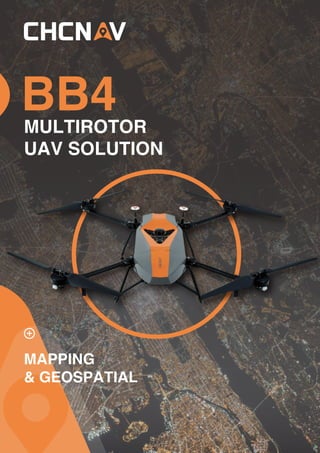
Jual CHCNAV UAV BB4 dengan rancangan khusus untuk pekerjaan survey profesional

  • 2. CHCNAV · BB4 PROFESSIONAL UAV PLATFORM REALITY CAPTURE 2 min for flight preparation. BB4 UAV is specially designed for professional industrial applications. The modular design with pre-installed arms and antennas reduces the time required for setup, making the platform ready for use in just 2 minutes. Thanks to its structure, little space is required for BB4 take-offs and landings. Operated by DJI Ground Station Pro. Enhance the BB4's operation with the DJI Ground Station Pro (DJI GS Pro), an iPad App. Perform automated flight missions, manage flight data in the cloud, and collaborate between projects to efficiently manage your drone workflow. Extended survey coverage capacity. BB4 offers up to 55 minutes of flight time with a 1 kg payload and up to 40 minutes with a 5 kg payload, providing users with the ability to install a high-performance LiDAR and survey large areas in a single flight mission. Operating range up to 5 km. The BB4s use the DJI Lightbridge 2 flight controller with an operating range of 5 km. The integrated controller and advanced algorithms set a new standard for wireless HD image transmission by reducing latency and increasing maximum range and reliability. Up to 7 kg payload. Due to its large capacity of up to 7 kg, the BB4 can be configured according to your mission needs. To generate an accurate 3D point cloud, the BB4 can carry CHCNAV scanners with DSRL cameras. 3D photogrammetry is also possible with an oblique camera system. For inspection and agriculture, users can use multi-spectral cameras. Integrated GNSS Units + IMU. The BB4 integrates dual DJI A3 IMUs and G N S S u n i t s t h a t w o r k t o g e t h e r w i t h CHCNAV's advanced positioning solution, consisting of a high-end GNSS receiver and an industry leading IMU to meet the high accuracy requirements of the surveying and mapping industry. STATE-OF-THE-ART PLATFORM INTELLIGENT, SIMPLIFIED FLIGHT SOFTWARE SUPERIOR FLYING PERFORMANCE LONG RANGE OPERATION HIGH CAPACITY SURVEY-GRADE ACCURACY BB4 is a high-end unmanned aircraft system resulting from an alliance between the two industry leaders in their respective segments. Its scientific design and highly integrated production technology come from CHCNAV - a global manufacturer specialized in efficient geospatial measurement technologies - and its fully automated flight control system from DJI, the pioneer in the manufacturing of commercial UAVs.
  • 4. SPECIFICATIONS CHC Navigation Europe Infopark Building , Sétány 1, 1117 Budapest, Hungary +36 20 235 8248 +36 20 5999 369 info@chcnav.eu CHC Navigation USA LLC 6380 S. Valley View Blvd Suite 246 Las Vegas, NV 89118 USA +1 480 399 9533 CHC Navigation India 409 Trade Center, Khokhra Circle, Maninagar East, Ahmedabad, Gujarat, India +91 90 99 98 08 02 CHC Navigation Headquarter Shanghai Huace NavigationTechnology Ltd. 599 Gaojing Road, Building D, Shanghai, 201702, China , +86 21 54260273 WWW.CHCNAV.COM | SALES@CHCNAV.COM © 2021 Shanghai Huace Navigation Technology Ltd. All rights reserved. The CHC and CHC logo are trademarks of Shanghai Huace Navigation Technology Limited. All other trademarks are the property of their respective owners. Revision July 2021. *All specifications are subject to change without notice. (1) Flight time depends on operation mode, weather conditions, altitude and payload. General system performance Type Quadcopter with 4 propellers Structure Carbon fiber, quickly release design Assembly time Start 2 min / finish 2 min Empty weight 10.9 kg Max. payload 7.1 kg Max. takeoff weight 28.0 kg (with battery) Dimensions of instrument 110.0 110.0 44.0 cm 43.3" 43.3" 17.32" Transport container Water, dust and quakeproof Dimensions of unit in container 94.0 64.0 50.0 cm 37.0" 25.2" 19.7" Flight Control System Dual DJI A3 Remote control SW DJI GS PRO Operating temperature -10 C to +40 C Control system Dual-frequency GNSS navigation, dual redundancy sensor design, fully-automatic work mode Hovering accuracy 1 cm + 1 ppm Hz 2 cm + 1 ppm V Auto-flight mode Pre-design air route, flight height change Flight performance Max.flight altitude MAMSL 5000 m Flight time (1) 55 mins with 1 kg payload 40 mins with 5 kg payload Max.speed 14 m/sec Max.ascent speed 5 m/sec Max.descent speed 3 m/sec Max.wind resistance 13.9 m/sec (level 6) Takeoff type Automated takeoff and landing ≤ ≤ × × × × × × × × ° ° Remote controller Operating frequency 2.400 GHz to 2.483 GHz Max. transmission distance Specialized UAV frequency, auti-disturb feature, radius 7 km Video output port HDMI, SDI, USB Operating temperature -10 C to +40 C Battery 6000 mAh LiPo 2S Electrical Standard battery 4x Li-Polymer batteries, 22000 mAh Voltage 22.2 V Energy 501.6 Wh Connectors XT60 XT -60 XT60 female Supported payload RGB camera CHC AS-C420(calibrated Sony A7 RII) 7952 x 5304, 42.4 MP, 5 fps CHC AS-C240 (calibrated Sony A6000) 6000 x 4000, 24.3 MP, 11 fps Other sensors, but request factory customisation and calibration LiDAR CHC AlphaUniXXX series Riegl miniVUX and VUX-1 based scanners CHC ASXXXseries 3rd party LiDARS 7 kg weight ° ° ≤