SlideShare a Scribd company logo
1 of 33
Download to read offline
Research Project for BSc Degree
Impacts of Gold Mining in Zarshouran Gold
Deposit and Suggesting Methods for
Remediating and Rehabilitating the Mine Area
Ali Sadighi, BSc in Mining Engineering
Supervisor: Dr. Ezzeddin Bakhtavar
Urmia University of Technology
September 2014
Page | 2
Acknowledgments: The author would like to oblige all
the help and favors that he has received form people in
Urmia University of Technology and Zarshouran Gold
Mine, especially Dr. Ezzeddin Bakhtavar, Mr. Mahmoud
Yekani, Mr. Reza Alvan, Mr. Ahmad Eftekari, Mr. Kaveh
Kalantari and Mr. Armin Fallahi.
Page | 3
Table of Contents
Preface ............................................................................................................................................ 4
1. Introduction ..................................................................................................................... 6
1-1. Location and Geography...................................................................................................... 7
1-2. Climate................................................................................................................................. 9
1-3. Vegetation............................................................................................................................ 9
1-4. Wildlife............................................................................................................................... 10
1-5. Geology .............................................................................................................................. 11
2. Impacts of Arsenic and Gold Mining in Zarshouran......................................................... 14
2-1. Impacts on human life ........................................................................................................... 14
2-2. Impacts on wildlife................................................................................................................. 15
2-3. Impacts on plant life .............................................................................................................. 15
2-4. Impacts on the environment (air, water and soil)................................................................. 15
2-4-1. Air ....................................................................................................................................... 16
2-4-2. Water.................................................................................................................................. 16
2-4-3. Soil ...................................................................................................................................... 19
3. Suggested Technologies and Solutions for Remediation and Reclamation in Zarshouran 21
3-1. Remediating the region from mineral contaminations......................................................... 21
3-2. Rehabilitating the mine area ................................................................................................. 24
Conclusion............................................................................................................................. 26
Bibliography .......................................................................................................................... 27
Appendix 1 – Geology Map of Zarshouran Gold Mine Area......................................................... 29
Appendix 2 – Applications of Arsenic Treatment Technologies for Soil, Waste and Water ........ 30
Appendix 3 – Zarshouran final pit illustration on Google Satellite Image.................................... 31
Appendix 4 – Map of the final pit of Zarshouran Gold Mine........................................................ 32
Page | 4
Preface
In our very first BSc semester we, mining engineering students, get to take a lesson named
General Geology or Fundamentals of Geology. Geology has always been my favorite field of study
but there was something very disappointing in our lesson. General Geology, written by Hassan
Madani, was taught by the lecturer, but without its very vital basics. The first chapter of the book,
which was about Astronomy, was thoroughly skipped. My classmates never got to know the real
genesis of everything around them.
Either geologists or miners, we all need to have a more top-down main definition of this top-
down sight. In 1990, NASA received a pretty simple but meaningful image from their Voyager 1
spacecraft. The pale blue dot in the image you see on this page
is our home, the Earth, photographed from a 6.5-billion
kilometer distance on edge of our solar system. That’s us,
wandering about a small star among hundreds of billions of
other stars living their lives in a very medium sized galaxy, which
lives among some other hundreds of billions of galaxies, named
the Milky Way galaxy. We, our home planet and our entire solar
system are nothing but a grain of sand on an infinite shore.
This absolutely basic fact has always been neglected by us,
human beings, geologists and especially miners. In 2012 I was
accepted as a trainee to enter Zarshouran Gold Deposit. By that
time and based on incomplete exploration data, the deposit was
the largest in the Middle East. I was pretty much tempted by
this title, but when I entered the area, I saw nothing but an
absolutely unique nature. They hadn’t begun mining by that time yet, so I had the chance to see
a real exploration project for the first time. In my three months of traineeship in Zarshouran,
besides the tons of things I learnt about my future career, I picked up quite a lot of information
about my future colleagues. They had literally no idea what was going on above their heads!
Most of them had absolutely no respect toward the nature around them, their home. This turned
into a huge concern in me, one with no solution but to try hard to hide this reality like others did
and help them with their earth-destroying work.
Later, in 2013 I was lucky enough to take my second traineeship in an oil exploration project near
Masjed-Soleiman, Khoozestan. In my two months of stay in that region things were pretty much
the same as Zarshouran. Land was destroyed and air was polluted by oil companies. No one had
the slightest concerns about nature. Nobody cared about his home!
I had heard some my university teachers and professors talk about mine reclamation, and that in
most countries laws were very strict about hazards caused by mining activities, but I’d never
gotten the chance to involve myself in this subject up until the time I had to choose this topic for
my BSc thesis.
Page | 5
Chapter 1
Introduction
Page | 6
1. Introduction
Zarshouran Gold Deposit, located in South-East of Azarbaijan-e-Gharbi (West Azarbaijan), has
been known as the largest gold deposit in the Middle East (Figure 1). (ParsKaniCo. &
KavoshgaranCo., 2011)
It has been home to Gold and Arsenic miners since Sassanid’s time and it has been subject to
several geological surveys and gold exploration projects since 1840. The current target ore is
called “invisible gold”, which has been left form hydrothermal activities in the host rocks. The
average grade of gold in the ore is about 4.5 parts per million and the mine has been estimated
to produce about 110 tons of gold in its 20 years of exploitation.
The mine area and the surrounding regions are habitats of a wide range of plant species and wild
life, and often serves people from nearby villages and towns as a recreational resort. Springs
originating from the mine, which carry high amounts of Arsenic contaminations, easily enter
drinking water streams that flow down to villages located in the downstream parts.
In this article we are going to discuss the influences of mining activities on the environment and
suggest applicable and effective methods of reclamation during the mine’s activity and after its
closure.
Figure 1 Location of Zarshouran village
Page | 7
1-1. Location and Geography
Zarshouran Gold Mine is located 5 kilometers North to North East of Zarshouran Village (aerial
distance) and 26 kilometers north of the town of Takab (Figure 2).
The mine area is a rectangle within the coordinates mentioned
in Table 1.
The average height of the area is about 2350 meters above sea
level, with a minimum of 2200 meters in the mine valley and a
maximum of 2796 meters on top of Chaldagh Mountain.
The mine can be accessed through either of the roads below:
a) Tehran > Zanjan > Bijar > Takab > Zarshouran Village > Zarshouran Deposit (630km)
b) Tehran > Zanjan > Dandi > Takht-e-Soleiman > Zarshouran Village > Zarshouran Deposit
(530km) (ParsKaniCo. & KavoshgaranCo., 2011)
Corners X Y
A 690658/8 4066835
B 690086 4066259
C 691422 4064911
D 692004 4065486
Table 1 Coordinates to the four
corners around the area.
Figure 2 Detailed Location Map of Zarshouran Gold Mine
Page | 8
The processing factory is located about 2 km away from Zarshouran village and 5 km away from
the deposit itself. It consists of crushing, grinding and processing buildings, accommodations,
offices and facility buildings. The tailing storage area has been founded in the valley next to the
factory as seen in Figure 3.
Figure 3 Locations of the deposit, the
factory and the tailing dam.
Page | 9
1-2. Climate
Zarshouran Deposit is located on the heights of ImanKhan anticline with an average elevation of
2300 meters above sea level. Therefore the climate of the area can be categorized as Cold and
Mountainous in which there is much precipitation in forms of rain and snow, as a result mining
is not feasible during four months of frost in the region. The coldest and hottest months of year
are December (-32°C) and June (44°C) respectively. According to the climatological data the
wettest season is spring and the driest is summer. Snow usually begins in early November and
ends in late March. The average precipitation of the region is about 434 millimeters. (ParsKaniCo.
& KavoshgaranCo., 2011)
1-3. Vegetation
Considering the fairly high amount of precipitation, the suitable weather conditions and the thick
soil layers in the region, vegetation is very diverse in Zarshouran. It’s mainly seen in forms of
shrublands and meadows and forests can only be seen in limited areas along some valleys. Such
forests often include trees like Ghareaghaj and Hazelnut which are pretty common in Northern
and Western Takab. Pasture plants such as Gramineae, Legume and Umbelliferae naturally grow
in the region. In valleys containing spring water, grass and reed can also be noted which create
spectacular views in places like Kabkan Valley and the valley across. (ParsKaniCo. &
KavoshgaranCo., 2011)
Figure 4 Zarshouran Mine Area in September (left) and March (right)
Page | 10
1-4. Wildlife
Due to being close to Angouran Protected Area, Zarshouran hosts a diverse wildlife. Species such
as bears, pigs, wolves, foxes, rabbits, eagles, falcons, partridges, quails, sparrows, pigeons, crows,
lizards, crabs, salamanders and snakes have frequently been sighted in and around the mine area.
The area is also home to a diversity of insects. Unfortunately, exploration operations have caused
Figure 5 Examples of Shrublands (left) Meadows (middle) and Valleys (right) in the mine area.
Figure 6 Examples of wildlife in Zarshouran (The photo of the bears has been taken in Angouran
Protected Area.).
Page | 11
the migration of some species such as bears that tend to quiet and safe habitats and the only
return to the area for food and hunting.
1-5. Geology
Zarshouran mine area is part of the south-eastern anticline illustrated in the 1:100000 Takht-e-
Soleiman sheet, which generally includes series of heights and V-shaped valleys. The project area
has been highly influenced by the tectonics of the region, hydrothermal mineral fluid activities
and also volcanic activities (Which can be seen as quartz porphyry to rhyolitic rock outcrops in
the area.) and has been severely intermingled by these factors. On the other hand, intense
weathering has resulted in thick layers of soil which makes mapping the area painstakingly hard,
especially when it adds up to the vast vegetation covering most parts.
Imankhan schist, Chaldagh limestone and the Zarshouran Black Shale unit (Figure 7), which are
believed to date back to the Precambrian, have been uplifted by a lifting force then covered by
younger Neogene units and a long stratigraphic gap. The area has been altered in several places
under the influence of atmospheric and penetrating water, quartz porphyry intrusions and also
the activities of mineralization phases, which can be seen in many parts around the ore deposit
(Figure 8). The geology map has been provided in Appendix 1 – Geology Map of Zarshouran Gold
Mine Area. (ParsKaniCo. & KavoshgaranCo., 2011)
Figure 7 Geology of the deposit.
Page | 12
Figure 8 Some alteration out crops along the trenches in Zarshouran Gold Mine.
Page | 13
Chapter 2
Impacts of Arsenic and Gold Mining in
Zarshouran
Page | 14
2. Impacts of Arsenic and Gold Mining in Zarshouran
As mentioned in the introduction section, Zarshouran has always been mined throughout the
known history of the region. There are signs of ancient placer gold mining which are thought to
date back to the Sassanid’s time. The present gold deposit had also been mined as an
underground Arsenic mine until 1991. The tunnels and shafts left from the Arsenic mining times
still remain and are considered as one of the main sources of water contamination in the region
(Figure 9). Since 1991 Zarshouran had been under exploration operations up until 2014, in which
the mine stripping and exploitation began along with the activity of the processing factory.
Impacts of mining in any area can be generally categorized into the four types listed below which
have been briefly discussed in this research:
1. Impacts on human life;
2. Impacts on wildlife;
3. Impacts on plant life;
4. Impacts on the environment (air, water and soil).
2-1. Impacts on human life
The most considered impact of every mining project is the impact of the activity on human life in
the societies around the mine, and there are both positive and negative effects to every mining
activity.
The most obvious positive impact of the mining operations in Zarshouran is involvement and
employment of hundreds of work force who reside in nearby villages, towns, cities and provinces.
Mining has also helped the improvement of life quality in Zarshouran and the nearby village,
Aloucheloo, by bringing technology, public health service and wealth in the region.
Figure 9 Old Arsenic Mining tunnels.
Page | 15
Despite its positive impacts, mining in Zarshouran has had few negative outcomes, too. People
used to work on farms, keep livestock, produce dairy, etc. But now they are changing jobs
according to the current needs in the area. This can be avoided by providing and supporting job
opportunities that are in danger of extinction. On the other hand contaminations caused by
mining directly affect the human life in Zarshouran (Discussed in 2-4. Impacts on the environment
(air, water and soil).)
The mining area also includes lands that host ancient cemeteries and archeological sites.
Trenches dug along the exploration phase have destroyed parts of these historical lands.
2-2. Impacts on wildlife
Wild life is often highly sensitive to changes in the environment. Same thing goes with Zarshouran
mine area. As mentioned in Chapter 1, a diversity of wild animals live in the region, most of which
have migrated to neighboring lands as a result of mining activities. Another harm that threats the
wildlife in Zarshouran is chemical and mineral contaminations around the prospecting boreholes
and trenches, tailing storage area and the processing factory.
The wildlife residing in the valleys around the mine has also faced another major problem which
is water. Water from springs along Karbalai Abbas valley has been plumbed to Yaraziz village and
the camp site near Zarshouran village.
2-3. Impacts on plant life
Imankhan Mountain, which contains the main part of the deposit, is covered with several types
of plant species which have different values. Acanthus, Rhubarb, Savory, Thyme, Stachys,
Oregano, Hollyhock, Wild Almonds, Wild Plums and many other species are commonly used by
the locals for food and medicinal purposes. Farm animals are often fed bythe grass and shrubs
from the mountains around the Mine Mountain. Any contamination in soil or water can enter
the human food cycle through the vegetation in the area.
2-4. Impacts on the environment (air, water and soil)
Zarshouran can be named as “Paradise of Geologists” due to the enormous variety of minerals
that can be found in and around the deposit. But this paradise can turn into hell if some of these
minerals find way into civilization or wildlife. Realgar, Orpiment, Cinnabar, Gechelite, Galena,
Page | 16
Pyrite, Arsenopyrite, Sphalerite, Tremolite, Actinolite, Serpentine, Barite, Fluorite, Gypsum,
Anhydrite, Seresite, Chlorite, Clay Minerals, etc. are some of the minerals found in Zarshouran.
Some of these minerals contain elements that can be extremely harmful to living creatures. Take
Arsenic, Mercury, Lead and Zinc as examples and imagine what harms they could do to the
workers and locals of Zarshouran.
There are three main ways in which mining contaminants can enter the body of a living creature,
Air, Water and Soil. Here we discuss the impacts of mining on these three elements.
2-4-1. Air
Wind can be a good carrier for dust and chemicals raised from the mine and the factory. Silica,
Arsenic, Lead, Zins and especially asbestos minerals such as Actenolite and Tremolite can cause
severe health problems like Lung Cancer if breathed, and they can easily travel through wind.
Hopefully wind generally blows in the West-East direction which is good since there is no
civilization along this direction, plus there are hills and mountains that can block such air
convections, but it can still act as a very harmful factor in distributing toxic minerals on the soils
around the Mine Mountain.
2-4-2. Water
Old Arsenic mining tunnels, new exploration trenches and cuttings left around boreholes are the
main sources of water and soil contamination in Zarshouran. Atmospheric water washes down
everything on surface of the ground and leads it into the streams. Springs inside the deposit on
the other hand wash out minerals and carry them into the streams flowing toward the
downstream villages. Orpiment crystals can easily be observed in sediments of the streams
flowing around the deposit, especially streams which are formed from spring waters originated
in the former Arsenic mining tunnels (Figure 12).
Figure 10 Left to Right -Specimens of Realgar, Orpiment & Realgar on Quartz, Weathered Orpiment on
Chaldagh Limestone, and Tremolite found in Imankhan Schist.
Page | 17
Hydrothermal deposits generally contain
elements such as Au, As, Ag, Pd, Zn, Sb, Hg,
Cd, Si, S, F, Cl, Pb, Zn, etc. Zarshouran deposit
lacks none of these elements! The one which
has made all of the world concerned is
Arsenic (As). According to statistics and as it
can be seen in the diagram in front, Arsenic is
the second contamination of concern in the
US. (EPA, 2004)
Streams running down the mine valley
toward the farms, gardens and Zarshouran
village contain obvious concentrations of As and several local people have reported symptoms pf
toxicity in their farm animals which had drunk the stream water. Also some mine workers have
experienced kidney and liver failures during their years of work in Zarshouran, but no official
statistics on the effects of Arsenic in the region have been released until today.
A research in India has revealed some of the symptoms that can be caused by Arsenic. The disease
mentioned in the research are Bowen’s, Cancer, Gangrene, Bronchitis, Melanosis and Keratosis.
Figure 11 presents information and pictures of three individuals suffering from chronic As
toxicity. (Chakrabortia, et al., 2012)
Such studies need to be done in Zarshouran, Alouchelou and Yaraziz villages as well, in order to
avoid an Arsenic Crisis in the entire region.
Figure 11 Characteristics of three individuals from Kiradalli Tanda, India suffering from chronic
As toxicity.
Page | 18
Figure 12 Images showing trenches, tunnels,
springs, streams and stream sediments which
are evidently contaminated with Arsenic and
probably other toxic minerals washed down
from the deposit.
Page | 19
2-4-3. Soil
Beside Air and Water contamination, Soil contamination is a much more serious issue that needs
to be avoided and taken care of. Trenches and streams in the mine area have distributed toxic
minerals all over the mine area, which is still a limited part of the region and makes the
contamination more controllable. If soil is contaminated, wind and precipitation spread the toxic
elements all over the region and contaminate more soil and more land which will trigger an
enormous crisis scenario. Yet there are techniques and solutions that deal with such problems.
Chapter 3 introduces solutions and technologies for remediating polluted soil and water.
Page | 20
Chapter 3
Suggested Technologies and Solutions for
Remediation and Reclamation
in Zarshouran
Page | 21
3. Suggested Technologies and Solutions for Remediation and
Reclamation in Zarshouran
The main purpose behind this research is to present an example of what can be done but has
always been neglected. Providing base materials for industries and producing wealth for the
country is something, and keeping the humanity and environment safe and healthy is another,
which is hardly ever taken into consideration in countries like Iran.
So far, we have learnt some about Zarshouran gold mine and discussed the impacts of mining in
the area. In this chapter we introduce and suggest some methods for remediating and
rehabilitating Zarshouran Gold Mine during and after the mining process.
3-1. Remediating the region from mineral contaminations
As mentioned in chapter 2, the mine area has been highly contaminated during the former
Arsenic mining activities and along the exploration process. There are several technologies for
different Arsenic removal conditions that have been utilized in many places around the world.
Each technology has got its own strong and weak points that are briefly explained below.
Hera are 13 technologies applicable to Arsenic-contaminated soil, waste, and water.
Technologies are considered applicable if they are used at a full scale to treat Arsenic (EPA,
2004) .
Soil and Waste Treatment Technologies:
 Solidification/Stabilization
 Vitrification
 Soil Washing/Acid Extraction
 Pyrometallurgical Recovery
 In Situ Soil Flushing
Water Treatment Technologies:
 Precipitation/Coprecipitation
 Membrane Filtration
 Adsorption
 Ion Exchange
 Permeable Reactive Barriers
Page | 22
Soil, Waste, and Water Treatment Technologies:
 Electrokinetics
 Phytoremediation
 Biological Treatment
In Appendix 2 – Applications of Arsenic Treatment Technologies for Soil, Waste and Water,
diagram D1 shows the number for technologies applicable to soil and waste based on available
data. The most frequently used technology for soil and waste containing Arsenic is
solidification/stabilization. The available data show that this technology can effectively meet
regulatory cleanup levels, is commercially available to treat both soil and waste, is usually less
expensive, and generates a residual that typically does not require further treatment before
disposal. Other Arsenic treatment technologies for soil and waste are typically used for specific
applications.
Vitrification may be used when a combination of contaminants are present that cannot be
effectively treated using solidification/stabilization. It has also been used when the vitrification
residual could be sold as a commercial product. However, Vitrification typically requires large
amounts of energy, can be more expensive than S/S, and may generate off-gasses containing
Arsenic.
Soil washing/acid extraction is used to treat soil primarily. However, it is not applicable to all
types of soil or to waste.
Pyrometallurgical treatment has been used primarily to recycle Arsenic from industrial wastes
containing high concentrations of Arsenic from metals refining and smelting operations. These
technologies may not be applicable to soil and waste containing low concentrations of Arsenic.
In situ soil flushing treats soil in place, eliminating the need to excavate soil. However, no
performance data were identified for the limited number of full-scale applications of this
technology to Arsenic.
Diagram D2 shows the number of treatment projects identified for technologies applicable to
water. For water containing Arsenic, the most frequently used technology is
precipitation/coprecipitation. Based on the information gathered, precipitation/ coprecipitation
is frequently used to treat Arsenic contaminated water, and is capable of treating a wide range
concentrations of Arsenic. The effectiveness of this technology is less likely to be reduced by
characteristics and contaminants other than Arsenic, compared to other water treatment
technologies. It is also capable of treating water characteristics or contaminants other than
Arsenic, such as hardness or heavy metals.
The effectiveness of adsorption and ion exchange for Arsenic treatment is more likely than
precipitation/ coprecipitation to be affected by characteristics and contaminants other than
Page | 23
Arsenic. Small capacity systems using these technologies tend to have lower operating and
maintenance costs, and require less operator expertise.
Membrane filtration is used less frequently because it tends to have higher costs and produces a
larger volume of residuals than other Arsenic treatment technologies.
Permeable reactive barriers are used to treat groundwater in situ. This technology tends to have
lower operation and maintenance costs than ex situ (pump and treat) technologies, and typically
requires a treatment time of many years.
Diagram D3 shows the number of treatment projects identified for technologies applicable to
soil, waste, and water. Three Arsenic treatment technologies are generally applicable to soil,
waste, and water: electrokinetics, phytoremediation, and biological treatment. These
technologies have been applied in only a limited number of applications.
Electrokinetic treatment is an in situ technology intended to be applicable to soil, waste and
water. This technology is most applicable to fine-grained soils, such as clays. Phytoremediation is
an in situ technology intended to be applicable to soil, waste, and water. This technology tends
to have low capital, operating, and maintenance costs relative to other Arsenic treatment
technologies because it relies on the activity and growth of plants. However, this technology
tends to be less robust. The references identified for this report contained information on one
full-scale application of this technology to Arsenic treatment. Biological treatment for Arsenic is
used primarily to treat water above-ground in processes that use microorganisms to enhance
precipitation/ coprecipitation. Bioleaching of Arsenic from soil has also been tested on a bench
scale. This technology may require pretreatment or addition of nutrients and other treatment
agents to encourage the growth of key microorganisms. (EPA, 2004)
Page | 24
In a case study in Thailand, Phytoremediation was used for Arsenic removal from lands
contaminated by old mine tailings. Of 36 plant species studied in the research, only two species
of ferns, Pityrogramma calomelanos and Pteris vittata, a herb, Mimosa pudica, and a shrub,
Melastoma malabrathricum, seemed suitable for phytoremediation. The ferns were by far the
most proficient plants at accumulating arsenic from soil (Figure 13). (Visoottiviseth & Sridokchan,
2002)
Such plants might not be suitable for the climate of Zarshouran, so a full study of the plants and
vegetation of the region needs to be undertaken in order to find candidates with the best
performances before planning a Phytoremediation project. Such plants can also be very useful in
the reclamation phase of the project.
3-2. Rehabilitating the mine area
Zarshouran Gold Mine has been planned to be excavated using the Open-Pit method, through
which it’s going to end up with a nearly 300 meter deep pit in 20 years. There’s also going to be
a nearly 100,000 square meter insulated tailing storage area and an overburden storage area.
Zarshouran Gold Mine Reclamation Plan should describe the reclamation of the disturbed land
from mining and ore processing operations to a stabilized condition that will provide for the long
term protection of land and water resources for post-mining land uses. Additional goals include:
Figure 13
Pityrogramma calomelanos
(top left), Pteris vittata (top
right), Mimosa pudica
(bottom left), and
Melastoma malabrathricum
(bottom right)
Page | 25
 Reducing the environmental impacts of mining;
 Utilizing simultaneous reclamation where appropriate throughout the mining process;
 Minimizing the need for long-term active water management requirements through the
conversion to and use of passive treatment technology at the tailing storage area and the
overburden storage area; and
 Decreasing the generation of Acid Rock Drainage from the sulfide materials exposed as a
result of the mining operations. (SchlumbergerWaterServices, 2013)
In the reclamation stage, these features must be considered:
 historic sites and burial grounds
 wildlife
 erosion control
 re-vegetation (YukonGovernment, 2006)

Re-establishing vegetation on impacted lands will be essential for preventing erosion, restoring
surface stability, providing site productivity, and providing wildlife forage and cover opportunities
as well as visual values at Zarshouran Gold Mine during operations and reclamation. Appropriate
seeds and saplings should be prepared and planted over the area. The primary goal of
revegetation is soil stabilization while a secondary goal is to provide a habitat for wildlife and the
natural succession of vegetation.
Based on the assumption that the overburden has been separated into different groups (3 at
least) according to its acid generating potential, and since the pit of Zarshouran Gold Mine isn’t
a large one, it’s a good idea to have it backfilled using the non-acidic overburden. Occasional large
boulders that are uncovered during re-grading may be left on the surface to provide topographic
diversity, microhabitats for wildlife and vegetation, and to break the linear appearance of the
final slope. The surface of the pit backfill will be seeded using an approved seed mix and
appropriate seeding methods.
A general approach for reclamation of the overburden facilities is described below. Additional
details related to the individual OSAs are presented in the following sections.
 Concurrent re-grading of overburden storage slopes, followed by installation of storm
water controls and revegetation.
 All overburden storage areas should be revegetated using an approved seed mix and
appropriate seeding methods.
 Construction of storm water conveyance channels to direct storm water off the re-graded
overburden storage area face.
 Final reclamation of the overburden storage areas should minimize impoundment of
storm water. The top of the overburden storage areas should be sloped towards a number
Page | 26
of armored storm water conveyance channels constructed on each overburden storage
area to move storm water off of the area while minimizing erosion.
 The reclaimed overburden storage areas will have potential future land use of
recreation/hunting.
Acidic overburden should be covered with a layer of geomembrane and then covered with soil
and vegetation. It can be used for recreation but it needs to be monitored.
(SchlumbergerWaterServices, 2013)
And finally for the Tailing Storage Area, there are different approaches that are used for insulating
the toxic material stored there. The key point is that no ground water should seep or pass into
the storage area. And defects in the isolation system of the Tailing Storage Area can have
irrecoverable consequences.
Conclusion
Zarshouran Gold Mine has been located in a spectacular natural and geological paradise which needs to
be treated much more carefully. In order to keep the environment safe from hazards resulted from mining
operations, the mine can choose, modify and utilize the technologies introduced in this research for
remediating the area from present and probable future contaminations. The key factor that can help a lot
in the area of the mine is the vegetation which can stabilize the soil and remove the contamination as
well. Zarshouran Gold Mine also requires a well-organized plan for post-mining land use in the area to
reclaim the environment. Separating the overburden based on acid generation potentials is also a vital
step toward rehabilitating the area.
It should be noted that indifference can end up getting stock in the middle of a humanitarian crisis in the
region which might last for generations. But an eco-friendly mining plan can help avoid such nightmares
for our descendants.
Page | 27
Bibliography
 Chakrabortia, D., Rahmana, M. M., Murrilla, M., Dasa, R., Siddayya, S. P., Sarkar, A., . . . R. Ahmed,
K. K. (2012). Environmental arsenic contamination and its health effects in a historic gold mining
area of the Mangalur greenstone belt of Northeastern Karnataka, India. Journal of Hazardous
Materials.
 EPA, U. S. (2004). Arsenic Treatment Technologies for Soil, Waste, and Water.
 ParsKaniCo., & KavoshgaranCo. (2011). Zarshouran 1:1000 Geological Map Report. IMIDRO.
 SchlumbergerWaterServices. (2013). Haile Gold Mine EIS Reclamation Plan.
 Visoottiviseth, P., & Sridokchan, W. (2002). The potential of Thai indigenous plant species for the
phytoremediation of arsenicc ontaminated land. ENVIRONMENTAL POLLUTION.
 YukonGovernment. (2006). HANDBOOK OF RECLAMATION TECHNIQUES AND MINING LAND USE.
Yukon Government.
Page | 28
Appendices
Page | 29
Appendix 1 – Geology Map of Zarshouran Gold Mine Area
Page | 30
Appendix 2 – Applications of Arsenic Treatment Technologies for Soil,
Waste and Water (EPA, 2004)
D1
D2
D3
Page | 31
Appendix 3 – Zarshouran final pit illustration on Google Satellite Image
Page | 32
Appendix 4 – Map of the final pit of Zarshouran Gold Mine
Page | 33

More Related Content

Similar to Impacts of Gold Mining in Zarshouran-final-s

Cox's bazar field work 2017
Cox's bazar field work 2017Cox's bazar field work 2017
Cox's bazar field work 2017Srimontorumpa
 
Geological Field report on Salt Range and Hazara Area
Geological Field report on Salt Range and Hazara AreaGeological Field report on Salt Range and Hazara Area
Geological Field report on Salt Range and Hazara AreaHamzaGujjar14
 
Radioactivity levels and dose rates from rocks in selected mining areas and q...
Radioactivity levels and dose rates from rocks in selected mining areas and q...Radioactivity levels and dose rates from rocks in selected mining areas and q...
Radioactivity levels and dose rates from rocks in selected mining areas and q...eSAT Journals
 
Field report Gilgit Baltistan by Samiullah
Field report Gilgit Baltistan by SamiullahField report Gilgit Baltistan by Samiullah
Field report Gilgit Baltistan by Samiullahsami ullah
 
Salt range field report
Salt range field reportSalt range field report
Salt range field reportUmer Bhatti
 
Salt Range Field Report
Salt Range Field ReportSalt Range Field Report
Salt Range Field ReportAHMAD GHANI
 
Gilgit field report by zeeshan (uoh )
Gilgit field report by zeeshan (uoh )Gilgit field report by zeeshan (uoh )
Gilgit field report by zeeshan (uoh )Zeeshan Wahab
 
SALT RANGE FIELD REPORT
SALT RANGE FIELD REPORT SALT RANGE FIELD REPORT
SALT RANGE FIELD REPORT Mansoooraziz84
 
Earth sciences field work along jointiapur tamabil-jaflong section; sylhet
Earth sciences field work along jointiapur tamabil-jaflong section; sylhetEarth sciences field work along jointiapur tamabil-jaflong section; sylhet
Earth sciences field work along jointiapur tamabil-jaflong section; sylhetSyadur Rahaman
 
Geological field report_on_salt_range_333
Geological field report_on_salt_range_333Geological field report_on_salt_range_333
Geological field report_on_salt_range_333AhmadInayat2
 
Earth Science_W6-Ores_Mining Process (students' copy).pdf
Earth Science_W6-Ores_Mining Process (students' copy).pdfEarth Science_W6-Ores_Mining Process (students' copy).pdf
Earth Science_W6-Ores_Mining Process (students' copy).pdfMydelCampehios
 
INVESTIGATION OF COAL QUALITY AT THE MUSHITHE COAL OCCURRENCE, SOUTPANSBERG C...
INVESTIGATION OF COAL QUALITY AT THE MUSHITHE COAL OCCURRENCE, SOUTPANSBERG C...INVESTIGATION OF COAL QUALITY AT THE MUSHITHE COAL OCCURRENCE, SOUTPANSBERG C...
INVESTIGATION OF COAL QUALITY AT THE MUSHITHE COAL OCCURRENCE, SOUTPANSBERG C...Thangeni Mphanama
 
ghizer-hunza field report
ghizer-hunza field reportghizer-hunza field report
ghizer-hunza field reportWasal Khan
 
Mining of gold in south africa
Mining of gold in south africaMining of gold in south africa
Mining of gold in south africaKELETSO MANAMELA
 
Kurdistan's Geological Formations Properties (Geology)
Kurdistan's Geological Formations Properties (Geology)Kurdistan's Geological Formations Properties (Geology)
Kurdistan's Geological Formations Properties (Geology)Raboon Redar
 

Similar to Impacts of Gold Mining in Zarshouran-final-s (20)

Cox's bazar field work 2017
Cox's bazar field work 2017Cox's bazar field work 2017
Cox's bazar field work 2017
 
Geological Field report on Salt Range and Hazara Area
Geological Field report on Salt Range and Hazara AreaGeological Field report on Salt Range and Hazara Area
Geological Field report on Salt Range and Hazara Area
 
Radioactivity levels and dose rates from rocks in selected mining areas and q...
Radioactivity levels and dose rates from rocks in selected mining areas and q...Radioactivity levels and dose rates from rocks in selected mining areas and q...
Radioactivity levels and dose rates from rocks in selected mining areas and q...
 
Field report Gilgit Baltistan by Samiullah
Field report Gilgit Baltistan by SamiullahField report Gilgit Baltistan by Samiullah
Field report Gilgit Baltistan by Samiullah
 
Salt range field report
Salt range field reportSalt range field report
Salt range field report
 
Salt Range Field Report
Salt Range Field ReportSalt Range Field Report
Salt Range Field Report
 
Gilgit field report by zeeshan (uoh )
Gilgit field report by zeeshan (uoh )Gilgit field report by zeeshan (uoh )
Gilgit field report by zeeshan (uoh )
 
Salt Range Field Report
Salt Range Field ReportSalt Range Field Report
Salt Range Field Report
 
Topic 1-Concepts of an ore deposit
Topic 1-Concepts of an ore depositTopic 1-Concepts of an ore deposit
Topic 1-Concepts of an ore deposit
 
SALT RANGE FIELD REPORT
SALT RANGE FIELD REPORT SALT RANGE FIELD REPORT
SALT RANGE FIELD REPORT
 
Earth sciences field work along jointiapur tamabil-jaflong section; sylhet
Earth sciences field work along jointiapur tamabil-jaflong section; sylhetEarth sciences field work along jointiapur tamabil-jaflong section; sylhet
Earth sciences field work along jointiapur tamabil-jaflong section; sylhet
 
Ravindra
RavindraRavindra
Ravindra
 
Geological field report_on_salt_range_333
Geological field report_on_salt_range_333Geological field report_on_salt_range_333
Geological field report_on_salt_range_333
 
Earth Science_W6-Ores_Mining Process (students' copy).pdf
Earth Science_W6-Ores_Mining Process (students' copy).pdfEarth Science_W6-Ores_Mining Process (students' copy).pdf
Earth Science_W6-Ores_Mining Process (students' copy).pdf
 
INVESTIGATION OF COAL QUALITY AT THE MUSHITHE COAL OCCURRENCE, SOUTPANSBERG C...
INVESTIGATION OF COAL QUALITY AT THE MUSHITHE COAL OCCURRENCE, SOUTPANSBERG C...INVESTIGATION OF COAL QUALITY AT THE MUSHITHE COAL OCCURRENCE, SOUTPANSBERG C...
INVESTIGATION OF COAL QUALITY AT THE MUSHITHE COAL OCCURRENCE, SOUTPANSBERG C...
 
828MID12-KINANZARO
828MID12-KINANZARO828MID12-KINANZARO
828MID12-KINANZARO
 
ghizer-hunza field report
ghizer-hunza field reportghizer-hunza field report
ghizer-hunza field report
 
Mugaha Creek ProjectA
Mugaha Creek ProjectAMugaha Creek ProjectA
Mugaha Creek ProjectA
 
Mining of gold in south africa
Mining of gold in south africaMining of gold in south africa
Mining of gold in south africa
 
Kurdistan's Geological Formations Properties (Geology)
Kurdistan's Geological Formations Properties (Geology)Kurdistan's Geological Formations Properties (Geology)
Kurdistan's Geological Formations Properties (Geology)
 

Impacts of Gold Mining in Zarshouran-final-s

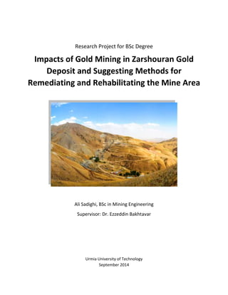
  • 1. Research Project for BSc Degree Impacts of Gold Mining in Zarshouran Gold Deposit and Suggesting Methods for Remediating and Rehabilitating the Mine Area Ali Sadighi, BSc in Mining Engineering Supervisor: Dr. Ezzeddin Bakhtavar Urmia University of Technology September 2014
  • 2. Page | 2 Acknowledgments: The author would like to oblige all the help and favors that he has received form people in Urmia University of Technology and Zarshouran Gold Mine, especially Dr. Ezzeddin Bakhtavar, Mr. Mahmoud Yekani, Mr. Reza Alvan, Mr. Ahmad Eftekari, Mr. Kaveh Kalantari and Mr. Armin Fallahi.
  • 3. Page | 3 Table of Contents Preface ............................................................................................................................................ 4 1. Introduction ..................................................................................................................... 6 1-1. Location and Geography...................................................................................................... 7 1-2. Climate................................................................................................................................. 9 1-3. Vegetation............................................................................................................................ 9 1-4. Wildlife............................................................................................................................... 10 1-5. Geology .............................................................................................................................. 11 2. Impacts of Arsenic and Gold Mining in Zarshouran......................................................... 14 2-1. Impacts on human life ........................................................................................................... 14 2-2. Impacts on wildlife................................................................................................................. 15 2-3. Impacts on plant life .............................................................................................................. 15 2-4. Impacts on the environment (air, water and soil)................................................................. 15 2-4-1. Air ....................................................................................................................................... 16 2-4-2. Water.................................................................................................................................. 16 2-4-3. Soil ...................................................................................................................................... 19 3. Suggested Technologies and Solutions for Remediation and Reclamation in Zarshouran 21 3-1. Remediating the region from mineral contaminations......................................................... 21 3-2. Rehabilitating the mine area ................................................................................................. 24 Conclusion............................................................................................................................. 26 Bibliography .......................................................................................................................... 27 Appendix 1 – Geology Map of Zarshouran Gold Mine Area......................................................... 29 Appendix 2 – Applications of Arsenic Treatment Technologies for Soil, Waste and Water ........ 30 Appendix 3 – Zarshouran final pit illustration on Google Satellite Image.................................... 31 Appendix 4 – Map of the final pit of Zarshouran Gold Mine........................................................ 32
  • 4. Page | 4 Preface In our very first BSc semester we, mining engineering students, get to take a lesson named General Geology or Fundamentals of Geology. Geology has always been my favorite field of study but there was something very disappointing in our lesson. General Geology, written by Hassan Madani, was taught by the lecturer, but without its very vital basics. The first chapter of the book, which was about Astronomy, was thoroughly skipped. My classmates never got to know the real genesis of everything around them. Either geologists or miners, we all need to have a more top-down main definition of this top- down sight. In 1990, NASA received a pretty simple but meaningful image from their Voyager 1 spacecraft. The pale blue dot in the image you see on this page is our home, the Earth, photographed from a 6.5-billion kilometer distance on edge of our solar system. That’s us, wandering about a small star among hundreds of billions of other stars living their lives in a very medium sized galaxy, which lives among some other hundreds of billions of galaxies, named the Milky Way galaxy. We, our home planet and our entire solar system are nothing but a grain of sand on an infinite shore. This absolutely basic fact has always been neglected by us, human beings, geologists and especially miners. In 2012 I was accepted as a trainee to enter Zarshouran Gold Deposit. By that time and based on incomplete exploration data, the deposit was the largest in the Middle East. I was pretty much tempted by this title, but when I entered the area, I saw nothing but an absolutely unique nature. They hadn’t begun mining by that time yet, so I had the chance to see a real exploration project for the first time. In my three months of traineeship in Zarshouran, besides the tons of things I learnt about my future career, I picked up quite a lot of information about my future colleagues. They had literally no idea what was going on above their heads! Most of them had absolutely no respect toward the nature around them, their home. This turned into a huge concern in me, one with no solution but to try hard to hide this reality like others did and help them with their earth-destroying work. Later, in 2013 I was lucky enough to take my second traineeship in an oil exploration project near Masjed-Soleiman, Khoozestan. In my two months of stay in that region things were pretty much the same as Zarshouran. Land was destroyed and air was polluted by oil companies. No one had the slightest concerns about nature. Nobody cared about his home! I had heard some my university teachers and professors talk about mine reclamation, and that in most countries laws were very strict about hazards caused by mining activities, but I’d never gotten the chance to involve myself in this subject up until the time I had to choose this topic for my BSc thesis.
  • 5. Page | 5 Chapter 1 Introduction
  • 6. Page | 6 1. Introduction Zarshouran Gold Deposit, located in South-East of Azarbaijan-e-Gharbi (West Azarbaijan), has been known as the largest gold deposit in the Middle East (Figure 1). (ParsKaniCo. & KavoshgaranCo., 2011) It has been home to Gold and Arsenic miners since Sassanid’s time and it has been subject to several geological surveys and gold exploration projects since 1840. The current target ore is called “invisible gold”, which has been left form hydrothermal activities in the host rocks. The average grade of gold in the ore is about 4.5 parts per million and the mine has been estimated to produce about 110 tons of gold in its 20 years of exploitation. The mine area and the surrounding regions are habitats of a wide range of plant species and wild life, and often serves people from nearby villages and towns as a recreational resort. Springs originating from the mine, which carry high amounts of Arsenic contaminations, easily enter drinking water streams that flow down to villages located in the downstream parts. In this article we are going to discuss the influences of mining activities on the environment and suggest applicable and effective methods of reclamation during the mine’s activity and after its closure. Figure 1 Location of Zarshouran village
  • 7. Page | 7 1-1. Location and Geography Zarshouran Gold Mine is located 5 kilometers North to North East of Zarshouran Village (aerial distance) and 26 kilometers north of the town of Takab (Figure 2). The mine area is a rectangle within the coordinates mentioned in Table 1. The average height of the area is about 2350 meters above sea level, with a minimum of 2200 meters in the mine valley and a maximum of 2796 meters on top of Chaldagh Mountain. The mine can be accessed through either of the roads below: a) Tehran > Zanjan > Bijar > Takab > Zarshouran Village > Zarshouran Deposit (630km) b) Tehran > Zanjan > Dandi > Takht-e-Soleiman > Zarshouran Village > Zarshouran Deposit (530km) (ParsKaniCo. & KavoshgaranCo., 2011) Corners X Y A 690658/8 4066835 B 690086 4066259 C 691422 4064911 D 692004 4065486 Table 1 Coordinates to the four corners around the area. Figure 2 Detailed Location Map of Zarshouran Gold Mine
  • 8. Page | 8 The processing factory is located about 2 km away from Zarshouran village and 5 km away from the deposit itself. It consists of crushing, grinding and processing buildings, accommodations, offices and facility buildings. The tailing storage area has been founded in the valley next to the factory as seen in Figure 3. Figure 3 Locations of the deposit, the factory and the tailing dam.
  • 9. Page | 9 1-2. Climate Zarshouran Deposit is located on the heights of ImanKhan anticline with an average elevation of 2300 meters above sea level. Therefore the climate of the area can be categorized as Cold and Mountainous in which there is much precipitation in forms of rain and snow, as a result mining is not feasible during four months of frost in the region. The coldest and hottest months of year are December (-32°C) and June (44°C) respectively. According to the climatological data the wettest season is spring and the driest is summer. Snow usually begins in early November and ends in late March. The average precipitation of the region is about 434 millimeters. (ParsKaniCo. & KavoshgaranCo., 2011) 1-3. Vegetation Considering the fairly high amount of precipitation, the suitable weather conditions and the thick soil layers in the region, vegetation is very diverse in Zarshouran. It’s mainly seen in forms of shrublands and meadows and forests can only be seen in limited areas along some valleys. Such forests often include trees like Ghareaghaj and Hazelnut which are pretty common in Northern and Western Takab. Pasture plants such as Gramineae, Legume and Umbelliferae naturally grow in the region. In valleys containing spring water, grass and reed can also be noted which create spectacular views in places like Kabkan Valley and the valley across. (ParsKaniCo. & KavoshgaranCo., 2011) Figure 4 Zarshouran Mine Area in September (left) and March (right)
  • 10. Page | 10 1-4. Wildlife Due to being close to Angouran Protected Area, Zarshouran hosts a diverse wildlife. Species such as bears, pigs, wolves, foxes, rabbits, eagles, falcons, partridges, quails, sparrows, pigeons, crows, lizards, crabs, salamanders and snakes have frequently been sighted in and around the mine area. The area is also home to a diversity of insects. Unfortunately, exploration operations have caused Figure 5 Examples of Shrublands (left) Meadows (middle) and Valleys (right) in the mine area. Figure 6 Examples of wildlife in Zarshouran (The photo of the bears has been taken in Angouran Protected Area.).
  • 11. Page | 11 the migration of some species such as bears that tend to quiet and safe habitats and the only return to the area for food and hunting. 1-5. Geology Zarshouran mine area is part of the south-eastern anticline illustrated in the 1:100000 Takht-e- Soleiman sheet, which generally includes series of heights and V-shaped valleys. The project area has been highly influenced by the tectonics of the region, hydrothermal mineral fluid activities and also volcanic activities (Which can be seen as quartz porphyry to rhyolitic rock outcrops in the area.) and has been severely intermingled by these factors. On the other hand, intense weathering has resulted in thick layers of soil which makes mapping the area painstakingly hard, especially when it adds up to the vast vegetation covering most parts. Imankhan schist, Chaldagh limestone and the Zarshouran Black Shale unit (Figure 7), which are believed to date back to the Precambrian, have been uplifted by a lifting force then covered by younger Neogene units and a long stratigraphic gap. The area has been altered in several places under the influence of atmospheric and penetrating water, quartz porphyry intrusions and also the activities of mineralization phases, which can be seen in many parts around the ore deposit (Figure 8). The geology map has been provided in Appendix 1 – Geology Map of Zarshouran Gold Mine Area. (ParsKaniCo. & KavoshgaranCo., 2011) Figure 7 Geology of the deposit.
  • 12. Page | 12 Figure 8 Some alteration out crops along the trenches in Zarshouran Gold Mine.
  • 13. Page | 13 Chapter 2 Impacts of Arsenic and Gold Mining in Zarshouran
  • 14. Page | 14 2. Impacts of Arsenic and Gold Mining in Zarshouran As mentioned in the introduction section, Zarshouran has always been mined throughout the known history of the region. There are signs of ancient placer gold mining which are thought to date back to the Sassanid’s time. The present gold deposit had also been mined as an underground Arsenic mine until 1991. The tunnels and shafts left from the Arsenic mining times still remain and are considered as one of the main sources of water contamination in the region (Figure 9). Since 1991 Zarshouran had been under exploration operations up until 2014, in which the mine stripping and exploitation began along with the activity of the processing factory. Impacts of mining in any area can be generally categorized into the four types listed below which have been briefly discussed in this research: 1. Impacts on human life; 2. Impacts on wildlife; 3. Impacts on plant life; 4. Impacts on the environment (air, water and soil). 2-1. Impacts on human life The most considered impact of every mining project is the impact of the activity on human life in the societies around the mine, and there are both positive and negative effects to every mining activity. The most obvious positive impact of the mining operations in Zarshouran is involvement and employment of hundreds of work force who reside in nearby villages, towns, cities and provinces. Mining has also helped the improvement of life quality in Zarshouran and the nearby village, Aloucheloo, by bringing technology, public health service and wealth in the region. Figure 9 Old Arsenic Mining tunnels.
  • 15. Page | 15 Despite its positive impacts, mining in Zarshouran has had few negative outcomes, too. People used to work on farms, keep livestock, produce dairy, etc. But now they are changing jobs according to the current needs in the area. This can be avoided by providing and supporting job opportunities that are in danger of extinction. On the other hand contaminations caused by mining directly affect the human life in Zarshouran (Discussed in 2-4. Impacts on the environment (air, water and soil).) The mining area also includes lands that host ancient cemeteries and archeological sites. Trenches dug along the exploration phase have destroyed parts of these historical lands. 2-2. Impacts on wildlife Wild life is often highly sensitive to changes in the environment. Same thing goes with Zarshouran mine area. As mentioned in Chapter 1, a diversity of wild animals live in the region, most of which have migrated to neighboring lands as a result of mining activities. Another harm that threats the wildlife in Zarshouran is chemical and mineral contaminations around the prospecting boreholes and trenches, tailing storage area and the processing factory. The wildlife residing in the valleys around the mine has also faced another major problem which is water. Water from springs along Karbalai Abbas valley has been plumbed to Yaraziz village and the camp site near Zarshouran village. 2-3. Impacts on plant life Imankhan Mountain, which contains the main part of the deposit, is covered with several types of plant species which have different values. Acanthus, Rhubarb, Savory, Thyme, Stachys, Oregano, Hollyhock, Wild Almonds, Wild Plums and many other species are commonly used by the locals for food and medicinal purposes. Farm animals are often fed bythe grass and shrubs from the mountains around the Mine Mountain. Any contamination in soil or water can enter the human food cycle through the vegetation in the area. 2-4. Impacts on the environment (air, water and soil) Zarshouran can be named as “Paradise of Geologists” due to the enormous variety of minerals that can be found in and around the deposit. But this paradise can turn into hell if some of these minerals find way into civilization or wildlife. Realgar, Orpiment, Cinnabar, Gechelite, Galena,
  • 16. Page | 16 Pyrite, Arsenopyrite, Sphalerite, Tremolite, Actinolite, Serpentine, Barite, Fluorite, Gypsum, Anhydrite, Seresite, Chlorite, Clay Minerals, etc. are some of the minerals found in Zarshouran. Some of these minerals contain elements that can be extremely harmful to living creatures. Take Arsenic, Mercury, Lead and Zinc as examples and imagine what harms they could do to the workers and locals of Zarshouran. There are three main ways in which mining contaminants can enter the body of a living creature, Air, Water and Soil. Here we discuss the impacts of mining on these three elements. 2-4-1. Air Wind can be a good carrier for dust and chemicals raised from the mine and the factory. Silica, Arsenic, Lead, Zins and especially asbestos minerals such as Actenolite and Tremolite can cause severe health problems like Lung Cancer if breathed, and they can easily travel through wind. Hopefully wind generally blows in the West-East direction which is good since there is no civilization along this direction, plus there are hills and mountains that can block such air convections, but it can still act as a very harmful factor in distributing toxic minerals on the soils around the Mine Mountain. 2-4-2. Water Old Arsenic mining tunnels, new exploration trenches and cuttings left around boreholes are the main sources of water and soil contamination in Zarshouran. Atmospheric water washes down everything on surface of the ground and leads it into the streams. Springs inside the deposit on the other hand wash out minerals and carry them into the streams flowing toward the downstream villages. Orpiment crystals can easily be observed in sediments of the streams flowing around the deposit, especially streams which are formed from spring waters originated in the former Arsenic mining tunnels (Figure 12). Figure 10 Left to Right -Specimens of Realgar, Orpiment & Realgar on Quartz, Weathered Orpiment on Chaldagh Limestone, and Tremolite found in Imankhan Schist.
  • 17. Page | 17 Hydrothermal deposits generally contain elements such as Au, As, Ag, Pd, Zn, Sb, Hg, Cd, Si, S, F, Cl, Pb, Zn, etc. Zarshouran deposit lacks none of these elements! The one which has made all of the world concerned is Arsenic (As). According to statistics and as it can be seen in the diagram in front, Arsenic is the second contamination of concern in the US. (EPA, 2004) Streams running down the mine valley toward the farms, gardens and Zarshouran village contain obvious concentrations of As and several local people have reported symptoms pf toxicity in their farm animals which had drunk the stream water. Also some mine workers have experienced kidney and liver failures during their years of work in Zarshouran, but no official statistics on the effects of Arsenic in the region have been released until today. A research in India has revealed some of the symptoms that can be caused by Arsenic. The disease mentioned in the research are Bowen’s, Cancer, Gangrene, Bronchitis, Melanosis and Keratosis. Figure 11 presents information and pictures of three individuals suffering from chronic As toxicity. (Chakrabortia, et al., 2012) Such studies need to be done in Zarshouran, Alouchelou and Yaraziz villages as well, in order to avoid an Arsenic Crisis in the entire region. Figure 11 Characteristics of three individuals from Kiradalli Tanda, India suffering from chronic As toxicity.
  • 18. Page | 18 Figure 12 Images showing trenches, tunnels, springs, streams and stream sediments which are evidently contaminated with Arsenic and probably other toxic minerals washed down from the deposit.
  • 19. Page | 19 2-4-3. Soil Beside Air and Water contamination, Soil contamination is a much more serious issue that needs to be avoided and taken care of. Trenches and streams in the mine area have distributed toxic minerals all over the mine area, which is still a limited part of the region and makes the contamination more controllable. If soil is contaminated, wind and precipitation spread the toxic elements all over the region and contaminate more soil and more land which will trigger an enormous crisis scenario. Yet there are techniques and solutions that deal with such problems. Chapter 3 introduces solutions and technologies for remediating polluted soil and water.
  • 20. Page | 20 Chapter 3 Suggested Technologies and Solutions for Remediation and Reclamation in Zarshouran
  • 21. Page | 21 3. Suggested Technologies and Solutions for Remediation and Reclamation in Zarshouran The main purpose behind this research is to present an example of what can be done but has always been neglected. Providing base materials for industries and producing wealth for the country is something, and keeping the humanity and environment safe and healthy is another, which is hardly ever taken into consideration in countries like Iran. So far, we have learnt some about Zarshouran gold mine and discussed the impacts of mining in the area. In this chapter we introduce and suggest some methods for remediating and rehabilitating Zarshouran Gold Mine during and after the mining process. 3-1. Remediating the region from mineral contaminations As mentioned in chapter 2, the mine area has been highly contaminated during the former Arsenic mining activities and along the exploration process. There are several technologies for different Arsenic removal conditions that have been utilized in many places around the world. Each technology has got its own strong and weak points that are briefly explained below. Hera are 13 technologies applicable to Arsenic-contaminated soil, waste, and water. Technologies are considered applicable if they are used at a full scale to treat Arsenic (EPA, 2004) . Soil and Waste Treatment Technologies:  Solidification/Stabilization  Vitrification  Soil Washing/Acid Extraction  Pyrometallurgical Recovery  In Situ Soil Flushing Water Treatment Technologies:  Precipitation/Coprecipitation  Membrane Filtration  Adsorption  Ion Exchange  Permeable Reactive Barriers
  • 22. Page | 22 Soil, Waste, and Water Treatment Technologies:  Electrokinetics  Phytoremediation  Biological Treatment In Appendix 2 – Applications of Arsenic Treatment Technologies for Soil, Waste and Water, diagram D1 shows the number for technologies applicable to soil and waste based on available data. The most frequently used technology for soil and waste containing Arsenic is solidification/stabilization. The available data show that this technology can effectively meet regulatory cleanup levels, is commercially available to treat both soil and waste, is usually less expensive, and generates a residual that typically does not require further treatment before disposal. Other Arsenic treatment technologies for soil and waste are typically used for specific applications. Vitrification may be used when a combination of contaminants are present that cannot be effectively treated using solidification/stabilization. It has also been used when the vitrification residual could be sold as a commercial product. However, Vitrification typically requires large amounts of energy, can be more expensive than S/S, and may generate off-gasses containing Arsenic. Soil washing/acid extraction is used to treat soil primarily. However, it is not applicable to all types of soil or to waste. Pyrometallurgical treatment has been used primarily to recycle Arsenic from industrial wastes containing high concentrations of Arsenic from metals refining and smelting operations. These technologies may not be applicable to soil and waste containing low concentrations of Arsenic. In situ soil flushing treats soil in place, eliminating the need to excavate soil. However, no performance data were identified for the limited number of full-scale applications of this technology to Arsenic. Diagram D2 shows the number of treatment projects identified for technologies applicable to water. For water containing Arsenic, the most frequently used technology is precipitation/coprecipitation. Based on the information gathered, precipitation/ coprecipitation is frequently used to treat Arsenic contaminated water, and is capable of treating a wide range concentrations of Arsenic. The effectiveness of this technology is less likely to be reduced by characteristics and contaminants other than Arsenic, compared to other water treatment technologies. It is also capable of treating water characteristics or contaminants other than Arsenic, such as hardness or heavy metals. The effectiveness of adsorption and ion exchange for Arsenic treatment is more likely than precipitation/ coprecipitation to be affected by characteristics and contaminants other than
  • 23. Page | 23 Arsenic. Small capacity systems using these technologies tend to have lower operating and maintenance costs, and require less operator expertise. Membrane filtration is used less frequently because it tends to have higher costs and produces a larger volume of residuals than other Arsenic treatment technologies. Permeable reactive barriers are used to treat groundwater in situ. This technology tends to have lower operation and maintenance costs than ex situ (pump and treat) technologies, and typically requires a treatment time of many years. Diagram D3 shows the number of treatment projects identified for technologies applicable to soil, waste, and water. Three Arsenic treatment technologies are generally applicable to soil, waste, and water: electrokinetics, phytoremediation, and biological treatment. These technologies have been applied in only a limited number of applications. Electrokinetic treatment is an in situ technology intended to be applicable to soil, waste and water. This technology is most applicable to fine-grained soils, such as clays. Phytoremediation is an in situ technology intended to be applicable to soil, waste, and water. This technology tends to have low capital, operating, and maintenance costs relative to other Arsenic treatment technologies because it relies on the activity and growth of plants. However, this technology tends to be less robust. The references identified for this report contained information on one full-scale application of this technology to Arsenic treatment. Biological treatment for Arsenic is used primarily to treat water above-ground in processes that use microorganisms to enhance precipitation/ coprecipitation. Bioleaching of Arsenic from soil has also been tested on a bench scale. This technology may require pretreatment or addition of nutrients and other treatment agents to encourage the growth of key microorganisms. (EPA, 2004)
  • 24. Page | 24 In a case study in Thailand, Phytoremediation was used for Arsenic removal from lands contaminated by old mine tailings. Of 36 plant species studied in the research, only two species of ferns, Pityrogramma calomelanos and Pteris vittata, a herb, Mimosa pudica, and a shrub, Melastoma malabrathricum, seemed suitable for phytoremediation. The ferns were by far the most proficient plants at accumulating arsenic from soil (Figure 13). (Visoottiviseth & Sridokchan, 2002) Such plants might not be suitable for the climate of Zarshouran, so a full study of the plants and vegetation of the region needs to be undertaken in order to find candidates with the best performances before planning a Phytoremediation project. Such plants can also be very useful in the reclamation phase of the project. 3-2. Rehabilitating the mine area Zarshouran Gold Mine has been planned to be excavated using the Open-Pit method, through which it’s going to end up with a nearly 300 meter deep pit in 20 years. There’s also going to be a nearly 100,000 square meter insulated tailing storage area and an overburden storage area. Zarshouran Gold Mine Reclamation Plan should describe the reclamation of the disturbed land from mining and ore processing operations to a stabilized condition that will provide for the long term protection of land and water resources for post-mining land uses. Additional goals include: Figure 13 Pityrogramma calomelanos (top left), Pteris vittata (top right), Mimosa pudica (bottom left), and Melastoma malabrathricum (bottom right)
  • 25. Page | 25  Reducing the environmental impacts of mining;  Utilizing simultaneous reclamation where appropriate throughout the mining process;  Minimizing the need for long-term active water management requirements through the conversion to and use of passive treatment technology at the tailing storage area and the overburden storage area; and  Decreasing the generation of Acid Rock Drainage from the sulfide materials exposed as a result of the mining operations. (SchlumbergerWaterServices, 2013) In the reclamation stage, these features must be considered:  historic sites and burial grounds  wildlife  erosion control  re-vegetation (YukonGovernment, 2006)  Re-establishing vegetation on impacted lands will be essential for preventing erosion, restoring surface stability, providing site productivity, and providing wildlife forage and cover opportunities as well as visual values at Zarshouran Gold Mine during operations and reclamation. Appropriate seeds and saplings should be prepared and planted over the area. The primary goal of revegetation is soil stabilization while a secondary goal is to provide a habitat for wildlife and the natural succession of vegetation. Based on the assumption that the overburden has been separated into different groups (3 at least) according to its acid generating potential, and since the pit of Zarshouran Gold Mine isn’t a large one, it’s a good idea to have it backfilled using the non-acidic overburden. Occasional large boulders that are uncovered during re-grading may be left on the surface to provide topographic diversity, microhabitats for wildlife and vegetation, and to break the linear appearance of the final slope. The surface of the pit backfill will be seeded using an approved seed mix and appropriate seeding methods. A general approach for reclamation of the overburden facilities is described below. Additional details related to the individual OSAs are presented in the following sections.  Concurrent re-grading of overburden storage slopes, followed by installation of storm water controls and revegetation.  All overburden storage areas should be revegetated using an approved seed mix and appropriate seeding methods.  Construction of storm water conveyance channels to direct storm water off the re-graded overburden storage area face.  Final reclamation of the overburden storage areas should minimize impoundment of storm water. The top of the overburden storage areas should be sloped towards a number
  • 26. Page | 26 of armored storm water conveyance channels constructed on each overburden storage area to move storm water off of the area while minimizing erosion.  The reclaimed overburden storage areas will have potential future land use of recreation/hunting. Acidic overburden should be covered with a layer of geomembrane and then covered with soil and vegetation. It can be used for recreation but it needs to be monitored. (SchlumbergerWaterServices, 2013) And finally for the Tailing Storage Area, there are different approaches that are used for insulating the toxic material stored there. The key point is that no ground water should seep or pass into the storage area. And defects in the isolation system of the Tailing Storage Area can have irrecoverable consequences. Conclusion Zarshouran Gold Mine has been located in a spectacular natural and geological paradise which needs to be treated much more carefully. In order to keep the environment safe from hazards resulted from mining operations, the mine can choose, modify and utilize the technologies introduced in this research for remediating the area from present and probable future contaminations. The key factor that can help a lot in the area of the mine is the vegetation which can stabilize the soil and remove the contamination as well. Zarshouran Gold Mine also requires a well-organized plan for post-mining land use in the area to reclaim the environment. Separating the overburden based on acid generation potentials is also a vital step toward rehabilitating the area. It should be noted that indifference can end up getting stock in the middle of a humanitarian crisis in the region which might last for generations. But an eco-friendly mining plan can help avoid such nightmares for our descendants.
  • 27. Page | 27 Bibliography  Chakrabortia, D., Rahmana, M. M., Murrilla, M., Dasa, R., Siddayya, S. P., Sarkar, A., . . . R. Ahmed, K. K. (2012). Environmental arsenic contamination and its health effects in a historic gold mining area of the Mangalur greenstone belt of Northeastern Karnataka, India. Journal of Hazardous Materials.  EPA, U. S. (2004). Arsenic Treatment Technologies for Soil, Waste, and Water.  ParsKaniCo., & KavoshgaranCo. (2011). Zarshouran 1:1000 Geological Map Report. IMIDRO.  SchlumbergerWaterServices. (2013). Haile Gold Mine EIS Reclamation Plan.  Visoottiviseth, P., & Sridokchan, W. (2002). The potential of Thai indigenous plant species for the phytoremediation of arsenicc ontaminated land. ENVIRONMENTAL POLLUTION.  YukonGovernment. (2006). HANDBOOK OF RECLAMATION TECHNIQUES AND MINING LAND USE. Yukon Government.
  • 29. Page | 29 Appendix 1 – Geology Map of Zarshouran Gold Mine Area
  • 30. Page | 30 Appendix 2 – Applications of Arsenic Treatment Technologies for Soil, Waste and Water (EPA, 2004) D1 D2 D3
  • 31. Page | 31 Appendix 3 – Zarshouran final pit illustration on Google Satellite Image
  • 32. Page | 32 Appendix 4 – Map of the final pit of Zarshouran Gold Mine