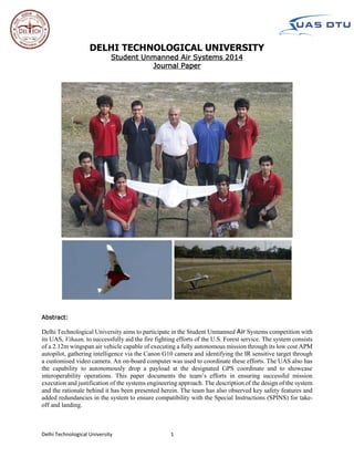
1. Delhi Technological University 1
DELHI TECHNOLOGICAL UNIVERSITY
Student Unmanned Air Systems 2014
Journal Paper
Abstract:
Delhi Technological University aims to participate in the Student Unmanned Air Systems competition with
its UAS, Vihaan, to successfully aid the fire fighting efforts of the U.S. Forest service. The system consists
of a 2.12m wingspan air vehicle capable of executing a fully autonomous mission through its low cost APM
autopilot, gathering intelligence via the Canon G10 camera and identifying the IR sensitive target through
a customised video camera. An on-board computer was used to coordinate these efforts. The UAS also has
the capability to autonomously drop a payload at the designated GPS coordinate and to showcase
interoperability operations. This paper documents the team’s efforts in ensuring successful mission
execution and justification of the systems engineering approach. The description of the design of the system
and the rationale behind it has been presented herein. The team has also observed key safety features and
added redundancies in the system to ensure compatibility with the Special Instructions (SPINS) for take-
off and landing.
2. Delhi Technological University 2
Table of Contents
1. Introduction………………………………………………………………………………………………………………………………….. 3
2 Systems Engineering Approach…………………………………………………………………………………………………….. 3
2.1 Mission Requirements Analysis…………………………………………………………………………………………………….. 3
2.2 Design Rationale …………………………………………………………….……………………………………………………………..3
2.2.1 Design And Development Model………………………………………………………………………………….………..3
2.2.2 Air Vehicle Selection………………………………………………………………………………………………………………4
2.2.3 Autopilot Selection…………………………………………………………………………………………………………………4
2.2.4 Intelligence Gathering Payload……………………………………………………………………………………………….5
2.2.4.1 Imagery System……………………………………………………………………………………………………………….5
2.2.4.2 Simulated Remote Intelligence Centre (Sric) ……………………………………………………………………6
2.2.4.3 Infrared Target Capture System……………………………………………………………………………………….6
2.3 Expected Performance…………………………………………………………………………………………………………………….6
2.4 Programmatic Risks And Mitigation…………………………………………………………………………………………………6
3. Uas Design Description…………………………………………………………………………………………………………………….7
3.1 Airframe Design……………………………………………………………………………………………………………………………….8
3.2 Propulsion System……………………………………………………………………………………………………………………………9
3.3 Power Systems…..…………………………………………………………………………………………………………………………….9
3.4 Autopilot Systems…………………………………………………………………………………………………………………………….9
3.5 Communication System…………………………………………………………………………………………..………………………10
3.6 Ground Control Station…………………………………………………………………………………………..………………………10
3.7 Imagery System…………………………………………………………………………………………..………………………………….11
3.8 Sric System Payload…………………………………………………………………………………………..……………………………13
3.9 Infrared Target Capture System…………………………………………………………………………………………..………….13
3.10 Airdrop Task Description…………………………………………………………………………………………..…………………….14
4. Mission Planning And Profile…………………………………………………………………………………………..………………14
4.1 Mission Tasks Attempted…………………………………………………………………………………………..……………………14
4.2 Mission Profile…………………………………………………………………………………………..……………………………………14
5. Test And Evaluation Results…………………………………………………………………………………………..…………….….15
5.1. Guidance System Performance…………………………………………………………………………………………..……….….15
5.2 Payload System Performance…………………………………………………………………………………………..………….….16
5.2.1 Imagery System Performance …………………………………………………………………………………………..……16
5.2.2 Sric System Performance…………………………………………………………………………………………..……………17
5.2.3 Infrared Target System Performance………………………………………………………………………………………17
5.3 Mission Tasks Performance…………………………………………………………………………………………..………….…….18
5.3.1 Air-Drop Task Performance…………………………………………………………………………………………..….…….18
5.3.2 Interoperability Operations…………………………………………………………………………………………..….…….18
5.4 Projected Mission Performance…………………………………………………………………………………………..……….….18
6. Safety Considerations…………………………………………………………………………………………..…………………..……..19
6.1 Design Safety…………………………………………………………………………………………..………………………………..……..19
6.2 Operational Safety…………………………………………………………………………………………..…………………………..…..20
6.3 Information Safety…………………………………………………………………………………………..……………………………....21
7. Conclusion: …………………………………………………………………………………………..………………………………………….21
3. Delhi Technological University 3
1.INTRODUCTION
The team is entering this edition of the Student Unmanned Air Systems competition with its smallest airframe till
date. The team has shifted its flight testing base from an airstrip 100 miles away from the college to the sports
complex of its own college. Vihaan has completed the most number of flights in a year in the team’s history of
preparation. The team has also analysed the feasibility of integration of the newly introduced tasks and has
incorporated them in the mission profile.
2.SYSTEMS ENGINEERING APPROACH
As has been reiterated by the judges each year, the competition is a mission-oriented challenge which not only tests
the technical advances made by a team but also its systems engineering approach. The team has therefore outlined
its systems engineering approach towards successful completion of the mission.
2.1 Mission Requirements Analysis
The team has analysed the requirements associated with the mission and identified the key subparts necessary for
successful execution of the mission tasks. The requirement analysis has been depicted in Table 1.
2.2 Design Rationale
2.2.1 Design and Development Model
The team’s design rationale is based on a V-model which incorporated all the essential stages of designing a system
capable of successful mission completion. The model established by the team depicts the interdependence of the
complete UAS design and subsystem validation, neither of which hold any significance individually.
Task Task Threshold
Requirement
Task Objective Requirements for successful
Mission Execution
Autonomous Flight Autonomous
Waypoint
Navigation
Autonomous take-off/
landing
Optimal Navigation Tuning
Maximum take-off/landing
simulations
Search Area
Intelligence Gathering
Manual
Identification of
targets
Autonomous
Identification Of All
Targets
Suitable resolution acquisition
payload
Robust Image Processing
Algorithm
Simulated Remote
Intelligence Centre
Post Mission
Message Decoding
During Mission Message
Decoding and action
Autonomous Intelligence
Gathering
Real Time Relaying to GCS
Payload Drop Manual Release,
Accuracy within
200ft
Autonomous Release,
Accuracy within 50 ft.
Projectile trajectory calculation,
variable estimation and testing.
Standard egg-payload
fabrication
Infrared Target Primary target
identification
Primary and Secondary
target Identification
IR sensitive payload
Suitable Resolution IR camera
Interoperability
Operations
- Real-time plot on Google
Earth
Extracting GPS data from UAS
communication feed.
Simulating Judge’s setup
Mission Time <40 minutes <30 minutes High number of full mission
simulations
Table 1- Mission Requirements Analysis
4. Delhi Technological University 4
The Skywalker X-8 proved to be the most suitable platform and was selected for its low empty-weight and
rapid deployment without the need of a paved runway for launch and recovery. The X-8 met
the payload capacity and volume requirements and also has positive consumer reviews.
Figure 1- V Model for Design and Development
2.2.2 Air Vehicle Selection
The team, learning from last years’ experience, identified that a system requiring a large deployment space proved
taxing both financially and logistically. The constraint of travelling to an airstrip over a 100 miles away could be
overcome if a smaller and hand/catapult launched air vehicle could be utilised to fulfil the mission requirements.
This would not only reduce the financial and logistical burden, but also increase the frequency of flight testing.
Considering the increased reliability the system would have if the frequency of flight testing were to increase, the
team decided to go with an Almost Ready to Fly (ARF) air vehicle as it allowed the team to invest its time and human
resources on systems integration and airframe customisation rather than its design and fabrication. Three shortlisted
ARF kits were evaluated against mission requirements depicted in Table 2.
2.2.3 Autopilot Selection
The team has had experience in integrating both the Piccolo II (High-End COTS Autopilot) and the Ardupilot Mega
2.6 (Low cost Open Source Autopilot). The team decided to compare these autopilots not merely on the basis of
technical specifications, but on the basis of their capabilities with respect to the mission requirements of this
year’s competition.
Parameter Units Requirement Sig Rascal Skywalker X-8 Zephyr
Wingspan Inch <120 105 86 54
Empty Weight Pounds <20 8 4 2
Payload Capacity Pounds >10 10 8 4.5
Payload Volume Cubic Inch >200 756 450 70
Take-off/Landing
Requirements
- Catapult/Hand
Launched
Paved Runway Catapult/Hand
launched
Catapult/Hand
launched
Cruise Speed Metres/sec 10-16 14 15 12
Minimum Turning
Radius
Metres <35 40 25 25
Approximate
Endurance
Minutes >40 25 30 30
Mission Requirement Specification Mission Simulation
UAS Requirement Specification UAS Validation and Flight Testing
Sub-system design Sub-system Validation
Fabrication and Integration
Table 2- Airframe Trade Study
5. Delhi Technological University 5
Parameter Piccolo II APM 2.6
Dynamic 3D waypoint navigation Yes Yes
Auto take-off/auto-land routines More Complex Less Complex
Source code accessibility Propreitary Code Open-source, well-
documented
Communication Range 10 km 5km (with amplifier)
Dimensions 142x46x63mm 90x45x15 mm
Robustness High Low
Serial NMEA GPS Data Output Through Plugins Yes
ITAR Regulated Product Yes No
Cost 15,000 USD 240 USD
Table 3- Autopilot Comparison
It can be seen that while the Piccolo II offers a more robust system, the APM is highly customisable to incorporate
new tasks. The excessive cost of the Piccolo II and its strict ITAR regulations make the Piccolo II less replaceable in
the event of a crash. Considering the above mission relevant factors, the APM 2.6 was chosen as the autopilot to be
integrated with the air vehicle.
2.2.4 Intelligence Gathering Payload
2.2.4.1 Imagery System
Due to the increase in the number of tasks this year, the overall payload volume and weight has increased. This
compelled the team to make a systems engineering decision and consider shifting to a lighter digital camera and yet
not lose on image quality significantly. In-flight images taken from the Canon G10 point and shoot camera at different
altitudes were compared to the images of a Canon EOS 500D DSLR. It was confirmed that images obtained at a lower
altitude (150ft) from the Canon G10 camera provide equally good image quality for the image processing algorithm
to work. The smaller airframe allowed the team to fly at this lower altitude as the safety risk associated with it was
lower.
Figure 2- Extracted Target Comparison
Canon G10 at 150 feet
Canon DSLR at 150 feet
Processing
Processing
6. Delhi Technological University 6
It can be seen that the extracted target obtained in the DSLR image has better quality. However, the image extracted
from the G10 is of sufficient quality as required by the algorithm. Thus, the system’s engineering decision was justified
and the Canon Powershot G10 camera was chosen as the main image acquisition payload. The PandaBoard ES has
proven to be a reliable on-board computer. Its adequate processing power, expansion ports, on-board WiFi and
small form factor facilitated its integration with the X-8.
2.2.4.2 Simulated Remote Intelligence Centre (SRIC)
The team has reduced the complexity of the connection with SRIC by using the same on-board computer which
controls the digital camera. This would not hinder its image acquisition routine as it is independent of the SRIC
routine. The amount of data being transferred from the SRIC is small enough to not hinder any pending imagery data
transfer. This has enabled the team to utilize the full processing power of the on-board computer and avoid the
addition of any other SRIC-oriented payload. However, it was found that the range of the on-board Wi-Fi was not
enough to communicate with the SRIC at high altitudes. To increase the wireless communication range, an external
antenna was attached to its UFL antenna port of the WiFi chip. The SRIC data utilised the existing imagery downlink
eliminating the need for a dedicated link to relay the gathered SRIC data to the Ground Control Station.
2.2.4.3 Infrared Target Capture System
After conducting a market survey of available thermal imaging cameras it was concluded that the cameras available
were either oversized or very expensive. Owing to budgetary constraints, the team decided to go in for the
modification of existing cameras to increase their near-IR sensitivity. A video camera was preferred over a still
camera to reduce the processing power required on the air vehicle. The video would be disseminated on the ground,
which would reduce the burden on the on-board computer and not interfere with the image acquisition routine.
2.3 Expected Performance
As of this writing, the team has conducted 62 flight tests, including 6 full mission simulations. A brief
summary of the expected performance is provided in Table 4.
Table 4- Expected Performance
2.4 Programmatic Risks and Mitigation
The team’s motto for successful systems engineering has always been ‘Plans
are nothing, Planning is everything’. Likewise, the team has always
emphasised on identifying risks affecting the project as a whole and
formulated plans for their mitigation. The programmatic risk
mitigation model is depicted in Figure 3.
The first four stages of the risk management model were implemented
and risks were identified, prioritised and their mitigation strategies
developed. The results are summarised in a risk matrix in Figure 4.
Task Threshold Requirement Objective Requirement
Autonomous Flight
Search Area Intelligence Gathering
SRIC
Payload Drop
Infrared Target
Interoperability
Endurance
Mission/Setup Time
Risk
Identification
Impact
Assessment
Prioritisation
Mitigation
Strategy
Development
Status
Monitoring
Figure 3- Risk Management Model
7. Delhi Technological University 7
Risks Mitigations
Airframe might
not support
GTOW> 5.5kg
Airframe
Reinforcement
Insufficient Thrust Thrust Measurement Rig Development
Autopilot Link Loss Alternate Communication System
IR target Not
Detected
Tests with Different IR Filters
Launcher Failure Bungee Force Increased
Personnel Failure
Proper Documentation for design and testing,
Operator Manuals Developed
Component
Failure
Backup Of Components and Air Vehicle Ready
Blurred Images Camera Properties Optimisation
Project Start/Design Phase System Integration Flight Testing Competition
Stage of Mitigation
Figure 4- Risk Identification and Mitigation
The last stage of the risk model was implemented during the testing and evaluation phase of the project. Key
parameters associated with risks were recorded periodically in flight test books. Any change in the parameters was
noted and its impact was subsequently analysed.
3.UAS DESIGN DESCRIPTION
Figure 5- Overall UAS Description
8. Delhi Technological University 8
3.1 AIRFRAME DESIGN
The aerial vehicle chosen as per the design rationale was the Skywalker X8, a blended body flying wing airframe. It
is a low-cost COTS vehicle that provides a lightweight, portable and durable solution to carry the payload for avionics
testing and sub-systems integration. A custom-made catapult launcher
is used to achieve take-off at an optimum speed.
The Airframe’s EPO construction allows for quick and easy repairs
arising due to day to day handling and flight testing. This has helped in
reducing the Maintenance Man-Hours per Flight-Hour.
Several significant modifications were made to the stock airframe for
better performance in terms of mission execution and to ensure
aircraft crash survivability of internal and mission critical components.
The first modification was to increase the strength of the wings,
thereby increasing the operational life of the vehicle. This was needed
due to increased wing loading on the aircraft. The stiffness of the wings
was enhanced by embedding a 2mm thick flat carbon fiber ribbon. This
was glued in position using standard CA (cyanoacrylate) and covered with glass
fiber tape-on cover. As a result, there has been no noticeable wing flutter even with wind speeds up to 20 knots.
Other modifications included installation of the servo control arms on the upper wing surface and covering the stock
foam elevons with glass fiber tape to increase impact resistance and stiffness.
The fuselage of the frame has been widened to allow for quick and
easy access of mission essential equipment. The wing is safely
joined to the fuselage with an Allen bolt and nut which facilitates
in quick assembly and disassembly of the air vehicle. Overall, the
vehicle design is robust and rugged for both transportation and
flight.
The camera, with its roll stabilized gimbal, is placed in the front
section which allows dedicated access to it. To accommodate the
gimbal, the front section of the underbelly has been modified to
grant a +/- 40 degree roll stability with the fully extended Canon
G10 lens. The region around the payload aperture has been
reinforced using carbon fiber, ensuring the integrity of the
payload system. The belly of the air vehicle has been covered with
bright red vinyl to reduce damage to the foam under-belly with an
added benefit of increasing visibility of the aircraft.
The layout of the payload bay showcasing the component placement is
represented in Figure 7.
Table 5- Airframe Parameters
VINYL COVERING & CARBON
FIBRE REINFORCEMENT ON
BELLY
FLAT CARBON RIBBON
EMBEDDED IN WING
Figure 6- Airframe Reinforcement
Figure 7- Payload bay Layout
9. Delhi Technological University 9
3.2 PROPULSION SYSTEM
The propulsion system of the X-8 is a 2kW, 580 kV Electric Motor with two five Cell Lithium Polymer batteries in
connected in parallel. The team earlier integrated a 1400 W, 500 kV Electric motor with the air vehicle but found
that the thrust, even though sufficient to test individual avionics components, was not sufficient to carry the entire
avionics payload. This resulted in more unsuccessful attempts during auto-take-off. After conducting thrust
measurement of several motors, the most suitable motor with the highest thrust to weight ratio was integrated. The
number of failed auto-take-offs since then have been nil.
An experimental estimate of the endurance was taken by noting down the average Ampere-hours consumed after
each flight test. This data was plotted against the flight time and after linear approximations, an endurance of about
thirty five minutes was estimated. A mathematical estimate of the battery capacity was made as follows-
Threshold battery capacity = (Current draw at full thrust * Time for take-off routine) + (Current draw at cruise
speed * Mission time) = (60 A * 30 sec) + (21 A* 29 min) = 10.69 Ampere-hours
3.3 POWER SYSTEMS
The avionics derives its power from a 4-cell 2100mAh Lithium Polymer
battery. Due to negligible loading effects on the five volt line, the servos
are powered using the same source. Power charting of all the avionics
components was conducted and tabulated in Table 6.
Avionics endurance =
𝐁𝐚𝐭𝐭𝐞𝐫𝐲 𝐜𝐚𝐩𝐚𝐜𝐢𝐭𝐲 (𝐀−𝐡) 𝐗 𝟔𝟎
𝐏𝐨𝐰𝐞𝐫 𝐂𝐨𝐧𝐬𝐮𝐦𝐩𝐭𝐢𝐨𝐧 (𝐀)
=
2.1 𝑋 60
2.095
= 60.143 minutes
Factor of Safety =
Calculated endurance
Threshold endurance
=
60.143
30
= 2
3.4 AUTOPILOT SYSTEMS
The APM 2.6 is an open source autopilot and is a robust platform for mini
UAVs. With the right system parameters and control law tuning, the APM
2.6 gives the desired performance for multiple airframe types.
3.4.1 HARDWARE IN THE LOOP SIMULATION
Before actual flight testing of the airframe, it was decided to first model
and conduct control law tuning of the air vehicle in a Hardware in the
Loop Simulator. A software model of the plane was made in Planemaker
which was then tested in X-Plane 10 Virtual Flight Simulator. The
simulator also supported the simulation of a catapult launcher. The HILS
helped us understand the airframe characteristics and flight tendencies.
Figure 9- HILS
Figure 8- Propulsion System Calculations
Table 6- Power Charting
10. Delhi Technological University 10
3.4.2 CONTROL LAW & NAVIGATION TUNING
The tuning was performed in an iterative manner with inner-to-
outer loops tuning being conducted. Roll and pitch loops tuning
was performed first, followed by Navigational loops tuning to
increase accuracy of waypoint tracking and minimize snaking. The
initial tuning was done with the gains obtained from HILS tuning
of the air vehicle with avionics-equivalent dead weight.
An additional kind of tuning, Total Energy Control System (TECS)
tuning was done to improve ascent and descent of the aircraft.
TECS tuning is based on the principle of conservation of
mechanical energy which increases the efficiency while ascending
and descending, thereby, increasing the total endurance of the
system.
3.4.3 GIMBAL CONTROL
The camera gimbal is controlled via the autopilot which generates signals for the camera to always face the nadir
point irrespective of the air vehicle orientation. The gimbal is stabilised with respect to the roll of the air vehicle and
not due to the pitching motion due to increased weight of pitch compensation. The need for pitch compensation is
reduced with the air vehicle holding its altitude while traversing the search area. The off axis target task is
accomplished by sending an extreme pulse to the camera before the waypoint near the off axis target.
3.5 COMMUNICATION SYSTEM
The team utilises four communication channels for continuous
transmission of information to the Ground Control Station. The
Command and Control links include a 2.4GHz Remote Control link with
Frequency Hopping Spread Spectrum capabilities and a 2.4 GHz link of
the Autopilot via an XBee communication module. The frequency
hopping nature of both these modules eliminates any interference they
may cause each other.
The intelligence gathered is relayed via a 5.8 GHz link for the camera
payload and a 1.2 GHz link for live IR video feed. Due to the unavailability
of a 1.2 GHz antenna in India, an indigenous high-gain patch antenna
optimized for 1.2GHz was fabricated and tested successfully.
Data transfer speeds of the imagery link have also improved due to the upgradation of the imagery router, reducing
the image acquisition time from 3 seconds to less than one second, increasing the efficiency of intelligence
dissemination.
3.6 GROUND CONTROL STATION
The ground control station was designed with the ideology to reduce
the overall set-up time of the mission, provide an integrated, robust
system to the UAS operators and increase the efficiency of
intelligence dissemination at each terminal.
The GCS consists of an autopilot terminal operator and three payload
operators, all connected to the same local area network. Two of the
three payload operators run an independent Graphical User
Interface for the dissemination of imagery data and share the same
database over the network. The third operator monitors the
incoming Infrared video feed and, if the need arises, can also access
the image database. The inclusion of the autopilot terminal on the
payload operators’ network adds a link redundancy to the system.
The GCS is capable of being powered from both a 110V or 220V
Figure 11- Fabricated 1.2 GHz Antenna
Figure 12- Ground Control Station
Figure 10- Well Tuned Navigation
Controller
11. Delhi Technological University 11
source and consists of a portable case with an anti-glare screen, a network switch, communication routers and a
charging port for the transmitter battery.
3.7 IMAGERY SYSTEM
The mission demands for an imagery unit that automatically locates targets in the search area and classifies them in
real time. Therefore, the imagery system aims at a fast, efficient and reliable functioning with minimal human
intervention. The image processing unit performs Automatic Detection/Cueing, Localizing and Classification on the
acquired aerial images. For achieving this in real time, the processing time for an image should not be greater than
the total time spent in capturing and transferring the image.
3.7.1 AUTONOMOUS IMAGE ACQUISITION UNIT
The On-board Image acquisition unit comprises of the Canon G10 camera controlled by an on-board computer. The
gimballed control of the camera ensures the roll-invariant nature of images and subsequent targets. The on-board
computer (OBC) controls the camera parameters such as aperture, shutter speed, focus and captures images at
equal intervals. The time interval between consecutive images ensures a fifteen percent land overlap in consecutive
images. This increases the likelihood of complete coverage of the search area and reduces the probability of missing
any targets. As soon as an image is captured, the GPS information is added to its metadata. The images are
simultaneously transmitted to the Ground Station for processing using a secured 5.8 GHz Wi-Fi link. The images are
also stored on the OBC’s memory card which acts as a backup storage in case of transmission failure.
3.7.2 GRAPHICAL USER INTERFACE
The Graphical User Interface (GUI) is the first interface through which an imagery operator interacts with all other
units of the imagery system. Thus, an iterative design and development model was followed throughout the GUI’s
life cycle to make it more reliable and effective. The GUI runs independent processes running on separate threads,
reducing the execution time significantly. It is important for the interface to be easy for the ease of the user. The
GUI was designed such that the data being processed remain on one screen while the processed or stackable
information remains on the other. This enables the user to focus more on the incoming intelligence, making it an
essential asset during the mission. The details of all processed targets are stored in a SQL database common to all
users. The GUI is capable of generating a text file for submission in accordance with the competition’s requirements
thereby reducing the mission completion time. Screenshots of the GUI are shown in Figure 13.
3.7.3 IMAGE ANALYSIS
The image processing code for autonomous target classification and identification was written in C++ using OpenCV,
an open source image processing library. The algorithm designed is fast and has a very low false-positive rate, which
is important to process images in real time. The image processing technique has been described in the following
flow chart:
Figure 13- Imagery GUI Terminals
12. Delhi Technological University 12
..
11
1
Image Filtering
Original Image Image after Filtering
The unwanted texture in image is first removed by
performing mean shift filtering. The smoothened image in
output reduces the algorithmic complexities in
segmentation of the target.
Target Segmentation
Saliency Map
This is the most crucial part for further autonomous recognition and classification
process. To segment targets from the images, a frequency tuned approach of
segmenting salient objects was implemented. The result of this is a grayscale image in
which only the salient objects (probable targets in our case) appear white.
Target Extraction
Mask Image Extracted Target
A graph-cut based technique was then used to extract
targets from its background.
Color Recognition
Color Distribution Histogram
To recognize the colors, a histogram of the colors in the target was generated
using the Hue values from HSV colour space. The highest peak of this
histogram gives the shape’s colour while the second highest peak gives the
colour of the alphabet.
Shape Recognition
Distance – Theta curve
Ray tracing technique was used to identify the shape of the target. This technique
was found to be highly reliable and was improved for distorted shapes also. Once
correctly segmented, the unit can now recognize various polygonal and non-
polygonal images with 78% accuracy.
Character Recognition
Extracted
Character
Two possible orientations
The algorithm utilizes the fact that each character has a nearly
constant stroke width. Width to height ratio of character creates
two possible orientations, one with character correctly aligned and
the other character rotated by 180 degrees. These two images are
then passed to an OCR engine which identifies the character.
Target Localization
𝐿𝑎𝑡𝑖𝑡𝑢𝑑𝑒T = asin((sin(𝑙𝑎𝑡𝑡𝑖𝑡𝑢𝑑𝑒c) ∗ cos
𝐷
𝑅
) + (cos(𝑙𝑎𝑡𝑖𝑡𝑢𝑑𝑒c) ∗ sin
𝐷
𝑅
∗ cos(𝑏𝑒𝑎𝑟𝑖𝑛𝑔))
𝐿𝑜𝑛𝑔𝑖𝑡𝑢𝑑𝑒T = 𝑙𝑜𝑛𝑔𝑖𝑡𝑢𝑑𝑒c + 𝑎𝑡𝑎𝑛2 𝑠𝑖𝑛(𝑏𝑒𝑎𝑟𝑖𝑛𝑔) ∗ 𝑠𝑖𝑛
𝐷
𝑅
∗ 𝑐𝑜𝑠(𝑙𝑎𝑡𝑡𝑖𝑡𝑢𝑑𝑒c), 𝑐𝑜𝑠
𝐷
𝑅
− (𝑠𝑖𝑛(𝑙𝑎𝑡𝑖𝑡𝑢𝑑𝑒c) ∗ 𝑠𝑖𝑛 ∗ 𝑙𝑎𝑡𝑖𝑡𝑢𝑑𝑒T)
Determination of the target location requires the air vehicle’s GPS coordinates,
altitude and heading information. These values are tagged by the on-board
computer in each of the images. The formula to calculate the GPS coordinates given
the distance and bearing is:
13. Delhi Technological University 13
3.8 SRIC SYSTEM PAYLOAD
The SRIC setup utilizes the on-board computer to connect to the SRIC. This ensures that the SRIC process can be
controlled by any of the terminals on the Ground Control Station.
Data acquisition from the SRIC is done autonomously by the on-board computer. It requires the payload operator to
launch a code on the on-board computer once the UAV has entered the SRIC search area. The script is fed with the
IP Address, Username and Password and other relevant data as soon as it is provided by the judges. Once the script
is launched, it recursively tries to gather data. Once the data is gathered, it cues it for transfer and exits automatically.
3.9 INFRARED TARGET CAPTURE SYSTEM
The infrared target capture system includes a 1080p resolution video
camera with its IR-cut filter removed. Removing this filter allowed the
camera sensor to be sensitive to the near-IR spectrum of light. After
subsequent testing, it was found that removing the IR-cut filter was
insufficient as the camera still permitted the visible spectrum,
thereby decreasing the contrast between the IR target and the
background grass.
To overcome this problem, the team customised the lens of the
camera to experiment with materials that could act as visible cut
filters- Floppy drive films and Kodak filmstrips. The on-ground testing
has been successful, but the detection of the target in-flight has been
inconsistent. This can be attributed to the fact that the team has
faced problems replicating the target with the same characteristics
on a consistent basis.
A separate GUI for the IR terminal was designed to capture the IR target and minimize human involvement. Thus, it
consists of two main functionalities; capturing the live feed and target identification. The two functionalities were
implemented on two different threads so that one is not altered by the other. As soon as a probable IR target is
spotted in the live feed, a new window containing the video feed till that point is opened for re-analysis. The video
can be re-played to pause at the target and capture a screenshot. The target can then be analysed for its
characteristics.
Figure 14- SRIC Information Flow
Figure 15- Infrared Task Ground Station
GUI
14. Delhi Technological University 14
3.10 AIRDROP TASK DESCRIPTION
Integrating the payload drop mechanism on the outside of the air vehicle was not feasible as it would damage the
underbelly during landing. At the same time, placing the egg-shaped payload inside the fuselage would consume
precious payload volume. Hence, the team came up with an indigenous drop mechanism that is embedded in the
bottom skin of the fuselage thus saving considerable volume.
The team developed a GUI for calculating the ideal waypoint for dropping the payload. The GUI accepts parameters
such as the mass of the egg, the velocity of the air vehicle, the coefficient of drag of the egg, the drop altitude and
the wind speed. The GUI then accepts two waypoints to calculate the intended heading and the coordinates of the
intended target. Upon receiving this data, the GUI outputs the release coordinates for successful drop. These
coordinates are then fed to the autopilot as a special waypoint at which the autopilot triggers a servo.
The payload drop can only go through if a switch is enabled by the autopilot operator. Alternatively, the drop can be
manually triggered by the payload operator.
4.MISSION PLANNING AND PROFILE
4.1 MISSION TASKS ATTEMPTED
The team plans to attempt all the mission tasks since it has tested them for this edition of the competition. To
accommodate all the mission tasks in the set mission time, a complete mission profile was designed with each task
being completed in a set time.
4.2 MISSION PROFILE
A simulated mission profile based on the sample search area provided is shown in Figure 17. The figure shows the
various stages of the mission, the altitude of the air vehicle at that stage and the time dedicated to each stage.
According to the plan, the team should ideally complete the mission in 35 minutes with a buffer of 3 minutes.
Figure 16- Airdrop Release Mechanism and Coordinates Calculator
15. Delhi Technological University 15
Figure 17- Mission Tasks Profile
5.TEST AND EVALUATION RESULTS
5.1. Guidance System Performance
The APM autopilot is highly customisable and allows the user to change any one of the 515 available system
parameters associated with launch, navigation and recovery.
The various system parameters associated with peripherals were adjusted for maximum performance. The guidance
system has been successfully tested and tuned both on the HILS and in-flight. The navigation unit at times faced
problems like snaking around waypoints and porpoising due to improper tuning values. These problems have been
successfully mitigated through mid-flight control loops tuning with a safety pilot. This year, a fully autonomous
system, capable of auto take-off, autonomous waypoint navigation and auto land has been developed, integrated
and extensively tested for reliability and adequate performance.
The Auto-take-off has been accomplished 24 times on the air vehicle out of the 35 attempts made. The reason
attributed to this failure was the insufficient thrust provided by the motor. After the motor replacement, there have
been no instances of failed take-off.
Parameter Value
Minimum Turning Radius 30m
Maximum Bank Angle 55 degrees
Maximum Pitch Angle 25 degrees
Altitude Tolerance 9 feet
Climb Rate 17 feet/s
Descent Rate Max 7 feet/s
Successful Autonomous Take Offs 24
Successful Autonomous Landing 15
Table 7- Autopilot Performance Specifications
16. Delhi Technological University 16
Autonomous waypoint navigation has been achieved with dynamic updating of waypoints. The air vehicle navigates
well around tight-corner waypoints due to optimization of the damping constant associated with the navigation. The
navigation tuning has enabled better mapping of the search area.
One of the primary objectives this year, autonomous landing was tested several times in HILS before trying it in-
flight. The behavior of the actual air - vehicle was found to be different from than observed in HILS with the air
vehicle overshooting its landing waypoint. This was attributed to the air vehicle’s glider like characteristics and also
due to inaccuracies in setting the landing altitude. Adjustments to the landing approach plan was made to
successfully rectify this problem.
5.2 PAYLOAD SYSTEM PERFORMANCE
5.2.1 IMAGERY SYSTEM PERFORMANCE
The images obtained by the Canon Powershot G10 camera at an altitude of 120-150 feet have significant image
quality which is enough for determining the target characteristics. However, the air vehicle is flown at 150 feet for
complete search area coverage with fifteen percent overlap.
The data analysis unit was rigorously tested for various types of target shapes, colors and letters. It was found that
the processing of an image took roughly 5 seconds, which makes it feasible to use in the mission. The current image
processing software can now segment targets autonomously with about 72% accuracy. The accuracy of the results
would increase on the grounds with uniformity in grass cover and less pattern variations. Such has not been the case
in the team’s test images which has led to certain false positives.
The shapes that can be identified autonomously include star, cross, circle, semi-circle, triangle, square, rectangle,
arc, trapezium and rhombus. The shapes can be recognised with 78% accuracy. The accuracy for character
recognition was found to be approximately 50%. This number is low because of the size of the character in images,
noise and other complexities involved in recognition.
The location of the target was calculated for different positions of the target. The error obtained in the targets
located at the boundary of the image is more because of the involvement of latitudinal and longitudinal distance
along with the altitude. Certain factors such as the synchronization between the GPS and Image Capture, Lens
Distortion, GPS Accuracy and Roll/Pitch were found responsible for causing errors. However, no measure was taken
to avoid these errors, as the maximum error obtained is within threshold limits.
S.
No.
Cropped
Image
After
Segmentation
Shape Shape Color Letter Letter Color
1 Semi-Circle Red Not analyzed White
2 Square Blue F Yellow
3 Star Sea Blue A Sea Blue
4 Semi-Circle Sea Blue A Red
5 Triangle Pink Not analyzed Not analyzed
6 Cross Red Not analyzed Red
7 Circle Yellow T Grey
8 Semi-Circle Pink Z Blue
9 Triangle Sea Blue D Pink
10 Rhombus Yellow T Grey
Table 8- Target Characteristics
17. Delhi Technological University 17
Target Location
Measured Location
(Latitude, Longitude)
Calculated Location
(Latitude, Longitude)
Error (in feet)
Centre of The Image 28.752422, 77.116176 28.752512, 77.116198 33.5629 (Within
Objective)
Between Centre and
Border
28.752401, 77.116111 28.752499, 77.116197 45.115 (Within Objective)
Border of the Image 28.752411, 77.116109 28.752587, 77.116199 70.3740 (Within
Threshold)
5.2.2 SRIC SYSTEM PERFORMANCE
The team employed an omnidirectional antenna on
the on-board computer to communicate with the
server. After analyzing the radiation pattern of the
antenna, the team concluded that the antenna should
be placed horizontally on the aircraft and not project
vertically from it. There were two possible
configurations with the first being the antenna placed
laterally facing the wing while the second being it
facing the nose.
Flight testing was conducted in both configurations. It
can be seen from Figure 18 that the lateral
configuration is most suited for lower altitude passes
and the longitudinal configuration is suited for higher
altitude loiters.
5.2.3 INFRARED TARGET SYSTEM PERFORMANCE
The infrared task was implemented via a high resolution video camera with a variety of filters. Testing was conducted
first in the team’s lab itself and then carried out during flight.
Both the floppy-disk filter and the filmstrip filter were able to distinguish between Nichrome wires heated through
a variable transformer. In-flight testing revealed the serious limitations of the floppy-disk filter in identifying the IR
target from a distance. The filmstrip filter was not able to successfully identify the IR target as the video was filled
with a pink tinge. Upon tripling the filter, the team was able to increase the contrast of the IR target and clearly
distinguish the target from its background.
Table 9- Target Location Results
Processing
Figure 18 SRIC Data Transfer
Figure 19- Infrared Target Processing
18. Delhi Technological University 18
5.3 MISSION TASKS PERFORMANCE
5.3.1 AIR-DROP TASK PERFORMANCE
Air Drop task encountered failure initially due to software
problem and hardware failure. The failed release
mechanism was mitigated by improved and extensively
tested software and hardware changes to make the release
much easier while maintaining a secure lock of the payload.
The results in Figure 20 were obtained after 12 successful
payload drops.
The promising results and a steady error of about 15 feet is
now incorporated in the revised version of the software to
get results with better accuracy.
5.3.2 INTEROPERABILITY OPERATIONS
Mission Planner, the open source and customisable Ground Control Station software, was modified to transmit live
NMEA GPS data received via the telemetry on a serial port. On testing it was observed that Google Earth plots this
data at 4800 baud rate only unless EarthBridge is used. The GCS software is capable of transmitting the NMEA data
at various baud rates from 4800 to 19200.
It was also found that the judges’ serial port laptop could not be simulated by using USB to Serial converters due to
lack of proper handshaking signals. Upon investigation, it was found that these serial cables do not come with
handshaking pins by default. Upon their modification, their data were successfully plotted in Google Earth as well.
5.4 PROJECTED MISSION PERFORMANCE
As of this writing, the team has conducted over 62 test flights of the system. Throughout the flight testing phase
there has been an improvement in the set up time, mission time and mission tasks that the team plans to execute
in the competition. The following curve shows the performance of the team in the six full mission simulations.
The above curve shows that the team will be able to set up for the mission under 30 minutes and successfully
complete the mission in less than 40 minutes. Further, the results of all the flight tasks conducted are represented
as a bar graph below.
0
10
20
30
40
50
0 1 2 3 4 5 6 7
TimeinMinutes
Number of Full Mission Simulations
Mission Simulation Results
Mission Time
Setup Time
Figure 21- Mission Simulation
76
15
25
65
38
10
24
9
36
15 14
19
1 2 3 4 5 6 7 8 9 10 11 12
Distance from Bull's eye
Figure 20- Distance from Bull’s eye vs Attempts
19. Delhi Technological University 19
The above results show a consistent performance with a very good success probability of secondary tasks like
Interoperability and Payload Drop. These simulations also provided good quality images in which the imagery
operator has consistently been able to identify all 5 target characteristics, thus meeting both levels of the i
magery requirements.
Through the flight tests and mission simulation results, the team is confident that it
will successfully meet the Objective requirements of all the KPP’s with an exception of the Infrared Imagery Task.
6.SAFETY CONSIDERATIONS
Safety considerations were adopted at each step of UAS integration, beginning from the design phase to the actual
deployment of the UAS. This year the team has not only emphasised on the safety of the air vehicle and its
operations, but also on the safety aspects of the intelligence information gathered by it.
6.1 Design Safety
The airframe’s control surfaces and wings were secured using glass fibre at key areas to avoid any failure during
flight. Notwithstanding this, there was an inherent need to thoroughly investigate the airworthiness and stall-spin
characteristics of the modified air vehicle due to the increased wing loading. The air vehicle was flown with avionics
equivalent dead weight to ensure the safety of the avionics. It was concluded that the airframe is inherently stable
and has good controllability with the payload the team plans to carry.
The air vehicle’s ability to be hand launched is limited by its GTOW. With the current system’s GTOW of 12 lbs, hand
launching would not impart enough velocity to the plane during take-offs, thereby, increasing the possibility of a tip
stall. Moreover, as the motor would have to be running before the launch in order for the plane to take-off, it was
established that hand launching was very unsafe for the operator launching the air vehicle. Hence the team designed
and fabricated a bungee catapult launcher which enables the air vehicle to be launched at speeds above its stall
speed. The catapult launcher has a safety lock that prevents any unexpected launch of the cradle. Thorough visual
and physical inspection of the launcher and the bungees is conducted before flights.
To increase the safety of the air vehicle whilst placed on the catapult cradle, a safety ‘kill-switch’ projecting from the
fuselage was integrated. The switch eliminates any accidental motor turn on while the crew is working near the air
vehicle. This was done to ensure the safety of the personnel deployed at the flight line and the safety pilot.
Initially, the camera gimbal design was the cause of severe damage to the G10 camera’s USB port during a hard
landing. This prompted the team to reinforce the airframe’s nose and redesign the gimbal with aluminium so that
the gimbal absorbs most of the kinetic energy and does not transfer it to the camera.
0 10 20 30 40
Payload Drop
Interoprability
Infrared Target
SRIC
Search Area Intelligence Gathering
Autonomous Flights
Number Of Flights Tests
Tasks
Flight Test Data
Successful Attempts
Unsuccessful Attempts
Figure 22- Flight Test Data
20. Delhi Technological University 20
A significant failure point with respect to the autopilot was identified as the on-board 3.3V voltage regulator IC which
powers the IMU sensors, magnetometer and the GPS. It is known to not support sustained periods of high current
draw and has been found to malfunction frequently. Alternate voltage regulators were procured and tested
simultaneously subject to the same loading conditions.
Table 10- MTBF of Regulator ICs
The AMS 1117(A) has a significantly more MTBF and reliability than the original regulator, TPS 79133. The autopilot
was modified to bypass its original regulator by feeding the output of the AMS 1117(A) to the autopilot’s I2
C port.
6.2 Operational Safety
The safety of the team personnel, air vehicle and avionics is one of the top priorities. The team follows a well-
structured protocol during the flight tests to overcome unprecedented situations and to minimise in-flight risk.
A safety switch on the transmitter allows control of the aircraft to be transferred to the safety pilot in case of any
autopilot malfunctions. A Range-test is conducted before flight to spot glitches with the manual RC link. The system
is declared flight-ready after the checklists of each member is verified by the flight director. The flight director
ensures that the set protocol is being followed and the competition’ mission conditions are replicated. The
autonomous landing may be affected by factors like wind gusts and altitude error which may lead to variation in
landing distance. Sufficient buffer in distances is taken while waypoint planning to ensure the safety of both the
plane and personnel in case of an inaccurate landing. Apart from the manual override available to the safety pilot at
any instant, there are different failsafe's deployed to deal with various flight crisis scenarios:
The team has implemented rigorous system checks and pre-flight procedures that are strictly followed by all
members of the team. A pre-defined chain of command is followed during flight-tests to ensure proper flow of
information and to avoid any miscommunication. Prior to each flight, there is a small team discussion in which the
flight director assigns the roles to each member and also briefs about mission objectives of the test. The team has
also listed down possible failure modes, prioritised them and listed possible contingency measures in Figure 23.
Code Blue: Mission Continues, Fully Autonomous
Code Yellow: Mission Continues, Manual Override
Code Red: Mission Haults, Emergency Landing
Failure Mode Indication Effect Primary Response Secondary Response
Telemetry Link
Loss
‘Link ‘ indicator
shows 0%
Link between 60%
to 80%
Observe Autopilot
telemetry for link
improvement.
Observe Autopilot telemetry
for link improvement.
Link less than 60% Observe Autopilot
Telemetry for 15 seconds
for link improvement.
Switch to manual and
Troubleshoot
communication link.
Image Acquisition
System Failure
Image
synchronisation
fails or is
unresponsive
Image processing
possible but slow
Observe link for 2
minutes for improvement
Reset router power and
observe link
Image processing
not possible
Reset router power and
observe link again
Emergency landing to
troubleshoot imagery
subsystem
IC Component No. TPS
79133(A)
TPS 79133
(B)
TPS
79133(C)
AMS
1117(A)
AMS
1117(B)
AMS
1117(C)
Mean Time Between
Failures (MTBF in
hours)
47 43 52 135 121 126
21. Delhi Technological University 21
Structural Failure Visible damage,
erratic behaviour
Aircraft integrity
affected
Manual Control over-
ride, land immediately
R/C link Failure Actuator response
time increases
Manual control over
UAV lost.
Automatically shifted to
RPV using autopilot link,
mission continues
Emergency landing, mission
stops for trouble shooting.
Mission Control
Centre computer
crashes
Command Centre
hangs or Shuts
own
Autopilot
Navigation Affected
Shift to R/C, backup
computer brought in
Resume mission after setting
up backup
Autopilot terminalImagery Terminal
Crashes
No output on
Screen
Image Processing
affected
Terminal restarted,
backup image processing
terminal brought inMotor cut-off Continuously
falling Airspeed
and/or Altitude
Aircraft Stability
affected
Shift to R/C and
emergency landing
engaged
Swift battery replacement
and take-off
Component
Disintegration
Falling debris,
erratic behaviour
Aircraft integrity
affected
Shift to R/C and
emergency landing
engaged
Quick ground assessment
and take-off if feasible
Unable to hold
altitude/Enters no
fly zone
Altitude or
position error
observed on MCC
Autonomous
navigation accuracy
affected
Switch to manual,
mission continues; Adjust
the control law gains
Switch to autopilot and
observe
6.3 Information Safety
All the operator terminals on the Ground Station are connected to one central database, which stores all the targets
related information. Even if one of the operator terminal develops a fault, no information is lost. The information
can be retrieved by the other running terminal from the Database, thus ensuring mission information safety. The
information is retrieved and stored onto the Database using a set of SQL commands embedded in the Ground Station
GUI. These commands are governed by a set of constraints which ensure that only the operator terminals are able
to access the database, thus disallowing access to any third party intrusion.
Since, this edition of the competition may also test interoperability operations with respect to several RF links
operating in the same vicinity, the team tested its RF links with a spectrum analyser and studied the effect of two
transmitters being operated simultaneously. The frequency hopping offered by the Futaba FAAST transmitters
ensured that both the transmitters could be operated simultaneously.
7.CONCLUSION
With more than 62 flights and 338 minutes of fully autonomous flight hours, Vihaan aims at attempting all the tasks
of the mission and achieving the objectives in all but one task. The team has been able to implement its systems
engineering V-Model through analytical decision making and quantifying the results of subsystem design as well as
testing. This has resulted in Vihaan being the most flight-tested system the team would be bringing to this edition
of the competition. This increase in system deployment frequency has not come at the cost of any compromises
made on the safety of the UAS which is of paramount importance. The team intends to observe and iron out any
inconsistencies that may arise during the final simulations before the competition and is confident that Vihaan would
showcase complete mission execution during the mission demonstration.
Figure 23- Failure Mode Effect Analysis
Operational Safety