Tony Rees: The c-squares nested global grid
•Download as PPT, PDF•
1 like•951 views

Presentation to ANZLIC National Nested Grid workshop, Canberra, September 2011
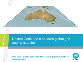
![Rationale for c-squares and this talk ,[object Object],[object Object],[object Object],[object Object],[object Object],[object Object],[object Object],[object Object],[object Object],[object Object],[object Object],Tony Rees: C-squares nested grid notation](data:image/gif;base64,R0lGODlhAQABAIAAAAAAAP///yH5BAEAAAAALAAAAAABAAEAAAIBRAA7)
Recommended
Recommended
More Related Content
Similar to Tony Rees: The c-squares nested global grid
Similar to Tony Rees: The c-squares nested global grid (20)
Recently uploaded
Recently uploaded (20)
Tony Rees: The c-squares nested global grid
- 1. Nested Grids: the c-squares global grid and its notation Tony Rees – CSIRO Marine and Atmospheric Research, Australia September 2011
- 4. WMO Squares: global quadrants Tony Rees: C-squares nested grid notation Tony Rees: C-squares nested grid notation NW (7---) NE (1---) SE (3---) SW (5---) Global quadrants numbered 1, 3, 5, 7 anticlockwise from NE 7817 7816 7815 7814 7813 7812 7811 7810 7809 7808 7807 7806 7805 7804 7803 7802 7801 7800 1800 1801 1802 1803 1804 1805 1806 1807 1808 1809 1810 1811 1812 1813 1814 1815 1816 1817 7717 7716 7715 7714 7713 7712 7711 7710 7709 7708 7707 7706 7705 7704 7803 7702 7701 7700 1700 1701 1702 1703 1704 1705 1706 1707 1708 1709 1710 1711 1712 1713 1714 1715 1716 1717 7617 7616 7615 7614 7613 7612 7611 7610 7609 7608 7607 7606 7605 7604 7803 7602 7601 7600 1600 1601 1602 1603 1604 1605 1606 1607 1608 1609 1610 1611 1612 1613 1614 1615 1616 1617 7517 7516 7515 7514 7513 7512 7511 7510 7509 7508 7507 7506 7505 7504 7803 7502 7501 7500 1500 1501 1502 1503 1504 1505 1506 1507 1508 1509 1510 1511 1512 1513 1514 1515 1516 1517 7417 7416 7415 7414 7413 7412 7411 7410 7409 7408 7407 7406 7405 7404 7803 7402 7401 7400 1400 1401 1402 1403 1404 1405 1406 1407 1408 1409 1410 1411 1412 1413 1414 1415 1416 1417 7317 7316 7315 7314 7313 7312 7311 7310 7309 7308 7307 7306 7305 7304 7803 7302 7301 7300 1300 1301 1302 1303 1304 1305 1306 1307 1308 1309 1310 1311 1312 1313 1314 1315 1316 1317 7217 7216 7215 7214 7213 7212 7211 7210 7209 7208 7207 7206 7205 7204 7803 7202 7201 7200 1200 1201 1202 1203 1204 1205 1206 1207 1208 1209 1210 1211 1212 1213 1214 1215 1216 1217 7117 7116 7115 7114 7113 7112 7111 7110 7109 7108 7107 7106 7105 7104 7803 7102 7101 7100 1100 1101 1102 1103 1104 1105 1106 1107 1108 1109 1110 1111 1112 1113 1114 1115 1116 1117 7017 7016 7015 7014 7013 7012 7011 7010 7009 7008 7007 7006 7005 7004 7803 7002 7001 7000 1000 1001 1002 1003 1004 1005 1006 1007 1008 1009 1010 1011 1012 1013 1014 1015 1016 1017 5017 5016 5015 5014 5013 5012 5011 5010 5009 5008 5007 5006 5005 5004 5003 5002 5001 5000 3000 3001 3002 3003 3004 3005 3006 3007 3008 3009 3010 3011 3012 3013 3014 3015 3016 3017 5117 5116 5115 5114 5113 5112 5111 5110 5109 5108 5107 5106 5105 5104 5103 5102 5101 5100 3100 3101 3102 3103 3104 3105 3106 3107 3108 3109 3110 3111 3112 3113 3114 3115 3116 3117 5217 5216 5215 5214 5213 5212 5211 5210 5209 5208 5207 5206 5205 5204 5203 5202 5201 5200 3200 3201 3202 3203 3204 3205 3206 3207 3208 3209 3210 3211 3212 3213 3214 3215 3216 3217 5317 5316 5315 5314 5313 5312 5311 5310 5309 5308 5307 5306 5305 5304 5303 5302 5301 5300 3300 3301 3302 3303 3304 3305 3306 3307 3308 3309 3310 3311 3312 3313 3314 3315 3316 3317 5417 5416 5415 5414 5413 5412 5411 5410 5409 5408 5407 5406 5405 5404 5403 5402 5401 5400 3400 3401 3402 3403 3404 3405 3406 3407 3408 3409 3410 3411 3412 3413 3414 3415 3416 3417 5517 5516 5515 5514 5513 5512 5511 5510 5509 5508 5507 5506 5505 5504 5503 5502 5501 5500 3500 3501 3502 3503 3504 3505 3506 3507 3508 3509 3510 3511 3512 3513 3514 3515 3516 3517 5617 5616 5615 5614 5613 5612 5611 5610 5609 5608 5607 5606 5605 5604 5603 5602 5601 5600 3600 3601 3602 3603 3604 3605 3606 3607 3608 3609 3610 3611 3612 3613 3614 3615 3616 3617 5717 5716 5715 5714 5713 5712 5711 5710 5709 5708 5707 5706 5705 5704 5703 5702 5701 5700 3700 3701 3702 3703 3704 3705 3706 3707 3708 3709 3710 3711 3712 3713 3714 3715 3716 3717 5817 5816 5815 5814 5813 5812 5811 5810 5809 5808 5807 5806 5805 5804 5803 5802 5801 5800 3800 3801 3802 3803 3804 3805 3806 3807 3808 3809 3810 3811 3812 3813 3814 3815 3816 3817 30 ° N 60 ° N 90 ° N 0 ° 30 ° S 60 ° S 90 ° S 180 ° W 150 ° W 120 ° W 90 ° W 60 ° W 30 ° W 0 ° 30 ° E 60 ° E 90 ° E 120 ° E 150 ° E 180 ° E
- 5. WMO Squares: ten degree squares Tony Rees: C-squares nested grid notation Tony Rees: C-squares nested grid notation NW (7yxx) NE (1yxx) SE (3yxx) SW (5yxx) Then: y = tens of latitude N / S 0–8 xx = tens of longitude W / E 00–17 7817 7816 7815 7814 7813 7812 7811 7810 7809 7808 7807 7806 7805 7804 7803 7802 7801 7800 1800 1801 1802 1803 1804 1805 1806 1807 1808 1809 1810 1811 1812 1813 1814 1815 1816 1817 7717 7716 7715 7714 7713 7712 7711 7710 7709 7708 7707 7706 7705 7704 7803 7702 7701 7700 1700 1701 1702 1703 1704 1705 1706 1707 1708 1709 1710 1711 1712 1713 1714 1715 1716 1717 7617 7616 7615 7614 7613 7612 7611 7610 7609 7608 7607 7606 7605 7604 7803 7602 7601 7600 1600 1601 1602 1603 1604 1605 1606 1607 1608 1609 1610 1611 1612 1613 1614 1615 1616 1617 7517 7516 7515 7514 7513 7512 7511 7510 7509 7508 7507 7506 7505 7504 7803 7502 7501 7500 1500 1501 1502 1503 1504 1505 1506 1507 1508 1509 1510 1511 1512 1513 1514 1515 1516 1517 7417 7416 7415 7414 7413 7412 7411 7410 7409 7408 7407 7406 7405 7404 7803 7402 7401 7400 1400 1401 1402 1403 1404 1405 1406 1407 1408 1409 1410 1411 1412 1413 1414 1415 1416 1417 7317 7316 7315 7314 7313 7312 7311 7310 7309 7308 7307 7306 7305 7304 7803 7302 7301 7300 1300 1301 1302 1303 1304 1305 1306 1307 1308 1309 1310 1311 1312 1313 1314 1315 1316 1317 7217 7216 7215 7214 7213 7212 7211 7210 7209 7208 7207 7206 7205 7204 7803 7202 7201 7200 1200 1201 1202 1203 1204 1205 1206 1207 1208 1209 1210 1211 1212 1213 1214 1215 1216 1217 7117 7116 7115 7114 7113 7112 7111 7110 7109 7108 7107 7106 7105 7104 7803 7102 7101 7100 1100 1101 1102 1103 1104 1105 1106 1107 1108 1109 1110 1111 1112 1113 1114 1115 1116 1117 7017 7016 7015 7014 7013 7012 7011 7010 7009 7008 7007 7006 7005 7004 7803 7002 7001 7000 1000 1001 1002 1003 1004 1005 1006 1007 1008 1009 1010 1011 1012 1013 1014 1015 1016 1017 5017 5016 5015 5014 5013 5012 5011 5010 5009 5008 5007 5006 5005 5004 5003 5002 5001 5000 3000 3001 3002 3003 3004 3005 3006 3007 3008 3009 3010 3011 3012 3013 3014 3015 3016 3017 5117 5116 5115 5114 5113 5112 5111 5110 5109 5108 5107 5106 5105 5104 5103 5102 5101 5100 3100 3101 3102 3103 3104 3105 3106 3107 3108 3109 3110 3111 3112 3113 3114 3115 3116 3117 5217 5216 5215 5214 5213 5212 5211 5210 5209 5208 5207 5206 5205 5204 5203 5202 5201 5200 3200 3201 3202 3203 3204 3205 3206 3207 3208 3209 3210 3211 3212 3213 3214 3215 3216 3217 5317 5316 5315 5314 5313 5312 5311 5310 5309 5308 5307 5306 5305 5304 5303 5302 5301 5300 3300 3301 3302 3303 3304 3305 3306 3307 3308 3309 3310 3311 3312 3313 3314 3315 3316 3317 5417 5416 5415 5414 5413 5412 5411 5410 5409 5408 5407 5406 5405 5404 5403 5402 5401 5400 3400 3401 3402 3403 3404 3405 3406 3407 3408 3409 3410 3411 3412 3413 3414 3415 3416 3417 5517 5516 5515 5514 5513 5512 5511 5510 5509 5508 5507 5506 5505 5504 5503 5502 5501 5500 3500 3501 3502 3503 3504 3505 3506 3507 3508 3509 3510 3511 3512 3513 3514 3515 3516 3517 5617 5616 5615 5614 5613 5612 5611 5610 5609 5608 5607 5606 5605 5604 5603 5602 5601 5600 3600 3601 3602 3603 3604 3605 3606 3607 3608 3609 3610 3611 3612 3613 3614 3615 3616 3617 5717 5716 5715 5714 5713 5712 5711 5710 5709 5708 5707 5706 5705 5704 5703 5702 5701 5700 3700 3701 3702 3703 3704 3705 3706 3707 3708 3709 3710 3711 3712 3713 3714 3715 3716 3717 5817 5816 5815 5814 5813 5812 5811 5810 5809 5808 5807 5806 5805 5804 5803 5802 5801 5800 3800 3801 3802 3803 3804 3805 3806 3807 3808 3809 3810 3811 3812 3813 3814 3815 3816 3817 30 ° N 60 ° N 90 ° N 0 ° 30 ° S 60 ° S 90 ° S 180 ° W 150 ° W 120 ° W 90 ° W 60 ° W 30 ° W 0 ° 30 ° E 60 ° E 90 ° E 120 ° E 150 ° E 180 ° E
- 6. WMO Squares: ten degree squares Tony Rees: C-squares nested grid notation Tony Rees: C-squares nested grid notation NW (7yxx) NE (1yxx) SE (3yxx) SW (5yxx) Example: Canberra ( SE global quadrant, lat. 3 5.27603 S, 14 9.13435 E) is in square 3314 (simple to encode/decode once the principle is known; next digits “5” and “9” will be used in c-squares notation for 1 deg. square, and so on) 7817 7816 7815 7814 7813 7812 7811 7810 7809 7808 7807 7806 7805 7804 7803 7802 7801 7800 1800 1801 1802 1803 1804 1805 1806 1807 1808 1809 1810 1811 1812 1813 1814 1815 1816 1817 7717 7716 7715 7714 7713 7712 7711 7710 7709 7708 7707 7706 7705 7704 7803 7702 7701 7700 1700 1701 1702 1703 1704 1705 1706 1707 1708 1709 1710 1711 1712 1713 1714 1715 1716 1717 7617 7616 7615 7614 7613 7612 7611 7610 7609 7608 7607 7606 7605 7604 7803 7602 7601 7600 1600 1601 1602 1603 1604 1605 1606 1607 1608 1609 1610 1611 1612 1613 1614 1615 1616 1617 7517 7516 7515 7514 7513 7512 7511 7510 7509 7508 7507 7506 7505 7504 7803 7502 7501 7500 1500 1501 1502 1503 1504 1505 1506 1507 1508 1509 1510 1511 1512 1513 1514 1515 1516 1517 7417 7416 7415 7414 7413 7412 7411 7410 7409 7408 7407 7406 7405 7404 7803 7402 7401 7400 1400 1401 1402 1403 1404 1405 1406 1407 1408 1409 1410 1411 1412 1413 1414 1415 1416 1417 7317 7316 7315 7314 7313 7312 7311 7310 7309 7308 7307 7306 7305 7304 7803 7302 7301 7300 1300 1301 1302 1303 1304 1305 1306 1307 1308 1309 1310 1311 1312 1313 1314 1315 1316 1317 7217 7216 7215 7214 7213 7212 7211 7210 7209 7208 7207 7206 7205 7204 7803 7202 7201 7200 1200 1201 1202 1203 1204 1205 1206 1207 1208 1209 1210 1211 1212 1213 1214 1215 1216 1217 7117 7116 7115 7114 7113 7112 7111 7110 7109 7108 7107 7106 7105 7104 7803 7102 7101 7100 1100 1101 1102 1103 1104 1105 1106 1107 1108 1109 1110 1111 1112 1113 1114 1115 1116 1117 7017 7016 7015 7014 7013 7012 7011 7010 7009 7008 7007 7006 7005 7004 7803 7002 7001 7000 1000 1001 1002 1003 1004 1005 1006 1007 1008 1009 1010 1011 1012 1013 1014 1015 1016 1017 5017 5016 5015 5014 5013 5012 5011 5010 5009 5008 5007 5006 5005 5004 5003 5002 5001 5000 3000 3001 3002 3003 3004 3005 3006 3007 3008 3009 3010 3011 3012 3013 3014 3015 3016 3017 5117 5116 5115 5114 5113 5112 5111 5110 5109 5108 5107 5106 5105 5104 5103 5102 5101 5100 3100 3101 3102 3103 3104 3105 3106 3107 3108 3109 3110 3111 3112 3113 3114 3115 3116 3117 5217 5216 5215 5214 5213 5212 5211 5210 5209 5208 5207 5206 5205 5204 5203 5202 5201 5200 3200 3201 3202 3203 3204 3205 3206 3207 3208 3209 3210 3211 3212 3213 3214 3215 3216 3217 5317 5316 5315 5314 5313 5312 5311 5310 5309 5308 5307 5306 5305 5304 5303 5302 5301 5300 3300 3301 3302 3303 3304 3305 3306 3307 3308 3309 3310 3311 3312 3313 3314 3315 3316 3317 5417 5416 5415 5414 5413 5412 5411 5410 5409 5408 5407 5406 5405 5404 5403 5402 5401 5400 3400 3401 3402 3403 3404 3405 3406 3407 3408 3409 3410 3411 3412 3413 3414 3415 3416 3417 5517 5516 5515 5514 5513 5512 5511 5510 5509 5508 5507 5506 5505 5504 5503 5502 5501 5500 3500 3501 3502 3503 3504 3505 3506 3507 3508 3509 3510 3511 3512 3513 3514 3515 3516 3517 5617 5616 5615 5614 5613 5612 5611 5610 5609 5608 5607 5606 5605 5604 5603 5602 5601 5600 3600 3601 3602 3603 3604 3605 3606 3607 3608 3609 3610 3611 3612 3613 3614 3615 3616 3617 5717 5716 5715 5714 5713 5712 5711 5710 5709 5708 5707 5706 5705 5704 5703 5702 5701 5700 3700 3701 3702 3703 3704 3705 3706 3707 3708 3709 3710 3711 3712 3713 3714 3715 3716 3717 5817 5816 5815 5814 5813 5812 5811 5810 5809 5808 5807 5806 5805 5804 5803 5802 5801 5800 3800 3801 3802 3803 3804 3805 3806 3807 3808 3809 3810 3811 3812 3813 3814 3815 3816 3817 30 ° N 60 ° N 90 ° N 0 ° 30 ° S 60 ° S 90 ° S 180 ° W 150 ° W 120 ° W 90 ° W 60 ° W 30 ° W 0 ° 30 ° E 60 ° E 90 ° E 120 ° E 150 ° E 180 ° E
- 7. Other 10 deg. squares in the Australian + NZ region of interest Tony Rees: C-squares nested grid notation
- 10. C-squares nested subdivisions (e.g. in SE global quadrant): Tony Rees: C-squares nested grid notation Intermediate quadrant notation (based on absolute values irrespective of positive or negative): 1: low lat, low lon 2: low lat, high lon 3: high lat, low lon 4: high lat, high lon
- 11. C-squares nested subdivisions (e.g. in SE global quadrant): Tony Rees: C-squares nested grid notation Continuing “Canberra” example , lat. 3 5 S, 14 9 E: 5 deg. square will be 3314:4 1 deg. square will be 3314:4 59 (etc.)
- 13. http://www.cmar.csiro.au/csquares/ Tony Rees: C-squares nested grid notation
- 14. C-squares in practice – e.g. in CMAR “MarLIN” metadata system Tony Rees: C-squares nested grid notation
- 15. C-squares in practice – e.g. in CMAR “MarLIN” metadata system Tony Rees: C-squares nested grid notation
- 16. C-squares in practice – e.g. in CMAR “MarLIN” metadata system Tony Rees: C-squares nested grid notation adds these elements:
- 17. C-squares in practice – e.g. in CMAR “MarLIN” metadata system Tony Rees: C-squares nested grid notation adds these elements:
- 18. C-squares in practice – e.g. in CMAR “MarLIN” metadata system Tony Rees: C-squares nested grid notation adds these elements: … can even Google “3414:371:2” to retrieve this dataset description (plus spatially overlapping ones)
- 19. Tony Rees: C-squares nested grid notation Sample c-squares enabled systems (as at Sep 2011) AquaMaps marine species modelled distribution OBIS point data records CMAR project survey sites CMAR satellite data footprint
- 22. Thank you Tony Rees: C-squares nested grid notation image courtesy Tisham Dhar, CMAR VIZ project Contact Us Phone: 1300 363 400 or +61 3 9545 2176 Email: enquiries@csiro.au Web: www.csiro.au
- 23. Tony Rees: C-squares nested grid notation Supplementary slides
- 25. Tony Rees: C-squares nested grid notation Equal area satellite data swath requires more grid squares as it approaches the poles – but system can handle this
- 26. Tony Rees: C-squares nested grid notation
Editor's Notes
- codes vary systematically in each quadrant: 1000-1817, 3000-3817, 5000-5817, 7000-7817
- uses 1 digit for latitude (N or S), 2 for longitude (W or E)
- This approximates to region of interest for CMAR, IMOS etc. – including regional seas and S. Ocean down to Australian Antarctic Territory
- Online converters available for points, multi-points, lines and polygons (using pl/sql in this instance) cia the c-squares website, www.cmar.csiro.au/csquares/
- C-squares mapper is a simple web utility in existence since 2002, can be called from any web page by embedding a small HTML form and sending relevant c-square codes to be plotted (or could convert to KML or other and plot on Google Earth etc.)
- Exposing the codes as searchable text also permits third party indexing – will support spatial searches without realising it.
- AquaMaps for ~10,000 marine species since 2005 CMAR Satellite data index (60,000 scenes searchable in <1 sec) constructed 2004 OBIS using c-squares for mapping since 2002, spatial indexing since 2004 CMAR project data – indexed in MarLIN metadata system for almost 10 years (+ ongoing)
- Shows why 0.5 deg. squares are a good choice for global mapping – “sweet spot” between resolution (~50km) and storage requirements For Australian use, will be a matter to determine same sweet spot for regional data (plus surrounding seas too)
- This visualisation shows 0.01 deg / 1 km squares colour coded for annual fishing catch, draped over a hi-res bathy off the coast of Tasmania
- If reprojected e.g. on polar projection, true shape over the ground is revealed