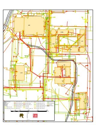
This map displays structures, electrical lines and water lines of a portion of the campus at USA which were borrowed from a CAD drawing. I used a rubber-sheeting technique in Arc Map to place the lines and structures into a real world coordinate system.