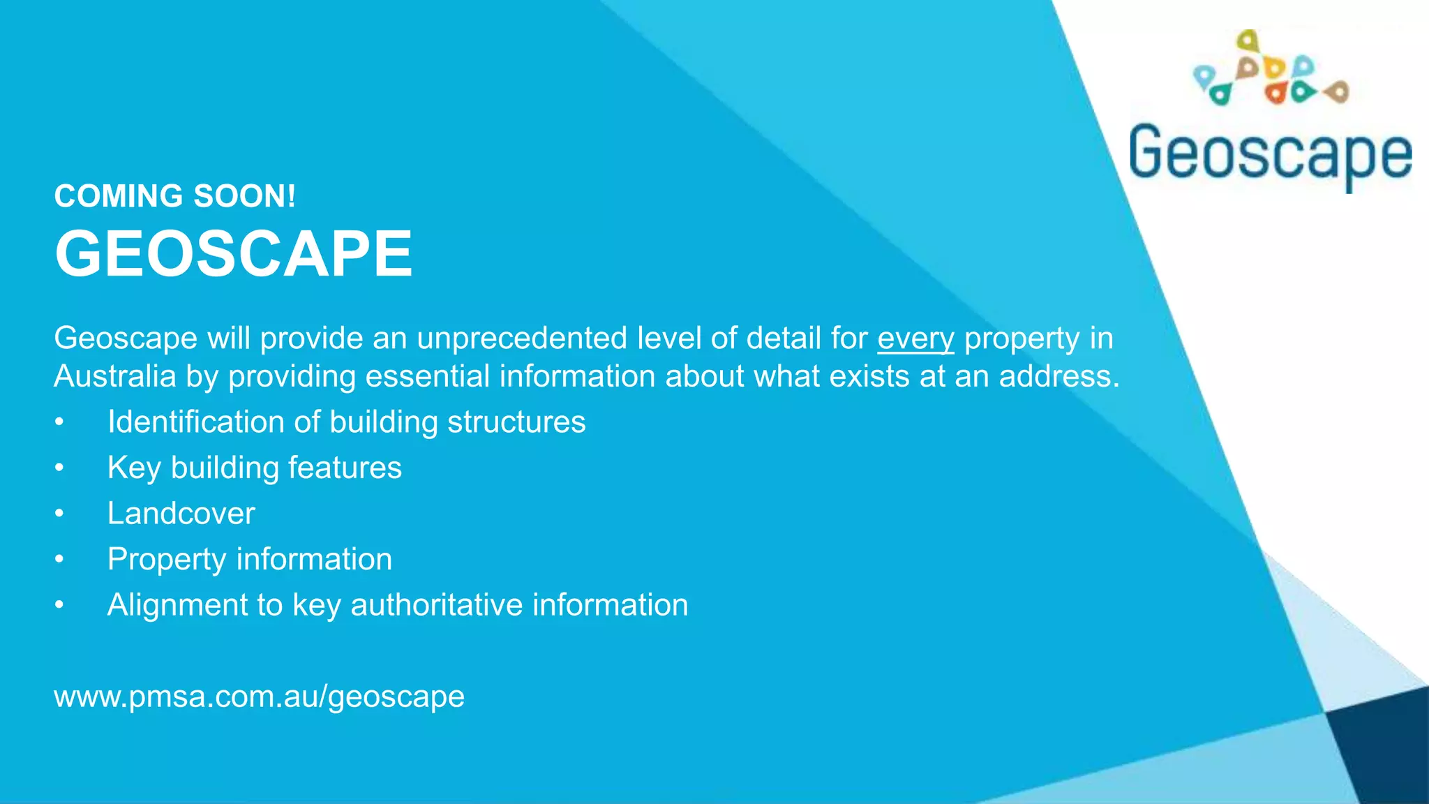
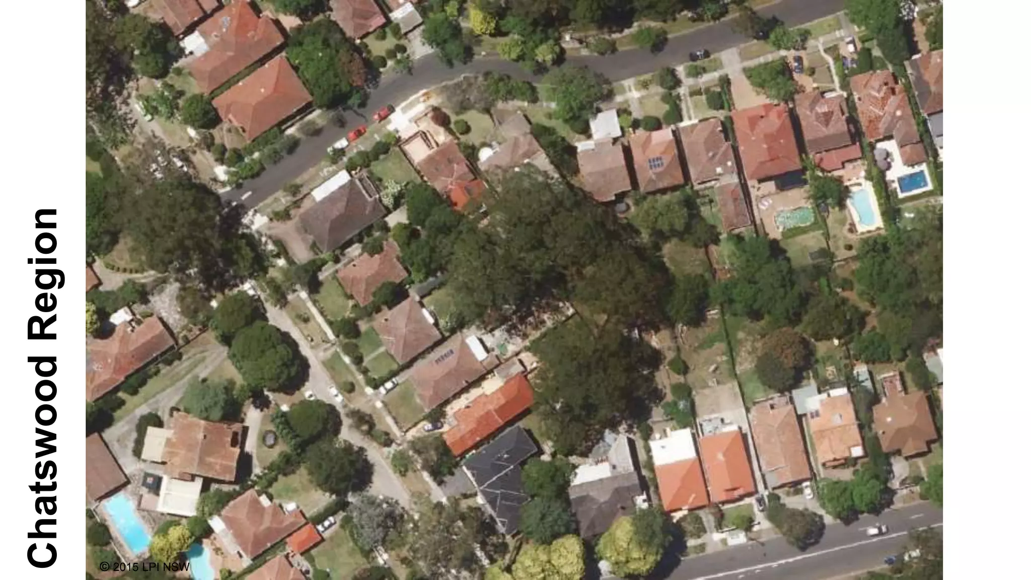
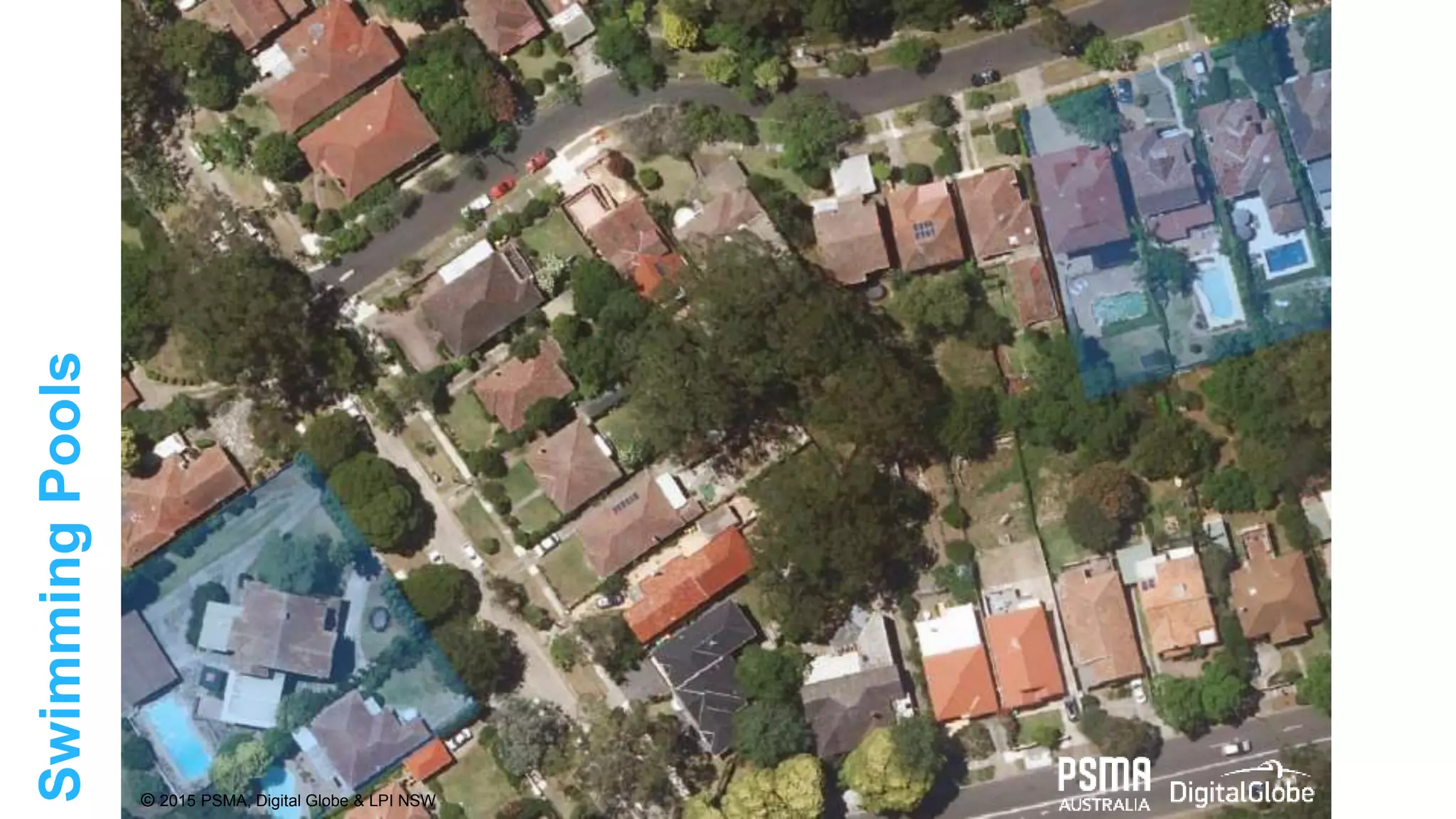
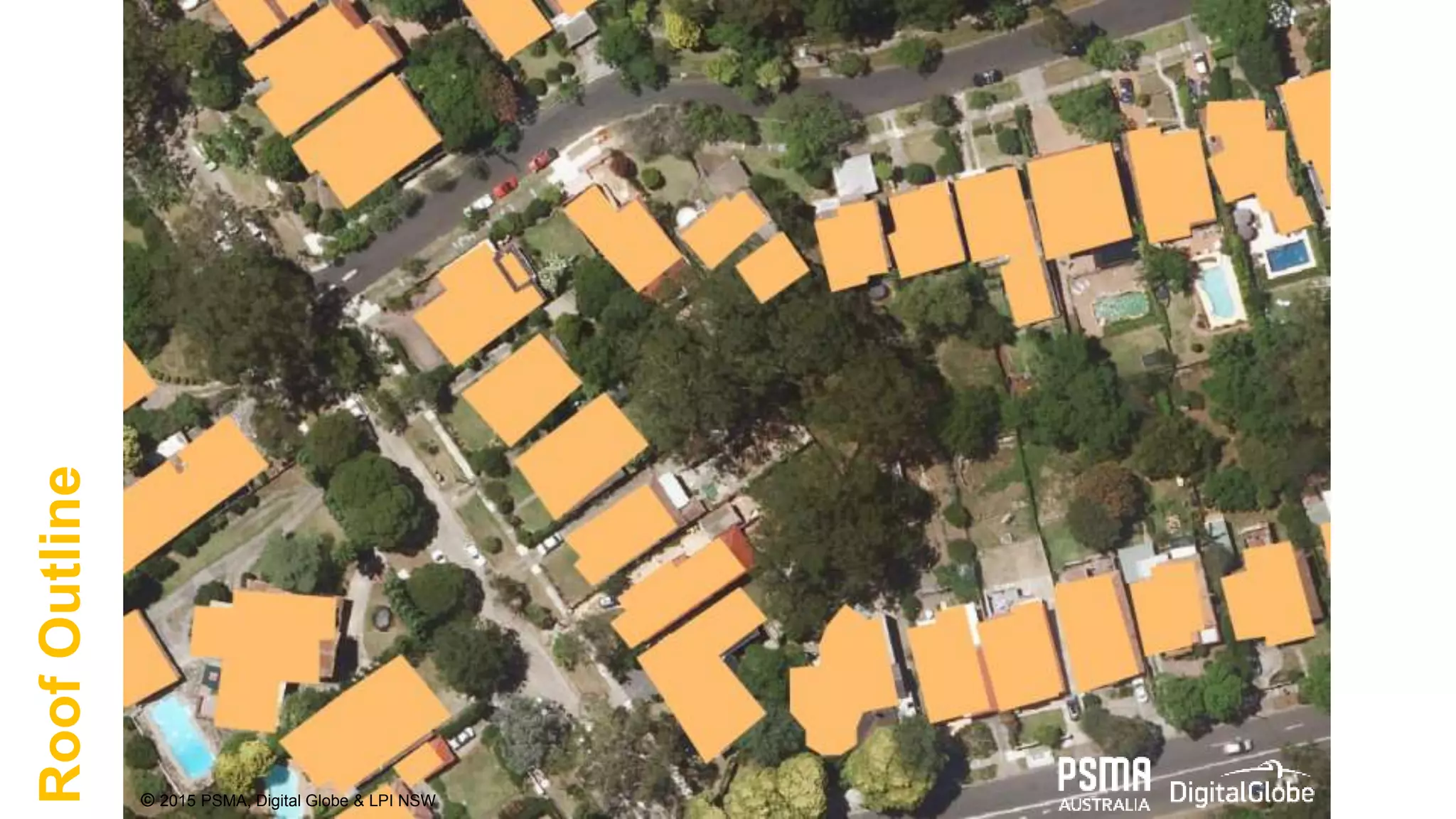
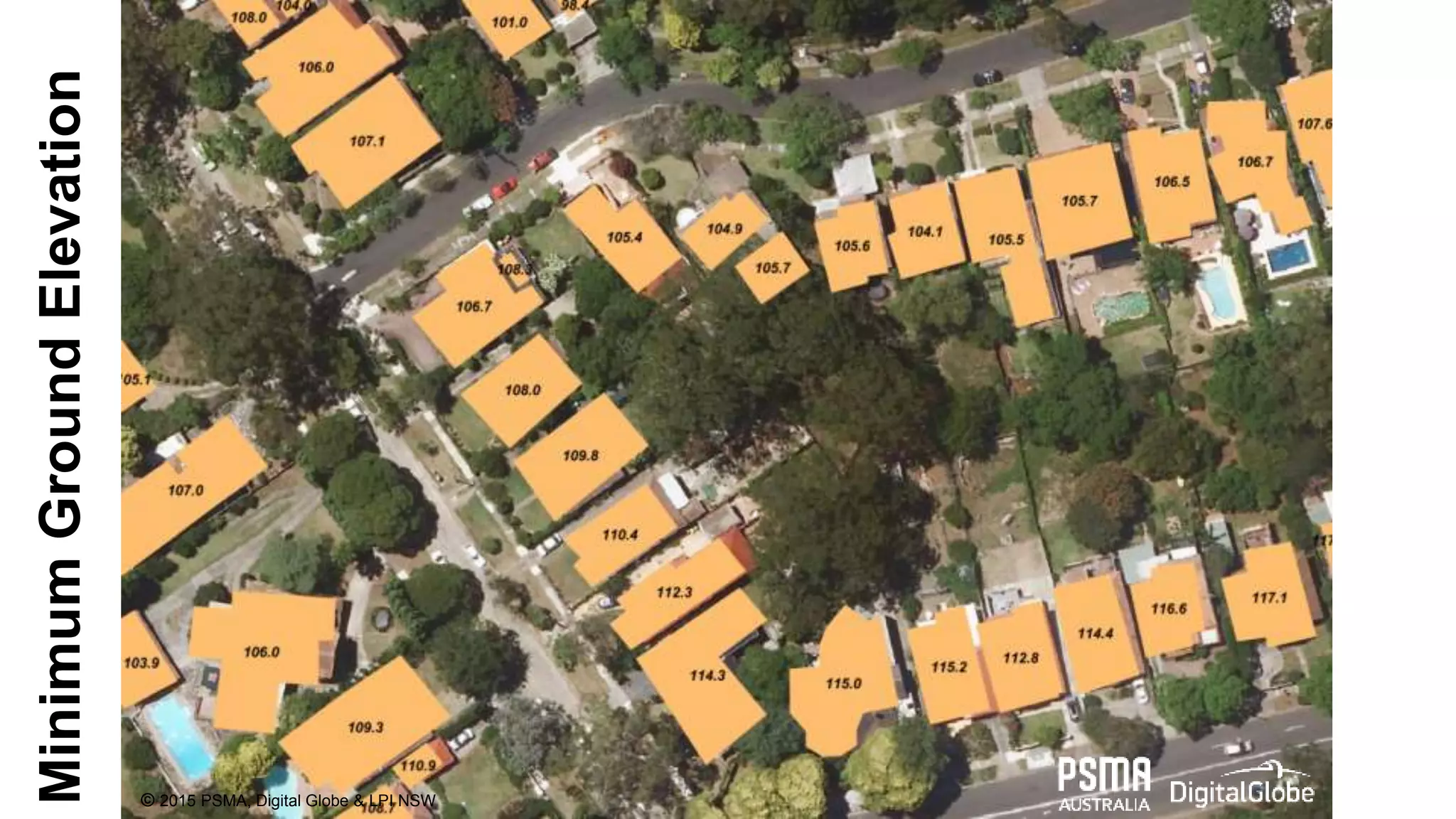
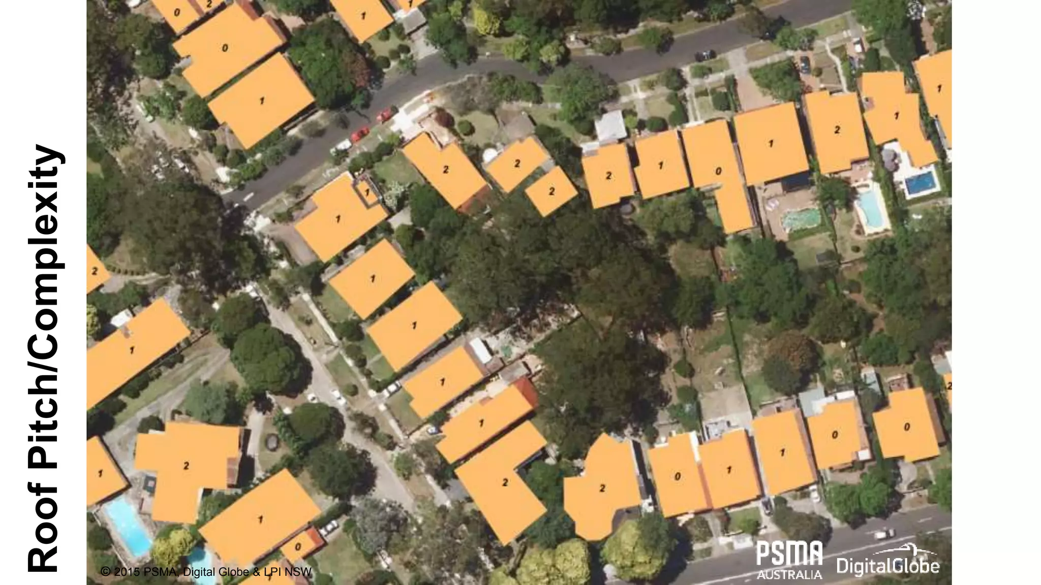
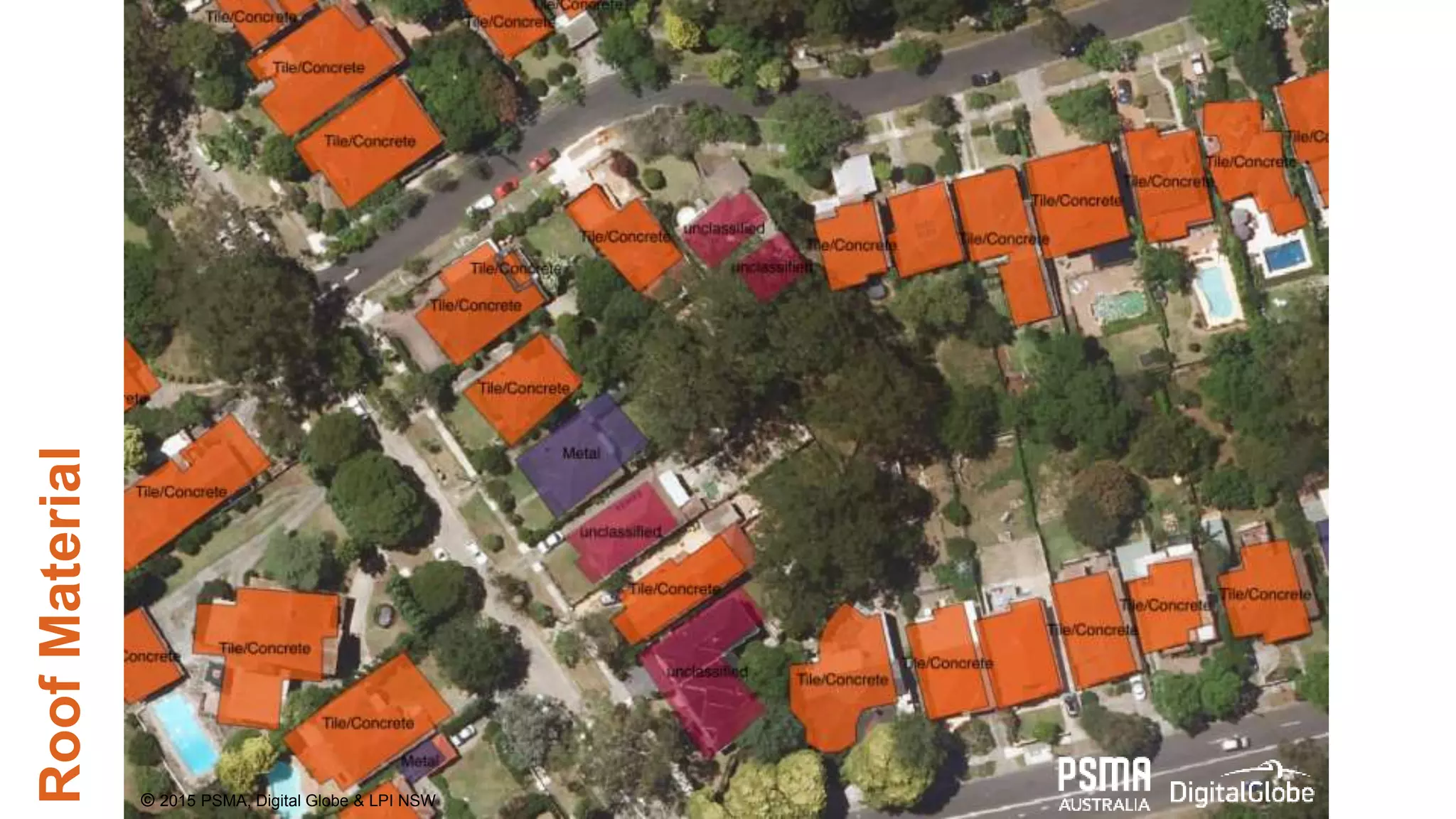
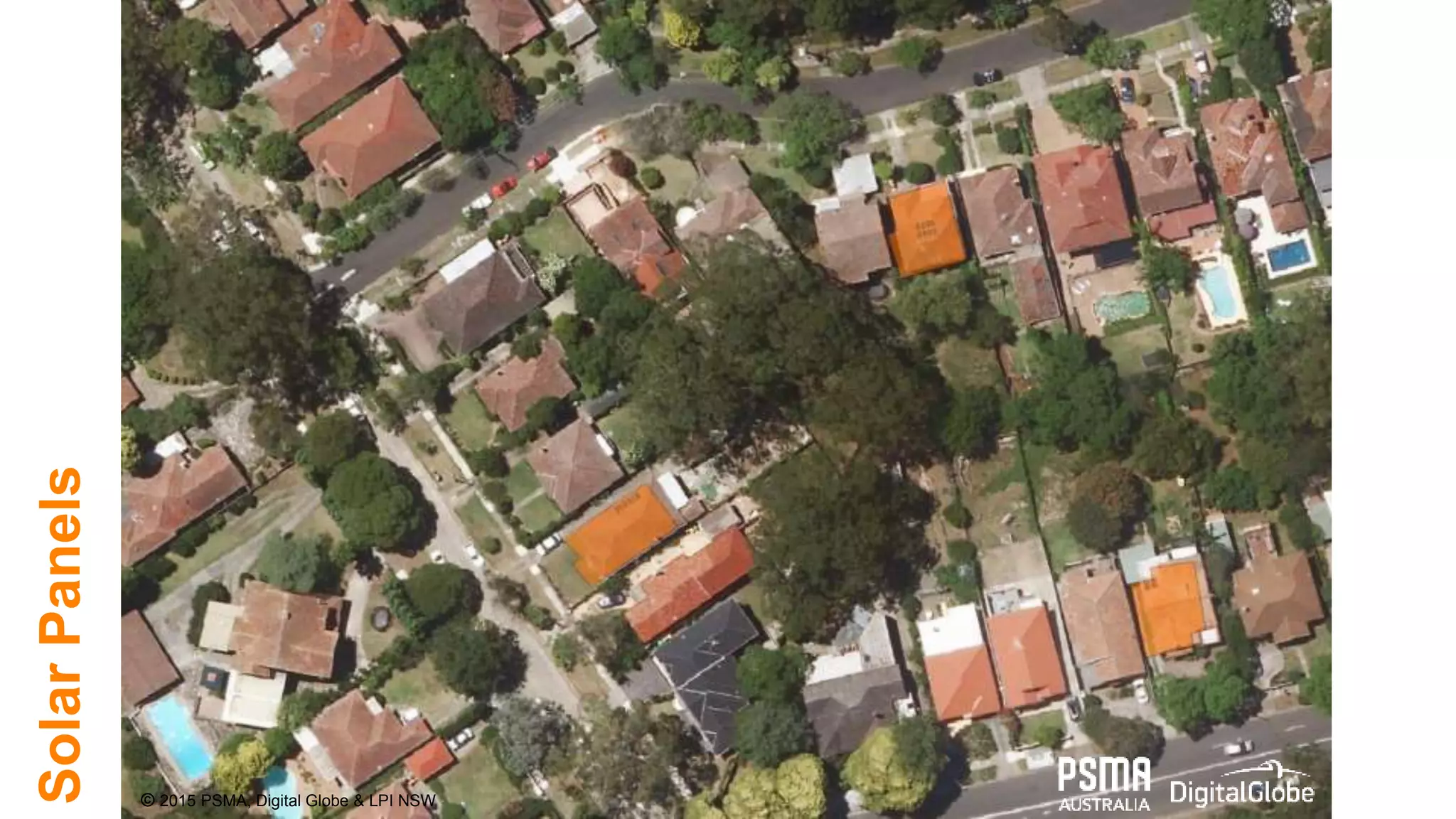
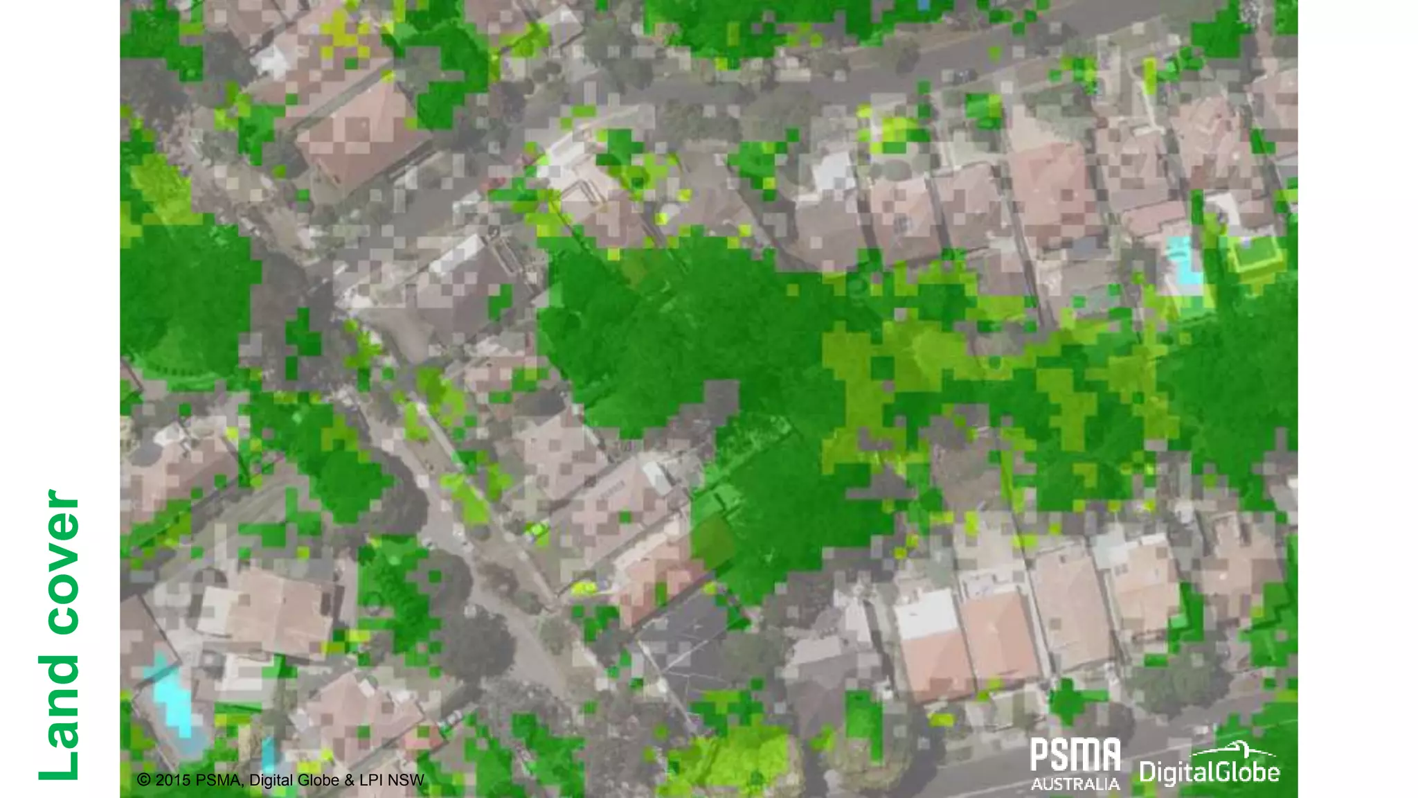
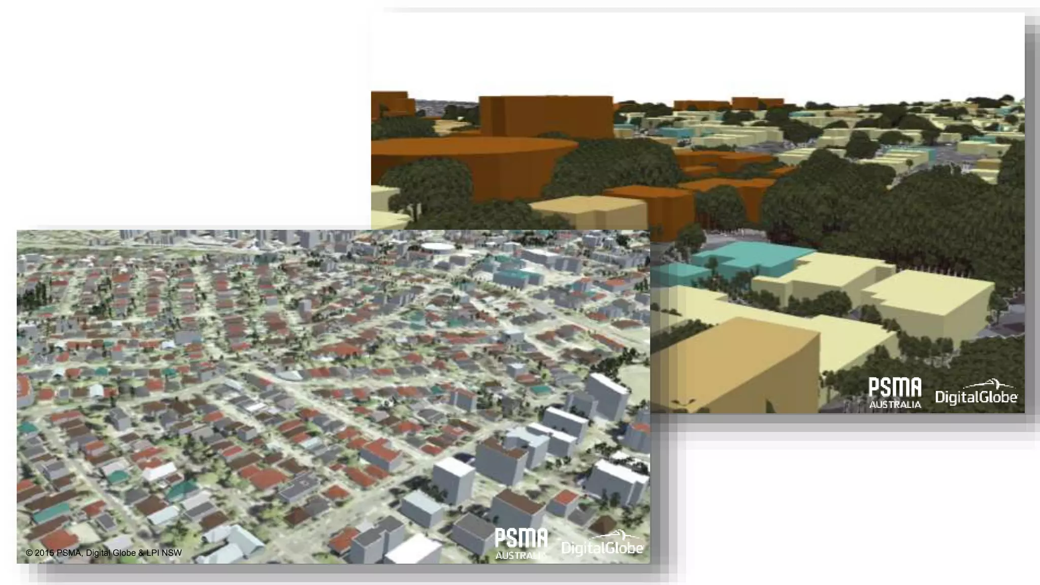
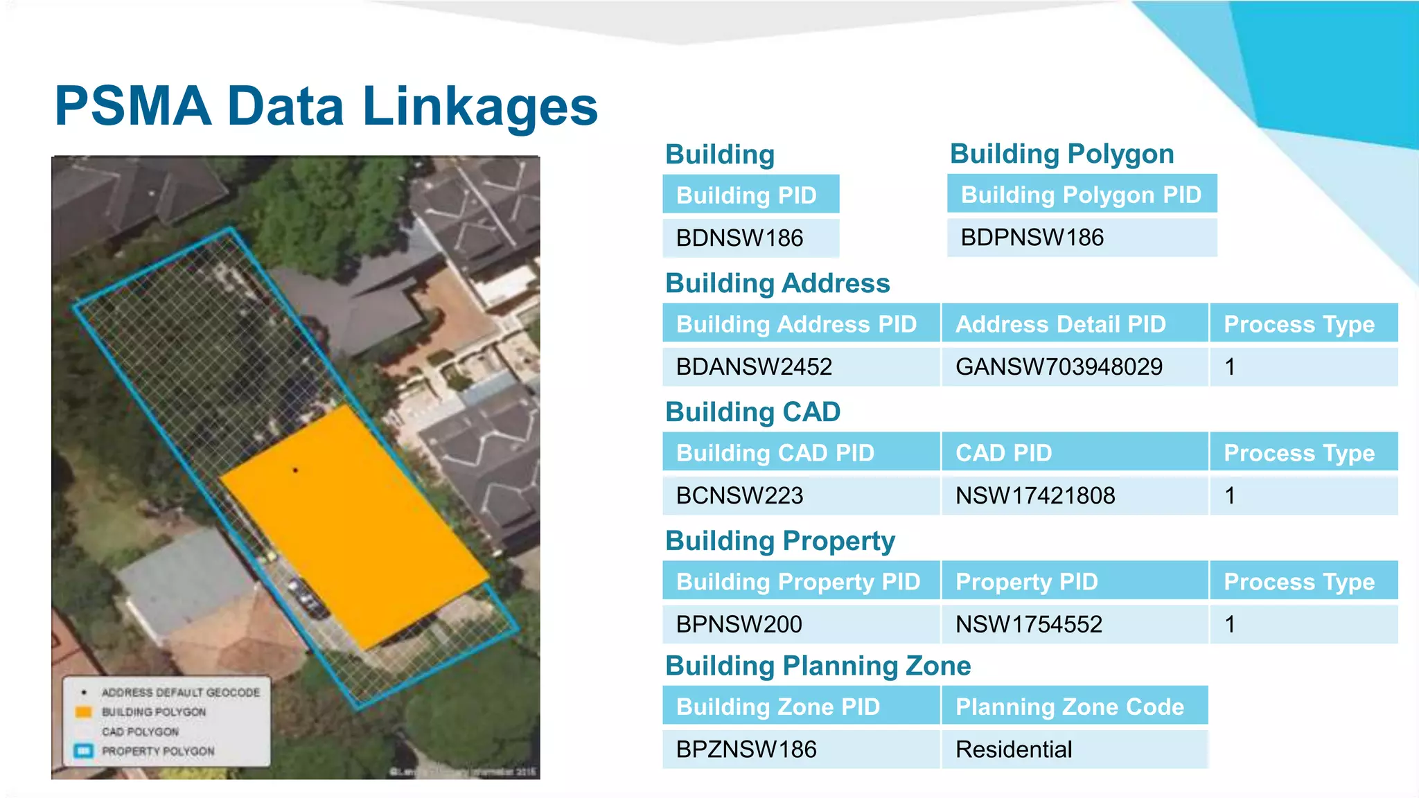
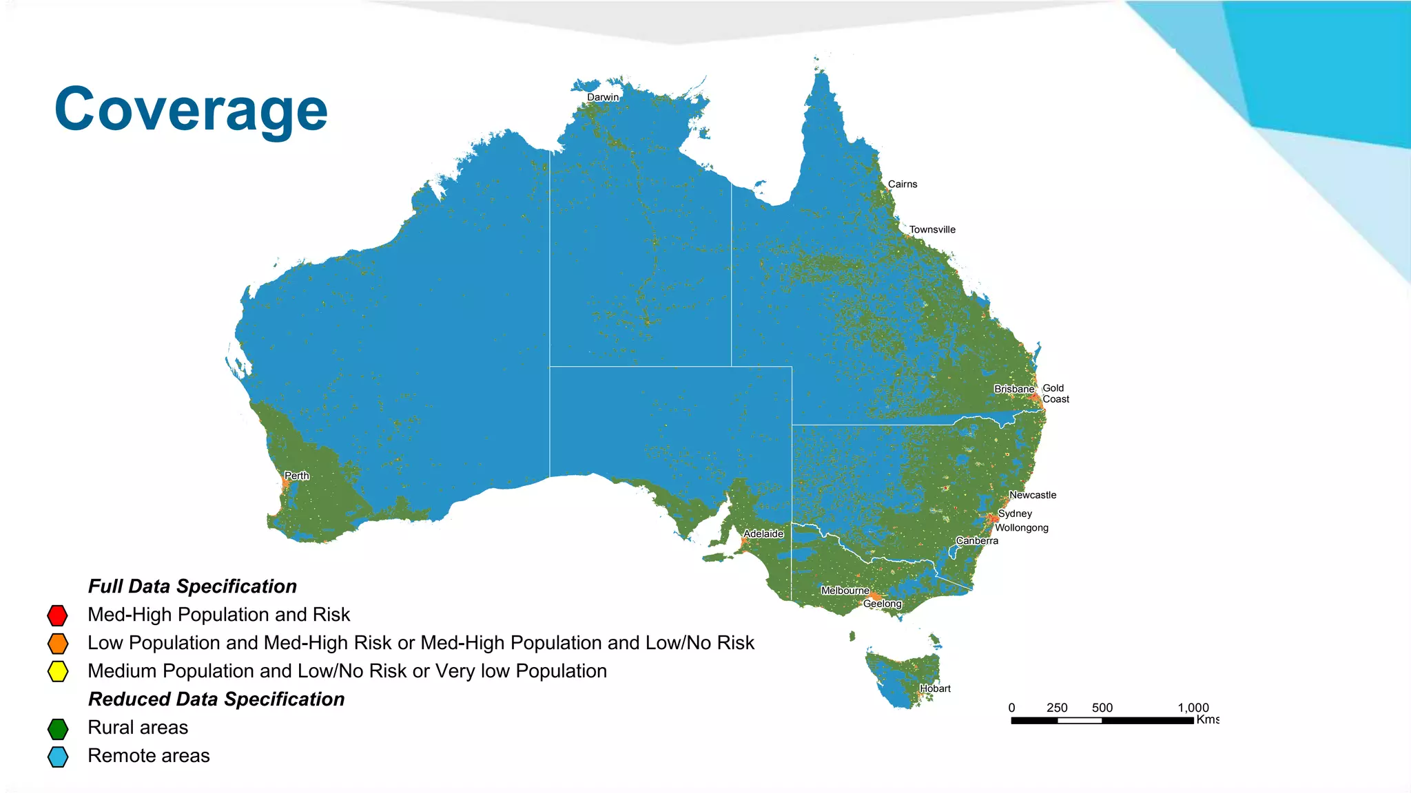
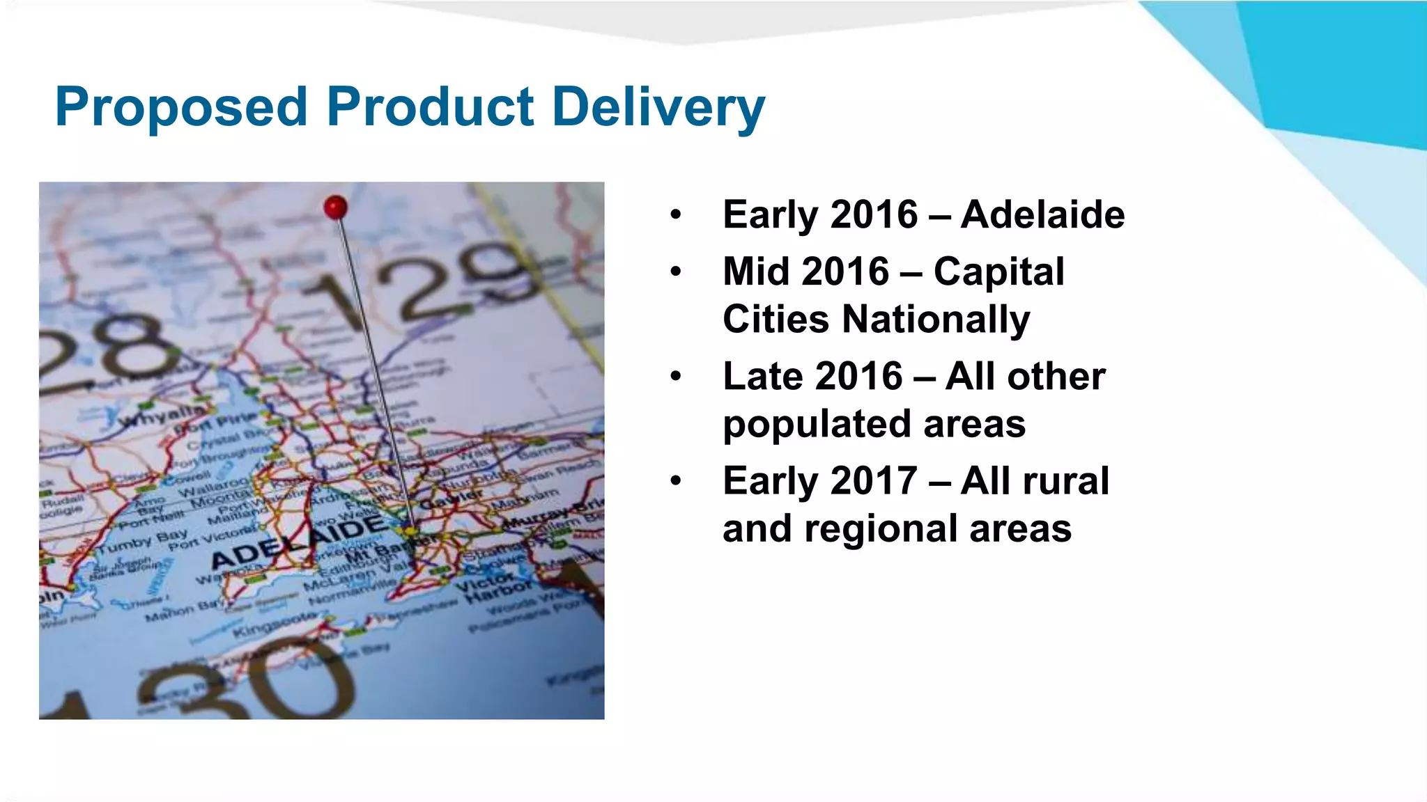
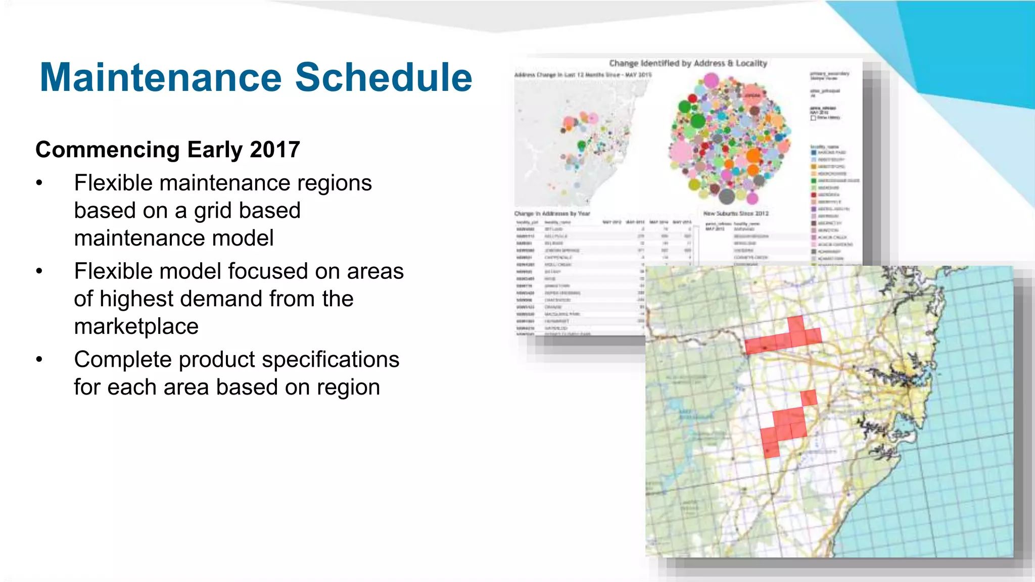
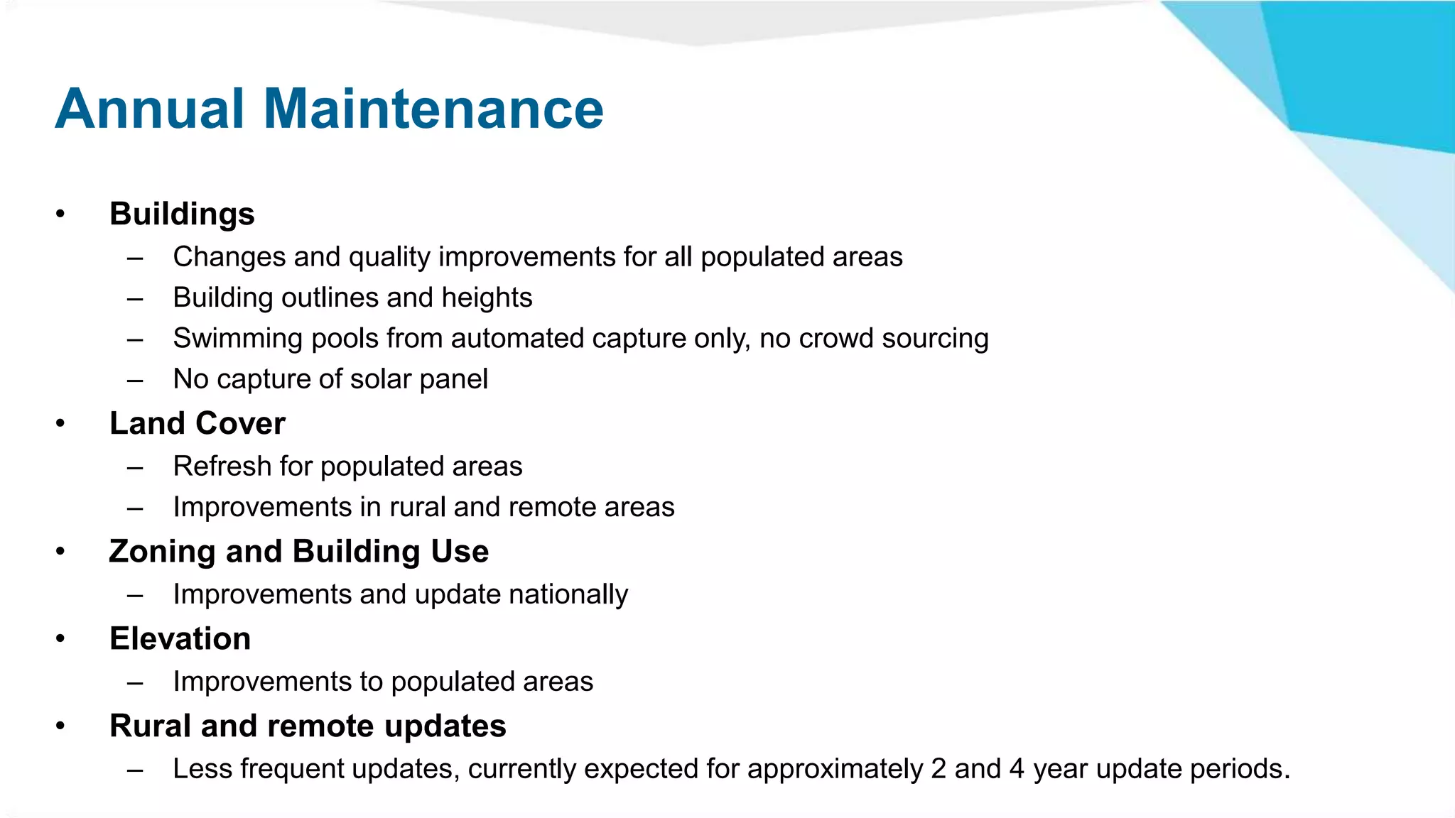
Geoscape
Capturing the Built Environment
The Built Environment
“The human-made space in which
people live, work, and recreate on
a day-to-day basis. The built
environment encompasses places
and spaces created or modified
by people including buildings,
parks, and transportation
systems.”1
1 Roof, K; Oleru N. (2008). "Public Health: Seattle and King County’s Push for the Built Environment.". J Environ Health 71: 24–27.
Defining the built environment
COMING SOON!
GEOSCAPE
Geoscape will provide an unprecedented level of detail for every property in
Australia by providing essential information about what exists at an address.
• Identification of building structures
• Key building features
• Landcover
• Property information
• Alignment to key authoritative information
www.pmsa.com.au/geoscape
Base Product
Building
• Roof outline
• Max roof height
• Eave height
• Ground height
• Number of vertices
• Area
• Roof pitch/complexity
• Roof material
• Zoning
• Residential flag
• Solar panels
Swimming Pool
• Association to an address
Landcover
• Road
• Rock
• Roof
• Trees, including height information
• Grass
• Unspecified Vegetation
• Buildings
• Water
Linkages
• Address
• Cadastre
• Property
ChatswoodRegion
© 2015 LPI NSW
SwimmingPools
© 2015 PSMA, Digital Globe & LPI NSW
RoofOutline
© 2015 PSMA, Digital Globe & LPI NSW
MaximumBuildingHeight
© 2015 PSMA, Digital Globe & LPI NSW
MinimumGroundElevation
© 2015 PSMA, Digital Globe & LPI NSW
RoofPitch/Complexity
© 2015 PSMA, Digital Globe & LPI NSW
RoofMaterial
© 2015 PSMA, Digital Globe & LPI NSW
SolarPanels
© 2015 PSMA, Digital Globe & LPI NSW
Landcover
© 2015 PSMA, Digital Globe & LPI NSW
PSMA Data Linkages
Building PID
BDNSW186
Building Polygon PID
BDPNSW186
Building Address PID Address Detail PID Process Type
BDANSW2452 GANSW703948029 1
Building CAD PID CAD PID Process Type
BCNSW223 NSW17421808 1
Building Property PID Property PID Process Type
BPNSW200 NSW1754552 1
Building Zone PID Planning Zone Code
BPZNSW186 Residential
Building PolygonBuilding
Building Address
Building CAD
Building Property
Building Planning Zone
ROLLOUT AND
MAINTENANCE
!
!
!
!
!
!
!
!
!
!
!
!
!
!
Canberra
Newcastle
Sydney
Wollongong
Darwin
Townsville
Gold
Coast
Cairns
Brisbane
Adelaide
Hobart
Geelong
Melbourne
Perth
Category
1
2
3
4
5
PRIORITY AND QUALITY CLASSIFICATION 0 500 1,000250
Kms
Coverage
Full Data Specification
Med-High Population and Risk
Low Population and Med-High Risk or Med-High Population and Low/No Risk
Medium Population and Low/No Risk or Very low Population
Reduced Data Specification
Rural areas
Remote areas
Proposed Product Delivery
• Early 2016 – Adelaide
• Mid 2016 – Capital
Cities Nationally
• Late 2016 – All other
populated areas
• Early 2017 – All rural
and regional areas
Maintenance Schedule
Commencing Early 2017
• Flexible maintenance regions
based on a grid based
maintenance model
• Flexible model focused on areas
of highest demand from the
marketplace
• Complete product specifications
for each area based on region
Annual Maintenance
• Buildings
– Changes and quality improvements for all populated areas
– Building outlines and heights
– Swimming pools from automated capture only, no crowd sourcing
– No capture of solar panel
• Land Cover
– Refresh for populated areas
– Improvements in rural and remote areas
• Zoning and Building Use
– Improvements and update nationally
• Elevation
– Improvements to populated areas
• Rural and remote updates
– Less frequent updates, currently expected for approximately 2 and 4 year update periods.
ACCESS
Licensing and Access
• Reseller Channel
– Annual royalty fees
– Spatial and a-spatial options
– Whole of Australia through to transactional options
• Licensing
– Annual license option
– Perpetual license option
www.psma.com.au/geoscape
For further information, please contact:
Gerry Stanley
gerry.stanley@psma.com.au

Geoscape - Capturing the built environment