Strategic destination marketing presentation 2015 part4
•
0 likes•563 views

Strategic Destination Marketing Part 4 : 1) Cultural Landscape Management 2) Transforming Cultural Landscape Management into Cultural Heritage Management in Practice 3) ทบทวน4รู้ชุมชน 4) ขยายความการศึกษา4รู้ชุมชนในพื้นที่ ด้วย11ขั้นตอนเพื่อการสร้างแผนการบริหารจัดการมรดกในชุมชนอย่างยั่งยืน 5) เครื่องมือ 7 ชิ้น สำหรับการเข้าใจชุมชนแนวลึก เพื่อการสร้างการมีส่วนร่วมของชุมชน (โดย นพ.ดร. โกมาตร จึงเสถียรทรัพย์ และคณะ) 6) สรุปย่อ แผนบริหารการตลาดการท่องเที่ยวอย่างยั่งยืน ก่อนนำไปสู่แผนการบริหารการตลาดการท่องเที่ยวเชิงกลยุทะ์ของพื้นที่

Recommended
Recommended
More Related Content
More from Silpakorn University
More from Silpakorn University (9)
Strategic destination marketing presentation 2015 part4
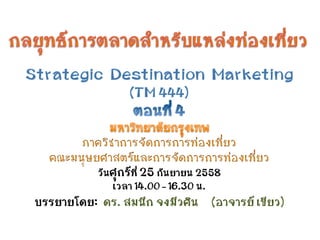
- 1. วันศุกร์ที่ 25 กันยายน 2558 เวลา 14.00 – 16.30 น. บรรยายโดย: ดร. สมนึก จงมีวศิน (อาจารย์ เขียว)
- 2. CULTURAL LANDSCAPE MANAGEMENT SOMNUCK JONGMEEWASIN., Ph.D.
- 4. • รูปแบบของกิจกรรมมนุษย์ และ/หรือ โครงสร้าง เชิงสัญลักษณ์ที่ทำให้กิจกรรมนั้นเด่นชัดและมี ความสำคัญ วิถีการดำเนินชีวิต ซึ่งเป็นพฤติกรรม และสิ่งที่คนในหมู่ผลิตสร้างขึ้น ด้วยการเรียนรู้ จากกันและกัน และร่วมใช้อยู่ในหมู่พวกของตน ซึ่ง สามารถเปลี่ยนแปลงได้ตามยุคสมัย และ ความ เหมาะสม
- 5. • วัฒนธรรมส่วนหนึ่งสามารถแสดงออกผ่าน ดนตรี วรรณกรรม จิตรกรรม ประติมากรรม การละคร และภาพยนตร์ แม้บางครั้งอาจมีผู้กล่าวว่า วัฒนธรรมคือเรื่องที่ว่าด้วยการบริโภคและสินค้า บริโภค เช่น วัฒนธรรมระดับสูง วัฒนธรรมระดับ ต่ำ วัฒนธรรมพื้นบ้าน หรือวัฒนธรรมนิยม เป็นต้น
- 6. • แต่นักมานุษยวิทยาโดยทั่วไปมักกล่าวถึง วัฒนธรรมว่า มิได้เป็นเพียงสินค้าบริโภค แต่หมาย รวมถึงกระบวนการในการผลิตสินค้าและการให้ ความหมายแก่สินค้านั้น ๆ ด้วย ทั้งยังรวมไปถึง ความสัมพันธ์ทางสังคมและแนวการปฏิบัติที่ทำให้ วัตถุและกระบวนการผลิตหลอมรวมอยู่ด้วยกัน • ในสายตาของนักมานุษยวิทยาจึงรวมไปถึง เทคโนโลยี ศิลปะ วิทยาศาสตร์รวมทั้งระบบศีล ธรรม
- 7. • วัฒนธรรมชุมชน ก็คือ พัฒนาการของชุมชน หรือ เราอาจเรียกว่า Modernity (ความเป็นสมัยใหม่) ของชุมชน
- 8. LANDSCAPE ภูมิทัศน ์
- 10. ความหมายของภูมิทัศน์ • ภาพรวมของพื้นที่ใดพื้นที่หนึ่ง ที่มนุษย์รับรู้ทางสายตาใน ระยะห่าง อาจเป็นพื้นที่ธรรมชาติที่ประกอบด้วยรูปทรง ของแผ่นดิน น้ำ ต้นไม้ สัตว์และสรรพสิ่งมนุษย์สร้างใน สภาพอากาศหนึ่งและช่วงเวลาหนึ่งที่เรียกว่าภูมิทัศน์ ธรรมชาติ หรือภาพรวมของเมืองหรือส่วนของเมือง เรียกว่าภูมิทัศน์เมือง นอกจากนี้ยังมีการใช้คำ “ภูมิทัศน์” กับพื้นที่ที่มีลักษณะเฉพาะเด่นชัด เช่น ภูมิทัศน์ทะเล ภูมิ ทัศน์ภูเขา ภูมิทัศน์ทะเลทราย หรือ ภูมิทัศน์พระจันทร์ ซึ่ง หมายถึงภาพรวมของพื้นที่บนผิวดวงจันทร์ที่ มนุษย์อวกาศไปเยือน
- 11. • จิตรกรรมภูมิทัศน์ (Landscape art) ได้แก่งาน จิตรกรรมภาพวิวทิวทัศน์ หรือสื่ออื่นที่แสดงภูมิทัศน์ • ภาพถ่ายภูมิทัศน์ (Nature photography) ได้แก่ งานการถ่ายภาพภาพวิวทิวทัศน์ • ภูมิทัศน์สถาปัตยกรรม หรือภูมิสถาปัตยกรรม (Landscape architecture) ได้แก่ศิลปะและ วิทยาศาสตร์ว่าด้วยการวางแผน การออกแบบ และการ จัดการงานภูมิทัศน์สาธารณะ งานภูมิทัศน์และสวนส่วน บุคคลซึ่งสามารถแบ่งเป็นสาขาย่อยได้ดังนี้ • การออกแบบภูมิทัศน์ (Landscape design) ได้แก่ การออกแบบที่ว่างทั้งในเมืองและชนบท
- 12. • ภูมิทัศน์วิศวกรรม (Landscape engineering) ได้แก่งานด้านเทคนิคในงานภูมิสถาปัตยกรรม • การวางแผนภูมิทัศน์ (Landscape planning) ได้แก่ การวางแผนพื้นที่ขนาดใหญ่ และ/หรืองานพัฒนา โครงการภูมิทัศน์ระยะยาว • ก า ร จ ั ด ก า ร ง า น ภ ู ม ิ ท ั ศ น ์ ( L a n d s c a p e management) ได้แก่การดูแลและจัดการภูมิทัศน์ มนุษย์สร้างและภูมิทัศน์ธรรมชาติ • งานภูมิทัศน์สวน (Landscape gardening) ได้แก่ งานออกแบบสวนในคฤหาสก์ขนาดใหญ่ ซึ่งนิยมทำและมี ความสำคัญในคริสต์ศตวรรษที่ 18-19 ในยุโรป โดย เฉพาะประเทศอังกฤษ นับเป็นต้นตอของภูมิ สถาปัตยกรรม
- 13. • ภูมิทัศน์ชุมชน (Urban landscape) ได้แก่การ ออกแบบหรือปรับปรุงคุณภาพทางทัศนียภาพในสภาพ แวดล้อมที่เป็นส่วนของเมือง โดยเฉพาะที่เป็นชุมชนให้มี ความร่มรื่น สวยงาม มีเอกลักษณ์และร่มรื่น • ภูมิทัศน์นิเวศวิทยา (Landscape ecology) ได้แก่ สาขาย่อยในวิชานิเวศวิทยาที่ว่าด้วยการศึกษาสาเหตุ ผลกระทบและกระบวนการของรูปลักษณ์ภูมิทัศน์ของ พื้นที่ที่ถูกเปลี่ยนแปลง
- 14. What is a Natural Landscape? • View the following images and state whether you consider them to be natural landscapes
- 17. Defining Natural Landscapes • What do we mean by natural? – Parts of the environment that are present within it without the influence of people • What do we mean by landscape? – All the features of the environment that can be seen or observed
- 18. Describing a Landscape • ConcentraIng on a couple of the images we have already looked at, how can we describe the landscape in more detail?
- 21. NATURAL LANDSCAPE VS CULTURAL LANDSCAPE
- 23. Natural landscape • Refers to the Visible features of the environment – Varies from place to place and form paLerns which can be described/mapped • Includes interacIng components or elements, including – Relief – Climate – Soils – Vegeta2on
- 24. Relief • Height and shape of the land • Processes that have formed the land over geological Ime
- 25. Climate • Average atmospheric condiIons over a long period of Ime • Rainfall, temperature, sunshine hours, humidity, wind etc
- 26. Soils • Weathered or eroded materials from rocks • Of interest is soil type, ferIlity, drainage
- 27. VegetaIon • Plant cover of an area • VegetaIon types and their distribuIon
- 28. InteracIon • Elements of the landscape affect one another in different ways • As a consequence of interac2on the natural landscape of an area can be seen as a system Climate Relief Vegetation Soils Interactions in the natural landscape Direct interaction Indirect interaction
- 29. AcIvity 1. Define ‘natural landscapes’ 2. Define ‘interacIon’ 3. Study photo and answer the following a) Describe two relief features of the area b) Describe one feature of the climate c) Describe one vegetaIon feature d) Describe one soil feature 4. Describe how relief is interacIng with climate in the area 5. Describe how climate is interacIng with relief in the area Head of Lake Wakatipu, Dart River
- 31. Cultural landscapes • The acIviIes and ways which people have influenced the landscape are known as it’s cultural landscape • Cultural features are established by people as they modify the natural landscape – In order to use it • The main cultural features are (leave two lines between each) – Land use – Transport features – PopulaIon and seLlement • Natural features in the area will affect the cultural features – Very few people live in the hoLest or coldest climates • Cultural factors can influence features of the environment as people and the environment interact – An opencast mine changes the relief features of the environment
- 32. ภูมิทัศน์ทางวัฒนธรรม (Cultural Landscape) • การรวมเข้าด้วยกันในงานของธรรมชาติและงาน ของมนุษย์” เป็นการแสดงให้เห็นภาพของ วิวัฒนาการของสังคมมนุษย์และการตั้งถิ่นฐาน ตามกาลเวลาที่ล่วงเลยมา ซึ่งได้รับอิทธิพลจากข้อ จำกัดทางกายภาพและ/หรือโอกาสในสิ่งแวดล้อม ธรรมชาติและจากการสืบทอดทางสังคม เศรษฐกิจและพลังอิทธิพลทางวัฒนธรรมทั้งที่เกด ภายในและที่ได้รับจากภายนอก
- 33. Land use • PaLerns made by people as they use the land for mining, farming, forestry etc • For example – Altering the vegetaIon by clearing forests to make pasture
- 34. Transport features • Networks of roads, railways, canals, shipping lanes, airports etc • Known as infrastructure
- 35. PopulaIon and seLlement • PaLerns of populaIon, its distribuIon and the locaIon of seLlements • Such as – Farmsteads – Villages – Towns – CiIes
- 36. AcIvity 1. Define ‘cultural landscape’ 2. Study the photograph of The Canterbury Plains 3. Describe 2 natural features 4. Describe 3 cultural features 5. Show an example of a. Influence of relief on climate b. Influence of relief on farming
- 37. ความหมายของ…การจัดการ (Management) P – Planing - วางแผน O – Organizing - จัดองคกร C – Coordinating - ประสานงาน C – Communicating - สื่อสาร C – Controlling - ควบคุม
- 38. ประเภทของภูมิทัศน์วัฒนธรรม • UNESCO – ภูมิทัศน์ซึ่งได้ออกแบบและสร้างสรรค์อย่างตั้งใจจาก มนุษย์ เช่น สวน สวนสาธารณะ – ภูมิทัศน์ที่มีวิวัฒนาการอันเป็นผลสืบเนื่องมาจากการ เปลี่ยนแปลงทางสังคม เศรษฐกิจ การปกครอง ศาสนา ความเชื่อ – ภูมิทัศน์ที่เกี่ยวเนื่องกับศาสนา ศิลปะ วัฒนธรรม หรือ องค์ประกอบทางธรรมชาติ
- 39. ประเภทของภูมิทัศน์วัฒนธรรม • LUCAS .. แบ่งตามอิทธิพลของมนุษย์ต่อการ เปลี่ยนแปลงสิ่งแวดล้อมธรรมชาติ – ภูมิทัศน์ที่ได้รับการจัดการ (Managed Landscape) – ภูมิทัศน์เกษตรกรรม (Cultivated Landscape) – ภูมิทัศน์รอบนอกศูนย์กลางเมือง (Suburban Landscape) – ภูมิทัศน์ในเมือง (Urban Landscape)
- 40. สรุป การแบ่งภูมิทัศน์วัฒนธรรม (1) • ภูมิทัศน์ที่เกิดจากการเปลี่ยนแปลงสภาพ ธรรมชาติ สภาพภูมิศาสตร์เดิม เพื่อการตั้งถิ่นฐาน บ้านเรือน ชุมชน สังคม มีพัฒนาการอันเป็นผลมา จากการเปลี่ยนแปลงทางเศรษฐกิจ สังคมการ ปกครอง ศาสนา ความเชื่อ และ/หรือมีความเกี่ยว เนื่องกับ ศาสนา ศิลปะ วัฒนธรรม ภูมิทัศน์แบบนี้ ต้องการการจัดการที่ละเอียดลึกซึ้ง มีระบบ ระเบียบ เนื่องจากเกี่ยวข้องกับปัจจัยหลายด้าน
- 41. สรุป การแบ่งภูมิทัศน์วัฒนธรรม (2) • ภูมิทัศน์ที่เกิดจากออกแบบสร้างสรรค์อย่างตั้งใจ มีความสวยงาม โดยคำนึงถึงสุนทรียภาพ มี ลักษณะเป็นสวน หรือ สถานที่พักผ่อนหย่อนใจ ภูมิ ทัศน์วัฒนธรรมประเภทนี้เป็นผลจากปัจจัยที่มี วัตถุประสงค์ไม่หลากหลาย จึงมีการจัดการ การ ดำเนินการที่น้อยกว่า
- 42. เหตุผลที่ต้องมีการจัดการภูมิทัศน์วัฒนธรรม • ไม่มีสิ่งทดแทนได้ หรือทำขึ้นใหม่ได้ • หากถูกทำลายแล้ว ไม่มีทางนำกลับมาใหม่ได้ • ไวต่อการสูญหาย ถูกทำลาย หรือหมดไป • เป็นสิ่งที่แสดงถึงความเป็นอยู่ หรือเอกลักษณ์ของ สังคมนั้น • เป็นพื้นฐานอย่างหนึ่งเพื่อการพัฒนาสังคมอย่าง ยั่งยืน
- 43. วัตถุประสงค์ของ การจัดการภูมิทัศน์วัฒนธรรม (1) • เพื่อให้ได้ข้อมูลเกี่ยวกับภูมิทัศน์วัฒนธรรม สำหรับ การวางแผน และดำเนินการรักษาคุณค่า และ ความ สำคัญ เพื่อประโยชน์ของการดำรงอยู่ของสังคม นั้น • เพื่อการวิเคราะห์ วางแผน และดำเนินงานเกี่ยวกับ ภูมิทัศน์วัฒนธรรมของสังคมนั้นอย่างเหมาะสม
- 44. วัตถุประสงค์ของ การจัดการภูมิทัศน์วัฒนธรรม (2) • เพื่อสร้างความตระหนักในคุณค่าและความสำคัญ ของภูมิทัศน์วัฒนธรรมของสังคมนั้นแก่สมาชิกใน สังคม • เพื่อสร้างการมีส่วนร่วมของสมาชิกในสังคม ผู้เป็น เจ้าของภูมิทัศน์วัฒนธรรม
- 45. โครงสร้างแผนการจัดการ ภูมิทัศน์วัฒนธรรม • ศึกษาข้อมูลรายละเอียดเกี่ยวกับพื้นที่และ โครงสร้างของโครงการ • ประเมินผลและกำหนดวัตถุประสงค์ของการ จัดการ รวมทั้งแสดงเหตุผลประกอบ • กำหนดวิธีการ และ เครื่องมือที่จะทำให้บรรลุ วัตถุประสงค์ อย่างไรก็ตามแต่ละพื้นที่โครงการจะ มีรายละเอียดเฉพาะต่างๆกัน
- 46. หลักการจัดการภูมิทัศน์วัฒนธรรมของ IUCN • การรักษาภูมิทัศน์วัฒนธรรมต้องการการสนับสนุน ในเชิงเศรษฐกิจ • การรักษาภูมิทัศน์วัฒนธรรมต้องการการสนับสนุน จากท้องถิ่น และผู้ที่เกี่ยวข้อง • องค์ประกอบของภูมิทัศน์วัฒนธรรมต้องมีการ ศึกษาในรายละเอียด เก็บข้อมูล วิเคราะห์ เพื่อการ จัดการได้อย่างเหมาะสม
- 47. หลักการจัดการภูมิทัศน์วัฒนธรรมของ IUCN • การวางแผนจัดการ ต้องวิเคราะห์คุณค่า จุดมุ่ง หมาย ผลกระทบ และข้อมูลด้านต่างๆ เพื่อการ ตัดสินใจที่เหมาะสม • กฎระเบียบ ข้อบังคับ ควรยืดหยุ่นได้และต้องคำนึง ถึงสิทธิของชุมชนท้องถิ่น • การจัดการภูมิทัศน์วัฒนธรรมต้องพิจารณาปัจจัย ครอบคลุม ทั้งสภาพแวดล้อม เศรษฐกิจ ารเมือง การปกครองสังคม และ วัฒนธรรม
- 48. CULTURAL LANDSCAPE MANAGEMENT เกี่ยวข้องกับ การอนุรักษ์และพัฒนา คือ สมดุลของการอนุรักษ์และการพัฒนา
- 49. ระบบการอนุรักษ์ภูมิทัศน์วัฒนธรรม (Pregil & Volkman) • การศึกษาพื้นที่โดยละเอียด • ค้นหาความสำคัญของบริเวณที่มีคุณค่าต่อชุมชน • ศึกษาคุณค่าของพื้นที่เพื่อแปลความหมายแสดงให้ สังคมรับรู้ • กำหนดขอบเขตพื้นที่สงวนรักษาและพื้นที่พัฒนา • กำหนดกลยุทธ์ในการอนุรักษ์พื้นที่
- 50. การแบ่งภูมิทัศน์วัฒนธรรม ตามความเข้มข้นของการจัดการ ของมนุษย์ที่มีต่อสภาพแวดล้อม • ชุมชนที่มีภูมิทัศน์นำวัฒนธรรม • ชุมชนที่มีลักษณะเด่นร่วมกันทั้งภูมิทัศน์และ วัฒนธรรม • ชุมชนที่มีวัฒนธรรมนำภูมิทัศน์
- 51. ขนาดของแหล่งภูมิทัศน์วัฒนธรรม • อาคาร • บริเวณ ย่าน • ชุมชน • เมือง
- 52. องค์ประกอบของ เมือง • เส้นทางสัญจร (Path) • เส้นขอบ (Edge) • ชุมทาง ชุมนุมชน (Node) • ย่าน (District) • จุดหมายตา (Landmark)
- 53. แนวทางการบริหารจัดการ ภูมิทัศน์วัฒนธรรม • การดูแลรักษา (Maintenance) • การรักษาให้คงสภาพ (Preservation) • การบูรณะปฎิสังขรณ์ (Restoration๗ • การสร้างขึ้นใหม่ (Reconstruction) • การปรับประโยชน์ใช้สอยใหม่ (Adaptation) • การพัฒนาและสร้างสรรค์ใหม่ (Development & Creation)
- 54. Burra Charter The The Australia ICOMOS Charter for Places of Cultural Significance 1 9 9 9 International Council on Monuments and Sites
- 55. The Burra Charter Process Sequence of investigations, decisions and actions 10 Australia ICOMOS Inc The Burra Charter, 1999 IDENTIFY PLACE AND ASSOCIATIONS Secure the place and make it safe GATHER AND RECORD INFORMATION ABOUT THE PLACE SUFFICIENT TO UNDERSTAND SIGNIFICANCE Documentary Oral Physical ASSESS SIGNIFICANCE MONITOR AND REVIEW PREPARE A STATEMENT OF SIGNIFICANCE IDENTIFY OBLIGATIONS ARISING FROM SIGNIFICANCE PREPARE A STATEMENT OF POLICY GATHER INFORMATION ABOUT OTHER FACTORS AFFECTING THE FUTURE OF THE PLACE Owner/manager’s needs and resources External factors Physical condition MANAGE PLACE IN ACCORDANCE WITH POLICY Develop strategies Implement strategies through a management plan Record place prior to any change DEVELOP POLICY Identify options Consider options and test their impact on significance
- 57. แนวทางการทำ Inventory Report Cultural Landscape Management (1) • The study and its context • Study area • Study method • IdenIficaIon • Contextual boundaries • DescripIon: Landscape type • DescripIon: Site boundaries • Primary landscape features • DescripIon: Significant landscape systems
- 58. แนวทางการทำ Inventory Report Cultural Landscape Management (2) • DescripIon: Landscape details and historic remnants • History • Statement of significance • Type of integrity • Threats to the significance • Future acIons for management of the area
- 59. Past, current and future trends in Latvian landscapes Inga Rasa University of Latvia E-mail: Inga.Rasa@lu.lv
- 60. • Rural landscape in Latvia is the result of interaction between nature and human and has a particular structure of land-use and settlement dynamics
- 61. The image of traditional Latvian landscape often is associated with the rural landscape of the 1st Latvia’s independence (1918 – 1940)
- 62. • Basic structure of rural landscape in Latvia formed at the end of 19th century and at the beginning of 20th century: – large forest massives on less fertile soils, – agricultural lands (arable lands, pastures, meadows) with single farmsteads, – wetlands, – unique cultural landscapes (river valleys, lake surroundings)
- 63. • Since 1920ties the main tendencies are – growth of woodlands and decrease of agricultural lands 0% 10% 20% 30% 40% 50% 60% 70% 80% 90% 100% 1935 1949 1960 1970 1980 1992 2000 2004 Other land use Forests Agricultural land
- 64. Research questions – Changes of rural landscapes in Latvia during the 20th century – Factors influencing these changes – Current and future trends in rural landscapes
- 65. Materials and Methods – Analysis of topographic maps, ortophotos and other cartographic materials by using ArcGIS software – Field work to analyse present tendencies of land-use – Analysis of farmers applications for the EU direct payments (single area payment), to estimate possible changes of rural landscape in future
- 66. Study areas
- 67. Types of land-use changes 1. Increase and homogenisation of large forest massives Bārta parish at the beginning of the 20th century Bārta parish at the end of 20th century
- 68. 2. Formation of the mosaic-type landscape instead of agricultural landscape (in morain uplands) Nautrēni parish at the beginning of the 20th century Nautrēni parish at the end of 20th century Types of land-use changes
- 69. 3. Formation of woodland patches and large forest massives (at the margins of rural muncipalities) Vecsaule parish at the beginning of the 20th century Vecsaule parish at the end of 20th century Types of land-use changes
- 70. 4. Changes of unique cultural landscapes (e.g. change of land-use in valley of Gauja river) View from “Gleznotāju kalns” to the valley of Gauja river in 1959 View from “Gleznotāju kalns” to the valley of Gauja river in 2005 Types of land-use changes
- 71. Valley of Gauja river at the beginning of the 20th century Valley of Gauja river at the end of the 20th century
- 72. Politics - the crucial factor causing changes in rural landscapes during the 20th century • Agricultural reforms • Afforestation of agricultural lands • Deportation of the inhabitants to Russia • Elimination of single farmsteads and formation of villages • Amelioration of agricultural lands • Other factors
- 73. Current and future trends in rural landscapes in Latvia • Single area payment – a payment for agricultural land, which has mantained in good agricultural and environmental conditions: – Agricultural land is cultivated; – At least yearly pastures, meadows and perennial graslands are cut or pastured; – There are no shrubs or weeds in agricultural land; – Agricultural land is not bogged up or afforested. • Single area payment can get for all agricultural land, which corresponds to the receipt conditions.
- 74. Farmers application for the EU Single area payment in 2005 (Bārta parish)
- 75. Farmers application for the EU Single area payment in 2005 (Nautrēni parish)
- 76. Farmers application for the EU Single area payment in 2005 (Vecsaule parish)
- 77. Farmers application for the EU Single area payment in 2005 (Gauja national park)
- 78. Conclusions • In the 20th century the rural landscape in Latvia has become, on the one hand, more homogeneous, on the other – more heterogeneous • With the present land-use tendencies in Latvia, woodlands will increase and the agricultural lands will decrease • The main factors influencing these changes are economic, social factors and land owners’ decisions – to use or not to use the agricultural land
- 79. Transform Cultural Landscape Management into Cultural Heritage Management in Practice มาสร้างแผนการบริหารจัดการมรดก ที่อยู่ใน ชุมชน / พื้นที่ / เส้นทาง อย่างยั่งยืนกันเถอะ สรุปขั้นตอนและวิธีการเพื่อให้ได้มาซึ่งแผนฯ
- 80. ทบทวน 4 รู้ชุมชน • รู้จักตัวตน … อัตลักษณ์ และ พัฒนาการของพื้นที่ ศึกษา • รู้จักมรดก … ฐานทรัพยากรทางธรรมชาติและ วัฒนธรรม ในพื้นที่ศึกษา • รู้จักปัญหา … ผลกระทบ ภาวะคุกคาม ในพื้นที่ศึกษา • รู้จักอนาคต … วิธีการแก้ไขปัญหา ในพื้นที่ เช่น ทำ ทันที แผนระยะสั้น แผนระยะยาว
- 81. ขยายความ การศึกษา 4 รู้ชุมชน ในพื้นที่ ด้วย…. 11 ขั้นตอน เพื่อการสร้างแผนบริหารจัดการ มรดกในชุมชนอย่างยั่งยืน เมื่อแผนการบริหารจัดการพื้นที่พร้อม จึงจะพัฒนา “นโยบายและแผนการตลาดการท่องเที่ยว เชิงกลยุทธ์ของพื้นที่” ได้อย่างมีประสิทธิภาพและยั่งยืน SERVICE DESIGN จะเป็นเครื่องมือที่ดีที่จะช่วยเรา
- 82. • ชื่อพื้นที่มรดกทางธรรมชาติและวัฒนธรรม (ชื่อทางการ และ ชื่อไม่เป็นทางการ) • ตําแหน่ง (หมู่บ้าน ตําบล อําเภอ จังหวัด) • ขนาดของพื้นที่ • ลักษณะพื้นที่ (ที่ราบลุ่ม ป่า ภูเขา แม่น้ํา คลอง อ่าว แหลม ฯลฯ) • ประเภทของพื้นที่ (พื้นที่ต้นน้ํา พื้นที่กลางน้ํา พื้นที่ปลายน้ํา) !
- 83. • ความสําคัญ (คุณค่าและมูลค่า) ของพื้นที่" " พื้นที่สําคัญ(พื้นที่ที่น่าสนใจ)ในชุมชน" " พื้นที่ที่จับต้องได้ (วัด วัง บ้าน โบสถ์ มัสยิด ป่าชายเลน ป่าดิบชื้น พื้นที่ปลูกข้าวโบราณ แหล่งเกษตรอินทรีย์ อ่าว ทองคํา แหล่งชีวมณฑล ฯลฯ)" " พื้นที่ที่จับต้องไม่ได้ (พื้นที่ศักดิ์สิทธิ์ พื้นที่ที่เคยมีอยู่ใน อดีต ฯลฯ)" ! คําสําคัญเพื่อบ่งบอกคุณค่า (และหรือมูลค่า) โดยรวมของ ชุมชน " (เช่น พื้นที่ความมั่นคงทางอาหารที่สําคัญของประเทศ อ่าวทองคําแห่งภาคใต้ ธนาคารทางทะเลแห่งบูรพาทิศ ด้วยมูลค่ากว่าพันล้านบาทต่อปี ฯลฯ)
- 84. • แผนผังโดยรวมของพื้นที่ (ผังภูมิศาสตร์ ผังนิเวศวัฒนธรรม..คน ธรรมชาติ สิ่งปลูกสร้าง)! • พัฒนาการของชุมชนจากอดีตจนถึงปัจจุบัน • ข้อมูลประวัติศาสตร์ท้องถิ่น เรื่องเล่าท้องถิ่น วัฒนธรรมท้องถิ่น รูปภาพอดีต-ปัจจุบัน (ภูมิทัศน์ทางวัฒนธรรม .. วัฒนธรรมข้าว วัฒนธรรมน้ํา ฯลฯ)! • พัฒนาการทางภูมิศาสตร์ การเปลี่ยนแปลงของพื้นที่ในอดีต! ! ที่ผ่านมา (ภูมิบ้าน ภูมิเมือง)! • ความรุ่งเรืองในอดีต ปัญหาหรือผลกระทบในอดีต ! จุดพลิกผัน (ภูมิสังคม)
- 85. • การประเมินคุณค่าของมรดกชุมชนแบบบูรณาการ! • คุณค่าทางประวัติศาสตร์! • คุณค่าทางสุนทรียศาสตร์ (รูป รส กลิ่น เสียง สัมผัส อารมณ์ ความรู้สึก)! • คุณค่าทางวิทยาศาสตร์ (รวมถึงภูมิปํญญา) ! • คุณค่าทางสังคม! • คุณค่าทางจิตวิญญาณ (รวมถึงศาสนา ความเชื่อ)! • คุณค่าจากการตีความ (คุณค่าร่วมระดับท้องถิ่น ระดับ ประเทศ หรือระดับโลก)! • คุณค่าจากความร่วมมือร่วมใจ (ความสัมพันธ์ ความ สามัคคี ความเป็นน้ําหนึ่งใจเดียวกัน)! • คุณค่าจากความจริงแท้ ความสมบูรณ์ และความต่อเนื่อง ของมรดกในชุมชน!
- 86. • สถานการณ์ปัจจุบันของการมีส่วนร่วมของชุมชนต่อการ บริหารจัดการมรดกในชุมชน • ปํญหาและอุปสรรคที่มีผลกระทบต่ออนาคตของมรดกใน ชุมชน (ที่มีผลกระทบต่อคุณค่าและมูลค่าของมรดกใน ชุมชน) • การพัฒนานโยบายการบริหารจัดการมรดกในชุมชน! • คําสําคัญเพื่อบ่งบอกถึงนโยบายโดยรวมในการจัดการมรดก ในชุมชน ! • ร่างนโยบายการบริหารจัดการมรดกในชุมชน ในเชิงสงวน รักษาหรืออนุรักษ์! • ทางเลือกต่างๆที่มีของนโยบายการบริหารจัดการมรดกใน ชุมชน ในเชิงสงวนรักษาหรืออนุรักษ์! • แผนการสงวนรักษาหรืออนุรักษ์ และแผนการจัดการบริหาร มรดกในชุมชนเพื่อความยั่งยืน!
- 87. แผนการสงวนรักษาหรืออนุรักษ์ แผนการจัดการบริหารมรดกในชุมชนเพื่อ ความยั่งยืน • ต้องประกอบไปด้วย :-! • วิสัยทัศน์ ! • เป้าหมาย! • ยุทธศาสตร์ (กลยุทธ์การจัดการ)! • แผนการจัดการหลัก (ต้องมีวัตถุประสงค์ และเป้าหมายเป็นตัวชี้วัด)! • แผนการจัดการย่อย หรือ แผนปฎิบัติ การ (5W1H ต้องครบ ต้องมีรูปแบบ การวัดผลที่ชัดเจน)!
- 88. อย่าลืม: ในทุกๆครั้งที่จะมีการจัดการบริหาร มรดกชุมชน ใน ภาคปฎิบัติ จะต้อง :- • บันทึกสถานภาพของมรดกในชุมชนก่อนการเปลี่ยนแปลง และหลังการใช้งานแผนการจัดการ! • การแปลความหมายของผลลัพธ์ต้องชัดเจนและอธิบายได้ใน มุมกว้าง (เข้าถึงภาคประชาชน) • ตรวจสอบและประเมินผลอย่างต่อเนื่อง • แผนการปรับปรุง หรือ แผนการแก้ไข ต้องมีต่อเนื่อง (แผนการจัดการ วิธีวัดผล การแปลผล และเป้าหมาย สามารถปรับปรุงเปลี่ยนแปลงได้) • การสื่อสารการเปลี่ยนแปลงสู่สาธารณชนทั้งในและนอก ชุมชน! !
- 90. เครื่องมือ 7 ชิ้น สําหรับการวิจัยชุมชนแนวลึก เพื่อ การสร้่างการมีส่วนร่วมของชุมชน
- 128. สรุปย่อ แผนการบริหารการตลาด การท่องเที่ยวอย่างยั่งยืน ก่อนนำไปสู่ แผนการบริการการตลาดการท่องเที่ยว เชิงกลยุทธ์ของพื้นที่ เมื่อ “นวัตกรรม (Innovation)” มีความหมายอย่างง่าย คือ สิ่งที่มีอยู่แล้วอย่างน้อยสองสิ่งมารวมกันเป็นสิ่งใหม่
- 129. แผนการตลาดอย่างยั่งยืน (1) • บทสรุปสําหรับผู้บริหาร • สรุปเรื่องทั้งหมดของแผนการตลาดที่สร้างขึ้น • วิสัยทัศน์ • บอกเป้าหมายของชุมชนที่เกี่ยวกับการท่องเที่ยวที่จะไปถึงในระยะยาว • ภารกิจ • บอกกับผู้มีส่วนได้ส่วนเสียว่าชุมชนจะทําอะไร • สภาวะการตลาดท่องเที่ยวในปัจจุบัน • สภาวะตลาด • ตลาดเป้าหมาย ขนาดตลาด การเจริญเติบโต ส่วนแบ่งการตลาด พฤติกรรมนักท่องเที่ยว • สภาวะผลิตภัณฑ์ / บริการ • ยอดขาย ราคา กําไรขั้นต้น กําไรสุทธิ • สภาพการแข่งขัน • คู่แข่ง ขนาดคู่แข่ง ส่วนแบ่งตลาดของคู่แข่ง กลยุทธ์คู่แข่ง • สภาวะการกระจายผลิตภัณฑ์ / บริการ • ใครเป็นคนกระจายผลิตภัณฑ์ / บริการให้ • สภาพแวดล้อมมหภาค • ด้านประชากร ด้านเศรษฐกิจ ด้านเทคโนโลยี การเมือง การปกครอง สังคม วัฒนธรรม
- 130. แผนการตลาดอย่างยั่งยืน (2) • การวิเคราะห์โอกาสและความเป็นไปได้ • การวิเคราะห์จุดแข็งและจุดอ่อน • 4P • Product / Price / Place / Promotion • 7S • Structure / Strategy / System / Style / Staff / Skill / Shared Value • ทําเลที่ตั้งสถานที่ท่องเที่ยว • ภาพลักษณ์ของชุมชน / สถานที่ท่องเที่ยว • การวิจัยและพัฒนา ผลิตภัณฑ์ / บริการ • การวิเคราะห์โอกาสและอุปสรรค • ประชากร เศรษฐกิจ การเมือง กฎหมาย เทคโนโลยี ธรรมชาติ สังคม วัฒนธรรม สภาพการแข่งขัน ห่วงโซ่อุปทาน • การวิเคราะห์ปัญหา • หาปัญหาจาก จุดอ่อน อุปสรรค • หาปัญหาจาก จุดเด่น โอกาส • นําปัญหาออกมาวิเคราะห์ให้ชัดเจน เพื่อสร้างแผนการตลาดใหม่ (วัตถุประสงค์ใหม่ กลยุทธ์ใหม่ แผนปฎิบัติการใหม่)
- 131. สภาพการแข่งขัน วิเคราะห์จาก 5 Forces • อุปสรรคจากคู่แข่งขันปัจจุบันของเรา (Current Competitor) • อุปสรรคจากคู่แข่งขันหน้าใหม่ของเรา (New Entries) • อํานาจการต่อรองจากซัพพลายเออร์ของเรา (Suppliers) • อุปสรรคจากผลิตภัณฑ์และบริการที่สามารถเข้ามาทดแทนเรา (Substituted Products / Services) • อํานาจการต่อรองจากผู้ซื้อของเรา (Buyers)
- 132. แผนการตลาดอย่างยั่งยืน (3) • วัตถุประสงค์ • ระบุวัตถุประสงค์ทางการตลาดเพื่อใช้เป็นแนวทางในการกําหนด กลยุทธ์ และ แผนปฎิบัติการด้านการตลาด • Sales Revenue / % Share / Number of Tourist ฯลฯ • อาจนําวัตถุประสงค์ทางด้านการเงิน เช่น เศรษฐกิจชุมชนเป็นตัว กําหนดร่วมกันไปด้วย .. ตั้งเป้า ROI / Net Profit / Cash Flow ฯลฯ • กลยุทธ์ทางการตลาด • S: Mass / Segment / Niche / Local / Individual • T: Single Segment / Selective Specialization / Specialized Product/ Specialized Market / Mass • P: Positioning on Price & Quality • กลยุทธ์ • Product Differentiation / Cost Leadership / Focus (Market Differentiation) • Time to React / Strategic Alliance / Merge r& Acquisition • Growth Strategy (Market Penetration , Market / Product / Service Development) • โปรแกรมปฎิบัติงาน • กําหนดแผนการปฎิบัติการเพื่อให้บรรลุเป้าหมายที่ตั้งไว้ • อะไรที่ต้องทํา/ เมื่อไหร่ที่ต้องทํา/ เมื่อไหร่เสร็จ /ใครทํา /งบประมาณเท่าไหร่
- 133. อ้างอิง ( REFERENCE) • SLIDE หน้า 91-127 อ้างจาก Presentation Package “วิถีชุมชนเครื่องมือ 7 ชิ้น” จัดทำโดย ดร.นพ. โกมาตร จึงเสถียรทรัพย์, ส่วนหนึ่งของ หนังสือ “วิถีชุมชนเครื่องมือ7ชิ้น ที่ทำให้งานชุมชน ง่าย ได้ผล และสนุก” โดย โกมาตร จึงเสถียร ทรัพย์, คณิสร เต็งรัง, ราตรี ปิ่นแก้ว, และ วรัญญา เพ็ชรคง, สนพ สุขศาลา, กรุงเทพฯ : 2555