Water quality analysis eloor panchayath
•
0 likes•53 views

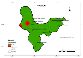
GIS is a powerful tool for representation and analysis of spatial information related to groundwater quality analysis. In this study, Inverse Distance Weighted method of GIS was used to prepare the spatial variation map of physico-chemical parameters of groundwater and Water Quality Index Map of study area which is used to assess the groundwater quality.