SlideShare a Scribd company logo
1 of 5
Download to read offline
Jesus Chico Fernandez Urban Hydraulic Analysis Skills
Municipal Water Network Data Analysis with ArcGIS
(Raster Digital Elevation Model , Sectors Geographical Data, Spatial Data Infrastructure )
Municipal Water Network displayed on Google Earth
with Spatial Data Infrastructure Query
Municipal Water Network Analysis with EPANET
Municipal Water Statistical Performance Examination with SCADA data

More Related Content

What's hot

Arslan Ahmad Resume
Arslan Ahmad ResumeArslan Ahmad Resume
Arslan Ahmad ResumeArslan Ahmad
 
2012 GISCO Track, Emerging Technologies for Field Data Capture, Bill Timmins
2012 GISCO Track, Emerging Technologies for Field Data Capture, Bill Timmins2012 GISCO Track, Emerging Technologies for Field Data Capture, Bill Timmins
2012 GISCO Track, Emerging Technologies for Field Data Capture, Bill TimminsGIS in the Rockies
 
Geographical information system
Geographical information systemGeographical information system
Geographical information systemBipin Karki
 
Limoke oscarg4 sppt
Limoke oscarg4 spptLimoke oscarg4 sppt
Limoke oscarg4 spptLimoke Oscar
 
CARTO BUILDER: from visualization to geospatial analysis
CARTO BUILDER: from visualization to geospatial analysisCARTO BUILDER: from visualization to geospatial analysis
CARTO BUILDER: from visualization to geospatial analysisJorge Sanz
 
2015 FOSS4G Track: Analyzing Aspen's Community Forest with Lidar, Object-Base...
2015 FOSS4G Track: Analyzing Aspen's Community Forest with Lidar, Object-Base...2015 FOSS4G Track: Analyzing Aspen's Community Forest with Lidar, Object-Base...
2015 FOSS4G Track: Analyzing Aspen's Community Forest with Lidar, Object-Base...GIS in the Rockies
 
Welcome to GIS solutions for petroleum companies seminar
Welcome to GIS solutions for petroleum companies seminarWelcome to GIS solutions for petroleum companies seminar
Welcome to GIS solutions for petroleum companies seminarGeodata AS
 
Max Bolen Resume 12202016
Max Bolen Resume 12202016Max Bolen Resume 12202016
Max Bolen Resume 12202016Max Bolen
 
UC Presentation
UC PresentationUC Presentation
UC PresentationYichi Liu
 
2015 GIS in Colorado: Going Mobile, Aurora Water Empowers Field Staff with Ta...
2015 GIS in Colorado: Going Mobile, Aurora Water Empowers Field Staff with Ta...2015 GIS in Colorado: Going Mobile, Aurora Water Empowers Field Staff with Ta...
2015 GIS in Colorado: Going Mobile, Aurora Water Empowers Field Staff with Ta...GIS in the Rockies
 
Imagery and beyond - BK 2016
Imagery and beyond - BK 2016Imagery and beyond - BK 2016
Imagery and beyond - BK 2016Geodata AS
 
Watershed development and drainage assessments
Watershed development and drainage assessmentsWatershed development and drainage assessments
Watershed development and drainage assessmentsAndrew Harrison
 
Headings - 2008 issue 2
Headings - 2008 issue 2Headings - 2008 issue 2
Headings - 2008 issue 2Headings
 
Urban Change in Gilbert_GIS255
Urban Change in Gilbert_GIS255Urban Change in Gilbert_GIS255
Urban Change in Gilbert_GIS255Asha Katti
 

What's hot (20)

GIS in Utah
GIS in UtahGIS in Utah
GIS in Utah
 
Utah Reorganizes its GIS Around Web Services
Utah Reorganizes its GIS Around Web ServicesUtah Reorganizes its GIS Around Web Services
Utah Reorganizes its GIS Around Web Services
 
Arslan Ahmad Resume
Arslan Ahmad ResumeArslan Ahmad Resume
Arslan Ahmad Resume
 
2012 GISCO Track, Emerging Technologies for Field Data Capture, Bill Timmins
2012 GISCO Track, Emerging Technologies for Field Data Capture, Bill Timmins2012 GISCO Track, Emerging Technologies for Field Data Capture, Bill Timmins
2012 GISCO Track, Emerging Technologies for Field Data Capture, Bill Timmins
 
Geographical information system
Geographical information systemGeographical information system
Geographical information system
 
Limoke oscarg4 sppt
Limoke oscarg4 spptLimoke oscarg4 sppt
Limoke oscarg4 sppt
 
CARTO BUILDER: from visualization to geospatial analysis
CARTO BUILDER: from visualization to geospatial analysisCARTO BUILDER: from visualization to geospatial analysis
CARTO BUILDER: from visualization to geospatial analysis
 
2015 FOSS4G Track: Analyzing Aspen's Community Forest with Lidar, Object-Base...
2015 FOSS4G Track: Analyzing Aspen's Community Forest with Lidar, Object-Base...2015 FOSS4G Track: Analyzing Aspen's Community Forest with Lidar, Object-Base...
2015 FOSS4G Track: Analyzing Aspen's Community Forest with Lidar, Object-Base...
 
Welcome to GIS solutions for petroleum companies seminar
Welcome to GIS solutions for petroleum companies seminarWelcome to GIS solutions for petroleum companies seminar
Welcome to GIS solutions for petroleum companies seminar
 
Max Bolen Resume 12202016
Max Bolen Resume 12202016Max Bolen Resume 12202016
Max Bolen Resume 12202016
 
UC Presentation
UC PresentationUC Presentation
UC Presentation
 
Honolulu Board of Water Supply: Enterprise GIS
Honolulu Board of Water Supply: Enterprise GISHonolulu Board of Water Supply: Enterprise GIS
Honolulu Board of Water Supply: Enterprise GIS
 
2015 GIS in Colorado: Going Mobile, Aurora Water Empowers Field Staff with Ta...
2015 GIS in Colorado: Going Mobile, Aurora Water Empowers Field Staff with Ta...2015 GIS in Colorado: Going Mobile, Aurora Water Empowers Field Staff with Ta...
2015 GIS in Colorado: Going Mobile, Aurora Water Empowers Field Staff with Ta...
 
resume2
resume2resume2
resume2
 
Imagery and beyond - BK 2016
Imagery and beyond - BK 2016Imagery and beyond - BK 2016
Imagery and beyond - BK 2016
 
Watershed development and drainage assessments
Watershed development and drainage assessmentsWatershed development and drainage assessments
Watershed development and drainage assessments
 
Headings - 2008 issue 2
Headings - 2008 issue 2Headings - 2008 issue 2
Headings - 2008 issue 2
 
Nick_Farrel_Resume
Nick_Farrel_ResumeNick_Farrel_Resume
Nick_Farrel_Resume
 
EENA2019: Track2 session2 _Emergency Management : an approach to real time ma...
EENA2019: Track2 session2 _Emergency Management : an approach to real time ma...EENA2019: Track2 session2 _Emergency Management : an approach to real time ma...
EENA2019: Track2 session2 _Emergency Management : an approach to real time ma...
 
Urban Change in Gilbert_GIS255
Urban Change in Gilbert_GIS255Urban Change in Gilbert_GIS255
Urban Change in Gilbert_GIS255
 

uban_hydraulic_analysis_skills
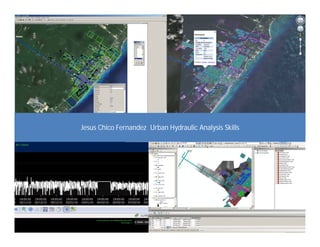