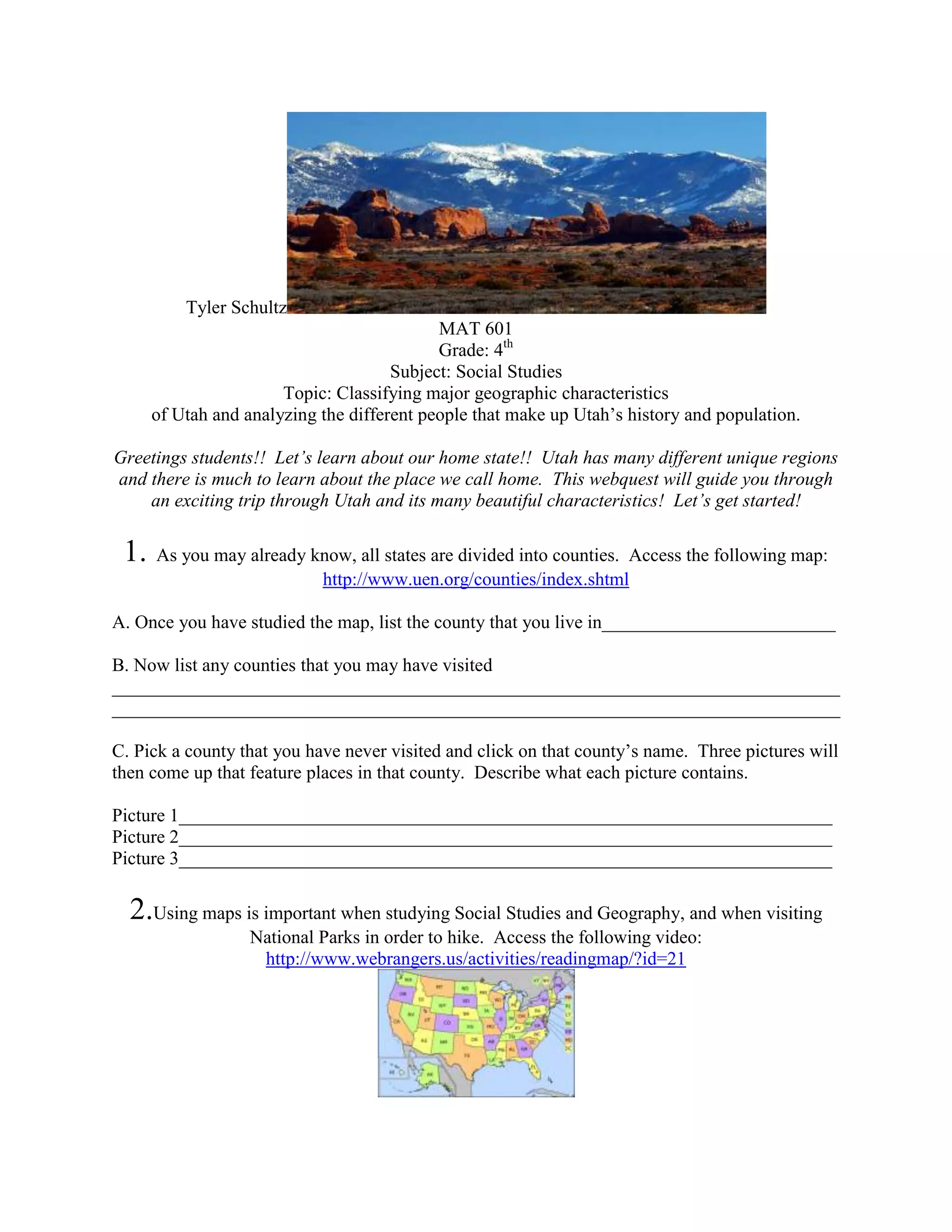
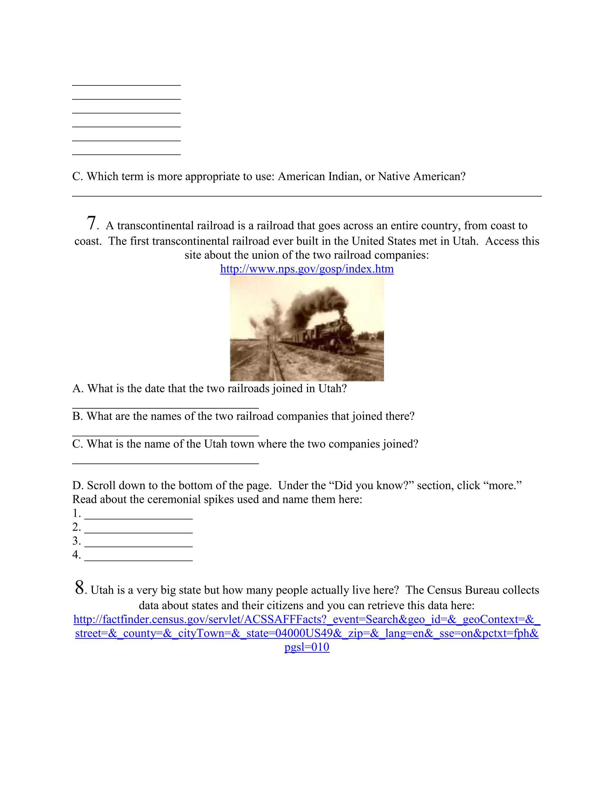
Tyler Schultz
                                            MAT 601
                                            Grade: 4th
                                      Subject: Social Studies
                       Topic: Classifying major geographic characteristics
      of Utah and analyzing the different people that make up Utah’s history and population.

Greetings students!! Let’s learn about our home state!! Utah has many different unique regions
and there is much to learn about the place we call home. This webquest will guide you through
    an exciting trip through Utah and its many beautiful characteristics! Let’s get started!

 1.   As you may already know, all states are divided into counties. Access the following map:
                          http://www.uen.org/counties/index.shtml

A. Once you have studied the map, list the county that you live in_________________________

B. Now list any counties that you may have visited
______________________________________________________________________________
______________________________________________________________________________

C. Pick a county that you have never visited and click on that county’s name. Three pictures will
then come up that feature places in that county. Describe what each picture contains.

Picture 1______________________________________________________________________
Picture 2______________________________________________________________________
Picture 3______________________________________________________________________

  2.Using maps is important when studying Social Studies and Geography, and when visiting
                   National Parks in order to hike. Access the following video:
                    http://www.webrangers.us/activities/readingmap/?id=21
A. According to the presentation, what is important about these three features of maps?
The legend_____________________________________________________________________
The scale______________________________________________________________________
The direction indicator___________________________________________________________

  3. Freeways help us to get from one place to the next. Utah has many freeways. Access the
                                          following site:
                             http://geology.com/state-map/utah.shtml

The third map from the top shows all of Utah’s freeways. Now that you surely know where to
locate our county, find this map and write which two freeways pass through Salt Lake County.

A. Freeways have a blue sign that looks like this:
(Write the freeway number)
1.______________
2.______________

B. There are additionally two other freeways in Utah that do not pass through Salt Lake County.
What are their numbers?
1.______________
2.______________

4. National Parks are sights that the federal government sets aside so that people cannot disturb
  the land and to ensure that they stay beautiful. Access this site about Utah’s National Parks:
                              http://www.uen.org/utahnationalparks/


A. List all 5 of Utah’s National Parks.
1.__________________________
2.__________________________
3.__________________________
4.__________________________
5.__________________________

B. Choose one National Park and click on it. Scroll down to “Sights to See” and choose one
sight that you would like to visit.
Name the sight_____________________
Explain why you would like to visit this site.
______________________________________________________________________________
______________________________________________________________________________

 5. As you know, many Utahans live in the Salt Lake City area. Many people live in Southern
   Utah as well. When the first Mormon settlers arrived in Utah, they also sought to settle in
    Southern Utah. Some of these pioneers sought to settle in Bryce Canyon, one of Utah’s
            spectacular National Parks. Access this web page about Bryce Canyon:
          http://www.nps.gov/history/nr/twhp/wwwlps/lessons/64bryce/64bryce.htm


A. After reading the first paragraph, answer these questions:
What three kinds of stone are the “hoodoos” made of?
1._________________ 2._________________ 3._________________

B. According to the Paiute Indians, what are the “hoodoos?”_____________________________
Why were they turned to stone? ___________________________________________________

C. Under the paragraph that you read is a “table of contents.” Here you will find a sentence that
reads “Locating the site: Maps.” Click on “Utah and Arizona.” Locate Bryce National Park on
the map and write the name of the state that is closest to Bryce National Park (besides Utah).
____________________

   6. Many American Indians lived in Utah long before any European Explorers or Mormon
   pioneers came to Utah. Access the following site and scroll through the Frequently Asked
                                          Questions:
                            http://uintahbasintah.org/ai101.htm

Answer the following questions:
A. What is an Indian reservation?
_____________________________________________________
B. The site lists seven different Indian reservations in Utah.
List them here:
__________________
__________________
__________________
__________________
__________________
__________________
__________________

C. Which term is more appropriate to use: American Indian, or Native American?
______________________________________________________________________________

  7 . A transcontinental railroad is a railroad that goes across an entire country, from coast to
coast. The first transcontinental railroad ever built in the United States met in Utah. Access this
                        site about the union of the two railroad companies:
                                http://www.nps.gov/gosp/index.htm


A. What is the date that the two railroads joined in Utah?
_______________________________
B. What are the names of the two railroad companies that joined there?
_______________________________
C. What is the name of the Utah town where the two companies joined?
_______________________________

D. Scroll down to the bottom of the page. Under the “Did you know?” section, click “more.”
Read about the ceremonial spikes used and name them here:
1. __________________
2. __________________
3. __________________
4. __________________

8. Utah is a very big state but how many people actually live here?     The Census Bureau collects
               data about states and their citizens and you can retrieve this data here:
http://factfinder.census.gov/servlet/ACSSAFFFacts?_event=Search&geo_id=&_geoContext=&_
street=&_county=&_cityTown=&_state=04000US49&_zip=&_lang=en&_sse=on&pctxt=fph&
                                               pgsl=010
A. In the statistics presented, Find out how many total people live in Utah.
________________________

In New York City, there are over 8,000,000 people!

B. Why do you think that more people live in New York even though the state of Utah is so
much bigger?
______________________________________________________________________________
______________________________________________________________________________

           9. Access the following YouTube video about Utah’s geographic features:
                        http://www.youtube.com/watch?v=EU0i3tWasuo

A. According to the Video, what are Utah’s 3 major Geographic Features?
1. ______________________
2. ______________________
3. ______________________

B. What prehistoric lake caused the formation of the Bonneville Salt Flats and the Salt Lake
Valley?
________________________

C. Utah has amazing mountains very suitable for skiing and snowboarding. What year were the
Winter Olympic Games held in Salt Lake City?
________________________

10. The Great Salt Lake is Utah’s largest body of water, and located near us in Salt Lake City.
   Access the following page about this lake and read through the frequently asked questions:
                   http://geology.utah.gov/online_html/pi/pi-39/pi39pg03.htm
A. What explorer visited the lake in 1825?
______________________________

B. The Great Salt Lake is a “terminal lake.” What does this mean?
______________________________________________________________________________

C. What are the four major rivers that empty into the Great Salt Lake?
___________________________
___________________________
___________________________
___________________________

 Great Job!!! Now that we’ve learned a lot about some basic facts about our home state we can
                   go home and tell our parents about what we found out!!!
Answer Key
1a. Salt Lake County
1b. Answers will vary
1c. Answers will vary

2a. The legend tells you what the symbols on a map represent. The scale allows you to decipher
the distance between landmarks on a map. The direction indicator tells you which way is North,
South, East, and West. (Student answers will be loosely based on these answers).

3a. I-15 and I-80
3b. I-84 and I-70

4a. Arches, Bryce, Canyonlands, Capitol Reef and Zion
4b. Answer will vary

5a. Limestone, Sandstone, and mudstone
5b. “Legend People” who were turned to stone for performing bad deeds.
5c. Arizona

6a. "A reservation is a territory reserved by tribes as a permanent tribal homeland. Some
reservations were created through treaties while others were created by statutes or executive
orders."
6b. Goshute Indian Reservation, Navajo Nation, Skull Valley Band of Goshute Indians,
Northwestern Band of Shoshoni Tribe, Ute Indian Tribe, Paiute Indian Tribe of Utah, White
Mesa Ute Tribe
6c. Most tribes prefer the use of “American Indian”

7a. May 10, 1869
7b. Central Pacific and Union Pacific
7c. Promontory Summit
7d. Golden Spike, Nevada’s Silver Spike, Arizona’s Gold and Silver Spike, 2nd Golden Spike

8a. 2,651,816
8b. Answer will vary, but should mention that the population is not dense, and there is much
open, uninhabited land in Utah.

9a. Rocky Mountains, Great Basin, Colorado Plateau
9b. Lake Bonneville
9c. 2002

10a. Jim Bridger
10b. Answers will vary but must mention that no streams or rivers go OUT of the Great Salt
Lake.
10c. Bear River, Ogden River, Weber River, Jordan River

Tyler's Webquest

  • 1.
    Tyler Schultz MAT 601 Grade: 4th Subject: Social Studies Topic: Classifying major geographic characteristics of Utah and analyzing the different people that make up Utah’s history and population. Greetings students!! Let’s learn about our home state!! Utah has many different unique regions and there is much to learn about the place we call home. This webquest will guide you through an exciting trip through Utah and its many beautiful characteristics! Let’s get started! 1. As you may already know, all states are divided into counties. Access the following map: http://www.uen.org/counties/index.shtml A. Once you have studied the map, list the county that you live in_________________________ B. Now list any counties that you may have visited ______________________________________________________________________________ ______________________________________________________________________________ C. Pick a county that you have never visited and click on that county’s name. Three pictures will then come up that feature places in that county. Describe what each picture contains. Picture 1______________________________________________________________________ Picture 2______________________________________________________________________ Picture 3______________________________________________________________________ 2.Using maps is important when studying Social Studies and Geography, and when visiting National Parks in order to hike. Access the following video: http://www.webrangers.us/activities/readingmap/?id=21
  • 2.
    A. According tothe presentation, what is important about these three features of maps? The legend_____________________________________________________________________ The scale______________________________________________________________________ The direction indicator___________________________________________________________ 3. Freeways help us to get from one place to the next. Utah has many freeways. Access the following site: http://geology.com/state-map/utah.shtml The third map from the top shows all of Utah’s freeways. Now that you surely know where to locate our county, find this map and write which two freeways pass through Salt Lake County. A. Freeways have a blue sign that looks like this: (Write the freeway number) 1.______________ 2.______________ B. There are additionally two other freeways in Utah that do not pass through Salt Lake County. What are their numbers? 1.______________ 2.______________ 4. National Parks are sights that the federal government sets aside so that people cannot disturb the land and to ensure that they stay beautiful. Access this site about Utah’s National Parks: http://www.uen.org/utahnationalparks/ A. List all 5 of Utah’s National Parks. 1.__________________________ 2.__________________________ 3.__________________________ 4.__________________________ 5.__________________________ B. Choose one National Park and click on it. Scroll down to “Sights to See” and choose one sight that you would like to visit. Name the sight_____________________ Explain why you would like to visit this site.
  • 3.
    ______________________________________________________________________________ ______________________________________________________________________________ 5. Asyou know, many Utahans live in the Salt Lake City area. Many people live in Southern Utah as well. When the first Mormon settlers arrived in Utah, they also sought to settle in Southern Utah. Some of these pioneers sought to settle in Bryce Canyon, one of Utah’s spectacular National Parks. Access this web page about Bryce Canyon: http://www.nps.gov/history/nr/twhp/wwwlps/lessons/64bryce/64bryce.htm A. After reading the first paragraph, answer these questions: What three kinds of stone are the “hoodoos” made of? 1._________________ 2._________________ 3._________________ B. According to the Paiute Indians, what are the “hoodoos?”_____________________________ Why were they turned to stone? ___________________________________________________ C. Under the paragraph that you read is a “table of contents.” Here you will find a sentence that reads “Locating the site: Maps.” Click on “Utah and Arizona.” Locate Bryce National Park on the map and write the name of the state that is closest to Bryce National Park (besides Utah). ____________________ 6. Many American Indians lived in Utah long before any European Explorers or Mormon pioneers came to Utah. Access the following site and scroll through the Frequently Asked Questions: http://uintahbasintah.org/ai101.htm Answer the following questions: A. What is an Indian reservation? _____________________________________________________ B. The site lists seven different Indian reservations in Utah. List them here: __________________
  • 4.
    __________________ __________________ __________________ __________________ __________________ __________________ C. Which termis more appropriate to use: American Indian, or Native American? ______________________________________________________________________________ 7 . A transcontinental railroad is a railroad that goes across an entire country, from coast to coast. The first transcontinental railroad ever built in the United States met in Utah. Access this site about the union of the two railroad companies: http://www.nps.gov/gosp/index.htm A. What is the date that the two railroads joined in Utah? _______________________________ B. What are the names of the two railroad companies that joined there? _______________________________ C. What is the name of the Utah town where the two companies joined? _______________________________ D. Scroll down to the bottom of the page. Under the “Did you know?” section, click “more.” Read about the ceremonial spikes used and name them here: 1. __________________ 2. __________________ 3. __________________ 4. __________________ 8. Utah is a very big state but how many people actually live here? The Census Bureau collects data about states and their citizens and you can retrieve this data here: http://factfinder.census.gov/servlet/ACSSAFFFacts?_event=Search&geo_id=&_geoContext=&_ street=&_county=&_cityTown=&_state=04000US49&_zip=&_lang=en&_sse=on&pctxt=fph& pgsl=010
  • 5.
    A. In thestatistics presented, Find out how many total people live in Utah. ________________________ In New York City, there are over 8,000,000 people! B. Why do you think that more people live in New York even though the state of Utah is so much bigger? ______________________________________________________________________________ ______________________________________________________________________________ 9. Access the following YouTube video about Utah’s geographic features: http://www.youtube.com/watch?v=EU0i3tWasuo A. According to the Video, what are Utah’s 3 major Geographic Features? 1. ______________________ 2. ______________________ 3. ______________________ B. What prehistoric lake caused the formation of the Bonneville Salt Flats and the Salt Lake Valley? ________________________ C. Utah has amazing mountains very suitable for skiing and snowboarding. What year were the Winter Olympic Games held in Salt Lake City? ________________________ 10. The Great Salt Lake is Utah’s largest body of water, and located near us in Salt Lake City. Access the following page about this lake and read through the frequently asked questions: http://geology.utah.gov/online_html/pi/pi-39/pi39pg03.htm
  • 6.
    A. What explorervisited the lake in 1825? ______________________________ B. The Great Salt Lake is a “terminal lake.” What does this mean? ______________________________________________________________________________ C. What are the four major rivers that empty into the Great Salt Lake? ___________________________ ___________________________ ___________________________ ___________________________ Great Job!!! Now that we’ve learned a lot about some basic facts about our home state we can go home and tell our parents about what we found out!!!
  • 7.
    Answer Key 1a. SaltLake County 1b. Answers will vary 1c. Answers will vary 2a. The legend tells you what the symbols on a map represent. The scale allows you to decipher the distance between landmarks on a map. The direction indicator tells you which way is North, South, East, and West. (Student answers will be loosely based on these answers). 3a. I-15 and I-80 3b. I-84 and I-70 4a. Arches, Bryce, Canyonlands, Capitol Reef and Zion 4b. Answer will vary 5a. Limestone, Sandstone, and mudstone 5b. “Legend People” who were turned to stone for performing bad deeds. 5c. Arizona 6a. "A reservation is a territory reserved by tribes as a permanent tribal homeland. Some reservations were created through treaties while others were created by statutes or executive orders." 6b. Goshute Indian Reservation, Navajo Nation, Skull Valley Band of Goshute Indians, Northwestern Band of Shoshoni Tribe, Ute Indian Tribe, Paiute Indian Tribe of Utah, White Mesa Ute Tribe 6c. Most tribes prefer the use of “American Indian” 7a. May 10, 1869 7b. Central Pacific and Union Pacific 7c. Promontory Summit 7d. Golden Spike, Nevada’s Silver Spike, Arizona’s Gold and Silver Spike, 2nd Golden Spike 8a. 2,651,816 8b. Answer will vary, but should mention that the population is not dense, and there is much open, uninhabited land in Utah. 9a. Rocky Mountains, Great Basin, Colorado Plateau 9b. Lake Bonneville 9c. 2002 10a. Jim Bridger 10b. Answers will vary but must mention that no streams or rivers go OUT of the Great Salt Lake. 10c. Bear River, Ogden River, Weber River, Jordan River