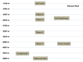
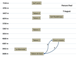
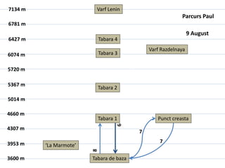
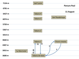
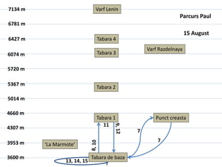
The document appears to be a map or chart showing elevations and locations over multiple dates from August 7th to August 17th. It includes elevations for Varf Lenin, Tabara 4, Varf Razdelnaya, Tabara 3, Tabara 2, Tabara 1, Punct creasta, 'La Marmote', and Tabara de baza. The same locations and elevations are listed each date.