Презентація головного архітектора Закарпатської області Михайла Пігуляка під час тренінгу з планування стратегічного розвитку та просторового планування
11 12 final invasives and health smj_july24_englishnatavoloshyna
This document discusses indicators for terrestrial invasive species and forest health in watershed condition assessments. It provides descriptions of "good", "fair", and "poor" ratings for the extent of invasive species populations and levels of insect/disease impacts and ozone damage in forests. Maps and data sources are presented as examples of how to evaluate these indicators, such as by showing areas at risk of tree mortality from insects/diseases or where ozone causes decreased tree growth. The document recommends collaboration and citizen science, such as through databases that track invasive species treatments or map their distributions, to share information on these forest and watershed health issues.
The document discusses Indicator 10 of the Watershed Condition Framework, which addresses the effects of rangeland vegetation on soil and water quality. Specifically, it examines the composition of native and desirable non-native plant species in rangeland areas compared to their natural levels based on site potential. A rating system of Functioning Properly, Functioning at Risk, and Impaired Function is provided based on the vegetation's contribution to soil, nutrient cycling, hydrology, plant production levels, and the presence of introduced plant species. The likelihood of watershed impacts increases as plant production decreases relative to the site's potential.
This document provides guidance on assessing Indicator 8 (Fire Regime or Wildfire) of the Watershed Condition Framework. It can be assessed using either Attribute 8.1 (Fire Regime Condition Class) or 8.2 (Wildfire Effects). Attribute 8.1 evaluates departure from the natural fire regime based on vegetation, fuels, and fire characteristics. Attribute 8.2 evaluates effects of wildfire on soils and ground cover in terms of recovery time. The potential for watershed impacts increases with greater departure from the natural fire regime and as wildfire recovery times lengthen.
1. The document analyzes forest fire data in the Polana region of Ukraine from 2001 to present using satellite data.
2. It maps over 500 individual forest fire locations that were detected by satellites in the Polana river basin during this period.
3. The mapping of forest fire locations over time enables an assessment of the impact of forest fires on the region based on satellite data.
The document discusses wildfire detection and assessment using remote sensing tools and data. It presents a global wildfire detection tool from NASA that uses satellite data to identify fire occurrences. Maps of the Polyana watershed show the location of detected fires from 2001 to the present time based on this satellite data. The objectives are to detect wildfires using remote sensing tools and assess wildfire effects also using remote sensing data.
This document discusses indicator 4 of the 12 indicator model for watershed condition - aquatic biota. It focuses on the distribution, structure, and density of native and introduced aquatic fauna. There are three attributes: 1) aquatic life form presence, 2) native species, and 3) exotic and/or invasive species. Condition is rated on a scale of 1 to 3, with 1 being properly functioning and 3 being impaired. The document provides examples of how the US Forest Service applied the indicator and attributes to evaluate watershed conditions in West Virginia. It also discusses considerations for field applications related to aquatic habitat and sampling strategies.
This document discusses indicator 3 of the Watershed Condition Framework, which is aquatic habitat. It addresses three attributes of aquatic habitat: 1) habitat fragmentation, which occurs when physical barriers isolate aquatic populations; 2) large woody debris (LWD), which performs important ecological functions in aquatic ecosystems; and 3) channel shape and function. The document provides examples and guidance on assessing each attribute, including considering road-stream crossings, barrier culverts, and LWD recruitment for attributes 1 and 2. It also provides a hypothetical example assessment for a US Forest Service area that rated attributes 1 and 2 as impaired based on fragmentation from crossings and historically low LWD due to past land management practices.
The document discusses methods for assessing channel shape and function, including measuring channel dimensions, sediment balance, width to depth ratios, meander patterns, floodplains, headcuts, and alluvial fans. Specific metrics are described such as expected meander belt width and considerations for evaluating meander bends. Signs of channel instability and impairment are provided for incised channels, over-widened channels, and where roads intersect channels and floodplains. Alluvial fans are described as dynamic landforms where sediment is deposited.
This document discusses water quantity as an indicator of watershed condition. It defines a natural hydrograph as the natural seasonal flows of a river without human influence, and an altered hydrograph as flows that have been changed by dams, diversions or groundwater withdrawals. These changes are measured using streamflow gauges and proxy features to assess the impact on magnitude, duration and timing of flows. The condition is rated as minor if flows are free flowing with limited impacts, moderate if dams mimic natural patterns and extreme flows are unaffected, and high if dams significantly alter seasonal flows and extreme events.
1 final water quality smj july26_englishnatavoloshyna
- Water quality can be impacted by nonpoint source pollution from many sources across a watershed and point source pollution from identifiable sources like pipes or factories.
- The document discusses water quality criteria from state regulations and federal guidelines, water quality data from government agencies, and how water quality informs environmental management decisions.
- Specific examples include state surface water quality standards, fish consumption advisories, and monitoring data on parameters like pH, aluminum, turbidity, and phosphorus from various water bodies.
Методологія планування стратегічного та просторового розвитку територій
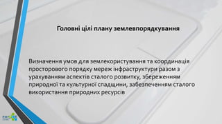
1. Головні цілі плану землевпорядкування
Визначення умов для землекористування та координація
просторового порядку мереж інфраструктури разом з
урахуванням аспектів сталого розвитку, збереженням
природної та культурної спадщини, забезпеченням сталого
використання природних ресурсів
2. Процес планування територіальних планів (землекористування)
Підготовча
фаза
• Точка відліку: попередній ПЗ (якщо такий є)
• Збір даних
• Визначення поточного стану (у т.ч. на мапі)
Розробка
проекту
плану
• Розробка проекту документу
• Обговорення з зацікавленими сторонами
• Обговорення з відповідними органами влади
Фаза
консультацій з
громадськістю
• Надсилання документу, що обговорюється, зацікавленими сторонам– рецензентам, збір відгуків
• Публічне представлення документу заікавленим сторонам
• Обговорення спірних питань
Затверджен
ня ПЗ
• Підготовка кінцевого варіанту змістовної частини ПЗ на основі результатів консультацій з
громадськістю
• Затвердження ПЗ відповідним органом влади/ самоврядування
3. Допоміжні документи та необхідні аналізи для ПЗ 1.
1. Вступ (попередні документи, законодавчі умови, структура документу)
2. Оцінка поточного стану
• Загальна характеристика міста/ регіону
• Система заселення (структура поселення, густина, географічні риси, адміністративні території)
• Демографія (населення, народжуваність, міграція, меншини, зайнятість, освіта …)
• Економіка (ключові галузі, ВВП, додана вартість, виробництво промислової продукції, підприємства,
промислові парки...)
• Туризм (природні та культурні характеристики, кількість ночівель, середня тривалість перебування туристів,
потужності сфери гостинності …)
• Транспорт (мережа швидкісних доріг та головних доріг, основні транспортні коридори, розвиток
інфраструктури, транскордонні перевезення, залізничних транспорт, вантажний транспорт, велосипедні
маршрути ...)
• Захист навколишнього середовища (повітря, шуми, вода, ґрунти, управління відходами …)
• Захист ландшафтів (природозаповідні території, вразливі природні зони, збереження ландшафтів, конфлікти
землекористування ...)
• Лісове господарство (лісові площі, система лісогосподарювання, збереження природи …)
• Інше (захист, комунальні ресурси, водне господарство …)
4. Допоміжні документи та необхідні аналізи для ПЗ 2.
3. Система поселення
• Територія поселення (міста, сільські території)
• Промислові парки
• Логістичні центри
• Мережі поселень
• Вразливі / дуже вразливі міські території
• Сади
4. Захист цінностей
• Національні заповідні зони (у відповідності з національним ПЗ)
• Структура поселення, що потребує збереження
• Захист пам‘яток та історичних будівель
• Археологічні ділянки
5. Допоміжні документи та необхідні аналізи для ПЗ 3.
5. Розвиток транспорту
• Макро-регіональний зв‘язок (міжнародні, національні, регіональні шляхи)
• Мережа доріг (автомобільних, головні дороги, другорядні дороги регіонального значення)
• Залізничних транспорт (транс-Європейська мережа, національні лінії, місцеві лінії, вузькоколійки)
• Велосипедний рух (шляхи міжнародного, національного та місцевого значення)
• Водний транспорт (водні шляхи, порти, пороми)
• Авіатранспорт
• Пункти перетину кордону
6. Комунальні послуги
• Водопостачання
• Водовідведення
• Енергетика (електроенергія, нафто- газопроводи…)
7. Допоміжні документи та необхідні аналізи для ПЗ 4.
7. Захист ландшафтів та природозаповідні території
• Зони екологічної мережі
• Високопродуктивні лісові території
• Території, що підходять для заліснення
• Території, що потребують комплексного відновлення ландшафтів
• Території захисту ландшафтів
• Специфічні для місцевості умови
8. Території захисту навколишнього середовища
• Території, що потребують комплексного відновлення ландшафтів
• Дуже вразливі території для захисту якості ґрунтових вод
• Території водозборів для захисту якості поверхневих вод
• Потенційні ділянки для регіональних полігонів для захоронення відходів
• Території, що регулярно затоплюються внутрішніми водами
• Пойми річок
• Території, вразливі до вітрової ерозії
• Мінеральні ресурси
9. Допоміжні документи та необхідні аналізи для ПЗ 5.
9. Інші території та будівлі
10.Оцінка впливу на екологію, економічна та соціальна оцінки
вплив ПЗ та запропоновані заходи