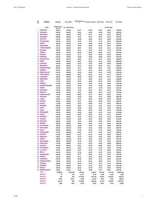
This document contains a table with 64 rows of demographic and agricultural data for mandals (administrative districts) in a region of India. The data includes population density, sex ratio, literacy rates, percentage of workers and main workers, percentage of land used for agriculture, pastures, barren land and more. The table provides this data to allow analysis of the current situation across mandals to help with planning and decision making.