Download as PDF, PPTX
![1/15/2019 From Tibet to the 'Nine Dragons', Vietnam's Mekong Delta is losing sand
https://www.reuters.com/article/us-vietnam-mekong/from-tibet-to-the-nine-dragons-vietnams-mekong-delta-is-losing-sand-idUSKCN1P8018 10/14
court said in a statement.
Schellenberg was told in court he had the right to appeal to Liaoning High Court within 10 days upon
receiving the ruling, the intermediate court said in a second statement.
“It is of extreme concern to us as a government, as it should be to all our international friends and allies,
that China has chosen to begin to arbitrarily apply (the) death penalty ... as in this case,” Trudeau told
reporters in Ottawa.
Schellenberg’s aunt, Lauri Nelson-Jones, said the family’s worst fears had been confirmed.
“Our thoughts are with Robert at this time. It is rather unimaginable what he must be feeling and
thinking,” she said in a statement to Reuters.
“It is a horrific, unfortunate, heartbreaking situation. We anxiously anticipate any news regarding an
appeal.”
China-Canada ties turned icy in early December after Meng Wanzhou, chief financial officer of Chinese
telecommunications giant Huawei Technologies Co Ltd [HWT.UL], was arrested in Vancouver on a
U.S. extradition warrant.
China warned of unspecified consequences unless Meng was released, and detained Michael Kovrig, a
Canadian diplomat on unpaid leave from the embassy in Beijing, and Michael Spavor, a Canadian
consultant, on suspicion of endangering state security.](https://image.slidesharecdn.com/sandminingisdestroyingasiasrivers-190114235905/85/SAND-MINING-IS-DESTROYING-ASIA-S-RIVERS-10-320.jpg)
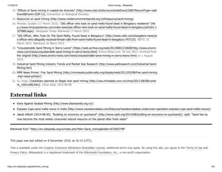
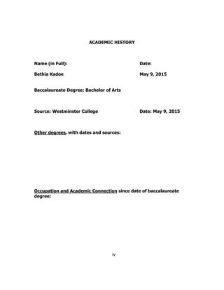
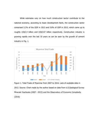
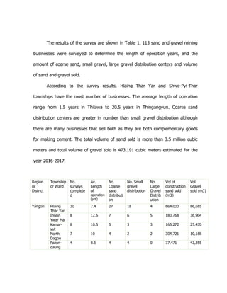
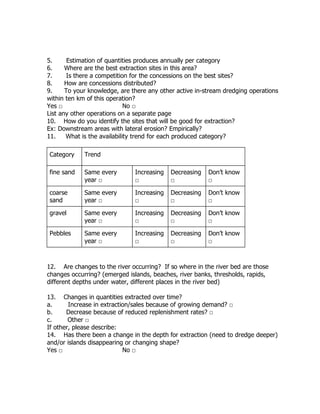
![1/15/2019 Sandmining is destroying Asia’s rivers | The Third PoleThe Third Pole
https://www.thethirdpole.net/en/2017/05/05/sandmining-is-destroying-asias-rivers/ 2/26
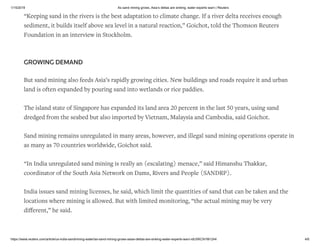
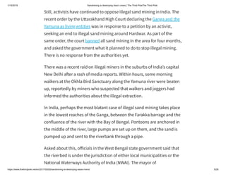
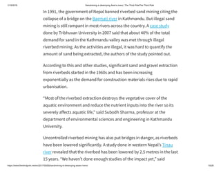
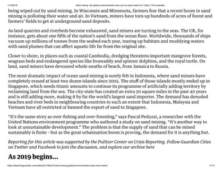
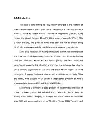
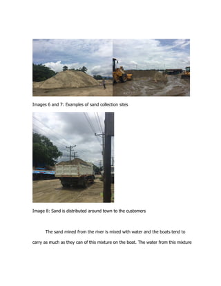
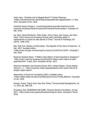
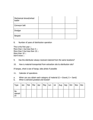
Banned in 1991, sand mining from riverbeds continues illegally in
Nepal [image by Nabin Baral]](https://image.slidesharecdn.com/sandminingisdestroyingasiasrivers-190114235905/85/SAND-MINING-IS-DESTROYING-ASIA-S-RIVERS-21-320.jpg)
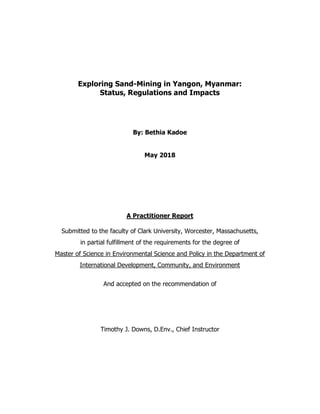
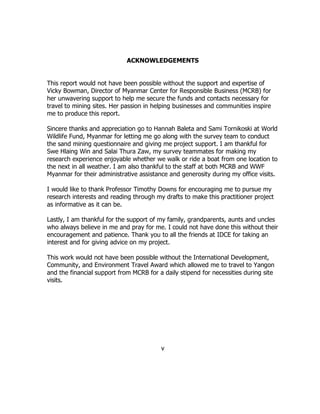
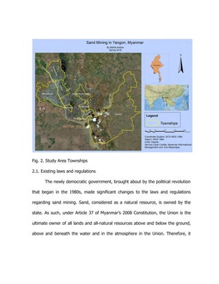
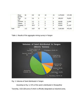
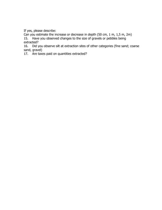
![1/15/2019 Sandmining is destroying Asia’s rivers | The Third PoleThe Third Pole
https://www.thethirdpole.net/en/2017/05/05/sandmining-is-destroying-asias-rivers/ 4/26
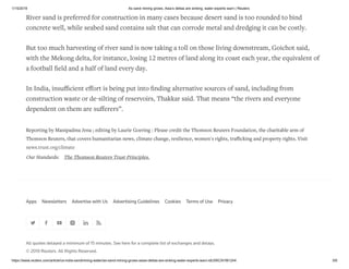
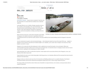
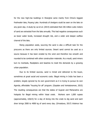
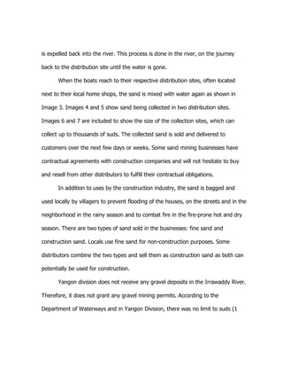
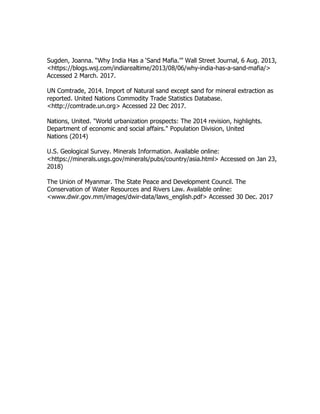
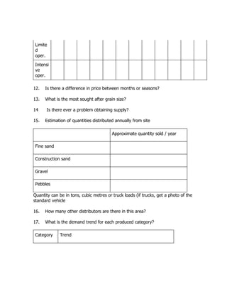
Post monsoon sand being extracted daily out of rivers near Mangalore [image by
Ashwin Kamath]
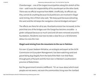
Apart from journalists, there was the death of the monk who opposed
illegal sand mining around Hardwar, where the Ganga comes down from
the Himalayas and enters the north Indian plains. The monk had been on
hunger strike and had been taken to hospital, where he died. Mystery
surrounds the cause of his death.](https://image.slidesharecdn.com/sandminingisdestroyingasiasrivers-190114235905/85/SAND-MINING-IS-DESTROYING-ASIA-S-RIVERS-23-320.jpg)
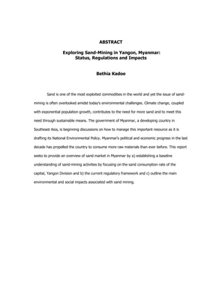
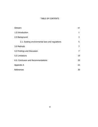
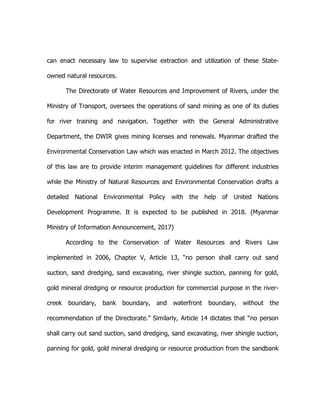
![1/15/2019 Sandmining is destroying Asia’s rivers | The Third PoleThe Third Pole
https://www.thethirdpole.net/en/2017/05/05/sandmining-is-destroying-asias-rivers/ 8/26
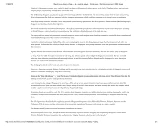
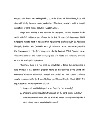
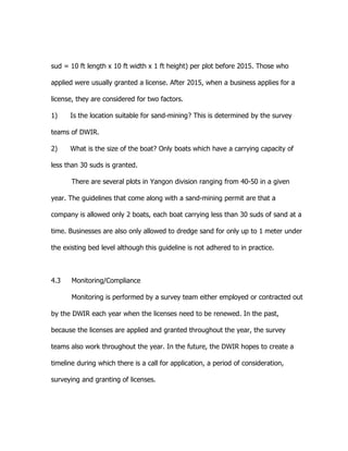
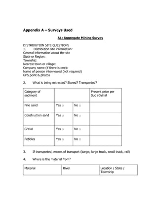
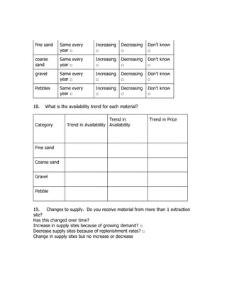
Mining in Poonch river using heavy machinery is destroying river habitats [image
courtesy: Hagler Bailly Pakistan]
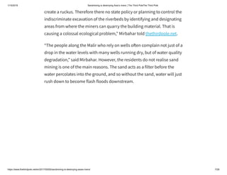
The situation is similar across the the Jhelum river (in Punjab), and the
Neelum and the Kunhar rivers (in Khyber Pakhtunkhwa), according to
Vaqar Zakaria, an environmental flow specialist and managing director of
Hagler Bailly Pakistan, a consultancy firm.
See Riverbed mining destroys rivers in Jhelum basin](https://image.slidesharecdn.com/sandminingisdestroyingasiasrivers-190114235905/85/SAND-MINING-IS-DESTROYING-ASIA-S-RIVERS-27-320.jpg)
![1/15/2019 Sandmining is destroying Asia’s rivers | The Third PoleThe Third Pole
https://www.thethirdpole.net/en/2017/05/05/sandmining-is-destroying-asias-rivers/ 12/26
In Bangladesh sandmining happens in the open, here at the Dharla river in
Kurigram [image by: Sheikh Rokon]
Recent media reports say illegal sand mining is rampant Narayanganj,
Tangail, Sirajganj, Munshiganj, Rajshahi and Manikganj districts, and
almost rivers of Bangladesh – big and small – are a ected. There is hardly
ever any action taken against the illegal sand mining mafia, despite
complaints from green activists.
Syed Rizwana Hasan, chief executive of Bangladesh Environmental
Lawyers’ Association (BELA) told thethirdpole.net, “Use of heavy](https://image.slidesharecdn.com/sandminingisdestroyingasiasrivers-190114235905/85/SAND-MINING-IS-DESTROYING-ASIA-S-RIVERS-31-320.jpg)
![1/15/2019 Sandmining is destroying Asia’s rivers | The Third PoleThe Third Pole
https://www.thethirdpole.net/en/2017/05/05/sandmining-is-destroying-asias-rivers/ 14/26
Labourers, allegedly backed by politicians, cart away sand from Jamuneshwari
River in Nilphamari [image by Sheikh Rokon]
The decision was reportedly taken at a meeting of the National Sand
Corridor Management Committee with land minister Shamsur Rahman
Sharif in the chair on March 5. The ministry stated that the sand would be
sold at 1 taka (about 1 US cent) per cubic feet.
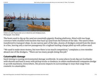
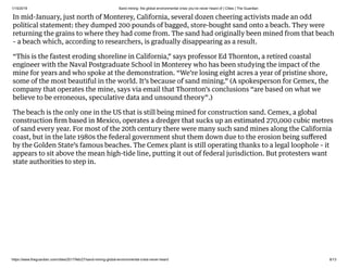
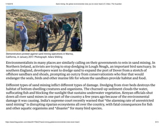
China, the biggest sand market
In China, demand for sand is greater than anywhere else in the world due
to rapid urbanisation. Demand for cement has increased 400% over the
past two decades, according to the United Nations Environment
Programme.
In the past four years, China has used more cement than the US used in
the entire 20th century.
Cement manufacturing needs sand, and all that sand has to come from
somewhere. In the region around Shanghai, it came until recently from
the bed of the Yangtze River. By the late 1990s miners had pulled out so
much that bridges were destabilised, shipping was hampered, and
swaths of riverbank collapsed.](https://image.slidesharecdn.com/sandminingisdestroyingasiasrivers-190114235905/85/SAND-MINING-IS-DESTROYING-ASIA-S-RIVERS-33-320.jpg)
![1/15/2019 Sandmining is destroying Asia’s rivers | The Third PoleThe Third Pole
https://www.thethirdpole.net/en/2017/05/05/sandmining-is-destroying-asias-rivers/ 16/26
Poyang lake in 1995 [image by: Nasa Earth Observatory]](https://image.slidesharecdn.com/sandminingisdestroyingasiasrivers-190114235905/85/SAND-MINING-IS-DESTROYING-ASIA-S-RIVERS-35-320.jpg)
![1/15/2019 Sandmining is destroying Asia’s rivers | The Third PoleThe Third Pole
https://www.thethirdpole.net/en/2017/05/05/sandmining-is-destroying-asias-rivers/ 17/26
Poyang lake in 2013 [image by: Nasa Earth Observatory]](https://image.slidesharecdn.com/sandminingisdestroyingasiasrivers-190114235905/85/SAND-MINING-IS-DESTROYING-ASIA-S-RIVERS-36-320.jpg)
![1/15/2019 Sand mining - Wikipedia
https://en.wikipedia.org/wiki/Sand_mining 1/5
Sand mining
Sand mining is the extraction of sand, mainly through an open pit but sometimes mined from beaches and inland dunes or dredged from ocean and river beds.
Sand is often used in manufacturing, for example as an abrasive or in concrete. It is also used on icy and snowy roads, usually mixed with salt, to lower the melting
point temperature on the road surface. Sand can replace eroded coastline.[1] Some uses require higher purity than others; for example sand used in concrete must
be free of seashell fragments.
Sand mining presents opportunity to extract rutile, ilmenite and zircon, which contain the industrially useful elements titanium and zirconium. These minerals
typically occur combined with ordinary sand, then are separated in water by virtue of their different densities, before the sand is redeposited.
Sand mining is a direct cause of erosion, and impacts the local wildlife.[2] Various animals depend on sandy beaches for nesting clutches, and mining has led to the
near extinction of gharials (a species of crocodile) in India. Disturbance of underwater and coastal sand causes turbidity in the water, which is harmful for
organisms like coral that need sunlight. It can also destroy fisheries, financially harming their operators.
Removal of physical coastal barriers, such as dunes, sometimes leads to flooding of beachside communities, and the destruction of picturesque beaches causes
tourism to dissipate. Sand mining is regulated by law in many places, but is often done illegally.[3] Globally, it is a $70 billion industry, with sand selling at up to
$90 per cubic yard.[4]
By country
Australia
India
Sierra Leone
United States
Wisconsin, Minnesota, Illinois, Indiana, Iowa and Florida
China
See also
References
Contents](https://image.slidesharecdn.com/sandminingisdestroyingasiasrivers-190114235905/85/SAND-MINING-IS-DESTROYING-ASIA-S-RIVERS-57-320.jpg)
![1/15/2019 Sand mining - Wikipedia
https://en.wikipedia.org/wiki/Sand_mining 2/5
External links
In the 1940 mining operations began on the Kurnell Peninsula (Captain Cook's
landing place in Australia) to supply the expanding Sydney building market. It
continued until 1990 with an estimate of over 70 million tonnes of sand having
been removed. The sand has been valued for many decades by the building
industry, mainly because of its high crushed shell content and lack of organic
matter, it has provided a cheap source of sand for most of Sydney since sand mining operations began. The site has now been reduced to a few remnant dunes and
deep water-filled pits which are now being filled with demolition waste from Sydney's building sites. Removal of the sand has significantly weakened the
peninsula's capacity to resist storms. Ocean waves pounding against the reduced Kurnell dune system have threatened to break through to Botany Bay, especially
during the storms of May and June back in 1974 and of August 1998.[5] Sand Mining also takes place in the Stockton sand dunes north of Newcastle and in the
Broken Hill region in the far west of the state.
A large and long-running sand mine in Queensland, Australia (on North Stradbroke Island) provides a case study in the (disastrous) environmental consequences
on a fragile sandy-soil based ecosystem, justified by the provision of low wage casual labor on an island with few other work options.[6] The Labor state
government pledged to end sand mining by 2025, but this decision was overturned by the LNP government which succeeded it. This decision has been subject to an
allegation of corrupt conduct.[7]
Sand mining contributes to the construction of buildings and development. However, the negative effects of sand mining include the permanent loss of sand in
areas, as well as major habitat destruction.
Sand mining is a practice that is becoming an environmental issue in India. Environmentalists have raised public awareness of illegal sand mining in the states of
Maharashtra, Madhya Pradesh[8] and Goa of India.[9][10][11][12][13] Conservation and environmental NGO Awaaz Foundation filed a public interest litigation in
the Bombay High Court seeking a ban on mining activities along the Konkan coast.[13] Awaaz Foundation, in partnership with the Bombay Natural History Society
also presented the issue of sand mining as a major international threat to coastal biodiversity at the Conference of Parties 11, Convention on Biological Diversity,
Hyderabad in October 2012.[14] [15] D. K. Ravi, an Indian Administrative Service officer of the Karnataka state, who was well known for his tough crackdown on
the rampant illegal sand mining in the Kolar district, was found dead at his residence in Bengaluru, on March 16, 2015. It is widely alleged that the death is not due
to suicide but the handiwork of the mafia involved in land grabbing and sand mining.[16][17]
By country
Sand mine in the Czech Republic.
Australia
India](https://image.slidesharecdn.com/sandminingisdestroyingasiasrivers-190114235905/85/SAND-MINING-IS-DESTROYING-ASIA-S-RIVERS-58-320.jpg)
![1/15/2019 Sand mining - Wikipedia
https://en.wikipedia.org/wiki/Sand_mining 3/5
Recently, activists and local villagers have protested against sand mining on Sierra Leone's Western Area Peninsular. The activity is contributing to Sierra Leone's
coastal erosion, which is proceeding at up to 6 meters a year.[18]
The current size of the sand mining market in the United States is slightly over a billion dollars per year. The industry has been growing by nearly 10% annually
since 2005 because of its use in hydrocarbon extraction. The majority of the market size for mining is held by Texas and Illinois.[19]
Silica sand mining business has more than doubled since 2009 because of the need for this particular type of sand, which is used in a process known as hydraulic
fracturing. Wisconsin is one of the five states that produce nearly 2/3 of the nation’s silica. As of 2009, Wisconsin, along with other northern states, is facing an
industrial mining boom, being dubbed the "sand rush" because of the new demand from large oil companies for silica sand. According to Minnesota Public Radio,
"One of the industry's major players, U.S. Silica, says its sand sales tied to hydraulic fracturing nearly doubled to $70 million from 2009 to 2010 and brought in
nearly $70 million in just the first nine months of 2011."[20] According to the Wisconsin Department of Natural Resources (WDNR), there are currently 34 active
mines and 25 mines in development in Wisconsin. In 2012, the WDNR released a final report on the silica sand mining in Wisconsin titled Silica Sand Mining in
Wisconsin. The recent boom in silica sand mining has caused concern from residents in Wisconsin that include quality of life issues and the threat of silicosis.
However, these are issues that the state has no authority to regulate. According to the WDNR (2012) these issues include noise, lights, hours of operation, damage
and excessive wear to roads from trucking traffic, public safety concerns from the volume of truck traffic, possible damage and annoyance resulting from blasting,
and concerns regarding aesthetics and land use changes.
As of 2013, industrial frac sand mining has become a cause for activism, especially in the Driftless Area of southeast Minnesota, northeast Iowa and southwest
Wisconsin.
Much sand is extracted by dredges from the bottom of rivers such as the Red River in Yunnan, or quarried in dry river beds. Due to the large demand for sand for
construction, illicit sand mining is not uncommon.[21]
Heavy mineral sands ore deposits
Beach theft
Resource depletion
Sierra Leone
United States
Wisconsin, Minnesota, Illinois, Indiana, Iowa and Florida
China
See also](https://image.slidesharecdn.com/sandminingisdestroyingasiasrivers-190114235905/85/SAND-MINING-IS-DESTROYING-ASIA-S-RIVERS-59-320.jpg)
![1/15/2019 Sand mining - Wikipedia
https://en.wikipedia.org/wiki/Sand_mining 4/5
Sand mining in Tamil Nadu
Sand mining in Kerala
Environmental issues with mining
1. "Battle lines in the sand" (http://www.smh.com.au/news/national/battle-lines-in-the-sand/2005/11/01/11308232
10734.html). The Sydney Morning Herald. 2 November 2005.
2. Green Left - Opposition to sand mining on Stradbroke (http://www.greenleft.org.au/1997/269/17263) Archived
(https://archive.is/20120903184252/http://www.greenleft.org.au/1997/269/17263) 3 September 2012 at
Archive.today
3. Land and Environment: Sand Mining (http://localhistory.kingston.vic.gov.au/htm/article/294.htm)
4. Mills, Ryan; Staats, Eric (17 November 2016). "Shrinking Shores: Florida sand shortage leaves beaches in lurch"
(http://www.naplesnews.com/story/news/special-reports/2016/11/17/shrinking-shores-florida-sand-shortage-lea
ves-beaches-lurch/92052152/). Naples Daily News. Retrieved 3 November 2017.
5. Kurnell - A Pictorial History (http://www.ssec.org.au/our_environment/our_bioregion/kurnell/history/industries/sa
ndmining.htm)
6. Victorian sand mining moves closer to full production:: ABC Western Victoria (http://www.abc.net.au/westernvic/
stories/s1630536.htm)
7. [1] (https://www.theguardian.com/world/2014/jun/24/queensland-sandmining-corruption-watchdog-asked-to-inv
estigate-donation)
8. Illegal Mining In Madhya Pradesh (http://www.ndtv.com/topic/illegal-mining-in-madhya-pradesh), NDTV.
9. Rajadhyaksha, Radha (10 Jan 2010). "No attacker brought to book so far" (http://articles.timesofindia.indiatime
s.com/2010-01-10/mumbai/28118792_1_activists-anandini-thakoor-sand-mining-mafia). Times Of India.
Retrieved 22 April 2013.
10. B, Viju (24 March 2011). "Creeks and rivers up for sale" (http://blogs.timesofindia.indiatimes.com/Second-Natur
e/entry/creeks-and-rivers-up-for). Times Of India. Retrieved 22 April 2013.
11. Singh, Vijay (3 April 2012). "NCP leader waves gun at tehsildar" (http://articles.timesofindia.indiatimes.com/2012
-04-03/mumbai/31280601_1_sand-mining-tehsildar-sand-mafia). Times Of India. Retrieved 22 April 2013.
12. B, Viju (Oct 27, 2009). "Sand mining issue haunts Naik" (http://mobiletoi.timesofindia.com/mobile.aspx?article=y
es&pageid=9§id=edid=&edlabel=TOIM&mydateHid=24-10-2009&pubname=Times%20of%20India%20-%2
0Mumbai&edname=&articleid=Ar00901&publabel=TOI). Times Of India. Retrieved 22 April 2013.
13. B, Viju (25 Sep 2010). "HC bans sand mining across Maharashtra" (http://articles.timesofindia.indiatimes.com/20
10-09-25/mumbai/28251944_1_sand-mining-sand-extraction-crz-areas). Times of India. Retrieved 22 April 2013.
A sand mining operation in the Red
River, in Jinping County, Yunnan
References](https://image.slidesharecdn.com/sandminingisdestroyingasiasrivers-190114235905/85/SAND-MINING-IS-DESTROYING-ASIA-S-RIVERS-60-320.jpg)
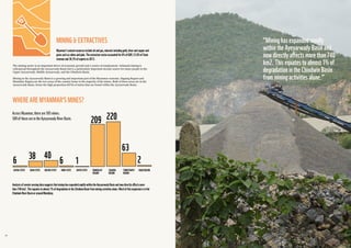


![1/15/2019 Amnesty International slams abusive, poorly regulated Myanmar mining industry - News
https://www.myanmar-responsiblebusiness.org/news/amnesty-international-myanmar-mining-industry.html 5/7
a ecting the health of villagers. In May 2014, Myaung Pyo villagers in the Dawei district launched
legal action against Myanmar Pongpipat and state-owned Mining Enterprise No. 2, seeking
compensation for the damage caused by the Heinda mine.
"The mine has not engaged adequately with communities to address these problems and villagers
are now suing the mine for damages under tort, in the absence of other available remedies,"
Bowman said. "Since the mine had successfully been running for decades without causing such
damage, prior to it being leased to [Myanmar Pongpipat Co.], it is not clear whether one factor
leading to the damage is a short lease term and a lack of regulation and enforcement, which
combined are leading the mine to high-grade the asset without taking the time to make
appropriate HSE e orts."
Moves to encourage greater transparency Bowman said the MCRB has participated in mining-
related discussions with government and the Myanmar Federation of Mining Associations to raise
awareness of international standards such as those of the IFC and good practices such as those of
the International Council of Mining and Metals. Good practice in community engagement in mining
was also the subject of a two-day MCRB multistakeholder workshop in January which involved
government, companies and civil society.
The center has also contributed advice on operational-level grievance mechanisms in the context
of the Extractives Industries Transparency Initiative. However, Wanbao failed to attend despite
being invited, according to Bowman. "Their failure to engage with civil society groups is one
contributing factor to ensuring that the company continues to lack a social license to operate," she
said.
Read also
River Sand Extraction in Myanmar
Recommend Sign Up to see what your friends recommend.
Email Facebook LinkedIn Twitter](https://image.slidesharecdn.com/sandminingisdestroyingasiasrivers-190114235905/85/SAND-MINING-IS-DESTROYING-ASIA-S-RIVERS-152-320.jpg)

SAND MINING IS DESTROYING ASIA'S RIVERS Sand mining is the extraction of sand, mainly through an open pit but sometimes mined from beaches and inland dunes or dredged from ocean and river beds. Sand is often used in manufacturing, for example as an abrasive or in concrete. https://en.wikipedia.org/wiki/Sand_mining JANUARY 14, 2019 / 7:45 AM From Tibet to the 'Nine Dragons', Vietnam's Mekong Delta is losing sand Mai Nguyen, James Pearson https://www.reuters.com/article/us-vietnam-mekong/from-tibet-to-the-nine-dragons-vietnams-mekong-delta-is-losing-sand-idUSKCN1P8018


