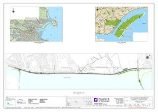
The document appears to be an engineering drawing showing the location and design of a proposed cycle and footway project along a section of road between Bull Road and Causeway Road. It includes a Dublin area map and site location plan at scales of 1:100,000 and 1:3,000 respectively to show the broader context of the project site. It also provides more detailed local area maps and longitudinal section drawings at larger scales to illustrate design aspects such as carriageway levels and wall heights along the 460m section of road where works will be undertaken.