Downloaded 75 times


![26
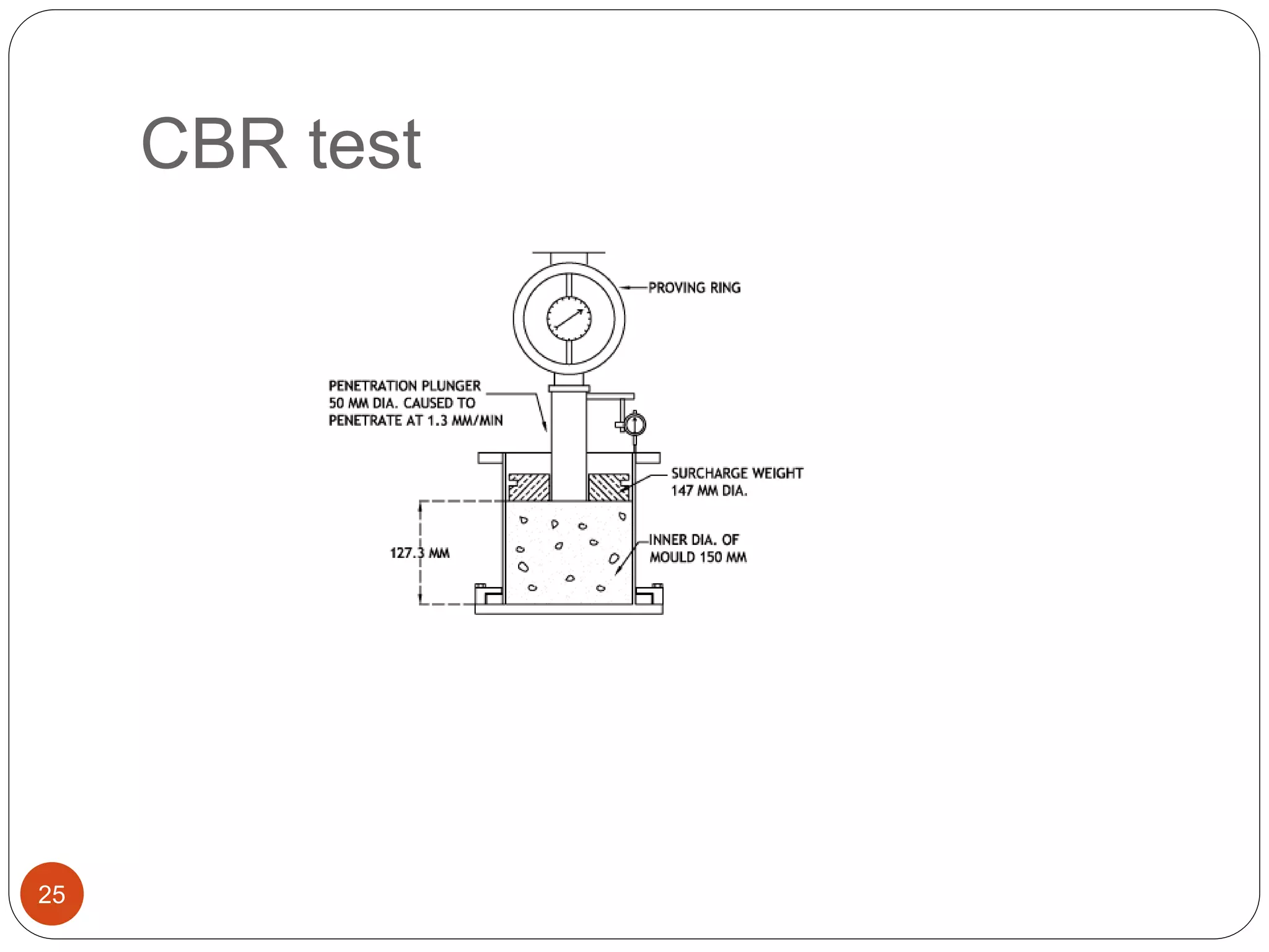
CB
R
= CBR [%]
p = measured pressure for site soils [N/mm²]
ps
= pressure to achieve equal penetration on standard
soil [N/mm²]](https://image.slidesharecdn.com/presentation1lagbhagfinal-150331063521-conversion-gate01/75/project-work-presentation-on-road-feasibility-study-need-to-be-corrected-but-can-be-used-as-reference-26-2048.jpg)


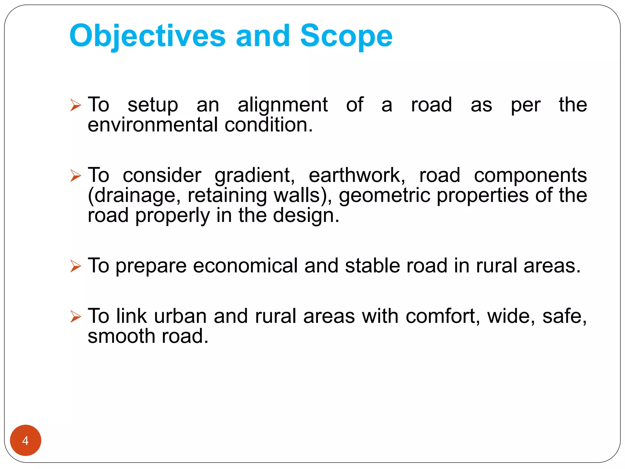
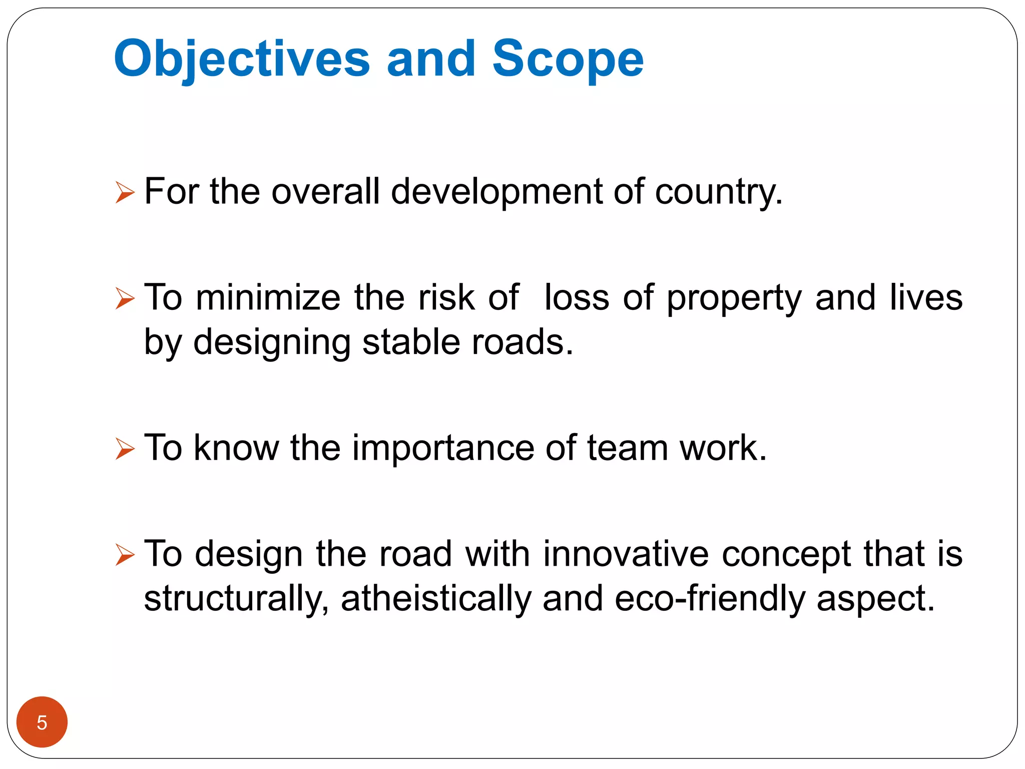
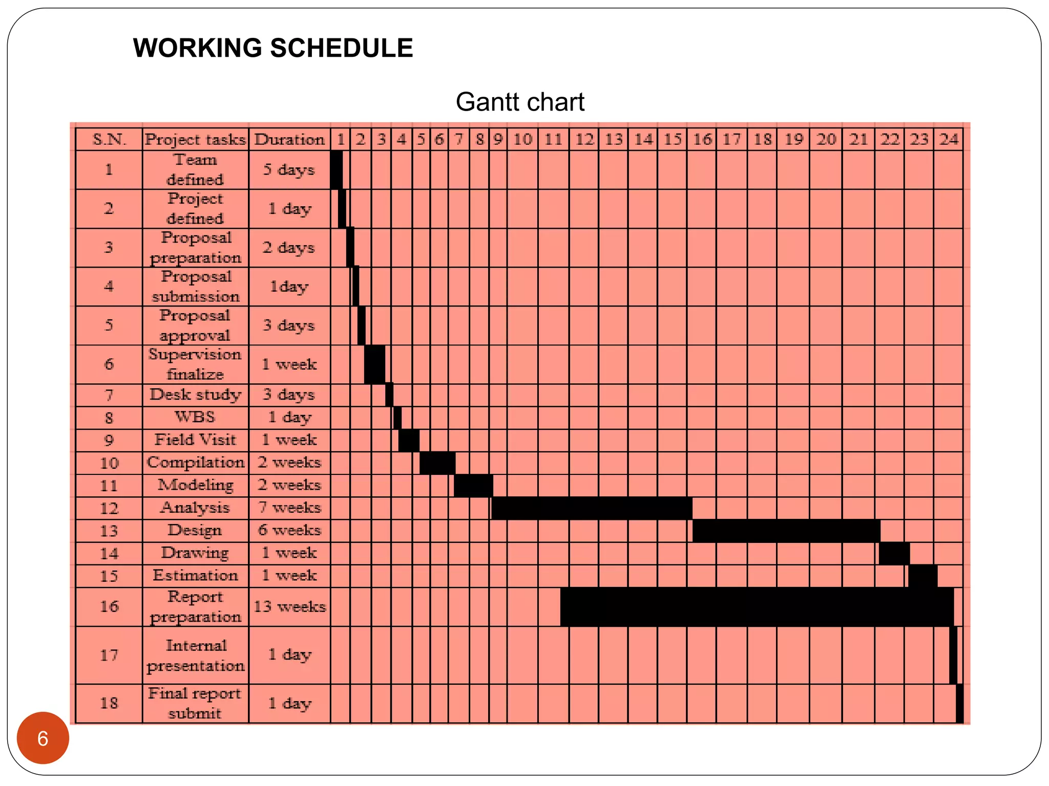
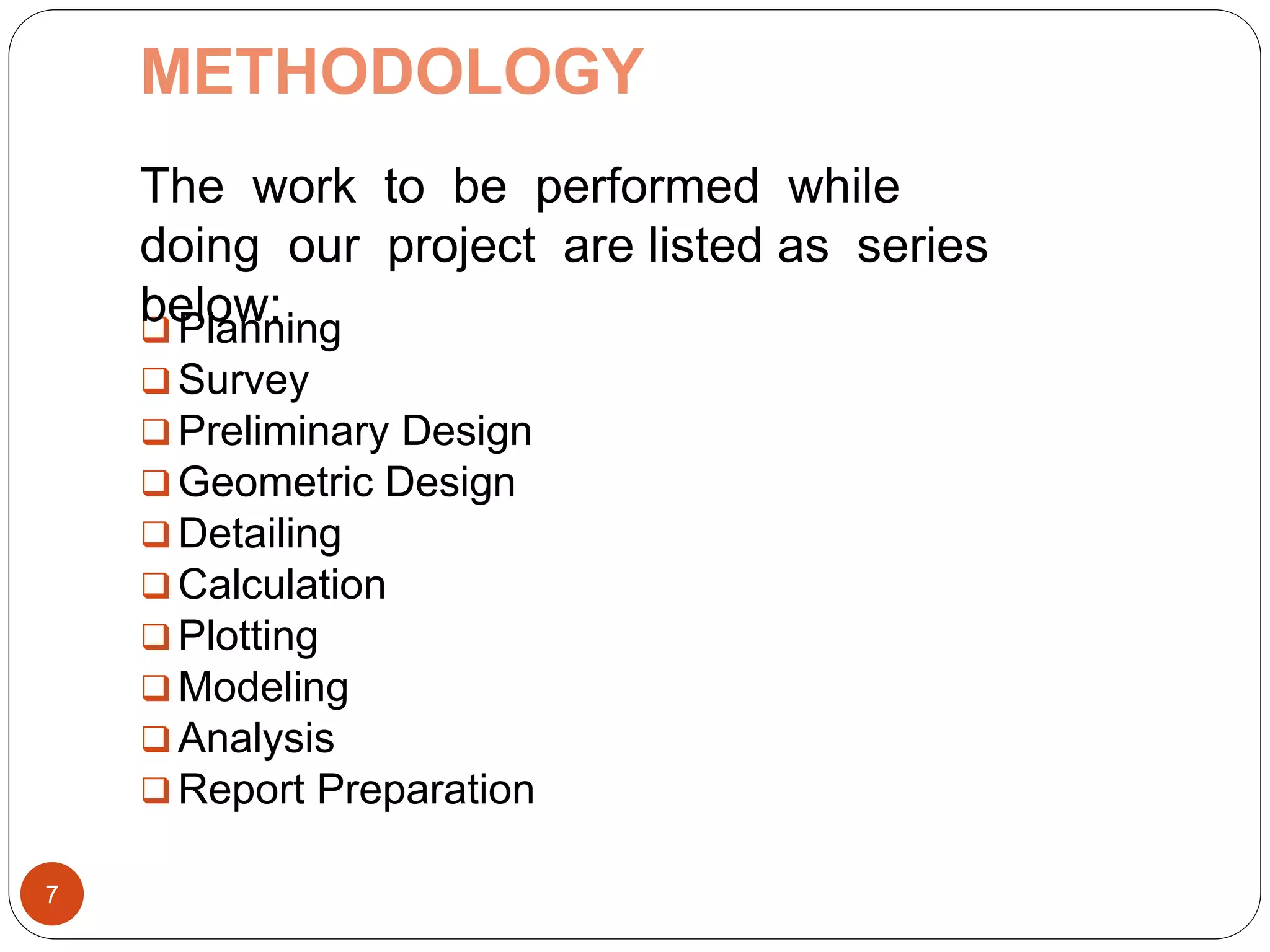
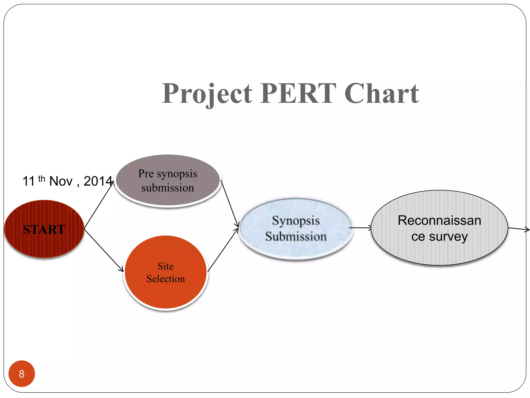
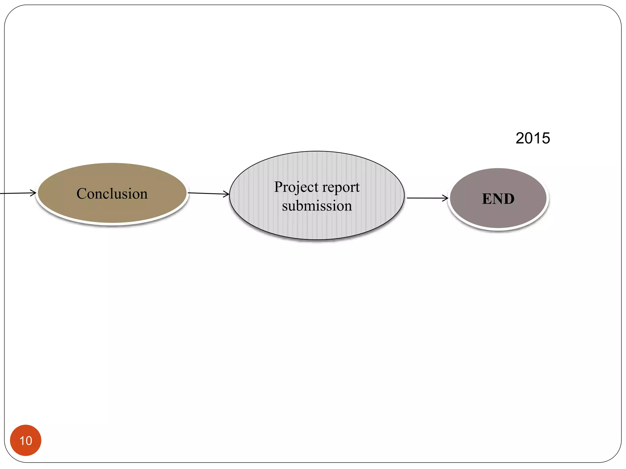
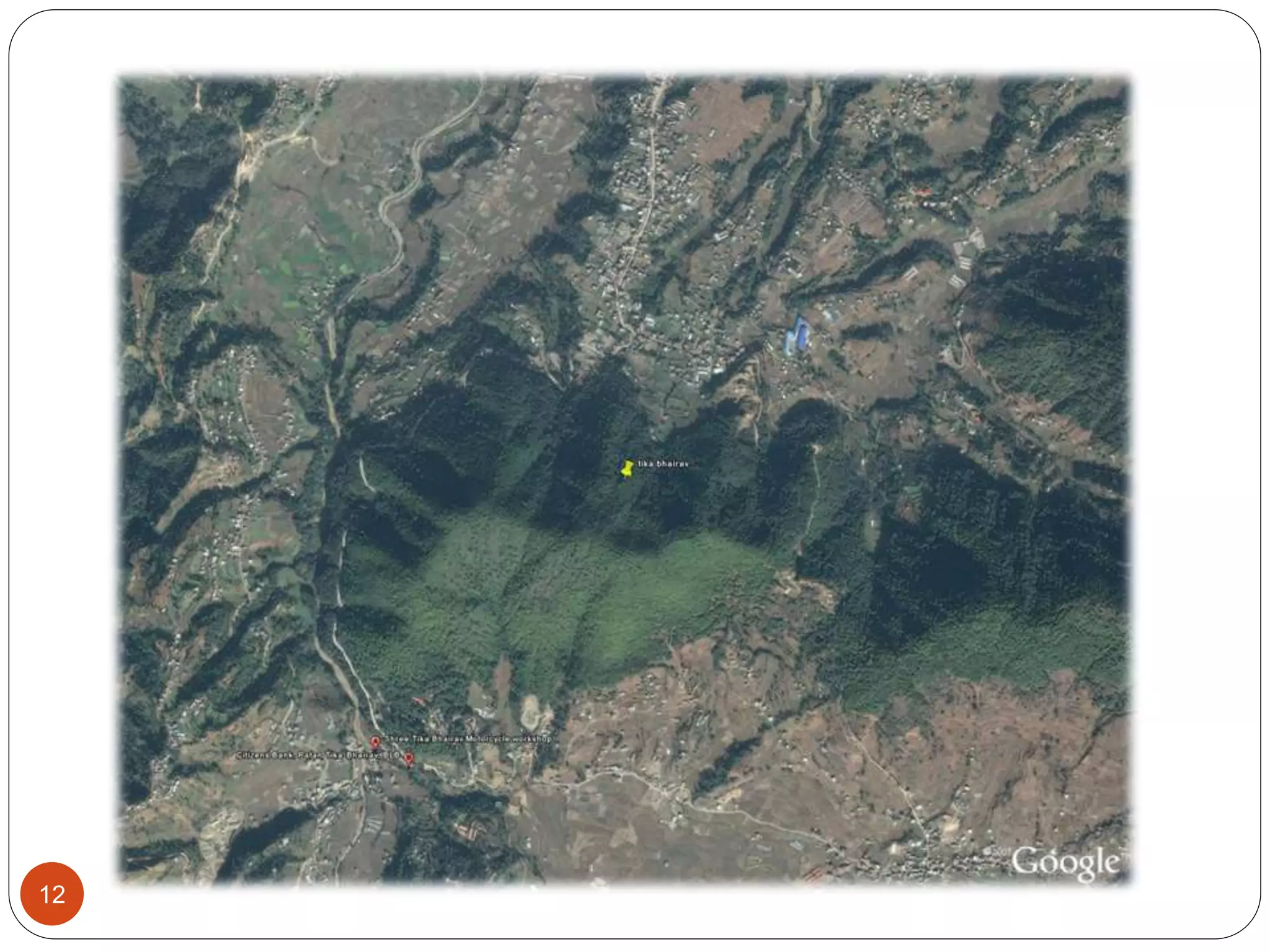
This document outlines the plans for a student project to design a rural road connecting two villages in Nepal. It includes background information on the project requirements and objectives to design an environmentally friendly and structurally sound road. Site selection and surveys were conducted, including traffic counts, soil testing, and topographic surveys. The project scope involves preliminary design, geometric design, calculations, and reporting. Design considerations include alignment, grading, drainage, retaining walls and pavement structure based on traffic and soil conditions. The project is intended to provide experience in designing stable rural roads and supporting infrastructure development in Nepal.