Download to read offline
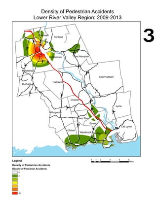
This document appears to be a map showing the density of pedestrian accidents that occurred from 2009 to 2013 in towns located in the Lower River Valley Region of Connecticut. The map legend indicates that the shaded areas represent the density of pedestrian accidents, with darker shading signifying higher densities. Town names are listed around the map.


