GAGANYAAN PROJECT
1. Gaganyaanis the first project taken up by
ISRO for demonstrating the human space
flight capability.
2. The Gaganyaan programme envisages
undertaking the demonstration of human
spaceflight to LEO (Low Earth Orbit) with
a crew of three astronauts to 400 km LEO.
3. This task necessitates three major
components, namely
1.Human Rated Launch Vehicle,
2.Crew EscapeSystem and
3.Orbital Module with human
presence.
ககன்யான் திட்டம்
1. ககன்யான் என்பது மனிதனின் விண்வெளிப்
பயணத் திறனை நிரூபிப்பதற்காக இஸ்ர ாொல்
எடுக்கப்பட்ட முதல் திட்டமாகும்.
2. ககன்யான் திட்டம் மனித விண்வெளிப்
பயணத்னத பூமியின் தாழ் ெட்டப்பானதக்கு
(LEO) மூன்று விண்வெளி வீ ர்களுடன் 400 கிமீ
பூமியின் தாழ் ெட்டப்பானத ென பயணத்
திறனை நிரூபிப்பனதக் குறிக்கிறது.
3. இந்த பணிக்கு மூன்று முக்கிய கூறுகள்
ரதனெப்படுகின்றை, அதாெது
1. மனித மதிப்பிடப்பட்ட வெளியீட்டு ொகைம்,
2. பயணக் குழு தப்பிக்கும் முனறக்காை
வதாழில்நுட்பம் மற்றும்
3. மனித இருப்பு ெசதி வ ொண்ட சுற்றுப்பொதத
வதாகுதி ஆகியனெயாகும்.
3.
4. Apart fromthis the Ground Control
station is planned for the entire mission
duration during ascent, on-orbit and
descant phase of the mission.
5. As per the mandate of Gaganyaan, two
unmanned missions will be undertaken
prior to the mannedmission.
4. இது தவி சுற்றுப்பொததயில் பயணத்தின்
ஏறுதல் மற்றும் இறங்கும் ட்டத்தில் முழு
பணி ொலத்திற்கும், ததைக் ட்டுப்பொட்டு
நிதலயம் திட்டமிடப்பட்டுள்ளது.
5. ககன்யான் விண்வெளிப் பயண திட்டப்படி,
மனித பயணத்திற்கு முன்ைதாக இ ண்டு
ஆளில்லா பயணங்கள் விண்வெளிக்கு
ரமற்வகாள்ளப்படும்.
4.
Objective
1. Gaganyaan Programmeis to achieve
autonomy in access to space providing
both tangible and intangible benefits to
the development of the national with
maximal industry/academia participation
and collaboration.
2. Scientific experiments to advance the
knowledge of the solar system are planned
to be conducted.
3. This project will also accelerate the
scientific & technological development in
the country to foster intellectual capacity
and innovation.
குறிக்க ொள்
1. ககன்யான் திட்டமாைது, அதிகபடச
வதாழில்/கல்வித்துனற பங்ரகற்பு மற்றும்
ஒத்துனைப்புடன் ரதசிய ெளர்ச்சிக்கு
உறுதியாை மற்றும் அருெமாை பலன்கனள
ெைங்கும் விண்வெளி அணுகலில்
சுயாட்சினய அனடெதாகும்.
2. சூரிய குடும்பம் பற்றிய அறினெ
ரமம்படுத்த இத்தனகய அறிவியல்
ரசாதனைகள் நடத்த
திட்டமிடப்பட்டுள்ளது.
3. இந்த திட்டம் அறிொர்ந்த திறன் மற்றும்
கண்டுபிடிப்புகனள ெளர்க்கும், நாட்டில்
அறிவியல் மற்றும் வதாழிலநுட்ப
ெளர்ச்சினய துரிதப்படுத்தும்.
5.
Significance of GaganyaanProject
1. It will help improve the country's ability
to develop technology to carry out
scientific manned spaceexploration.
2. The success of the Gaganyaan project will
help in advancing affordable human and
robotic missions to explore the Solar
System or beyond.
ன்யொன் திட்டத்தின் முக்கியத்துெம்
1. விஞ்ஞாை மனித விண்வெளி ஆய்வுகனள
ரமற்வகாள்ெதற்காை வதாழில்நுட்பத்னத
ெளர்ப்பதில் நாட்டின் திறனை ரமம்படுத்த
உதவும்.
2. ககன்யான் திட்டம் சூரிய குடும்பத்னத
அல்லது சூரிய குடும்பத்திற்கு
அப்பாலுள்ளெற்னற ஆ ாய மலிவு
வினலயில் மனித மற்றும் ர ாரபா
திட்டங்களின் முன்ரைற்றத்திற்கு இந்த
திடட வெற்றி உதவும்.
6.
GAGAN NAVIGATION SYSTEM
GAGAN
1.GAGAN is an acronym for GPS Aided
GEO Augmented Navigation.
2. It is a Space Based Augmentation
System (SBAS) jointly developed by
ISRO and AAI
3. Provide the best possible navigational
services over Indian FIR (Flight
Information Region) with the capability
of expanding to neighboring FIRs.
4. GAGAN is a system of satellites and
ground stations that provide GPS signal
corrections, giving you better
position accuracy.
ன் என்றொல் என்ன?
1. ககன் என்பது புவிநிதல ொட்டி
மிகுதிப்படுத்திய ெழிநடத்துதல் என்பதன்
சுருக்கமாகும்.
2. இது இந்திய விமாைத் தகெல் மண்டலம்
மூலம் அண்னட நாடுகளின் விமாைத் தகெல்
மண்டலங்களுக்கு விரிெனடயும் திறன்
வகாண்ட சிறந்த ெழிவசலுத்தல்
ரசனெகனள ெைங்குெதற்காக
3. இஸ்ர ா மற்றும் இந்திய ொனூர்தி
நினலயங்கள் ஆனணயம் இனணந்து
உருொக்கிய விண்வெளி அடிப்பனடயிலாை
வபருக்க அனமப்பாகும்.
4. ககன் என்பது வசயற்னகக்ரகாள்கள் மற்றும்
தன நினலயங்களின் அனமப்பாகும், இது
புவியிடங் ொட்டி சமிக்த திருத்தங் தை
ெழங்குகிறது, இது உங்களுக்கு சிறந்த இட
துல்லியத்னத அளிக்கிறது.
7.
5. GPS alonedoes not meet the ICAOs
navigational requirements for accuracy,
integrity and availability.
6. GAGAN corrects for GPS signal errors
caused by Ionospheric disturbances,
timing and satellite orbit errors and
also it provides vital information
regarding the health of each satellite.
7. It is the first such system developed
for India and neighboring countries in
the equatorial region.
5. துல்லியம், ஒருனமப்பாடு மற்றும்
கினடக்கும் தன்னமக்காை பன்ைாட்டு
குடிசார் ொன்பயண அனமப்பின்
ெழிவசலுத்தல் ரதனெகனள
புவியிடங்காட்டி பூர்த்தி வசய்யவில்னல.
6. அயை மண்டல இனடயூறுகள், ரந ம்
மற்றும் வசயற்னகக்ரகாள் சுற்றுப்பானத
பினைகள் ஆகியெற்றால் ஏற்படும்
புவியிடங்காட்டி சமிக்னக பினைகனள ககன்
சரிவசய்கிறது ரமலும் ஒவ்வொரு
வசயற்னகக்ரகாளின் ஆர ாக்கியம் பற்றிய
முக்கிய தகெனலயும் ெைங்குகிறது
7. பூமத்திய ர னகப் பகுதியில் இந்தியா
மற்றும் அண்னட நாடுகளுக்காக
உருொக்கப்பட்ட முதல் துல்லிய
புவியிடங்காட்டி அனமப்பு இதுொகும்.
8.
GAGAN APPLICATIONS
GAGANprovides the additional accuracy,
availability, and integrity necessary for all
phases of flight, from enroute through
approach for all qualified airports within
the GAGAN service volume.
GAGAN system is being used for effective
management of wildlife resources and
monitoring of forests using GAGAN
enabled GPS SXTREO-T51.
It can provide navigational support to
Indian railway for signalling when train
approaches to no man crossing and also
for alignment of railway tracks.
னின் பயன்பொடு ள்
1. ககன் ஆைது விமாைத்தின் அனைத்து
கட்டங்களுக்கும் ரதனெயாை கூடுதல்
துல்லியம், கினடக்கும் தன்னம
ஒருனமப்பாடு ஆகியெற்னற ெைங்குகிறது.
2. ககன் அனமப்பு புவியிடங்காட்டி SXTREO-T51
ஐப் பயன்படுத்தி ெைவிலங்கு ெளங்கனள
திறம்பட நிர்ெகிப்பதற்கும் காடுகனளக்
கண்காணிப்பதற்கும் பயன்படுத்தப்படுகிறது.
3. ஆளில்லா யில் பானதகளில் யில்
வநருங்கும் ரபாது சமிக்னக வசய்ெதற்கும்,
யில் பானதகனள சீ னமப்பதற்கும் இது
இந்திய யில்ரெக்கு ெழிவசலுத்தல்
ஆத னெ ெைங்க முடியும்.
9.
Road AssetManagement System (RAMS)
is likely to be developed for all National
Highways in the country and a modern
management system that will use GAGAN
system.
GAGAN signals can also be used to manage
traffic in real time to avoid traffic jams.
4. சானல வசாத்து ரமலாண்னம அனமப்பு
வமன்வபாருள் (RAMS) நாட்டிலுள்ள
அனைத்து ரதசிய வநடுஞ்சானலகளுக்கும்
உருொக்கப்படும் மற்றும் ககன் அனமப்னபப்
பயன்படுத்தும் நவீை ரமலாண்னம அனமப்பு
ஆகும்.
5. ரபாக்குெ த்து வநரிசனலத் தவிர்க்க,
நிகழ்ரந த்தில் ரபாக்குெ த்னத நிர்ெகிக்க
ககன் சமிக்னககனளப் பயன்படுத்தலாம்.
10.
COVERAGE AREA:
GAGANGEO footprint expands from Africa to
Australia and GAGAN system has capability to
cater 45 reference stations for expansion to
neighbouring countries.
GAGAN provides a civil aeronautical
navigation signal consistent with
International Civil Aviation Organization
(ICAO) Standards and Recommended
Practices (SARPs) as established by the
Global Navigation Satellite System (GNSS)
Panel.
பைவெல்தல பகுதி:
1. ககன் GEO தடம் ஆப்பிரிக்காவிலிருந்து
ஆஸ்திர லியா ென விரிெனடகிறது மற்றும்
ககன் அனமப்பு அண்னட நாடுகளுக்கு
விரிொக்கம் வசய்ெதற்காக 45 குறிப்பு
நினலயங்கனள ெைங்குெதற்காை திறனைக்
வகாண்டுள்ளது.
2. ககன் பன்ைாட்டு குடிசார் ொன்பயண
அனமப்பு (ICAO) த நினலகள் மற்றும்
உலகளாவிய ெழிவசலுத்தல்
வசயற்னகக்ரகாள் அனமப்பு (GNSS) குழுொல்
நிறுெப்பட்ட பரிந்துன க்கப்பட்ட
நனடமுனறகள் (SARPs) உடன் இணக்கமாை
பயண ொனூர்தி ெழிவசலுத்தலுக்கு
சமிக்னஞனய ெைங்குகிறது.
11.
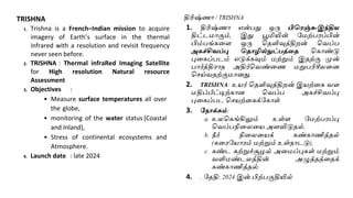
ISRO’s UPCOMMING MISSION
NISARMission: S – Band SAR Payload delivered
to NASA
1. NISAR: NASA–ISRO–SAR
2. NASA: provides satellite radars, GPS, payloads
and data systems
3. ISRO: provides spacecraft bus, S–band radar,
launch vehicle and launch services.
4. SAR – Synthetic Aperture Radar – use to
measure changes in the surface of the Earth, a
technique for producing high–resolution
images using this technique it can collect data
day and night in any weather.
5. Launch Date: Early 2023
6. Lifetime: 3 years
NISAR பணி: S - கபண்ட் SAR கபகலொட் நொசொவிற்கு
ெழங் ப்பட்டது
1. நிசொர்: நாசா–இஸ்ர ா–சார்
2. நொசொ: வசயற்னகக்ரகாள் ர டார்கள், ஜிபிஎஸ்,
ரபரலாடுகள் மற்றும் த வு அனமப்புகனள
ெைங்குகிறது
3. நிசொர் பணி: ரபண்ட் சர் பயனலப்
பயன்படுத்தி நாசாவுக்கு ெைங்கப்பட்டது.
இஸ்கைொ: விண்கல ரபருந்து, எஸ்-ரபண்ட்
ர டார், ஏவுதல் ொகைம் மற்றும் ஏவுதள
ரசனெகனள ெைங்குகிறது.
4. SAR - வசயற்னக நுண்துனள ர டார்-பூமியின்
ரமற்ப ப்பில் ஏற்படும் மாற்றங்கனள
அளவிடுெதற்காை பயன்பாடு, இந்த
நுட்பத்னதப் பயன்படுத்தி உயர்
வதளிவுத்திறன் வகாண்ட படங்கனள
உருொக்குெதற்காை ஒரு நுட்பம், இது எந்த
ொனினலயிலும் இ வும் பகலும் த னெ
ரசகரிக்க முடியும்.
5. ரததி: ஆ ம்ப 2023
6. ொழ்நாள்: 3 ஆண்டுகள்
12.
NISAR Mission
Objective:
1. Tomeasure Earth’s changing ecosystems,
2. dynamic surfaces, and ice masses
3. providing information about biomass,
4. natural hazards,
5. sea level rise, and
6. groundwater, and
7. will support a host ofother applications.
NISAR Mission
கநொக் ம்:
1. பூமியின் மாறிெரும் சுற்றுச்சூைல்
அனமப்புகள்,
2. மாறும் ரமற்ப ப்புகள் மற்றும் பனிக்கட்டி
தி ள்கள் ஆகியெற்னற அளவிடுதல்,
3. உயிரிைத்வதாகுதி,
4. இயற்னக அபாயங்கள்,
5. கடல் மட்ட உயர்வு மற்றும்
6. நிலத்தடி நீர் பற்றிய தகெல்கனள ெைங்குதல்
மற்றும்
7. பிற பயன்பாடுகனள ஆதரிக்கும்
13.
NISAR Mission
Benefits:
1. NISAR'sdata can help people worldwide
better manage natural resources and
hazards,
2. Providing information for scientists to better
understand the effects and pace of climate
change.
3. It will also add to our understanding of our
planet's hard outer layer, called its crust.
NISAR Mission
நன்தம ள்:
1. NISAR இன் த வுகள் உலவகங்கிலும் உள்ள
மக்கள் இயற்த ெைங் ள் மற்றும்
அபொயங் தை சிறப்பொ நிர்ெகிக் வும்,
2. காலநினல மாற்றத்தின் வினளவுகள் மற்றும்
ரெகத்னத விஞ்ஞானிகள் நன்கு புரிந்து வகாள்ள
தகெல்கனள ெைங்கவும் உதவும்
3. இது நமது கி கத்தின் கடிைமாை வெளிப்புற
அடுக்னகப் பற்றிய நமது புரிதனலயும் ரசர்க்கும்,
அது "ரமரலாடு" என்று அனைக்கப்படுகிறது.
14.
TRISHNA
1. Trishna isa French–Indian mission to acquire
imagery of Earth’s surface in the thermal
infrared with a resolution and revisit frequency
never seen before.
2. TRISHNA : Thermal infraRed Imaging Satellite
for High resolution Natural resource
Assessment
3. Objectives :
• Measure surface temperatures all over
the globe,
• monitoring of the water status (Coastal
and Inland),
• Stress of continental ecosystems and
Atmosphere.
4. Launch date : late 2024
திரிஷ்ணா / TRISHNA
1. திரிஷ்ணா என்பது ஒரு பிவைஞ்சு-இந்திய
திட்டமாகும், இது பூமியின் ரமற்ப ப்பின்
பிம்பங்கனள ஒரு வதளிவுத்திறன் வெப்ப
அ ச்சிெப்பு வதொழில்நுட்பத்தத வகாண்டு
புனகப்படம் எடுக்கவும் மற்றும் இதற்கு முன்
பார்த்தி ாத அதிர்வெண்னண மறுபரிசீலனை
வசய்ெதற்குமாைது.
2. TRISHNA: உயர் வதளிவுத்திறன் இயற்னக ெள
மதிப்பீட்டிற்காை வெப்ப அகச்சிெப்பு
புனகப்பட வசயற்னகக்ரகாள்
3. கநொக் ம்:
a. உலவகங்கிலும் உள்ள ரமற்ப ப்பு
வெப்பநினலனய அளவிடுதல்,
b. நீர் நினலனயக் கண்காணித்தல்
(கன ரயா ம் மற்றும் உள்நாடடு),
c. கண்ட சுற்றுச்சூைல் அனமப்புகள் மற்றும்
ெளிமண்டலத்தின் அழுத்தத்னதக்
கண்காணித்தல்.
4. . ரததி: 2024 இன் பிற்பகுதியில்
15.
5. Partners :ISRO and CNES
6. Instruments: Thermal InfraRed (TIR)
telescope
: Visible and Near InfraRed /
Short Wave InfraRed
(VNIR/SWIR)
7. Orbit : Sun–synchronous,
8. Lifetime :5 years
5. பங்குதொைர் ள்: இஸ்ர ா மற்றும் CNES
6. கருவிகள்: வெப்ப அகச்சிெப்பு (TIR)
வதானலரநாக்கி , புலப்படும் மற்றும்
அகச்சிெப்பு / குறுகிய அனல அகச்சிெப்பு (VNIR
/SWIR)
7. . சுற்றுப்பானத சூரிய ஒத்தினசவு
சுற்றுப்பானத
8. ஆயுட்காலம்: 5 ஆண்டுகள்
16.
DISHA (Disturbed andquiet–type System
at High Altitude)
1. It is a twin–satellite system that
will study Earth’s aeronomy, the
uppermost layer of Earth’s
atmosphere.
2. It will involve twin satellites orbiting
Earth at an altitude of 450km.
திஷொ / DISHA (Disturbed and quiet-type System at
High Altitude
1. இது பூமியின் ெளிமண்டலத்தின் மிக
உயர்த்த அடுக்காை பூமியின் ொனியனல
ஆய்வுவசய்யும் இ ட்னட வசயற்னகக்ரகாள்
அனமப்பாகும்.
2. இது 450 கி.மீ உயாத்தில் பூமினயச் சுற்றி
ெரும் இ ட்னட வசயற்னகக்ரகாள்கனள
உள்ளடக்கியது.
17.
CHANDRAYAAN – 3
1.ALunar Polar Exploration Mission (3rd
moon mission)
2.Successor of Chandrayaan–2 mission
Aimed at landing rover on the south
pole of the moon
3.In partnership with Japan
4.Launch date : Late 2023
5.Will have an orbiter and a landing
module
சந்திையொன் - 3
1. ஒரு சந்தி துருெ ஆய்வு திட்டம் (3ெது
நிலவு பணி)
2. சந்தி யான்-2 திட்டத்தின் வதாடர்ச்சி
நிலவின் வதன் துருெத்தில் உலவினய
தன யிறக்குெனத ரநாக்கமாகக் வகாண்டது
3. ஐப்பானுடன் இனணந்து பணிபுரிகிறது
இஸ்ர ா
4. ரததி 2023 இன் பிற்பகுதியில்
5. ஒரு சுற்றுகலம் மற்றும் ஒரு தன
இறங்கும் வதாகுதி வகாண்டது.
18.
Shukrayaan–1
1.VENUS MISSION –The Shukrayaan – 1
2.Launch date: December 2024
3.Orbiter Mission to neighbouring planet
Venus.
4.Indian space agency’s first mission to
Venus
5.Expected mission life: 4 years
6.During this time, multiple instruments
will carry out studies on the planet.
7.The Venus orbiter will be launched on
the rockets made by ISRO.
சுக் யான்-1
1. வெள்ளி கி கித்திற்குறியது - சுக யான்-1
2. ரததி டிசம்பர் 2024
3. அண்னட கி கமாை வீைஸ் / வெள்ளி
கி கத்திற்கு சுற்றுகலம் அனுப்பும் திட்டம்
4. வெள்ளி கி கத்திற்கு இந்திய விணவெளி
நிறுெைத்தின் முதல் பயணம்
எதிர்பார்க்கப்படும்
5. ொழ்நாள்: 4 ஆண்டுகள்
6. பல கருவிகள் கி கத்தில் ஆய்வுகனள
ரமற்வகாள்ளும்.
7. இஸ்ர ா தயாரித்த ஏவுகலனைக்
வகாண்டு வெள்ளி/வீைஸ் சுற்றுகலம்
ஏெப்படும்.
19.
DEEP OCEAN MISSION
1.TheUnited Nations (UN) has declared the
decade 2021-2030 as the Decade of Ocean
Science for Sustainable Development.
2.India has a unique maritime situation. Its 7517
km long coastline covers nine coastal states.
There are 1382 islands.
3.“Deep Ocean Mission” is a project of the
Ministry of Geosciences to promote deep
sea research andpromote blue economy.
4.The objective of this mission is to explore
deep sea resources and develop deep sea
technologies for sustainable utilization of
marine resources.
ஆழ் டல் ஆைொய்ச்சி திட்டம்
1. ஐக்கிய நாடுகள் சனப (ஐ.நா) 2021-2030
தசாப்தத்னத நினலயாை ெளர்ச்சிக்காை
வபருங்கடல் அறிவியலின் தசாப்தமாக
அறிவித்துள்ளது.
2. இந்தியாவுக்கு ஒரு தனித்துெமாை கடல் நினல
உள்ளது. இதன் 7517 கி.மீ நீளமுள்ள கடற்கன
ஒன்பது கடரலா மாநிலங்களில் உள்ளை. 1382
தீவுகள் உள்ளை.
3. ஆழ்கடல் ஆ ாய்ச்சினய ஊக்குவிக்க மற்றும்
நீல வபாருளாதா த்னத ரமம்படுத்துெதற்காக
"ஆழ் வபருங்கடல் பணி" என்பது புவி
அறிவியல் அனமச்சகத்தின் திட்டமாகும்.
4. ஆைகடல் ெளங்கனள ஆ ாயெதும், கடல்
ெளங்களின் நினலயாை பயன்பாட்டிற்காக
ஆைகடல் வதாழில்நுடபங்கனள
உருொக்குெதும் இந்தப் பணியின்
ரநாக்கமாகும்.
20.
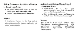
Salient features ofDeep Ocean Mission
1. Samudrayaan Project
1. The Samudrayan project is part of deep sea
mission under MoES approved in 2021.
2. It is India's first unique manned sea mission.
Purpose:
It aims to send humans into the deep sea in a
submersible vehicle for deep-sea exploration and
mining ofrare minerals.
ஆழ் டல் பணியின் முக்கிய அம்சங் ள்
1.சமுத்திையொன் திட்டம்
1. சமுத்தி யான் திட்டம் 2021 இல்
அங்கீகரிக்கப்பட்ட MoES இன் கீழ் ஆழ்கடல்
கடல் பணியின் ஒரு பகுதியாகும்.
2. இது இந்தியாவின் முதல் தனித்துெமாை
மனிதர்கனளக் வகாண்ட கடல் பணியாகும்
கநொக் ம்:
இது ஆழ்கடல் கடல் ஆய்வு மற்றும் அரிய
கனிமங்கனள சு ங்கப்படுத்துெதற்காக நீரில்
மூழ்கக்கூடிய ொகைத்தில் ஆழ்கடலுக்கு
மனிதர்கனள அனுப்புெனத ரநாக்கமாகக்
வகாண்டுள்ளது.
21.
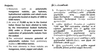
Projects:
1.Resources such aspolymetallic
manganese nodules, gas hydrates,
hydrothermal sulphides and cobalt crusts
are generally located at depths of 1000 to
5500 meters.
2.An area of 75,000 sq km in the Central
Indian Ocean has been allotted to India
by the International Seabed Authority
(ISA) under a 15-year agreement for
exploration of polymetallic nodules from
the seabed.
3.The estimated resource potential of
polymetallic nodules from preliminary
studies is 380 million tonnes.
4.The main elements in these nodules are
manganese, nickel, copper and cobalt.
திட்டப்பணி ள்:
1. வபாதுொக 1000 முதல் 5500 மீட்டர் ஆைத்தில்
அனமந்துள்ள பொலிவமட்டொலிக் மொங் னீசு
முடிச்சு ள், ெொயு தைட்கைட்டு ள்,
தைட்கைொவதர்மல் சல்தபடு ள் மற்றும்
க ொபொல்ட் கமகலொடு ள் ரபான்ற ெளங்கள்
ஆ ாயப்படும்.
2. மத்திய இந்தியப் வபருங்கடல் பகுதியில்
75,000 சதுை கிமீ பைப்பைதெ சர்ெகதச டல்
படுக்த ஆதணயம் (ISA) 15 ஆண்டு ொல
ஒப்பந்தத்தில் டற்பைப்பில் இருந்து
பொலிவமட்டொலிக் முடிச்சு தை ஆய்வு
வசய்ெதற்காக இந்தியாவுக்கு ஒதுக்கியுள்ளது.
3. பூர்ொங்க ஆய்வுகள் மூலம் பொலிவமட்டொலிக்
முடிச்சு ளின் மதிப்பிடப்பட்ட ெை திறன் 380
மில்லியன் டன் ள் ஆகும்.
4. இந்த முடிச்சுகளில் உள்ள முக்கிய கூறு ள்
மொங் னீசு, நிக் ல், தொமிைம் மற்றும் க ொபொல்ட்.
22.
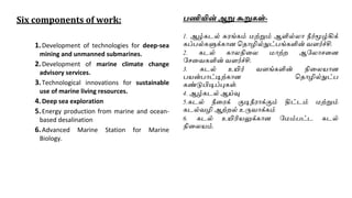
Six components ofwork:
1.Development of technologies for deep-sea
mining and unmanned submarines.
2.Development of marine climate change
advisory services.
3.Technological innovations for sustainable
use of marine living resources.
4.Deep sea exploration
5.Energy production from marine and ocean-
based desalination
6.Advanced Marine Station for Marine
Biology.
பணியின் ஆறு கூறு ள்-
1. ஆழ்கடல் சு ங்கம் மற்றும் ஆளில்லா நீர்மூழ்கிக்
கப்பல்களுக்காை வதாழில்நுட்பங்களின் ெளர்ச்சி.
2. கடல் காலநினல மாற்ற ஆரலாசனை
ரசனெகளின் ெளர்ச்சி.
3. கடல் உயிர் ெளங்களின் நினலயாை
பயன்பாட்டிற்காை வதாழில்நுட்ப
கண்டுபிடிப்புகள்.
4. ஆழ்கடல் ஆய்வு
5.கடல் நீன க் குடிநீ ாக்கும் திட்டம் மற்றும்
கடல்ெழி ஆற்றல் உருொக்கம்
6. கடல் உயிரியலுக்காை ரமம்பட்ட கடல்
நினலயம்.
23.
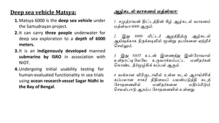
Deep sea vehicleMatsya:
1.Matsya 6000 is the deep sea vehicle under
the Samudrayan project.
2.It can carry three people underwater for
deep sea exploration to a depth of 6000
meters.
3.It is an indigenously developed manned
submarine by ISRO in association with
NIOT.
4.Undergoing initial usability testing for
human-evaluated functionality in sea trials
using ocean research vessel Sagar Nidhi in
the Bay of Bengal.
ஆழ் டல் ெொ னம் மத்ஸ்யொ:
1. சமுத் ாயன் திட்டத்தின் கீழ் ஆழ்கடல் ொகைம்
மத்ஸ்யா 6000 ஆகும்.
2. இது 6000 மீட்டர் ஆைத்திற்கு ஆழ்கடல்
ஆய்வுக்காக நீருக்கடியில் மூன்று நபர்கனள ஏற்றிச்
வசல்லும்.
3. இது NIOT உடன் இனணந்து இஸ்ர ாொல்
உள்நாட்டிரலரய உருொக்கப்பட்ட மனிதர்கள்
வகாண்ட நீர்மூழ்கிக் கப்பல் ஆகும்.
4 ெங்காள விரிகுடாவில் உள்ள கடல் ஆ ாய்ச்சிக்
கப்பலாை சாகர் நிதினயப் பயன்படுத்தி கடற்
ரசாதனையில் மனிதர்கனள மதிப்பிடும்
வசயல்பாடு ஆ ம்ப ரசாதனையில் உள்ளது.