Israel Tour: Best Place for Family and Honeymoon Trip
•Download as PPT, PDF•
0 likes•369 views

Israel Tour: Best Place for Family and Honeymoon Trip, Israel Tour: Best Place for Family and Honeymoon Trip

Recommended
Recommended
More Related Content
Featured
Featured (20)
Israel Tour: Best Place for Family and Honeymoon Trip
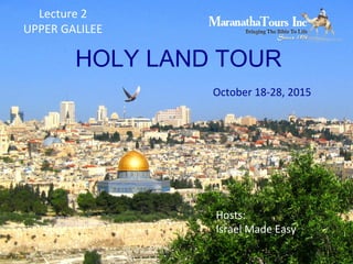
- 1. HOLY LAND TOUR October 18-28, 2015 Hosts: Israel Made Easy Lecture 2 UPPER GALILEE
- 3. Galilee Located: in the North of Israel Traditionally Divided: •Upper Galilee •Lower Galilee •Western Galilee Size: 1/3 of the State of Israel Hebrew: ילגהלהגלי Meaning: literally “a circuit”
- 6. Keshet Cave or Rainbow Cave "PikiWiki Israel 4518 Keshet Cave" by אלהפאוסט . Licensed under CC BY 2.5 via Wikimedia "AmudHorses" by Maglanist Horses roam in Amud stream
- 13. Contact of Israel Made Easy www.Facebook.com/israelmadeeasy www.twitter.com/israelmadeeasy http://israelmadeeasy.com Mail : go@israelmadeeasy.com Call: +972-722525997
Editor's Notes
- The Galilee literally means a circuit and is a large region in Northern Israel. The region is traditionally divided in the Upper Galilee, Lower Galilee and Western Galilee, it makes up one third Israel extending from Dan in the north at the base of Mount Hermon along the ridges of Mount Lebanon to Mount Carmel and Mount Gilboa to the south, and from the Jordan Valley to the east across the plains of the Jezreel Valley and Akko to the shores of the Mediterranean Ocean and Israel’s coastal plain in the west. Most of the Galilee consists of rocky terrain, at heights of between 500 and 700 meters. There are several high mountains including Mount Tabor and Mount Meron in the region which relatively low temperatures and high rainfall in comparison to elsewhere in Israel. As a result of this climate, flora and wildlife thrive in the region, whilst many birds annually migrate from colder climates to Africa and back through the Hulah-Jordan corridor.
- Following the dissolution of the Ottoman Empire and the Balfour Declaration in which the British Empire promised to to create “A Jewish National Home” in Palestine, the Zionist Movement presented to the Versailles Peace Conference a document calling for including in the British Mandate of Palestine the entire territory up to the Litani River – with a view to this becoming eventually part of a future Jewish state. In the event, only less than half this area came to be actually included in British Mandatory Palestine, the final border being influenced both by diplomatic maneuverings and struggles between Britain and France and by fighting on the ground, especially the March 1920 battle of Tel Hai. For a considerable time after the border was defined so to make the northern portion of the territory concerned part of the French mandated territory that became Lebanon, many Zionist geographers — and Israeli geographers in the state's early years — continued to speak of "The Upper Galilee" as being "the northern sub-area of the Galilee region of Israel and Lebanon”. Under this definition, "The Upper Galilee" covers an area spreading over 1,500 km², about 700 in Israel and the rest in Lebanon. This included the highland region, located in South Lebanon and known in Arabic as Jabal Amel, which was known for some time in Hebrew as “the Lebanese Galilee”. In geographical terms, “it is separated from the Lower Galilee by the Beit HaKerem valley; its mountain are taller and valleys are deeper than those in the Lower Galilee area. In recent decades, however, this usage has virtually disappeared from the general Israeli discourse, the term "Upper Galilee" being used solely in reference to the part located in Israel.
- For Christians, the Jesus Boat is one of the most precious and meaningful archaeological treasures in the world. On a drought-dried shore of the Sea of Galilee in January 1986, two brothers who were fishermen from Ginosar—called Gennesaret in Jesus’ day (Matt. 14:34, Mark 6:53)—spied a mysterious object poking up out of the mud. Twelve days later, an ancient vessel saw the light of day for the first time since it sank nearly 2,000 years ago. Scholars say it was a combined ferry and fishing boat, and might have even served in a sea battle against the Romans, but for more than a million Christians who have seen it over the years, and for those looking forward to doing so, it will always be “the Jesus boat.” While no one knows exactly who rode in the boat or what its purpose was, it serves as a powerful visual reminder of the Gospel stories of Jesus and his disciples, many of whom were fishermen themselves. After complex restoration, the Galilee Boat now sits above a calm blue-green sea at the Yigal Alon Center at Kibbutz Ginosar. At this superb indoor display, visitors learn that this mainly oak-and-cedar craft was patched repeatedly and lovingly with 12 different kinds of wood, and that these very trees still grow along the walk to the museum. Sculptor and kibbutz gardener Yuvi Lufan, who along with his brother Moshe discovered the boat, is now part of the living history of the Galilee Boat. “Our parents taught us to love the Sea of Galilee,” Lufan says, “and I always knew it would give us a gift. And it did—a legacy that brought something special to the whole world.”
- The boat's construction conforms to other boats constructed in that part of the Mediterranean during the period between 100 BC and AD 200. Constructed primarily of cedar planks joined together by pegged mortise and tenon joints and nails, the boat is shallow drafted with a flat bottom, allowing it to get very close to the shore while fishing. However, the boat is composed of ten different wood types, suggesting either a wood shortage or that the boat was made of scrap wood and had undergone extensive and repeated fixes. The boat was row-able, with four staggered rowers, and also had a mast allowing the fisherman to sail the boat.
- The boat has been dated to 40 BC (plus or minus 80 years) based on radiocarbon dating, and 50 BC to AD 50 based on pottery (including a cooking pot and lamp) and nails found in the boat, as well as hull construction techniques. The evidence of repeated repairs shows the boat was used for several decades, perhaps nearly a century. When its fishermen owners thought it was beyond repair, they removed all useful wooden parts and the hull eventually sank to the bottom of the lake. There it was covered with mud which prevented bacterial decomposition.
- The famous Via Maris road running between the empires of the Fertile Crescent to the north and east and Egypt to the south and west runs through many of the sites we will visit.
- One of the remarkable features of Israel is that it contains the area of lowest elevation on land on the earth, the Dead Sea at 427 metres (1,401 ft) below sea level. Notice that in the space of 45 miles (70 km) Israel goes from the warm Mediterranean climate of Tel Aviv to the arid desert of the Dead Sea valley. The Dead Sea has about a 33% salt content making it one of the saltiest bodies of water on the planet.