SlideShare a Scribd company logo
GPS Training 
21st& 22nd May 2012 
Lucknow 
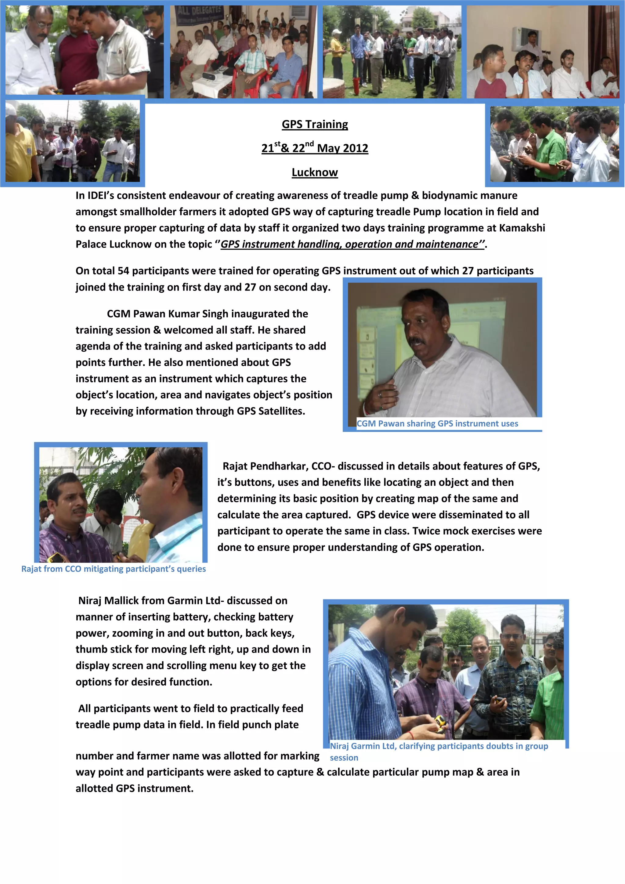
In IDEI’s consistent endeavour of creating awareness of treadle pump & biodynamic manure amongst smallholder farmers it adopted GPS way of capturing treadle Pump location in field and to ensure proper capturing of data by staff it organized two days training programme at Kamakshi Palace Lucknow on the topic ‘’GPS instrument handling, operation and maintenance’’. 
On total 54 participants were trained for operating GPS instrument out of which 27 participants joined the training on first day and 27 on second day. 
CGM Pawan Kumar Singh inaugurated the training session & welcomed all staff. He shared agenda of the training and asked participants to add points further. He also mentioned about GPS instrument as an instrument which captures the object’s location, area and navigates object’s position by receiving information through GPS Satellites. 
Rajat Pendharkar, CCO- discussed in details about features of GPS, it’s buttons, uses and benefits like locating an object and then determining its basic position by creating map of the same and calculate the area captured. GPS device were disseminated to all participant to operate the same in class. Twice mock exercises were done to ensure proper understanding of GPS operation. 
Niraj Mallick from Garmin Ltd- discussed on manner of inserting battery, checking battery power, zooming in and out button, back keys, thumb stick for moving left right, up and down in display screen and scrolling menu key to get the options for desired function. 
All participants went to field to practically feed treadle pump data in field. In field punch plate number and farmer name was allotted for marking way point and participants were asked to capture & calculate particular pump map & area in allotted GPS instrument. 
CGM Pawan sharing GPS instrument uses 
Rajat from CCO mitigating participant’s queries 
Niraj Garmin Ltd, clarifying participants doubts in group session
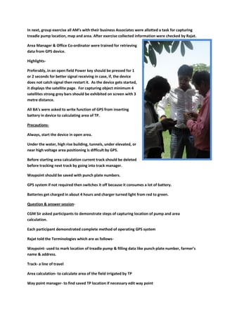
In next, group exercise all AM’s with their business Associates were allotted a task for capturing treadle pump location, map and area. After exercise collected information were checked by Rajat. 
Area Manager & Office Co-ordinator were trained for retrieving data from GPS device. 
Highlights- 
Preferably, in an open field Power key should be pressed for 1 or 2 seconds for better signal receiving in case, if, the device does not catch signal then restart it. As the device gets started, it displays the satellite page. For capturing object minimum 4 satellites strong grey bars should be exhibited on screen with 3 metre distance. 
All BA’s were asked to write function of GPS from inserting battery in device to calculating area of TP. 
Precautions- 
Always, start the device in open area. 
Under the water, high rise building, tunnels, under elevated, or near high voltage area positioning is difficult by GPS. 
Before starting area calculation current track should be deleted before tracking next track by going into track manager. 
Waypoint should be saved with punch plate numbers. 
GPS system if not required then switches it off because it consumes a lot of battery. 
Batteries get charged in about 4 hours and charger turned light from red to green. 
Question & answer session- 
CGM Sir asked participants to demonstrate steps of capturing location of pump and area calculation. 
Each participant demonstrated complete method of operating GPS system 
Rajat told the Terminologies which are as follows- 
Waypoint- used to mark location of treadle pump & filling data like punch plate number, farmer’s name & address. 
Track- a line of travel 
Area calculation- to calculate area of the field irrigated by TP 
Way point manager- to find saved TP location if necessary edit way point
Track manager- it manages & find saved tracks/area. If necessary edit areas. 
At the end CGM Sir thanks all participants for their active participation and shared his hope that the training knowledge will continue to disseminate to new joinee as well and Treadle Pump data will be correctly captured by GPS instrument in field.

More Related Content

Similar to GPS training to Assosiates

GPS_Manual_2016.pdf
GPS_Manual_2016.pdfGPS_Manual_2016.pdf
GPS_Manual_2016.pdf
suonsovannaka
 
Excavator Monitoring And Auto Reporting Using GSM
Excavator Monitoring And Auto Reporting Using GSMExcavator Monitoring And Auto Reporting Using GSM
Excavator Monitoring And Auto Reporting Using GSM
IRJET Journal
 
Land use land cover mapping for smart village using gis
Land use land cover mapping for smart village using gisLand use land cover mapping for smart village using gis
Land use land cover mapping for smart village using gis
Sumit Yeole
 
Abijit sharma 201818510 survey report converted by_abcdpdf
Abijit sharma 201818510 survey report converted by_abcdpdfAbijit sharma 201818510 survey report converted by_abcdpdf
Abijit sharma 201818510 survey report converted by_abcdpdf
SingayWangchuk2
 
DIGITAL FARE METER
DIGITAL FARE METERDIGITAL FARE METER
DIGITAL FARE METER
Pere Robin Domanhog
 
A Major Project Report On Quot VEHICLE TRACKING SYSTEM USING GPS AND GSM Q...
A Major Project Report On  Quot  VEHICLE TRACKING SYSTEM USING GPS AND GSM  Q...A Major Project Report On  Quot  VEHICLE TRACKING SYSTEM USING GPS AND GSM  Q...
A Major Project Report On Quot VEHICLE TRACKING SYSTEM USING GPS AND GSM Q...
Leonard Goudy
 
Gps navigation
Gps navigationGps navigation
Gps navigation
Jayesh Kheskani
 
IRJET- Arduino Based Child Tracking System Using GPS and GSM
IRJET-  	  Arduino Based Child Tracking System Using GPS and GSMIRJET-  	  Arduino Based Child Tracking System Using GPS and GSM
IRJET- Arduino Based Child Tracking System Using GPS and GSM
IRJET Journal
 
Importance of GPS in Transport
Importance of GPS in TransportImportance of GPS in Transport
Importance of GPS in Transport
WebXpress.IN
 
Introduction to gps
Introduction to gpsIntroduction to gps
Introduction to gps
Sharad Ladumor
 
Using the GPS for people tracking
Using the GPS for people trackingUsing the GPS for people tracking
Using the GPS for people tracking
Argongra Gis
 
GPS IN PRECISION AGRICULTURE
GPS IN PRECISION AGRICULTUREGPS IN PRECISION AGRICULTURE
GPS IN PRECISION AGRICULTURE
Ambuja Mohanty
 
Vehicle Tracking System Using GPS
Vehicle Tracking System Using GPSVehicle Tracking System Using GPS
Vehicle Tracking System Using GPS
International Journal of Science and Research (IJSR)
 
Single camera depth control in micro class ROV
Single camera depth control in micro class ROVSingle camera depth control in micro class ROV
Single camera depth control in micro class ROV
TELKOMNIKA JOURNAL
 
Vehicle Tracking System For Commercial Vehicles
Vehicle Tracking System For Commercial VehiclesVehicle Tracking System For Commercial Vehicles
Vehicle Tracking System For Commercial Vehicles
NIET Journal of Engineering & Technology (NIETJET)
 
Abijit sharma 201818510 survey report
Abijit sharma 201818510 survey reportAbijit sharma 201818510 survey report
Abijit sharma 201818510 survey report
SingayWangchuk2
 
Paper id 252014138
Paper id 252014138Paper id 252014138
Paper id 252014138
IJRAT
 
GPS Device Instructions with Area Calculation of Field
GPS Device Instructions with Area Calculation of FieldGPS Device Instructions with Area Calculation of Field
GPS Device Instructions with Area Calculation of Field
Rajat Pendharkar
 
EGT10 DESIGN AND APPLICATION FOR POSITION GPS TRACKER WITH VISUAL BASIC
EGT10 DESIGN AND APPLICATION FOR POSITION GPS TRACKER WITH VISUAL BASICEGT10 DESIGN AND APPLICATION FOR POSITION GPS TRACKER WITH VISUAL BASIC
EGT10 DESIGN AND APPLICATION FOR POSITION GPS TRACKER WITH VISUAL BASIC
ijmnct
 
Design and Construction of Navigation Based Auto Self Driving Vehicle using G...
Design and Construction of Navigation Based Auto Self Driving Vehicle using G...Design and Construction of Navigation Based Auto Self Driving Vehicle using G...
Design and Construction of Navigation Based Auto Self Driving Vehicle using G...
ijtsrd
 

Similar to GPS training to Assosiates (20)

GPS_Manual_2016.pdf
GPS_Manual_2016.pdfGPS_Manual_2016.pdf
GPS_Manual_2016.pdf
 
Excavator Monitoring And Auto Reporting Using GSM
Excavator Monitoring And Auto Reporting Using GSMExcavator Monitoring And Auto Reporting Using GSM
Excavator Monitoring And Auto Reporting Using GSM
 
Land use land cover mapping for smart village using gis
Land use land cover mapping for smart village using gisLand use land cover mapping for smart village using gis
Land use land cover mapping for smart village using gis
 
Abijit sharma 201818510 survey report converted by_abcdpdf
Abijit sharma 201818510 survey report converted by_abcdpdfAbijit sharma 201818510 survey report converted by_abcdpdf
Abijit sharma 201818510 survey report converted by_abcdpdf
 
DIGITAL FARE METER
DIGITAL FARE METERDIGITAL FARE METER
DIGITAL FARE METER
 
A Major Project Report On Quot VEHICLE TRACKING SYSTEM USING GPS AND GSM Q...
A Major Project Report On  Quot  VEHICLE TRACKING SYSTEM USING GPS AND GSM  Q...A Major Project Report On  Quot  VEHICLE TRACKING SYSTEM USING GPS AND GSM  Q...
A Major Project Report On Quot VEHICLE TRACKING SYSTEM USING GPS AND GSM Q...
 
Gps navigation
Gps navigationGps navigation
Gps navigation
 
IRJET- Arduino Based Child Tracking System Using GPS and GSM
IRJET-  	  Arduino Based Child Tracking System Using GPS and GSMIRJET-  	  Arduino Based Child Tracking System Using GPS and GSM
IRJET- Arduino Based Child Tracking System Using GPS and GSM
 
Importance of GPS in Transport
Importance of GPS in TransportImportance of GPS in Transport
Importance of GPS in Transport
 
Introduction to gps
Introduction to gpsIntroduction to gps
Introduction to gps
 
Using the GPS for people tracking
Using the GPS for people trackingUsing the GPS for people tracking
Using the GPS for people tracking
 
GPS IN PRECISION AGRICULTURE
GPS IN PRECISION AGRICULTUREGPS IN PRECISION AGRICULTURE
GPS IN PRECISION AGRICULTURE
 
Vehicle Tracking System Using GPS
Vehicle Tracking System Using GPSVehicle Tracking System Using GPS
Vehicle Tracking System Using GPS
 
Single camera depth control in micro class ROV
Single camera depth control in micro class ROVSingle camera depth control in micro class ROV
Single camera depth control in micro class ROV
 
Vehicle Tracking System For Commercial Vehicles
Vehicle Tracking System For Commercial VehiclesVehicle Tracking System For Commercial Vehicles
Vehicle Tracking System For Commercial Vehicles
 
Abijit sharma 201818510 survey report
Abijit sharma 201818510 survey reportAbijit sharma 201818510 survey report
Abijit sharma 201818510 survey report
 
Paper id 252014138
Paper id 252014138Paper id 252014138
Paper id 252014138
 
GPS Device Instructions with Area Calculation of Field
GPS Device Instructions with Area Calculation of FieldGPS Device Instructions with Area Calculation of Field
GPS Device Instructions with Area Calculation of Field
 
EGT10 DESIGN AND APPLICATION FOR POSITION GPS TRACKER WITH VISUAL BASIC
EGT10 DESIGN AND APPLICATION FOR POSITION GPS TRACKER WITH VISUAL BASICEGT10 DESIGN AND APPLICATION FOR POSITION GPS TRACKER WITH VISUAL BASIC
EGT10 DESIGN AND APPLICATION FOR POSITION GPS TRACKER WITH VISUAL BASIC
 
Design and Construction of Navigation Based Auto Self Driving Vehicle using G...
Design and Construction of Navigation Based Auto Self Driving Vehicle using G...Design and Construction of Navigation Based Auto Self Driving Vehicle using G...
Design and Construction of Navigation Based Auto Self Driving Vehicle using G...
 

Recently uploaded

Serial Arm Control in Real Time Presentation
Serial Arm Control in Real Time PresentationSerial Arm Control in Real Time Presentation
Serial Arm Control in Real Time Presentation
tolgahangng
 
5th LF Energy Power Grid Model Meet-up Slides
5th LF Energy Power Grid Model Meet-up Slides5th LF Energy Power Grid Model Meet-up Slides
5th LF Energy Power Grid Model Meet-up Slides
DanBrown980551
 
AI 101: An Introduction to the Basics and Impact of Artificial Intelligence
AI 101: An Introduction to the Basics and Impact of Artificial IntelligenceAI 101: An Introduction to the Basics and Impact of Artificial Intelligence
AI 101: An Introduction to the Basics and Impact of Artificial Intelligence
IndexBug
 
Fueling AI with Great Data with Airbyte Webinar
Fueling AI with Great Data with Airbyte WebinarFueling AI with Great Data with Airbyte Webinar
Fueling AI with Great Data with Airbyte Webinar
Zilliz
 
Unlock the Future of Search with MongoDB Atlas_ Vector Search Unleashed.pdf
Unlock the Future of Search with MongoDB Atlas_ Vector Search Unleashed.pdfUnlock the Future of Search with MongoDB Atlas_ Vector Search Unleashed.pdf
Unlock the Future of Search with MongoDB Atlas_ Vector Search Unleashed.pdf
Malak Abu Hammad
 
HCL Notes und Domino Lizenzkostenreduzierung in der Welt von DLAU
HCL Notes und Domino Lizenzkostenreduzierung in der Welt von DLAUHCL Notes und Domino Lizenzkostenreduzierung in der Welt von DLAU
HCL Notes und Domino Lizenzkostenreduzierung in der Welt von DLAU
panagenda
 
Columbus Data & Analytics Wednesdays - June 2024
Columbus Data & Analytics Wednesdays - June 2024Columbus Data & Analytics Wednesdays - June 2024
Columbus Data & Analytics Wednesdays - June 2024
Jason Packer
 
Mariano G Tinti - Decoding SpaceX
Mariano G Tinti - Decoding SpaceXMariano G Tinti - Decoding SpaceX
Mariano G Tinti - Decoding SpaceX
Mariano Tinti
 
How to use Firebase Data Connect For Flutter
How to use Firebase Data Connect For FlutterHow to use Firebase Data Connect For Flutter
How to use Firebase Data Connect For Flutter
Daiki Mogmet Ito
 
Nordic Marketo Engage User Group_June 13_ 2024.pptx
Nordic Marketo Engage User Group_June 13_ 2024.pptxNordic Marketo Engage User Group_June 13_ 2024.pptx
Nordic Marketo Engage User Group_June 13_ 2024.pptx
MichaelKnudsen27
 
GraphRAG for Life Science to increase LLM accuracy
GraphRAG for Life Science to increase LLM accuracyGraphRAG for Life Science to increase LLM accuracy
GraphRAG for Life Science to increase LLM accuracy
Tomaz Bratanic
 
20240609 QFM020 Irresponsible AI Reading List May 2024
20240609 QFM020 Irresponsible AI Reading List May 202420240609 QFM020 Irresponsible AI Reading List May 2024
20240609 QFM020 Irresponsible AI Reading List May 2024
Matthew Sinclair
 
UiPath Test Automation using UiPath Test Suite series, part 6
UiPath Test Automation using UiPath Test Suite series, part 6UiPath Test Automation using UiPath Test Suite series, part 6
UiPath Test Automation using UiPath Test Suite series, part 6
DianaGray10
 
Generating privacy-protected synthetic data using Secludy and Milvus
Generating privacy-protected synthetic data using Secludy and MilvusGenerating privacy-protected synthetic data using Secludy and Milvus
Generating privacy-protected synthetic data using Secludy and Milvus
Zilliz
 
みなさんこんにちはこれ何文字まで入るの?40文字以下不可とか本当に意味わからないけどこれ限界文字数書いてないからマジでやばい文字数いけるんじゃないの?えこ...
みなさんこんにちはこれ何文字まで入るの?40文字以下不可とか本当に意味わからないけどこれ限界文字数書いてないからマジでやばい文字数いけるんじゃないの?えこ...みなさんこんにちはこれ何文字まで入るの?40文字以下不可とか本当に意味わからないけどこれ限界文字数書いてないからマジでやばい文字数いけるんじゃないの?えこ...
みなさんこんにちはこれ何文字まで入るの?40文字以下不可とか本当に意味わからないけどこれ限界文字数書いてないからマジでやばい文字数いけるんじゃないの?えこ...
名前 です男
 
Choosing The Best AWS Service For Your Website + API.pptx
Choosing The Best AWS Service For Your Website + API.pptxChoosing The Best AWS Service For Your Website + API.pptx
Choosing The Best AWS Service For Your Website + API.pptx
Brandon Minnick, MBA
 
June Patch Tuesday
June Patch TuesdayJune Patch Tuesday
June Patch Tuesday
Ivanti
 
WeTestAthens: Postman's AI & Automation Techniques
WeTestAthens: Postman's AI & Automation TechniquesWeTestAthens: Postman's AI & Automation Techniques
WeTestAthens: Postman's AI & Automation Techniques
Postman
 
Cosa hanno in comune un mattoncino Lego e la backdoor XZ?
Cosa hanno in comune un mattoncino Lego e la backdoor XZ?Cosa hanno in comune un mattoncino Lego e la backdoor XZ?
Cosa hanno in comune un mattoncino Lego e la backdoor XZ?
Speck&Tech
 
Your One-Stop Shop for Python Success: Top 10 US Python Development Providers
Your One-Stop Shop for Python Success: Top 10 US Python Development ProvidersYour One-Stop Shop for Python Success: Top 10 US Python Development Providers
Your One-Stop Shop for Python Success: Top 10 US Python Development Providers
akankshawande
 

Recently uploaded (20)

Serial Arm Control in Real Time Presentation
Serial Arm Control in Real Time PresentationSerial Arm Control in Real Time Presentation
Serial Arm Control in Real Time Presentation
 
5th LF Energy Power Grid Model Meet-up Slides
5th LF Energy Power Grid Model Meet-up Slides5th LF Energy Power Grid Model Meet-up Slides
5th LF Energy Power Grid Model Meet-up Slides
 
AI 101: An Introduction to the Basics and Impact of Artificial Intelligence
AI 101: An Introduction to the Basics and Impact of Artificial IntelligenceAI 101: An Introduction to the Basics and Impact of Artificial Intelligence
AI 101: An Introduction to the Basics and Impact of Artificial Intelligence
 
Fueling AI with Great Data with Airbyte Webinar
Fueling AI with Great Data with Airbyte WebinarFueling AI with Great Data with Airbyte Webinar
Fueling AI with Great Data with Airbyte Webinar
 
Unlock the Future of Search with MongoDB Atlas_ Vector Search Unleashed.pdf
Unlock the Future of Search with MongoDB Atlas_ Vector Search Unleashed.pdfUnlock the Future of Search with MongoDB Atlas_ Vector Search Unleashed.pdf
Unlock the Future of Search with MongoDB Atlas_ Vector Search Unleashed.pdf
 
HCL Notes und Domino Lizenzkostenreduzierung in der Welt von DLAU
HCL Notes und Domino Lizenzkostenreduzierung in der Welt von DLAUHCL Notes und Domino Lizenzkostenreduzierung in der Welt von DLAU
HCL Notes und Domino Lizenzkostenreduzierung in der Welt von DLAU
 
Columbus Data & Analytics Wednesdays - June 2024
Columbus Data & Analytics Wednesdays - June 2024Columbus Data & Analytics Wednesdays - June 2024
Columbus Data & Analytics Wednesdays - June 2024
 
Mariano G Tinti - Decoding SpaceX
Mariano G Tinti - Decoding SpaceXMariano G Tinti - Decoding SpaceX
Mariano G Tinti - Decoding SpaceX
 
How to use Firebase Data Connect For Flutter
How to use Firebase Data Connect For FlutterHow to use Firebase Data Connect For Flutter
How to use Firebase Data Connect For Flutter
 
Nordic Marketo Engage User Group_June 13_ 2024.pptx
Nordic Marketo Engage User Group_June 13_ 2024.pptxNordic Marketo Engage User Group_June 13_ 2024.pptx
Nordic Marketo Engage User Group_June 13_ 2024.pptx
 
GraphRAG for Life Science to increase LLM accuracy
GraphRAG for Life Science to increase LLM accuracyGraphRAG for Life Science to increase LLM accuracy
GraphRAG for Life Science to increase LLM accuracy
 
20240609 QFM020 Irresponsible AI Reading List May 2024
20240609 QFM020 Irresponsible AI Reading List May 202420240609 QFM020 Irresponsible AI Reading List May 2024
20240609 QFM020 Irresponsible AI Reading List May 2024
 
UiPath Test Automation using UiPath Test Suite series, part 6
UiPath Test Automation using UiPath Test Suite series, part 6UiPath Test Automation using UiPath Test Suite series, part 6
UiPath Test Automation using UiPath Test Suite series, part 6
 
Generating privacy-protected synthetic data using Secludy and Milvus
Generating privacy-protected synthetic data using Secludy and MilvusGenerating privacy-protected synthetic data using Secludy and Milvus
Generating privacy-protected synthetic data using Secludy and Milvus
 
みなさんこんにちはこれ何文字まで入るの?40文字以下不可とか本当に意味わからないけどこれ限界文字数書いてないからマジでやばい文字数いけるんじゃないの?えこ...
みなさんこんにちはこれ何文字まで入るの?40文字以下不可とか本当に意味わからないけどこれ限界文字数書いてないからマジでやばい文字数いけるんじゃないの?えこ...みなさんこんにちはこれ何文字まで入るの?40文字以下不可とか本当に意味わからないけどこれ限界文字数書いてないからマジでやばい文字数いけるんじゃないの?えこ...
みなさんこんにちはこれ何文字まで入るの?40文字以下不可とか本当に意味わからないけどこれ限界文字数書いてないからマジでやばい文字数いけるんじゃないの?えこ...
 
Choosing The Best AWS Service For Your Website + API.pptx
Choosing The Best AWS Service For Your Website + API.pptxChoosing The Best AWS Service For Your Website + API.pptx
Choosing The Best AWS Service For Your Website + API.pptx
 
June Patch Tuesday
June Patch TuesdayJune Patch Tuesday
June Patch Tuesday
 
WeTestAthens: Postman's AI & Automation Techniques
WeTestAthens: Postman's AI & Automation TechniquesWeTestAthens: Postman's AI & Automation Techniques
WeTestAthens: Postman's AI & Automation Techniques
 
Cosa hanno in comune un mattoncino Lego e la backdoor XZ?
Cosa hanno in comune un mattoncino Lego e la backdoor XZ?Cosa hanno in comune un mattoncino Lego e la backdoor XZ?
Cosa hanno in comune un mattoncino Lego e la backdoor XZ?
 
Your One-Stop Shop for Python Success: Top 10 US Python Development Providers
Your One-Stop Shop for Python Success: Top 10 US Python Development ProvidersYour One-Stop Shop for Python Success: Top 10 US Python Development Providers
Your One-Stop Shop for Python Success: Top 10 US Python Development Providers
 

GPS training to Assosiates

  • 1. GPS Training 21st& 22nd May 2012 Lucknow In IDEI’s consistent endeavour of creating awareness of treadle pump & biodynamic manure amongst smallholder farmers it adopted GPS way of capturing treadle Pump location in field and to ensure proper capturing of data by staff it organized two days training programme at Kamakshi Palace Lucknow on the topic ‘’GPS instrument handling, operation and maintenance’’. On total 54 participants were trained for operating GPS instrument out of which 27 participants joined the training on first day and 27 on second day. CGM Pawan Kumar Singh inaugurated the training session & welcomed all staff. He shared agenda of the training and asked participants to add points further. He also mentioned about GPS instrument as an instrument which captures the object’s location, area and navigates object’s position by receiving information through GPS Satellites. Rajat Pendharkar, CCO- discussed in details about features of GPS, it’s buttons, uses and benefits like locating an object and then determining its basic position by creating map of the same and calculate the area captured. GPS device were disseminated to all participant to operate the same in class. Twice mock exercises were done to ensure proper understanding of GPS operation. Niraj Mallick from Garmin Ltd- discussed on manner of inserting battery, checking battery power, zooming in and out button, back keys, thumb stick for moving left right, up and down in display screen and scrolling menu key to get the options for desired function. All participants went to field to practically feed treadle pump data in field. In field punch plate number and farmer name was allotted for marking way point and participants were asked to capture & calculate particular pump map & area in allotted GPS instrument. CGM Pawan sharing GPS instrument uses Rajat from CCO mitigating participant’s queries Niraj Garmin Ltd, clarifying participants doubts in group session
  • 2. In next, group exercise all AM’s with their business Associates were allotted a task for capturing treadle pump location, map and area. After exercise collected information were checked by Rajat. Area Manager & Office Co-ordinator were trained for retrieving data from GPS device. Highlights- Preferably, in an open field Power key should be pressed for 1 or 2 seconds for better signal receiving in case, if, the device does not catch signal then restart it. As the device gets started, it displays the satellite page. For capturing object minimum 4 satellites strong grey bars should be exhibited on screen with 3 metre distance. All BA’s were asked to write function of GPS from inserting battery in device to calculating area of TP. Precautions- Always, start the device in open area. Under the water, high rise building, tunnels, under elevated, or near high voltage area positioning is difficult by GPS. Before starting area calculation current track should be deleted before tracking next track by going into track manager. Waypoint should be saved with punch plate numbers. GPS system if not required then switches it off because it consumes a lot of battery. Batteries get charged in about 4 hours and charger turned light from red to green. Question & answer session- CGM Sir asked participants to demonstrate steps of capturing location of pump and area calculation. Each participant demonstrated complete method of operating GPS system Rajat told the Terminologies which are as follows- Waypoint- used to mark location of treadle pump & filling data like punch plate number, farmer’s name & address. Track- a line of travel Area calculation- to calculate area of the field irrigated by TP Way point manager- to find saved TP location if necessary edit way point
  • 3. Track manager- it manages & find saved tracks/area. If necessary edit areas. At the end CGM Sir thanks all participants for their active participation and shared his hope that the training knowledge will continue to disseminate to new joinee as well and Treadle Pump data will be correctly captured by GPS instrument in field.