GPR survey at the site of the fall of the Chelyabinsk meteorite, Lake Chebarkul, Chelyabinsk, Russia.
Studying the place of the fall of the Chelyabinsk meteorite in the winter of 2013, GPR-team returned to this place after 6 years.
Доклад на третьей международной научной конференции «Полярная механика 2016», прошедшей в период с 27 по 30 сентября 2016 г. в Дальневосточном федеральном университете (г. Владивосток).
Авторы: сотрудники ООО «Морстройтехнология» Горгуца Роман Юльевич, Ксенофонтова Дарья Андреевна, Соколов Артемий Валерьевич.
Аналитические зависимости в действующих отечественных нормативных документах не в полной мере учитывают особенности связанные с изменением распределения солености в толще льда, которая в свою очередь влияет на его прочность.
В статье уделено внимание строению льда и его солености. Приведены и систематизированы основные зависимости для определения солености льда и количества жидкой фазы в нем на основе отечественной нормативной базы и зарубежных источников. Выполнен сравнительный анализ влияния вышеупомянутых параметров, рассчитанных по различным методикам, на итоговую прочность льда. Предложены способы корректировки прочности льда в некоторых слоях, в случае, если соленость в них, полученная аналитическим путем, по отношению к замеренной при натурных испытаниях оказалась завышенной или, наоборот, заниженной. Уточненное распределение солености по толщине льда может снизить расчетные нагрузки на ГТС.
Информация, приведенная в настоящей статье, дает необходимые пояснения к расчетным методикам нормативных документов и позволяет определить итоговую прочность льда более корректно, при отсутствии данных натурных испытаний.
Geo-radar LOZA and it application for sounding high resistive sections in Sou...Leonid Krinitsky
The LOZA uses for various purposes such as search for hydrogeological objects, paleo- reliefs, kimberlite pipes and fissures, voids in the underlying medium, and geological structures. Some experiments with the DPR were carried out in South Africa in 2018 where traditionally GPR were used only for mine exploration.
This article documents the use of portable georadar for measuring the thickness of sea ice.
This device was developed to replace the method for measuring ice thickness by drilling ice
holes. The device based on the use of the LOZA georadar (ground penetrating radar, GPR)
and a specially developed method of field measurements when landing on the studied ice
formations. The study of the thickness and structure of sea ice by radar method is a complex
problem. The salinity of sea ice determines its significant conductivity, which, in turn, causes
a large attenuation of the electromagnetic signal of the georadar. The widespread GPR with
a pulse power of 50–100 W are not applicable for sounding sea ice precisely because of the
large signal attenuation. The LOZA instrument is equipped with a transmitter with a pulse
power of 1 MW. This is, on average, 10,000 times greater than that of “traditional” GPRs.
Multiple measurements of the thickness of ice formations, carried out on the one-year ice of the
eastern shelf of Sakhalin Island during winter expeditions of 2016 and 2019, have shown that
the device can quickly, accurately and with a high spatial resolution measure the thickness of
both flat and highly deformed ice (hummocks, rafted ice, and rubble field) over large areas.
KEYWORDS: Sea ice thickness; ice formations; georadar; GPR.
Geophysical mapping of the old granite quarry.
The granite quarry was developed by hand in the 17th and 18th centuries, convicts worked in the quarry, and the quarried stone was used for road construction.
Determination of the roof of granites. Determining the depth of the quarry. Determination of the contours of the quarry. Determination of the thickness of bulk soils. Research tool GPR Loza-N, dipole antennas 100 MHz.
GPR Probing of Smoothly Layered Subsurface Medium: 3D Analytical ModelLeonid Krinitsky
An analytical approach to GPR probing of a
horizontally layered subsurface medium is developed, based on the coupled-wave WKB approximation. An empirical model of current in dipole transmitter antenna is used.
Numerical studies of the radiation patterns of resistively loaded dipolesLeonid Krinitsky
This document describes a numerical study of the radiation patterns of resistively loaded dipole antennas. It computes the far field radiation patterns as a superposition of transient solutions for infinitesimal dipole elements. The current excitation for each dipole element is modeled as a half cycle of a sine squared waveform that propagates along the antenna at an adjustable speed. The radiation patterns are presented for different dielectric media to model antennas used in ground penetrating radar applications in various materials like water, ice, and soil. Comparisons are made to field observations.
Deep Penetration Radar. Exploration of Geological Substructures. Experimental...Leonid Krinitsky
When developing the "Loza" deep penetration radar, great efforts were taken to make the device's sounding depth attractive for geologists and geophysicists. Loza’s deep penetration radar has the following characteristics; ultrahigh power, signal energy concentration in the low-frequency spectrum area, large dynamic range of reflected signal recording [1], enabling the GPR to be applied in the exploration of subsurface structures to depths of 100-150 meters in heavy-textured low-resistivity soils and up to 200-300 meters in high-resistivity rocks.
GPR INVESTIGATION es una empresa dedicada a la prospección geofísica geológica exploración y estudio del subsuelo con tecnología rusa de última generación, mediante metodología de Georadar (GPR – Radar de Penetración Terrestre) NO INVASIVA y AMIGABLE con el medio ambiente.
Equipo basado en un método innovador en la geofísica cerca de la superficie.
La principal característica distintiva del GPR Loza es la acumulación de energía en un único impulso de alta tensión transmitido en vez de la síntesis de la señal recibida mediante el procesamiento estroboscópico repetitivo.
Deep Penetration Radar: Hydrogeology and Paleorelief of Underlying MediumLeonid Krinitsky
We discuss geophysical applications of enhanced-power ground penetrating radar. Its technical characteristics assure penetration depth and resolution sufficient for probing weak subsurface boundaries, such as buried riverbeds or interfaces between natural and artificial grounds. Examples of deep GPR scans demonstrate weak protracted echo signals originated at smooth permittivity gradients of the subsurface medium. Their quantitative interpretation can be done with the help of time-domain version of coupled WKB approximation.
Paper presented at the First International Congress of Geosciences: Innovatio...Leonid Krinitsky
the use of low-frequency GPR Loza, for prospecting and exploration of mineral resources. Capabilities. Methodology. Examples. Comparison with other methods.
El documento describe varias secciones de terreno entre puntos A-F, A-B, C-D y C-G. En cada sección se mencionan características geológicas como material sedimentario, roca madre, fallas, fracturas, agua, nivel del mar y flujo de agua, así como también se nombran algunos pozos de monitoreo designados como pz-06, pz-07 y pz-10.
Georadar survey of the fall of the METEORITE fragment СhebarculLeonid Krinitsky
1. Georadar surveys of Lake Chebarkul in Russia were conducted to locate fragments of the Chelyabinsk meteorite that witnesses reported falling into the lake.
2. The surveys identified an anomaly on the lake bottom with a sharp drop in topography and disruption of the ice layer, which is interpreted as the impact crater from a meteorite fragment.
3. Further evidence supporting the meteorite impact hypothesis includes the meteorite's trajectory approaching the lake from the northeast and ejection of ice around the impact site.
Georadar survey of the fall of the METEORITE fragment Сhebarcul
GPR survey of the bottom of Lake Chebarkul. Six years after the fall of the Chelyabinsk meteorite.
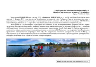
1. Георадарное обследование дна озера Чебаркуль.
Шесть лет после падения метеорита «Челябинск».
Проект РФФИ 18-02-00185.
Экспедиция ИЗМИРАН при участии ООО «Компания ВНИИСМИ» с 24 по 28 сентября обследовала место
падения 15 февраля 2013 года фрагмента Челябинского метеорита в озеро Чебаркуль. Задача экспедиции состояла в
дистанционном обследовании участка дна в месте падения через 6 лет после события. Первая экспедиция ИЗМИРАН на
озере Чебаркуль работала 12-13 марта 2013 года. Георадарное обследование выполнялось с поверхности льда.
Экспедиция 2019 года повторила георадарные исследования по тем же направлениям и профилям, как и в первой
экспедиции. Положение георадарных профилей, их начальные и конечные точки на местности определялись с помощью
«GPSmap Garmin 62s» по координатам первой экспедиции и космоснимка Google Earth (рис. 1). Работы проводились с
поверхности воды с использованием специальных водных чехлов (фото 3). И в первом и во втором случае обследования
проводились низкочастотным георадаром Лоза-1Н с 3-х метровыми антеннами (центральная частота 50 МГц) и
передатчиком 10 кВ. Основная площадка обследования была выбрана в соответствии с реконструкцией пути фрагмента
метеорита Челябинск после взрыва до падения в озеро Чебаркуль.
Фото 1. Участники экспедиции перед началом работ (25.09.19).
2. Фото 2. Космоснимок места падения (февраль 2013 г).
Условные обозначения:
трасса падения
фрагмента метеорита (~ 285◦
).
(1) – точка на расстоянии 40 м от
центра полыньи по оси падения.
(2) - точка на расстоянии 80 м от
центра полыньи по оси падения.
Пр. Р708.
Пр. Р702.
Пр. Р706.
Для сравнения с результатами георадарного обследования 2019 года были выбраны из архива экспедиции марта 2013 года
три профиля (Р702, Р706 и Р708), которые совпадали с положением профилей съемки 2019 года. Профиль Р702 был выполнен по
оси падения фрагмента метеорита через центр полыньи. Профили Р706 и Р708 были выполнены параллельно профилю Р702 на
расстоянии 20 метров севернее и южнее (фото 2).
3. 1
Ц
2
На рисунке 1 приведено 3D представление рельефа дна через
месяц после падения метеорита построенное по данным профилей
Р701 – Р708 георадарной съемки 2013 года. В рельефе дна
регистрируются две обширные «ямы» на расстоянии 40 и 95
метров от проекции полыньи на дно в направлении падения
метеорита. Нарушений поверхности дна под полыньей не
зарегистрировано [1-4].
Полынья и ее
проекция на дно озера
Рис 1. 3D (Р701-Р708).
(2013г).
55 м
40 м
Направление «входа»
фрагмента метеорита.
4. Пр. 08.
Пр. 09.
Пр. 10.
Пр. 11.
Пр. 12.
Основная часть георадарного обследования 2019 года состояла из пяти георадарных профилей (пр-08, пр-09, пр-10, пр-11,
пр-12). Профиль (08) был выполнен по оси падения фрагмента метеорита через центр полыньи, точки (1), (2) и совпадает с
положением профиля Р702 2013 года. Профили (09) – (12) были выполнены параллельно профилю (08) на расстоянии 20 и 40
метров севернее и южнее его (фото 3).
Фото 3. Космоснимок места падения (сентябрь 2019г).
5. Фото 4. Плавающие чехлы антенн георадара.
Георадарное обследование проводилось с помощью 3-х метровых антенн с центральной частотой 50 МГц, размещенных в
специальных плавающих герметичных чехлах (фото 4). Антенны георадара располагались последовательно. Приемник георадара
находился на первой (ближней к лодке) антенне. Блок регистрации находился в лодке. Регистрация проводилась в
автоматическом режиме: одно измерение в секунду. Результирующий пространственный шаг измерений – 30÷50 см. Временная
развертка 1024 нсек.
6. 2 1 Ц
Рис 2. Р702
(2013г).
Рис 3. Пр.08
(2019г).
1. Георадарные сечения Р702 (2013г) и пр. 08
(2019г) выполнены по профилям, проходящим через
центр полыньи (ц) и точки (1) и (2) (фото 2 и 3).
Данные зондирований обработаны в одной и той же
программе с одними и теми же настройками и в
одинаковом масштабе.
Георадарные данные 2013 года регистрируют
аномальные нарушения в донных отложениях,
глубиной до 4-5 метров. Первое нарушение (точка (1))
регистрируется на расстоянии ~ 40 метров от центра
полыньи (точка (ц)). Второе – расположено на
расстоянии 80-90 метров от полыньи и имеет меньшие
размеры (точка (2)) (рис.2). На георадарном сечении
пр. 08 (2019) никаких аномальных нарушений
поверхности дна не зарегистрировано (рис. 3). За
шесть лет со дня падения метеорита «Челябинск»,
течения и движение иловых отложений скрыли все
последствия удара метеорита о дно озера. Особый
интерес представляет аномалия (Л) на профиле Р702.
Это лед, захваченный метеоритом (рис. 2).
Анализ георадарных данных.Л
7. Рис 5. Пр.09
(2019г).
Рис 4. Р708
(2013г).
2. Георадарные профили Р708 (2013г) и профили 09 и
10 (2019г) выполнены на одном и том же участке, на 20 и 40
метров севернее оси падения метеорита (фото 2 и 3).
Данные зондирования обработаны в одной и той же
программе с одними и теми же настройками и в одинаковом
масштабе. Георадарные данные 2013 года отражают
состояние поверхности дна на расстоянии около 20 метров
от трассы. Следов падения метеорита по профилю не
зарегистрировано. Профиль отражает северную периферию
зоны контакта метеорита с дном озера Чебаркуль (рис. 4).
На георадарных сечениях пр. 09 и 10 (2019г) никаких
аномальных нарушений поверхности дна не
зарегистрировано (рис. 5 и 6). За шесть лет со дня падения
метеорита «Челябинск», течения и движение иловых
отложений скрыли все последствия удара метеорита о дно
озера.
Рис 6. Пр.10
(2019г).
2 1 Ц
2 1 Ц
8. Рис 7. Р706
(2013г).
Рис 9. Пр.12
(2019г).
3. Георадарные профиль Р706 (2013г) и профили 11 и
12 (2019г) выполнены на одном и том же участке южнее
оси падения метеорита (фото 2 и 3). Данные зондирования
обработаны в одной и той же программе с одними и теми
же настройками и в одинаковом масштабе. Георадарные
данные 2013 года отражают состояние поверхности дна на
расстоянии около 20 метров от трассы падения по профилю,
Следов падения и аномальных нарушений поверхности дна
не зарегистрировано. Профиль отражает южную периферию
зоны контакта метеорита с дном озера Чебаркуль (рис. 7).
На георадарных сечениях пр. 11 и 12 (2019г) никаких
аномальных нарушений поверхности дна не
зарегистрировано (рис. 8 и 9). За шесть лет со дня падения
метеорита «Челябинск», течения и движение иловых
отложений скрыли все последствия удара метеорита о дно.
Рис 8. Пр.11
(2019г).
Ц12
2 1 Ц
9. 2 1 Ц
Рис 10. Р702
(2013г).
Рис 11. Пр.08
(2019г).
5. На рисунке 11 представлен результат
обработки данных по профилю 08 с помощью ВЧ
фильтрации в режиме выделения максимумов и
минимумов сигнала. Специальные методы обработки
позволили выделить локальный объект (3) в
окрестности точки (1). Точка (1) расположена в
центре самых больших нарушений поверхности дна
озера в месте первого контакта метеорита с дном
озера (рис. 9 и 10). Выделенный объект по
характеристикам своего положения и размерам, с
большой вероятностью, может представлять собой
фрагмент метеорита «Челябинск». На других
георадарных профилях, выполненных южнее и
севернее оси падения, подобных локальных объектов
не обнаружено. Глубина залегания локального
объекта от поверхности дна -3,5 ÷ 4,0 метра.
3
10. Заключение:
Аномальные нарушения поверхности донных отложений озера Чебаркуль (глубиной до 4÷5 метров), связанные с
контактом метеорита Челябинск с дном озера, на момент съемки в сентябре 2019 года (через 6 лет) не
зарегистрированы. Результаты георадарной съемки показали, что все неровности дна озера выровнены и заполнены
илом.
Специальные методы обработки позволили выделить локальный объект (3) на рис. 11 в окрестности зоны самых
больших нарушений поверхности донных отложений в месте первого контакта метеорита с дном озера. Выделенный
объект по своему положению и размерам, с большой вероятностью, может представлять собой фрагмент метеорита
«Челябинск».
Это заключение носит предварительный характер и требует дополнительных исследований.
В проведении экспедиции в сентябре 2019 года принимали участие:
Попов А.В., Морозов П.А., Прокопович И.В. и Морозов Ф.П.
Активное участие в проведении и обеспечении экспедиции принимал Корольков Е.В..
В отчете использованы георадарные данные экспедиций 2013 года, в которых принимали участие
Копейкин В.В., Воровский П.Л. и Меркулов С.В.
Георадар «Лоза-Н» и плавающие герметичные чехлы для проведения измерений в Чебаркульской экспедиции
предоставлены «Компанией ВНИИСМИ».
Подготовка материалов отчета:
Морозов П.А., Андрющенко В.В.
02.12.2019
1. В.Б. Бузин, Д.Е. Едемский, С.А. Гудошников, П.А. Морозов, А.В. Попов, И.В. Прокопович, В.С. Скомаровский, Н.Н. Мельник, А.И.
Беркут, С.В. Меркулов, П.Л. Воровский, Л.А. Боголюбов. Поиск фрагментов метеорита «Челябинск» в грунте дна озера Чебаркуль
(георадарные и магнитометрические данные). В сб. "Электромагнитные процессы от недр Солнца до недр Земли», т. 2, с. 134-152. М.,
ИЗМИРАН, 2018.
11. 2. Buzin V., D. Edemsky, S. Gudoshnikov, V. Kopeikin, P. Morozov, A. Popov, I. Prokopovich, V. Skomarovsky, N. Melnik, A.Berkut, S. Merkulov,
P.Vorovsky, L.Bogolyubov. Search for Chelyabinsk meteorite fragments in Chebarkul Lake bottom (GPR and magnetic data). //Journ. Telecom.
Informat. Technology, No 3, pp. 69-78, NIT, Poland, 2017. ISSN 1509-4553, DOI: 10.26636/jtit.2017.120817.
3. В.В.Копейкин, В.Д. Кузнецов, П.А.Морозов, А.В. Попов, А.И. Беркут, С.В. Меркулов, В.А. Алексеев. «Георадарное обследование места
падения фрагмента метеорита Челябинск», Сборник Всероссийской научной конференции «Метеорит Челябинск – год на Земле», с. 286-293,
Челябинск, февраль 2014.
4. В.В. Копейкин, В.Д. Кузнецов, П.А. Морозов, А.В. Попов, А.И. Беркут, С.В. Меркулов, В.А. Алексеев. Георадарное обследование
предполагаемого места падения фрагмента метеорита Челябинск в озеро Чебаркуль. Геохимия, № 7, с. 636-642, 2013.