Downloaded 46 times
![Roma Hewlett [All instruction in this presentation pertains to Google Earth version 4.2]](https://image.slidesharecdn.com/google-earth-tools-for-teachers-1210329124977465-8/85/Google-Earth-Tools-For-Teachers-1-320.jpg)


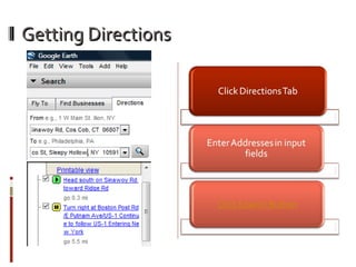

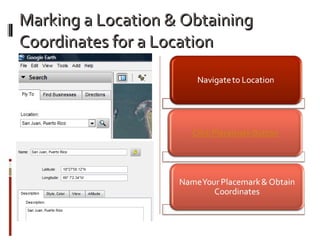
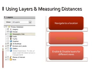
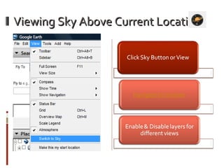
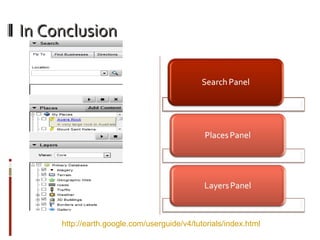
This document provides instructions for using various navigation and measurement tools in Google Earth version 4.2, including how to fly to a location, find a business, get directions, use navigation controls like the joystick and zoom slider, mark locations and obtain coordinates, use layers and measure distances, view the sky above a location, and concludes with a link to more tutorials.


