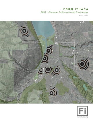
1. F O R M I T H A C A
PART 1: Character Preferences and Focus Areas
M a y 2 0 1 5
2. This report summarizes the Form Ithaca Workshop hosted January 16, 2015,
at the Tompkins County Library — plus field research, meetings, and design
and planning work that occurred both before and after the Workshop.
Form Ithaca is an initiative to help support the ongoing efforts of the City
and Town of Ithaca, New York, to update land use regulations to meet the
goals and objectives of their comprehensive plans.
The project supports a full range of housing and lifestyle options within a
framework that facilitates transportation choice, a reduction in greenhouse
gas emissions, and a strong economy for the region.
This report delves into the character of Ithaca’s neighborhoods, what aspects
resonate with Workshop participants, and how they could be supported
with land use regulations. In addition, the report explores focus areas for
development and places that could use special attention from a new code.
The New York State Energy Research and Development Authority is funding
Form Ithaca with matching resources from the Park Foundation, the City,
and the Town.
Because Ithaca’s success will come, partly, from how land use regulations and
development shape the community, this project offers exciting opportunities
for the City and Town. I feel privileged to be part of the Form Ithaca team
and I look forward to more community comments and participation as we
move forward
Consultant Team:
Better! Cities & Towns
Robert Steuteville CNU-A
Katie Stoner
Randall+West Planners
CJ Randall LEED ND
David West LEED AP
STREAM Collaborative
Noah Demarest AIA, RLA, LEED AP
Key Advisors:
Seth Harry and Associates
Sandy Sorlien
Jessica Millman
Chuck Banas
Chris Hawley
3. | 3
Why character is
important to Ithaca
The “character” of Ithaca’s neighborhoods are key to their appeal. Character shapes
people’s activities and daily lives—such as how often they walk or ride a bike to destinations,
and how often they use car-share or transit. Zoning and land use regulations shape the
physical components of neighborhoods that contribute to character. Understanding how
zoning affects character is therefore critical to quality of life and the future of Ithaca.
The character of a place is often equated
with specific architectural elements, a
particular historical style, or the manner
in which a single use predominates
an area. While these elements are
important, character is also shaped by
the relationship of buildings to streets.
Most importantly, the way buildings,
yards, sidewalks, street trees and
street widths create public space and
“outdoor rooms” defines character
and creates places where people live,
work, and play.
Placemaking and
Local DNA
Placemaking is the art and craft of
making people-centered public spaces.
Creating unique places based on local
history, community assets, culture and
enterprise has measurable positive
impacts on social interaction, public
health, and economic stability.
Ithaca has a rich urban fabric and our
neighborhoods have a strong sense of
pride and place. Buildings, sidewalks,
street trees, roadways and blocks work
together to create a public realm that
is pleasant and inviting. Understanding
exactly how these elements work together
in Ithaca is important in considering
how to preserve the uniqueness of
existing neighborhoods and shape
future neighborhoods.
Most of the City of Ithaca’s neighborhoods
were developed prior to the proliferation
of cars, and the dramatic changes
in planning that came into fashion
in the mid-20th century. Most of our
neighborhoods also predate zoning and
were built before the financial industry
made it easy for developers to build
large swaths of homes at the same
time. As a result, these neighborhoods
are walkable and compact. Diverse
residential buildings are located near
shops, restaurants, and other businesses.
In cooperation with the city and town of
Ithaca, Form Ithaca hosted a Community
Character Workshop on January 16. At
this event, Ithacans worked together
to understand the past, present, and
future of their neighborhoods. The
purpose was to gather community input
to help write a code for the city and
town based on community character.
We are using the SmartCode, the most
frequently used “form-based code,” as
a basis. The SmartCode is calibrated
Ithaca has a rich urban fabric and our
neighborhoods have a strong sense of
pride and place.
4. 4 | F O R M I T H A C A
Creating zoning that reflects each neighborhood’s
unique development pattern will protect and
preserve neighborhood character.
5. | 5
to local conditions based on physical surveys of
Ithaca’ neighborhoods, paying special attention to
places that Ithacans find most appealing. Surveys
document residential densities, block sizes, lot widths,
thoroughfares (including posted speed limit), civic
spaces, lot occupation, setbacks, public and private
frontages, and building shape, size, function, and
disposition. The measurements help to define Ithaca’s
DNA; which in turn can shape a zoning code that
allows the built environment to reflect both historic
character and shared aspirations.
Ithaca is made up of neighborhoods
Ithaca is a collection of neighborhoods: places with
their own character and culture. Neighborhoods
have changed in character over the years. Many of
the small shops that used to be scattered throughout
the neighborhoods have disappeared, replaced by
national chains along Route 13 and other locations.
Manufacturing in neighborhoods, such as Morse
Chain, Ithaca Gun, and Ithaca Calendar Clocks, has
declined as well. However, many small businesses
still thrive in the community and other forms of
mixed-use, such as schools and churches, thrive.
Neighborhoods are coming back in many ways.
As technology increasingly allows people to work
remotely from or near their homes, the market for a
car-free or “car-lite” lifestyle is growing.
Studying and understanding Ithaca from a neighborhood
perspective allows a nuanced approach to guiding
future development and redevelopment. We can
identify key opportunities to reintegrate amenities
and housing choices into appropriate locations with
sensitivity to the unique context of each place.
Impact of zoning on character,
community, and performance
Zoning regulates what kinds of buildings can be
built in a particular area, how tall they can be, the
sizes of lots that are allowed, what parts of a lot
can be covered and what uses are allowed. Since
Ithaca has great neighborhoods, one may assume
that the zoning that shaped those neighborhoods is
great, but that is not necessarily the case. Most of
Ithaca’s neighborhoods and the features that make
up their unique character were designed and built
before zoning.
When zoning was developed, starting in the 1920s
but really taking hold in the mid-20th Century, city
leaders sought to retrofit the historic neighborhoods
with more “modern,” car-oriented development.
Zoning was enacted to remove commercial and
industrial uses from neighborhoods. Diverse amenities
within walking distance were not prioritized because
automotive transportation was viewed as the inevitable
wave of the future. Zoning was also used to separate
housing types and classes in a hierarchy. Single-family
homes are allowed almost everywhere, duplexes are
allowed in fewer places, and multifamily buildings are
limited to fewer areas still—with added restrictions.
Commercial and business development is separated
from most neighborhoods, though many people are
unaware of this because there is so much that has
been “grandfathered” into existing locations.
Because current zoning was originally intended to
make neighborhoods more car-friendly, it includes
provisions that negatively affect walkability and
character when new development does occur. Setbacks
are one example. Historic development of walkable
human scale streetscapes has very small setbacks;
yet, zoning in Fall Creek, Southside and Northside
requires that new development be set back from the
Source: Esri, DigitalGlobe, GeoEye, Earthstar Geographics, CNES/Airbus
DS, USDA, USGS, AEX, Getmapping, Aerogrid, IGN, IGP, swisstopo, and the
GIS User Community
Ithaca Walkable Form
Transect Translation Map
Neighborhood Edge
Urban Neighborhood
Main Street
Regional Center
Civic
Park
Mixed-use, walkable neighborhoods
typically measure a quarter mile from center
to edge, a distance that is called a “pedshed.”
The map above shows pedsheds in Ithaca’s
walkable areas, color-coded by type.
6. 6 | F O R M I T H A C A
street significantly more than the surrounding historic
buildings. Imposing deeper setbacks weakens the
sense of an “outdoor room” as new buildings replace
the old. Minimum lot sizes are also problematic. Most
City and all Town residential zones require lots that
are much larger than the fabric of the community’s
historic neighborhoods. Traditional neighborhoods
have a variety of lot sizes, creating different housing
opportunities for people with different needs. When
large, uniform lot sizes are required, infill sites
become more difficult to develop and new greenfield
development lacks the diversity and character that
makes historic neighborhoods attractive.
At the January 16, 2015 workshop, the consultant team
used interactive tools like brainwriting, pedestrian
shed delineation, and zoning character ‘trading
cards’ to enable participants to visualize and respond
to how the community is changing. The interactive
tools helped the participants understand metrics—
like density, housing and transportation costs and
diversity, and GHG emissions per household — of
various forms of growth.
Reflecting community values
The SmartCode helps address the community goals
of a reduction in GHG emissions and vehicle miles
traveled, preservation of farmland and nature, and
increased tax base. Consultant engagement with
the city’s comprehensive plan committee allows for
a holistic, integrated, and value-added approach.
The City of Ithaca Comprehensive Plan draft Future
Population Scenarios forecasts the current 2010 city
population rising from 30,014 to 46,240 by 2035, an
increase in the city’s share of the county’s population
from 29.6 percent to 40 percent. This corresponds
with the Regional Sustainability Plan’s Land Use
target of increasing the proportion of Southern Tier
residents who live in existing cities and villages.
The Town of Ithaca adopted a new Comprehensive
Plan in September, 2014. The plan calls for preservation
of the Town’s rural character through compact,
mixed-use growth in three areas—one each on East
Hill, South Hill, and West Hill.
0 0.50.25 Miles
¯
Buildings in red could not
have been built
under today's zoning code.
Ithaca Building Footprints -- Lot Coverage Violations
Randall-West 2013 -- NY Central State Plane
Most of Ithaca’s
neighborhoods would not
be allowed under current
zoning.
This map represents buildings that
exceed the allowed lot coverage in
residential zones, this is just one of
many zoning parameters that conflict
with the built environment that
Ithacan’s love.
7. | 7
Mixed-use Main Street buildings create value
and a sense of community, but they are not
allowed in most neighborhoods because of
outdated zoning.
8. Working together,
participants
weigh in on which
development
types contribute
positively to Ithaca’s
unique character
and sort cards
by development
intensity.
8 | F O R M I T H A C A
The SmartCode is a tool for preserving existing character and directing
the new growth in a way that enhances community character.
One of the SmartCode’s strengths as an open-source zoning tool is its ability to be adjusted to reflect and
respond to local character. The SmartCode is based on the Transect, a system to analyze and code land use
patterns on a rural-to-urban continuum. A prototypical American rural-to-urban transect has been divided into
six Transect Zones, or T-zones. This zoning system replaces conventional separated-use zoning systems that
have encouraged a car-dependent culture and land-consuming sprawl. Parking lots and garages are placed
away from the street and the mix of housing styles, types, and sizes allows for walkability and connectivity.
The overall goal of the workshop was for participants to gain a thorough understanding of the project and
how they can be involved.
Workshop
9. | 9
Pre-Workshop Activities
We invited the planning, zoning, and sustainability staff
from the City and Town of Ithaca to a pre-workshop
staff retreat in downtown Ithaca on December 12.
The retreat was well-attended by the respective
City and Town departments, and offered a chance
for staff to interact and discuss big-picture planning
ideas in an organized but informal atmosphere. After
a bus tour around the city and town to examine local
examples of development patterns and building
types, staff gathered around a large combined
zoning map to consider focus areas for SmartCode
implementation. SmartCode author Sandy Sorlien of
Philadelphia, Pennsylvania, presented examples of
how the SmartCode has been implemented across
a variety of locales nationwide. Earlier in November,
SmartCode retail module author Seth Harry visited
Ithaca for a meeting with the Form Ithaca team to
evaluate Ithaca’s retail landscape and potential
future development.
10. 1 0 | F O R M I T H A C A
Workshop Participation
We used many methods of participation during the
workshop, including a process where participants
were asked to become familiar with the characteristics
of existing Ithaca neighborhoods and building types.
Another process asked participants to reply to a series
of three placemaking questions using “brainwriting.”
Brainwriting builds on the brainstorming process by
removing fear of evaluation through eliminating the
step by which participants publicly state ideas one
at a time. Participants are focused on the questions
presented rather than extraneous chat. Workshop
attendees were asked to quickly (within two minutes)
write down their ideas on three separate index
cards about three pre-selected questions: 1) What
are your favorite places in the community and why?;
2) What’s missing from Ithaca? – Draw on some of
your favorite places around the country and world;
3) What are areas in the community you feel need
some work? (Participants turned their answers in
and we compiled feedback from these questions;
that information is available below under the section
‘Lessons Learned.’) A brief discussion followed, based
on what the participants wrote on the cards.
Planning and development ‘trading
card’ activities
We created two sets of planning and development
trading cards: a set of building typology trading
cards and a set of neighborhood unit trading
cards.
Building typology trading cards illustrated the
characteristics of building types common in Ithaca.
Each 3½” x 5” building type trading card included
the name of the neighborhood prominently placed at
the top left hand corner along with a plan view map
with amenities and diverse uses highlighted. Statistics
included lot size; lot coverage; frontage length;
front setback; stories; and housing units. To create
an interactive planning and zoning experience for
practitioners and the public, we asked participants to
first decide whether the character of the development
was inherently compatible with Ithaca neighborhood
characteristics; after eliminating the building types
not deemed representative of Ithaca, the participants
were asked to assign the remaining trading cards a
Transect zone, following the local T-2 through T-6
nomenclature. We have documented this process
in the following photos:
11. | 1 1
DEVELOPMENT TYPES
What types would you like to see more of in Ithaca?
12. 1 2 | F O R M I T H A C A
Place-based trading cards illustrated the characteristics of
four neighborhoods centered around a pedestrian shed in
and around Ithaca: Deer Run, Northeast Ithaca, Southside,
and the Village of Dryden. Each 8½” x 11” neighborhood
trading card included the name of the neighborhood at the
top left corner along with a plan view map with amenities
and diverse uses highlighted. Running along the right
side of the trading card are four ‘action shots,’ character
photo examples from that neighborhood that illustrate
the building types of the community. Statistics included
population; amenities; dwelling units/acre; Walk Score;
housing and transportation as a percentage of income;
housing diversity; and carbon emissions in tons per
household. To create an interactive planning and zoning
experience for both practitioners and the public, we then
clipped the pedestrian shed from the neighborhood trading
cards for workshop participants to use as hypothetical
overlays on areas of Ithaca targeted for redevelopment.
We documented this process:
Both the neighborhood and building type “trading cards”
engaged the participants, who were split up into four
large (8+ person) tables, for about an hour and a half. We
received helpful verbal and written feedback from these
activities. Participants followed up with suggestions, like
the following example, that inform our plans for expanded
and targeted participation: “When we looked at the different
building types, we were only shown examples already
within Ithaca. I suggest that you consider inclusion of types
that we currently don’t have, or have in just small supply,
such as: townhouses/row houses; low-rise 4-plex or 6-plex
styles; “woonerf” styles where the “road” is more like a
shared driveway.”
Deer Run
Population: 424
Amenities: school, park
DU/acre: 1.6
Walk Score: 6,
Car-Dependent; alm
ost all
errands require a car.
Housing: 34% of income
Transportation Costs:
32% of income
Housing & Transportation:
66% of income
Housing Diversity:
duplexes,
single
family
homes
GHG: 10.35 tons per year/
household
Northeast Ithaca
Population: 647
Amenities: park
DU/acre: 2.1
Walk Score: 1,
Car-Dependent
Housing: 30% of income
Transportation Costs:
30% of income
Housing & Transportation:
60% of income
Housing Diversity:
triplex, duplexes, single
family homes
GHG: 10.36 tons per year/
household
Dryden
Population: 687
Amenities: grocer, coffeeshops, schools, restaurants,bars, pharmacy, library,shipping
DU/acre: 2.75
Walk Score: 57,Somewhat WalkableSome errands can be ac-complished on foot.
Housing: 20% of incomeTransportation Costs:34% of income
Housing & Transportation:54% of income
Housing Diversity:apartments, duplexes, sin-gle family homes
GHG: 10.17 tons per year/household
Southside
Population: 1,472
Amenities: grocers, coffee
shops, schools, restaurants,
bars, pharmacy, library,
park, entertainment
DU/acre: 6Walk Score: 86,
Very Walkable
Most errands can be
accomplished on foot.
Housing: 23% of income
Transportation Costs:
24% of incomeHousing & Transportation:
47% of incomeHousing Diversity:
apartments, duplexes, sin-
gle family homes
GHG: 6.12 tons per year/
household
13. | 1 3
Feedback
Participants provided comments and questions after
the workshop via email, such as the comment in the
previous paragraph. The next event will be a “charrette”
or intense multi-day planning workshop to be held in
early June of 2015. During this event we plan to identify
missing development forms and include measured
character examples from other places.
The following is participant feedback collected from
the “brainwriting” index cards:
The Route 13 corridor is both a problem and opportunity,
according to citizens and stakeholders. The waterfront,
Stewart Park, Cass Park, the Waterfront Trail, the Ithaca
Farmer’s Market, and important stores like Wegman’s
are located on the west side of the highway. Most
residents live on the east side. “Barriers like Route
13 need to be overcome,” says one resident. “Better
crossings could weave communities together.”
In our informal survey, Route 13 was frequently cited as
a problem and an opportunity for growth. “The Route
13 corridor doesn’t have to be suburban form—it could
be more urban, pedestrian-oriented,” and “Route 13
shopping could be more mixed-use and walkable,”
are typical comments.
By making the road more pedestrian friendly, residents
would be connected to the city’s greatest natural asset,
the lake. Residents call for “lakefront access,” an “urban
waterfront,” “restaurants on the water,” “waterfront
neighborhoods,” and a “waterfront district with cafes/
bookstores/mixed-use, and the density to make that
happen.” Says one resident, “I miss having a good
connection to the lake.”
The West End, where Route 13 is split into Meadow
and Fulton streets, “could be cool some day. It has a
ton of potential but is so pedestrian unfriendly.” Inlet
Island is underutilized.
The coordination, and quantity, of traffic lights may add
to automobile congestion. One resident of West Hill
notes that “when the signals are out, traffic flows better.”
Downtown is a favorite place for many Ithacans. The
Commons, Restaurant Row, and the area around Dewitt
Park were singled out as places of particular importance.
Downtown is the community’s chief gathering place.
It’s a primary recreational spot. Much of the day-to-day
businesses is transacted there. But vacant buildings
like the old Tompkins County Library and the Masonic
Temple, and vacant storefronts on The Commons rob
the downtown of vibrancy, many residents feel. The
downtown could be improved with more general retail,
more residents, and more liveliness at night.
Ithaca’s neighborhoods are tremendous assets,
particularly their diverse character, historic homes,
small-scale gathering spots, and walkable scale. More
“third places” and corner stores could improve these
neighborhoods in many cases, residents feel. “There’s
no small commercial gathering place on West Hill—it
needs a Gimme Coffee equivalent,” says one resident.
“South Hill needs a grocery store,” notes another. Many
residents appreciate easy access to small-scale retail
and mixed use, in neighborhoods like Fall Creek and
Northside, and downtown.
Connections on foot and by bicycle are valued in Ithaca.
Residents would like more of these connections in places
like the Southwest, the West End, and across Route
13. Most comments relate in some way to walkability
in neighborhoods, downtown, across corridors, and
connecting to nature.
The waterfalls and gorges are huge assets—particularly
Ithaca Falls, Cascadilla, and Six Mile Creek, which
residents can easily reach in a few minutes on foot.
In the Town of Ithaca, Forest Home is singled out as
Lessons Learned
14. 1 4 | F O R M I T H A C A
Hundreds of responses to the brain writing activity have been archived digitally.
To briefly understand the most significant responses we have created word clouds
of the top 50 responses for Favorite Places and Places That Need Work.
Text size is relative to how frequently each word or phrase was repeated by multiple
respondents. Responses were minimally edited to use consistent language when
referring to the same location, for example Restaurant Row was inserted whenever
a respondent mentioned the block of Aurora St. between State and Seneca.
Places That Need Work
Favorite Places
15. | 1 5
a striking, appealing community. Many cite the natural assets of the town—the farms, The Plantations, and farm
stands— as important. Problems noted include sprawl and limited public access to the lake. East Hill Plaza is an
opportunity for mixed-use development.
The universities are assets to many—particularly East Hill with its intellectual life and adjacent neighborhoods like
the 1920s Belle Sherman area, Collegetown, and gathering places like the Chapter House.
Many residents call for more affordable housing—in particular housing that is integrated into existing neighborhoods
and amenities. Transit access to West Village is problematic, one resident notes. More diversity in housing is missed.
Residents mentioned condominiums, townhouses and rowhouses, bungalows, duplexes and other multiplexes,
stacked flats, and apartments in short supply.
More frequent transit and better connections to outlying areas is desired.
Workshop participants rated places
highly when they had:
Shallow Setbacks
Small Lots
High Lot Coverage
Pedestrian Scale Detail
Neighborhood Retail
Walkable Streets
Relatively Dense and Diverse Housing
Workshop participants rated places
poorly when they had:
Off street parking along the sidewalk
Deep Setbacks
Large Lots
Low Lot Coverage
Monoculture Development
Auto-Dependent Strip Retail
Examples of Positive Character
16. 1 6 | F O R M I T H A C A
Mixed-use development focus areas
The project team used a multifaceted approach to create
the map of development focus areas. These are the areas
of the City and the Town where mixed-use development
is desired and most likely to occur—and therefore are
places of special attention for code reform. In this report,
the mixed-use development focus areas map is a draft—
subject to refinement, if necessary, based upon further
input from citizens and community leaders.
The city’s draft Comprehensive Plan and the Town’s
adopted Comprehensive Plan are the documents that
set the parameters for this work. The city’s plan calls for
significant mixed-use growth in its existing mixed-use
centers of downtown (including the State Street corridor),
and Collegetown. Additional mixed-use growth is called for
along the Route 13 corridor from Southwest to the waterfront
area. The town’s plan calls for areas of higher density on
East Hill near Cornell University and South Hill near Ithaca
College, and medium density walkable development on
West Hill, some adjacent to Cayuga Medical Center, the
county’s fifth largest employer.
The team conducted field research with mixed-use
development expert Seth Harry, who was active in the
January 16 workshop. In addition, a bus tour on December
12 with City and Town planning staff toured potential areas
of growth and focus areas for SmartCode implementation.
During the January Workshop, participants placed
hypothetical overlays of four different development
patterns, two mixed-use and two single-use. Participants
overwhelmingly preferred the mixed-use patterns, one
lower intensity and one higher intensity.
In the map at right we see the outcome of this process.
The gray areas are the existing urban centers of downtown
and Collegetown. The black concentric circles are eight
potential mixed-use focus areas—four are in the city, three
are in the town, and one is shared between the city and
the town.
1) East Hill Plaza. This high-intensity mixed-use focus area
is adjacent to Tompkins County’s major employer, Cornell
University. Cornell has located some of its facilities in this
shopping area that includes a supermarket and other
neighborhood-serving shops, businesses, and restaurants,
and a hotel. This area could be transformed into a walkable
urban center with a significant residential component.
2) Chain Works District. This lower-intensity mixed-use
focus area is centered on the redevelopment of Ithaca’s
largest former industrial site, a prime location between
downtown and Tompkins County’s second largest employer,
Ithaca College.
3) Danby Road and King Road. This lower-intensity focus
area is centered on an important gateway to the community
near Ithaca College.
4) Cayuga Medical Center. This lower-intensity mixed-use
focus area is adjacent to the county’s fifth-largest employer.
5) Waterfront District. This higher-intensity mixed-use area is
among the most promising sites for development in the city,
centered along the waterfront and Route 13. The attention of
Workshop participants gravitated to this area.
6) Inlet Island/West End. This area already has significant
mixed-use and is becoming more diverse. Workshop
participants viewed this area as having tremendous potential
for higher-intensity mixed-use development.
7) Meadow Street/Old Elmira Road. This commercial area
is beginning to attract new development and is an area
where the city’s draft Comprehensive Plan calls for more
residential. The city recently invested in streetscape
infrastructure along Old Elmira Road.
8) Southwest Development Area. This area behind Walmart
and Lowe’s has long been slated for development.
This map provides a framework for the SmartCode process
but also, potentially, clarifies future development patterns
in Ithaca’s urbanized area in a way that could guide
infrastructure investment that boosts quality of life.
17. MIXED-USE DEVELOPMENT
FOCUS AREAS
City and Town of Ithaca, NY
Town of Ithaca
1. East Hill Plaza
2. Chain Works District
3. Danby/King Road Intersection
4. Cayuga Medical Center
City of Ithaca
2. Chain Works District
5. Waterfront District
6. Inlet Island/West End
7. Meadow Street/Old Elmira Road
8. Southwest Development Area
LOWER INTENSITY
MIXED-USE FOCUS ARE A
0 MILES
1/4
1/2
HIGHER INTENSITY
MIXED-USE FOCUS AREA
0 MILES
1/4
1/2
EXISTING MIXED-USE
0 MILES
1/4
1/2
1
2
3
4
6
78
5
18. 1 8 | F O R M I T H A C A
Plans for expanded and targeted participation
The next major event in the development of a better zoning code for the
City and Town of Ithaca will be a 4-day long intensive “charrette” focused
on key areas for the new mixed-use centers that were identified in the
January 16th Community Workshop. The charrette is a dynamic collaborative
process that brings together representatives from a mix of established
planning, architecture, engineering, and development disciplines. This
process is open to all members of the community, regardless of expertise.
It helps to bring out the generalist in practitioners, and gives the public
the benefit of expert opinion in an open, inclusive forum.
A charrette is divided into two phases: creative phase and the production
phase. The creative phase includes a host of community engagement
techniques including a welcome message from the city mayor and town
supervisor, respectively, prior to presentations giving an overview of the
entire project process and important existing conditions. We anticipate that
the charrette will be held at a highly visible public location refashioned
as a ‘studio.’
In the lead up to the charrette, the Form Ithaca Team will be meeting
frequently with neighborhood groups and other local organizations.
These meetings are an opportunity to build support for better zoning
and a chance for the team to hear concerns and new ideas that can be
incorporated into the code. Form Ithaca will be working closely with city
and town staff to develop draft definitions of each zone based on the
historic fabric of Ithaca’s neighborhoods. These definitions will be the
starting point for more specific urban design and planning work for new
and existing neighborhoods during the charrette process.
Once we have a draft code, Form Ithaca is planning a ‘Crack the Code’
event, where the public and planning design practitioners are invited to a
public event to test the worst development possible under the proposed
guidelines. Participants will be encouraged to ‘crack the code’ – to find
gaps in the existing and proposed zoning code that permit undesirable
community character. This participation helps further the production of a
feasible, working code developed in an engaging, transparent, interactive,
and even fun environment. It allows for the public review of the zoning
code’s strengths and weaknesses and promotes the assessment of the
code in relation to the respective comprehensive plans.
Presentation of character examples alongside the code increases
confidence that the renderings are representative examples of what may
actually get built. Examination of the proposed zoning on a constrained
site, balanced alongside factors such as market conditions, is essential
in a project that seeks to connect sustainability metrics to fundamental
aspects in design of the built environment.
Next Steps
20. Share your thoughts
There are a number of ways you can ask questions and share
your thoughts about the Form Ithaca project, including sending us
a message or contacting your local municipal planning staff and
representatives.
Better Cities & Towns
Robert Steuteville, Executive Director
(607) 275-3087 mail@newurbannews.com
Better Cities & Towns
218 Utica St.
Ithaca, NY 14850
You can also call or write your local planning staff and/or
representatives:
Town of Ithaca
Susan Ritter, Director of Planning
(607) 273-1736 x120
Town Hall
215 North Tioga St
Ithaca, NY 14850
City of Ithaca
JoAnn Cornish, Director of Planning & Economic Development
(607) 274-6550
City Hall
108 E. Green Street
Ithaca, NY 14850
Project Schedule:
June 3-6, 2015
Focus Area Planning Charrette
September 2015
Consultant Presentations to City and Town
December 2015
Anticipated City Common Council and Town Board formal acceptance
of draft zoning report
Early 2016
Formal municipal review process of re-zoning gets underway