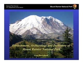
The document is about Mount Rainier National Park. It contains information from the National Park Service and U.S. Department of the Interior. Specifically, it details the geological history of Mount Rainier, including periods where the mountain was glacier free with different flora present at higher elevations. It also discusses the earliest human use of the area around 9,000-9,500 years ago and how fire frequency increased after 3,500 years ago likely due to human ignition to maintain more open parkland habitats.
This document outlines Washington State Parks' strategy for transforming its operations in response to declining state funding. It discusses the challenges of reduced tax support since 2009 and the need to deliver a strategic plan, self-support report, legislative agenda and budget by 2013. Three alternative themes are presented: Parks as an Enterprise, Parks as a Community Non-Profit, and Parks as a Public model. Feedback from stakeholders is sought to help shape the future of State Parks.
The document provides information about the Nisqually Delta and surrounding areas in Washington state. It discusses how the delta formed 15,000 years ago and was originally inhabited by the Nisqually Indians. It describes the land purchases and dike construction in the early 1900s to reclaim delta lands for agriculture. It also outlines how the delta was later protected through the establishment of the Nisqually National Wildlife Refuge in 1974 to preserve the habitat.
This plan, written under the guidance of the Model Forest Policy Program's Climate Solutions University (CSU), aims to analyze and address climate related threats to forests, water and people in the Nisqually Watershed. The over-arching goal is to increase resiliency of the watershed against current and future climate impacts.
The Puget Sound Pressures Assessment is a ranked list of pressures impacting the health of Puget Sound. Scott Redman, of the Puget Sound Partnership, presented on the PSPA at the February NRC meeting.
Chris Ellings presented the Nisqually new projects, as required by the SRF Board process, at the May 2015 meeting. The list did not require approval at this meeting.
Funding Mechanisms for Restoring and Maintaining a Healthy Nisqually WatershedNisqually River Council
In a follow-up to their 2009 Report, Earth Economics produced these recommendations for using ecosystem services to support conservation efforts in the Nisqually Watershed. Earth Economics worked closely with stakeholders in the watershed to develop the report.
Sarah Hamman (Center for Natural Lands Management) presented on a recent research project aimed at using multiple eradication methods to remove reed canary grass from sites along Muck Creek on JBLM. Sarah presented at the January 2017 NRC meeting.
The document discusses a pilot project to test a new mobile biofiltration system for managing stormwater runoff from Highway 7 into Ohop Creek in Washington. The system was installed in January 2022 to capture and filter runoff, collecting water quality samples during rain events to test the effectiveness of removing contaminants harmful to salmon. If successful, the relatively inexpensive and scalable system could help address a major threat to salmon recovery from increasing stormwater pollution due to growing traffic volumes. The results will inform whether wider use of the technology could help prevent harmful chemicals from polluting salmon streams.
This document summarizes a study that tracked the origins of juvenile Chinook salmon in the Nisqually River estuary using coded wire tags. The study found that most fish caught came from local Nisqually River hatcheries, but fish also originated from hatcheries in the Green, Puyallup, and Skykomish Rivers. The tagging data provides insights into the fish's migration patterns and survival rates, helping managers evaluate hatchery programs and protect wild salmon populations.
The document summarizes a study of potential improvements to Interstate 5 between Tumwater and Mounts Road in Washington. $550,000 in state and local funds were provided to identify mid- and long-term strategies to address increasing congestion in the area. The study analyzed various scenarios like operations improvements, land use changes, transit expansion, and additional lanes. Performance measures related to travel time, accessibility, and the environment were used to evaluate scenarios. Draft recommendations include prioritizing strategies like land use changes, transit expansion, and travel demand management in the short- and mid-term.
Kayak Nisqually provides sea kayaking tours in the Nisqually Reach and Puget Sound areas. The owner grew up canoeing in Kentucky and has a background in conservation biology. He has years of experience as a sea kayaking guide and working for the USGS on biological research. Currently he partners with local nature centers and wildlife refuges to provide educational kayaking tours that highlight the natural and human history of the area while supporting conservation efforts. He is looking to expand his business by acquiring space and equipment to accommodate larger groups and hire more local guides.
This document summarizes the objectives and approach of Melanie Davis' research on developing dynamic habitat models for estuary-dependent species. The objectives are to: 1) Model changes in restoring habitat mosaics over time, 2) Determine prey availability in each habitat type, 3) Identify prey consumed by juvenile Chinook salmon, and 4) Use a bioenergetics model to estimate habitat quality as the mosaic shifts. The research involves modeling different restoration and climate change scenarios to understand their impacts on salt marsh habitats and prey availability/consumption. Field studies are being conducted to understand prey use by salmon in different habitat types to parameterize the bioenergetics model. The goal is to provide tools to help restoration planning under
Karen Povey is the Conservation Engagement Manager at an aquarium partnership. She lists several South Sound area restaurants that are ocean-friendly. The document then provides statistics from volunteer species monitoring programs from 2014-2018, including the number of participants and species found each year. Tables show purple martin nesting rates from 2014-2018 and frog and salamander observations by life stage. Pika detections from volunteer monitoring efforts increased from 2015 to 2017. The final section provides total bat counts from June and July 2018.
This document contains appendices to the "Nisqually Watershed Response to the 2018 Streamflow Restoration Act". Appendix B contains WAC 173-511, the Nisqually Instream Flow Rule, which establishes instream flows and surface and groundwater limitations in the Nisqually River basin to protect instream resources pursuant to state law. The rule applies waters within the Nisqually River basin and was promulgated to retain perennial rivers, streams and lakes with minimum instream flows and levels.
This document describes various mitigation strategies to increase streamflows in different sub-basins in WRIA 11. It provides details for each strategy such as the sub-basin(s) it would benefit, estimated annual water benefits in acre-feet and cubic feet per second, potential ecological benefits, and uncertainties. Some of the strategies described include connecting new developments to city water to reduce consumptive use, purchasing and retiring water rights, stream restoration projects, forest management projects, stormwater projects, and managed aquifer recharge projects. The document provides a table that summarizes the strategies and estimates their total annual water benefits could range from 2,470 to 8,623 acre-feet.
This document is an addendum to the Nisqually Watershed Management Plan that provides the watershed's response to Washington's 2018 Streamflow Restoration Act. It was prepared by the Nisqually Watershed Planning Unit with assistance from various stakeholders and state agencies. The addendum describes the watershed context and characteristics that influence mitigation alternatives to offset new domestic permit-exempt groundwater withdrawals projected between 2018-2040. It then outlines a variety of habitat restoration projects, land use strategies, and policy options that could provide ecological and instream flow benefits to help the watershed achieve no-net-loss of annual average streamflows.
The document is a planning unit agreement to update the Nisqually Watershed Management Plan per the mandate of ESSB 6091. It establishes the Nisqually Indian Tribe as the lead agency and identifies participating governmental and non-governmental entities. The scope is to estimate impacts of new permit-exempt domestic wells through 2040, identify appropriate mitigation, and develop an addendum to the 2003 watershed plan by February 2019. The agreement sets ground rules for consensus-based decision making and open public participation in the planning unit.
- A study analyzed land use and habitat changes in the lower Nisqually River valley over the past 60 years using aerial imagery from 1957, 1980, and 2015.
- Between 1957 and 1980, riparian forest decreased by 7.7% due to conversion to agriculture. From 1980 to 2015, riparian forest increased 2.3% within a restoration area.
- Upland forest saw minimal loss between 1957-1980 but declined 8.2% between 1980-2015 due to land development.
- Overall forest cover in the study area decreased 8.6% from 1957-1980 and another 5.9% from 1980-2015 through land development, agriculture, and river channel movement.
-
This document summarizes efforts to evaluate biodiversity in the Salish Sea at the population level. It describes studying the genetic structure of populations to better understand how different populations may respond differently to environmental changes. Examples discussed include studying eelgrass and Olympia oyster populations to inform conservation efforts, and chum salmon populations to inform management. The document also describes a project using Autonomous Reef Monitoring Structures to study cryptic and understudied species diversity at different sites, finding varying numbers of species and individuals across sites. Studying population diversity is important for conservation, management and education.
This document outlines 8 habitat restoration projects proposed along the Nisqually River in Washington. Project 1 requests $290,710 to protect 60 acres and 0.5% of the flood zone at river mile 33. Project 2 requests $469,844 to acquire 90 acres for future restoration and protect 12.7% more floodplain. Project 3 requests $510,000 to continue removing levees and restoring natural areas along the Wilcox Reach.
41. National Park Service
U.S. Department of the Interior
Mount Rainier National Park
Lakebed Mud
Top, Modern Lakebed Rainier C, 2300 BP
St. Helens Yn, 3400 RCYBP
Oldest Lakebed Mud (not
Tephra & mixed
shown), 7,200 RCYBP
organics
55. National Park Service
U.S. Department of the Interior
Mount Rainier National Park
• Mount Rainier glacier free with modern flora to 5,500 feet for ca. 10,000 years
• Mid to late Holocene replacement of open parkland habitats by more nearly
closed forest communities
• Earliest human use of upper elevation landscapes about 9,000 to 9,500 years
ago, consistent with early Holocene land-use onset
• Increased fire frequency after 3,500 years ago; best explained by human
ignition –arguably to retard forest cover in favor of more productive parklands