EI_4_LEIP_vaidmuo_EII.pptx
•Download as PPTX, PDF•
0 likes•13 views

Presentation at symposium on Lithuanian SDI

Recommended
More Related Content
More from geoportal.lt
More from geoportal.lt (15)
EI_4_LEIP_vaidmuo_EII.pptx
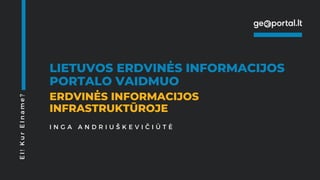
- 1. LIETUVOS ERDVINĖS INFORMACIJOS PORTALO VAIDMUO ERDVINĖS INFORMACIJOS INFRASTRUKTŪROJE E I ! K u r E I n a m e ? I N G A A N D R I U Š K E V I Č I Ū T Ė
- 2. ei!
- 3. LEII – Lietuvos erdvinės informacijos infrastruktūra. Jungia erdvinių duomenų rinkinius teikiančias organizacijas į tinklą. LEI portalas – valstybės informacinė sistema, LEII realizuojanti platforma. „Langas“, per kurį naudotojai pasiekia visas oficialiąsias erdvinių duomenų paslaugas. geoportal.lt – LEI portalo URL ir „prekės ženklas“
- 6. 53/375
- 9. Kas šiuo metu labiau reikalinga: lengvas duomenų pasiekiamumas harmonizuotų duomenų pasiekiamumas
- 13. >1%
- 17. • TIIIS • LitPOS • ŽIS • EDVI? • ...
- 18. Kas svarbiau ateities poreikių nustatyme: principas „iš apačios“ - naudotojas principas „iš viršaus“ - ...
- 19. Turiningos popietinės sesijos! info@geoportal.lt
Editor's Notes
- 1.7.2013
- 1.7.2013
- 1.7.2013
- 1.7.2013
- 1.7.2013
- 1.7.2013
- 1.7.2013
- 1.7.2013
- 1.7.2013
- 1.7.2013
- 1.7.2013
- 1.7.2013
- 1.7.2013
- 1.7.2013
- 1.7.2013
- 1.7.2013