
More Related Content
Recently uploaded
Recently uploaded (20)
Featured
Featured (20)
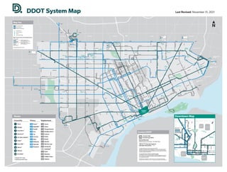
DDOT-SystemMap_Nov21_012022.pdf
- 1. Palmer Park Palmer Park C l a r k P a r k C l a r k P a r k Belle Isle Rouge Park Chandler Park Chandler Park D e t ro i t R i v e r A m b a s s a d o r B r i d g e A m b a s s a d o r B r i d g e Downtown Detroit see detail map WCCCD WCCCD WCCCD WCCCD WCCCD WCCCD Western Int’l HS Western Int’l HS Wayne State University Wayne State University U of D Mercy U of D Mercy U of D Jesuit HS U of D Jesuit HS Social Security Administration Social Security Administration Southeastern HS Southeastern HS Secretary of State Secretary of State Renaissance HS Renaissance HS Pershing HS Pershing HS Patton Rec Center Patton Rec Center Osborn HS Osborn HS Northwest Activities Center Northwest Activities Center Mumford HS Mumford HS Meijer Gateway Meijer Gateway Main Post Office Main Post Office King HS King HS Kemeny Rec Center Kemeny Rec Center Henry Ford HS Henry Ford HS Heilmann Rec Center Heilmann Rec Center Ford-Rouge Plant - Gate 4 Ford-Rouge Plant - Gate 4 Focus: HOPE Focus: HOPE Fairlane Fairlane Fairgrounds Fairgrounds EEV Prep HS EEV Prep HS Eastern Market Eastern Market Douglass Academy Douglass Academy Detroit Collegiate Prep HS Detroit Collegiate Prep HS Denby HS Denby HS Cody HS Cody HS CMA HS CMA HS City Airport City Airport Central HS Central HS Cass Tech HS Cass Tech HS Butzel Rec Center Butzel Rec Center Breithaupt VTC Breithaupt VTC Bel Air Center Bel Air Center Transfer to multiple SMART routes St John Hospital Transfer to multiple SMART routes 7 Mile & Grand River Transfer to multiple SMART routes Transfer to multiple SMART routes Transfer to multiple SMART routes Bel Air Center Transfer to multiple SMART routes 8 Mile & Gratiot Transfer to multiple SMART routes Northland Dr HAMTRAMCK HIGHLAND PARK GROSSE POINTE PARK GROSSE POINTE GROSSE POINTE FARMS GROSSE POINTE WOODS HARPER WOODS EASTPOINTE WARREN HAZEL PARK FERNDALE OAK PARK SOUTHFIELD REDFORD LIVONIA DEARBORN HEIGHTS DEARBORN RIVER ROUGE MELVINDALE Lahser 7 Mile McNichols Fenkell Schoolcraft Tireman Paul W Chicago Southfield Greenfield Grand River Tireman Schaefer Wyoming Livernois Evergreen Oakman W Outer Dr Southfield Greenfield Schaefer Wyoming Evergreen Dearborn Vernor Vernor M i l l e r Bagley Lafayette T r u m b u l l 2 1 s t R o s a P a r k s W G r a n d B l C l a r k J u n c t i o n L i v e r n o i s W o o d m e r e S p r i n g w e l l s C e n t r a l W e s t E n d McGraw Joy W Chicago Plymouth Schoolcraft Grand River Fenkell 7 Mile McNichols Puritan Michigan Michigan L o n y o Lafayette Jefferson V a n D y k e Van Dyke Burt Ewald Circle Oakman Davison Manchester 3 r d H a m i l t o n R o s a P a r k s Glendale W o o d r o w W i l s o n O a k l a n d Davison J o s C a m p a u Jerome McNichols Linwood 7 Mile E Outer Dr Ryan 7 Mile Nevada Nevada Dequindre Holbrook S t A u b i n Clay R u s s e l l G r a t i o t E Grand Bl G r a t i o t G r a t i o t G r a t i o t State Fair W Outer Dr D e q u i n d r e Forest Warren Warren Lafayette Jefferson Jefferson E G r a n d B l M t E l l i o t t C o n a n t C a d i l l a c C a d i l l a c C o n n e r C o n n e r G u n s t o n Hoover Hoover S t J e a n C h a l m e r s L a k e w o o d D i c k e r s o n Freud Korte L e n o x Hayes Hayes C a d i e u x C a d i e u x O u t e r D r W h i t t i e r Outer Dr Chandler Park Dr Warren Warren Warren C h a l m e r s Kercheval Houston- Whittier Whittier S t J e a n Mack C e n t r a l J u n c t i o n R o s a P a r k s 1 4 t h Five Points W o o d w a r d W o o d w a r d W o o d w a r d W o o d w a r d Van Dyke V a n D y k e E Outer Dr Morang Chester W Outer Dr Curtis Livernois McNichols Fairfield Puritan Dexter D e x t e r W Grand Bl C a s s C a s s D e x t e r K e l l y Telegraph Telegraph 1 4 t h 1 4 t h Grand River Grand River F o r t F o r t Fort Fort McGraw Fenkell 7 Mile Joy Plymouth Schoolcraft Fenkell Warren Grand River McNichols S c h a e f e r M t E l l i o t t Kercheval Kercheval I n s e l r u h e Mt Elliott C o n a n t C o n a n t H a m i l t o n W Outer Dr R o s a P a r k s John R Clairmount 3 r d L o d g e S v c D r 3 r d 2 n d Temple 3 r d Dailey Beechwood Tireman W Grand Bl Risdon V i n e w o o d Toledo MLK Jr Blvd Mack Mack Van Dyke Mack E Outer Dr Seymour K e l l y H a r p e r Harper Harper Mt Elliott Grinnell St Cyril Miller Mound Mt Elliott Caniff Calvert Collingwood Trowbridge Harmon B y r o n L a S a l l e Elmhurst Tuxedo Mt Elliott McNichols Canfield D e q u i n d r e E Outer Dr Livernois L i v e r n o i s D r a g o o n L i v e r n o i s C l a r k W Jefferson W J e ff e r s o n O a k l a n d Webb S t A n t o i n e B e a u b i e n Kirby 2 n d Oakman Bl Ewald Circle Davison Cloverlawn Northlawn H a m t r a c k D r C h e n e C h e n e A n t i e t a m P e n n s y l v a n i a M c C l e l l a n Schoenherr 7 Mile Chalmers 8 Mile Evergreen Plymouth W Chicago Joy Warren Ford Hubbard Evergreen 9 Mile 10 Mile 9 Mile 8 Mile Eagle Michigan Michigan M i l l e r W y o m i n g F e r n e y I n d u s t r i a l Schaefer D i x Wyoming Ford Warren Greenfield 8 Mile 8 Mile Oakman Jefferson A l t e r Moross Moross 8 Mile 8 Mile 8 Mile M a r y l a n d JL Hudson Dr Greenfield N o r t h w e s t e r n North Park Dr Northland Dr Telegraph 8 Mile Ford Plymouth Middlebelt Inkster Beech Daly Schaefer Southfield Southfield F r e n c h W Outer Dr W Outer Dr St John Hospital St John Hospital Sinai-Grace Hospital Sinai-Grace Hospital Providence Hospital Providence Hospital Henry Ford Hospital Henry Ford Hospital D M C / V A H o s p i t a l D M C / V A H o s p i t a l Last Revised: November 15, 2021 College/University Hospital/Clinic School Point of Interest University/College Primary Route ConnectTen Route Neighborhood Route Map Key Transfer to multiple SMART routes Major Transfer Points/Ends of Multiple Routes White background = End/beginning of route Gray background = Route makes a stop here, but continues on Routes Neighborhood * Denotes 24/7 route. # Denotes part-time route. ConnectTen Primary # Schematic Map, Not To Scale D e t r o i t R i v e r Larned Larned Randolph Randolph Washington Washington Jefferson Jefferson Woodward Woodward Cass Cass Congress Congress Fort Fort Lafayette Lafayette 3rd 3rd Bagley Bagley G r a n d R i v e r G r a n d R i v e r Brush Brush Beaubien Beaubien St Antoine St Antoine Cass Cass Clifford Clifford Park Park Adams Adams 1st 1st Shelby Shelby Gratiot Gratiot W a s h i n g t o n W a s h i n g t o n Lafayette Lafayette Griswold Griswold Michigan Michigan Ford Field C a m p u s M a r t i u s C a m p u s M a r t i u s Comerica Park Renaissance Center Huntington Place Hart Plaza CAYMC Grand Circus Park Grand Circus Park WCCCD WCCCD Detroit Public Safety HQ Detroit Public Safety HQ Frank Murphy Hall of Justice Frank Murphy Hall of Justice 36th District Court 36th District Court Detroit Riverwalk Rosa Parks Transit Center Downtown Map The Detroit Department of Transportation (DDOT) operates its programs without regard to race, color, and national origin in accordance with Title VI of the Civil Rights Act. Persons who believe they have been aggrieved by any unlawful discriminatory practice under Title VI may file a complaint with DDOT. For more information on DDOT’s civil rights program, our obligations and procedures for filing a complaint, call Customer Service at (313) 933-1300; email DDOTtitle6@detroitmi.gov; visit our administrative office at 100 Mack, Detroit, MI 48201 or website at www.detroitmi.gov/ddot. Schedules are available in braille, large-print and multiple languages. Contact DDOT Customer Service to request accessible-format materials. 313.933.1300 detroitmi.gov/ddot Detroit MetroLift (ADA Paratransit Service): 313.208.7363 TDD & TTY Hearing-Impaired Schedule Information: 7-1-1 Contact DDOT