Data for Good#1- Understanding where we live
•Download as PPTX, PDF•
0 likes•126 views

Workshop on statistical geography given as part of Open Data Manchester's Data for Good programme on the 24th April 2018. Presentation looks at the types of UK statistical geographies and serves was part of an easy introduction to stats and maps

Recommended
More Related Content
More from Open Data Manchester
More from Open Data Manchester (11)
Recently uploaded
Recently uploaded (20)
Data for Good#1- Understanding where we live
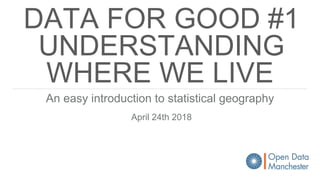
- 1. DATA FOR GOOD #1 UNDERSTANDING WHERE WE LIVE An easy introduction to statistical geography April 24th 2018
- 2. THE POWER OF THE MAP Mappa Mundi - 1300 Hereford Cathedral
- 3. Soviet map of strategic sites in Manchester
- 4. Isochrone map showing time taken to get to different parts of Manchester by tram (2014)
- 5. Stockport emotion map - Christian Nold (2007) http://stockport.emotionmap.net
- 7. KNOW YOUR COUNTRY Lake (km2) Mountain (m) River (km) Area km2 (%) Population % England Scotland Wales N. Ireland
- 8. KNOW YOUR COUNTRY Lake (km2) Mountain (m) River (km) Area km2 (%) Population % England Scotland Wales N. Ireland Lock Neagh (381.8)
- 9. KNOW YOUR COUNTRY Lake (km2) Mountain (m) River (km) Area km2 (%) Population % England Scotland Wales N. Ireland Loch Lomond (71.3) Lock Neagh (381.8)
- 10. KNOW YOUR COUNTRY Lake (km2) Mountain (m) River (km) Area km2 (%) Population % England Scotland Wales N. Ireland Windermere (14.7) Loch Lomond (71.3) Lock Neagh (381.8)
- 11. KNOW YOUR COUNTRY Lake (km2) Mountain (m) River (km) Area km2 (%) Population % England Scotland Wales N. Ireland Windermere (14.7) Loch Lomond (71.3) Lake Vyrnwy (4.5) Lock Neagh (381.8)
- 12. KNOW YOUR COUNTRY Lake (km2) Mountain (m) River (km) Area km2 (%) Population % England Scotland Wales N. Ireland Windermere (14.7) Loch Lomond (71.3) Ben Nevis (1,346) Lake Vyrnwy (4.5) Lock Neagh (381.8)
- 13. KNOW YOUR COUNTRY Lake (km2) Mountain (m) River (km) Area km2 (%) Population % England Scotland Wales N. Ireland Windermere (14.7) Loch Lomond (71.3) Ben Nevis (1,346) Lake Vyrnwy (4.5) Snowdon (1,085) Lock Neagh (381.8)
- 14. KNOW YOUR COUNTRY Lake (km2) Mountain (m) River (km) Area km2 (%) Population % England Scotland Wales N. Ireland Windermere (14.7) Scafell Pike (978) Loch Lomond (71.3) Ben Nevis (1,346) Lake Vyrnwy (4.5) Snowdon (1,085) Lock Neagh (381.8)
- 15. KNOW YOUR COUNTRY Lake (km2) Mountain (m) River (km) Area km2 (%) Population % England Scotland Wales N. Ireland Windermere (14.7) Scafell Pike (978) Loch Lomond (71.3) Ben Nevis (1,346) Lake Vyrnwy (4.5) Snowdon (1,085) Lock Neagh (381.8) Slieve Donard (850)
- 16. KNOW YOUR COUNTRY Lake (km2) Mountain (m) River (km) Area km2 (%) Population % England Scotland Wales N. Ireland Windermere (14.7) Scafell Pike (978) Thames (346) Loch Lomond (71.3) Ben Nevis (1,346) Lake Vyrnwy (4.5) Snowdon (1,085) Lock Neagh (381.8) Slieve Donard (850)
- 17. KNOW YOUR COUNTRY Lake (km2) Mountain (m) River (km) Area km2 (%) Population % England Scotland Wales N. Ireland Windermere (14.7) Scafell Pike (978) Thames (346) Loch Lomond (71.3) Ben Nevis (1,346) Tay (188) Lake Vyrnwy (4.5) Snowdon (1,085) Towy (120) Lock Neagh (381.8) Slieve Donard (850) Bann (129)
- 18. KNOW YOUR COUNTRY Lake (km2) Mountain (m) River (km) Area km2 (%) Population % England Scotland Wales N. Ireland Windermere (14.7) Scafell Pike (978) Thames (346) Loch Lomond (71.3) Ben Nevis (1,346) Tay (188) Lake Vyrnwy (4.5) Snowdon (1,085) Towy (120) Lock Neagh (381.8) Slieve Donard (850) Bann (129) UK Severn (354)
- 19. KNOW YOUR COUNTRY Lake (km2) Mountain (m) River (km) Area km2 (%) Population % England Scotland Wales N. Ireland Windermere (14.7) Scafell Pike (978) Thames (346) Loch Lomond (71.3) Ben Nevis (1,346) Tay (188) 80,226.36 (32.28) Lake Vyrnwy (4.5) Snowdon (1,085) Towy (120) Lock Neagh (381.8) Slieve Donard (850) Bann (129) UK Severn (354)
- 20. KNOW YOUR COUNTRY Lake (km2) Mountain (m) River (km) Area km2 (%) Population % England Scotland Wales N. Ireland Windermere (14.7) Scafell Pike (978) Thames (346) 132,947.76 (59.49) Loch Lomond (71.3) Ben Nevis (1,346) Tay (188) 80,226.36 (32.28) Lake Vyrnwy (4.5) Snowdon (1,085) Towy (120) 21,224.48 (8.54) Lock Neagh (381.8) Slieve Donard (850) Bann (129) 14,133.38 (5.69) UK Severn (354)
- 21. KNOW YOUR COUNTRY Lake (km2) Mountain (m) River (km) Area km2 (%) Population % England Scotland Wales N. Ireland Windermere (14.7) Scafell Pike (978) Thames (346) 132,947.76 (59.49) 54.3 (84) Loch Lomond (71.3) Ben Nevis (1,346) Tay (188) 80,226.36 (32.28) Lake Vyrnwy (4.5) Snowdon (1,085) Towy (120) 21,224.48 (8.54) Lock Neagh (381.8) Slieve Donard (850) Bann (129) 14,133.38 (5.69) UK Severn (354)
- 22. KNOW YOUR COUNTRY Lake (km2) Mountain (m) River (km) Area km2 (%) Population % England Scotland Wales N. Ireland Windermere (14.7) Scafell Pike (978) Thames (346) 132,947.76 (59.49) 54.3 (84) Loch Lomond (71.3) Ben Nevis (1,346) Tay (188) 80,226.36 (32.28) 5.3 (8) Lake Vyrnwy (4.5) Snowdon (1,085) Towy (120) 21,224.48 (8.54) 3.1 (5) Lock Neagh (381.8) Slieve Donard (850) Bann (129) 14,133.38 (5.69) 1.8 (3) UK Severn (354)
- 24. Office for National Statistics - Open Government Licence
- 25. ELECTORAL
- 26. ADMINISTRATI VE
- 27. HEALTH
- 29. CENSUS 2011
- 30. AND THE REST…
- 31. DIFFERENT GEOGRAPHIES FOR DIFFERENT PURPOSES https://mappinggm.org.uk/gmodin/
- 32. DIFFERENT GEOGRAPHIES FOR DIFFERENT PURPOSES https://mappinggm.org.uk/gmodin/
- 33. DIFFERENT GEOGRAPHIES FOR DIFFERENT PURPOSES https://mappinggm.org.uk/gmodin/
- 34. DIFFERENT GEOGRAPHIES FOR DIFFERENT PURPOSES https://mappinggm.org.uk/gmodin/
- 35. DIFFERENT GEOGRAPHIES FOR DIFFERENT PURPOSES https://mappinggm.org.uk/gmodin/
- 36. DIFFERENT GEOGRAPHIES FOR DIFFERENT PURPOSES https://mappinggm.org.uk/gmodin/
- 37. DIFFERENT GEOGRAPHIES FOR DIFFERENT PURPOSES https://mappinggm.org.uk/gmodin/
- 38. DIFFERENT GEOGRAPHIES FOR DIFFERENT PURPOSES https://mappinggm.org.uk/gmodin/
- 39. DIFFERENT GEOGRAPHIES FOR DIFFERENT PURPOSES https://mappinggm.org.uk/gmodin/
- 40. DIFFERENT GEOGRAPHIES FOR DIFFERENT PURPOSES https://mappinggm.org.uk/gmodin/
- 41. SUPER OUTPUT AREAS Output Areas (OAs)- 100 - 625 people or 40 - 250 households Lower Super Output Areas (LSOAs) 1,000 - 3,000 people or 400 - 1,200 households Medium Super Output Areas (MSOAs) 5,000 - 15,000 people or 2,000 - 6,000 households
- 42. LOCAL AUTHORITIES, WARDS AND LSOAS (ENTITIES) ONS uses codes for statistical geography these are created along the lines of ANNNNNNNN where the first three characters are called the area entity code and the rest the unique ID for that area e.g. E08000003 is the Local Authority District Code for Manchester E = England 08 = Metropolitan District 0000003 = Manchester (0000002 = Bury and 0000004 = Oldham) Electoral Wards are E05 000722 = Chadderton LSOAs are E01 005347 = LSOA in Chadderton
- 44. MERCHAN DISE Stickers FREE Enamel pin badges Merchandise can be found here - http://bit.ly/ODMmerch
Editor's Notes
- The challenge looking at the city region
- The challenge looking at the city region
- The challenge looking at the city region
- The challenge looking at the city region
- The challenge looking at the city region
- The challenge looking at the city region
- The challenge looking at the city region
- The challenge looking at the city region
- The challenge looking at the city region
- The challenge looking at the city region
- The challenge looking at the city region
- The challenge looking at the city region
- The challenge looking at the city region
- The challenge looking at the city region
- The challenge looking at the city region
- The challenge looking at the city region
- The challenge looking at the city region
- The challenge looking at the city region
- The challenge looking at the city region