SlideShare a Scribd company logo
1 of 16
Download to read offline
Urban Ecosystem Analysis				
Mecklenburg County and the
City of Charlotte, North Carolina
April 2010
Report Contents
	 2	 Introduction and Project Overview
	 2-3	 Major Findings Summary
	 4-5	 Land Cover Change Trends: Landsat 1985-2008
	 5-10	 High Resolution Analysis 2008 and Ecosystem Benefits
	10-13	 Protecting Watershed Scale Tree Canopy for Water Quality
	 14	 Implementation Recommendations
	15-16	 About the Urban Ecosystem Analysis
Calculating the Value of Nature
The project’s objectives are threefold: 1) To provide detailed
information regarding land cover trends and their ecological
implications relevant to both Mecklenburg County and the
City of Charlotte; 2) to replace Charlotte Mecklenburg’s ag-
ing 2002 high resolution land cover data with 2008 high reso-
lution land cover data, so local staff, as project partners can
analyze how to best preserve tree canopy, target tree planting
and reforestation efforts and to enhance riparian vegetation
corridors, all of which are vital to protecting the area’s envi-
ronmental assets; and 3) to provide tools to enable local deci-
sion makers to more effectively plan for and manage growth
in Mecklenburg County, the City of Charlotte and surround-
ing towns. These tools, if used in accordance with recom-
mendations in this report, will help the community improve
air and water quality and minimize degradation of the area’s
tree canopy, stream network and remaining open space.
Unfortunately, this UEA confirms that Charlotte Mecklen-
burg has continued its trend of losing tree canopy and open
space while its urban area has continued to expand. How-
ever, the good news is that the tools used to complete this
analysis also offer feasible solutions. Charlotte Mecklenburg
can use the tools and new data provided as part of this proj-
ect to change this trend and maintain a healthy, sustainable
tree canopy and maximize its ecosystem services benefits.
With this goal in mind American Forests recommends that
the community: 1) Integrate these new land cover data into
its planning processes so that impacts from future growth
and development can be anticipated and managed to pre-
serve canopy wherever possible; 2) Use the integrated data
to conduct additional and more detailed analysis of the com-
munity’s natural assets using CITYgreen®
software with con-
sideration of the community’s land use plans, zoning catego-
ries, transportation plans, etc.; 3) Guided by this additional
analysis, establish tree canopy goals that can be attained
within various zoning categories and key watershed areas
as it continues to develop; and 4) Preserve and plant trees
throughout Charlotte Mecklenburg on a continuing basis to
obtain and sustain a suitable and level of tree canopy.
Major Findings Summary
An analysis of Landsat data, used to identify landcover change
trends found:
•	 Between 1985 and 2008, Mecklenburg County, lost 33%
of its tree canopy and 3% of its open space, while gaining
60% of urban area (Table 1). These changes resulted in
the loss of the tree canopy’s ability to naturally manage
252 million cubic feet of stormwater, valued at $504 mil-
lion using a local engineering cost of $2 per cubic foot.2
2
Introduction and Project Overview
Trees are important indicators of the health of a community’s
urban ecosystem. When trees are large and healthy, the eco-
logical systems that support them are also healthy. Healthy
trees provide valuable environmental benefits through the
biological functions of their roots and leaves. These can be
measured in terms of ecosystem services including reducing
stormwater runoff, increasing carbon storage, and improving
air and water quality. The greater the tree cover and the less
the impervious surface in a community, the more ecosystem
services are produced.
American Forests assesses the health and benefits of urban
ecosystems through a process called Urban Ecosystem Analy-
sis (UEA). This Urban Ecosystem Analysis of Charlotte Meck-
lenburg updates American Forests’ earlier local, regional, and
multi-state work including an UEA of Mecklenburg County in
2003, the Carolina Piedmont Green Initiative - an analysis of
the 15 county region surrounding Charlotte in 2005, and an
UEA of the Mountain Island Lake Watershed in 2007.1
With an understanding of these prior American Forests’ proj-
ects and recognizing that the continued conversion of natural
areas into urban areas contributes to increased management
costs to preserve quality of life for its residents, the City of
Charlotte commissioned American Forests to conduct this new
UEA of Charlotte Mecklenburg to document current land-
cover change trends and to provide detailed data for decision
making going forward. The project was made possible through
a generous grant from our major contributor, The Women’s
Impact Fund, through the use of digital imagery provided by
Mecklenburg County, and through additional funding from
the City of Charlotte and the Blumenthal Foundation.
This new UEA used satellite imagery, GIS technology and
American Forests’ CITYgreen software, to analyze land cover
of Mecklenburg County, including Charlotte and the towns
of Davidson, Cornelius, Huntersville, Matthews, Mint Hill,
and Pineville at two scales, spanning two time periods. The
first analysis, a trend analysis, utilized moderate-resolution
30-meter Landsat imagery acquired in 1985 and 2008 to
quantify land cover changes that occurred during this 23
year time period. The second analysis, a much more detailed
high resolution analysis, used National Agricultural Imagery
Program (NAIP) data from 2008 one meter pixel resolution
digital imagery to determine current land cover for Mecklen-
burg County, the City of Charlotte, the McDowell Creek and
Goose Creek Subwatersheds, and the County’s stream buf-
fer network in its entirety. In addition, 2002 high resolution
data from the previous UEA was used to compare tree canopy
changes with 2008 high resolution data.
Urban Ecosystem Analysis: Mecklenburg County and the City of Charlotte, North Carolina
3
The County’s green infrastructure3
also lost the ability to
remove approximately 3.8 million lbs. of air pollutants an-
nually, valued at $8.8 million per year, 192 million lbs. of
carbon stored in trees’ wood and 1.5 million lbs. of annual
carbon sequestration—the rate at which carbon is stored.
•	 Between 1985 and 2008, the City of Charlotte lost 49% of
its tree canopy and 5% of its open space while gaining 39%
of urban area (Table 1).
An analysis of recent high resolution data4
providing a snap-
shot in time and quantifying what a workhorse Charlotte
Mecklenburg’s current green infrastructure is to the com-
munity, found:
•	 As of 2008, Mecklenburg County had a 50% tree canopy
cover, which provided 1.4 billion cubic feet of stormwater
detention services, valued at $2.8 billion, removed 14.9 mil-
lion lbs. of air pollutants at a value of $40 million per year,
stored 7.5 million tons of carbon in trees’ wood and seques-
tered 59,000 tons of carbon annually (Table 4).
•	 As of 2008, the City of Charlotte had a 46% tree canopy
that provided 662 million cubic feet of stormwater deten-
tion services, valued at $1.3 billion, removed 7.2 million lbs.
of air pollutants at a value of $19.2 million per year, stored
3.7 million tons of carbon in trees’ wood and sequestered
28,000 tons of carbon annually (Table 4).
•	 Of Charlotte Mecklenburg’s 32,000 acres of stream buf-
fers (vegetation adjacent to streams that filters out water
pollutants before they can enter streams), 22,627 acres
(71%) is tree canopy. This buffer network removes 1.9 mil-
lion lbs. of air pollutants annually, valued at $5.1 million,
manages 177 million cubic feet of stormwater, valued at
$354 million, stores 974,000 tons of carbon, and sequesters
7,600 tons of carbon per year (Table 4).
American Forests Report
•	 Certain land areas within Charlotte Mecklenburg, like
the McDowell Creek Subwatershed, are vital to protecting
the area’s drinking water. Yet even at the Subwatershed’s
current 51% tree canopy, the Environmental Protection
Agency has documented McDowell Creek as an impaired
stream and unfit for swimming. In these critical areas, los-
ing additional tree canopy to urban development only
exacerbates the water pollutants entering the Creek and
increases the costs of providing drinking water to the com-
munity. For example, a 5% change from tree canopy to
urban landcover in McDowell Creek Subwatershed would
decrease the watershed’s ability to naturally manage 4.9
million cubic feet of stormwater, valued at $9.8 million.
•	 Charlotte Mecklenburg’s tree cover has declined for the
last 23 years and new policies and practices will need to
emerge to reverse this trend. Based upon this latest data,
tree canopy in Mecklenburg County has reached the point
where further decline will cause the County to fall below
levels recommended by American Forests. Charlotte Meck-
lenburg is now at a crossroads that will set the course for
environmental quality for decades to come. The data and
tools provided with this UEA offer decision support tools
to help Charlotte Mecklenburg communities maintain
the recommended levels of tree canopy as they continue
to grow. These tools will also allow local leaders and staff
to calculate the positive contributions of not only halting
decline, but enhancing green infrastructure. For example
by increasing tree canopy from its current 50% to 55%,
Mecklenburg County’s ecosystem benefits would provide
an additional 1.5 million lbs. of air pollutant removal an-
nually, valued at $4 million, decrease 232 million cubic
feet of stormwater runoff, valued at $464 million, increase
carbon storage 772,000 tons and increase carbon seques-
tration 6,000 tons per year (Table 6).
The UEA process involves a technical analysis of a community’s land cover data taken from satellite imagery and aerial
photography, computer technology called Geographic Information Systems (GIS), and the application of scientific and en-
gineering models developed by experts to quantify environmental benefits. In short, the UEA calculates the benefits the
studied community derives from ecosystem services provided by its natural assets.
Upon completion of an UEA the community receives data that accurately depict and quantify the community’s land cover
by type (trees, open space, urban area, and water) and detailed information about the ecosystem services and associated
financial benefits. American Forests also provides CITYgreen®
software to the community’s planners and managers which
enable them to integrate data about the natural assets into growth and development planning and management endeavors.
This in turn enables the community to design and adopt effective measures to protect and preserve the community’s trees
and other natural assets.
American Forests has conducted UEAs within 40 different urban areas across the country and documented a disturbing
trend--urban areas are losing trees at an alarming rate while urban land cover like roads and buildings, has been increasing
rapidly. This trend is harming local environmental assets and quality of life in significant ways and is also costing communi-
ties billions of dollars because ecosystem services are lost when trees are removed.
4
Land Cover Change Trends:
Landsat 1985-2008
Using moderate resolution satellite data
from Landsat imagery acquired in1985
and 2008, American Forests measured
changes in four distinct land cover
types: tree canopy, urban, open space,
and water within Mecklenburg County.
This moderate resolution data identi-
fies land cover change trends between
these years. The analysis quantified the
impacts these changes had on stormwa-
ter management, air and water quality,
and carbon sequestration and storage.
It is important to note that Landsat data
is valuable for identifying general trends
and comparing landcover from one pe-
riod of time to another in large areas
but these data are not used to deter-
mine where trees, open space and urban
area are located due to its coarse scale.
In contrast, the high resolution dataset
discussed later in this report provides
an accurate spatial location of land-
cover and is the appropriate resolution
to use to determine land cover existing
in smaller parcels. High resolution data
are used for planning and management
functions involved in achieving tree can-
opy and open space goals, etc. Because
of the difference in resolution, Landsat
data and high resolution data cannot be
compared to one another.
Landcover change trends from this
study continue to document tree can-
opy decline noted in the earlier UEAs.
Between 1985 and 2008, Mecklenburg
County lost 33% tree canopy and 3%
open space while gaining 60% urban
area. In the same time period, the City
of Charlotte lost 49% tree canopy and
5% open space while gaining 39% ur-
ban area (Figure 1). Table 1 shows
landcover percent change trends, both
historic and projected trends to 2015,
assuming that landcover continues to
change at the current rates.
Figure 1. Mecklenburg County Tree Loss 1985-2008
Urban Ecosystem Analysis: Mecklenburg County and the City of Charlotte, North Carolina
American Forests Report
5
There are ecological consequences when there is a loss of per-
vious land cover, such as tree canopy, open space and other
vegetated areas, which defines an area’s green infrastructure.
There are also ecosystem impacts with an increase in urban
areas. The 23-year trend data for Mecklenburg County shows
that the loss of green infrastructure adversely affected the
County’s natural environment’s ability to provide ecosystem
services for air, water, and carbon (Table 2).
Mecklenburg County lost the ability to naturally manage 252
million cubic feet of stormwater, valued at $504 million. The
City of Charlotte provided local engineered unit cost of $2
per cubic foot to calculate the value of mitigating this ad-
ditional stormwater. Mecklenburg County’s land cover also
To update the County’s aging 2002 land cover data set,
American Forests classified Mecklenburg County-provided
2008 NAIP data taken from high resolution imagery. This
dataset provides a current snapshot of Charlotte Mecklen-
burg’s landcover at a scale suitable to be further analyzed by
the local community. Using these data, small areas of land-
cover within Charlotte Mecklenburg such as subwatersheds,
zoning categories, and stream buffers can be accurately mea-
sured and related ecosystem services quantified. This dataset
also provides Charlotte Mecklenburg with the most recently
available planning and management tools.
American Forests classified these high resolution data into
five land cover categories: trees, open space, urban area,
bare soil, and water. American Forests then used CITYgreen
software to conduct UEAs of Mecklenburg County, the City
of Charlotte, the McDowell Creek Subwatershed, the Meck-
lenburg County portion of the Goose Creek Subwatershed,
and the County’s stream network and buffer zone in its en-
tirety. As described in the Implementation Recommenda-
tions section on page 14, American Forests recommends that
Charlotte Mecklenburg use this updated digital data set to
identify areas for reforestation projects and engage the other
community partners in reforesting these areas to improve
stream health and water quality.
Landcover	 1985-2008		 Projected 2008-2015*
	 Charlotte	 Mecklenburg Co.	 Charlotte	 Mecklenburg Co.
Open Space	 -5%	 -3%	 -3%	 -5%
Trees	 -49%	 -33%	 -1%	 -3%
Urban	 39%	 60%	 4%	 9%
Table 1. Landsat Land Cover Percent Change Trends5
	
			 		 Loss in 	
	 Tree	 Loss of Air	 Loss in	 Loss in	 Stormwater Value	 Loss of	 Carbon
	Canopy Change 	 Pollution Removal	 Removal Value 	 Stormwater Value	 @ $2/cu ft.	 Carbon Stored	 Sequestered
	 %	 lbs./yr	 dollar value	 cu. ft.	 dollar value	 tons	 tons
	 -33.0%	 -3,779,778	 -$8,771,658	 251,789,395	 $503,578,789	 -192,066,507	 -1,495,289
Table 2. Mecklenburg County Change in Ecosystem Services Landsat Data 1985-2008	 			
lost $8.8 in annual air pollution removal benefits, 192 million
pounds of carbon storage and 1.5 million pounds of carbon
sequestration annually.
Tree roots absorb water pollutants for which nine measures
are available: Biological Oxygen Demand, Cadmium, Chro-
mium, Chemical Oxygen Demand, Lead, Nitrogen, Phospho-
rus, Suspended Solids, and Zinc. In Mecklenburg County the
amount of these contaminants entering streams and lakes
worsened in the past 23 years. This chronological analysis
provides valuable public policy information regarding the
continual loss trends in tree canopy cover and associated eco-
system impacts.
For this UEA, American Forests used the U.S. Geological
Survey’s (USGS) 2001 National Land Cover Data (NLCD) as
the baseline to update land cover change.6
The USGS data,
considered the gold-standard for land cover change analysis,
was classified from 30-meter Landsat data acquired in 2001.
American Forests utilized this dataset as the basis to compare
land cover change from 1985 to 2008.
High Resolution Analysis 2008 and Ecosystem Benefits
6
Figure 2. 2008 Mecklenburg County Landcover
7
Figure 3. 2008 Charlotte Landcover
8
2002 and 2008 High Resolution Comparison
To determine landcover change trends during the most
recent six year period, American Forests compared the
2002 high resolution data used in the previous UEA with
2008 high resolution data from this project after making
appropriate data scaling and boundary adjustments. Since
Charlotte gained land area due to boundary changes by
2008, this analysis used the 2008 boundary area in order to
make an accurate comparison. The six year period shows
that tree canopy continued to decline in both the City and
County. Charlotte lost 3,231 acres of trees, a 2% decline and
Mecklenburg County lost 9,475 acres of trees, a 3% decline
over this six year period (Figure 4). If no action is taken to
reverse this trend, and the rate of landcover change contin-
ues, projections to 2015 show that Mecklenburg County will
lose an additional 20,500 acres of tree canopy and Charlotte
will lose an additional 7,000 acres of tree canopy.
Urban Ecosystem Analysis: Mecklenburg County and the City of Charlotte, North Carolina
Figure 4. Actual and Projected Tree Canopy Decline 		
in Charlotte Mecklenburg
Stormwater Benefits
Trees reduce the volume of stormwater runoff by capturing
some rain on their leaves and branches, which then evapo-
rates back into the atmosphere. Other water is absorbed by
the tree roots or infiltrates into the soil rather than running
off the land. As a result less runoff must be managed by
manmade infrastructure. In 2008, Mecklenburg County had
Table 3. Landcover, Tree Canopy and Population Comparison (4 meter pixel resolution)*				
		 2002**			 2008**	
	 Total Acres*	 Canopy Acres*	 Population***	 Total Acres	 Canopy Acres	 Population***
Mecklenburg County	 348,962	 184,528 (53%)	 746,427	 349,162	 175,053 (50%)	 902,803
Charlotte	 183,575	 88,184 (48%)	 579,684	 183,575	 84,953 (46%)	 695,995
*The acreage reported in Tables 3 and 4 will be different due to data scaling adjustments made in order to compare 2002 and 2008 data.
** Since Charlotte’s land boundaries changed during this time, the 2008 land boundary was used in both analyses to make an accurate comparison of canopy change. Even though the
same boundary was used in both analyses, the acreage reported is slightly different due to data scaling adjustments when changing from a 1 meter to a 4 meter pixel resolution.
***Population source: Charlotte Chamber: http://www.charlottechamber.com/index.php?submenu=population_estimates&src=gendocs&ref=PopulationEstimates2008&category=
Demo_ecoProfile					
a 50% tree canopy, which managed 1.4 billion cubic feet of
stormwater, valued at $2.8 billion using a $2 per cubic foot
value based on local costs (see Analysis Formulas, pg. 8). In
2008, Charlotte’s 46% tree canopy provided 662 million cubic
feet of stormwater management, valued at $1.3 billion.
		 			 Air
				 Air	 Pollution				 Stormwater
		 2008 Tree 	 2008 Tree 	 Pollution	 Removal	 Carbon	 Carbon	 Stormwater	 Value
	 Area	 Canopy	 Canopy	 Removal	 Value 	 Stored	 Sequestered 	 Value*	 @ $2 per cu. ft
	 acres	 acres	 percent	 lbs./ yr	 dollar value	 tons	 tons	 cu. ft.	 dollar value
Mecklenburg Co.	 351,507	 175,395	 50%	 14,853,127	 $39,639,770	 7,547,502	 58,759	 1,376,836,456	 $2,753,672,911
Charlotte	 183,570	 84,943	 46%	 7,193,286	 $19,197,318	 3,655,213	 28,457	 661,848,956	 $1,323,697,911
McDowell Cr. Wsd	 18,628	 9,427	 51%	 798,325	 $2,130,555	 405,663	 3,158	 70,323,500	 $140,647,000
Goose Cr. Wsd**	 7,161	 4,380	 61%	 370,948	 $989,979	 188,494	 1,467	 38,711,659	 $77,423,318
Stream Buffer Network	 31,952	 22,627	 71%	 1,916,118	 $5,113,703	 973,661	 7,580	 177,236,524	 $354,473,048	
			 	 	
“*Stormwater analysis uses a 2yr, 24 hour storm event. The value of managing stormwater is based on current local construction costs of $2.00 per cubic foot (city of Charlotte).
**Only the Mecklenburg County portion of the Goose Creek Watershed is included in this study.									
Table 4. 2008 Tree Canopy and Ecosystem Services from High-Resolution Data (1 meter pixel resolution)
54%
52%
50%
48%
46%
44%
42%
2002 2008 2015
Charlotte
Mecklenburg Co.
9
American Forests Report
Water Quality Benefits
Trees provide very valuable water quality ecosystem services.
Tree roots absorb water pollutants for which ten measures are
available: Biological Oxygen Demand, Cadmium, Chromium,
Chemical Oxygen Demand, Lead, Nitrogen, Phosphorus,
Suspended Solids, and Zinc. For Mecklenburg County, water
pollution, as measured in percent change in pollutant load-
ing, would worsen, from 21% for Zinc to 132% for Chemical
Oxygen Demand if the existing trees were removed from the
land. For the City of Charlotte, water pollution, as measured
in percent change in pollutant loading, would worsen, from
19% for Zinc to 108% for Chemical Oxygen Demand if the
existing trees were removed from the land.
Air Quality Benefits
Air quality is of particular concern in the Charlotte Mecklen-
burg region because the Environmental Protection Agency
(EPA) has designated Mecklenburg County and surround-
ing counties as a non-attainment area for ozone and carbon
monoxide. “Sunlight and hot weather can cause ground- lev-
el ozone to form in harmful concentrations in the air. As a
result, it is known as a summertime air pollutant. For this rea-
son, the months of April through October often are referred
to as the “ozone season” in this area.”7
The air quality ecosystem services provided by trees are a
big plus for the Charlotte Mecklenburg region. Tree canopy
cools the air by evaporating water and by direct shading of
buildings and pavement. This lowers the ambient tempera-
ture in cities (known as urban heat islands), reducing ground
level ozone production and related smog conditions. While
trees also emit hydrocarbons that contribute to smog ozone,
research shows that because of trees cooling effects, they pro-
vide a net benefit in reducing air pollution.8
The ecological value of air quality ecosystem services is based
on the UFORE model developed by the U.S. Forest Service.
The dollar value is calculated based on externality costs to so-
ciety (such as public health-related respiratory costs) due to
the additional air pollution. Externality values are established
by State Public Service Commissions. Mecklenburg County’s
urban forest removes 14.9 million lbs. of air pollutants annu-
ally, valued at almost $40 million per year. Charlotte’s urban
forest removes 7.2 million lbs. of air pollutants annually, val-
ued at almost 19.2 million per year (Table 5).
Mecklenburg County Water Pollutants As Measured 		
In Percent Change in Contaminant Loading
City of Charlotte Water Pollutants As Measured 		
In Percent Change in Contaminant Loading
Air Pollutant Mecklenburg Co. Charlotte
	 Lbs. 		 Lbs. 	
	 Removed 	 $ Value	 Removed	 $ Value	
	 per yr.	 per yr.	 per yr.	 per yr.
Carbon Monoxide	 625,395	 $306,928 	 302,895	 $148,653
Nitrogen Dioxide	 1,094,441	 $22,647,903 	 530,067	 $1,872,752
Ozone	 6,410,297	 $3,866,715	 3,104,675	 $10,968,976
Particulate Matter	 4,690,461	 $11,064,084 	 2,271,714	 $5,358,627
Sulfur Dioxide	 2,032,533	 $1,754,140 	 984,409	 $849,576
Totals	 14,853,127	 $39,639,770 	 7,193,760	 $19,198,584	
Table 5. Urban Forest Air Pollutant Removal Benefits
010
Protecting Watershed Scale Tree Canopy	
for Water Quality
McDowell Creek Subwatershed
In its most comprehensive analysis of the region, American
Forests’ Urban Ecosystem Center9
and Michael Gallis and
Associates10
completed a study in 2007 of the Piedmont
Crescent region,11
an area covering seven states including
North Carolina, to evaluate the natural system, the human
network and their interactions. The findings showed that
the ecosystem in the region, once designated as globally
outstanding because of its lush flora and fauna,12
is in a state
of decline even greater than suspected. Growth and develop-
ment across the region has resulted in natural land fragmen-
tation, resource depletion, pollution, erosion, and species
extinction.
Urban Ecosystem Analysis: Mecklenburg County and the City of Charlotte, North Carolina
Carbon Storage and Sequestration Benefits
Trees have a direct impact on the carbon footprint—the
amount of atmospheric carbon a community produces that
contributes to global warming. Trees provide a carbon sink
by storing and sequestering atmospheric carbon in their
wood. Both the total storage and the rate at which car-
bon is stored (known as sequestration) can be measured.
Charlotte’s tree canopy stores 3.7 million tons of carbon
and sequesters 28,000 tons of carbon annually. Planting new
trees and maintaining existing trees provide opportunities
for the public and private sector to reduce their commu-
nity’s carbon footprint.
Modeling Ecosystem Benefits of Increased Tree Canopy
As mentioned earlier, Charlotte Mecklenburg continues
to lose tree canopy cover and open space. Fortunately,
Mecklenburg County is already using the data from
American Forests’ previous UEA and is poised to use
the data set produced by this UEA for land use planning
(see Implementation Recommendations, pg. 14) and to
implement watershed management practices as described
for McDowell Creek below. To illustrate how Charlotte,
Mecklenburg County, and the local towns might go about
reversing the trend of canopy loss and leverage the benefits
that tree canopy provides, American Forests modeled an
increase in Mecklenburg County’s tree canopy from its cur-
rent 50% to 55% and calculated the additional ecosystem
service benefits this resource would provide in helping the
community achieve its water and air quality goals.
If the County increased its canopy cover by 5% overall, the
ecosystem services would provide an additional $4 million
in annual air pollutant removal value, an additional 771,000
tons of stored carbon and an annual 6,000 tons of seques-
tered carbon, as well as 232 million cubic feet of additional
managed stormwater, valued at $464 million. Table 6 details
these increased benefits. Of course the region would also
realize other benefits in the form of increased property
value, increased tax revenue, reduced energy consumption,
etc., not detailed in this report. Charlotte Mecklenburg
planners can use the data set delivered with this project to
establish overall tree canopy goals and also to stratify goals by
land use. Staff can look for opportunities within public and
private land to increase tree canopy cover which will improve
overall environmental benefits. Tree planting and ongoing
care engages all sectors of the community, where everyone
has the opportunity and responsibility to contribute.
A community’s pervious land cover serves as its green
infrastructure; its protection and enhancement provides
direct benefits to the taxpayer and improved environmen-
tal quality including slowing stormwater runoff, improv-
ing water and air quality, protecting soil from erosion,
and storing atmospheric carbon. Green infrastructure
includes vegetation and their complex interactions with
soil, air and water systems. As defined in this project,
green infrastructure includes tree canopy, open space,
and water. American Forests used CITYgreen software to
analyze the environmental and dollar value of each ben-
efit. For more details and formulas used in each assess-
ment visit: http://www.americanforests.org/resources/
urbanforests/naturevalue.php
	 			 Additional				 Additional
			 Additional	 Air Pollution	 Additional	 Additional	 Additional	 Stormwater
	 2008 Tree 	 Modeled	 Air Pollution	 Removal	 Carbon	 Carbon	 Stormwater	 Value
	 Canopy	 Tree Canopy	 Removal	 Value 	 Stored	 Sequestered 	 Mgmt Reduced	 @ $2 per cu. ft*
	 percent	 percent	 lbs./ yr	 dollar value	 tons	 tons	 cu. ft.	 dollar value
Mecklenburg Co.	 50%	 55%	 1,518,710	 $4,053,109	 771,721	 6,008	 -231,982,887	 -$463,965,775	
		 	 	
*Stormwater analysis uses a 2yr, 24 hour storm event. The value of managing stormwater is based on current local construction costs of $2.00 per cubic foot (source of unit cost: City of Charlotte).				
				
Table 6. Modeled Ecosystem Benefits from Increasing Mecklenburg County’s Tree Cover
11
Figure 5. 2008 McDowell Creek Watershed Landcover
12
The magnitude and relevance of these findings are best
illustrated at the watershed scale—where the importance of
protecting urban forests for water quality touches everyone.
In Mecklenburg County, this is best illustrated with two case
studies—McDowell Creek and Goose Creek. The McDowell
Creek subwatershed is 19,200 acres in area and has thou-
sands of existing homes with many more planned. Water
flows from McDowell Creek into Mountain Island Lake that
provides eighty percent of the drinking water for 700,000
people who live in Charlotte Mecklenburg. This area’s
rapid development has severely threatened the community’s
water quality; McDowell Creek is already documented as an
impaired stream under EPA regulations and is unhealthy for
swimming. The main cause of this impairment is increased
pollution from sediment and erosion as a result of develop-
ment. McDowell Creek subwatershed, with its current 9,427
acres (51%) tree canopy, provides 70 million cubic feet in
non-structural stormwater runoff management, valued at
$141 million (Table 4).
The ecological impacts of losing tree canopy cover in this crit-
ical area will increase stormwater runoff and exacerbate the
water pollutants flowing into Mountain Island Lake which
can in turn increase the costs of providing drinking water.
For example, a 5% change from tree canopy to urban land-
cover in the McDowell Creek Sub-watershed will decrease the
ability to naturally manage 4.9 million cubic feet of stormwa-
ter, valued at $9.8 million in stormwater management alone.
The damage to water quality for the city and county drinking
water is a cost too high to measure. Increasing the tree cover
in critical places, like planting trees to buffer the stream is a
high priority task. The green data layer provided as part of
this project will allow the local officials to identify the critical
places and organize a replanting strategy.
Charlotte-Mecklenburg Storm Water Services and the North
Carolina Division of Water Quality have long recognized the
need to protect the area’s drinking water supply. In response
to this need, water supply watershed protection ordinances
were implemented in the McDowell Creek Watershed in
1992. The ordinances only apply to the portions of McDowell
Creek designated as Water Supply (WS) waters which are
approximately located in the downstream third of the water-
shed. Subsequent to adoption of the watershed protection
ordinance, the S.W.I.M. Buffer ordinance was implemented
in 1999 that required undisturbed stream buffers through-
out the McDowell Creek Watershed. Additionally, in 2003
Huntersville adopted a land development ordinance that
Urban Ecosystem Analysis: Mecklenburg County and the City of Charlotte, North Carolina
required new development to implement low-impact develop-
ment practices as well as dedicate a percentage of develop-
ment area as open space. Implementation of these require-
ments has helped to hold the line on further degradation in
the watershed; however it did not address pre-existing sources
of pollution.
The Charlotte-Mecklenburg Stormwater Services staff devel-
oped the McDowell Creek Watershed Management Plan
(2005) that sets water quality goals and presents a detailed
plan of action to achieve them. The County, as a partner
in this UEA project, will be able to use the new data set
and software tools provided as part of this UEA to update
its 2002 stream network data set, and to: 1) Identify areas
for reforestation projects over the next three years; and 2)
Engage with other community partners in reforesting these
areas to improve stream health and water quality. Overall,
the data will provide a baseline for future assessments, moni-
toring how effective the Watershed Management Plan has
been, how effective Charlotte Mecklenburg stream buffer
ordinances have been over the last six years, and what adjust-
ments need to be made to protect and enhance tree canopy
at the subwatershed scale like McDowell Creek.
Goose Creek Subwatershed
The Mecklenburg County portion of the Goose Creek
Subwatershed is comprised of 7,161 acres of land of which
61% is currently tree canopy. In 2008, tree canopy provided
39 million cubic feet in stormwater management services,
valued at $77 million (Table 4). The U.S. Fish and Wildlife
Service designated Goose Creek as habitat for a federally-
endangered species of fresh water mussel called the Carolina
Heelsplitter. The Heelsplitter is an indicator species, known
for its sensitivity to water pollution. Mussels need cool, clean,
well-oxygenated water, typically found in stable creeks with
stable banks to survive.
Goose Creek is currently listed as an impaired stream under
criteria established by the Clean Water Act; the main cause
of impairment is non-point source pollutants. Mecklenburg
County and the Towns of Mint Hill, Stallings and Indian
Trail, in accordance with State and Federal laws, have imple-
mented the Goose Creek Water Quality Recovery Program to
improve water quality conditions in Goose Creek in an effort
to protect the Carolina Heelsplitter. Planting and maintain-
ing existing vegetation in buffer areas that line creek banks
is the best way to stabilize them.13
American Forests Report
13
Figure 6. Mecklenburg County’s Network of Forested Stream Buffers
Species diversity is an indicator of ecological health. The Piedmont Crescent region of the Southeast United States is
recognized as globally outstanding by the World Wildlife Fund in Terrestrial Ecosystems of North America, (Island Press,
1999). As described in this report, the protection of the Carolina Heelsplitter in Goose Creek begs a broader question, why
does species diversity matter? Humans thrive at the top of the food chain because a diverse set of species exists below
them. What may seem to be an obscure species in a stream or woodland plays an important role in the conversion of energy
and nutrients within the natural system so that people have the air, water and nutrients they need to thrive.
Stream Buffers
Mecklenburg County has 32,000 acres
of stream buffers.14
With 22,600 acres
(71%) of tree canopy, this extensive
network currently provides 177 million
cubic feet of stormwater management,
valued at $354 million (Table 4). The
County has measured the pollutant
removal benefits that riparian buffers
naturally achieve by diffusing stormwa-
ter runoff--specifically removing 30%
Nitrogen, 30% Phosphorus, and 85%
of Suspended Solids (Diffuse Flow
Requirement 15A NCAC 2B.0233(5)).
Additional land cover analyses of
watersheds throughout Charlotte
Mecklenburg,likethosecompletedhere
for Goose Creek and McDowell Creek
can support local efforts to protect the
entire stream network. Reforestation
can reduce stormwater runoff into the
streams, reduce pollutant loading now
occurring in the streams, improve air
quality and provide habitat for wildlife.
County and citizen tree planting part-
nerships can significantly reduce the
cost of reforestation and enhance this
valuable resource that contributes to
water quality without costly construct-
ed infrastructure (see Implementation
Recommendations pg. 14).
14
Urban Ecosystem Analysis: Mecklenburg County and the City of Charlotte, North Carolina
Implementation Recommendations
The digital data set included in this project is packaged into
GIS interactive data layers compatible with existing GIS data
so that Charlotte Mecklenburg staff and local leaders can
use it to make well-informed planning decisions. American
Forests recommends the following actions to better integrate
green infrastructure into local decision making.
Use the green data layer and CITYgreen software to calculate
the ecosystem services provided by existing tree programs
•	 Share the green data layer provided with this project
among County and City departments concerned with eco-
system services.
•	 Test the impacts of changing tree canopy, impervious sur-
faces, and other land covers under different development
scenarios. Using the high resolution data, analyses can be
conducted on a neighborhood, subwatershed, or citywide
scale.
Plan and establish tree canopy goals
American Forests recommends that Mecklenburg County
adopt an overall 50%-55% tree canopy goal. This revised goal
from the previous UEA responds to the continuing County-
wide tree canopy decline trend, especially in critical water-
shed areas. Increasing canopy to the higher end of this range
in key areas will have the most beneficial impact. Since the
County is currently at the bottom of this recommended goal,
this requires developing no net loss of canopy strategies for
future development. This can be accomplished if Charlotte
Mecklenburg will:
•	 Integrate these new land cover data into Charlotte Meck-
lenburg’s planning processes so that impacts from future
growth and development can be anticipated and managed
to preserve canopy wherever possible. Where this is not
possible, establish a tree replacement fee to plant trees
elsewhere in the County.
•	 Conduct additional and more detailed analysis of the com-
munity’s natural assets using CITYgreen software with con-
sideration with the community’s land use plans, zoning
categories, transportation plans, etc.
•	 Use this additional analysis to guide the community in es-
tablishing tree canopy goals that can be attained within
various zoning categories and key watershed areas as it
continues to develop.
•	 Budget adequately to both maintain existing canopy and
to plant trees throughout Charlotte Mecklenburg on a
continuing basis until a suitable and sustainable level of
tree canopy is achieved.
Use green data layer data to identify critical areas for refor-
estation
•	 Conduct additional UEAs to focus reforestation efforts on
critical areas such as riparian stream buffers within Mc-
Dowell Creek Subwatershed and the Goose Creek Subwa-
tershed.
Use the findings from the Urban Ecosystem Analysis to in-
crease awareness of the relationship between trees and en-
vironmental quality and to engage citizens in environmental
improvement efforts like tree planting.
•	 Communicate the findings to media.
•	 Incorporate findings from the UEA into active citizen pro-
grams:
–	 The Creek ReLeaf ®
Program is a collaborative effort
of the Charlotte Public Tree Fund, Charlotte Mecklen-
burg Stormwater Services, the Center for Sustainability
at Central Piedmont Community College, and the Sier-
ra Club Central Piedmont Group. Dedicated volunteers
and financial supporters plant trees in riparian areas
(floodplain and stream buffers) of Mecklenburg County.
Visit: http://www.charlottetreefund.org/?page_id=20
–	 Big Sweep is an award–winning grassroots nonprofit
organization whose mission is a litter–free environment.
They conduct year-round education to prevent litter
and coordinate the annual North Carolina Big Sweep,
to clean up statewide land and waterways. Visit: http://
www.ncbigsweep.org/
–	 Trees for Change is a collaborative program of the
Charlotte Public Tree Fund and the Charlotte Tree Ad-
visory Commission that educates local school children
on the value of trees and then engages the students in
a tree planting program either at their school or else-
where in the community. Visit: http://www.charlottet-
reefund.org/?page_id=22
•	 Incorporate CITYgreen schools program into public
schools to increase awareness of environmental issues, by
teaching practical applications of GIS, math, science and
geography. Curriculum is available through American For-
ests’ Urban Ecosystem Center.
American Forests Report
015
About the Urban Ecosystem Analysis
American Forests Urban Ecosystem Analysis is based on the
assessment of “ecological structures”—unique combinations
of landuse and land cover patterns. Each combination per-
forms ecological functions differently and is therefore as-
signed a different value. For example, a site with greater tree
canopy provides more stormwater reduction benefits than
one with less tree canopy and more impervious surface.
Data Used
Landsat (30 meter pixel resolution) Imagery: To keep current with
rapidly changing Geographic Information Systems (GIS) tech-
nology, American Forests calibrated land cover change for this
UEA report based on the US Geological Survey (USGS) 2001
National Land cover Dataset (NLCD). The USGS’s NLCD data
set is now the standard for Landsat-derived land cover change
analysis and was used to classify the imagery of Mecklenburg
County for 1985 and 2008. This enabled very accurate compari-
son trends of the landcover data for these years to determine
changesthatoccurred.Imageryfrom1985and2008alsoaligned
almost perfectly, further increasing the accuracy of landcover
change calculations. This approach also enables comparisons
of this data to data collected in the future more reliable.
Unfortunately, the NLCD was not available when American For-
ests completed the previous UEA and this is but the first reason
comparisons between the Landsat data from two UEAs should
not be made. Second, the previous UEA reported landcover
change for trees, open space and impervious surfaces (build-
ings, roads, and parking lots primarily). Since then, the Multi
Resolution Land (MLRC) consortium redefined urban land
cover and this broader category, as used in the new UEA, now
includes not only impervious cover but adds landcover such as
compacted gravel. Third, the time periods differ--1984 to 2001
in the earlier UEA and 1985 and 2008 in the current. Fourth,
changes to both boundaries and acreage for Charlotte and
Mecklenburg County have occurred since the previous UEA
was completed. During this time period, Mecklenburg County
lost 2,352 acres and Charlotte gained 28,336 acres of land.
To summarize, the Landsat data and landcover change trends
from the previous UEA report are accurate and were based
upon the best technology available at that time, they cannot
however be reliably compared to the calculations based upon
Landsat data in this new UEA for the reasons described.
NAIP High Resolution (1 meter pixel resolution) Imagery: For the
high resolution imagery, Mecklenburg County acquired Na-
tional Agriculture Imagery Program (NAIP) 1-meter pixel res-
olution, 4-band, multi-spectral satellite imagery in 2008. Amer-
ican Forests conducted a knowledge-based classification of this
imagery to divide the land cover into five land cover catego-
ries: trees, open space, urban, bare soil, and water. The high
resolution data was resampled to 4 meter, a size suitable for
running ArcGIS to conduct these analyses. The classified data
set provided with this project is at 1-meter. Although USGS re-
defined urban landcover as mentioned above, comparisons of
the high resolution data from 2002 and 2008 for tree canopy
are still valuable and instructive to indicate trends.
Analysis Formulas
Urban Ecosystem Analyses were conducted using American
Forests’ CITYgreen software®
. CITYgreen for ArcGIS calculates
the value of green infrastructure. Data inputs include rainfall,
soil types and remotely sensed imagery. These data are used to
populate scientific and engineering formulas so calculations
of ecosystem services can be performed.
TR-55 for Stormwater Runoff: The CITYgreen stormwater analy-
sis estimates the amount of stormwater that runs off a land
area during a major storm. The stormwater runoff calcula-
tions incorporate volume of runoff formulas from the Urban
Hydrology of Small Watersheds model (TR-55) developed
by the U.S. Natural Resources Conservation Service (NRCS),
formerly known as the U.S. Soil Conservation Service. Don
Woodward, P.E., a hydrologic engineer with NRCS, custom-
ized the formulas to determine the benefits of trees and other
urban vegetation with respect to stormwater management.
The City of Charlotte staff provided a local average $2 per
cubic foot dollar value for the CITYgreen stormwater calcu-
lations based on North Carolina State University study for
wet ponds (2003) http://www.bae.ncsu.edu/stormwater/
PublicationFiles/BMPCost&Benefit2003.pdf. This value was
used in all the stormwater analyses. However, it is important
to note that American Forests’ Urban Ecosystem Center has
worked with the retired national hydrologist of the National
Soil Conservation Service and dozens of metropolitan areas
around the country to determine the value per cubic foot and
in many cases this value is significantly higher, in the range
of $6 per cubic foot. It is therefore important that each com-
munity determine its own values to accurately calculate the
stormwater benefits it would realize from its tree canopy.
L-THIA for Water Quality: Using values from the U.S. Envi-
ronmental Protection Agency (EPA) and Purdue Univer-
sity’s Long-Term Hydrological Impact Assessment (L-THIA)
spreadsheet water quality model, the Natural Resources Con-
servation Service (NRCS) developed the CITYgreen water
quality model. This model estimates the change in the con-
centration of the pollutants in runoff during a typical storm
event given the change in the land cover from existing trees
to a no tree condition. This model estimates the event mean
concentrations of nitrogen, phosphorus, suspended solids,
zinc, lead, cadmium, chromium, chemical oxygen demand
(COD), and biological oxygen demand (BOD). Pollutant val-
ues are shown as a percentage of change.
American Forests, P.O. Box 2000, Washington D.C. 20013
Phone: 202/737-1944; Fax: 202/737-2457
Web: www.americanforests.org
UFORE Model for Air Pollution: CITYgreen®
uses formulas from
a model developed by David Nowak, PhD, of the USDA For-
est Service. The model estimates how many pounds of ozone,
sulfur dioxide, nitrogen dioxide, and carbon monoxide and
particulate matter less than 10 microns are absorbed and fil-
tered by tree canopies. The urban forest effects (UFORE)
model is based on data collected in 55 U.S. cities. Dollar val-
ues for air pollutants are based on averaging the externality
costs set by the State Public Service Commission in each state.
Externality costs are the indirect costs to society, such as ris-
ing health care expenditures as a result of air pollutants’ det-
rimental effects on human health. The UFORE model also
estimates the carbon storage capacity and the annual amount
of carbon sequestered by the tree canopy in a given area.
Acknowledgements for this Study
We gratefully acknowledge the support of the following in
conducting this study:
Donors:
Women’s Impact Fund
City of Charlotte
Mecklenburg County
Blumenthal Foundation
Special thanks to:
Curt Walton, Charlotte City Manager
City of Charlotte Urban Forestry Staff, especially Tom Johnson
Mecklenburg County Stormwater Staff, David Kroening, 	
Water Quality Manager
Mecklenburg County Mapping and Andy Goretti, Division
Manager
Rick Roti, Project Consultant
For More Information
American Forests, founded in 1875, is the oldest national
nonprofit citizen conservation organization. Its three cen-
ters—Global ReLeaf, Urban Ecosystem Center, and Forest
Policy Center—mobilize people to improve the environment
by planting and caring for trees.
American Forests’ CITYgreen software provides individu-
als, organizations, and agencies with a powerful tool to evalu-
ate development and restoration strategies and impacts on ur-
ban ecosystems. American Forests offers regional training,
teacher workshops and technical support for CITYgreen and
is a certified ESRI developer and reseller of ArcGIS products.
Footnotes
1		 UEA reports are available for download at: 			
http://www.americanforests.org/resources/urbanforests/analysis.php
2		 Source of unit cost: City of Charlotte
3		 Green infrastructure is defined by pervious land cover, such as tree
canopy, open space and other vegetated areas.
4	 	 High resolution data (1meter pixel resolution) is used for day to day
management decisions of smaller land areas such as subwatersheds,
zoning categories, and stream buffers.
5		 Based on a straight line projection of the two most recent data points
(2001and 2008) assuming that all landcover trends continue.
6		 Due to an update of land cover classification methodologies set by 	
the Multi Resolution Land (MLRC) consortium and adopted as the
national standard, land cover changes from previous Urban Ecosys-
tem Analyses can not be compared with this one (see Data Used pg 15
for more information.)
7		 2008 State of the Environment Report, Mecklenburg County, pg. 20 	
	 	 http://www.charmeck.org/Departments/LUESA/SOER+2008.htm)
8	 	 Urban smog control: A new role for trees? http://findarticles.com/p/
articles/mi_m1200/is_n1_v138/ai_9177813/pg_2/?tag=content;col1
9		 American Forests’ Urban Ecosystem Center is staffed with experts
in ecological systems, image analysis, and Geographic Information
System technology.
10		 Michael Gallis and Associates is nationally recognized for its expertise
on the Human Network and is located in the Charlotte region.
11		 The Piedmont Crescent Report is available from American Forests
upon request 202-737-1944
12		 The Piedmont Crescent region of the Southeast United States is 	
recognized as globally outstanding by the World Wildlife Fund in 	
Terrestrial Ecosystems of North America, (Island Press, 1999).
13		 http://stormwater.charmeck.org; select “Pollution Prevention”
14		 Buffer width varies from 0-200 ft dependent on several criteria. First,
buffer widths were determined from various ordinances (Watershed
Protection Ordinance, SWIM Buffers and Post Construction Buffers);
the most stringent was applied. Second, each of the ordinances have
different applicability requirements (such as impervious triggers) and
timeframe during which the ordinance was in place ( e.g. SWIM was
overtaken by Post Construction 2 years ago). Lastly, the starting point
on the stream of the Post Construction Buffers is established in the field.
Urban Ecosystem Analysis: Mecklenburg County and the City of Charlotte, North Carolina

More Related Content

Viewers also liked

Figures of questionnaires
Figures of questionnairesFigures of questionnaires
Figures of questionnaires
holliemorriss
 
4 Security Guidelines for SharePoint Governance
4 Security Guidelines for SharePoint Governance4 Security Guidelines for SharePoint Governance
4 Security Guidelines for SharePoint Governance
Imperva
 
Las necesidades humanas
Las necesidades humanasLas necesidades humanas
Las necesidades humanas
Guanchulero
 

Viewers also liked (12)

Figures of questionnaires
Figures of questionnairesFigures of questionnaires
Figures of questionnaires
 
4 Security Guidelines for SharePoint Governance
4 Security Guidelines for SharePoint Governance4 Security Guidelines for SharePoint Governance
4 Security Guidelines for SharePoint Governance
 
Objeción de conciencia en el ámbito sanitario
Objeción de conciencia en el ámbito sanitarioObjeción de conciencia en el ámbito sanitario
Objeción de conciencia en el ámbito sanitario
 
Pertemuan 12&13
Pertemuan 12&13Pertemuan 12&13
Pertemuan 12&13
 
Rosaria Mabica: WaterAid Workshop, 23 May 2013
Rosaria Mabica: WaterAid Workshop, 23 May 2013Rosaria Mabica: WaterAid Workshop, 23 May 2013
Rosaria Mabica: WaterAid Workshop, 23 May 2013
 
Windows vs linux
Windows vs linuxWindows vs linux
Windows vs linux
 
Las necesidades humanas
Las necesidades humanasLas necesidades humanas
Las necesidades humanas
 
Caravaggio
CaravaggioCaravaggio
Caravaggio
 
Mcsa certification 410
Mcsa certification 410Mcsa certification 410
Mcsa certification 410
 
Wired-Polaroid-Front
Wired-Polaroid-FrontWired-Polaroid-Front
Wired-Polaroid-Front
 
Tecnica n°047 usa tu nombre como un mantra
Tecnica n°047 usa tu nombre como un mantraTecnica n°047 usa tu nombre como un mantra
Tecnica n°047 usa tu nombre como un mantra
 
Kentucky united 2012 13 rates
Kentucky united 2012 13 ratesKentucky united 2012 13 rates
Kentucky united 2012 13 rates
 

Similar to charlotte_2010

san_antonio_2009
san_antonio_2009san_antonio_2009
san_antonio_2009
Kenneth Kay
 
Capitalising on river flow data to meet changing national needs a uk perspe...
Capitalising on river flow data to meet changing national needs   a uk perspe...Capitalising on river flow data to meet changing national needs   a uk perspe...
Capitalising on river flow data to meet changing national needs a uk perspe...
hydrologywebsite1
 
Feb 2009 Climate Change Task Force (2)
Feb 2009 Climate Change Task Force (2)Feb 2009 Climate Change Task Force (2)
Feb 2009 Climate Change Task Force (2)
Phil Bresee
 
Land-usePlanning-AdaptationPolicy
Land-usePlanning-AdaptationPolicyLand-usePlanning-AdaptationPolicy
Land-usePlanning-AdaptationPolicy
Sylvia Abernathy
 

Similar to charlotte_2010 (20)

san_antonio_2009
san_antonio_2009san_antonio_2009
san_antonio_2009
 
miami_dade_2008
miami_dade_2008miami_dade_2008
miami_dade_2008
 
Mexico Group April 2014 with NADBank
Mexico Group April 2014 with NADBank Mexico Group April 2014 with NADBank
Mexico Group April 2014 with NADBank
 
Collaboration, Science, and Technology Merge to Improve Water Quality
Collaboration, Science, and Technology Merge to Improve Water QualityCollaboration, Science, and Technology Merge to Improve Water Quality
Collaboration, Science, and Technology Merge to Improve Water Quality
 
bellevue_2008
bellevue_2008bellevue_2008
bellevue_2008
 
Capitalising on river flow data to meet changing national needs a uk perspe...
Capitalising on river flow data to meet changing national needs   a uk perspe...Capitalising on river flow data to meet changing national needs   a uk perspe...
Capitalising on river flow data to meet changing national needs a uk perspe...
 
Okanagan Waterwise: Trepanier Landscape Water Management Plan
Okanagan Waterwise: Trepanier Landscape Water Management PlanOkanagan Waterwise: Trepanier Landscape Water Management Plan
Okanagan Waterwise: Trepanier Landscape Water Management Plan
 
Physics Based Predictive Modeling for Integrated Agricultural and Examination...
Physics Based Predictive Modeling for Integrated Agricultural and Examination...Physics Based Predictive Modeling for Integrated Agricultural and Examination...
Physics Based Predictive Modeling for Integrated Agricultural and Examination...
 
Assessing the importance of geo hydrological data acquisition in the developm...
Assessing the importance of geo hydrological data acquisition in the developm...Assessing the importance of geo hydrological data acquisition in the developm...
Assessing the importance of geo hydrological data acquisition in the developm...
 
Waste Management Strategies
Waste Management StrategiesWaste Management Strategies
Waste Management Strategies
 
Water extremes in austin texas
Water extremes in austin texasWater extremes in austin texas
Water extremes in austin texas
 
Feb 2009 Climate Change Task Force (2)
Feb 2009 Climate Change Task Force (2)Feb 2009 Climate Change Task Force (2)
Feb 2009 Climate Change Task Force (2)
 
Rangeland Carbon Sequestration In California
Rangeland Carbon Sequestration In CaliforniaRangeland Carbon Sequestration In California
Rangeland Carbon Sequestration In California
 
A novel fuzzy rule based system for assessment of ground water potability: A ...
A novel fuzzy rule based system for assessment of ground water potability: A ...A novel fuzzy rule based system for assessment of ground water potability: A ...
A novel fuzzy rule based system for assessment of ground water potability: A ...
 
Ottawa County Parks Five-Year Sustainability Plan
Ottawa County Parks Five-Year Sustainability PlanOttawa County Parks Five-Year Sustainability Plan
Ottawa County Parks Five-Year Sustainability Plan
 
Peatland tipping points
Peatland tipping pointsPeatland tipping points
Peatland tipping points
 
Capstone design final project upload
Capstone design final project uploadCapstone design final project upload
Capstone design final project upload
 
WATERSHED MANAGEMENT AT BHARANANGANAM PANCHAYATH OF KOTTAYAM DISTRICT,INDIA
WATERSHED MANAGEMENT AT BHARANANGANAM PANCHAYATH OF KOTTAYAM DISTRICT,INDIAWATERSHED MANAGEMENT AT BHARANANGANAM PANCHAYATH OF KOTTAYAM DISTRICT,INDIA
WATERSHED MANAGEMENT AT BHARANANGANAM PANCHAYATH OF KOTTAYAM DISTRICT,INDIA
 
Kathleenbaskingcc2013
Kathleenbaskingcc2013Kathleenbaskingcc2013
Kathleenbaskingcc2013
 
Land-usePlanning-AdaptationPolicy
Land-usePlanning-AdaptationPolicyLand-usePlanning-AdaptationPolicy
Land-usePlanning-AdaptationPolicy
 

charlotte_2010

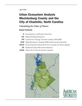
  • 1. Urban Ecosystem Analysis Mecklenburg County and the City of Charlotte, North Carolina April 2010 Report Contents 2 Introduction and Project Overview 2-3 Major Findings Summary 4-5 Land Cover Change Trends: Landsat 1985-2008 5-10 High Resolution Analysis 2008 and Ecosystem Benefits 10-13 Protecting Watershed Scale Tree Canopy for Water Quality 14 Implementation Recommendations 15-16 About the Urban Ecosystem Analysis Calculating the Value of Nature
  • 2. The project’s objectives are threefold: 1) To provide detailed information regarding land cover trends and their ecological implications relevant to both Mecklenburg County and the City of Charlotte; 2) to replace Charlotte Mecklenburg’s ag- ing 2002 high resolution land cover data with 2008 high reso- lution land cover data, so local staff, as project partners can analyze how to best preserve tree canopy, target tree planting and reforestation efforts and to enhance riparian vegetation corridors, all of which are vital to protecting the area’s envi- ronmental assets; and 3) to provide tools to enable local deci- sion makers to more effectively plan for and manage growth in Mecklenburg County, the City of Charlotte and surround- ing towns. These tools, if used in accordance with recom- mendations in this report, will help the community improve air and water quality and minimize degradation of the area’s tree canopy, stream network and remaining open space. Unfortunately, this UEA confirms that Charlotte Mecklen- burg has continued its trend of losing tree canopy and open space while its urban area has continued to expand. How- ever, the good news is that the tools used to complete this analysis also offer feasible solutions. Charlotte Mecklenburg can use the tools and new data provided as part of this proj- ect to change this trend and maintain a healthy, sustainable tree canopy and maximize its ecosystem services benefits. With this goal in mind American Forests recommends that the community: 1) Integrate these new land cover data into its planning processes so that impacts from future growth and development can be anticipated and managed to pre- serve canopy wherever possible; 2) Use the integrated data to conduct additional and more detailed analysis of the com- munity’s natural assets using CITYgreen® software with con- sideration of the community’s land use plans, zoning catego- ries, transportation plans, etc.; 3) Guided by this additional analysis, establish tree canopy goals that can be attained within various zoning categories and key watershed areas as it continues to develop; and 4) Preserve and plant trees throughout Charlotte Mecklenburg on a continuing basis to obtain and sustain a suitable and level of tree canopy. Major Findings Summary An analysis of Landsat data, used to identify landcover change trends found: • Between 1985 and 2008, Mecklenburg County, lost 33% of its tree canopy and 3% of its open space, while gaining 60% of urban area (Table 1). These changes resulted in the loss of the tree canopy’s ability to naturally manage 252 million cubic feet of stormwater, valued at $504 mil- lion using a local engineering cost of $2 per cubic foot.2 2 Introduction and Project Overview Trees are important indicators of the health of a community’s urban ecosystem. When trees are large and healthy, the eco- logical systems that support them are also healthy. Healthy trees provide valuable environmental benefits through the biological functions of their roots and leaves. These can be measured in terms of ecosystem services including reducing stormwater runoff, increasing carbon storage, and improving air and water quality. The greater the tree cover and the less the impervious surface in a community, the more ecosystem services are produced. American Forests assesses the health and benefits of urban ecosystems through a process called Urban Ecosystem Analy- sis (UEA). This Urban Ecosystem Analysis of Charlotte Meck- lenburg updates American Forests’ earlier local, regional, and multi-state work including an UEA of Mecklenburg County in 2003, the Carolina Piedmont Green Initiative - an analysis of the 15 county region surrounding Charlotte in 2005, and an UEA of the Mountain Island Lake Watershed in 2007.1 With an understanding of these prior American Forests’ proj- ects and recognizing that the continued conversion of natural areas into urban areas contributes to increased management costs to preserve quality of life for its residents, the City of Charlotte commissioned American Forests to conduct this new UEA of Charlotte Mecklenburg to document current land- cover change trends and to provide detailed data for decision making going forward. The project was made possible through a generous grant from our major contributor, The Women’s Impact Fund, through the use of digital imagery provided by Mecklenburg County, and through additional funding from the City of Charlotte and the Blumenthal Foundation. This new UEA used satellite imagery, GIS technology and American Forests’ CITYgreen software, to analyze land cover of Mecklenburg County, including Charlotte and the towns of Davidson, Cornelius, Huntersville, Matthews, Mint Hill, and Pineville at two scales, spanning two time periods. The first analysis, a trend analysis, utilized moderate-resolution 30-meter Landsat imagery acquired in 1985 and 2008 to quantify land cover changes that occurred during this 23 year time period. The second analysis, a much more detailed high resolution analysis, used National Agricultural Imagery Program (NAIP) data from 2008 one meter pixel resolution digital imagery to determine current land cover for Mecklen- burg County, the City of Charlotte, the McDowell Creek and Goose Creek Subwatersheds, and the County’s stream buf- fer network in its entirety. In addition, 2002 high resolution data from the previous UEA was used to compare tree canopy changes with 2008 high resolution data. Urban Ecosystem Analysis: Mecklenburg County and the City of Charlotte, North Carolina
  • 3. 3 The County’s green infrastructure3 also lost the ability to remove approximately 3.8 million lbs. of air pollutants an- nually, valued at $8.8 million per year, 192 million lbs. of carbon stored in trees’ wood and 1.5 million lbs. of annual carbon sequestration—the rate at which carbon is stored. • Between 1985 and 2008, the City of Charlotte lost 49% of its tree canopy and 5% of its open space while gaining 39% of urban area (Table 1). An analysis of recent high resolution data4 providing a snap- shot in time and quantifying what a workhorse Charlotte Mecklenburg’s current green infrastructure is to the com- munity, found: • As of 2008, Mecklenburg County had a 50% tree canopy cover, which provided 1.4 billion cubic feet of stormwater detention services, valued at $2.8 billion, removed 14.9 mil- lion lbs. of air pollutants at a value of $40 million per year, stored 7.5 million tons of carbon in trees’ wood and seques- tered 59,000 tons of carbon annually (Table 4). • As of 2008, the City of Charlotte had a 46% tree canopy that provided 662 million cubic feet of stormwater deten- tion services, valued at $1.3 billion, removed 7.2 million lbs. of air pollutants at a value of $19.2 million per year, stored 3.7 million tons of carbon in trees’ wood and sequestered 28,000 tons of carbon annually (Table 4). • Of Charlotte Mecklenburg’s 32,000 acres of stream buf- fers (vegetation adjacent to streams that filters out water pollutants before they can enter streams), 22,627 acres (71%) is tree canopy. This buffer network removes 1.9 mil- lion lbs. of air pollutants annually, valued at $5.1 million, manages 177 million cubic feet of stormwater, valued at $354 million, stores 974,000 tons of carbon, and sequesters 7,600 tons of carbon per year (Table 4). American Forests Report • Certain land areas within Charlotte Mecklenburg, like the McDowell Creek Subwatershed, are vital to protecting the area’s drinking water. Yet even at the Subwatershed’s current 51% tree canopy, the Environmental Protection Agency has documented McDowell Creek as an impaired stream and unfit for swimming. In these critical areas, los- ing additional tree canopy to urban development only exacerbates the water pollutants entering the Creek and increases the costs of providing drinking water to the com- munity. For example, a 5% change from tree canopy to urban landcover in McDowell Creek Subwatershed would decrease the watershed’s ability to naturally manage 4.9 million cubic feet of stormwater, valued at $9.8 million. • Charlotte Mecklenburg’s tree cover has declined for the last 23 years and new policies and practices will need to emerge to reverse this trend. Based upon this latest data, tree canopy in Mecklenburg County has reached the point where further decline will cause the County to fall below levels recommended by American Forests. Charlotte Meck- lenburg is now at a crossroads that will set the course for environmental quality for decades to come. The data and tools provided with this UEA offer decision support tools to help Charlotte Mecklenburg communities maintain the recommended levels of tree canopy as they continue to grow. These tools will also allow local leaders and staff to calculate the positive contributions of not only halting decline, but enhancing green infrastructure. For example by increasing tree canopy from its current 50% to 55%, Mecklenburg County’s ecosystem benefits would provide an additional 1.5 million lbs. of air pollutant removal an- nually, valued at $4 million, decrease 232 million cubic feet of stormwater runoff, valued at $464 million, increase carbon storage 772,000 tons and increase carbon seques- tration 6,000 tons per year (Table 6). The UEA process involves a technical analysis of a community’s land cover data taken from satellite imagery and aerial photography, computer technology called Geographic Information Systems (GIS), and the application of scientific and en- gineering models developed by experts to quantify environmental benefits. In short, the UEA calculates the benefits the studied community derives from ecosystem services provided by its natural assets. Upon completion of an UEA the community receives data that accurately depict and quantify the community’s land cover by type (trees, open space, urban area, and water) and detailed information about the ecosystem services and associated financial benefits. American Forests also provides CITYgreen® software to the community’s planners and managers which enable them to integrate data about the natural assets into growth and development planning and management endeavors. This in turn enables the community to design and adopt effective measures to protect and preserve the community’s trees and other natural assets. American Forests has conducted UEAs within 40 different urban areas across the country and documented a disturbing trend--urban areas are losing trees at an alarming rate while urban land cover like roads and buildings, has been increasing rapidly. This trend is harming local environmental assets and quality of life in significant ways and is also costing communi- ties billions of dollars because ecosystem services are lost when trees are removed.
  • 4. 4 Land Cover Change Trends: Landsat 1985-2008 Using moderate resolution satellite data from Landsat imagery acquired in1985 and 2008, American Forests measured changes in four distinct land cover types: tree canopy, urban, open space, and water within Mecklenburg County. This moderate resolution data identi- fies land cover change trends between these years. The analysis quantified the impacts these changes had on stormwa- ter management, air and water quality, and carbon sequestration and storage. It is important to note that Landsat data is valuable for identifying general trends and comparing landcover from one pe- riod of time to another in large areas but these data are not used to deter- mine where trees, open space and urban area are located due to its coarse scale. In contrast, the high resolution dataset discussed later in this report provides an accurate spatial location of land- cover and is the appropriate resolution to use to determine land cover existing in smaller parcels. High resolution data are used for planning and management functions involved in achieving tree can- opy and open space goals, etc. Because of the difference in resolution, Landsat data and high resolution data cannot be compared to one another. Landcover change trends from this study continue to document tree can- opy decline noted in the earlier UEAs. Between 1985 and 2008, Mecklenburg County lost 33% tree canopy and 3% open space while gaining 60% urban area. In the same time period, the City of Charlotte lost 49% tree canopy and 5% open space while gaining 39% ur- ban area (Figure 1). Table 1 shows landcover percent change trends, both historic and projected trends to 2015, assuming that landcover continues to change at the current rates. Figure 1. Mecklenburg County Tree Loss 1985-2008 Urban Ecosystem Analysis: Mecklenburg County and the City of Charlotte, North Carolina
  • 5. American Forests Report 5 There are ecological consequences when there is a loss of per- vious land cover, such as tree canopy, open space and other vegetated areas, which defines an area’s green infrastructure. There are also ecosystem impacts with an increase in urban areas. The 23-year trend data for Mecklenburg County shows that the loss of green infrastructure adversely affected the County’s natural environment’s ability to provide ecosystem services for air, water, and carbon (Table 2). Mecklenburg County lost the ability to naturally manage 252 million cubic feet of stormwater, valued at $504 million. The City of Charlotte provided local engineered unit cost of $2 per cubic foot to calculate the value of mitigating this ad- ditional stormwater. Mecklenburg County’s land cover also To update the County’s aging 2002 land cover data set, American Forests classified Mecklenburg County-provided 2008 NAIP data taken from high resolution imagery. This dataset provides a current snapshot of Charlotte Mecklen- burg’s landcover at a scale suitable to be further analyzed by the local community. Using these data, small areas of land- cover within Charlotte Mecklenburg such as subwatersheds, zoning categories, and stream buffers can be accurately mea- sured and related ecosystem services quantified. This dataset also provides Charlotte Mecklenburg with the most recently available planning and management tools. American Forests classified these high resolution data into five land cover categories: trees, open space, urban area, bare soil, and water. American Forests then used CITYgreen software to conduct UEAs of Mecklenburg County, the City of Charlotte, the McDowell Creek Subwatershed, the Meck- lenburg County portion of the Goose Creek Subwatershed, and the County’s stream network and buffer zone in its en- tirety. As described in the Implementation Recommenda- tions section on page 14, American Forests recommends that Charlotte Mecklenburg use this updated digital data set to identify areas for reforestation projects and engage the other community partners in reforesting these areas to improve stream health and water quality. Landcover 1985-2008 Projected 2008-2015* Charlotte Mecklenburg Co. Charlotte Mecklenburg Co. Open Space -5% -3% -3% -5% Trees -49% -33% -1% -3% Urban 39% 60% 4% 9% Table 1. Landsat Land Cover Percent Change Trends5 Loss in Tree Loss of Air Loss in Loss in Stormwater Value Loss of Carbon Canopy Change Pollution Removal Removal Value Stormwater Value @ $2/cu ft. Carbon Stored Sequestered % lbs./yr dollar value cu. ft. dollar value tons tons -33.0% -3,779,778 -$8,771,658 251,789,395 $503,578,789 -192,066,507 -1,495,289 Table 2. Mecklenburg County Change in Ecosystem Services Landsat Data 1985-2008 lost $8.8 in annual air pollution removal benefits, 192 million pounds of carbon storage and 1.5 million pounds of carbon sequestration annually. Tree roots absorb water pollutants for which nine measures are available: Biological Oxygen Demand, Cadmium, Chro- mium, Chemical Oxygen Demand, Lead, Nitrogen, Phospho- rus, Suspended Solids, and Zinc. In Mecklenburg County the amount of these contaminants entering streams and lakes worsened in the past 23 years. This chronological analysis provides valuable public policy information regarding the continual loss trends in tree canopy cover and associated eco- system impacts. For this UEA, American Forests used the U.S. Geological Survey’s (USGS) 2001 National Land Cover Data (NLCD) as the baseline to update land cover change.6 The USGS data, considered the gold-standard for land cover change analysis, was classified from 30-meter Landsat data acquired in 2001. American Forests utilized this dataset as the basis to compare land cover change from 1985 to 2008. High Resolution Analysis 2008 and Ecosystem Benefits
  • 6. 6 Figure 2. 2008 Mecklenburg County Landcover
  • 7. 7 Figure 3. 2008 Charlotte Landcover
  • 8. 8 2002 and 2008 High Resolution Comparison To determine landcover change trends during the most recent six year period, American Forests compared the 2002 high resolution data used in the previous UEA with 2008 high resolution data from this project after making appropriate data scaling and boundary adjustments. Since Charlotte gained land area due to boundary changes by 2008, this analysis used the 2008 boundary area in order to make an accurate comparison. The six year period shows that tree canopy continued to decline in both the City and County. Charlotte lost 3,231 acres of trees, a 2% decline and Mecklenburg County lost 9,475 acres of trees, a 3% decline over this six year period (Figure 4). If no action is taken to reverse this trend, and the rate of landcover change contin- ues, projections to 2015 show that Mecklenburg County will lose an additional 20,500 acres of tree canopy and Charlotte will lose an additional 7,000 acres of tree canopy. Urban Ecosystem Analysis: Mecklenburg County and the City of Charlotte, North Carolina Figure 4. Actual and Projected Tree Canopy Decline in Charlotte Mecklenburg Stormwater Benefits Trees reduce the volume of stormwater runoff by capturing some rain on their leaves and branches, which then evapo- rates back into the atmosphere. Other water is absorbed by the tree roots or infiltrates into the soil rather than running off the land. As a result less runoff must be managed by manmade infrastructure. In 2008, Mecklenburg County had Table 3. Landcover, Tree Canopy and Population Comparison (4 meter pixel resolution)* 2002** 2008** Total Acres* Canopy Acres* Population*** Total Acres Canopy Acres Population*** Mecklenburg County 348,962 184,528 (53%) 746,427 349,162 175,053 (50%) 902,803 Charlotte 183,575 88,184 (48%) 579,684 183,575 84,953 (46%) 695,995 *The acreage reported in Tables 3 and 4 will be different due to data scaling adjustments made in order to compare 2002 and 2008 data. ** Since Charlotte’s land boundaries changed during this time, the 2008 land boundary was used in both analyses to make an accurate comparison of canopy change. Even though the same boundary was used in both analyses, the acreage reported is slightly different due to data scaling adjustments when changing from a 1 meter to a 4 meter pixel resolution. ***Population source: Charlotte Chamber: http://www.charlottechamber.com/index.php?submenu=population_estimates&src=gendocs&ref=PopulationEstimates2008&category= Demo_ecoProfile a 50% tree canopy, which managed 1.4 billion cubic feet of stormwater, valued at $2.8 billion using a $2 per cubic foot value based on local costs (see Analysis Formulas, pg. 8). In 2008, Charlotte’s 46% tree canopy provided 662 million cubic feet of stormwater management, valued at $1.3 billion. Air Air Pollution Stormwater 2008 Tree 2008 Tree Pollution Removal Carbon Carbon Stormwater Value Area Canopy Canopy Removal Value Stored Sequestered Value* @ $2 per cu. ft acres acres percent lbs./ yr dollar value tons tons cu. ft. dollar value Mecklenburg Co. 351,507 175,395 50% 14,853,127 $39,639,770 7,547,502 58,759 1,376,836,456 $2,753,672,911 Charlotte 183,570 84,943 46% 7,193,286 $19,197,318 3,655,213 28,457 661,848,956 $1,323,697,911 McDowell Cr. Wsd 18,628 9,427 51% 798,325 $2,130,555 405,663 3,158 70,323,500 $140,647,000 Goose Cr. Wsd** 7,161 4,380 61% 370,948 $989,979 188,494 1,467 38,711,659 $77,423,318 Stream Buffer Network 31,952 22,627 71% 1,916,118 $5,113,703 973,661 7,580 177,236,524 $354,473,048 “*Stormwater analysis uses a 2yr, 24 hour storm event. The value of managing stormwater is based on current local construction costs of $2.00 per cubic foot (city of Charlotte). **Only the Mecklenburg County portion of the Goose Creek Watershed is included in this study. Table 4. 2008 Tree Canopy and Ecosystem Services from High-Resolution Data (1 meter pixel resolution) 54% 52% 50% 48% 46% 44% 42% 2002 2008 2015 Charlotte Mecklenburg Co.
  • 9. 9 American Forests Report Water Quality Benefits Trees provide very valuable water quality ecosystem services. Tree roots absorb water pollutants for which ten measures are available: Biological Oxygen Demand, Cadmium, Chromium, Chemical Oxygen Demand, Lead, Nitrogen, Phosphorus, Suspended Solids, and Zinc. For Mecklenburg County, water pollution, as measured in percent change in pollutant load- ing, would worsen, from 21% for Zinc to 132% for Chemical Oxygen Demand if the existing trees were removed from the land. For the City of Charlotte, water pollution, as measured in percent change in pollutant loading, would worsen, from 19% for Zinc to 108% for Chemical Oxygen Demand if the existing trees were removed from the land. Air Quality Benefits Air quality is of particular concern in the Charlotte Mecklen- burg region because the Environmental Protection Agency (EPA) has designated Mecklenburg County and surround- ing counties as a non-attainment area for ozone and carbon monoxide. “Sunlight and hot weather can cause ground- lev- el ozone to form in harmful concentrations in the air. As a result, it is known as a summertime air pollutant. For this rea- son, the months of April through October often are referred to as the “ozone season” in this area.”7 The air quality ecosystem services provided by trees are a big plus for the Charlotte Mecklenburg region. Tree canopy cools the air by evaporating water and by direct shading of buildings and pavement. This lowers the ambient tempera- ture in cities (known as urban heat islands), reducing ground level ozone production and related smog conditions. While trees also emit hydrocarbons that contribute to smog ozone, research shows that because of trees cooling effects, they pro- vide a net benefit in reducing air pollution.8 The ecological value of air quality ecosystem services is based on the UFORE model developed by the U.S. Forest Service. The dollar value is calculated based on externality costs to so- ciety (such as public health-related respiratory costs) due to the additional air pollution. Externality values are established by State Public Service Commissions. Mecklenburg County’s urban forest removes 14.9 million lbs. of air pollutants annu- ally, valued at almost $40 million per year. Charlotte’s urban forest removes 7.2 million lbs. of air pollutants annually, val- ued at almost 19.2 million per year (Table 5). Mecklenburg County Water Pollutants As Measured In Percent Change in Contaminant Loading City of Charlotte Water Pollutants As Measured In Percent Change in Contaminant Loading Air Pollutant Mecklenburg Co. Charlotte Lbs. Lbs. Removed $ Value Removed $ Value per yr. per yr. per yr. per yr. Carbon Monoxide 625,395 $306,928 302,895 $148,653 Nitrogen Dioxide 1,094,441 $22,647,903 530,067 $1,872,752 Ozone 6,410,297 $3,866,715 3,104,675 $10,968,976 Particulate Matter 4,690,461 $11,064,084 2,271,714 $5,358,627 Sulfur Dioxide 2,032,533 $1,754,140 984,409 $849,576 Totals 14,853,127 $39,639,770 7,193,760 $19,198,584 Table 5. Urban Forest Air Pollutant Removal Benefits
  • 10. 010 Protecting Watershed Scale Tree Canopy for Water Quality McDowell Creek Subwatershed In its most comprehensive analysis of the region, American Forests’ Urban Ecosystem Center9 and Michael Gallis and Associates10 completed a study in 2007 of the Piedmont Crescent region,11 an area covering seven states including North Carolina, to evaluate the natural system, the human network and their interactions. The findings showed that the ecosystem in the region, once designated as globally outstanding because of its lush flora and fauna,12 is in a state of decline even greater than suspected. Growth and develop- ment across the region has resulted in natural land fragmen- tation, resource depletion, pollution, erosion, and species extinction. Urban Ecosystem Analysis: Mecklenburg County and the City of Charlotte, North Carolina Carbon Storage and Sequestration Benefits Trees have a direct impact on the carbon footprint—the amount of atmospheric carbon a community produces that contributes to global warming. Trees provide a carbon sink by storing and sequestering atmospheric carbon in their wood. Both the total storage and the rate at which car- bon is stored (known as sequestration) can be measured. Charlotte’s tree canopy stores 3.7 million tons of carbon and sequesters 28,000 tons of carbon annually. Planting new trees and maintaining existing trees provide opportunities for the public and private sector to reduce their commu- nity’s carbon footprint. Modeling Ecosystem Benefits of Increased Tree Canopy As mentioned earlier, Charlotte Mecklenburg continues to lose tree canopy cover and open space. Fortunately, Mecklenburg County is already using the data from American Forests’ previous UEA and is poised to use the data set produced by this UEA for land use planning (see Implementation Recommendations, pg. 14) and to implement watershed management practices as described for McDowell Creek below. To illustrate how Charlotte, Mecklenburg County, and the local towns might go about reversing the trend of canopy loss and leverage the benefits that tree canopy provides, American Forests modeled an increase in Mecklenburg County’s tree canopy from its cur- rent 50% to 55% and calculated the additional ecosystem service benefits this resource would provide in helping the community achieve its water and air quality goals. If the County increased its canopy cover by 5% overall, the ecosystem services would provide an additional $4 million in annual air pollutant removal value, an additional 771,000 tons of stored carbon and an annual 6,000 tons of seques- tered carbon, as well as 232 million cubic feet of additional managed stormwater, valued at $464 million. Table 6 details these increased benefits. Of course the region would also realize other benefits in the form of increased property value, increased tax revenue, reduced energy consumption, etc., not detailed in this report. Charlotte Mecklenburg planners can use the data set delivered with this project to establish overall tree canopy goals and also to stratify goals by land use. Staff can look for opportunities within public and private land to increase tree canopy cover which will improve overall environmental benefits. Tree planting and ongoing care engages all sectors of the community, where everyone has the opportunity and responsibility to contribute. A community’s pervious land cover serves as its green infrastructure; its protection and enhancement provides direct benefits to the taxpayer and improved environmen- tal quality including slowing stormwater runoff, improv- ing water and air quality, protecting soil from erosion, and storing atmospheric carbon. Green infrastructure includes vegetation and their complex interactions with soil, air and water systems. As defined in this project, green infrastructure includes tree canopy, open space, and water. American Forests used CITYgreen software to analyze the environmental and dollar value of each ben- efit. For more details and formulas used in each assess- ment visit: http://www.americanforests.org/resources/ urbanforests/naturevalue.php Additional Additional Additional Air Pollution Additional Additional Additional Stormwater 2008 Tree Modeled Air Pollution Removal Carbon Carbon Stormwater Value Canopy Tree Canopy Removal Value Stored Sequestered Mgmt Reduced @ $2 per cu. ft* percent percent lbs./ yr dollar value tons tons cu. ft. dollar value Mecklenburg Co. 50% 55% 1,518,710 $4,053,109 771,721 6,008 -231,982,887 -$463,965,775 *Stormwater analysis uses a 2yr, 24 hour storm event. The value of managing stormwater is based on current local construction costs of $2.00 per cubic foot (source of unit cost: City of Charlotte). Table 6. Modeled Ecosystem Benefits from Increasing Mecklenburg County’s Tree Cover
  • 11. 11 Figure 5. 2008 McDowell Creek Watershed Landcover
  • 12. 12 The magnitude and relevance of these findings are best illustrated at the watershed scale—where the importance of protecting urban forests for water quality touches everyone. In Mecklenburg County, this is best illustrated with two case studies—McDowell Creek and Goose Creek. The McDowell Creek subwatershed is 19,200 acres in area and has thou- sands of existing homes with many more planned. Water flows from McDowell Creek into Mountain Island Lake that provides eighty percent of the drinking water for 700,000 people who live in Charlotte Mecklenburg. This area’s rapid development has severely threatened the community’s water quality; McDowell Creek is already documented as an impaired stream under EPA regulations and is unhealthy for swimming. The main cause of this impairment is increased pollution from sediment and erosion as a result of develop- ment. McDowell Creek subwatershed, with its current 9,427 acres (51%) tree canopy, provides 70 million cubic feet in non-structural stormwater runoff management, valued at $141 million (Table 4). The ecological impacts of losing tree canopy cover in this crit- ical area will increase stormwater runoff and exacerbate the water pollutants flowing into Mountain Island Lake which can in turn increase the costs of providing drinking water. For example, a 5% change from tree canopy to urban land- cover in the McDowell Creek Sub-watershed will decrease the ability to naturally manage 4.9 million cubic feet of stormwa- ter, valued at $9.8 million in stormwater management alone. The damage to water quality for the city and county drinking water is a cost too high to measure. Increasing the tree cover in critical places, like planting trees to buffer the stream is a high priority task. The green data layer provided as part of this project will allow the local officials to identify the critical places and organize a replanting strategy. Charlotte-Mecklenburg Storm Water Services and the North Carolina Division of Water Quality have long recognized the need to protect the area’s drinking water supply. In response to this need, water supply watershed protection ordinances were implemented in the McDowell Creek Watershed in 1992. The ordinances only apply to the portions of McDowell Creek designated as Water Supply (WS) waters which are approximately located in the downstream third of the water- shed. Subsequent to adoption of the watershed protection ordinance, the S.W.I.M. Buffer ordinance was implemented in 1999 that required undisturbed stream buffers through- out the McDowell Creek Watershed. Additionally, in 2003 Huntersville adopted a land development ordinance that Urban Ecosystem Analysis: Mecklenburg County and the City of Charlotte, North Carolina required new development to implement low-impact develop- ment practices as well as dedicate a percentage of develop- ment area as open space. Implementation of these require- ments has helped to hold the line on further degradation in the watershed; however it did not address pre-existing sources of pollution. The Charlotte-Mecklenburg Stormwater Services staff devel- oped the McDowell Creek Watershed Management Plan (2005) that sets water quality goals and presents a detailed plan of action to achieve them. The County, as a partner in this UEA project, will be able to use the new data set and software tools provided as part of this UEA to update its 2002 stream network data set, and to: 1) Identify areas for reforestation projects over the next three years; and 2) Engage with other community partners in reforesting these areas to improve stream health and water quality. Overall, the data will provide a baseline for future assessments, moni- toring how effective the Watershed Management Plan has been, how effective Charlotte Mecklenburg stream buffer ordinances have been over the last six years, and what adjust- ments need to be made to protect and enhance tree canopy at the subwatershed scale like McDowell Creek. Goose Creek Subwatershed The Mecklenburg County portion of the Goose Creek Subwatershed is comprised of 7,161 acres of land of which 61% is currently tree canopy. In 2008, tree canopy provided 39 million cubic feet in stormwater management services, valued at $77 million (Table 4). The U.S. Fish and Wildlife Service designated Goose Creek as habitat for a federally- endangered species of fresh water mussel called the Carolina Heelsplitter. The Heelsplitter is an indicator species, known for its sensitivity to water pollution. Mussels need cool, clean, well-oxygenated water, typically found in stable creeks with stable banks to survive. Goose Creek is currently listed as an impaired stream under criteria established by the Clean Water Act; the main cause of impairment is non-point source pollutants. Mecklenburg County and the Towns of Mint Hill, Stallings and Indian Trail, in accordance with State and Federal laws, have imple- mented the Goose Creek Water Quality Recovery Program to improve water quality conditions in Goose Creek in an effort to protect the Carolina Heelsplitter. Planting and maintain- ing existing vegetation in buffer areas that line creek banks is the best way to stabilize them.13
  • 13. American Forests Report 13 Figure 6. Mecklenburg County’s Network of Forested Stream Buffers Species diversity is an indicator of ecological health. The Piedmont Crescent region of the Southeast United States is recognized as globally outstanding by the World Wildlife Fund in Terrestrial Ecosystems of North America, (Island Press, 1999). As described in this report, the protection of the Carolina Heelsplitter in Goose Creek begs a broader question, why does species diversity matter? Humans thrive at the top of the food chain because a diverse set of species exists below them. What may seem to be an obscure species in a stream or woodland plays an important role in the conversion of energy and nutrients within the natural system so that people have the air, water and nutrients they need to thrive. Stream Buffers Mecklenburg County has 32,000 acres of stream buffers.14 With 22,600 acres (71%) of tree canopy, this extensive network currently provides 177 million cubic feet of stormwater management, valued at $354 million (Table 4). The County has measured the pollutant removal benefits that riparian buffers naturally achieve by diffusing stormwa- ter runoff--specifically removing 30% Nitrogen, 30% Phosphorus, and 85% of Suspended Solids (Diffuse Flow Requirement 15A NCAC 2B.0233(5)). Additional land cover analyses of watersheds throughout Charlotte Mecklenburg,likethosecompletedhere for Goose Creek and McDowell Creek can support local efforts to protect the entire stream network. Reforestation can reduce stormwater runoff into the streams, reduce pollutant loading now occurring in the streams, improve air quality and provide habitat for wildlife. County and citizen tree planting part- nerships can significantly reduce the cost of reforestation and enhance this valuable resource that contributes to water quality without costly construct- ed infrastructure (see Implementation Recommendations pg. 14).
  • 14. 14 Urban Ecosystem Analysis: Mecklenburg County and the City of Charlotte, North Carolina Implementation Recommendations The digital data set included in this project is packaged into GIS interactive data layers compatible with existing GIS data so that Charlotte Mecklenburg staff and local leaders can use it to make well-informed planning decisions. American Forests recommends the following actions to better integrate green infrastructure into local decision making. Use the green data layer and CITYgreen software to calculate the ecosystem services provided by existing tree programs • Share the green data layer provided with this project among County and City departments concerned with eco- system services. • Test the impacts of changing tree canopy, impervious sur- faces, and other land covers under different development scenarios. Using the high resolution data, analyses can be conducted on a neighborhood, subwatershed, or citywide scale. Plan and establish tree canopy goals American Forests recommends that Mecklenburg County adopt an overall 50%-55% tree canopy goal. This revised goal from the previous UEA responds to the continuing County- wide tree canopy decline trend, especially in critical water- shed areas. Increasing canopy to the higher end of this range in key areas will have the most beneficial impact. Since the County is currently at the bottom of this recommended goal, this requires developing no net loss of canopy strategies for future development. This can be accomplished if Charlotte Mecklenburg will: • Integrate these new land cover data into Charlotte Meck- lenburg’s planning processes so that impacts from future growth and development can be anticipated and managed to preserve canopy wherever possible. Where this is not possible, establish a tree replacement fee to plant trees elsewhere in the County. • Conduct additional and more detailed analysis of the com- munity’s natural assets using CITYgreen software with con- sideration with the community’s land use plans, zoning categories, transportation plans, etc. • Use this additional analysis to guide the community in es- tablishing tree canopy goals that can be attained within various zoning categories and key watershed areas as it continues to develop. • Budget adequately to both maintain existing canopy and to plant trees throughout Charlotte Mecklenburg on a continuing basis until a suitable and sustainable level of tree canopy is achieved. Use green data layer data to identify critical areas for refor- estation • Conduct additional UEAs to focus reforestation efforts on critical areas such as riparian stream buffers within Mc- Dowell Creek Subwatershed and the Goose Creek Subwa- tershed. Use the findings from the Urban Ecosystem Analysis to in- crease awareness of the relationship between trees and en- vironmental quality and to engage citizens in environmental improvement efforts like tree planting. • Communicate the findings to media. • Incorporate findings from the UEA into active citizen pro- grams: – The Creek ReLeaf ® Program is a collaborative effort of the Charlotte Public Tree Fund, Charlotte Mecklen- burg Stormwater Services, the Center for Sustainability at Central Piedmont Community College, and the Sier- ra Club Central Piedmont Group. Dedicated volunteers and financial supporters plant trees in riparian areas (floodplain and stream buffers) of Mecklenburg County. Visit: http://www.charlottetreefund.org/?page_id=20 – Big Sweep is an award–winning grassroots nonprofit organization whose mission is a litter–free environment. They conduct year-round education to prevent litter and coordinate the annual North Carolina Big Sweep, to clean up statewide land and waterways. Visit: http:// www.ncbigsweep.org/ – Trees for Change is a collaborative program of the Charlotte Public Tree Fund and the Charlotte Tree Ad- visory Commission that educates local school children on the value of trees and then engages the students in a tree planting program either at their school or else- where in the community. Visit: http://www.charlottet- reefund.org/?page_id=22 • Incorporate CITYgreen schools program into public schools to increase awareness of environmental issues, by teaching practical applications of GIS, math, science and geography. Curriculum is available through American For- ests’ Urban Ecosystem Center.
  • 15. American Forests Report 015 About the Urban Ecosystem Analysis American Forests Urban Ecosystem Analysis is based on the assessment of “ecological structures”—unique combinations of landuse and land cover patterns. Each combination per- forms ecological functions differently and is therefore as- signed a different value. For example, a site with greater tree canopy provides more stormwater reduction benefits than one with less tree canopy and more impervious surface. Data Used Landsat (30 meter pixel resolution) Imagery: To keep current with rapidly changing Geographic Information Systems (GIS) tech- nology, American Forests calibrated land cover change for this UEA report based on the US Geological Survey (USGS) 2001 National Land cover Dataset (NLCD). The USGS’s NLCD data set is now the standard for Landsat-derived land cover change analysis and was used to classify the imagery of Mecklenburg County for 1985 and 2008. This enabled very accurate compari- son trends of the landcover data for these years to determine changesthatoccurred.Imageryfrom1985and2008alsoaligned almost perfectly, further increasing the accuracy of landcover change calculations. This approach also enables comparisons of this data to data collected in the future more reliable. Unfortunately, the NLCD was not available when American For- ests completed the previous UEA and this is but the first reason comparisons between the Landsat data from two UEAs should not be made. Second, the previous UEA reported landcover change for trees, open space and impervious surfaces (build- ings, roads, and parking lots primarily). Since then, the Multi Resolution Land (MLRC) consortium redefined urban land cover and this broader category, as used in the new UEA, now includes not only impervious cover but adds landcover such as compacted gravel. Third, the time periods differ--1984 to 2001 in the earlier UEA and 1985 and 2008 in the current. Fourth, changes to both boundaries and acreage for Charlotte and Mecklenburg County have occurred since the previous UEA was completed. During this time period, Mecklenburg County lost 2,352 acres and Charlotte gained 28,336 acres of land. To summarize, the Landsat data and landcover change trends from the previous UEA report are accurate and were based upon the best technology available at that time, they cannot however be reliably compared to the calculations based upon Landsat data in this new UEA for the reasons described. NAIP High Resolution (1 meter pixel resolution) Imagery: For the high resolution imagery, Mecklenburg County acquired Na- tional Agriculture Imagery Program (NAIP) 1-meter pixel res- olution, 4-band, multi-spectral satellite imagery in 2008. Amer- ican Forests conducted a knowledge-based classification of this imagery to divide the land cover into five land cover catego- ries: trees, open space, urban, bare soil, and water. The high resolution data was resampled to 4 meter, a size suitable for running ArcGIS to conduct these analyses. The classified data set provided with this project is at 1-meter. Although USGS re- defined urban landcover as mentioned above, comparisons of the high resolution data from 2002 and 2008 for tree canopy are still valuable and instructive to indicate trends. Analysis Formulas Urban Ecosystem Analyses were conducted using American Forests’ CITYgreen software® . CITYgreen for ArcGIS calculates the value of green infrastructure. Data inputs include rainfall, soil types and remotely sensed imagery. These data are used to populate scientific and engineering formulas so calculations of ecosystem services can be performed. TR-55 for Stormwater Runoff: The CITYgreen stormwater analy- sis estimates the amount of stormwater that runs off a land area during a major storm. The stormwater runoff calcula- tions incorporate volume of runoff formulas from the Urban Hydrology of Small Watersheds model (TR-55) developed by the U.S. Natural Resources Conservation Service (NRCS), formerly known as the U.S. Soil Conservation Service. Don Woodward, P.E., a hydrologic engineer with NRCS, custom- ized the formulas to determine the benefits of trees and other urban vegetation with respect to stormwater management. The City of Charlotte staff provided a local average $2 per cubic foot dollar value for the CITYgreen stormwater calcu- lations based on North Carolina State University study for wet ponds (2003) http://www.bae.ncsu.edu/stormwater/ PublicationFiles/BMPCost&Benefit2003.pdf. This value was used in all the stormwater analyses. However, it is important to note that American Forests’ Urban Ecosystem Center has worked with the retired national hydrologist of the National Soil Conservation Service and dozens of metropolitan areas around the country to determine the value per cubic foot and in many cases this value is significantly higher, in the range of $6 per cubic foot. It is therefore important that each com- munity determine its own values to accurately calculate the stormwater benefits it would realize from its tree canopy. L-THIA for Water Quality: Using values from the U.S. Envi- ronmental Protection Agency (EPA) and Purdue Univer- sity’s Long-Term Hydrological Impact Assessment (L-THIA) spreadsheet water quality model, the Natural Resources Con- servation Service (NRCS) developed the CITYgreen water quality model. This model estimates the change in the con- centration of the pollutants in runoff during a typical storm event given the change in the land cover from existing trees to a no tree condition. This model estimates the event mean concentrations of nitrogen, phosphorus, suspended solids, zinc, lead, cadmium, chromium, chemical oxygen demand (COD), and biological oxygen demand (BOD). Pollutant val- ues are shown as a percentage of change.
  • 16. American Forests, P.O. Box 2000, Washington D.C. 20013 Phone: 202/737-1944; Fax: 202/737-2457 Web: www.americanforests.org UFORE Model for Air Pollution: CITYgreen® uses formulas from a model developed by David Nowak, PhD, of the USDA For- est Service. The model estimates how many pounds of ozone, sulfur dioxide, nitrogen dioxide, and carbon monoxide and particulate matter less than 10 microns are absorbed and fil- tered by tree canopies. The urban forest effects (UFORE) model is based on data collected in 55 U.S. cities. Dollar val- ues for air pollutants are based on averaging the externality costs set by the State Public Service Commission in each state. Externality costs are the indirect costs to society, such as ris- ing health care expenditures as a result of air pollutants’ det- rimental effects on human health. The UFORE model also estimates the carbon storage capacity and the annual amount of carbon sequestered by the tree canopy in a given area. Acknowledgements for this Study We gratefully acknowledge the support of the following in conducting this study: Donors: Women’s Impact Fund City of Charlotte Mecklenburg County Blumenthal Foundation Special thanks to: Curt Walton, Charlotte City Manager City of Charlotte Urban Forestry Staff, especially Tom Johnson Mecklenburg County Stormwater Staff, David Kroening, Water Quality Manager Mecklenburg County Mapping and Andy Goretti, Division Manager Rick Roti, Project Consultant For More Information American Forests, founded in 1875, is the oldest national nonprofit citizen conservation organization. Its three cen- ters—Global ReLeaf, Urban Ecosystem Center, and Forest Policy Center—mobilize people to improve the environment by planting and caring for trees. American Forests’ CITYgreen software provides individu- als, organizations, and agencies with a powerful tool to evalu- ate development and restoration strategies and impacts on ur- ban ecosystems. American Forests offers regional training, teacher workshops and technical support for CITYgreen and is a certified ESRI developer and reseller of ArcGIS products. Footnotes 1 UEA reports are available for download at: http://www.americanforests.org/resources/urbanforests/analysis.php 2 Source of unit cost: City of Charlotte 3 Green infrastructure is defined by pervious land cover, such as tree canopy, open space and other vegetated areas. 4 High resolution data (1meter pixel resolution) is used for day to day management decisions of smaller land areas such as subwatersheds, zoning categories, and stream buffers. 5 Based on a straight line projection of the two most recent data points (2001and 2008) assuming that all landcover trends continue. 6 Due to an update of land cover classification methodologies set by the Multi Resolution Land (MLRC) consortium and adopted as the national standard, land cover changes from previous Urban Ecosys- tem Analyses can not be compared with this one (see Data Used pg 15 for more information.) 7 2008 State of the Environment Report, Mecklenburg County, pg. 20 http://www.charmeck.org/Departments/LUESA/SOER+2008.htm) 8 Urban smog control: A new role for trees? http://findarticles.com/p/ articles/mi_m1200/is_n1_v138/ai_9177813/pg_2/?tag=content;col1 9 American Forests’ Urban Ecosystem Center is staffed with experts in ecological systems, image analysis, and Geographic Information System technology. 10 Michael Gallis and Associates is nationally recognized for its expertise on the Human Network and is located in the Charlotte region. 11 The Piedmont Crescent Report is available from American Forests upon request 202-737-1944 12 The Piedmont Crescent region of the Southeast United States is recognized as globally outstanding by the World Wildlife Fund in Terrestrial Ecosystems of North America, (Island Press, 1999). 13 http://stormwater.charmeck.org; select “Pollution Prevention” 14 Buffer width varies from 0-200 ft dependent on several criteria. First, buffer widths were determined from various ordinances (Watershed Protection Ordinance, SWIM Buffers and Post Construction Buffers); the most stringent was applied. Second, each of the ordinances have different applicability requirements (such as impervious triggers) and timeframe during which the ordinance was in place ( e.g. SWIM was overtaken by Post Construction 2 years ago). Lastly, the starting point on the stream of the Post Construction Buffers is established in the field. Urban Ecosystem Analysis: Mecklenburg County and the City of Charlotte, North Carolina