Download as DOCX, PPTX
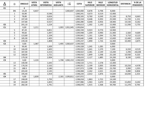


The document appears to contain data from a survey including location coordinates, elevation measurements, slopes, distances, and angles. It includes multiple observation points labeled E1 through E5 and C1 through C4 with associated numeric data. The data seems to describe the topography and layout of a land or structural survey with elevation and slope readings at different observation points.


