AGI-Neerananchal - April 9 2013
•
0 likes•160 views

The document summarizes a workshop on strengthening forward linkages for farmers through the Neeranchal program. The workshop discussed using Neeranchal to improve watershed management, agricultural performance, and linkages to markets. Geospatial technologies would play a key role in planning watershed interventions, linking farmers to markets, optimizing resource use, and monitoring hydrological outcomes. The Association of Geospatial Industries promotes the use of geospatial tools to support programs like Neeranchal.

Recommended
Recommended
More Related Content
Viewers also liked
Similar to AGI-Neerananchal - April 9 2013
Similar to AGI-Neerananchal - April 9 2013 (20)
AGI-Neerananchal - April 9 2013
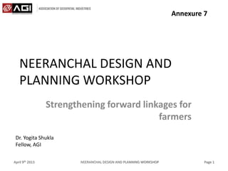
- 1. NEERANCHAL DESIGN AND PLANNING WORKSHOP Strengthening forward linkages for farmers April 9th 2013 NEERANCHAL DESIGN AND PLANNING WORKSHOP Page 1 Dr. Yogita Shukla Fellow, AGI Annexure 7
- 2. Neeranchal • Next step to IWMP – Integrated management of watershed and link it with the market need – Restricted not just to management of resources – Create a value from the various watershed interventions • Through enhanced productivity • Link the productivity to market requirements April 9th 2013 NEERANCHAL DESIGN AND PLANNING WORKSHOP Page 2
- 3. Neeranchal • Priority Areas – Improve existing watershed management approaches – Improve agricultural performance – Strengthen forward linkages for farmers – Improve hydrological outcomes in watersheds April 9th 2013 NEERANCHAL DESIGN AND PLANNING WORKSHOP Page 3
- 4. Strengthening forward linkages for farmers • Why strengthening? – Small-medium land holdings – Rare access to sufficient funds – Wide disparity between input costs and productivity gain – Optimal utilisation of available resources – Integrated Management – Create a value chain from farm to market April 9th 2013 NEERANCHAL DESIGN AND PLANNING WORKSHOP Page 4
- 5. Establish an agricultural value chain • Innovative financial products and services • Combination of financial services – Formal – Non-formal (Micro-finance) • Building vertical linkages • Strengthen non-financial services – Business planning – Market Development April 9th 2013 NEERANCHAL DESIGN AND PLANNING WORKSHOP Page 5
- 6. Unique partnerships • Innovative institutional partnerships – Farm cooperatives – Private Sector • Unique combination of management practices – At farms – In market • Building vertical linkages • Access to knowledge and latest technological interventions April 9th 2013 NEERANCHAL DESIGN AND PLANNING WORKSHOP Page 6
- 7. Geospatial: Role in Neeranchal • Geospatial – Where – How • Includes – Remote Sensing – Surveying – Photogrammetry – Global Navigation Satellite System (GNSS) – Geographical Information System (GIS) April 9th 2013 NEERANCHAL DESIGN AND PLANNING WORKSHOP Page 7
- 8. Geospatial: Role in Neeranchal • Improving existing watershed management approaches – Inclusive micro planning • Building spatial context – Virtualisation of real world April 9th 2013 NEERANCHAL DESIGN AND PLANNING WORKSHOP Page 8
- 9. April 9th 2013 NEERANCHAL DESIGN AND PLANNING WORKSHOP Page 9 Geospatial: Role in Neeranchal
- 10. Geospatial: Role in Neeranchal • Strengthening forward linkages for farmers – Direct access to information • Where to sell • How to reach • Nearest markets – Link micro to macro April 9th 2013 NEERANCHAL DESIGN AND PLANNING WORKSHOP Page 10
- 11. Geospatial: Role in Neeranchal
- 12. Geospatial: Role in Neeranchal
- 13. Geospatial: Role in Neeranchal • Improving agricultural performance – Optimal utilisation of resources • Soil – Types – Requirements • Water – Quality – Availability April 9th 2013 NEERANCHAL DESIGN AND PLANNING WORKSHOP Page 13
- 14. Geospatial: Role in Neeranchal
- 15. Geospatial: Role in Neeranchal • Improving hydrological outcomes in watersheds – Provide holistic scenario • Availability of resources • Resource requirement • Resource utilisation April 9th 2013 NEERANCHAL DESIGN AND PLANNING WORKSHOP Page 15
- 16. Geospatial: Role in Neeranchal
- 17. Geospatial: Role in Neeranchal • Association of Geospatial Industries – Premier body of geospatial industries in India – Promote the usage of geospatial technologies – Build a vibrant geospatial community – Work towards making geospatial ubiquitous April 9th 2013 NEERANCHAL DESIGN AND PLANNING WORKSHOP Page 17
- 18. About Us! • Association of Geospatial Industries (AGI) – Premier body of geospatial industries in India – Promote the usage of geospatial technologies across sectors – Advise and collaborate with policy formulators and geospatial decision makers for “right” geospatial technology adoption – Build a vibrant geospatial community – Create forums to bring together all stakeholders for effective geospatial usage – Research and inform through whitepapers, newsletters and workshops – Work towards making geospatial ubiquitous and integral for effective management April 9th 2013 NEERANCHAL DESIGN AND PLANNING WORKSHOP Page 18
- 19. Contact details: M: +91-9313345486 e-mail: yogita.shukla@agiindia.com