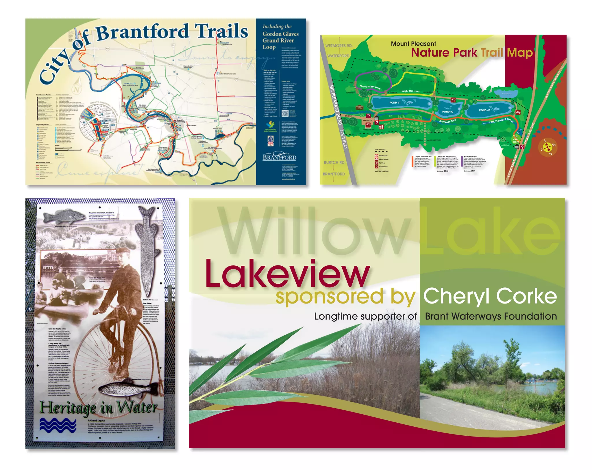
sponsored by Cheryl Corke
Lakeview
Longtime supporter of Brant Waterways Foundation
WillowLake
MT.PLEASANTROAD(OLD#24)
PARKING LOT
DRIVEWAY
Former Hatchery
office
circa 1915
PICNIC SHELTER
LE&NRAILTRAIL
TH&BRAILTRAIL
WATERFORD
BRANTFORD
BURTCH RD.
WETMORES RD.
Mt. Pleasant Creek
Dam
ToWillowLake(Oakland)
Private irrigation pond
Protected
archeological area
Nature Park Trail Map
Clayton Thompson Trail -
The name recognizes
Clayton Thompson’s vision
and work rehabilitating
Mount Pleasant Creek
and his work in the Park
as County Forester.
Haight Mill Heights Loop -
Elijah Haight operated the grist
(flour) and carding (woolen) mill
on this site beginning in the 1840s.
The flume which carried water to
the mill was on the south slope.
(Rubble from this installation is vis-
ible beside one of the paths)
Distance .3km
Racey Ridge Loop -
“Squire” James Racey was an
early owner of the property which
now encompasses the Nature Park.
He was a prominent member of
the colonial elite and built his
“log castle” on the flatland
above the ridge.
Distance .2km
Thompson Trail
Racey Ridge Loop
Haight Mill Loop
Mount Pleasant
POND #1
POND #2
POND #3
S
N
E
W
STEPS
FOOTBRIDGE FOOTBRIDGE FOOTBRIDGE
ACCESS TO BARNES SUBDIVISION
STEPS
Park Boundary
Washrooms
Picnic tables
Parking
Information
MAP NOT TO SCALE
You
are
here

4 sample signs

  • 1.
    sponsored by CherylCorke Lakeview Longtime supporter of Brant Waterways Foundation WillowLake MT.PLEASANTROAD(OLD#24) PARKING LOT DRIVEWAY Former Hatchery office circa 1915 PICNIC SHELTER LE&NRAILTRAIL TH&BRAILTRAIL WATERFORD BRANTFORD BURTCH RD. WETMORES RD. Mt. Pleasant Creek Dam ToWillowLake(Oakland) Private irrigation pond Protected archeological area Nature Park Trail Map Clayton Thompson Trail - The name recognizes Clayton Thompson’s vision and work rehabilitating Mount Pleasant Creek and his work in the Park as County Forester. Haight Mill Heights Loop - Elijah Haight operated the grist (flour) and carding (woolen) mill on this site beginning in the 1840s. The flume which carried water to the mill was on the south slope. (Rubble from this installation is vis- ible beside one of the paths) Distance .3km Racey Ridge Loop - “Squire” James Racey was an early owner of the property which now encompasses the Nature Park. He was a prominent member of the colonial elite and built his “log castle” on the flatland above the ridge. Distance .2km Thompson Trail Racey Ridge Loop Haight Mill Loop Mount Pleasant POND #1 POND #2 POND #3 S N E W STEPS FOOTBRIDGE FOOTBRIDGE FOOTBRIDGE ACCESS TO BARNES SUBDIVISION STEPS Park Boundary Washrooms Picnic tables Parking Information MAP NOT TO SCALE You are here