Earthquake presentation
•Download as PPT, PDF•
2 likes•82 views

in presentation i discuss the tibetan plateau seismology

Recommended
Recommended
More Related Content
Similar to Earthquake presentation
Similar to Earthquake presentation (20)
Recently uploaded
Recently uploaded (20)
Earthquake presentation
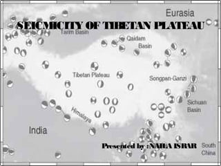
- 1. Presented by :NAILA ISRARPresented by :NAILA ISRAR SEICMICITY OF TIBETAN PLATEAU
- 2. Can you remember how Tibet / The Himalayas were formed?
- 7. COMPLEX PLATE BOUNDARY ZONE IN SOUTHEAST ASIA Northward motion of India deforms large region Many small plates (microplates) and blocks Molnar & Tapponnier, 1977 Davidson p304
- 8. COLLISION BETWEEN INDIAN AND EURASIAN PLATES: GPS MOTIONS. Mountain building by continental collision produced boundary zone extending 1000’s of km northward from the nominal plate boundary at the Himalayan front. Total plate convergence taken up several ways. About half (20 mm/yr) occurs across locked Himalayan frontal faults such as the Main Central Thrust These faults are part of the interface associated with the underthrusting Indian continental crust, which thickens crust under high Himalayas. Larson et al., 1999 Larson et al., 1999
- 9. COLLISION BETWEEN INDIAN AND EURASIAN PLATES: GPS MOTIONS. GPS data also show along-strike motion behind the convergent zone, in the Tibetan Plateau, presumably because the uplifted and thickened crust spreads under its own weight. Extension is part of a large-scale process of crustal "escape" or "extrusion" in which large fragments of continental crust are displaced eastward by the collision along major strike-slip faults. Larson et al., 1999
- 10. COLLISION BETWEEN INDIA AND EURASIA PLATES: EARTHQUAKES Large destructive thrust earthquakes reflect convergence on Himalayan frontal faults such as Main Central Thrust Normal faulting earthquakes occur behind convergent zone in the Tibetan Plateau, due to along strike extension from gravitational collapse Strike slip earthquakes occur further north Ni and Barazangi, 1984
- 11. • (a) Map of earthquakes with accurately constrained depths, from this study (Tables S1 and S2) and others (see supplementary material). Depths are indicated by colour, and earthquakes deeper than 20 km are scaled by magnitude. Black arrow indicates the India–Asia convergence vector. The dashed blue line (A) outlines the area in central southern Tibet where there is no deep seismicity • (b) Normal (purple) and strike-slip (green) focal mechanisms across the Tibetan Plateau • c) GPS velocities in southern Tibet, relative to India (Banerjee et al., 2008)
- 13. Regional earthquake distributions in this study and those of the Hi Climb project [Liang et‐ al. , 2008]. (a) Crosssection of seismicity across (left) the southern Tibet [Liang et al., 2008]) and (right) the northern Tibet.(b) Statistics of the focal depths in the (first panel) Himalayan orogen [Liang et al., 2008], (second panel) the southern Tibet [Liang et al.,2008], and (third and fourth panels) the northern Tibet. (c) Distributions of the events located in this study (black dots)and the events recorded by Hi ‐CLIMB project (cyan dots). The white lines show the profiles in Figure. The events in the white dashed rectangles are projected to the cross profiles. (d) Statistics of the focal depths and the crustal strength envelope.(left) For southern Tibet, the strength envelope of the wet quartz (the green curve), the wet anorthite (the red curve), the southern Tibetan crust (the black curve), and the Byerlee’s Law (the black line) were produced with the thermal gradient of34 °C/km. (right) For northern Tibet, the strength envelope of the wet quartz (the green curve), the dry anorthite (the bluecurve), the northern Tibetan crust (the black curve), and the Byerlee’s Law (the black line) were produced with the thermal gradient of 32 °C/km.
- 14. India Tibetan PlateauHimalayaIndia Himalayan earthquakes are caused by the slip of India beneath Tibet. R. Bilham
- 15. India Tibet critical stress Every few hundred years part of the Himalaya approaches failure R. Bilham
- 16. great earthquake TibetIndia 2-8 m surface rupture 1.5 m co-seismic subsidence … and a great earthquake ruptures the plate boundary. R. Bilham
- 17. R. Bilham
- 18. 20001900180017001600 time India/Tibetconvergence(m) 2 m M=7.4 6 m M=7.8 4 m M=7.6 8m M=8 10 m M=8.2 convergence rate 18 mm/yr The longer we wait the bigger the 'quake. R. Bilham
- 19. Bilham, R., V. K. Gaur and P. Molnar, Himalayan Seismic Hazard, Science, 293, 1442-4, 2001 FUTURE EARTHQUAKE POTENTIAL
- 20. CONCLUSION The well located 400 regional earthquakes in northern Tibetan Plateau‐ were distributed not only at the boundaries of major tectonic provinces but also within these provinces , supporting the hypothesis of continuous deformation within the Tibetan plateau. All well located earthquakes in‐ northern Tibet occur within the upper crust, mostly at depths of 0 15 km,‐ and there is no event deeper than 30 km. Com- bining data from previous studies, the depth distribution of regional earthquakes reported in this study strongly supports the existence of a weak and hot lower and middle crust in the northern Tibetan Plateau. Furthermore, the depth of the crustal seismogenic zone in northern Tibetan Plateau is apparently thicker than that in southern Tibet, which reflects the difference in temperature depth profile and rheological structure of the crust between southern and northern Tibet. Finally, there are no mantle earthquakes that would suggest continental subduction along this part of the northern Tibet margin
- 21. THANK YOU
Editor's Notes
- Himalayan earthquakes are caused by the slip of India beneath Tibet.
- Every few hundred years part of the Himalaya approaches failure
- --and a great earthquake ruptures the plate boundary allowing the Himalaya to slide southward over India, and India to sink a little further beneath Tibet.
- The size of the future event is determined by the convergence rate and the time since the last earthquake. Using GPS we have measured the rate of movement of India to be roughly 2 m each century. A giant earthquake destroyed Tibetan monasteries in 1505. Its recurrence may occur soon as a M=8.2 earthquake. Thermometers of earthquake potential can be constructed along the entire Himalayan arc.