2. 17th Century
Proprietor’s Map
1777 Map
Pre-1812 Map
1870 Map
Interactive
1895 Village
Interactive
1895 Environs
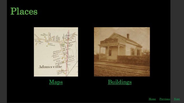
Little Compton
Maps
Previous
Home Next
Link to MapQuest
3. The Proprietor’s Map
Previous
Home
LCHS Collection
This map shows the first European owner of each lot of
land in Adamsville. Adamsville was purchased in a
series of sales from a branch of the Sakonnets led by
Mammanuah (Awashonk’s step-son). The land was
distributed by lotteries held in Little Compton
throughout 1694.
Some of these First Proprietor’s were quick to sell their
property to others and never actually settled in the
area. Other’s like the Shirtly’s (Shurtleff’s) Churches,
Cooks, Simmons and Brownells did build farms, homes
and businesses and still have descendants in
Adamsville today.
The triangle shaped segment indicates a highly
desirable area, perhaps the crossroads, perhaps the
river landing. The land was divided in this way to
provide more than one Proprietor access to a place that
was viewed as important.
Next
4. 1777 Map
Previous
Home
LCHS Collection
This small detail of Adamsville in 1777 comes from the
Blaskowitz Map which was created by the British
during the American Revolution. The mapmakers only
mapped Little Compton’s coastline. They were able to
map this small section of Adamsville by navigating up
the West Branch of the Westport River.
The building south of the road and west of the river is
likely the mill. The building across the street from the
mill is likely the Lemunyon-Brayton House. The house
to the north of the road and east of the river may be
Longfield House.
In 1777 the following had not yet been built: Gray’s
Store (1788), Church’s Mansion (1815), Manchester’s
Store (1820), Simmon’s Store (c. 1910.)
Next
5. Blaskowitz Map - 1777
Previous
Home
Courtesy of Newport Historical Society.
This map was created by the British during the
American Revolution for military purposes. Aquidneck
Island (Newport and Portsmouth, Middletown was
named later) was clearly their focus. The island was
ultimately seized and occupied by English troops. Note
that Little Compton (to the east of Aquidneck was only
mapped along the shore.)
Next
Back to Adamsville Detail
6. 1870 Map
Previous
Home
LCHS Collection
Mapmakers used their discretion to
determine if something on the border
needed to appear on the map. This
mapmaker included several buildings
just over the line in Westport and
Tiverton. P.O. indicates the post office
and a much smaller S.H. stands for
school house. B.S. Shop indicates a
blacksmith shop on Crandall Road.
This larger map containing this detail
focused on Little Compton’s ten school
districts. Adamsville was in District No.
6. Each district had a single one-
roomed school house.
Next
7. Little Compton
Previous
Home
LCHS Collection
Little Compton, RI contains several neighborhoods: The
Commons in the center of town, Pottersville in the center
east, Sakonnet Point at its far southwestern tip and
Adamsville in the northeast corner. Because of steep hills
and poor roads Adamsville and the rest of Little Compton
were essentially isolated from each other for the first 250
years of their existence.
Little Compton remained Adamsville’s seat of government,
but in every other way Adamsville developed in to an
independent village with its own church and stores. Its
mills were at its center. Adamsville residents could even
pay their Little Compton taxes at Manchester’s Store.
In many ways Adamsville was busier than the Commons.
Easier to reach from Fall River, New Bedford and even
Tiverton Four Corners, Adamsville was located on well-
traveled throughways while the rest of Little Compton was
a peninsula. Adamsville was selected as the site for Little
Compton’s first post office for this reason.
Next
10. An Adamsville Love Story
Previous
Home
Susan Peckham lives in the Wilcox House
on Cold Brook Road
Maggie Bodington came to my house, and we were
talking about the house. She told me there were two
brothers that used to live there. Her story was about
Alton Wilcox. Alton was sweet on this girl. He saw her
quite a bit and finally asked her to marry him. She said,
“No. You don’t have any money. You don’t have a house,
and you have no way of making a living. I cannot marry
you.” So he took that and went home.
Then he took off and went to Chicago. There he made a
fortune, and he came back. He bought a lot of land, and
he built a house. He built a barn and got animals. Then
he was all set, and he went back to her, found her, and
she was pleased to see him, but distant, but he
persisted. He told her of all the things he had, and
would she now marry him. She said, “No! I’m already
married.”
Now Alton continued to live on John Dyer Road, and he
never married. He made his living, and people knew him,
in the forties anyway, for the geese that he raised. They’d
have them for holidays. Fred Simmons’ Store would
deliver to him. So in the forties, Fred Simmons’s son told
Mr. Bodington that, “You know, [Alton is] still giving out
that old money.” So he must have made a fortune out
there!
When [Alton] died, the house was sold. Eventually the
house burned down and soon after, the barn burned down
too. Now I wonder, under what stair, under what brick,
where in the barn, where was the rest of the money!
Editor’s Note: Susan will be happy to know that at least
some of Alton’s money finally made it to the bank.
According to Tom Deschene, Alton was once robbed.
After the robbery Hap Simmons convinced Alton to go to
the bank, change his large old-fashioned bills into
current currency and deposit some of it in the bank.
Next
11. Manny Avila’s House
Previous
Home
In Private Collection
The Cornell Farm was a very large and very
successful goose farm perched atop Adamsville
Hill. The farmers would walk the geese down
the hill and all the way to Tiverton Four
Corners for shipment to nearby cities.
During Prohibition, Manual Avila thought the
farm’s commanding view of the Westport River
would make it a perfect spot for his rum-
running operation. Manny ran a gravel
company on the farm as a front for his rum-
running. He employed many local workers.
They would meet alcohol- ladened boats from
Canada on the river or nearby beaches, drive
the booze up to the farm on Bootleggers’s Lane,
and hide it.
Avila took good care of his workers, providing
them with a bunkhouse on the farm and hot
meals.
Next
12. Blacksmith Shop
Previous
Home
LCHS Collection
The Adamsville blacksmith shop changed
hands over the years. The last blacksmith to
work there was Fred Simmons who left
blacksmithing, as cars became more
popular, to establish Simmons’ Store. The
shop is now Brayton’s Garage.
Next
13. The Blanchards
Previous
Home
In the 1950s and sixties the Blanchards lived in the historic Athington House at the top of Adamsville Hill.
Sarah Desjardins Remembers the Blanchards
Next
My father was introduced to Adamsville by Ralph
Blanchard who was a professor of English at Brown.
They had this very nice old home up on Coldbrook
Hill. Dad came down with him one day and said,
“This is for me.” He had grown up summers in Little
Compton. He liked Westport, Adamsville. It was a lot
less social, more low-key. The Acoaxet Club was a lot
smaller than Sakonnet.
The Blanchards were interesting people. Ralph had
been engaged to a French woman who had a chateau
in France and died in the war, and he married her
sister Monette. Monette worked at the Athenaeum in
Providence, a very bright, intelligent, small woman.
Her mother was still living, Madame LaCaze, and she
was like a little bird dressed in black sitting next to
Monette.
Whenever we went up on Coldbrook Hill and had
Cambric Tea, and went through their beautiful garden,
we, the little kids, had to say, “Bonjour Madame!” That
was our French, and she’d twitter on with something
else and we had no idea what she was talking about. I
mentioned the fireplace. There is probably the largest—
best old cooking, baking, you could do anything in it, you
could stand in it upright—fireplace in the area.
You would see [Monette] driving around in a huge blue
sedan, barely able to see over the steering wheel, and
everybody was in fear and trembling. One day she did
miss one of the curves going down Coldbrook Hill going
toward Adamsville, but she survived. Monette always
pronounced it “Adamsveeeel.”
14. Frank Brownell - Painter
Previous
Home
Advertising blotter, c. 1915. Courtesy of Bruce Elwell.
Frank Brownell was a house painter who added car painting to improve his business.
Next
15. Church’s Mansion
Previous
Home
LCHS Collection.
Church’s Mansion is the
grandest home in Adamsville
and also the site of the Spite
Tower. It was built in 1815 by
Samuel Church. The Great
Gale of 1815 hit during
construction, and Samuel was
killed by a beam during
construction.
The house has two front doors.
The one pictured faces Main
Street. The older door faces the
“old road” and Gray’s Store,
built by Samuel Church in
1788.
Next
16. Home Previous
Courtesy of Jim and Rosalyn Weir
Electra Lodge was built in
Adamsville as an offshoot of the
Oddfellows Hall on the Little
Compton Commons. It was active
through the 1950s. After the lodge
closed the building became the
home of Stone Bridge Dishes. Today
it is a private office and residence.
James Brady:
My Parents Met at
the Odd Fellows Hall
Electra Lodge
The Odd Fellows Hall
Next
17. Gray’s Store
Previous
Home
Courtesy of Oscar Sylvia
Samuel Church built Gray’s Store
in 1788. The Church Family sold it
to the Gray Family in 1879 and
family members have owned it ever
since.
Note the Church Mansion on the
far right.
Next
Oldest Store in U.S.
Interior
Jonah Waite:
Today’s Owner
18. The Oldest Continuously Operating General Store in the U.S.
Previous
Home
For years, Gray’s Store vied with another
establishment in Virginia for the title “Oldest
General Store.” In 2007, the debate came to an
end when Gray’s was officially recognized by U.S.
Senator Jack Reed and other officials as the
“Oldest Continuously Operated General Store in
the United States.”
Gray’s was established in 1788 by Samuel
Church and was purchased by Jonah Waite’s
ancestor, Philip Gray in 1879. The store closed
unexpectedly in 2012 when owner Grayton Waite,
pictured in this newspaper photo, passed away
after a battle with cancer.
Jonah Waite:
The Oldest Store
Courtesy of Jonah Waite Next
19. Gray’s Store Interior, c. 1932
Previous
Home
From Left to Right:
Herman Gray
his sister, Marion Gray Hart,
her husband, John Hart,
Unknown customer,
store keeper, Ed Cook
the Hart’s daughter,
Millie Hart Waite,
Courtesy of Jonah Waite
Next
20. Gray’s Grist Mill – 20th Century
Previous
Home
The Interior
Courtesy of Thornton Simmons.
In the late-17th century, Gray’s
Grist Mill was an important
reason for Adamsville’s
founding. At the time the grist
mill and a nearby saw mill
were owned by Philip Taber.
The entire village was called
Taber’s Mills.
Next
Miller, John Hart
Miller, Tim McTague
Jonnycakes
21. Gray’s Grist Mill – Interior
Previous
Home
Photo by Gus Kelley. Color by Tim McTague
John Allen Hart
and Timothy
Taylor McTague
turning the
runner stone
over in
preparation to
sharpen the mill
stones, c. 1982.
Next
22. Greene’s Package Store
Previous
Home
Sheila Greene:
My Grandfather
Built the
Liquor Store
Betty Greene with her brother. c. 1953.
Courtesy of Sheila Greene Kauffman
Greene’s Package Store was
established in the early 1950s
by Herman and Elizabeth
Greene. It served not only
Adamsville but the nearby
summer community at
Westport Harbor.
Next
23. Lemunyon-Brayton House
Previous
Home
LCHS Collection
Anne “Pete” Baker was well-known for her
expertise in local historic architecture. She
believed the Lemunyon House was one of
the oldest remaining structures in the
village dating back to the 17th century. She
found evidence in the basement of a large
oven that may have served as a commercial
oven for the community. The vertical board
on the right hand side of the house indicates
where an addition was added.
The house overlooks Adamsville Pond.
Next
Ralph Guild:
The Brayton House
24. Longfield House
Previous
Home
LCHS Collection
One of the oldest existing houses in the
village, Longfield’s house (c. 1800) was
known in the 20th century as the home,
workshop and store of a husband and wife
team of blacksmiths, Mr. and Mrs. Gene
Longfield. They did both copper and
wrought iron work and specialized in
Longfield Lanterns and Lamps. Mrs.
Longfield continued her husband’s work
into the 1970s, and her son continues to
make the lamps today. Many homes in
Adamsville have Longfield Lanterns near
their front doors.
Next
Ralph Guild:
Longfields
25. Ralph Guild - The Houses on the Pond
Previous
Home
The Brayton House
[Pete Baker believes] that it could be late-seventeenth-century, and she would look at moldings and things like
that would give her clues. The base of the chimney, there’s an oven there that she thinks was a part of the small
community bakery, where they would do more than just bake for the home. When I think of a bakery today, I
think of display cases and things like that, but it would just be a few things at a time. She would take on a
project, there was no deviation from it being absolutely pure about the restoration. It was going to be exactly as
close to what it was as she could possibly make it. When you face the house, you’ll see a strip that is about
seventy percent from left to right, and then there’s the addition, and she said that was a way that they’re
supposed to when they add on to an old house, to indicate what’s the old part and what’s the new. So of course
that’s what we did. Oh, all of the things that we restored, if there was a chicken coop, the chicken coop has
remained, and if there was an outhouse, the outhouse is still there. So it’s as authentic as it can be.
Longfield’s
The one on the other side, 635 Adamsville Road, the chicken coop is now my office when I’m here. The Longfield
property, I think they built it in 1800 because that was the official marker on the building when I bought it. I’m
not sure that Longfield was the name but it was the Longfield family. Mr. Longfield was a blacksmith and the
barn in the back of the property was his blacksmith shop.
Next
26. Manchester’s Store
Previous
Home
LCHS Collection
Manchester’s Store began its
long history as a general store
in 1820 as the Estate of
Ebeneezer Church. Church
hired a young Philip
Manchester who eventually
took over the business and
renamed the store.
The building to the far left
was a sail loft. It was moved
and attached to the store in
the 1950s. Eventually it
became the bar area at
Manchester’s Restaurant.
Next
Photo Album
27. Manchester’s Store - Late 19th Century
Previous
Home
Courtesy of Constance Shurtleff McGee.
A late-19th century photograph of
Manchester’s porch.
Next
Photo Album - Next
28. Manchester’s Store - Abraham
Previous
Home
LCHS Collection
In 1906 Philip Manchester’s son
Abraham was running the store
under his own name.
Next
Photo Album - Next
29. Manchester’s Store - 1910
Previous
Home
Postcard by O.E. Dubois, c. 1910. LCHS Collection.
By 1910 the store was equipped
with a telephone.
Next
Photo Album - Next
30. Manchester’s Store - 1930s
Previous
Home
Courtesy of John M. Bergland, M.D.
A busy Manchester’s c. 1930.
Next
Photo Album - Next
31. Manchester’s Restaurant
Previous
Home
Postcard by Sarah Desjardins.
After a fire in 1963, then
storekeeper, David Morse closed
Manchester’s Store. The building
was repaired and Abraham
Manchester’s Tavern opened under
new management, It quickly
became a popular local restaurant
and watering-hole.
Next
Photo Album - Next
33. Manchester’s Store - The Fire
Previous
Home
Courtesy of Oscar Sylvia.
In 1991 a fire destroyed Abraham
Manchester’s Restaruant & Tavern
and the village was devastated.
Today its lot is vacant but people
still give directions based on where
Manchesters used to be.
Next
End of Manchester’s Photo Album
Next Building
34. The McKinnon House
Previous
Home
Jack and Dorothy McKinnon
purchased the family home on
Old Harbor Road, right across
from the ball field, in 1973. It
was originally built by Win
Hart who used the glass
breezeway as an appliance
showroom and put in the in-
ground pool to benefit his wife
who had a debilitating illness.
The McKinnons raised six
children here.
Scratchboard by Maureen McKinnon Rego
Next
35. The Mill Pond
Previous
Home
Postcard by O.E. Dubois, c. 1910. Courtesy of Oscar Sylvia.
The Mill Pond and the small stream connecting
it to the Westport River are in large part
responsible for the founding and location of
Adamsville. Shortly after King Philip’s War
(1675-1676), a small group of Baptists from
nearby Dartmouth, MA moved to Adamsville
and established Taber’s Mills. Mills were often
the catalyst for the formation of a village in the
17th century.
Grinding corn was essential to survival. At one
point Little Compton had as many as ten
operating mills, most of them windmills. Water-
powered mills were less common and more
powerful. In addition to grinding grains, they
were strong enough to power saw mills.
Adamsville Pond powered both a grist mill and
a saw mill. They may have shared a water
wheel.
Next
Ice Skating
36. No. 6 School
Previous
Home
LCHS Collection
At the top of Adamsville Hill stood the No.
6 School, a one-roomed schoolhouse
serving Adamsville children in grades 1-8.
Like all the one-room schools in Little
Compton’s 19th century school districts
(There were ten.), No. 6 School had a
winter term and a summer term that did
not conflict with the farm families’
planting and harvesting seasons. Children
attended when they could and received
individualized instruction. This allowed
them to take as long as they needed to
complete the eight grades.
The school was decommissioned in 1929
when Little Compton built a centralized
school on the Commons. The building was
sold to a Mr. Bliss for $650 and was moved
to Dartmouth, MA to become office space
for a propane gas company.
Next
37. Old Stone Church
Previous
Home
Postcard by O.E. Dubois, c. 1910. LCHS Collection
The Old Stone Free Will Baptist
Church was founded in 1684.
Members met in private homes.
They built their first church
building in 1752 and later replaced
it with this stone structure in 1841.
The parsonage is to the left. The
horse sheds are to the right. They
were removed to make room for a
Fellowship Hall in the late-20th
century.
Unlike most churches, the pews
face the entrance. Before the
Fellowship Hall was built, the only
way for a bride to walk down the
aisle to the alter was to climb
through a window in the back of the
church.
Next
38. Old Harbor Road - South View
Previous
Home
Postcard by O.E. Dubois, c. 1910. Courtesy of Oscar Sylvia.
Looking south on Old Harbor Road.
Many of the houses were built by
sailing ship captains who sailed out of
Westport Harbor.
Next
39. First Post Office
Previous
Home
Courtesy of Oscar Sylvia.
Because it was situated on direct routes
from New Bedford and Fall River,
Adamsville was selected as the site for
Little Compton’s first post office in 1804.
The office was located in the store
established by Samuel Gray in 1788,
now known as Gray’s Store.
The Adamsville post office was Little
Compton’s only post office for forty
years. Little Compton residents on the
western side of town found it much
easier to use the post office at Tiverton
Four Corners.
Next
Second Post Office
Third Post Office
40. Second Post Office
Previous
Home
Postcard by O. E. Dubois, c. 1910. LCHS Collection
This c. 1910 postcard shows that the
Adamsville post office had moved from its
original location in Gray’s Store to
Manchester’s Store. Local residents indicated
that the post office switched back and forth
between the two stores and attributed it to
changing elected officials employing different
postmasters.
The Lemunyon-Brayton House is to the far
right. The house in the center of the postcard
is now office space for Jacob Talbot, Builder.
Next
First Post Office
Third Post Office
41. Third Post Office
Previous
Home
LCHS Collection
Postmaster George Carr built
this small building on Crandall
Road in the 1960s near his home
and rented the space to the U.S.
Postal Service. It still serves as
the Adamsville Post Office and
has the lowest zip code in the
state: 02801.
Next
Second Post Office
First Post Office
42. St. Vincent’s Camp
Previous
Home
Courtesy of Walter Elwell.
St. Vincent’s was a summer
camp operated on Adamsville
Road in Westport, MA by the
Roman Catholic Diocese of Fall
River. Many Adamsville
residents remember seeing the
boys who were sometimes
brought into the village to shop,
most likely for penny candy.
Next
43. The Sheffield House
Previous
Home
Paving Old Stone Church Road, c. 1930. Courtesy of Alice Wordell Beattie.
The Sheffield’s rather grand
home is pictured on the
right. It no longer exists,
though portions of it’s stone
barn remain. The house on
the left was identified by
the photographer as “Ed
Taber’s House.”
The machinery is paving
Old Stone Church Road.
The workers would go as far
as they could in a day and
then stay overnight in a
nearby home.
Next
The Stone Barn
44. The Shurtleff House
Previous
Home
Courtesy of Connie Shurtleff McGee
The Shurtleff House was the site
of the short-lived Adamsville
Wayside Library in the 1920s. A
young Nettie Shurtleff ran the
library in the north room of the
house before she was married.
When she did marry and leave
town, the library closed.
The house, located at the bottom
of Adamsville Hill is now known
as Nancy Oliveira’s house.
Next
45. Grace Simmons’ House
Previous
Home
This postcard is labed as it is because the house is located at the end of
Crandall Road a direct (11 mile) route to Fall River, MA, c. 1910.
Postcard by O. E. Dubois. Courtesy of Oscar Sylvia.
Identified on an 1895 map
as belonging to Nancy
Head, this house on the
corner of Crandall Road
and Main Street is best
known as Grace Simmons’
house.
Grace ran Simmons’ Store
for the last half of the 20th
century.
Next
46. Simmons’ Store
Previous
Home
LCHS Collection.
Simmon’s Store was established
by Fred Simmons in the 1930s.
His son Ernest (Happy) Simmons
later ran the store and upon his
death his sister Grace Simmons
took over its operation. Simmon’s
was well-known for its delivery
service and its great selection of
penny candy.
Next
47. The Spite Tower
Previous
Home
Postcard dated 1916. LCHS Collection
Next
This tower was built in 1906 by the Hathaway
family as a well tower. It provided water to their
home which is sometimes referred to as Church’s
Mansion. The tower’s height helped gravity feed
water throughout the house. The second floor was
used as their chauffer’s bedroom. In later years
other owners ran gift shops out of the tower.
The tower is commonly called the “Spite Tower”
due to a local story that is mostly likely—just a
story. According to the story, Dr. Peter Hathaway
built the tower out of spite to block the view
between Manchester’s Store and the Manchester
home. Lizzie Manchester would hang a white cloth
in the window to let her brother Abraham know it
was time to come home from the store and eat.
The new tower prevented that custom.
Why was the tower really placed in that spot?
That is where the water was.
Pat McKinnon Goulart:
Sleepovers at the Spite Tower
48. The Stone Barn
Alice Beattie
Wordell:
Playing in
the Barn
Photo of stone barn.
Home Previous
LCHS Collection
The Stone Barn on Stone Church
Road is now in ruins. It appears
on early maps as the Sheffield
Barn. It has long been thought to
be one of the oldest stone barns in
New England.
Next
49. The Clark Taber House is
still located on Stone Church
Road in Adamsville. It was
the family farm of Theodore
and Betsy Taber and their
three daughters Lillian, Ruth
and Ida, pictured here. The
dog in the photo is Ted.
In the 1940s Alice’s Wordell
Beattie’s parents moved in
with her grandmother Ruth
Wordell and her great-aunt
Ida Sowle to help care for
them. There were ten people
living in the house at that
time. It was one of the few
remaining family farms in
Adamsville in the 1950s.
Photo courtesy of Alice Wordell Beattie
Home Previous
The Clark Taber House
Next
50. The von Trapp’s House
Previous
Home
Courtesy of Stephanie von Trapp Derbyshire
This home was originally part of a farm
that supplied raw milk to the villagers
of Adamsville.
Early maps show that it belonged to
the Tompkins family. It was later
operated by Tom White.
Its large barn was disassembled and
Win Hart used the lumber to build the
two “twin” Cape Cod-style houses on
Crandall Road.
This photo shows the construction of
Dr. Rupert von Trapp’s office in the
1950s.
Next
51. Dr. White’s Laboratory
Previous
Home
Bottle Digging
Dr. White
Dr. White’s Laboratory was located on Main
Street in Adamsville to the west of the Odd
Fellows Hall. The building was moved to
South Shore Road. You can still see the large
gap in the stone wall.
Courtesy of Tom and Leslie
Deschene
Next