SlideShare a Scribd company logo
1 of 216
Download to read offline
World
Geography
Brian Dufort, Sally Erickson, Matt Hamilton,
David Soderquist, Steve Zigray
MI OPEN BOOK PROJECT
World
Geography
ii
This is version 1.4.4 of this resource, released in August 2018.
Information on the latest version and updates are available on the
project homepage: http://textbooks.wmisd.org/dashboard.html
Attribution-NonCommercial-ShareAlike CC BY-NC-SA
The text of this book is licensed under a Creative Commons
NonCommercial-ShareAlike (CC-BY-NC-SA) license as part of
Michigan’s participation in the national #GoOpen movement.
The Michigan Open Book
Project
Project Manager: Dave Johnson,
Wexford-Missaukee Intermediate School
District
6th Grade Team Editor: Amy Salani,
Wexford-Missaukee Intermediate School
District
6th Grade Content Editor: Carol Egbo
6th Grade World Geography Authors
Brian Dufort, Shepherd Public Schools
Sally Erickson, Livonia Public Schools
Matt Hamilton, East Jordan Public
Schools
David Soderquist, Three Rivers Schools
Steve Zigray, Concord Public Schools
About the Authors - 6th Grade World Geography
Brian Dufort
Shepherd Public Schools
Odyssey MS/HS
Brian is originally from Midland, MI and is a graduate of Northern Michigan University.
He has spent his entire teaching career at Odyssey Middle/High School, an alternative
education program in the Shepherd Public School system. In 2001, his environmental
studies class was one of seven programs from the United States and Canada to be
chosen as a winner of the Sea World/Busch Gardens Environmental Excellence
Award. Brian is also the Northern Conference director of the Michigan Alternative Ath-
Sally Erickson
Livonia Public Schools
Cooper Upper Elementary
Sally has taught grades 3-6, as well as special education. She has served as
a district literacy leader for many years and participated in the Galileo Lead-
ership Academy in 2001-03. She is proud to be a teacher.
Matt Hamilton
East Jordan Public Schools
East Jordan Middle School
Matt grew up in Cadillac, MI. He holds a bachelor and masters degree from Michigan
State University. He currently teaches middle school History and Geography. Matt
started and advises a club at his school called the Shoe Club to inspire his students to
Dream Big. His wife and two daughters enjoy traveling and spending time in the out-
doors.
David Soderquist
Three Rivers Public Schools
Three Rivers Middle School
For the Past 11 years David has taught 6-8 grade Social Studies for Three Rivers
Middle School. He serves as Department Head, School Improvement Member and
Social Studies Rep for his area. Over the past few years he has completed his Mas-
ters Degree in Curriculum and Instruction and become a state recognized Instruc-
tional Coach.
Steve Zigray
Concord Community Schools
Concord Middle School
Steve Zigray is a 6th grade teacher. He holds a Bachelor’s Degree from Central Michi-
gan University and a Masters Degree in K-12 Administration from Eastern Michigan
University. Honors Steve has been awarded are the 2001 Junior Achievement Educa-
tor of the Year and he was nominated for Jackson Magazine’s, Educator of the year in
2014. He has also coached high school and middle school sports, worked on various
school improvement committees, wrote the 6th grade Common Assessment tests for
Jackson County ISD and is an active member in the community as well as the PTO. He
lives in southeast Jackson County with his beautiful wife and three fantastic daugh-
ters.
Chapter 1
Studying
Geography
QUESTIONS TO GUIDE INQUIRY
1. What is geography?
2. Why do we study geography?
3. What tools do geographers use?
4. What is geographic inquiry?
5. Why do we need to think globally?
Image source: http://upload.wikimedia.org/wikipedia/commons/0/05/Land_ocean_ice_cloud_1024.jpg
This year you will be studying the geography of the
world in which we live.  Right off the bat, think about
what you already know about geography - it could be
things you have learned in other classes at other
grade levels, things you’ve heard from your parents,
or things you’ve heard from teachers.  What comes to
mind?  Is it maps?  Latitude and longitude?  What
else?
	
	
Section 1
QUESTIONS TO GUIDE INQUIRY
1. What is geography?
2. Why do we study geography?
3. What tools do geographers use?
4. What is geographic inquiry?
5. Why do we need to think
globally?
What is Geography Anyway?
6
Interactive 1.1 What is
Geography?
Take a moment to view this brief
video online and then answer the
question in the blue box to the
best of your ability
What is Geography?
Quite simply, “Geography” broken down means “to study the
earth” and throughout your studies in the book, we are going to
expand on this definition. 
	 If you were to go home and ask your parents about
geography they may have studied in school, they might say when
they were students they memorized the states and capitals, or
major countries in the world.  This is only one part of what
geography really is however.  To study geography is to study
where we are in the world; what the world around us is like.  It is
the study of who lives there and why.  It can be the study of foods
people eat, clothes they wear, cars they drive, and homes they
live in.  It is the study of climate, land, economies, politics and
culture.  Like many of the disciplines in the social sciences, it is a
discipline that weaves the threads of the others.
	 When studying geography we are going to focus on two
aspects - physical geography and human geography.  When
we look at landforms, vegetation, climate, bodies of water such
as rivers, lakes, and seas, we will be studying physical geography,
the study of natural and physical characteristics.  Human
geography is different but related. It is the study of how people
interact with the earth.  It also includes culture, migration
patterns, and patterns of population.  
	 The study of something often begins with a question.  This
book itself is set around a series of questions, some smaller,
some larger.  Over the course of this entire world geography
book, you will explore one major
question:  “How are we, as members
of a global society, connected?”  In
each section of this book, we will
bring you back to this idea and have
you record any new thoughts and
ideas that occur to you based on what
you have explored in this book and
through class instruction and
discussion.  You will be doing this as
part of an interactive digital journal
which you can view here.
7
Interactive 1.2 Interactive
Journal
Please note: once you have
created your own copy of this
document, this widget will only
return you to the blank copy. You
will need to access yours by
opening from your own Google
Document.
While the teachers who have put this book together have
provided some questions to focus your study, you will be asked
and encouraged to come up with your own questions as well.
 The process you will be guided through is known as inquiry - the
act of seeking out information.  
How are the people in the picture above dressed?  Why might
people in this place wear clothing like this?  If you notice the fur
hoods surrounding their faces you might think it is cold where
they live.  If you investigated further, you would learn that this is a
historical photo of an Inupiat family from Alaska. It might lead you
to ask more questions - are there times of the year when they
would wear lighter clothing?  What is the average temperature
during winter?  What is the average temperature during the
summer months?  One question about why people dress the way
they do could lead to a series of new inquiries in the desire to
learn more.
View the image
gallery above -
practice asking
geographic
questions based
on the images
shown.
8
Image source: http://upload.wikimedia.org/wikipedia/commons/8/8c/
Inupiat_Family_from_Noatak,_Alaska,_1929,_Edward_S._Curtis_(restored).jpg
Image source: https://farm4.staticflickr.com/
3302/3570407917_585dd5a1e8_o.jpg
Gallery 1.1 Image Gallery
As you continue to study “the basics,” this chapter serves
not just as an introduction to your studies this year, but also as a
“how to use this book” in case this is your first time using a digital
textbook to explore Social Studies.  You will have an opportunity
to practice most of the things you will be asked to do in this book
during this introductory chapter.  The last thing you will be asked
to do is to once again revisit the question we posed at the start of
this section.  This time, you are going to write a brief response.
	
9
What is Geography, anyway?
You might now have a better idea about
what geography is, but why do we study it?
 There are many reasons.  Take a moment to
view the video clip here about how some
people use geography in their chosen
professions.
Section 2
QUESTIONS TO GUIDE
INQUIRY
1. What is geography?
2. Why do we study
geography?
3. What tools do
geographers use?
4. What is geographic
inquiry?
5. Why do we need to
think globally?
Why Do We Study Geography?
10
Image source: http://upload.wikimedia.org/wikipedia/commons/3/32/JohannesVermeer-
TheAstronomer(1668).jpg
Interactive 1.3 What can
you do with geography?
Learn more about what
geographers do with this YouTube
clip (requires internet connection)
Why we study geography is a question many have asked.
 While to some geography is viewed only as maps, in reality it has
links to science, mathematics, literacy, literature, and the other
social sciences.
	 Studying geography can provide you with an overview of the
planet upon which we live.  People who study it are better
equipped to understand topics such as why people live where
they do, what causes people to move between places, how we
use our natural resources, why countries and locations are broken
up into geographic regions...the list goes on and on!
	 In addition to knowing about our planet and the people who
live there, people study geography because it helps you learn to
think critically.  It provides opportunity to inquire about the world
around you and research to find answers.  
	 Geographers study the “why of where” which can be
simplified to “why there?” or “why here?”  You may have studied
the early history of the United States in other social studies
classes. Where did early settlements like Jamestown tend to
spring up and plant roots?  It was generally around water
sources.  A geographer would then ask and seek to explain “why
there?”
	
The image on this page is not an all inclusive list of why we study
geography, but it does include many of the major reasons we will
outline as you go through this book.  
11
Understanding the world around you - Why does Michigan
generally have colder temperatures in the winter than Florida?
 Why is a home on the beach so expensive?  Have humans had
an effect on the climate of the earth?  When studying geography
you can learn the answers to questions such as these which help
you make sense of the world around you.  
Becoming a global citizen - Back in the early 1900s it could take
a person coming from Europe to America over a week to make it
from one port to the next.  Now, flights leave major airports and
have people at their destination within hours.  When a natural
disaster happens in one part of the world, it can affect daily life on
another.  A tsunami in Japan back in March of 2011 ended up
affecting more
countries than
just Japan.  We
are citizens of
the United
States of
America, but no
matter where we
live, we are also
residents of this
ball of rock
floating in
space.  What
does that mean?
Learning about people and societies - If you slurp your soup in
America, folks might call you rude.  Burp at the table and it’s
possible your parents might send you to your room without any
dessert.  In Japan however, holding a bowl of soup and noodles
up to your mouth to eat it is considered a sign to the chef that the
food is delicious.  Slurping and all!  In parts of China, burping
after a meal is considered a sign of appreciation.  Religious
customs vary from country to country - the five major world
religions (discussed in more depth in later chapters) all help
dictate traditions and customs in parts of the world.  Studying
12
Image source: http://upload.wikimedia.org/wikipedia/commons/8/8d/
2011_Tohoku_earthquake_observed_tsunami_heights_en.png
Winter sunrise at Michigan’s St. Joseph Lighthouse
Image source: John McCormick/Shutterstock
geography
allows you to
learn more than
just where a
country is
located on a
map, but what
the people and
society are like
as well.
Learning about locations - This
may be the piece of geography that
sticks in almost everyone’s mind,
but geography is the study of
locations.  We do this by studying
maps, pictures, Geographic
Information Systems data, visiting
and exploring these places, among
others.  
Connections -
All of these things together help us explore the idea of how the
world around us affects every day life, as well as the
connections between how we relate to all of that.  
For that reason, the inquiry question we will keep coming back
to throughout the course of this book is:
“How are we, as members of a global society, connected?”
This question is not studied because there is a world
government that unifies the planet, but more to help you realize
that whatever country you are from is one of many, and that
actions in one place can have effects on other places.
Take a moment to record your thoughts to that question.  In the
next section we will begin to look at
some of the tools that geographers
use.
13
http://upload.wikimedia.org/wikipedia/commons/2/23/JapaneseBosozoku.jpg
Image source: http://upload.wikimedia.org/wikipedia/commons/1/12/
World_map_2004_CIA_large_1.7m_whitespace_removed.jpg
If you were to ask 100 people what tools geographers
use to study the earth, one of the first answers you will
undoubtedly hear will be “maps.”  And it is true that maps
are one of the most common tools used to answer
geographic questions.  A map is a visual representation of
the earth, or parts of the Earth and can showcase a variety
of spatial scales.
What are those spatial
scales?  You can represent a
very small portion of the map
with great details. Below is an
embedded map from Google.  It is
set to a city in Northern Michigan
zoomed in as far as that particular
map can go to.  Take a moment to
explore that map at different scales
and then complete the Google Drive
journal activity located here.
Section 3
QUESTIONS TO
GUIDE INQUIRY
1. What is geography?
2. Why do we study
geography?
3. What tools do
geographers use?
4. What is geographic
inquiry?
5. Why do we need to
think globally?
What Tools Do Geographers Use to Study the Earth?
14
Interactive 1.5 Google
Maps
Interactive 1.4 Google
Drive Journal Activity
Refer to this handout together
with the Google Maps widget.
A Note On Scale:
The map activity on this page is
set to focus on a city in Northern
Michigan at the most zoomed-in
scale. This is the smallest scale
for a map because objects like
buildings and roads are shown
at their largest size. At a more
zoomed-out scale, objects like
buildings and roads may be so
small that we cannot see them.
Maps
	 Maps are able to show information about geographic areas.
 Every map has at least one purpose.  They can represent a place
such as a neighborhood, a town, a country, or the world overall.
 Sometimes they can show human features.  In the very first map
you looked at in the Google Maps link above, what human
characteristics such as roads, buildings, etc. were you able to
see?  When you zoomed all the way out, were you still able to see
any human characteristics?
	 When your parents were younger, they probably went on a
trip with their families which involved using a map of a state or
region to get to their final destination.  Modern technology such
as smart phones have GPS built in which has made these two
dimensional maps obsolete for that purpose.  A road trip is not
the only use for a map of a city or a state, however.  Maps can
represent a variety of different features about a place.  There is a
small problem with maps however…
	 If you were to take a balloon
and inflate it, then draw a map of
the world on it, you could, if you
were careful, get a very close
approximation of what the world
overall looks like.  If you were
extremely careful you could
represent the continents of the
earth drawn to a precise scaled
size.  This is because a balloon is a
round, three-dimensional object.  A
map, however, is a two-dimensional
object.  If you were to pop that balloon (much like peeling the
orange in the video above) what you are left with is a much less
useful representation of the earth.
	 In an attempt to represent a three dimensional object in two
dimensions, mapmakers, known as cartographers, have created
different ways to represent the earth.  These are known as map
projections.  There are hundreds of different types of projections
and each has plusses and minuses in its usage.
15
Interactive 1.7 Map
Projections Video
Learn more about map projections
with this video. (Requires internet
connection)
Interactive 1.6 The Orange
Take this map for
example.  This is known
as a Mercator projection.
 A Mercator projection
would be an excellent
map for a navigator on a
ship.  In fact, this kind of
map was extremely useful
in navigation.  One of the
problems with this map is
the distortion of size.  If
you look at Greenland on this map, it appears to be huge.
 Australia, the small continent in the bottom right hand portion of
the map, looks like it is much smaller than Greenland.  In actuality
however, Greenland is much smaller.  Antarctica almost appears
to be as large as the rest of the continents together.  So, while a
Mercator Projection is a great map for use in navigation, it does
not project the world as it is due to the distorted size of certain
areas.
Another well known map projection is known as a Gall-Peters
Projection, or more commonly, a Peters Projection.  There is a
great controversy surrounding the origins of this map, which you
might want to take a few minutes to look up in the future.  In a
projection such as the one above, parts of the world are
represented
closer to
their actual
scales.  If,
however,
you
compare
this map to
the Mercator
projection,
what do you
notice about
the shape of land masses?  There is a distinct distortion
somewhere on
the map.
The next
projection we
will take a look
at is known as
a Robinson
Projection.
 Generally
speaking, a
Robinson
projection is an attempt to compromise and show the
landmasses as close to their natural size and shape as possible
16
Image source: http://upload.wikimedia.org/wikipedia/commons/3/34/Gall
%E2%80%93Peters_projection_SW.jpg
Image source: http://upload.wikimedia.org/wikipedia/commons/thumb/9/96/
Robinson_projection_SW.jpg/1280px-Robinson_projection_SW.jpg
on a two dimensional representation.  It too, however, suffers
from distortion.  In this case, much of the world is shown as close
to scale as possible, but as you move toward the top and bottom
of the map, what do you notice happening?
Now, think back to the video you watched at the beginning about
the orange.  Another projection is known as the Goode
Homolosine Projection, more commonly known as an Interrupted
Projection.  In this projection type, there is very little distortion in
terms of size of continents, however it is very difficult to calculate
distances on a map such as this.  If you were taking a plane ride
from New York to London, it would be difficult to figure out the
exact distance if this were the only map available to you.
Below is a gallery of many different map projections.  As you flip
through the gallery, think about how each map might be useful,
and what the disadvantages of the map might be.  
17
Image source: http://upload.wikimedia.org/wikipedia/commons/f/f2/Goode_homolosine_projection_SW.jpg
Gallery 1.2 More Map Projections
So, yes...maps are one of the many tools that geographers use to
study the earth.  But what are some of the others?
Aerial Photographs and Satellite Imagery
When you look at the image above, what do you see?  This is a
satellite image captured of the United States.  The “gold” on the
map represents city lights, which in turn can help someone
studying this image understand where some of the major
metropolitan areas are in the United States.  You will notice that
one portion of the United States seems to have a lot of
these lights, while large portions of the Western half of the
United States are much spottier.  A “why” question a
geographer might ask about this would be: “Why are there
more large urban areas on the eastern half of the United States
than the western half?”  By looking at this image, geographers
might then look at maps and other aerial photographs to get an
answer to this question.  
18
Image source: http://pixabay.com/p-92367/?no_redirect
Image source: http://upload.wikimedia.org/wikipedia/commons/d/da/Washington,_D.C._-
_2007_aerial_view.jpg
A satellite image has many purposes and can be helpful at a
variety of spatial scales from large to small.  An aerial photograph
is similar to this, but is generally speaking at a larger.  The aerial
photograph that shows Washington, DC, shows a zoomed-in
view of a city at a larger scale in which we can see individual
buildings and streets. A picture like this one might help someone
study patterns of development for neighborhood planning.  It
could be useful in surveying  an area for a potential building
project.  Other aerial photographs could be useful in determining
location of farmland, where irrigation systems could be created,
among many other things.  Both of these tools are useful for
geographers in answering their “why” and “where” questions.  
GPS (Global Positioning Systems)
	 Do your parents have a smartphone they sometimes use to
get directions to places they have never been?  What about you?
 Global Positioning
Systems (commonly
referred to as GPS)
make use of satellites in
orbit to collect
information about where
the user is on the earth.
 Your GPS device, be it
a phone or a
commercially available
stand-alone unit, sends information up into the sky where it
connects with a satellite, which then determines your position on
the planet.  This information is then relayed back to the user and
displayed on a map.  Aside from just locating yourself on a map,
how might GPS be a useful tool for geographers?
GIS (Geographic Information System)
A geographic information system, commonly referred to as GIS
utilizes software and hardware to collect and display data.  It can
help you display forms of information useful for geographers to
explore.  It is a combination of map making (cartography), data
19
Image source: http://upload.wikimedia.org/wikipedia/commons/5/59/
GPS_Receivers_2007.jpg
Image source: http://upload.wikimedia.org/wikipedia/commons/3/33/GvSIG_-_GIS.jpg
about places, and computer technology to create a
representation of places.  Someone who uses a GIS is then able
to create a representation of places by layering information on top
of the map and allowing the people using them to manipulate
information in an attempt to better understand a place.  
Other tools
You may not initially think of things like stories, people, charts,
tables and graphs as being things a geographer might use,
however, even with a wealth of other tools such as maps, satellite
imagery, and GPS and GIS available, more information is needed
in pursuit of the answer to the questions of “why” and “where.”
 In this case, geographers use some of the same tools as
everyone else to explore and learn more, such as data in tables,
and charts and graphs which can help with numerical data about
a place.  If a geographer is trying to understand why people
settled in a given area, they might look back at historical data
about when people came to a region in an attempt to understand
why.  They might also look at primary source documents - first
hand accounts from people who lived during the time to get a
sense of why people came there.  If movement to this region was
recent, they might even interview living people to get clues.  
What has been outlined in this section is by no means a full list
that shows you every tool a geographer can use.  It focused on
some of the most common ones, and you’ll et practice with these
and many more throughout the book.
Return once more to the “What Tools Do Geographers Use to
Study the Earth” note guide.  There is one final question for you
to explore before moving into the next section.
20
Interactive 1.8 Google
Drive Digital Journal Activity
So far you have learned about what geography is, why you are going study it, and
what tools geographers use.  One of the most important things to remember is
that just like people in every field, geographers ask questions.  Geographers go
through an inquiry process every time they ask themselves a question on
something that interests us, whether we are aware of it or not.  The first step is
asking the right question.  From there, you go out and find the right information.
 You evaluate, sometimes without knowing it,
whether the information is “good” or not, before
finally coming up with your conclusion.  These
are all steps in a good inquiry process.
	 Geographic inquiry is no different.  For the
purposes of this book the following process will
be used:
Section 4
QUESTIONS TO GUIDE INQUIRY
1. What is geography?
2. Why do we study geography?
3. What tools do geographers use?
4. What is geographic inquiry?
5. Why do we need to
think globally?
What is Geographic Inquiry?
21
Ask a geographic question
To begin any inquiry, you need to have a question in mind.  If you
are having a hard time beating a boss in a video game, you might
ask “How do I get past the level 12 boss?”  This is certainly a
question you can research, but it probably is not a question a
geographer would use.  Geographers are going to ask questions
about where things happen, what happened, and why it
happened. Two geographers headed to a rock concert (music,
not stones) might wonder why it costs $15 an hour to park their
car in the lot right next to the venue, the place where the concert
happens.  This is one of those times where economics also
comes into play.  If they drove several streets over, there might be
cheaper parking lots.  In this case, they may think the answer to
this question is “convenience.”  The closer you are to your
destination, the more expensive it is to park there.  To be certain
however, they are going to have to do a few more things.
Acquire Geographic Information
The second step once you have your question is to go out and
gather some information.  In the rock concert example above, a
geographer probably would not look at a world map to figure out
where to park, but if you think back to the geographic tools we
discussed in the previous section, you might look at aerial
photographs to see where available parking might be.  You might
also use a map that is more zoomed in so you can see more
specifically how streets connect a parking lot to the concert site.
 All of this information helps you as you begin the next stage of
geographic inquiry.
Organize Geographic Information
The date of the concert is approaching and the geographers’
excitement grows.  They do not want to pay too much, however,
so now that the question has been asked and they have an
opportunity to collect some resources, it’s time to explore and
organize that data.  As they look through aerial photographs of
the area to determine the number of parking lots in walking
22
distance of the concert venue, they also might have received
information from the city website on how much the parking costs
at various locations.  At this point they may create their own
special map which showcases prices.  Once this is done, they
are ready for the next step.
Analyze Geographic Information
Once their map has been assembled with the most up-to-date
data they have available, it is easy to see the available public
parking lots that are the furthest away from location A (the
concert venue) are cheaper than the ones located right near the
venue.  While our example has been relatively simple, sometimes
it takes a long time to analyze the geographic information that has
been collected and organized in response to a geographic
question.  And sometimes, as you get further into the inquiry
process, you might need to return to earlier steps.  Perhaps it is
asking a different question.  Maybe you need more information to
reach your conclusion.  Inquiry can be messy, but once you have
the right question and the right data, you can move to the final
step.
Answer Geographic Questions
Finally, the day of the concert arrives and our geographers are
ready to attend with all of the best knowledge on where to park in
the city.  Not only are they going to attempt to land themselves a
parking spot at points three or four on the map so they have more
money for souvenirs, but they conduct a little more geographic
inquiry to figure out how long it will take them to walk from their
parking spot to the venue.  They leave secure in the knowledge
that they went through the geographic inquiry process to answer
the important question about why parking so close to the concert
venue is more expensive.
23
Image source: Andrey Yurlov, Shutterstock
Chapter 2
North
America
QUESTIONS TO GUIDE INQUIRY
1. Why do people move?  
2. Why would you move?  
3. How do people, goods and ideas move?
4. Why do people, goods and ideas move?
Image source: https://www.flickr.com/photos/walkingsf/5912385701
The movement of people, the import and export of
goods, and mass communication have all played major
roles in shaping our world.  People everywhere interact
through movement.  They travel from place to place and
they communicate.  We live in a global village and global
economy.
People interact with
each other through
movement. Because
we are social beings,
we interact with each
other through travel,
trade, information and
political events.
Section 1
QUESTIONS TO
GUIDE INQUIRY
1. Why do people
move?  
2. Why would you
move?  
3. How do people,
goods and ideas
move?
4. Why do people,
goods and ideas
move?
Introduction - Movement and North America
25
Image source: http://upload.wikimedia.org/wikipedia/
commons/d/d1/
Biswa_Ijtema_Dhaka_Bangladesh_24012010.JPG
What is movement?
What factors push or pull people?  
Interactive 2.1 Movement
Learn more about this theme of
geography in this video (requires
internet connection)
The Geography of North America
The landmass of North America lies in the Western Hemisphere.
 It is bordered by the Arctic to the north, the continent of South
America and the Caribbean Sea to the south, the Atlantic Ocean
to the east, and the Pacific Ocean to the west.  The land is rich in
resources like coal, natural gas, oil, timber products, freshwater,
and an abundance of plant and animal species.  Renewable
resources such as wind, water, biomass, geothermal and solar
are widely used as well.
26
What is an example of an idea that moves?  
How do we depend on people in other places?  
How do they depend on us?   
What resources are where you live?
Who uses the resources?
How could people around the world use these resources?
Image source: http://upload.wikimedia.org/wikipedia/commons/2/29/
North_America_satellite_orthographic.jpg
The land is very diverse with a variety of climates, vegetation
zones and various other geographical features.  Due to its latitude
and longitude, the climates range greatly.  Around the Arctic
Circle, the climate is cold and is home to the Tundra region and
very barren land masses covered in snow and ice.  Move closer
to the equator and the climate and vegetation change. Although
the elevation varies due to the Rocky Mountains, this region
contains the Great Plains, forested and desert regions.  In other
places, the land narrows and contains a wide variety of
climates and vegetation zones for such a small area.
With an abundance of fresh water, North America is truly
blessed.  The Mississippi River is one of the world’s major river
systems in size, habitat diversity and biological productivity. It
is the third longest river in North America, flowing 2,350 miles
from its source at Lake Itasca through the center of the
continental United States to the Gulf of Mexico.
27
Image source: http://upload.wikimedia.org/wikipedia/commons/5/57/Climatemapusa2.PNG
The Great Lakes - Superior, Michigan, Huron, Erie and Ontario -
are a dominant part of the physical and cultural heritage of North
America.  Shared with Canada and spanning more than 750 miles
from west to east, these vast inland freshwater seas provide
water for consumption, transportation, power, recreation and a
host of other uses.  The Great Lakes are the largest surface
freshwater system on the earth. Only the polar ice caps contain
more fresh water.
28
Image source: http://upload.wikimedia.org/wikipedia/commons/5/57/Great_Lakes_from_space_crop_labeled.jpg
As you read this section, think about the following questions.
Over 15,000 years ago, a land bridge was exposed in
the Bering Sea.  During this time groups of hunters and
gatherers crossed this barren wasteland to follow
migrating animals. Many scientists believe that this land
bridge was the gateway to early settlement in North and
South America.  The area is still known today as
Beringia.
This was perhaps the first great movement to the
Americas by any group of people.  Beringia became a key migration route for
Section 2
QUESTIONS TO GUIDE INQUIRY
1. Why do people move?
2. Why would you move?
3. What’s worth moving to and
from?
The First Americans
29
How do we know these people moved?
What evidence do we have that they traveled and
settled?
Learn more about how early
humans arrived in North America
here.
Image source: http://upload.wikimedia.org/wikipedia/en/c/c8/Human_migration.png
humans, plants and animals.  Today, it is a preserve that lies 42
miles from the Bering Strait. This area of Northeast Alaska and
Eastern Russia is still home to the ancestors of people today.
 This heritage lives on in the culture of these people and can
easily be seen in their language, traditions and way of living.
The following section is a little controversial.  After reading and
discussing in class, you can form your own opinion.  Is it fact or
false? Why?
Other scientists believe there were people who crossed the
Atlantic prior to the Clovis period.  These people are thought to
have been outcasts or lost seal hunters from south western
Europe.  Whether a result of shelf ice detachment or lost hunters
traveling by foot or kayaks, there is evidence that suggests these
people moved and settled in what is now present day Nova
Scotia, Canada.
Like the land bridge people, grasses and animals could have
enticed these ancient travelers to migrate west and then south
along the Atlantic coast of America. These people were the
Solutreans.
The Solutreans theory began when tools found in Virginia were
the same as tools found in Western Europe during the Solutrean
period.  This relatively new information is highly debated due to
cultural characteristics like language and other artifacts found in
Europe.
Archaeologists have unearthed bones and tools resembling that
of ancient Europe and are believed to be older than the Bering
crossing. These tools and remains are much older because the
move would have been from east to west.  These people would
have moved the shorter distance.  
These theories explain the two movements from early humans.
 Over time, these first Americans spread out all over North and
South America.  They developed their own way of living in the
environment they chose.
30
No matter what theory is ultimately
deemed possible, these people moved.
31
Questions:
Why do people move?  
Put yourself in their shoes, what would cause you to move?
Map of the three migration hypotheses
The Vikings
Hope is both the earliest and the most indispensable virtue inherent in the state of
being alive. - Leif Erickson
Leif Eriksson was the son of Erik the Red, founder of the first European settlement
on what is now called Greenland. Around A.D. 1000, Eriksson sailed to Norway,
where King Olaf I converted him to Christianity.
According to one school of thought, Eriksson
sailed off course on his way back to Greenland
and landed on the North American continent
where he explored a region he called Vinland. He
may also have sought out Vinland based on
stories of an earlier voyage by an Icelandic trader.
After spending the winter in Vinland, Leif sailed
back to Greenland, and never returned to the
North American shores. He is generally believed
to be the first European to reach the North
American continent, nearly four centuries before
Christopher Columbus arrived in 1492.
Section 3
QUESTIONS TO GUIDE INQUIRY
1. Why do people move?  
2. Why would you move?  
3. What’s worth moving to and from?
4. What factors push or pull people?
The Vikings
32
Think about this:
How different would North America be if Eriksson had
started a settlement in Vineland?
How would the settlement affect future explorers
such as Columbus, Cortez and others?
Interactive 2.3 The Vikings
Learn more about the Vikings
exploration of North America with
this YouTube video (requires
internet connection)
The Columbian Exchange refers to the widespread movement of animals, plants,
culture, human populations, communicable diseases, technology and ideas
between the American and Afro-Eurasian hemispheres in the 15th and 16th
centuries.  This occurrence is related to European colonization and trade, including
the atlantic slave trade, following Christopher Columbus' 1492 voyage.  
This process between the two regions moved a large variety of fruits, vegetables
and domesticated animals between the continents.  Side effects included a
population boom in both places and an increase of disease particularly amongst
Native Americans in the Americas.  Traders returned to Europe with maize,
potatoes, and tomatoes, which became very important crops in Europe. Similarly,
Europeans introduced manioc and peanut to tropical Asia and West Africa, where
they flourished in soils that otherwise would not produce large yields.
The Spanish
Christopher Columbus, in the year 1492, sailed to the new world.  He was
searching for an easier path to the East Indies for trade.  The lives for millions of
indigenous people would be forever changed by this event.  This event opened a
Section 4
QUESTIONS TO GUIDE INQUIRY
1. Why do people move?
2. Why would you move?
3. What’s worth moving to and from?
4. What factors push or pull people?
The Europeans
33
Where are you located?  
What crops and animals are grown and raised?
Did they originate there?
Who brought them to your area?
flood
gate of migration from Europe.  Along with the Spanish, Great
Britain and France became key players in the migration of millions
of people to the Americas.


The Atlantic Slave Trade
Africans were forced onto slave ships, by European countries for
over 300 years.  These people were transported across the
Atlantic Ocean in horrible conditions.  Captain John Hawkins, led
the way for the British in the Transatlantic Slave Trade.
Starting in the late 1400s, Hawkins captured over 1300 Africans
and sold them in the Americas.  The willing buyers were the
Spanish and Portuguese colonists.  As the new world was settled
and thus more populated, these slave traders supplied British
colonies as well.  The estimated number of transported slaves
34
Research:
Choose any fruit to spend a little time researching. Where did it
come from?
How have domesticated animals changed your region?  
Image source: http://commons.wikimedia.org/wiki/File:Triangular_trade.png
runs around
3.4 million.
The willing
buyers used
these slaves
to work on
farms and
plantations.
 Laws were
passed
restricting the rights of the slaves.  Originally, Great Britain set up
ports on the coast of West Africa and created a monopoly in the
slave trade.  Only British ships could dock there and transport
slaves from these ports.  Policies like this created interlopers.
 Interlopers were illegal slave transporters who traded Africans at
discounted prices.  This caused a loss of profits, created less
populated ports and lowered prices for the British crown.  
In March of 1807, The United States and the British signed acts
that prohibited the transportation of slaves.  This did not abolish
slavery by any means; it just restricted the transportation of
Africans as slaves.  Over the next couple hundred years the
movement of people by illegal means posed serious international
problems.  The abolition of the slave trade was not internationally
recognized until 2001.
Movement in North America Today:
People, ideas, and products move about Earth.  Over the years,
people moved by foot, animal, ship and automobile. Their
products moved the same way.  Their ideas moved faster and
faster.  Each move connected people from place to place.  All
these moves made us who we are today.  From the first humans
to come to North America by land bridge to the colonists who
braved stormy seas.  These people moved.  Their products
moved.  Their ideas moved.  
Multiple factors play into why they
moved.  Were they pulled by desire,
food or just the curiosity as to what
is on the other side of the horizon?
 Were they pushed like the slaves on
the slave ships?  Slaves were
physically forced to move
35
Image source: http://www.tablespace.net/maps2/lowres/HumanCargo.jpg
Interactive 2.4 Slavery
Today
Does slavery still exist today?
Learn more with this article from
the Washington Post
Moving People
Historically speaking there are many reasons why people move TO North America,
but what does movement IN North America look like today?
People move.  You’ve already learned about push/pull factors.  Sometimes people
and families move because of jobs and opportunities elsewhere.  This kind of
movement could be across a town, a state, a region, a country, or in between
countries.
Movement of people can take place in a variety of ways.  You’ve already read a
little bit about historical methods of bringing people from place to place.  Early
migrations took place on foot.  European migrations began on ships.  Today
people move in many ways.  They can still travel on foot and on ship, though cars,
busses, trains, and planes have all made the speed at which people can travel
much faster.  
Section 5
QUESTIONS TO GUIDE INQUIRY
1. Why do people move?  
2. Why would you move?  
3. What’s worth moving to and from?
4. What factors push or pull people?
Movement in North America Today
36
Take a moment to look at the map below.  
Let’s pretend you live at
point 1 on the map and
you and your family are
moving to point 2.
 Based just off of this
map, trace your finger
over the route you might
take to get there.
Do you draw a direct
line connecting the two
points?  Do you travel
south first and then
move west?  What
method of travel is
best?  
37
It is difficult to answer some of those questions without some
more information.  Therefore, in practicing the skills of a
geographer, here is a second map.
You can see now that with a map scale added you can tell the
distance between the two locations.  Using a ruler or other
measuring device, do the following:
	
1.	 Determine the distance of the route you decided to
travel on the previous map.

2.	 Calculate the number of hours this trip would take by
car by dividing by 60

3. Will this change how you move from Point 1 to Point 2?
 Why?

38
Image source:  http://st.hist-geo.co.uk/img/usa-48/USA-48-Etats-1.png
You may choose to drive to this location still, but doing so will
probably require that you drive anywhere between 18-24 hours
depending on the route you chose, and assuming of course that
there are actually roads that lead to this location on the route you
traced with your finger.
To make certain you can actually travel this route by car, you need
to make certain that there are actually roads that get you there.
 The fastest way will be to utilize the major United States highway
system map.  Using this map, are you still able to make the trip
along your original route?
What are some reasons there might be fewer highways in
certain places?
How does your answer to the previous question possibly
relate to movement?
There is still one other thing to consider in this simulation.  Even
with the highway system in place, might movement from Point 1
to Point 2 be difficult at times?  To get one answer to that
question, you might want to take a look at yet another map.
39
Image source:  https://upload.wikimedia.org/wikipedia/commons/2/27/Interstate_Highway_System_Map.jpg
This map is a map that depicts the major mountain ranges of the
United States.  You can see from this map that Point 2 requires
travel through mountains.  If you’re driving in an old car without
enough power (and carrying your belongings in the back seat!)
your trip might end up being a little difficult in certain places.
That isn’t to say that you couldn’t fly there.  That trip would be
much shorter and probably less expensive.  You might also see if
there were train or bus routes that could get you there, though
that method of travel would add length to your time.
Looking back at the maps, could you take a boat from Point 1
to Point 2?
Depending on where and how a person wants to move, the trip
could be easy or difficult.  Right now a person in North America
could move almost anywhere on
the continent and to places in Latin
America by car with varying
degrees of ease.  If someone
wanted to drive from New York to
London England however, they
would be unable to do so right
now.  Learn more about how the
country of Russia would like to
solve that problem in the future at
this website.  
40
Image source:  https://upload.wikimedia.org/wikipedia/commons/c/c8/ReliefUSA_map.gif
Interactive 2.5 Road from
US To Europe
Moving Products
What did you have for breakfast this morning?
How did that breakfast make its way to your kitchen?
The short answer to the questions you were asked above might
be “food” and “my parents bought it.”
That food however came from somewhere.  Sometimes it came
from multiple places.  While it is true that people travel to a store
and purchase groceries, the movement of that product from the
store to their home is only one step in a longer journey.
If you had cereal for breakfast, it’s possible you used a brand that
was created in Michigan by Kelloggs, which made $14.8 billion in
revenue in 2014.  Kelloggs foods has their headquarters in Battle
Creek Michigan, and their cereals are manufactured and sold
world wide.  The factory in Battle Creek, as well as others around
the country and world produces many kinds of cereal which you
may have eaten this morning.
Some might be tempted to say that the journey of the product
from the store to a home begins at the factory, but that is still not
the case.  All of the parts of a product, such as ingredients for
making cereal, come from places outside of the factory.  It could
come from local sources, or much farther away - across a state,
the country, or even the world.
41
Image source:  https://upload.wikimedia.org/wikipedia/commons/a/a3/Froot_loops_in_a_bowl.jpg
Activity - Use the internet to find the ingredients in one
breakfast cereal of your choice.  Then, pick any three
ingredients (such as rice, sugar, or salt) to find out where in
the United States these materials might come from.  If it
does not come from the United States, where else might it
come from?  How might those ingredients “move” to the
factory in which they are processed and turned into cereal?
The journey of an ingredient for cereal could begin
hundreds or thousands of miles away from your house.  If
you live in Michigan however, it is quite possible that they
made their way to Battle Creek to be made into your
breakfast this morning.
It doesn’t necessarily matter where your cereal was created.
 Often times after production it is taken to centralized warehouses
which deliver the products to many regional stores.  The goods
travel over land and by air depending on the distance they must
travel.  
All goods and products move in this way.  If your family goes to a
local farmers market and purchases apples, the journey from the
farm to you may have been a relatively short one, but the product
still moved.  If your family purchases an American made car from
Ford, GM, or Chrysler, the parts came from all over the world, and
it’s possible that it wasn’t even assembled in the state that you
live in.
From apples to cars, to the breakfast you ate this morning, the
theme of movement is taking place all across your town, your
state, the country, and the world.
42
(image source:  https://upload.wikimedia.org/wikipedia/commons/2/20/Warehouse_of_Grupo_Martins_in_Cama%C3%A7ari_(Brazil).jpg)  
Moving Ideas
People and products move constantly, but a third major type of
movement also exists.  The third type of movement is the
movement of ideas.  Prior to the 1830s, movement of ideas could
be very slow.  To communicate across vast distances people
either had to travel to a place themselves or send a letter which
could take days, weeks, or months to arrive at their final
destination.  
While you will learn more about the major religions of the world in
a later chapter, the spread of religion around the world can be
traced to an idea called cultural diffusion, the spread of beliefs
and activities from one group to another.  In ancient times
religions such as Christianity, and Islam spread along trade
routes, with places in the world adopting the incoming religion,
and others taking pieces of it which mixed with local customs.
 When people moved from one region to another to trade goods,
their customs came with them and often times spread.  This was
not a process that happened overnight, rather, it took a great deal
of time.  The fastest methods of communication generally
involved people traveling long distances over long periods of
time.
   
Fast forward a thousand years and communication became
faster.   The telegraph was invented in the 1830s.  People could
now send a message to someone across a large distance much
faster, though it still required people to both send and receive the
transmission, decode it, and deliver it to a recipient.  The
telegraph did however make the spread of information and ideas
much faster.
Just forty years later, the telephone was invented.  For the first
time people could communicate with their voice over large
distances.  This also helped ideas and information spread faster.
As faster methods of travel became available, this also led to a
faster spread of information.
Today however, many people carry a phone in their pocket which
allows them to communicate with people all over the world
instantaneously.  That phone isn’t just used to send your voice.
 Many phones come equipped with cameras allowing easy face
to face communication.  You can text a message, a picture, or a
video to friends almost anywhere in the world and they can
receive it within seconds.  
43
People today can even communicate with people they have
never, and will never meet.  Social media - things like Twitter,
Facebook, and YouTube allow you to broadcast yourself to the
world.
An aspiring musician might make a video on their phone of them
playing an original song in their basement or bedroom.  They
upload that song to a place like YouTube and some of their
friends and family might view it and share it with their wider circle.
 A few weeks later it might have been viewed in all fifty states.  A
few months later, if the song was popular enough, it might make
its way outside of the country.  Some musicians have been
discovered by record labels this way and offered recording
contracts.  What begins as a song recorded in a basement in
Roscommon Michigan could become a hit in Tokyo Japan if the
conditions are right.
The movement of people, goods, and ideas is constantly taking
place.  You’ll learn more about how people, goods, and ideas
move in later chapters of this book.
Use the infographic at this website to research a method of
communication through the ages.  Explain how the method you
chose connects/connected
people during that time period.
Describe how a “tweet” on Twitter, or a Facebook status
update represents movement of an idea.
Return to your interactive journal and describe three
important things you have learned about movement in this
chapter.
44
Chapter 3
Latin
America
QUESTIONS TO GUIDE INQUIRY
1. How are we, as members of a global society,
interconnected?
2. How do people’s actions impact the world?
3. How does the environment affect human behavior and
actions?
Latin America
The area known as Latin America is
made up of the region south of the
United States, beginning at the river
that separates the U.S. from Mexico,
the Rio Grande’, and extending to the
southern tip of South America, an area
known as Cape Horn.
This region includes Mexico, Central
America, South America and the
islands of the Caribbean Sea.
Latin America is home to 23% of the
world’s forests and 31% of its freshwater. Despite a wealth of resources, the
region’s population growth and the way in which people have used the land
around them, have led to the destruction of many of these resources.
As the population continues to grow, a major challenge becomes finding safe
water and ways to maintain sanitation in towns and cities. Pollution, both in the air
and water (freshwater, oceans, and seas) is also a major problem confronting the
people of Latin America. In some areas, competition over scarce resources has
Section 1
QUESTIONS TO
GUIDE INQUIRY
1. How are we, as
members of a
global society,
interconnected?
2. How do people’s
actions impact
the world?
3. How does the
environment
affect human
behavior and
actions?
Human/Environment Interaction in Latin America
Introduction
46
Image source: http://en.wikipedia.org/wiki/Latin_America#/media/
File:Latin_America_%28orthographic_projection%29.svg
Interactive 3.1 More About
Latin America
This video created by a teacher
for his class gives an overview of
Latin America and many of the
things you’ll study about in this
section.
led to social and environmental conflicts. These then
pose a risk to the lifestyles of all who live there.
The Theme of “Human-Environment Interaction”
If you look back to the second and third questions
that guide this chapter: “How do people’s actions
impact the world?” and “How does the environment
affect human behavior and actions?” you’ll begin to
discover what the geographic theme of “Human-
Environment Interaction” means.
The theme of Human-Environment interaction is an
interesting one to explore because its roots are not
just planted in geography. It runs through all of the social studies
disciplines. It is a part of history, economics, and civics as well as
geography and the sciences. Here’s an example from early
history:
Humans have learned over time how to adapt to the environment
around them and how to modify it to suit their needs. Most early
permanent settlements sprang up around sources of water. In
some of these places humans began to modify the environment
around them so that they could settle in large regions around
water. An early form of humans interacting with the environment
was irrigation which allowed water from these major water
sources to be brought in to surrounding farms to provide food for
people.
Latin America is a great place to study this
theme. Humans interact both positively and
negatively with the environment around them.
For example, when humans dam a river, there
are consequences, both good and bad.
You will study some of these consequences
throughout this chapter.
47
Interactive 3.2 Rain Forest
Threats
This short article from National
Geographic will give you a little
background information on an
issue you might choose to study
further in this chapter.
Interactive 3.3 Interactive
Journal
Please note: once you have
created your own copy of this
document, this widget will only
return you to the blank copy. You
will need to access yours by
opening from your own Google
Document.
Mexico & Central America Mexico and the nations
of Central America make up the southern portion
of the North American continent. 

The Geography of Mexico
Mexico is bordered by the United States to its
north, with the Rio Grande dividing much of the
two countries. The Gulf of California and the
Pacific Ocean lie to the west of Mexico,
Guatemala and Belize are found to
the south, and the Gulf of Mexico and the Caribbean lay to its east.
Mexico is a land with a wide range of geographical features
ranging from swampy areas and tropical forests to arid deserts
and high mountain ranges.
Central Mexico is mainly a plateau which has mountain ranges on
both sides. The northern area of the plateau is very arid and makes
up nearly 40% of the total area of country. The two main mountain
ranges found in Mexico are the Sierra Madre Oriental and the
Sierra Madre Occidental. Volcanoes and smaller mountain ranges
Section 2
QUESTIONS TO GUIDE INQUIRY
1. How are we, as members of a global
society, interconnected?
2. How do people’s actions impact the world?
3. How does the environment affect human
behavior and actions?
Physical Geography - Mexico
48
Image source: http://www.earthchronicle.com/ECv1/Atlas/Images/AmericaSRTM-CentralLarge-picasa.jpg
Interactive 3.4 Google
Maps - Mexico
Use this interactive widget to
zoom in on and see the physical
characteristics of Mexico.
can also be found in southern areas
of Mexico. The appearance of the
many mountains and volcanoes, as
well as earthquakes is due to
Mexico’s placement along the
western edge of the North American
tectonic plate. Actually, Mexico is
located at a place on the earth
where three different tectonic plates
come together. The movement of
these plates causes a great deal of
geographic activity in Mexico.
49
Image source: http://upload.wikimedia.org/wikipedia/commons/a/ad/
World_tectonic_plate_map_large.png
Interactive 3.5
Earthquakes in Mexico
Find the most recent data for
earthquakes in Mexico using this
website.
What characteristic of Mexico’s geography do you think is
the biggest challenge for the people living there? Use
evidence to support your claim.
Central America
Central America is often referred to as its own
region, but it is actually the southern portion of the
North American continent.  There are seven
countries in this region which you can see on the
embedded Google Map: Belize, Costa Rica, El
Salvador, Guatemala, Honduras, Nicaragua,
and Panama.
Even though Central America is a relatively
small area, its physical geography is very
diverse. In some places it is very high, like
the volcanic mountains and highlands.
There are also lowlands covered in
rainforest and dry savanna areas.
Central America contains rugged
mountains and diverse amounts of
vegetation. It is located near two oceans - both the Atlantic and the
Pacific.
Section 3
QUESTIONS TO GUIDE INQUIRY
1. How are we, as members of a global
society, interconnected?
2. How do people’s actions impact the world?
3. How does the environment affect human
behavior and actions?
Physical Geography - Central America
50
Interactive 3.6 Google
Maps - Central America
Use this interactive widget to
zoom in on and see the physical
characteristics of Central America.
Image source: http://upload.wikimedia.org/wikipedia/commons/9/94/
CIA_map_of_Central_America.png
Using the Google Map and the
map on this page, describe
Central America’s location in
the world.
The major landform in Central America is the Sierra Madre
mountain range. These rugged mountains extend through the
center of Central America, running from Mexico in the west
through the center of the region.  Some of these mountains rise
as high as 14,000 feet, with the highest being found in
Guatemala. On each side of these highlands are coastal lowlands
that run along the Atlantic and Pacific coasts. The lowlands are
generally hot and humid, while the highlands are cool and
relatively dry. There is also an active belt of volcanic mountains
which runs along the Pacific coast from Mexico all the way down
to Costa Rica.
With natural hazards such as volcanic activity, earthquakes, and
hurricanes, Central America is the site of many natural disasters.
The volcanic activity results in eruptions and earthquakes. The
close location to the oceans make the area vulnerable to
hurricanes. In the past. Hurricanes and the floods that often
follow can have a devastating effect on the lowland areas. In
December  of 1998, Hurricane Mitch struck Central America
leaving thousands dead and even more homeless.
51
Image source: http://upload.wikimedia.org/wikipedia/commons/a/ae/Sierra_Madre_Occidental.jpg
How do natural disasters often result in people in
our global society becoming interconnected?
South America
South America is the
fourth-largest continent in
the world. It can be
divided into three
physical regions:
mountains/highlands,
river basins, and coastal
plains. Because of the
variety of geographic
features on this continent,
there are a large number of biomes, regions of the world
with similar climate, animals and plants, found here.
The deserts of the coastal plains rise up to meet the
mountains of the Andes. The river basin of the Amazon
has a dense, tropical rain forest, while the basin of
another major river, the Prana, is made up of Grassland.
With this great variety, there is a large number of plant
and animal species, making South America stand out
Section 4
QUESTIONS TO
GUIDE INQUIRY
1. How are we, as
members of a
global society,
interconnected?
2. How do people’s
actions impact
the world?
3. How does the
environment
affect human
behavior and
actions?
Physical Geography - South America
52
Interactive 3.7 Google
Maps - South America
Use this interactive widget to
zoom in on and see the physical
characteristics of South America.
Image source: http://upload.wikimedia.org/wikipedia/commons/5/51/
South_America_laea_relief_location_map.jpg
among the other continents of the world.
Mountains & Highlands
The major mountain system in South America is the Andes
Mountains, with a length of about 5,500 miles, which makes it the
world’s longest mountain range. The Andes sit on the western
side of the continent and stretch from its southern tip to its
northern coast. The highest mountain peak in the Andes is
Aconcagua, which is 22,841 feet tall, making Aconcagua the
tallest mountain outside Asia.
Highlands are also a major feature of South America. The
Altiplano (“high plain”) of Peru and Bolivia stands out at an
elevation of about 12,300 feet. Marked by cold, windy weather,
few trees survive here. The dominant vegetation is simply grass
and shrubs. The northern area receives enough rainfall to grow
crops, whereas the southern half receives relatively little rainfall.
53
Image source: http://simple.wikipedia.org/wiki/Andes#/media/File:Andes_70.30345W_42.99203S.jpg
Image source: http://commons.wikimedia.org/wiki/File:Romanceor_Altiplano_1.jpg
The southern portion of South America is known as Patagonia.
This region of Argentina and Chile consists of lower-elevation
plateaus and rugged glaciers. The Argentine side features arid
steppes, grasslands and deserts, while the western side found in
Chile has glaciers in the mountains and even rainforests.
River Basins
South America has three major river basins: the Amazon,
Orinoco, and the Paraná. The Amazon River basin covers nearly 3
million square miles, making it the largest watershed in the world.
It is also the world’s second longest river, stretching nearly 4,000
miles.
It begins in the norther part of South America and includes
smaller river tributaries that come from the glaciers of the Andes.
The Amazon River is the heart of the Amazon rain forest, which is
the world’s largest tropical rainforest and makes up about half of
54
Image source: Patagonia http://en.wikipedia.org/wiki/Santa_Cruz_Province,_Argentina#/media/
File:Landschaft_von_Patagonien.jpg
Image source: http://upload.wikimedia.org/wikipedia/commons/f/f6/Amazon_rainforest.jpg
the total rainforests found in the world . It covers about 40% of
South America and is spread over nine different countries.
The Amazon Rainforest is invaluable to the health of the planet as
it provides about 20% of the world’s oxygen and absorbs an
equal amount of carbon dioxide.
Nowhere else on Earth is there
the same kind of diversity of
animal life like there is in the
Amazon Rainforest. There are
more than 2 million species of
insects, a large variety of animals
that include many different
primates, and thousands of
native birds such as macaws,
parrots and toucans.
55
Interactive 3.8 The World
Wildlife Fund - Amazon
Rainforest
Learn even more about the
Amazon, including some of the
threats at this website from WWF.
Image source: http://upload.wikimedia.org/wikipedia/commons/6/62/
Investigation: Head to Google to investigate some of the plants that
make their home in the Amazon and find ways people have used these
plants.
The Paraná River basin is not as large as the Amazon, but is over
1 million square miles. It covers much of southeastern Brazil as
well as Bolivia, Paraguay, and northern Argentina. The Paraná
River basin supplies water to the large plains found in the
southern portion of South America, known as the Pampas. The
Pampas have rich, fertile soil and predictable rainfall patterns.
This makes the area important for ranching and farming.
The Orinoco River originates in the highlands of northern Brazil
and empties into the Atlantic Ocean in Venezuela. The basin
covers an area of about 366,000 square miles. There is a vast
grassland region (savanna) known as the Llanos that is found in
this area. The Llanos is a great habitat for many bird species, as
well as many different aquatic river species like the piranha,
electric eel, and the crocodile.
Coastal Plains
The coastal plains of South America are found on the
northeastern coast of Brazil on the Atlantic Ocean, and the Pacific
Ocean coast of Peru and Chile in the west. The coastal plains are
very dry, with the Brazilian Highlands blocking the  sea winds
from the Atlantic, and the Andes Mountains blocking out the
moisture coming in from the Pacific. The Atacama Desert is part
of the coastal plain in the west. It is considered the driest desert
region in the world, receiving less than a half inch of rainfall a
year. While the Atacama has few plants and animals found in the
region, it is a main source of copper which is important to the
economy
of  Chile.
56
Image source: http://upload.wikimedia.org/wikipedia/commons/0/08/Birds_eye_view_of_the_Chajnantor_plateau_in_Chile's_Atacama_Desert.jpg
Do you think people live in the Atacama Desert? Why or
why not?
The Caribbean
The Caribbean Sea is home to over 7,000
islands, thirteen of which are independent
nations. This area is very diverse in terms of its
physical geography. Many of these islands are
primarily the result of volcanic activity. There are
however few active volcanoes today. One well
known volcano that has been active recently is
Mt. Soufriere of Montserrat. After 365 years of
lying dormant, it erupted in 1995 and has been
the site of on-going volcanic activity ever since.
Various other islands of the
Caribbean are known to
experience various forms of
volcanic activity, even the island of
Trinidad has small volcanoes. Most
of the non-volcanic island found in
this area are coral islands that
formed from the coral reefs found
throughout the Caribbean.
Section 5
QUESTIONS TO GUIDE INQUIRY
1. How are we, as members of a global
society, interconnected?
2. How do people’s actions impact the world?
3. How does the environment affect human
behavior and actions?
Physical Geography - The Caribbean
57
Interactive 3.9 Google
Maps - The Caribbean
Use this interactive widget to
zoom in on and see the physical
characteristics of the Caribbean.
Image source: http://upload.wikimedia.org/wikipedia/commons/8/85/
CIA_map_of_the_Caribbean.png
Image source: http://upload.wikimedia.org/wikipedia/commons/7/7b/
Soufriere_Hills_Volcano.jpg
Hills & Mountains
With most of the main islands of the Caribbean being volcanic
islands, many are very hilly and mountainous. The largest
mountain ranges in the Caribbean include the Northern Range  of
Trinidad and the Blue Mountains of Jamaica. Many of these
ranges in the Caribbean are covered by rainforests and provide
an extensive variety of vegetation and wildlife. Because of the
mountainous and hilly nature found in the lands of the Caribbean,
many islands have little to no flat land leading up to these
mountainous areas. This results in the formation of swamps
where runoff rainwater is collected. Trinidad is home to two major
swamps, the Nariva and the Caroni.
Rainforests & Desert
Rainforests are commonly found in South America, but they are
also found on some of the islands of the Caribbean such as
Jamaica and Puerto Rico. Rainforests add to the diversity of the
flora and fauna of these islands. In contrast to these lush areas, a
number of islands are also found to be very arid, almost desert
like.  Some of these islands include Aruba, Bonaire, Curacao and
Grand Turk. Even though these islands are surrounded by water
they receive relatively little, or sporadic, rainfall. Islands such as
these have areas that are very rugged and dry. The plant life on
these islands often
include scrub
vegetation, and even
cactus.
Due to the dry
climate, cactus can
be found in many
areas on Aruba.
58
Photo credit: Brian Dufort
Arikok National Park, Aruba
Image source: http://en.wikipedia.org/wiki/Arikok_National_Park#/media/
File:Arikok_NP.jpg
So far a great deal of attention has been paid to the
Physical Geography of the region. As you go through
the next few sections of this text dealing with history,
think about how humans interacted with their
environment.
Early Civilizations
The cultivation of crops in the Americas first began
near present-day Mexico City around 5000 B.C.E.
Originally these crops were an addition to the hunting
and gathering that was done by these early people.
By 3000 B.C.E. these people began to rely more
heavily on agriculture. This development spread to
the other hunter-gatherers societies found in south
America.
Section 6
QUESTIONS TO GUIDE INQUIRY
1. How are we, as members of a global
society, interconnected?
2. How do people’s actions impact the world?
3. How does the environment affect human
behavior and actions?
History - Early Civilizations
59
Interactive 3.10 Interactive
Journal
Please note: once you have
created your own copy of this
document, this widget will only
return you to the blank copy. You
will need to access yours by
opening from your own Google
Document.
How are humans interacting with the environment when practicing agriculture?
Many important early civilizations developed in this area,
including the Olmecs, Zapotecs, Teotihuacanos, Mayas and
Aztecs. These cultures developed complex societies, achieved
high levels of technological advancement, developed complex
architecture, and shared many cultural aspects.
With the establishment of agriculture, groups of early Americans
began to develop more advanced societies. The earliest
civilization in the Americas first developed along the coast of the
Gulf of Mexico around 1200 B.C.E. This was the Olmec
civilization which flourished around the time of the ancient Greek
civilization and the Trojan War. They were a civilization that
flourished around the time of the ancient Greek civilizations and
the Trojan War. The rise of the Olmecs marked the beginnings of
civilization in Central America. Centuries later the oldest
civilization in South America developed in what would become
Peru.
These ancient civilizations would rise and fall, eventually being
replaced by the three great civilizations of Latin America: the
Maya, the Aztecs and the Inca.
The Maya
The Mayan civilization was at its
height from approximately 250 C.E.
until 700 C.E. The Mayan civilization
developed a written language,
understood advanced mathematics
and had an extensive knowledge of
astronomy. They even developed a
calendar based on their
astronomical observations. The
Mayans were also very skilled
architects, building large stone pyramids and well developed
large cities.
60
Map of Mesoamerica, showing locations of cities and historical sites Image source: http://
www.lib.uci.edu/about/publications/exhibits/meso/images/3.jpg
Interactive 3.11 Pyramids
in Mesoamerica
Follow this link to view a
slideshow of the pyramids of
Mesoamerica:
Mayan Calendar it was most likely a combination of these events. Although the
civilization collapsed, the Mayan people still can be found living
southern Mexico and into Central America.
61
Part of the Mayan Long Count Calendar included dates written out as five hieroglyphs separated by four
periods. Photo credit: LiveScience
Starting around the year 700 C.E., the Mayan empire began to
experience a decline . Archeologists are not sure why this
happened, although some theories as to why include epidemics,
earthquakes, drought, and warfare. Many researchers believe
that
Interactive 3.12 The Fall of
the Mayans
Follow this link to read a National
Geographic article about different
possible reasons for the fall of the
Mayan civilization. Which one do
you think is correct? Record
which theory you believe, and
why, in your Interactive Journal.
The Aztecs
The Aztecs appeared in
Mesoamerica sometime in the
early 13th century. Before then,
a group of people known as the
Toltecs dominated the area. The
Aztecs arrived as the Toltecs’
influence was on the decline.
Perhaps the Aztecs were
somewhat to blame for this
decline. They built their capital
city near Lake Texcoco in what
today is central Mexico. The Aztecs drained the swampy land
surrounding the lake and built artificial islands in the lake on
which they established the beginnings of their capital city. This
city, established in 1325 C.E., is known as Tenochtitlán. The city
had around 200,000 inhabitants at one point, making it the third
largest city in the world at that time. 
The Aztecs developed a complex system of agriculture, which
included irrigation practices, to support their civilization. Crops
grown by the Aztecs included corn, beans, squash, and potatoes.
They also built a powerful military. These two developments
allowed them to conquer other native peoples around them,
spread their influence, and build a strong empire.
The Inca
The Inca Empire began small, as a group that lived in a village in
the Andes Mountains. When there was an attempt by another
tribe to conquer them around the year 1200 C.E., the Inca were
able to fight off their attackers and emerge victorious. From that
time on, it would be the Inca that looked to expand their territory
and grow an empire. Over the next 100 years, the Inca conquered
many different tribes throughout
South America. The Inca Empire
would grow to stretch nearly the
entire length of the western side of
South America, becoming one of
the largest empires in the world.
The Inca had a well-developed
civilization. They built a strong
central government, and had an
equally strong army.  They built
roads, bridges and aqueducts to
carry water to their cities. The Incas
also kept official records with a
62
Interactive 3.13
Tenochtitlan
Learn more about Tenochtitlan at
this academic website.
In what ways did the Aztecs interact with the environment?
Interactive 3.14 The Inca
Watch this video (requires internet
connection) for an explanation of
how the Inca built their empire.
What examples of human-
environment interaction do you
see?
device called the quipu, which means knot. This was a cord
which had a series of smaller colored strings attached to it on
which knots were tied. As no South American culture had any
system of writing at this time, this record keeping system was a
major development for the Inca and allowed them to save and
send information in a much easier and reliable manner than
simple word of mouth.
The Inca also developed terrace farming in order to adapt to the
sharp mountain slopes and make farming possible in the
mountains. The Inca were so organized that they had stockpiles
of food that could be distributed to the people when times of
drought occurred and crops failed. Many of the foods we eat
today were developed and grown by the Inca, such as; potatoes,
beans and peanuts. The potato was especially important as it
could easily grow in the poor mountain soil and survive the cold
temperatures.
With their well-developed society, strong
military, agricultural practices and engineering
accomplishments, the Inca continued to grow
in power and influence. The Inca maintained
their dominance in South America until the
Spanish conquistadors arrived and defeated
them in 1533.
Return to your interactive journal. Describe
ways ancient civlizations adapted to and
changed their environment?
63
Image source: http://upload.wikimedia.org/wikipedia/commons/7/71/Pisac006.jpg
Image source: http://upload.wikimedia.org/wikipedia/commons/e/eb/Machu_Picchu,_Peru.jpg
Interactive 3.15
Interactive Journal
Please note: once you
have created your own
copy of this document,
this widget will only
return you to the blank
copy. You will need to
access yours by
opening from your own
Google Document.
Latin America is home to about 525 million people who live in 33 different
countries. The region’s population includes Native Americans, Europeans,
Africans, Asians, and mixtures of these groups. It is a unique blending of cultures
that has been influenced by both the native population and by the establishment
of colonies by the European nations of Spain and Portugal. Marriages between
European colonists and native populations established what is called the Mestizo
class. Mestizos are people with a mix of both indigenous and European ancestry.
Today, mestizos make up a large portion of the population of South America.
Another factor influencing the cultural landscape of South America was the
importation of enslaved Africans. Most of these Africans were brought to Brazil,
and it is their cultural practices, mixed with native and European beliefs that
created a unique cultural landscape that can be seen in cultural traits such as
music, dance and foods. Religion remains the backbone of many South American
cultures. While Catholicism, the official religion of both Spain and Portugal at the
time of colonization, dominates the continent, there are other spiritual beliefs that
have had an influence on other social activities.
The Day of the Dead Festival, or Dia de los Muertos, is a Mexican festival
celebrating the reunion of dead relatives with their families. This festival occurs
each year on November 1st (All Saints Day) and 2nd (All Souls Day). The origins of
the festival come from the ancient native peoples who believed that the souls of
Section 7
QUESTIONS TO GUIDE INQUIRY
1. How are we, as members of a global
society, interconnected?
2. How do people’s actions impact the world?
3. How does the environment affect human
behavior and actions?
Culture
64
the dead return each year to visit with their living relatives, and
to eat, drink and be merry. With the arrival of the Spanish,
certain Christian beliefs were brought into the festival.  Today’s
practice calls for all of the deceased children to be remembered
on November 1st, All Saints Day with toys and colorful balloons
adorning their graves. The next day, All Souls Day, adults who
have died are honored with displays of their favorite food and
drinks, as well as ornaments and personal belongings. Flowers
and candles are placed on the graves and are supposed to
guide the spirits home to their loved ones. Other parts of the
celebration today include; the pan de muerto (a coffee cake
decorated with candy bones), skull-shaped candies, paper
mache’ skeletons and skulls. Today, these symbols and other
items fill shops and candy counters in October. During this time,
homes are often decorated in the same manner as the graves.
The Carnival of Rio de Janeiro in Brazil is a festival that is held
every year before Easter. It is an example of a religious
celebration that has also become a popular social event. The Rio
Carnival is the largest carnival event in the world, attracting
millions of tourists.
Another distinct cultural example is the gaucho (or “cowboy”).
This cultural group was developed in the Pampas of South
America. In the 1700s, gauchos hunted the herds of wild horses
and cattle that had been roaming freely on the open  grasslands.
Much like the famous cowboys of America, the gaucho was seen
as free-spirit and became the focus of many songs, stories, and
films. The gaucho culture still exists today, especially in Argentina
and Uruguay.
65
Giant Parade Float, Carnival, Brazil http://mrfoster.blog.hu/2015/02/22/a_leggyonyorubb_jelmezek_amiket_el_tud_kepzelni
Political Geography
During the 1900s, the nations of Latin America experienced major
political and social changes. Slowly, control by European nations
began to decline, but they were replaced by the United States as
that nation began to influence the area more. An example of this
is the creation of Panama as an independent nation. Panama won
its independence with the support of the United States, and once
it became an independent country in 1903, Panama quickly
signed a treaty with the U.S. giving it the rights to control what
would become the Panama Canal Zone.
As the growth of industries, railroads and the expansion of trade
began to bring new wealth to the upper classes, a new middle
class began to form in the newly developing cities. But a vast
majority of Latin Americans, especially those living in the rural
areas, saw little to no  progress being made in the condition of
their lives. The gap between the rich and the poor grew and led to
unrest among farmers and workers. By this time, many of the
nations of Latin America were controlled by military dictators, and
it was these governments that resisted demands for reform. In
many cases, the military was used to put down these uprisings.
This trend continued well into the next century.
In 1959, a revolution in Cuba was led by Fidel Castro. The Cuban
president Fulgencio Batista was a military dictator who had the
support of the United States because of his friendly policies
towards the U.S. He was however unpopular in Cuba due to his
cruel tactics in dealing with the Cuban people. After Castro’s
victory and take-over of the island nation, he set up a communist
government. The United States feared that communism would
continue to spread throughout the region. Hoping to destroy the
communist presence, the U.S supported other various military
dictatorships throughout the region that opposed the communist
governments. Over the next few decades, Latin America would
continue to be the site of conflict between these competing
factions.
66
Image source: http://commons.wikimedia.org/wiki/File:Gaucho_in_action.jpg
These dictatorships were often brutal, and thousands of
political prisoners were arrested. Although communism
remained in Cuba, by the 1990s many of the military
dictatorships that had been in power were replaced with
people elected through a democratic voting process. The
transition hasn’t been an easy one as the nations of Latin
America struggle to replace  governments that had been run
by one man with ones elected by the people and rely on the
democratic voting process to make decisions. Today Latin
American countries are working to end corruption within their
governments and bring economic stability.
Below are political maps of the regions of Latin America
67
Image source: http://upload.wikimedia.org/wikipedia/commons/d/d8/
Map_of_Central_America.png
Image soruce: http://upload.wikimedia.org/wikipedia/commons/
7/70/%22Political_South_America
Image source: http://upload.wikimedia.org/wikipedia/commons/9/98/Caribbean_general_map.png
When Hernando Cortes
came upon Tenochtitlan, the
capital city of the Aztecs, it
was a large city sitting in the
middle of a great lake in
central Mexico. The Aztecs
had built causeways
connecting the city to the
shore. They had small island
which were used for farming,
also connected to the
causeway system. After the
Spaniards conquered the Aztecs, the city was taken
over. The Spaniards decided that they wanted to drain
the lake and use the land surrounding the city for
farming. As the city was rebuilt by the Spanish, the
forests surrounding what became Mexico City began to
shrink. This began a long process that would drastically
affect Mexico as we know it today.
Section 8
QUESTIONS TO
GUIDE INQUIRY
1. How are we, as
members of a
global society,
interconnected?
2. How do people’s
actions impact
the world?
3. How does the
environment
affect human
behavior and
actions?
Human-Environment Interaction
68
Interactive 3.16 Lake
Texcoco Area Today
Compare this map to the one on
the left. What do you think
caused the differences?
The depletion of the forests in the area in the early 19th century
led the springs that had supplied the city with fresh water to dry
up. New fresh water wells were dug in 1857. By the twentieth
century these wells numbered in the hundreds. The amount of
water that was removed from the ground could not be replaced
naturally, and the underground aquifer that fed the wells began to
dry up.
As more water was removed from the ground, the land that the
city was built on began to sink. Parts of the city sank below what
remained of Lake Texcoco. This caused a serious threat to the
city as it posed a flood risk during the rainy season. The course of
action to prevent this was to  sink wells into Lake Texcoco itself
and remove enough water from the aquifer that fed it to make the
level of the lake itself drop below the level of the city once again.
Lake Texcoco has been drained in one way or another since the
1600’s. It now occupies only a small area surrounded by salt
marshes just east of Mexico City. With the depletion of the
ground-water, the land that the city is built on has become
relatively unstable. Large fissures, or cracks, will open up from
time to time. This, along with the fact that much of Mexico City
today is built on top of the original Lake Texcoco lake bed, means
that the cities buildings are at a constant risk. As the area is prone
to earthquakes, the ground is not very solid and stable. The
instability magnifies the ground shaking effect of the earthquakes
causing greater damage than may have otherwise occurred.
69
Thinking Points - Record your responses in your Interactive Journal:
• Why do you think the Spanish settlers destroyed old Tenochtitlan and
then built a new city where the old city had been?
• What two things were done to the environment in this area that has led to
major problems today for Mexico City?
• What are these major problems?

Central America - Building the
Panama Canal
Prior to 1914, a trip from New York
to San Francisco required one to
sail around the tip of South
America. This was a journey of
approximately 12,000 miles. Not
only was this a long trip, but it was
a treacherous trip as well. The
voyage around Cape Horn, the
southern tip of South America, is marked by hazardous
conditions, including strong winds, strong currents and large
waves. With this in mind, nations such as the United States, Great
Britain and France decided that an alternate route was needed. If
a canal passing through Central America was constructed, it
would cut the travel distance between New York and San
Francisco by nearly 8,000 miles, and allow ships to avoid the
dangerous conditions around Cape Horn.
The next question became where to construct this new canal.
France began work on a canal in Panama in the 1870s. The
French effort was plagued by disease and financial problems and
the project was eventually abandoned. The United States then
considered its options. It could buy the rights to finish the French
canal, or it could build one through Nicaragua. A canal there
would be closer to the U.S., the terrain was flatter and easier to
work with, and the large number of lakes could be connected,
meaning less digging. But volcanic activity in Nicaragua
prompted the United States to try to buy the territory in Panama,
which at that time was a territory of Colombia. The U.S. failed to
acquire the rights to build the canal. Just about this same time,
an independence movement began. With support from the U.S.,
Panama successfully gained its independence. The United States
was the first nation in the world to recognize the new government
70
Interactive 3.17 Panama
Learn more about Panama at this
website.
Image source: http://upload.wikimedia.org/wikipedia/commons/c/cb/PanamaCanal1913a.jpg
of Panama. Within weeks, a treaty between the U.S. and Panama
gave a 10-mile strip of land to the United States.
Construction on the canal proved difficult. Beginning in 1907,
Americans began blasting through the mountains that stood in
the way. Yellow fever and malaria also posed a constant threat to
the workers and threatened to slow the progress being made.
Walter Reed, an Army medical doctor serving in Cuba during the
Spanish American War, had discovered that these diseases were
spread by mosquitoes that had bitten an infected person. When
that mosquito bit another person, that person was then infected
as well. Using the work of Walter Reed, anti-mosquito measures
that had combated yellow fever in Cuba were put into place in
Panama. Chemicals were sprayed on pools of shallow stagnant
water where the mosquitoes bred
and laid eggs. This treatment
proved to be effective and
greatly decreased the mosquito
population, and thereby reduced
the number of cases of yellow
fever and malaria. With the
disease factor no longer a major
problem, the Panama Canal was
finished and opened in 1914,
making travel from the Atlantic
Ocean to the Pacific much
easier.
71
Interactive 3.18 Panama
Canal
Learn more about the
construction of the Panama Canal
with this video.
Thinking Points - Record your responses in your Interactive Journal:
• Describe why there was a desire to build a canal through Central America.
• What difficulties were faced by those attempting to build such a canal.
• How were these difficulties overcome?
South America - Amazon Rainforest Deforestation (Global
Rainforest Deforestation)
The destruction of the Amazon rainforests is a serious concern.
 According to the World Wildlife Fund,  more than 20% of the
rainforest has already been destroyed. This number grows daily
as the land continues to be cleared for agriculture, livestock
ranches, mining operations and logging. In addition, some forest
areas are being purposefully burnt in order to make charcoal to
use as a source of fuel for local power plants. The effects of the
destruction of the rainforest
will have a lasting effect on
people worldwide, as well as
the planet itself. It has been
estimated that If the
deforestation continues at its
current rate, the entire Amazon
Rainforest will be depleted by
the end of the 21st century
What is at stake?
The Amazon Rainforest is known as “The Lungs of the Earth.”
The amount of oxygen produced by the vegetation of the
rainforest, as well as the amount of carbon dioxide that is
absorbed by it, cannot be replaced. The destruction of the
rainforest is believed by many to be a contributing factor to the
global warming trend. As the forests are reduced the Earth’s
ability to absorb adequate amounts of carbon dioxide are also
reduced. The increased levels of carbon dioxide contribute to
what is called “The Greenhouse Effect.” The Greenhouse Effect
occurs when  elevated levels of carbon dioxide help to trap the
sun’s energy in the Earth’s atmosphere. Just as a glass
greenhouse traps the heat from the sun, the Earth’s atmosphere,
when too much carbon dioxide is present, will trap the heat from
the sun as well. As we continue to burn more and more fossil
fuels, more and more carbon dioxide is put into the atmosphere.
Without healthy rainforests worldwide, the Earth cannot re-absorb
enough carbon dioxide to lessen the impact and reduce the
greenhouse effect.
Another issue caused by the destruction of the rainforests involve
what is found in those forests. Many fruits, spices and other
useful plants  come from the rainforest, including;  bananas,
guavas, figs, mangos, black pepper, cayenne pepper, chocolate,
cinnamon, cloves, ginger, coffee, vanilla and cashew nuts. It is
not just the foods that we eat that are being destroyed. About
25% of our current prescription drugs that come from plants
actually come from plants found in the rainforest. These include
drugs include those that are used to fight cancer, AIDS, and
various other viruses and infections.
72
Interactive 3.19
Rainforests in Brazil
Learn more about the Brazilian
rainforests here.
73
For each section, record one thing you
learned in your Interactive Journal:
• "Enter Amazonia" for general
information.
• "Water worlds" for information about
the waters and water animals
• "Life on Land" for land animals
•"The Big Top" for animals in trees
• "Powerful Plants" to find out what
plants are there and how the plants are used
•"Sacred Ground" to learn about problems in the rainforest.

Interactive 3.21 Enter
Amazonia
Interactive 3.20
Deforestation Web-quest
Conduct an investigation into
deforestation on this online web-
quest.
Thinking Points - Record your responses in your Interactive
Journal:
• What benefits do people get from the Amazon Rainforest?

• How have people changed the rainforest?

• What are the negative effects of the changes that people
have made to the rainforest?

Summary
People have been impacting the
environment in which they live
throughout history. Human
impact on the environment can
be explained in two ways. One
is how people have adapted to
and changed their environment
to survive and make life more
comfortable, the other is the
effect that these changes and
adaptations have on the
environment. Many of these changes and adaptations have had a
positive impact on the lives of humans, but often these changes
have proven to be bad for the environment. You have read about
a few of these examples as seen in Latin America. Consider what
you have read and viewed in this chapter, and answer the Final
Journal Discussion Questions below.
Final Journal Discussion Questions
After reading this section on Latin America, think about how the
people of the earth, as members of a global society, are
connected.
Show what you have learned by answering the following
questions:
	 1.	 How has the decision to harvest trees from the
rainforest (“cutting down the rainforest”) impacted the
environment in South America? How has it impacted the world as
a whole?

	 2.	 How has the environment of Latin America affected the
behavior and actions of the people that have lived there. Site
some specific actions.

74
Interactive 3.22
Destruction of the
Rainforest
Check out this short “Before &
“After” video highlighting the
destruction of the rainforest:
Interactive 3.23 Interactive
Journal
Please note: once you have
created your own copy of this
document, this widget will only
return you to the blank copy. You
will need to access yours by
opening from your own Google
Document.
Chapter 4
North Africa
and the
Middle East
QUESTIONS TO GUIDE INQUIRY
1. How are we, as members of a global society,
interconnected?
2. Does where you live affect your viewpoint on the areas
where others live?
3. How does culture impact a person’s perspective?

On the map above, the regions circled in green are North Africa and the Middle
East. Using only this map, try and answer one of the questions geographers
asked when studying place:
Section 1
QUESTIONS TO GUIDE INQUIRY
1. How are we, as members of a global
society, interconnected?
2. Does where you live affect your viewpoint
on the areas where others live?
3. How does culture impact a person’s
perspective?

Introduction and Physical Geography
76
Image source: https://upload.wikimedia.org/wikipedia/commons/d/d0/BlankMap-World-1ce.png
Where is it located?
The map above contains lines of latitude and longitude which
were discussed in the introduction. These imaginary lines run up
and down, as well as across the world to give geographers the
ability to assign coordinates which describe where a place is.
Use the map above (Hint: You can click on it to make it bigger) to
try and answer the same question you were asked before.
Where is it located?
In this chapter we’ll explore another theme of geography:
Location. In order to study a place you have to know where it is.
This allows you to then look at what is around it, and what is
connected to it.
The region of North Africa and the Middle East lies at the
continental crossroads of Asia, Africa and Europe. At this
intersection of the world, all three continents meet here at the
Mediterranean Sea. The region extends from the eastern border
of Pakistan to the Atlantic coast of Morocco in the west. The
region includes many diverse landscapes. It contains rugged
mountains, vast deserts, spacious plains and is surrounded by
numerous seas. In this unit, you will learn how geography impacts
the way people live. You will also discover how culture impacts a
person’s perspective.
Think about the following question:
When looking at this region, there are some different viewpoints
on an appropriate name. The Middle East has been known by
many different names throughout history, all depending on the
viewpoint of the people referring to the area. Today Southwest
Asia and Middle East are used interchangeably. With both terms
77
Does where you live affect your viewpoint on the
areas where others live?
Image source: http://190152612307854813.weebly.com/uploads/1/2/6/8/12683649/9446804_orig.jpg
6thWorldFull.pdf
6thWorldFull.pdf
6thWorldFull.pdf
6thWorldFull.pdf
6thWorldFull.pdf
6thWorldFull.pdf
6thWorldFull.pdf
6thWorldFull.pdf
6thWorldFull.pdf
6thWorldFull.pdf
6thWorldFull.pdf
6thWorldFull.pdf
6thWorldFull.pdf
6thWorldFull.pdf
6thWorldFull.pdf
6thWorldFull.pdf
6thWorldFull.pdf
6thWorldFull.pdf
6thWorldFull.pdf
6thWorldFull.pdf
6thWorldFull.pdf
6thWorldFull.pdf
6thWorldFull.pdf
6thWorldFull.pdf
6thWorldFull.pdf
6thWorldFull.pdf
6thWorldFull.pdf
6thWorldFull.pdf
6thWorldFull.pdf
6thWorldFull.pdf
6thWorldFull.pdf
6thWorldFull.pdf
6thWorldFull.pdf
6thWorldFull.pdf
6thWorldFull.pdf
6thWorldFull.pdf
6thWorldFull.pdf
6thWorldFull.pdf
6thWorldFull.pdf
6thWorldFull.pdf
6thWorldFull.pdf
6thWorldFull.pdf
6thWorldFull.pdf
6thWorldFull.pdf
6thWorldFull.pdf
6thWorldFull.pdf
6thWorldFull.pdf
6thWorldFull.pdf
6thWorldFull.pdf
6thWorldFull.pdf
6thWorldFull.pdf
6thWorldFull.pdf
6thWorldFull.pdf
6thWorldFull.pdf
6thWorldFull.pdf
6thWorldFull.pdf
6thWorldFull.pdf
6thWorldFull.pdf
6thWorldFull.pdf
6thWorldFull.pdf
6thWorldFull.pdf
6thWorldFull.pdf
6thWorldFull.pdf
6thWorldFull.pdf
6thWorldFull.pdf
6thWorldFull.pdf
6thWorldFull.pdf
6thWorldFull.pdf
6thWorldFull.pdf
6thWorldFull.pdf
6thWorldFull.pdf
6thWorldFull.pdf
6thWorldFull.pdf
6thWorldFull.pdf
6thWorldFull.pdf
6thWorldFull.pdf
6thWorldFull.pdf
6thWorldFull.pdf
6thWorldFull.pdf
6thWorldFull.pdf
6thWorldFull.pdf
6thWorldFull.pdf
6thWorldFull.pdf
6thWorldFull.pdf
6thWorldFull.pdf
6thWorldFull.pdf
6thWorldFull.pdf
6thWorldFull.pdf
6thWorldFull.pdf
6thWorldFull.pdf
6thWorldFull.pdf
6thWorldFull.pdf
6thWorldFull.pdf
6thWorldFull.pdf
6thWorldFull.pdf
6thWorldFull.pdf
6thWorldFull.pdf
6thWorldFull.pdf
6thWorldFull.pdf
6thWorldFull.pdf
6thWorldFull.pdf
6thWorldFull.pdf
6thWorldFull.pdf
6thWorldFull.pdf
6thWorldFull.pdf
6thWorldFull.pdf
6thWorldFull.pdf
6thWorldFull.pdf
6thWorldFull.pdf
6thWorldFull.pdf
6thWorldFull.pdf
6thWorldFull.pdf
6thWorldFull.pdf
6thWorldFull.pdf
6thWorldFull.pdf
6thWorldFull.pdf
6thWorldFull.pdf
6thWorldFull.pdf
6thWorldFull.pdf
6thWorldFull.pdf
6thWorldFull.pdf
6thWorldFull.pdf
6thWorldFull.pdf
6thWorldFull.pdf
6thWorldFull.pdf
6thWorldFull.pdf
6thWorldFull.pdf
6thWorldFull.pdf
6thWorldFull.pdf
6thWorldFull.pdf
6thWorldFull.pdf
6thWorldFull.pdf
6thWorldFull.pdf
6thWorldFull.pdf
6thWorldFull.pdf
6thWorldFull.pdf
6thWorldFull.pdf
6thWorldFull.pdf

More Related Content

Similar to 6thWorldFull.pdf

Cultivating the Global Competencies in Your Classroom: Tools and Strategies
Cultivating the Global Competencies in Your Classroom: Tools and StrategiesCultivating the Global Competencies in Your Classroom: Tools and Strategies
Cultivating the Global Competencies in Your Classroom: Tools and StrategiesOne To World's Global Classroom
 
Global Learning: Projects that Make a Difference
Global Learning: Projects that Make a DifferenceGlobal Learning: Projects that Make a Difference
Global Learning: Projects that Make a DifferenceMark Schulte
 
Info Literacy Plan
Info Literacy PlanInfo Literacy Plan
Info Literacy Planlhagey
 
Slides by students from HKUGA Primary School
Slides by students from HKUGA Primary SchoolSlides by students from HKUGA Primary School
Slides by students from HKUGA Primary SchoolKBTNHKU
 
Teaching Math and Science MulticulturallyEDF 2085Prof. Mukhe.docx
Teaching Math and Science MulticulturallyEDF 2085Prof. Mukhe.docxTeaching Math and Science MulticulturallyEDF 2085Prof. Mukhe.docx
Teaching Math and Science MulticulturallyEDF 2085Prof. Mukhe.docxdeanmtaylor1545
 
Teaching Math and Science MulticulturallyEDF 2085Prof. Mukhe.docx
Teaching Math and Science MulticulturallyEDF 2085Prof. Mukhe.docxTeaching Math and Science MulticulturallyEDF 2085Prof. Mukhe.docx
Teaching Math and Science MulticulturallyEDF 2085Prof. Mukhe.docxbradburgess22840
 
Top Essay Writing Service - Best Essay Writing Service UK 2020 - Essay ...
Top Essay Writing Service - Best Essay Writing Service UK 2020 - Essay ...Top Essay Writing Service - Best Essay Writing Service UK 2020 - Essay ...
Top Essay Writing Service - Best Essay Writing Service UK 2020 - Essay ...Nicole Savoie
 
MarketingResearchBubolzFinalReport
MarketingResearchBubolzFinalReportMarketingResearchBubolzFinalReport
MarketingResearchBubolzFinalReportMichael Nelson
 
Developing Enquiry Skills
Developing Enquiry SkillsDeveloping Enquiry Skills
Developing Enquiry SkillsGeoBlogs
 
Jacob's curriculum mapping
Jacob's curriculum mappingJacob's curriculum mapping
Jacob's curriculum mappingErika Ortiz
 
DISS_Q1_Mod1_Social Sciences to a Better World.pdf
DISS_Q1_Mod1_Social Sciences to a Better World.pdfDISS_Q1_Mod1_Social Sciences to a Better World.pdf
DISS_Q1_Mod1_Social Sciences to a Better World.pdfAngelicaCaranzoLatos
 
Primary source
Primary sourcePrimary source
Primary sourceSeth Dixon
 
Sue Miller and Valerie Becker: "In Search of the Thirteen Colonies"
Sue Miller and Valerie Becker: "In Search of the Thirteen Colonies"Sue Miller and Valerie Becker: "In Search of the Thirteen Colonies"
Sue Miller and Valerie Becker: "In Search of the Thirteen Colonies"yolink Education
 
Ancient World History.pdf
Ancient World History.pdfAncient World History.pdf
Ancient World History.pdfAlicia Buske
 
Getting creative with your (geography) curriculum
Getting creative with your (geography) curriculum   Getting creative with your (geography) curriculum
Getting creative with your (geography) curriculum David Rogers
 
What is Geography?
What is Geography? What is Geography?
What is Geography? rkcole
 
What is Geography?
What is Geography? What is Geography?
What is Geography? rkcole
 

Similar to 6thWorldFull.pdf (20)

Social Studies
Social StudiesSocial Studies
Social Studies
 
Cultivating the Global Competencies in Your Classroom: Tools and Strategies
Cultivating the Global Competencies in Your Classroom: Tools and StrategiesCultivating the Global Competencies in Your Classroom: Tools and Strategies
Cultivating the Global Competencies in Your Classroom: Tools and Strategies
 
Global Learning: Projects that Make a Difference
Global Learning: Projects that Make a DifferenceGlobal Learning: Projects that Make a Difference
Global Learning: Projects that Make a Difference
 
Info Literacy Plan
Info Literacy PlanInfo Literacy Plan
Info Literacy Plan
 
Slides by students from HKUGA Primary School
Slides by students from HKUGA Primary SchoolSlides by students from HKUGA Primary School
Slides by students from HKUGA Primary School
 
Teaching Math and Science MulticulturallyEDF 2085Prof. Mukhe.docx
Teaching Math and Science MulticulturallyEDF 2085Prof. Mukhe.docxTeaching Math and Science MulticulturallyEDF 2085Prof. Mukhe.docx
Teaching Math and Science MulticulturallyEDF 2085Prof. Mukhe.docx
 
Teaching Math and Science MulticulturallyEDF 2085Prof. Mukhe.docx
Teaching Math and Science MulticulturallyEDF 2085Prof. Mukhe.docxTeaching Math and Science MulticulturallyEDF 2085Prof. Mukhe.docx
Teaching Math and Science MulticulturallyEDF 2085Prof. Mukhe.docx
 
Top Essay Writing Service - Best Essay Writing Service UK 2020 - Essay ...
Top Essay Writing Service - Best Essay Writing Service UK 2020 - Essay ...Top Essay Writing Service - Best Essay Writing Service UK 2020 - Essay ...
Top Essay Writing Service - Best Essay Writing Service UK 2020 - Essay ...
 
MarketingResearchBubolzFinalReport
MarketingResearchBubolzFinalReportMarketingResearchBubolzFinalReport
MarketingResearchBubolzFinalReport
 
Developing Enquiry Skills
Developing Enquiry SkillsDeveloping Enquiry Skills
Developing Enquiry Skills
 
Jacob's curriculum mapping
Jacob's curriculum mappingJacob's curriculum mapping
Jacob's curriculum mapping
 
DISS_Q1_Mod1_Social Sciences to a Better World.pdf
DISS_Q1_Mod1_Social Sciences to a Better World.pdfDISS_Q1_Mod1_Social Sciences to a Better World.pdf
DISS_Q1_Mod1_Social Sciences to a Better World.pdf
 
Q1W1M1.pdf
Q1W1M1.pdfQ1W1M1.pdf
Q1W1M1.pdf
 
2015_Fall_Newsletter
2015_Fall_Newsletter2015_Fall_Newsletter
2015_Fall_Newsletter
 
Primary source
Primary sourcePrimary source
Primary source
 
Sue Miller and Valerie Becker: "In Search of the Thirteen Colonies"
Sue Miller and Valerie Becker: "In Search of the Thirteen Colonies"Sue Miller and Valerie Becker: "In Search of the Thirteen Colonies"
Sue Miller and Valerie Becker: "In Search of the Thirteen Colonies"
 
Ancient World History.pdf
Ancient World History.pdfAncient World History.pdf
Ancient World History.pdf
 
Getting creative with your (geography) curriculum
Getting creative with your (geography) curriculum   Getting creative with your (geography) curriculum
Getting creative with your (geography) curriculum
 
What is Geography?
What is Geography? What is Geography?
What is Geography?
 
What is Geography?
What is Geography? What is Geography?
What is Geography?
 

Recently uploaded

Chapter 2.ppt of macroeconomics by mankiw 9th edition
Chapter 2.ppt of macroeconomics by mankiw 9th editionChapter 2.ppt of macroeconomics by mankiw 9th edition
Chapter 2.ppt of macroeconomics by mankiw 9th editionMuhammadHusnain82237
 
How Automation is Driving Efficiency Through the Last Mile of Reporting
How Automation is Driving Efficiency Through the Last Mile of ReportingHow Automation is Driving Efficiency Through the Last Mile of Reporting
How Automation is Driving Efficiency Through the Last Mile of ReportingAggregage
 
Russian Call Girls In Gtb Nagar (Delhi) 9711199012 💋✔💕😘 Naughty Call Girls Se...
Russian Call Girls In Gtb Nagar (Delhi) 9711199012 💋✔💕😘 Naughty Call Girls Se...Russian Call Girls In Gtb Nagar (Delhi) 9711199012 💋✔💕😘 Naughty Call Girls Se...
Russian Call Girls In Gtb Nagar (Delhi) 9711199012 💋✔💕😘 Naughty Call Girls Se...shivangimorya083
 
Authentic No 1 Amil Baba In Pakistan Authentic No 1 Amil Baba In Karachi No 1...
Authentic No 1 Amil Baba In Pakistan Authentic No 1 Amil Baba In Karachi No 1...Authentic No 1 Amil Baba In Pakistan Authentic No 1 Amil Baba In Karachi No 1...
Authentic No 1 Amil Baba In Pakistan Authentic No 1 Amil Baba In Karachi No 1...First NO1 World Amil baba in Faisalabad
 
Instant Issue Debit Cards - School Designs
Instant Issue Debit Cards - School DesignsInstant Issue Debit Cards - School Designs
Instant Issue Debit Cards - School Designsegoetzinger
 
Vip B Aizawl Call Girls #9907093804 Contact Number Escorts Service Aizawl
Vip B Aizawl Call Girls #9907093804 Contact Number Escorts Service AizawlVip B Aizawl Call Girls #9907093804 Contact Number Escorts Service Aizawl
Vip B Aizawl Call Girls #9907093804 Contact Number Escorts Service Aizawlmakika9823
 
(办理原版一样)QUT毕业证昆士兰科技大学毕业证学位证留信学历认证成绩单补办
(办理原版一样)QUT毕业证昆士兰科技大学毕业证学位证留信学历认证成绩单补办(办理原版一样)QUT毕业证昆士兰科技大学毕业证学位证留信学历认证成绩单补办
(办理原版一样)QUT毕业证昆士兰科技大学毕业证学位证留信学历认证成绩单补办fqiuho152
 
Lundin Gold April 2024 Corporate Presentation v4.pdf
Lundin Gold April 2024 Corporate Presentation v4.pdfLundin Gold April 2024 Corporate Presentation v4.pdf
Lundin Gold April 2024 Corporate Presentation v4.pdfAdnet Communications
 
Classical Theory of Macroeconomics by Adam Smith
Classical Theory of Macroeconomics by Adam SmithClassical Theory of Macroeconomics by Adam Smith
Classical Theory of Macroeconomics by Adam SmithAdamYassin2
 
Instant Issue Debit Cards - High School Spirit
Instant Issue Debit Cards - High School SpiritInstant Issue Debit Cards - High School Spirit
Instant Issue Debit Cards - High School Spiritegoetzinger
 
Financial institutions facilitate financing, economic transactions, issue fun...
Financial institutions facilitate financing, economic transactions, issue fun...Financial institutions facilitate financing, economic transactions, issue fun...
Financial institutions facilitate financing, economic transactions, issue fun...Avanish Goel
 
VIP High Class Call Girls Saharanpur Anushka 8250192130 Independent Escort Se...
VIP High Class Call Girls Saharanpur Anushka 8250192130 Independent Escort Se...VIP High Class Call Girls Saharanpur Anushka 8250192130 Independent Escort Se...
VIP High Class Call Girls Saharanpur Anushka 8250192130 Independent Escort Se...Suhani Kapoor
 
Independent Lucknow Call Girls 8923113531WhatsApp Lucknow Call Girls make you...
Independent Lucknow Call Girls 8923113531WhatsApp Lucknow Call Girls make you...Independent Lucknow Call Girls 8923113531WhatsApp Lucknow Call Girls make you...
Independent Lucknow Call Girls 8923113531WhatsApp Lucknow Call Girls make you...makika9823
 
Andheri Call Girls In 9825968104 Mumbai Hot Models
Andheri Call Girls In 9825968104 Mumbai Hot ModelsAndheri Call Girls In 9825968104 Mumbai Hot Models
Andheri Call Girls In 9825968104 Mumbai Hot Modelshematsharma006
 
Quantitative Analysis of Retail Sector Companies
Quantitative Analysis of Retail Sector CompaniesQuantitative Analysis of Retail Sector Companies
Quantitative Analysis of Retail Sector Companiesprashantbhati354
 
letter-from-the-chair-to-the-fca-relating-to-british-steel-pensions-scheme-15...
letter-from-the-chair-to-the-fca-relating-to-british-steel-pensions-scheme-15...letter-from-the-chair-to-the-fca-relating-to-british-steel-pensions-scheme-15...
letter-from-the-chair-to-the-fca-relating-to-british-steel-pensions-scheme-15...Henry Tapper
 
SBP-Market-Operations and market managment
SBP-Market-Operations and market managmentSBP-Market-Operations and market managment
SBP-Market-Operations and market managmentfactical
 
(DIYA) Bhumkar Chowk Call Girls Just Call 7001035870 [ Cash on Delivery ] Pun...
(DIYA) Bhumkar Chowk Call Girls Just Call 7001035870 [ Cash on Delivery ] Pun...(DIYA) Bhumkar Chowk Call Girls Just Call 7001035870 [ Cash on Delivery ] Pun...
(DIYA) Bhumkar Chowk Call Girls Just Call 7001035870 [ Cash on Delivery ] Pun...ranjana rawat
 
Unveiling the Top Chartered Accountants in India and Their Staggering Net Worth
Unveiling the Top Chartered Accountants in India and Their Staggering Net WorthUnveiling the Top Chartered Accountants in India and Their Staggering Net Worth
Unveiling the Top Chartered Accountants in India and Their Staggering Net WorthShaheen Kumar
 

Recently uploaded (20)

Chapter 2.ppt of macroeconomics by mankiw 9th edition
Chapter 2.ppt of macroeconomics by mankiw 9th editionChapter 2.ppt of macroeconomics by mankiw 9th edition
Chapter 2.ppt of macroeconomics by mankiw 9th edition
 
How Automation is Driving Efficiency Through the Last Mile of Reporting
How Automation is Driving Efficiency Through the Last Mile of ReportingHow Automation is Driving Efficiency Through the Last Mile of Reporting
How Automation is Driving Efficiency Through the Last Mile of Reporting
 
Russian Call Girls In Gtb Nagar (Delhi) 9711199012 💋✔💕😘 Naughty Call Girls Se...
Russian Call Girls In Gtb Nagar (Delhi) 9711199012 💋✔💕😘 Naughty Call Girls Se...Russian Call Girls In Gtb Nagar (Delhi) 9711199012 💋✔💕😘 Naughty Call Girls Se...
Russian Call Girls In Gtb Nagar (Delhi) 9711199012 💋✔💕😘 Naughty Call Girls Se...
 
Authentic No 1 Amil Baba In Pakistan Authentic No 1 Amil Baba In Karachi No 1...
Authentic No 1 Amil Baba In Pakistan Authentic No 1 Amil Baba In Karachi No 1...Authentic No 1 Amil Baba In Pakistan Authentic No 1 Amil Baba In Karachi No 1...
Authentic No 1 Amil Baba In Pakistan Authentic No 1 Amil Baba In Karachi No 1...
 
Instant Issue Debit Cards - School Designs
Instant Issue Debit Cards - School DesignsInstant Issue Debit Cards - School Designs
Instant Issue Debit Cards - School Designs
 
Vip B Aizawl Call Girls #9907093804 Contact Number Escorts Service Aizawl
Vip B Aizawl Call Girls #9907093804 Contact Number Escorts Service AizawlVip B Aizawl Call Girls #9907093804 Contact Number Escorts Service Aizawl
Vip B Aizawl Call Girls #9907093804 Contact Number Escorts Service Aizawl
 
(办理原版一样)QUT毕业证昆士兰科技大学毕业证学位证留信学历认证成绩单补办
(办理原版一样)QUT毕业证昆士兰科技大学毕业证学位证留信学历认证成绩单补办(办理原版一样)QUT毕业证昆士兰科技大学毕业证学位证留信学历认证成绩单补办
(办理原版一样)QUT毕业证昆士兰科技大学毕业证学位证留信学历认证成绩单补办
 
Lundin Gold April 2024 Corporate Presentation v4.pdf
Lundin Gold April 2024 Corporate Presentation v4.pdfLundin Gold April 2024 Corporate Presentation v4.pdf
Lundin Gold April 2024 Corporate Presentation v4.pdf
 
Classical Theory of Macroeconomics by Adam Smith
Classical Theory of Macroeconomics by Adam SmithClassical Theory of Macroeconomics by Adam Smith
Classical Theory of Macroeconomics by Adam Smith
 
🔝9953056974 🔝Call Girls In Dwarka Escort Service Delhi NCR
🔝9953056974 🔝Call Girls In Dwarka Escort Service Delhi NCR🔝9953056974 🔝Call Girls In Dwarka Escort Service Delhi NCR
🔝9953056974 🔝Call Girls In Dwarka Escort Service Delhi NCR
 
Instant Issue Debit Cards - High School Spirit
Instant Issue Debit Cards - High School SpiritInstant Issue Debit Cards - High School Spirit
Instant Issue Debit Cards - High School Spirit
 
Financial institutions facilitate financing, economic transactions, issue fun...
Financial institutions facilitate financing, economic transactions, issue fun...Financial institutions facilitate financing, economic transactions, issue fun...
Financial institutions facilitate financing, economic transactions, issue fun...
 
VIP High Class Call Girls Saharanpur Anushka 8250192130 Independent Escort Se...
VIP High Class Call Girls Saharanpur Anushka 8250192130 Independent Escort Se...VIP High Class Call Girls Saharanpur Anushka 8250192130 Independent Escort Se...
VIP High Class Call Girls Saharanpur Anushka 8250192130 Independent Escort Se...
 
Independent Lucknow Call Girls 8923113531WhatsApp Lucknow Call Girls make you...
Independent Lucknow Call Girls 8923113531WhatsApp Lucknow Call Girls make you...Independent Lucknow Call Girls 8923113531WhatsApp Lucknow Call Girls make you...
Independent Lucknow Call Girls 8923113531WhatsApp Lucknow Call Girls make you...
 
Andheri Call Girls In 9825968104 Mumbai Hot Models
Andheri Call Girls In 9825968104 Mumbai Hot ModelsAndheri Call Girls In 9825968104 Mumbai Hot Models
Andheri Call Girls In 9825968104 Mumbai Hot Models
 
Quantitative Analysis of Retail Sector Companies
Quantitative Analysis of Retail Sector CompaniesQuantitative Analysis of Retail Sector Companies
Quantitative Analysis of Retail Sector Companies
 
letter-from-the-chair-to-the-fca-relating-to-british-steel-pensions-scheme-15...
letter-from-the-chair-to-the-fca-relating-to-british-steel-pensions-scheme-15...letter-from-the-chair-to-the-fca-relating-to-british-steel-pensions-scheme-15...
letter-from-the-chair-to-the-fca-relating-to-british-steel-pensions-scheme-15...
 
SBP-Market-Operations and market managment
SBP-Market-Operations and market managmentSBP-Market-Operations and market managment
SBP-Market-Operations and market managment
 
(DIYA) Bhumkar Chowk Call Girls Just Call 7001035870 [ Cash on Delivery ] Pun...
(DIYA) Bhumkar Chowk Call Girls Just Call 7001035870 [ Cash on Delivery ] Pun...(DIYA) Bhumkar Chowk Call Girls Just Call 7001035870 [ Cash on Delivery ] Pun...
(DIYA) Bhumkar Chowk Call Girls Just Call 7001035870 [ Cash on Delivery ] Pun...
 
Unveiling the Top Chartered Accountants in India and Their Staggering Net Worth
Unveiling the Top Chartered Accountants in India and Their Staggering Net WorthUnveiling the Top Chartered Accountants in India and Their Staggering Net Worth
Unveiling the Top Chartered Accountants in India and Their Staggering Net Worth
 

6thWorldFull.pdf

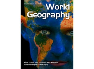
  • 1. World Geography Brian Dufort, Sally Erickson, Matt Hamilton, David Soderquist, Steve Zigray MI OPEN BOOK PROJECT
  • 3. ii This is version 1.4.4 of this resource, released in August 2018. Information on the latest version and updates are available on the project homepage: http://textbooks.wmisd.org/dashboard.html Attribution-NonCommercial-ShareAlike CC BY-NC-SA The text of this book is licensed under a Creative Commons NonCommercial-ShareAlike (CC-BY-NC-SA) license as part of Michigan’s participation in the national #GoOpen movement.
  • 4. The Michigan Open Book Project Project Manager: Dave Johnson, Wexford-Missaukee Intermediate School District 6th Grade Team Editor: Amy Salani, Wexford-Missaukee Intermediate School District 6th Grade Content Editor: Carol Egbo 6th Grade World Geography Authors Brian Dufort, Shepherd Public Schools Sally Erickson, Livonia Public Schools Matt Hamilton, East Jordan Public Schools David Soderquist, Three Rivers Schools Steve Zigray, Concord Public Schools About the Authors - 6th Grade World Geography Brian Dufort Shepherd Public Schools Odyssey MS/HS Brian is originally from Midland, MI and is a graduate of Northern Michigan University. He has spent his entire teaching career at Odyssey Middle/High School, an alternative education program in the Shepherd Public School system. In 2001, his environmental studies class was one of seven programs from the United States and Canada to be chosen as a winner of the Sea World/Busch Gardens Environmental Excellence Award. Brian is also the Northern Conference director of the Michigan Alternative Ath- Sally Erickson Livonia Public Schools Cooper Upper Elementary Sally has taught grades 3-6, as well as special education. She has served as a district literacy leader for many years and participated in the Galileo Lead- ership Academy in 2001-03. She is proud to be a teacher. Matt Hamilton East Jordan Public Schools East Jordan Middle School Matt grew up in Cadillac, MI. He holds a bachelor and masters degree from Michigan State University. He currently teaches middle school History and Geography. Matt started and advises a club at his school called the Shoe Club to inspire his students to Dream Big. His wife and two daughters enjoy traveling and spending time in the out- doors.
  • 5. David Soderquist Three Rivers Public Schools Three Rivers Middle School For the Past 11 years David has taught 6-8 grade Social Studies for Three Rivers Middle School. He serves as Department Head, School Improvement Member and Social Studies Rep for his area. Over the past few years he has completed his Mas- ters Degree in Curriculum and Instruction and become a state recognized Instruc- tional Coach. Steve Zigray Concord Community Schools Concord Middle School Steve Zigray is a 6th grade teacher. He holds a Bachelor’s Degree from Central Michi- gan University and a Masters Degree in K-12 Administration from Eastern Michigan University. Honors Steve has been awarded are the 2001 Junior Achievement Educa- tor of the Year and he was nominated for Jackson Magazine’s, Educator of the year in 2014. He has also coached high school and middle school sports, worked on various school improvement committees, wrote the 6th grade Common Assessment tests for Jackson County ISD and is an active member in the community as well as the PTO. He lives in southeast Jackson County with his beautiful wife and three fantastic daugh- ters.
  • 6. Chapter 1 Studying Geography QUESTIONS TO GUIDE INQUIRY 1. What is geography? 2. Why do we study geography? 3. What tools do geographers use? 4. What is geographic inquiry? 5. Why do we need to think globally? Image source: http://upload.wikimedia.org/wikipedia/commons/0/05/Land_ocean_ice_cloud_1024.jpg
  • 7. This year you will be studying the geography of the world in which we live.  Right off the bat, think about what you already know about geography - it could be things you have learned in other classes at other grade levels, things you’ve heard from your parents, or things you’ve heard from teachers.  What comes to mind?  Is it maps?  Latitude and longitude?  What else? Section 1 QUESTIONS TO GUIDE INQUIRY 1. What is geography? 2. Why do we study geography? 3. What tools do geographers use? 4. What is geographic inquiry? 5. Why do we need to think globally? What is Geography Anyway? 6 Interactive 1.1 What is Geography? Take a moment to view this brief video online and then answer the question in the blue box to the best of your ability What is Geography?
  • 8. Quite simply, “Geography” broken down means “to study the earth” and throughout your studies in the book, we are going to expand on this definition.  If you were to go home and ask your parents about geography they may have studied in school, they might say when they were students they memorized the states and capitals, or major countries in the world.  This is only one part of what geography really is however.  To study geography is to study where we are in the world; what the world around us is like.  It is the study of who lives there and why.  It can be the study of foods people eat, clothes they wear, cars they drive, and homes they live in.  It is the study of climate, land, economies, politics and culture.  Like many of the disciplines in the social sciences, it is a discipline that weaves the threads of the others. When studying geography we are going to focus on two aspects - physical geography and human geography.  When we look at landforms, vegetation, climate, bodies of water such as rivers, lakes, and seas, we will be studying physical geography, the study of natural and physical characteristics.  Human geography is different but related. It is the study of how people interact with the earth.  It also includes culture, migration patterns, and patterns of population.   The study of something often begins with a question.  This book itself is set around a series of questions, some smaller, some larger.  Over the course of this entire world geography book, you will explore one major question:  “How are we, as members of a global society, connected?”  In each section of this book, we will bring you back to this idea and have you record any new thoughts and ideas that occur to you based on what you have explored in this book and through class instruction and discussion.  You will be doing this as part of an interactive digital journal which you can view here. 7 Interactive 1.2 Interactive Journal Please note: once you have created your own copy of this document, this widget will only return you to the blank copy. You will need to access yours by opening from your own Google Document.
  • 9. While the teachers who have put this book together have provided some questions to focus your study, you will be asked and encouraged to come up with your own questions as well.  The process you will be guided through is known as inquiry - the act of seeking out information.   How are the people in the picture above dressed?  Why might people in this place wear clothing like this?  If you notice the fur hoods surrounding their faces you might think it is cold where they live.  If you investigated further, you would learn that this is a historical photo of an Inupiat family from Alaska. It might lead you to ask more questions - are there times of the year when they would wear lighter clothing?  What is the average temperature during winter?  What is the average temperature during the summer months?  One question about why people dress the way they do could lead to a series of new inquiries in the desire to learn more. View the image gallery above - practice asking geographic questions based on the images shown. 8 Image source: http://upload.wikimedia.org/wikipedia/commons/8/8c/ Inupiat_Family_from_Noatak,_Alaska,_1929,_Edward_S._Curtis_(restored).jpg Image source: https://farm4.staticflickr.com/ 3302/3570407917_585dd5a1e8_o.jpg Gallery 1.1 Image Gallery
  • 10. As you continue to study “the basics,” this chapter serves not just as an introduction to your studies this year, but also as a “how to use this book” in case this is your first time using a digital textbook to explore Social Studies.  You will have an opportunity to practice most of the things you will be asked to do in this book during this introductory chapter.  The last thing you will be asked to do is to once again revisit the question we posed at the start of this section.  This time, you are going to write a brief response. 9 What is Geography, anyway?
  • 11. You might now have a better idea about what geography is, but why do we study it?  There are many reasons.  Take a moment to view the video clip here about how some people use geography in their chosen professions. Section 2 QUESTIONS TO GUIDE INQUIRY 1. What is geography? 2. Why do we study geography? 3. What tools do geographers use? 4. What is geographic inquiry? 5. Why do we need to think globally? Why Do We Study Geography? 10 Image source: http://upload.wikimedia.org/wikipedia/commons/3/32/JohannesVermeer- TheAstronomer(1668).jpg Interactive 1.3 What can you do with geography? Learn more about what geographers do with this YouTube clip (requires internet connection)
  • 12. Why we study geography is a question many have asked.  While to some geography is viewed only as maps, in reality it has links to science, mathematics, literacy, literature, and the other social sciences. Studying geography can provide you with an overview of the planet upon which we live.  People who study it are better equipped to understand topics such as why people live where they do, what causes people to move between places, how we use our natural resources, why countries and locations are broken up into geographic regions...the list goes on and on! In addition to knowing about our planet and the people who live there, people study geography because it helps you learn to think critically.  It provides opportunity to inquire about the world around you and research to find answers.   Geographers study the “why of where” which can be simplified to “why there?” or “why here?”  You may have studied the early history of the United States in other social studies classes. Where did early settlements like Jamestown tend to spring up and plant roots?  It was generally around water sources.  A geographer would then ask and seek to explain “why there?” The image on this page is not an all inclusive list of why we study geography, but it does include many of the major reasons we will outline as you go through this book.   11
  • 13. Understanding the world around you - Why does Michigan generally have colder temperatures in the winter than Florida?  Why is a home on the beach so expensive?  Have humans had an effect on the climate of the earth?  When studying geography you can learn the answers to questions such as these which help you make sense of the world around you.   Becoming a global citizen - Back in the early 1900s it could take a person coming from Europe to America over a week to make it from one port to the next.  Now, flights leave major airports and have people at their destination within hours.  When a natural disaster happens in one part of the world, it can affect daily life on another.  A tsunami in Japan back in March of 2011 ended up affecting more countries than just Japan.  We are citizens of the United States of America, but no matter where we live, we are also residents of this ball of rock floating in space.  What does that mean? Learning about people and societies - If you slurp your soup in America, folks might call you rude.  Burp at the table and it’s possible your parents might send you to your room without any dessert.  In Japan however, holding a bowl of soup and noodles up to your mouth to eat it is considered a sign to the chef that the food is delicious.  Slurping and all!  In parts of China, burping after a meal is considered a sign of appreciation.  Religious customs vary from country to country - the five major world religions (discussed in more depth in later chapters) all help dictate traditions and customs in parts of the world.  Studying 12 Image source: http://upload.wikimedia.org/wikipedia/commons/8/8d/ 2011_Tohoku_earthquake_observed_tsunami_heights_en.png Winter sunrise at Michigan’s St. Joseph Lighthouse Image source: John McCormick/Shutterstock
  • 14. geography allows you to learn more than just where a country is located on a map, but what the people and society are like as well. Learning about locations - This may be the piece of geography that sticks in almost everyone’s mind, but geography is the study of locations.  We do this by studying maps, pictures, Geographic Information Systems data, visiting and exploring these places, among others.   Connections - All of these things together help us explore the idea of how the world around us affects every day life, as well as the connections between how we relate to all of that.   For that reason, the inquiry question we will keep coming back to throughout the course of this book is: “How are we, as members of a global society, connected?” This question is not studied because there is a world government that unifies the planet, but more to help you realize that whatever country you are from is one of many, and that actions in one place can have effects on other places. Take a moment to record your thoughts to that question.  In the next section we will begin to look at some of the tools that geographers use. 13 http://upload.wikimedia.org/wikipedia/commons/2/23/JapaneseBosozoku.jpg Image source: http://upload.wikimedia.org/wikipedia/commons/1/12/ World_map_2004_CIA_large_1.7m_whitespace_removed.jpg
  • 15. If you were to ask 100 people what tools geographers use to study the earth, one of the first answers you will undoubtedly hear will be “maps.”  And it is true that maps are one of the most common tools used to answer geographic questions.  A map is a visual representation of the earth, or parts of the Earth and can showcase a variety of spatial scales. What are those spatial scales?  You can represent a very small portion of the map with great details. Below is an embedded map from Google.  It is set to a city in Northern Michigan zoomed in as far as that particular map can go to.  Take a moment to explore that map at different scales and then complete the Google Drive journal activity located here. Section 3 QUESTIONS TO GUIDE INQUIRY 1. What is geography? 2. Why do we study geography? 3. What tools do geographers use? 4. What is geographic inquiry? 5. Why do we need to think globally? What Tools Do Geographers Use to Study the Earth? 14 Interactive 1.5 Google Maps Interactive 1.4 Google Drive Journal Activity Refer to this handout together with the Google Maps widget. A Note On Scale: The map activity on this page is set to focus on a city in Northern Michigan at the most zoomed-in scale. This is the smallest scale for a map because objects like buildings and roads are shown at their largest size. At a more zoomed-out scale, objects like buildings and roads may be so small that we cannot see them.
  • 16. Maps Maps are able to show information about geographic areas.  Every map has at least one purpose.  They can represent a place such as a neighborhood, a town, a country, or the world overall.  Sometimes they can show human features.  In the very first map you looked at in the Google Maps link above, what human characteristics such as roads, buildings, etc. were you able to see?  When you zoomed all the way out, were you still able to see any human characteristics? When your parents were younger, they probably went on a trip with their families which involved using a map of a state or region to get to their final destination.  Modern technology such as smart phones have GPS built in which has made these two dimensional maps obsolete for that purpose.  A road trip is not the only use for a map of a city or a state, however.  Maps can represent a variety of different features about a place.  There is a small problem with maps however… If you were to take a balloon and inflate it, then draw a map of the world on it, you could, if you were careful, get a very close approximation of what the world overall looks like.  If you were extremely careful you could represent the continents of the earth drawn to a precise scaled size.  This is because a balloon is a round, three-dimensional object.  A map, however, is a two-dimensional object.  If you were to pop that balloon (much like peeling the orange in the video above) what you are left with is a much less useful representation of the earth. In an attempt to represent a three dimensional object in two dimensions, mapmakers, known as cartographers, have created different ways to represent the earth.  These are known as map projections.  There are hundreds of different types of projections and each has plusses and minuses in its usage. 15 Interactive 1.7 Map Projections Video Learn more about map projections with this video. (Requires internet connection) Interactive 1.6 The Orange
  • 17. Take this map for example.  This is known as a Mercator projection.  A Mercator projection would be an excellent map for a navigator on a ship.  In fact, this kind of map was extremely useful in navigation.  One of the problems with this map is the distortion of size.  If you look at Greenland on this map, it appears to be huge.  Australia, the small continent in the bottom right hand portion of the map, looks like it is much smaller than Greenland.  In actuality however, Greenland is much smaller.  Antarctica almost appears to be as large as the rest of the continents together.  So, while a Mercator Projection is a great map for use in navigation, it does not project the world as it is due to the distorted size of certain areas. Another well known map projection is known as a Gall-Peters Projection, or more commonly, a Peters Projection.  There is a great controversy surrounding the origins of this map, which you might want to take a few minutes to look up in the future.  In a projection such as the one above, parts of the world are represented closer to their actual scales.  If, however, you compare this map to the Mercator projection, what do you notice about the shape of land masses?  There is a distinct distortion somewhere on the map. The next projection we will take a look at is known as a Robinson Projection.  Generally speaking, a Robinson projection is an attempt to compromise and show the landmasses as close to their natural size and shape as possible 16 Image source: http://upload.wikimedia.org/wikipedia/commons/3/34/Gall %E2%80%93Peters_projection_SW.jpg Image source: http://upload.wikimedia.org/wikipedia/commons/thumb/9/96/ Robinson_projection_SW.jpg/1280px-Robinson_projection_SW.jpg
  • 18. on a two dimensional representation.  It too, however, suffers from distortion.  In this case, much of the world is shown as close to scale as possible, but as you move toward the top and bottom of the map, what do you notice happening? Now, think back to the video you watched at the beginning about the orange.  Another projection is known as the Goode Homolosine Projection, more commonly known as an Interrupted Projection.  In this projection type, there is very little distortion in terms of size of continents, however it is very difficult to calculate distances on a map such as this.  If you were taking a plane ride from New York to London, it would be difficult to figure out the exact distance if this were the only map available to you. Below is a gallery of many different map projections.  As you flip through the gallery, think about how each map might be useful, and what the disadvantages of the map might be.   17 Image source: http://upload.wikimedia.org/wikipedia/commons/f/f2/Goode_homolosine_projection_SW.jpg Gallery 1.2 More Map Projections
  • 19. So, yes...maps are one of the many tools that geographers use to study the earth.  But what are some of the others? Aerial Photographs and Satellite Imagery When you look at the image above, what do you see?  This is a satellite image captured of the United States.  The “gold” on the map represents city lights, which in turn can help someone studying this image understand where some of the major metropolitan areas are in the United States.  You will notice that one portion of the United States seems to have a lot of these lights, while large portions of the Western half of the United States are much spottier.  A “why” question a geographer might ask about this would be: “Why are there more large urban areas on the eastern half of the United States than the western half?”  By looking at this image, geographers might then look at maps and other aerial photographs to get an answer to this question.   18 Image source: http://pixabay.com/p-92367/?no_redirect Image source: http://upload.wikimedia.org/wikipedia/commons/d/da/Washington,_D.C._- _2007_aerial_view.jpg
  • 20. A satellite image has many purposes and can be helpful at a variety of spatial scales from large to small.  An aerial photograph is similar to this, but is generally speaking at a larger.  The aerial photograph that shows Washington, DC, shows a zoomed-in view of a city at a larger scale in which we can see individual buildings and streets. A picture like this one might help someone study patterns of development for neighborhood planning.  It could be useful in surveying  an area for a potential building project.  Other aerial photographs could be useful in determining location of farmland, where irrigation systems could be created, among many other things.  Both of these tools are useful for geographers in answering their “why” and “where” questions.   GPS (Global Positioning Systems) Do your parents have a smartphone they sometimes use to get directions to places they have never been?  What about you?  Global Positioning Systems (commonly referred to as GPS) make use of satellites in orbit to collect information about where the user is on the earth.  Your GPS device, be it a phone or a commercially available stand-alone unit, sends information up into the sky where it connects with a satellite, which then determines your position on the planet.  This information is then relayed back to the user and displayed on a map.  Aside from just locating yourself on a map, how might GPS be a useful tool for geographers? GIS (Geographic Information System) A geographic information system, commonly referred to as GIS utilizes software and hardware to collect and display data.  It can help you display forms of information useful for geographers to explore.  It is a combination of map making (cartography), data 19 Image source: http://upload.wikimedia.org/wikipedia/commons/5/59/ GPS_Receivers_2007.jpg Image source: http://upload.wikimedia.org/wikipedia/commons/3/33/GvSIG_-_GIS.jpg
  • 21. about places, and computer technology to create a representation of places.  Someone who uses a GIS is then able to create a representation of places by layering information on top of the map and allowing the people using them to manipulate information in an attempt to better understand a place.   Other tools You may not initially think of things like stories, people, charts, tables and graphs as being things a geographer might use, however, even with a wealth of other tools such as maps, satellite imagery, and GPS and GIS available, more information is needed in pursuit of the answer to the questions of “why” and “where.”  In this case, geographers use some of the same tools as everyone else to explore and learn more, such as data in tables, and charts and graphs which can help with numerical data about a place.  If a geographer is trying to understand why people settled in a given area, they might look back at historical data about when people came to a region in an attempt to understand why.  They might also look at primary source documents - first hand accounts from people who lived during the time to get a sense of why people came there.  If movement to this region was recent, they might even interview living people to get clues.   What has been outlined in this section is by no means a full list that shows you every tool a geographer can use.  It focused on some of the most common ones, and you’ll et practice with these and many more throughout the book. Return once more to the “What Tools Do Geographers Use to Study the Earth” note guide.  There is one final question for you to explore before moving into the next section. 20 Interactive 1.8 Google Drive Digital Journal Activity
  • 22. So far you have learned about what geography is, why you are going study it, and what tools geographers use.  One of the most important things to remember is that just like people in every field, geographers ask questions.  Geographers go through an inquiry process every time they ask themselves a question on something that interests us, whether we are aware of it or not.  The first step is asking the right question.  From there, you go out and find the right information.  You evaluate, sometimes without knowing it, whether the information is “good” or not, before finally coming up with your conclusion.  These are all steps in a good inquiry process. Geographic inquiry is no different.  For the purposes of this book the following process will be used: Section 4 QUESTIONS TO GUIDE INQUIRY 1. What is geography? 2. Why do we study geography? 3. What tools do geographers use? 4. What is geographic inquiry? 5. Why do we need to think globally? What is Geographic Inquiry? 21
  • 23. Ask a geographic question To begin any inquiry, you need to have a question in mind.  If you are having a hard time beating a boss in a video game, you might ask “How do I get past the level 12 boss?”  This is certainly a question you can research, but it probably is not a question a geographer would use.  Geographers are going to ask questions about where things happen, what happened, and why it happened. Two geographers headed to a rock concert (music, not stones) might wonder why it costs $15 an hour to park their car in the lot right next to the venue, the place where the concert happens.  This is one of those times where economics also comes into play.  If they drove several streets over, there might be cheaper parking lots.  In this case, they may think the answer to this question is “convenience.”  The closer you are to your destination, the more expensive it is to park there.  To be certain however, they are going to have to do a few more things. Acquire Geographic Information The second step once you have your question is to go out and gather some information.  In the rock concert example above, a geographer probably would not look at a world map to figure out where to park, but if you think back to the geographic tools we discussed in the previous section, you might look at aerial photographs to see where available parking might be.  You might also use a map that is more zoomed in so you can see more specifically how streets connect a parking lot to the concert site.  All of this information helps you as you begin the next stage of geographic inquiry. Organize Geographic Information The date of the concert is approaching and the geographers’ excitement grows.  They do not want to pay too much, however, so now that the question has been asked and they have an opportunity to collect some resources, it’s time to explore and organize that data.  As they look through aerial photographs of the area to determine the number of parking lots in walking 22
  • 24. distance of the concert venue, they also might have received information from the city website on how much the parking costs at various locations.  At this point they may create their own special map which showcases prices.  Once this is done, they are ready for the next step. Analyze Geographic Information Once their map has been assembled with the most up-to-date data they have available, it is easy to see the available public parking lots that are the furthest away from location A (the concert venue) are cheaper than the ones located right near the venue.  While our example has been relatively simple, sometimes it takes a long time to analyze the geographic information that has been collected and organized in response to a geographic question.  And sometimes, as you get further into the inquiry process, you might need to return to earlier steps.  Perhaps it is asking a different question.  Maybe you need more information to reach your conclusion.  Inquiry can be messy, but once you have the right question and the right data, you can move to the final step. Answer Geographic Questions Finally, the day of the concert arrives and our geographers are ready to attend with all of the best knowledge on where to park in the city.  Not only are they going to attempt to land themselves a parking spot at points three or four on the map so they have more money for souvenirs, but they conduct a little more geographic inquiry to figure out how long it will take them to walk from their parking spot to the venue.  They leave secure in the knowledge that they went through the geographic inquiry process to answer the important question about why parking so close to the concert venue is more expensive. 23 Image source: Andrey Yurlov, Shutterstock
  • 25. Chapter 2 North America QUESTIONS TO GUIDE INQUIRY 1. Why do people move?   2. Why would you move?   3. How do people, goods and ideas move? 4. Why do people, goods and ideas move? Image source: https://www.flickr.com/photos/walkingsf/5912385701
  • 26. The movement of people, the import and export of goods, and mass communication have all played major roles in shaping our world.  People everywhere interact through movement.  They travel from place to place and they communicate.  We live in a global village and global economy. People interact with each other through movement. Because we are social beings, we interact with each other through travel, trade, information and political events. Section 1 QUESTIONS TO GUIDE INQUIRY 1. Why do people move?   2. Why would you move?   3. How do people, goods and ideas move? 4. Why do people, goods and ideas move? Introduction - Movement and North America 25 Image source: http://upload.wikimedia.org/wikipedia/ commons/d/d1/ Biswa_Ijtema_Dhaka_Bangladesh_24012010.JPG What is movement? What factors push or pull people?   Interactive 2.1 Movement Learn more about this theme of geography in this video (requires internet connection)
  • 27. The Geography of North America The landmass of North America lies in the Western Hemisphere.  It is bordered by the Arctic to the north, the continent of South America and the Caribbean Sea to the south, the Atlantic Ocean to the east, and the Pacific Ocean to the west.  The land is rich in resources like coal, natural gas, oil, timber products, freshwater, and an abundance of plant and animal species.  Renewable resources such as wind, water, biomass, geothermal and solar are widely used as well. 26 What is an example of an idea that moves?   How do we depend on people in other places?   How do they depend on us?    What resources are where you live? Who uses the resources? How could people around the world use these resources? Image source: http://upload.wikimedia.org/wikipedia/commons/2/29/ North_America_satellite_orthographic.jpg
  • 28. The land is very diverse with a variety of climates, vegetation zones and various other geographical features.  Due to its latitude and longitude, the climates range greatly.  Around the Arctic Circle, the climate is cold and is home to the Tundra region and very barren land masses covered in snow and ice.  Move closer to the equator and the climate and vegetation change. Although the elevation varies due to the Rocky Mountains, this region contains the Great Plains, forested and desert regions.  In other places, the land narrows and contains a wide variety of climates and vegetation zones for such a small area. With an abundance of fresh water, North America is truly blessed.  The Mississippi River is one of the world’s major river systems in size, habitat diversity and biological productivity. It is the third longest river in North America, flowing 2,350 miles from its source at Lake Itasca through the center of the continental United States to the Gulf of Mexico. 27 Image source: http://upload.wikimedia.org/wikipedia/commons/5/57/Climatemapusa2.PNG
  • 29. The Great Lakes - Superior, Michigan, Huron, Erie and Ontario - are a dominant part of the physical and cultural heritage of North America.  Shared with Canada and spanning more than 750 miles from west to east, these vast inland freshwater seas provide water for consumption, transportation, power, recreation and a host of other uses.  The Great Lakes are the largest surface freshwater system on the earth. Only the polar ice caps contain more fresh water. 28 Image source: http://upload.wikimedia.org/wikipedia/commons/5/57/Great_Lakes_from_space_crop_labeled.jpg
  • 30. As you read this section, think about the following questions. Over 15,000 years ago, a land bridge was exposed in the Bering Sea.  During this time groups of hunters and gatherers crossed this barren wasteland to follow migrating animals. Many scientists believe that this land bridge was the gateway to early settlement in North and South America.  The area is still known today as Beringia. This was perhaps the first great movement to the Americas by any group of people.  Beringia became a key migration route for Section 2 QUESTIONS TO GUIDE INQUIRY 1. Why do people move? 2. Why would you move? 3. What’s worth moving to and from? The First Americans 29 How do we know these people moved? What evidence do we have that they traveled and settled? Learn more about how early humans arrived in North America here. Image source: http://upload.wikimedia.org/wikipedia/en/c/c8/Human_migration.png
  • 31. humans, plants and animals.  Today, it is a preserve that lies 42 miles from the Bering Strait. This area of Northeast Alaska and Eastern Russia is still home to the ancestors of people today.  This heritage lives on in the culture of these people and can easily be seen in their language, traditions and way of living. The following section is a little controversial.  After reading and discussing in class, you can form your own opinion.  Is it fact or false? Why? Other scientists believe there were people who crossed the Atlantic prior to the Clovis period.  These people are thought to have been outcasts or lost seal hunters from south western Europe.  Whether a result of shelf ice detachment or lost hunters traveling by foot or kayaks, there is evidence that suggests these people moved and settled in what is now present day Nova Scotia, Canada. Like the land bridge people, grasses and animals could have enticed these ancient travelers to migrate west and then south along the Atlantic coast of America. These people were the Solutreans. The Solutreans theory began when tools found in Virginia were the same as tools found in Western Europe during the Solutrean period.  This relatively new information is highly debated due to cultural characteristics like language and other artifacts found in Europe. Archaeologists have unearthed bones and tools resembling that of ancient Europe and are believed to be older than the Bering crossing. These tools and remains are much older because the move would have been from east to west.  These people would have moved the shorter distance.   These theories explain the two movements from early humans.  Over time, these first Americans spread out all over North and South America.  They developed their own way of living in the environment they chose. 30
  • 32. No matter what theory is ultimately deemed possible, these people moved. 31 Questions: Why do people move?   Put yourself in their shoes, what would cause you to move? Map of the three migration hypotheses
  • 33. The Vikings Hope is both the earliest and the most indispensable virtue inherent in the state of being alive. - Leif Erickson Leif Eriksson was the son of Erik the Red, founder of the first European settlement on what is now called Greenland. Around A.D. 1000, Eriksson sailed to Norway, where King Olaf I converted him to Christianity. According to one school of thought, Eriksson sailed off course on his way back to Greenland and landed on the North American continent where he explored a region he called Vinland. He may also have sought out Vinland based on stories of an earlier voyage by an Icelandic trader. After spending the winter in Vinland, Leif sailed back to Greenland, and never returned to the North American shores. He is generally believed to be the first European to reach the North American continent, nearly four centuries before Christopher Columbus arrived in 1492. Section 3 QUESTIONS TO GUIDE INQUIRY 1. Why do people move?   2. Why would you move?   3. What’s worth moving to and from? 4. What factors push or pull people? The Vikings 32 Think about this: How different would North America be if Eriksson had started a settlement in Vineland? How would the settlement affect future explorers such as Columbus, Cortez and others? Interactive 2.3 The Vikings Learn more about the Vikings exploration of North America with this YouTube video (requires internet connection)
  • 34. The Columbian Exchange refers to the widespread movement of animals, plants, culture, human populations, communicable diseases, technology and ideas between the American and Afro-Eurasian hemispheres in the 15th and 16th centuries.  This occurrence is related to European colonization and trade, including the atlantic slave trade, following Christopher Columbus' 1492 voyage.   This process between the two regions moved a large variety of fruits, vegetables and domesticated animals between the continents.  Side effects included a population boom in both places and an increase of disease particularly amongst Native Americans in the Americas.  Traders returned to Europe with maize, potatoes, and tomatoes, which became very important crops in Europe. Similarly, Europeans introduced manioc and peanut to tropical Asia and West Africa, where they flourished in soils that otherwise would not produce large yields. The Spanish Christopher Columbus, in the year 1492, sailed to the new world.  He was searching for an easier path to the East Indies for trade.  The lives for millions of indigenous people would be forever changed by this event.  This event opened a Section 4 QUESTIONS TO GUIDE INQUIRY 1. Why do people move? 2. Why would you move? 3. What’s worth moving to and from? 4. What factors push or pull people? The Europeans 33 Where are you located?   What crops and animals are grown and raised? Did they originate there? Who brought them to your area?
  • 35. flood gate of migration from Europe.  Along with the Spanish, Great Britain and France became key players in the migration of millions of people to the Americas. 
 The Atlantic Slave Trade Africans were forced onto slave ships, by European countries for over 300 years.  These people were transported across the Atlantic Ocean in horrible conditions.  Captain John Hawkins, led the way for the British in the Transatlantic Slave Trade. Starting in the late 1400s, Hawkins captured over 1300 Africans and sold them in the Americas.  The willing buyers were the Spanish and Portuguese colonists.  As the new world was settled and thus more populated, these slave traders supplied British colonies as well.  The estimated number of transported slaves 34 Research: Choose any fruit to spend a little time researching. Where did it come from? How have domesticated animals changed your region?   Image source: http://commons.wikimedia.org/wiki/File:Triangular_trade.png
  • 36. runs around 3.4 million. The willing buyers used these slaves to work on farms and plantations.  Laws were passed restricting the rights of the slaves.  Originally, Great Britain set up ports on the coast of West Africa and created a monopoly in the slave trade.  Only British ships could dock there and transport slaves from these ports.  Policies like this created interlopers.  Interlopers were illegal slave transporters who traded Africans at discounted prices.  This caused a loss of profits, created less populated ports and lowered prices for the British crown.   In March of 1807, The United States and the British signed acts that prohibited the transportation of slaves.  This did not abolish slavery by any means; it just restricted the transportation of Africans as slaves.  Over the next couple hundred years the movement of people by illegal means posed serious international problems.  The abolition of the slave trade was not internationally recognized until 2001. Movement in North America Today: People, ideas, and products move about Earth.  Over the years, people moved by foot, animal, ship and automobile. Their products moved the same way.  Their ideas moved faster and faster.  Each move connected people from place to place.  All these moves made us who we are today.  From the first humans to come to North America by land bridge to the colonists who braved stormy seas.  These people moved.  Their products moved.  Their ideas moved.   Multiple factors play into why they moved.  Were they pulled by desire, food or just the curiosity as to what is on the other side of the horizon?  Were they pushed like the slaves on the slave ships?  Slaves were physically forced to move 35 Image source: http://www.tablespace.net/maps2/lowres/HumanCargo.jpg Interactive 2.4 Slavery Today Does slavery still exist today? Learn more with this article from the Washington Post
  • 37. Moving People Historically speaking there are many reasons why people move TO North America, but what does movement IN North America look like today? People move.  You’ve already learned about push/pull factors.  Sometimes people and families move because of jobs and opportunities elsewhere.  This kind of movement could be across a town, a state, a region, a country, or in between countries. Movement of people can take place in a variety of ways.  You’ve already read a little bit about historical methods of bringing people from place to place.  Early migrations took place on foot.  European migrations began on ships.  Today people move in many ways.  They can still travel on foot and on ship, though cars, busses, trains, and planes have all made the speed at which people can travel much faster.   Section 5 QUESTIONS TO GUIDE INQUIRY 1. Why do people move?   2. Why would you move?   3. What’s worth moving to and from? 4. What factors push or pull people? Movement in North America Today 36
  • 38. Take a moment to look at the map below.   Let’s pretend you live at point 1 on the map and you and your family are moving to point 2.  Based just off of this map, trace your finger over the route you might take to get there. Do you draw a direct line connecting the two points?  Do you travel south first and then move west?  What method of travel is best?   37
  • 39. It is difficult to answer some of those questions without some more information.  Therefore, in practicing the skills of a geographer, here is a second map. You can see now that with a map scale added you can tell the distance between the two locations.  Using a ruler or other measuring device, do the following: 1. Determine the distance of the route you decided to travel on the previous map.
 2. Calculate the number of hours this trip would take by car by dividing by 60
 3. Will this change how you move from Point 1 to Point 2?  Why?
 38 Image source:  http://st.hist-geo.co.uk/img/usa-48/USA-48-Etats-1.png
  • 40. You may choose to drive to this location still, but doing so will probably require that you drive anywhere between 18-24 hours depending on the route you chose, and assuming of course that there are actually roads that lead to this location on the route you traced with your finger. To make certain you can actually travel this route by car, you need to make certain that there are actually roads that get you there.  The fastest way will be to utilize the major United States highway system map.  Using this map, are you still able to make the trip along your original route? What are some reasons there might be fewer highways in certain places? How does your answer to the previous question possibly relate to movement? There is still one other thing to consider in this simulation.  Even with the highway system in place, might movement from Point 1 to Point 2 be difficult at times?  To get one answer to that question, you might want to take a look at yet another map. 39 Image source:  https://upload.wikimedia.org/wikipedia/commons/2/27/Interstate_Highway_System_Map.jpg
  • 41. This map is a map that depicts the major mountain ranges of the United States.  You can see from this map that Point 2 requires travel through mountains.  If you’re driving in an old car without enough power (and carrying your belongings in the back seat!) your trip might end up being a little difficult in certain places. That isn’t to say that you couldn’t fly there.  That trip would be much shorter and probably less expensive.  You might also see if there were train or bus routes that could get you there, though that method of travel would add length to your time. Looking back at the maps, could you take a boat from Point 1 to Point 2? Depending on where and how a person wants to move, the trip could be easy or difficult.  Right now a person in North America could move almost anywhere on the continent and to places in Latin America by car with varying degrees of ease.  If someone wanted to drive from New York to London England however, they would be unable to do so right now.  Learn more about how the country of Russia would like to solve that problem in the future at this website.   40 Image source:  https://upload.wikimedia.org/wikipedia/commons/c/c8/ReliefUSA_map.gif Interactive 2.5 Road from US To Europe
  • 42. Moving Products What did you have for breakfast this morning? How did that breakfast make its way to your kitchen? The short answer to the questions you were asked above might be “food” and “my parents bought it.” That food however came from somewhere.  Sometimes it came from multiple places.  While it is true that people travel to a store and purchase groceries, the movement of that product from the store to their home is only one step in a longer journey. If you had cereal for breakfast, it’s possible you used a brand that was created in Michigan by Kelloggs, which made $14.8 billion in revenue in 2014.  Kelloggs foods has their headquarters in Battle Creek Michigan, and their cereals are manufactured and sold world wide.  The factory in Battle Creek, as well as others around the country and world produces many kinds of cereal which you may have eaten this morning. Some might be tempted to say that the journey of the product from the store to a home begins at the factory, but that is still not the case.  All of the parts of a product, such as ingredients for making cereal, come from places outside of the factory.  It could come from local sources, or much farther away - across a state, the country, or even the world. 41 Image source:  https://upload.wikimedia.org/wikipedia/commons/a/a3/Froot_loops_in_a_bowl.jpg
  • 43. Activity - Use the internet to find the ingredients in one breakfast cereal of your choice.  Then, pick any three ingredients (such as rice, sugar, or salt) to find out where in the United States these materials might come from.  If it does not come from the United States, where else might it come from?  How might those ingredients “move” to the factory in which they are processed and turned into cereal? The journey of an ingredient for cereal could begin hundreds or thousands of miles away from your house.  If you live in Michigan however, it is quite possible that they made their way to Battle Creek to be made into your breakfast this morning. It doesn’t necessarily matter where your cereal was created.  Often times after production it is taken to centralized warehouses which deliver the products to many regional stores.  The goods travel over land and by air depending on the distance they must travel.   All goods and products move in this way.  If your family goes to a local farmers market and purchases apples, the journey from the farm to you may have been a relatively short one, but the product still moved.  If your family purchases an American made car from Ford, GM, or Chrysler, the parts came from all over the world, and it’s possible that it wasn’t even assembled in the state that you live in. From apples to cars, to the breakfast you ate this morning, the theme of movement is taking place all across your town, your state, the country, and the world. 42 (image source:  https://upload.wikimedia.org/wikipedia/commons/2/20/Warehouse_of_Grupo_Martins_in_Cama%C3%A7ari_(Brazil).jpg)  
  • 44. Moving Ideas People and products move constantly, but a third major type of movement also exists.  The third type of movement is the movement of ideas.  Prior to the 1830s, movement of ideas could be very slow.  To communicate across vast distances people either had to travel to a place themselves or send a letter which could take days, weeks, or months to arrive at their final destination.   While you will learn more about the major religions of the world in a later chapter, the spread of religion around the world can be traced to an idea called cultural diffusion, the spread of beliefs and activities from one group to another.  In ancient times religions such as Christianity, and Islam spread along trade routes, with places in the world adopting the incoming religion, and others taking pieces of it which mixed with local customs.  When people moved from one region to another to trade goods, their customs came with them and often times spread.  This was not a process that happened overnight, rather, it took a great deal of time.  The fastest methods of communication generally involved people traveling long distances over long periods of time.     Fast forward a thousand years and communication became faster.   The telegraph was invented in the 1830s.  People could now send a message to someone across a large distance much faster, though it still required people to both send and receive the transmission, decode it, and deliver it to a recipient.  The telegraph did however make the spread of information and ideas much faster. Just forty years later, the telephone was invented.  For the first time people could communicate with their voice over large distances.  This also helped ideas and information spread faster. As faster methods of travel became available, this also led to a faster spread of information. Today however, many people carry a phone in their pocket which allows them to communicate with people all over the world instantaneously.  That phone isn’t just used to send your voice.  Many phones come equipped with cameras allowing easy face to face communication.  You can text a message, a picture, or a video to friends almost anywhere in the world and they can receive it within seconds.   43
  • 45. People today can even communicate with people they have never, and will never meet.  Social media - things like Twitter, Facebook, and YouTube allow you to broadcast yourself to the world. An aspiring musician might make a video on their phone of them playing an original song in their basement or bedroom.  They upload that song to a place like YouTube and some of their friends and family might view it and share it with their wider circle.  A few weeks later it might have been viewed in all fifty states.  A few months later, if the song was popular enough, it might make its way outside of the country.  Some musicians have been discovered by record labels this way and offered recording contracts.  What begins as a song recorded in a basement in Roscommon Michigan could become a hit in Tokyo Japan if the conditions are right. The movement of people, goods, and ideas is constantly taking place.  You’ll learn more about how people, goods, and ideas move in later chapters of this book. Use the infographic at this website to research a method of communication through the ages.  Explain how the method you chose connects/connected people during that time period. Describe how a “tweet” on Twitter, or a Facebook status update represents movement of an idea. Return to your interactive journal and describe three important things you have learned about movement in this chapter. 44
  • 46. Chapter 3 Latin America QUESTIONS TO GUIDE INQUIRY 1. How are we, as members of a global society, interconnected? 2. How do people’s actions impact the world? 3. How does the environment affect human behavior and actions?
  • 47. Latin America The area known as Latin America is made up of the region south of the United States, beginning at the river that separates the U.S. from Mexico, the Rio Grande’, and extending to the southern tip of South America, an area known as Cape Horn. This region includes Mexico, Central America, South America and the islands of the Caribbean Sea. Latin America is home to 23% of the world’s forests and 31% of its freshwater. Despite a wealth of resources, the region’s population growth and the way in which people have used the land around them, have led to the destruction of many of these resources. As the population continues to grow, a major challenge becomes finding safe water and ways to maintain sanitation in towns and cities. Pollution, both in the air and water (freshwater, oceans, and seas) is also a major problem confronting the people of Latin America. In some areas, competition over scarce resources has Section 1 QUESTIONS TO GUIDE INQUIRY 1. How are we, as members of a global society, interconnected? 2. How do people’s actions impact the world? 3. How does the environment affect human behavior and actions? Human/Environment Interaction in Latin America Introduction 46 Image source: http://en.wikipedia.org/wiki/Latin_America#/media/ File:Latin_America_%28orthographic_projection%29.svg Interactive 3.1 More About Latin America This video created by a teacher for his class gives an overview of Latin America and many of the things you’ll study about in this section.
  • 48. led to social and environmental conflicts. These then pose a risk to the lifestyles of all who live there. The Theme of “Human-Environment Interaction” If you look back to the second and third questions that guide this chapter: “How do people’s actions impact the world?” and “How does the environment affect human behavior and actions?” you’ll begin to discover what the geographic theme of “Human- Environment Interaction” means. The theme of Human-Environment interaction is an interesting one to explore because its roots are not just planted in geography. It runs through all of the social studies disciplines. It is a part of history, economics, and civics as well as geography and the sciences. Here’s an example from early history: Humans have learned over time how to adapt to the environment around them and how to modify it to suit their needs. Most early permanent settlements sprang up around sources of water. In some of these places humans began to modify the environment around them so that they could settle in large regions around water. An early form of humans interacting with the environment was irrigation which allowed water from these major water sources to be brought in to surrounding farms to provide food for people. Latin America is a great place to study this theme. Humans interact both positively and negatively with the environment around them. For example, when humans dam a river, there are consequences, both good and bad. You will study some of these consequences throughout this chapter. 47 Interactive 3.2 Rain Forest Threats This short article from National Geographic will give you a little background information on an issue you might choose to study further in this chapter. Interactive 3.3 Interactive Journal Please note: once you have created your own copy of this document, this widget will only return you to the blank copy. You will need to access yours by opening from your own Google Document.
  • 49. Mexico & Central America Mexico and the nations of Central America make up the southern portion of the North American continent. 
 The Geography of Mexico Mexico is bordered by the United States to its north, with the Rio Grande dividing much of the two countries. The Gulf of California and the Pacific Ocean lie to the west of Mexico, Guatemala and Belize are found to the south, and the Gulf of Mexico and the Caribbean lay to its east. Mexico is a land with a wide range of geographical features ranging from swampy areas and tropical forests to arid deserts and high mountain ranges. Central Mexico is mainly a plateau which has mountain ranges on both sides. The northern area of the plateau is very arid and makes up nearly 40% of the total area of country. The two main mountain ranges found in Mexico are the Sierra Madre Oriental and the Sierra Madre Occidental. Volcanoes and smaller mountain ranges Section 2 QUESTIONS TO GUIDE INQUIRY 1. How are we, as members of a global society, interconnected? 2. How do people’s actions impact the world? 3. How does the environment affect human behavior and actions? Physical Geography - Mexico 48 Image source: http://www.earthchronicle.com/ECv1/Atlas/Images/AmericaSRTM-CentralLarge-picasa.jpg Interactive 3.4 Google Maps - Mexico Use this interactive widget to zoom in on and see the physical characteristics of Mexico.
  • 50. can also be found in southern areas of Mexico. The appearance of the many mountains and volcanoes, as well as earthquakes is due to Mexico’s placement along the western edge of the North American tectonic plate. Actually, Mexico is located at a place on the earth where three different tectonic plates come together. The movement of these plates causes a great deal of geographic activity in Mexico. 49 Image source: http://upload.wikimedia.org/wikipedia/commons/a/ad/ World_tectonic_plate_map_large.png Interactive 3.5 Earthquakes in Mexico Find the most recent data for earthquakes in Mexico using this website. What characteristic of Mexico’s geography do you think is the biggest challenge for the people living there? Use evidence to support your claim.
  • 51. Central America Central America is often referred to as its own region, but it is actually the southern portion of the North American continent.  There are seven countries in this region which you can see on the embedded Google Map: Belize, Costa Rica, El Salvador, Guatemala, Honduras, Nicaragua, and Panama. Even though Central America is a relatively small area, its physical geography is very diverse. In some places it is very high, like the volcanic mountains and highlands. There are also lowlands covered in rainforest and dry savanna areas. Central America contains rugged mountains and diverse amounts of vegetation. It is located near two oceans - both the Atlantic and the Pacific. Section 3 QUESTIONS TO GUIDE INQUIRY 1. How are we, as members of a global society, interconnected? 2. How do people’s actions impact the world? 3. How does the environment affect human behavior and actions? Physical Geography - Central America 50 Interactive 3.6 Google Maps - Central America Use this interactive widget to zoom in on and see the physical characteristics of Central America. Image source: http://upload.wikimedia.org/wikipedia/commons/9/94/ CIA_map_of_Central_America.png Using the Google Map and the map on this page, describe Central America’s location in the world.
  • 52. The major landform in Central America is the Sierra Madre mountain range. These rugged mountains extend through the center of Central America, running from Mexico in the west through the center of the region.  Some of these mountains rise as high as 14,000 feet, with the highest being found in Guatemala. On each side of these highlands are coastal lowlands that run along the Atlantic and Pacific coasts. The lowlands are generally hot and humid, while the highlands are cool and relatively dry. There is also an active belt of volcanic mountains which runs along the Pacific coast from Mexico all the way down to Costa Rica. With natural hazards such as volcanic activity, earthquakes, and hurricanes, Central America is the site of many natural disasters. The volcanic activity results in eruptions and earthquakes. The close location to the oceans make the area vulnerable to hurricanes. In the past. Hurricanes and the floods that often follow can have a devastating effect on the lowland areas. In December  of 1998, Hurricane Mitch struck Central America leaving thousands dead and even more homeless. 51 Image source: http://upload.wikimedia.org/wikipedia/commons/a/ae/Sierra_Madre_Occidental.jpg How do natural disasters often result in people in our global society becoming interconnected?
  • 53. South America South America is the fourth-largest continent in the world. It can be divided into three physical regions: mountains/highlands, river basins, and coastal plains. Because of the variety of geographic features on this continent, there are a large number of biomes, regions of the world with similar climate, animals and plants, found here. The deserts of the coastal plains rise up to meet the mountains of the Andes. The river basin of the Amazon has a dense, tropical rain forest, while the basin of another major river, the Prana, is made up of Grassland. With this great variety, there is a large number of plant and animal species, making South America stand out Section 4 QUESTIONS TO GUIDE INQUIRY 1. How are we, as members of a global society, interconnected? 2. How do people’s actions impact the world? 3. How does the environment affect human behavior and actions? Physical Geography - South America 52 Interactive 3.7 Google Maps - South America Use this interactive widget to zoom in on and see the physical characteristics of South America. Image source: http://upload.wikimedia.org/wikipedia/commons/5/51/ South_America_laea_relief_location_map.jpg
  • 54. among the other continents of the world. Mountains & Highlands The major mountain system in South America is the Andes Mountains, with a length of about 5,500 miles, which makes it the world’s longest mountain range. The Andes sit on the western side of the continent and stretch from its southern tip to its northern coast. The highest mountain peak in the Andes is Aconcagua, which is 22,841 feet tall, making Aconcagua the tallest mountain outside Asia. Highlands are also a major feature of South America. The Altiplano (“high plain”) of Peru and Bolivia stands out at an elevation of about 12,300 feet. Marked by cold, windy weather, few trees survive here. The dominant vegetation is simply grass and shrubs. The northern area receives enough rainfall to grow crops, whereas the southern half receives relatively little rainfall. 53 Image source: http://simple.wikipedia.org/wiki/Andes#/media/File:Andes_70.30345W_42.99203S.jpg Image source: http://commons.wikimedia.org/wiki/File:Romanceor_Altiplano_1.jpg
  • 55. The southern portion of South America is known as Patagonia. This region of Argentina and Chile consists of lower-elevation plateaus and rugged glaciers. The Argentine side features arid steppes, grasslands and deserts, while the western side found in Chile has glaciers in the mountains and even rainforests. River Basins South America has three major river basins: the Amazon, Orinoco, and the Paraná. The Amazon River basin covers nearly 3 million square miles, making it the largest watershed in the world. It is also the world’s second longest river, stretching nearly 4,000 miles. It begins in the norther part of South America and includes smaller river tributaries that come from the glaciers of the Andes. The Amazon River is the heart of the Amazon rain forest, which is the world’s largest tropical rainforest and makes up about half of 54 Image source: Patagonia http://en.wikipedia.org/wiki/Santa_Cruz_Province,_Argentina#/media/ File:Landschaft_von_Patagonien.jpg Image source: http://upload.wikimedia.org/wikipedia/commons/f/f6/Amazon_rainforest.jpg
  • 56. the total rainforests found in the world . It covers about 40% of South America and is spread over nine different countries. The Amazon Rainforest is invaluable to the health of the planet as it provides about 20% of the world’s oxygen and absorbs an equal amount of carbon dioxide. Nowhere else on Earth is there the same kind of diversity of animal life like there is in the Amazon Rainforest. There are more than 2 million species of insects, a large variety of animals that include many different primates, and thousands of native birds such as macaws, parrots and toucans. 55 Interactive 3.8 The World Wildlife Fund - Amazon Rainforest Learn even more about the Amazon, including some of the threats at this website from WWF. Image source: http://upload.wikimedia.org/wikipedia/commons/6/62/ Investigation: Head to Google to investigate some of the plants that make their home in the Amazon and find ways people have used these plants.
  • 57. The Paraná River basin is not as large as the Amazon, but is over 1 million square miles. It covers much of southeastern Brazil as well as Bolivia, Paraguay, and northern Argentina. The Paraná River basin supplies water to the large plains found in the southern portion of South America, known as the Pampas. The Pampas have rich, fertile soil and predictable rainfall patterns. This makes the area important for ranching and farming. The Orinoco River originates in the highlands of northern Brazil and empties into the Atlantic Ocean in Venezuela. The basin covers an area of about 366,000 square miles. There is a vast grassland region (savanna) known as the Llanos that is found in this area. The Llanos is a great habitat for many bird species, as well as many different aquatic river species like the piranha, electric eel, and the crocodile. Coastal Plains The coastal plains of South America are found on the northeastern coast of Brazil on the Atlantic Ocean, and the Pacific Ocean coast of Peru and Chile in the west. The coastal plains are very dry, with the Brazilian Highlands blocking the  sea winds from the Atlantic, and the Andes Mountains blocking out the moisture coming in from the Pacific. The Atacama Desert is part of the coastal plain in the west. It is considered the driest desert region in the world, receiving less than a half inch of rainfall a year. While the Atacama has few plants and animals found in the region, it is a main source of copper which is important to the economy of  Chile. 56 Image source: http://upload.wikimedia.org/wikipedia/commons/0/08/Birds_eye_view_of_the_Chajnantor_plateau_in_Chile's_Atacama_Desert.jpg Do you think people live in the Atacama Desert? Why or why not?
  • 58. The Caribbean The Caribbean Sea is home to over 7,000 islands, thirteen of which are independent nations. This area is very diverse in terms of its physical geography. Many of these islands are primarily the result of volcanic activity. There are however few active volcanoes today. One well known volcano that has been active recently is Mt. Soufriere of Montserrat. After 365 years of lying dormant, it erupted in 1995 and has been the site of on-going volcanic activity ever since. Various other islands of the Caribbean are known to experience various forms of volcanic activity, even the island of Trinidad has small volcanoes. Most of the non-volcanic island found in this area are coral islands that formed from the coral reefs found throughout the Caribbean. Section 5 QUESTIONS TO GUIDE INQUIRY 1. How are we, as members of a global society, interconnected? 2. How do people’s actions impact the world? 3. How does the environment affect human behavior and actions? Physical Geography - The Caribbean 57 Interactive 3.9 Google Maps - The Caribbean Use this interactive widget to zoom in on and see the physical characteristics of the Caribbean. Image source: http://upload.wikimedia.org/wikipedia/commons/8/85/ CIA_map_of_the_Caribbean.png Image source: http://upload.wikimedia.org/wikipedia/commons/7/7b/ Soufriere_Hills_Volcano.jpg
  • 59. Hills & Mountains With most of the main islands of the Caribbean being volcanic islands, many are very hilly and mountainous. The largest mountain ranges in the Caribbean include the Northern Range  of Trinidad and the Blue Mountains of Jamaica. Many of these ranges in the Caribbean are covered by rainforests and provide an extensive variety of vegetation and wildlife. Because of the mountainous and hilly nature found in the lands of the Caribbean, many islands have little to no flat land leading up to these mountainous areas. This results in the formation of swamps where runoff rainwater is collected. Trinidad is home to two major swamps, the Nariva and the Caroni. Rainforests & Desert Rainforests are commonly found in South America, but they are also found on some of the islands of the Caribbean such as Jamaica and Puerto Rico. Rainforests add to the diversity of the flora and fauna of these islands. In contrast to these lush areas, a number of islands are also found to be very arid, almost desert like.  Some of these islands include Aruba, Bonaire, Curacao and Grand Turk. Even though these islands are surrounded by water they receive relatively little, or sporadic, rainfall. Islands such as these have areas that are very rugged and dry. The plant life on these islands often include scrub vegetation, and even cactus. Due to the dry climate, cactus can be found in many areas on Aruba. 58 Photo credit: Brian Dufort Arikok National Park, Aruba Image source: http://en.wikipedia.org/wiki/Arikok_National_Park#/media/ File:Arikok_NP.jpg
  • 60. So far a great deal of attention has been paid to the Physical Geography of the region. As you go through the next few sections of this text dealing with history, think about how humans interacted with their environment. Early Civilizations The cultivation of crops in the Americas first began near present-day Mexico City around 5000 B.C.E. Originally these crops were an addition to the hunting and gathering that was done by these early people. By 3000 B.C.E. these people began to rely more heavily on agriculture. This development spread to the other hunter-gatherers societies found in south America. Section 6 QUESTIONS TO GUIDE INQUIRY 1. How are we, as members of a global society, interconnected? 2. How do people’s actions impact the world? 3. How does the environment affect human behavior and actions? History - Early Civilizations 59 Interactive 3.10 Interactive Journal Please note: once you have created your own copy of this document, this widget will only return you to the blank copy. You will need to access yours by opening from your own Google Document. How are humans interacting with the environment when practicing agriculture?
  • 61. Many important early civilizations developed in this area, including the Olmecs, Zapotecs, Teotihuacanos, Mayas and Aztecs. These cultures developed complex societies, achieved high levels of technological advancement, developed complex architecture, and shared many cultural aspects. With the establishment of agriculture, groups of early Americans began to develop more advanced societies. The earliest civilization in the Americas first developed along the coast of the Gulf of Mexico around 1200 B.C.E. This was the Olmec civilization which flourished around the time of the ancient Greek civilization and the Trojan War. They were a civilization that flourished around the time of the ancient Greek civilizations and the Trojan War. The rise of the Olmecs marked the beginnings of civilization in Central America. Centuries later the oldest civilization in South America developed in what would become Peru. These ancient civilizations would rise and fall, eventually being replaced by the three great civilizations of Latin America: the Maya, the Aztecs and the Inca. The Maya The Mayan civilization was at its height from approximately 250 C.E. until 700 C.E. The Mayan civilization developed a written language, understood advanced mathematics and had an extensive knowledge of astronomy. They even developed a calendar based on their astronomical observations. The Mayans were also very skilled architects, building large stone pyramids and well developed large cities. 60 Map of Mesoamerica, showing locations of cities and historical sites Image source: http:// www.lib.uci.edu/about/publications/exhibits/meso/images/3.jpg Interactive 3.11 Pyramids in Mesoamerica Follow this link to view a slideshow of the pyramids of Mesoamerica:
  • 62. Mayan Calendar it was most likely a combination of these events. Although the civilization collapsed, the Mayan people still can be found living southern Mexico and into Central America. 61 Part of the Mayan Long Count Calendar included dates written out as five hieroglyphs separated by four periods. Photo credit: LiveScience Starting around the year 700 C.E., the Mayan empire began to experience a decline . Archeologists are not sure why this happened, although some theories as to why include epidemics, earthquakes, drought, and warfare. Many researchers believe that Interactive 3.12 The Fall of the Mayans Follow this link to read a National Geographic article about different possible reasons for the fall of the Mayan civilization. Which one do you think is correct? Record which theory you believe, and why, in your Interactive Journal.
  • 63. The Aztecs The Aztecs appeared in Mesoamerica sometime in the early 13th century. Before then, a group of people known as the Toltecs dominated the area. The Aztecs arrived as the Toltecs’ influence was on the decline. Perhaps the Aztecs were somewhat to blame for this decline. They built their capital city near Lake Texcoco in what today is central Mexico. The Aztecs drained the swampy land surrounding the lake and built artificial islands in the lake on which they established the beginnings of their capital city. This city, established in 1325 C.E., is known as Tenochtitlán. The city had around 200,000 inhabitants at one point, making it the third largest city in the world at that time.  The Aztecs developed a complex system of agriculture, which included irrigation practices, to support their civilization. Crops grown by the Aztecs included corn, beans, squash, and potatoes. They also built a powerful military. These two developments allowed them to conquer other native peoples around them, spread their influence, and build a strong empire. The Inca The Inca Empire began small, as a group that lived in a village in the Andes Mountains. When there was an attempt by another tribe to conquer them around the year 1200 C.E., the Inca were able to fight off their attackers and emerge victorious. From that time on, it would be the Inca that looked to expand their territory and grow an empire. Over the next 100 years, the Inca conquered many different tribes throughout South America. The Inca Empire would grow to stretch nearly the entire length of the western side of South America, becoming one of the largest empires in the world. The Inca had a well-developed civilization. They built a strong central government, and had an equally strong army.  They built roads, bridges and aqueducts to carry water to their cities. The Incas also kept official records with a 62 Interactive 3.13 Tenochtitlan Learn more about Tenochtitlan at this academic website. In what ways did the Aztecs interact with the environment? Interactive 3.14 The Inca Watch this video (requires internet connection) for an explanation of how the Inca built their empire. What examples of human- environment interaction do you see?
  • 64. device called the quipu, which means knot. This was a cord which had a series of smaller colored strings attached to it on which knots were tied. As no South American culture had any system of writing at this time, this record keeping system was a major development for the Inca and allowed them to save and send information in a much easier and reliable manner than simple word of mouth. The Inca also developed terrace farming in order to adapt to the sharp mountain slopes and make farming possible in the mountains. The Inca were so organized that they had stockpiles of food that could be distributed to the people when times of drought occurred and crops failed. Many of the foods we eat today were developed and grown by the Inca, such as; potatoes, beans and peanuts. The potato was especially important as it could easily grow in the poor mountain soil and survive the cold temperatures. With their well-developed society, strong military, agricultural practices and engineering accomplishments, the Inca continued to grow in power and influence. The Inca maintained their dominance in South America until the Spanish conquistadors arrived and defeated them in 1533. Return to your interactive journal. Describe ways ancient civlizations adapted to and changed their environment? 63 Image source: http://upload.wikimedia.org/wikipedia/commons/7/71/Pisac006.jpg Image source: http://upload.wikimedia.org/wikipedia/commons/e/eb/Machu_Picchu,_Peru.jpg Interactive 3.15 Interactive Journal Please note: once you have created your own copy of this document, this widget will only return you to the blank copy. You will need to access yours by opening from your own Google Document.
  • 65. Latin America is home to about 525 million people who live in 33 different countries. The region’s population includes Native Americans, Europeans, Africans, Asians, and mixtures of these groups. It is a unique blending of cultures that has been influenced by both the native population and by the establishment of colonies by the European nations of Spain and Portugal. Marriages between European colonists and native populations established what is called the Mestizo class. Mestizos are people with a mix of both indigenous and European ancestry. Today, mestizos make up a large portion of the population of South America. Another factor influencing the cultural landscape of South America was the importation of enslaved Africans. Most of these Africans were brought to Brazil, and it is their cultural practices, mixed with native and European beliefs that created a unique cultural landscape that can be seen in cultural traits such as music, dance and foods. Religion remains the backbone of many South American cultures. While Catholicism, the official religion of both Spain and Portugal at the time of colonization, dominates the continent, there are other spiritual beliefs that have had an influence on other social activities. The Day of the Dead Festival, or Dia de los Muertos, is a Mexican festival celebrating the reunion of dead relatives with their families. This festival occurs each year on November 1st (All Saints Day) and 2nd (All Souls Day). The origins of the festival come from the ancient native peoples who believed that the souls of Section 7 QUESTIONS TO GUIDE INQUIRY 1. How are we, as members of a global society, interconnected? 2. How do people’s actions impact the world? 3. How does the environment affect human behavior and actions? Culture 64
  • 66. the dead return each year to visit with their living relatives, and to eat, drink and be merry. With the arrival of the Spanish, certain Christian beliefs were brought into the festival.  Today’s practice calls for all of the deceased children to be remembered on November 1st, All Saints Day with toys and colorful balloons adorning their graves. The next day, All Souls Day, adults who have died are honored with displays of their favorite food and drinks, as well as ornaments and personal belongings. Flowers and candles are placed on the graves and are supposed to guide the spirits home to their loved ones. Other parts of the celebration today include; the pan de muerto (a coffee cake decorated with candy bones), skull-shaped candies, paper mache’ skeletons and skulls. Today, these symbols and other items fill shops and candy counters in October. During this time, homes are often decorated in the same manner as the graves. The Carnival of Rio de Janeiro in Brazil is a festival that is held every year before Easter. It is an example of a religious celebration that has also become a popular social event. The Rio Carnival is the largest carnival event in the world, attracting millions of tourists. Another distinct cultural example is the gaucho (or “cowboy”). This cultural group was developed in the Pampas of South America. In the 1700s, gauchos hunted the herds of wild horses and cattle that had been roaming freely on the open  grasslands. Much like the famous cowboys of America, the gaucho was seen as free-spirit and became the focus of many songs, stories, and films. The gaucho culture still exists today, especially in Argentina and Uruguay. 65 Giant Parade Float, Carnival, Brazil http://mrfoster.blog.hu/2015/02/22/a_leggyonyorubb_jelmezek_amiket_el_tud_kepzelni
  • 67. Political Geography During the 1900s, the nations of Latin America experienced major political and social changes. Slowly, control by European nations began to decline, but they were replaced by the United States as that nation began to influence the area more. An example of this is the creation of Panama as an independent nation. Panama won its independence with the support of the United States, and once it became an independent country in 1903, Panama quickly signed a treaty with the U.S. giving it the rights to control what would become the Panama Canal Zone. As the growth of industries, railroads and the expansion of trade began to bring new wealth to the upper classes, a new middle class began to form in the newly developing cities. But a vast majority of Latin Americans, especially those living in the rural areas, saw little to no  progress being made in the condition of their lives. The gap between the rich and the poor grew and led to unrest among farmers and workers. By this time, many of the nations of Latin America were controlled by military dictators, and it was these governments that resisted demands for reform. In many cases, the military was used to put down these uprisings. This trend continued well into the next century. In 1959, a revolution in Cuba was led by Fidel Castro. The Cuban president Fulgencio Batista was a military dictator who had the support of the United States because of his friendly policies towards the U.S. He was however unpopular in Cuba due to his cruel tactics in dealing with the Cuban people. After Castro’s victory and take-over of the island nation, he set up a communist government. The United States feared that communism would continue to spread throughout the region. Hoping to destroy the communist presence, the U.S supported other various military dictatorships throughout the region that opposed the communist governments. Over the next few decades, Latin America would continue to be the site of conflict between these competing factions. 66 Image source: http://commons.wikimedia.org/wiki/File:Gaucho_in_action.jpg
  • 68. These dictatorships were often brutal, and thousands of political prisoners were arrested. Although communism remained in Cuba, by the 1990s many of the military dictatorships that had been in power were replaced with people elected through a democratic voting process. The transition hasn’t been an easy one as the nations of Latin America struggle to replace  governments that had been run by one man with ones elected by the people and rely on the democratic voting process to make decisions. Today Latin American countries are working to end corruption within their governments and bring economic stability. Below are political maps of the regions of Latin America 67 Image source: http://upload.wikimedia.org/wikipedia/commons/d/d8/ Map_of_Central_America.png Image soruce: http://upload.wikimedia.org/wikipedia/commons/ 7/70/%22Political_South_America Image source: http://upload.wikimedia.org/wikipedia/commons/9/98/Caribbean_general_map.png
  • 69. When Hernando Cortes came upon Tenochtitlan, the capital city of the Aztecs, it was a large city sitting in the middle of a great lake in central Mexico. The Aztecs had built causeways connecting the city to the shore. They had small island which were used for farming, also connected to the causeway system. After the Spaniards conquered the Aztecs, the city was taken over. The Spaniards decided that they wanted to drain the lake and use the land surrounding the city for farming. As the city was rebuilt by the Spanish, the forests surrounding what became Mexico City began to shrink. This began a long process that would drastically affect Mexico as we know it today. Section 8 QUESTIONS TO GUIDE INQUIRY 1. How are we, as members of a global society, interconnected? 2. How do people’s actions impact the world? 3. How does the environment affect human behavior and actions? Human-Environment Interaction 68 Interactive 3.16 Lake Texcoco Area Today Compare this map to the one on the left. What do you think caused the differences?
  • 70. The depletion of the forests in the area in the early 19th century led the springs that had supplied the city with fresh water to dry up. New fresh water wells were dug in 1857. By the twentieth century these wells numbered in the hundreds. The amount of water that was removed from the ground could not be replaced naturally, and the underground aquifer that fed the wells began to dry up. As more water was removed from the ground, the land that the city was built on began to sink. Parts of the city sank below what remained of Lake Texcoco. This caused a serious threat to the city as it posed a flood risk during the rainy season. The course of action to prevent this was to  sink wells into Lake Texcoco itself and remove enough water from the aquifer that fed it to make the level of the lake itself drop below the level of the city once again. Lake Texcoco has been drained in one way or another since the 1600’s. It now occupies only a small area surrounded by salt marshes just east of Mexico City. With the depletion of the ground-water, the land that the city is built on has become relatively unstable. Large fissures, or cracks, will open up from time to time. This, along with the fact that much of Mexico City today is built on top of the original Lake Texcoco lake bed, means that the cities buildings are at a constant risk. As the area is prone to earthquakes, the ground is not very solid and stable. The instability magnifies the ground shaking effect of the earthquakes causing greater damage than may have otherwise occurred. 69 Thinking Points - Record your responses in your Interactive Journal: • Why do you think the Spanish settlers destroyed old Tenochtitlan and then built a new city where the old city had been? • What two things were done to the environment in this area that has led to major problems today for Mexico City? • What are these major problems?

  • 71. Central America - Building the Panama Canal Prior to 1914, a trip from New York to San Francisco required one to sail around the tip of South America. This was a journey of approximately 12,000 miles. Not only was this a long trip, but it was a treacherous trip as well. The voyage around Cape Horn, the southern tip of South America, is marked by hazardous conditions, including strong winds, strong currents and large waves. With this in mind, nations such as the United States, Great Britain and France decided that an alternate route was needed. If a canal passing through Central America was constructed, it would cut the travel distance between New York and San Francisco by nearly 8,000 miles, and allow ships to avoid the dangerous conditions around Cape Horn. The next question became where to construct this new canal. France began work on a canal in Panama in the 1870s. The French effort was plagued by disease and financial problems and the project was eventually abandoned. The United States then considered its options. It could buy the rights to finish the French canal, or it could build one through Nicaragua. A canal there would be closer to the U.S., the terrain was flatter and easier to work with, and the large number of lakes could be connected, meaning less digging. But volcanic activity in Nicaragua prompted the United States to try to buy the territory in Panama, which at that time was a territory of Colombia. The U.S. failed to acquire the rights to build the canal. Just about this same time, an independence movement began. With support from the U.S., Panama successfully gained its independence. The United States was the first nation in the world to recognize the new government 70 Interactive 3.17 Panama Learn more about Panama at this website. Image source: http://upload.wikimedia.org/wikipedia/commons/c/cb/PanamaCanal1913a.jpg
  • 72. of Panama. Within weeks, a treaty between the U.S. and Panama gave a 10-mile strip of land to the United States. Construction on the canal proved difficult. Beginning in 1907, Americans began blasting through the mountains that stood in the way. Yellow fever and malaria also posed a constant threat to the workers and threatened to slow the progress being made. Walter Reed, an Army medical doctor serving in Cuba during the Spanish American War, had discovered that these diseases were spread by mosquitoes that had bitten an infected person. When that mosquito bit another person, that person was then infected as well. Using the work of Walter Reed, anti-mosquito measures that had combated yellow fever in Cuba were put into place in Panama. Chemicals were sprayed on pools of shallow stagnant water where the mosquitoes bred and laid eggs. This treatment proved to be effective and greatly decreased the mosquito population, and thereby reduced the number of cases of yellow fever and malaria. With the disease factor no longer a major problem, the Panama Canal was finished and opened in 1914, making travel from the Atlantic Ocean to the Pacific much easier. 71 Interactive 3.18 Panama Canal Learn more about the construction of the Panama Canal with this video. Thinking Points - Record your responses in your Interactive Journal: • Describe why there was a desire to build a canal through Central America. • What difficulties were faced by those attempting to build such a canal. • How were these difficulties overcome?
  • 73. South America - Amazon Rainforest Deforestation (Global Rainforest Deforestation) The destruction of the Amazon rainforests is a serious concern.  According to the World Wildlife Fund,  more than 20% of the rainforest has already been destroyed. This number grows daily as the land continues to be cleared for agriculture, livestock ranches, mining operations and logging. In addition, some forest areas are being purposefully burnt in order to make charcoal to use as a source of fuel for local power plants. The effects of the destruction of the rainforest will have a lasting effect on people worldwide, as well as the planet itself. It has been estimated that If the deforestation continues at its current rate, the entire Amazon Rainforest will be depleted by the end of the 21st century What is at stake? The Amazon Rainforest is known as “The Lungs of the Earth.” The amount of oxygen produced by the vegetation of the rainforest, as well as the amount of carbon dioxide that is absorbed by it, cannot be replaced. The destruction of the rainforest is believed by many to be a contributing factor to the global warming trend. As the forests are reduced the Earth’s ability to absorb adequate amounts of carbon dioxide are also reduced. The increased levels of carbon dioxide contribute to what is called “The Greenhouse Effect.” The Greenhouse Effect occurs when  elevated levels of carbon dioxide help to trap the sun’s energy in the Earth’s atmosphere. Just as a glass greenhouse traps the heat from the sun, the Earth’s atmosphere, when too much carbon dioxide is present, will trap the heat from the sun as well. As we continue to burn more and more fossil fuels, more and more carbon dioxide is put into the atmosphere. Without healthy rainforests worldwide, the Earth cannot re-absorb enough carbon dioxide to lessen the impact and reduce the greenhouse effect. Another issue caused by the destruction of the rainforests involve what is found in those forests. Many fruits, spices and other useful plants  come from the rainforest, including;  bananas, guavas, figs, mangos, black pepper, cayenne pepper, chocolate, cinnamon, cloves, ginger, coffee, vanilla and cashew nuts. It is not just the foods that we eat that are being destroyed. About 25% of our current prescription drugs that come from plants actually come from plants found in the rainforest. These include drugs include those that are used to fight cancer, AIDS, and various other viruses and infections. 72 Interactive 3.19 Rainforests in Brazil Learn more about the Brazilian rainforests here.
  • 74. 73 For each section, record one thing you learned in your Interactive Journal: • "Enter Amazonia" for general information. • "Water worlds" for information about the waters and water animals • "Life on Land" for land animals •"The Big Top" for animals in trees • "Powerful Plants" to find out what plants are there and how the plants are used •"Sacred Ground" to learn about problems in the rainforest.
 Interactive 3.21 Enter Amazonia Interactive 3.20 Deforestation Web-quest Conduct an investigation into deforestation on this online web- quest. Thinking Points - Record your responses in your Interactive Journal: • What benefits do people get from the Amazon Rainforest?
 • How have people changed the rainforest?
 • What are the negative effects of the changes that people have made to the rainforest?

  • 75. Summary People have been impacting the environment in which they live throughout history. Human impact on the environment can be explained in two ways. One is how people have adapted to and changed their environment to survive and make life more comfortable, the other is the effect that these changes and adaptations have on the environment. Many of these changes and adaptations have had a positive impact on the lives of humans, but often these changes have proven to be bad for the environment. You have read about a few of these examples as seen in Latin America. Consider what you have read and viewed in this chapter, and answer the Final Journal Discussion Questions below. Final Journal Discussion Questions After reading this section on Latin America, think about how the people of the earth, as members of a global society, are connected. Show what you have learned by answering the following questions: 1. How has the decision to harvest trees from the rainforest (“cutting down the rainforest”) impacted the environment in South America? How has it impacted the world as a whole?
 2. How has the environment of Latin America affected the behavior and actions of the people that have lived there. Site some specific actions.
 74 Interactive 3.22 Destruction of the Rainforest Check out this short “Before & “After” video highlighting the destruction of the rainforest: Interactive 3.23 Interactive Journal Please note: once you have created your own copy of this document, this widget will only return you to the blank copy. You will need to access yours by opening from your own Google Document.
  • 76. Chapter 4 North Africa and the Middle East QUESTIONS TO GUIDE INQUIRY 1. How are we, as members of a global society, interconnected? 2. Does where you live affect your viewpoint on the areas where others live? 3. How does culture impact a person’s perspective?

  • 77. On the map above, the regions circled in green are North Africa and the Middle East. Using only this map, try and answer one of the questions geographers asked when studying place: Section 1 QUESTIONS TO GUIDE INQUIRY 1. How are we, as members of a global society, interconnected? 2. Does where you live affect your viewpoint on the areas where others live? 3. How does culture impact a person’s perspective?
 Introduction and Physical Geography 76 Image source: https://upload.wikimedia.org/wikipedia/commons/d/d0/BlankMap-World-1ce.png Where is it located?
  • 78. The map above contains lines of latitude and longitude which were discussed in the introduction. These imaginary lines run up and down, as well as across the world to give geographers the ability to assign coordinates which describe where a place is. Use the map above (Hint: You can click on it to make it bigger) to try and answer the same question you were asked before. Where is it located? In this chapter we’ll explore another theme of geography: Location. In order to study a place you have to know where it is. This allows you to then look at what is around it, and what is connected to it. The region of North Africa and the Middle East lies at the continental crossroads of Asia, Africa and Europe. At this intersection of the world, all three continents meet here at the Mediterranean Sea. The region extends from the eastern border of Pakistan to the Atlantic coast of Morocco in the west. The region includes many diverse landscapes. It contains rugged mountains, vast deserts, spacious plains and is surrounded by numerous seas. In this unit, you will learn how geography impacts the way people live. You will also discover how culture impacts a person’s perspective. Think about the following question: When looking at this region, there are some different viewpoints on an appropriate name. The Middle East has been known by many different names throughout history, all depending on the viewpoint of the people referring to the area. Today Southwest Asia and Middle East are used interchangeably. With both terms 77 Does where you live affect your viewpoint on the areas where others live? Image source: http://190152612307854813.weebly.com/uploads/1/2/6/8/12683649/9446804_orig.jpg