SlideShare a Scribd company logo
1 of 15
Download to read offline
Company Profile
www.geoimaging.com.cy 2015
Information Tehcnology
Geoinformation
Research &
Innovation management services
2
Geo-informatics Research & Consultancy
Contents
Research & Consultancy
Completed EU & National funded projects	
Other projects
06
09
Indicative list of projects	
06
Running projects as project partner	
05
Running projects as coordinator	
04
Our services	
Short profile	
03
Geo-informatics Research & Consultancy
3
Short profile
GeoImaging Ltd [www.geoimaging.com.cy] is a leading SME in Cyprus, estab-
lished in 2002 at Nicosia. The company offers scientific and professional solutions in
Geo-informatics and IT. It is also active in Research and Development (R&D) pro-
grammes, in EU & national funded projects and provides consultations services as well.
TheservicesandconsultationsofGeoImagingaretailoredtowardsGeo-informaticsandITareathathelps
public and private sector succeed with improving their performance and implementing projects.GeoIm-
aging goal is to support its clients and partners in the responsible and successful completion of projects.
The products and services span state of the art knowledge and technology from spatial/image in-
formation acquisition, processing, analysis to representation and visualisation.The area of projects’
that GeoImaging is acting concerns informatics in the broader extent, i.e. Photogrammetry, Com-
puter Vision, Imaging, 3D modelling,Visualisation, GIS, IT & Software Development, Mobile & Web
Applications, Databases & Data Mining, Cartography, Remote Sensing, Surveying, Geodesy and GPS.
The quality management system of GeoImaging Ltd
has been implemented in 2013 and is fully compliant
with ISO 9001 standards.
Geomatics
Information Technology	
Research	
www.geoimaging.com.cy
4
Geo-informatics Research & Consultancy
Our services
Geomatics
GIS & Web GIS Services
Cartography & Maps
Rural Surveying Services
Photogrammetric Services - Laser Scanning
Image Processing
UAV Applications
Research & Innovation management services
Research Funding Consultation
Project and Administrative management
InformationTechnology
Managing Data and Databases
Mobile & Web applications
Geo-informatics Research & Consultancy
5
Running projects as coordinator
THEME: Horizon 2020
Project acronym: LARA
Project full title: “LBS Augmented Reality Assistive System for Utilities Infrastructure Management
through Galileo and EGNOS”
Grant agreement no: 641460
Timetable: ongoin
Website: www.lara-project.eu
THEME:Ambient Assisted Living (AAL)
Project acronym: SOPHIA
Project full title: “AAL project SOPHIA - Senior Occupation after Profession: Habit Intriguing Adults “
Grant agreement no: AAL-2013-6-119
Timetable: ongoin
Website: www.sophia-aal.eu
Research
LARA
SOPHIA
6
Geo-informatics Research & Consultancy
Running projects as project partner
THEME: Life Long Learning Programme (LLP)
Project acronym: ATMAPS
Project full title: “Specification of symbols used on audio-tactile maps for individuals with blindness”
Grant agreement no: 543316-LLP-1-2013-1-GR-KA3-KA3MP
Timetable: ongoing
Website: www.atmaps.eu
THEME: SiS.2012.1.3.3-1 Scientific data: open access, dissemination, preservation and use Scien-
tific data: open access, dissemination, preservation and use Marie-Curie Actions
Project acronym: RESPONSIBILITY
Project full title: “Global Model and Observatory for International Responsible Research and Innova-
tion Coordination ”
Grant agreement no: 321489
Timetable: ongoing
Website: www.responsibility-rri.eu
THEME:Ambient Assisted Living (AAL)
Project acronym: ELDERS UP!
Project full title: “Adaptive system for enabling the elderly collaborative knowledge transference to
small companies”
Grant agreement no: AAL-2013-6
Timetable: ongoing
Website: www.eldersup-aal.eu
Completed EU & National funded projects
THEME: Research for the benefit of SMEs / Research for SMEs.
Project acronym: SCOLIO-SEE
Project full title: “3D-image processing system for helping physicians in the diagnosis and monitoring
of scoliosis”
Grant agreement no: 315217
Timetable: from 10/2012 to 07/2015
Website: www.scolio-see.eu
THEME: FP7-ENV-2013- Environment (including climate change)
Project acronym: IASON
Project full title: “Fostering sustainability and uptake of research results through Networking actvites
in Black Sea & Mediterranean areas.”
Grant agreement no: 603534
Timetable: from 7/2013 to 05/2015
Website: www.iason-fp7.eu
ATMaps
RESPONSIBILTY
ELDERSUP
SCOLIO-SEE
IASON
Geo-informatics Research & Consultancy
7
THEME: EUROSTARS
Project acronym: FORSAT
Project full title: “A satellite image processing platform for high resolution forest assessment”
Grant agreement no: E!7358
Timetable: from 11/2012 to 10/2014
Website: www.forsat.eu
THEME:AMBIENT ASSISTED LIVING JOINT PROGRAMME - ICT for ageing well.
Project acronym: T&Tnet
Project full title: “Travel &Transport solutions through emotional-social NETworking”
Project no: AAL-2011-4-032
Timetable: from 07/2012 to 12/2014
Website: www.ttnet-aal.eu/
THEME: Research for the benefit of SMEs / Research for SMEs.
Project acronym: NUTRISTAT
Project full title: “Real-tme, in-situ, N, P, K, pH and electrical conducvity soil-analysis system to facili-
tate accurate”
nutrient management
Grant agreement no: 286489
Timetable: from 01/2012 to 12/2013
Website: www.nutristat-project.com
THEME: Research for the benefit of SMEs / Research for SMEs.
Project acronym: DE-MONTES
Project full title: “Deformation Monitoring by High ResolutionTerrestrial Long Range Sensing”
Grant agreement no: 285839
Timetable: from 01/2012 to 12/2013
website: www.de-montes.eu/
THEME: Research for the benefit of SMEs / Research for SMEs.
Project acronym: Champi-ON
Project full title: “Fully automatic system for picking and handling mushrooms for the fresh market:
from the growing bed to the cooling storage.”
Grant agreement no: 262037
Timetable: from 02/2011 to 01/2013
Website: www.champi-on.eu/
THEME: ENV.2010.4.1.4-1 , Identification and Networking of EO activities in the Balkan area
Project acronym: OBSERVE
Project full title: “Strengthening and Development of Earth Observation Activities for the Environment
in the Balkan Area”
Grant agreement no: 265282
Timetable: from 11/2010 to 10/2012
Website: www.observe-fp7.eu
CHAMPI-ON
OBSERVE
NUTRI-STAT
FORSAT
T&Tnet
DE-MONTES
8
Geo-informatics Research & Consultancy
THEME:TRANSPORT (including AERONAUTICS)
Project acronym: REACT
Project full title:“Supporting REseArch on Climate-friendly Transport”
Grant agreement no: 233984
Timetable: from 08/2009 to 07/2011
Website: www.react-transport.eu
THEME: FP7-SiS-2008-1.2.2.1. Promotion of pan-European and International Awareness of the
ethical aspects of Security Technologies
Project acronym: ETHICAL
Project full title: “Promoting International Debate on Ethical Implications of Data collection, use and
retention for Biometric and Medical Applications”
Grant agreement no: 230550
Timetable: from 01/2009 to 12/2010
Website: www.ethical-fp7.eu
THEME: ICT-2-5.3Virtual Physiological Human
Project acronym: RADICAL
Project full title: “Road mapping technology for enhancing security to protect medical & genetic data”
Grant agreement no: 223965
Timetable: from 07/2008 to 06/2010
SURF-DATA
PROGRAMME: Bilateral Cooperation Cyprus – Slovenia
Project acronym: SURF-DATA
Project full title: “Surface reconstruction from unorganised datasets”
ACTION: Information & Communication Technologies
Grant agreement no: CY-SLO/0407/11
Timetable: from 12/2007 to 11/2009
Digital cities in Cyprus
PROGRAMME: Providing access to international research infrastructures
Project acronym: MOST
Project full title: “Digital cities in Cyprus: the technology of permanent GPS network stations in serv-
ing society”
ACTION: -
Grant agreement no: ERYEX/0406/02
Timetable: from 09/2006 to 08/2008
MOST
SURF-DATA
ETHICAL
RARICAL
REACT
Geo-informatics Research & Consultancy
9
Indicative list of projects
The following list of projects presents an indicative picture of the projects implemented by the
company the last 6 years.
Title: Surveing services for the development of mobile network all over the Cyprus
Year: 2014 - 2015
Reciepient: CYTA telecom
Geoinformatics Projects
10
Geo-informatics Research & Consultancy
Title: Survey, Investigation,Assessment, Project Designs for four Monuments
1.	 Agios Panteleimonas Monastery in Myrtou/Mirtu/Camlibel
2.	 The Walls between Othello Tower/Citadel and Arsenal Gate both faces
3.	 Ravelin/Land Gate of the Famagusta Walls
4.	 Martinengo Bastion of the Famagusta Walls
Year: 2014
Title: Topographical survey of the views and streets of the project “Neightborhood of creative companies” of
the old town of Nicosia. ”
Year: 2014
Reciepient: Nicosia Municipality
Title: Topographic mapping, leveling and legal survey activity for land demarcation in Nicosia
Year: 2013
Reciepient:The Church of Cyprus
Geoimaging was contracted for the topographic mapping, leveling and boundaries definitions for a large
area of the Church of Cyprus.
The measurements were carried out with ground surveying methodswith the use of 2 GPS and a total
station.The field work lasted for 5 days. Electronic drawings, Digital Elevation Model and contour lines were
produced.The accuracy of the measurements was approximately 1-3 cm.
Geo-informatics Research & Consultancy
11
Title: Leveling and creation of DTM for quarries located in Mitsero and Farmaka – Calculations of volumes
Year: 2012
Recipient: Quarries Gennadius Theologous & Sons Ltd Our company was hired to provide the DTM of the 2
quarries in Mitsero and Farmaka and the calculation of the volume.The measurements were carried out with
ground surveying methods with the use of 1 GPS.The field work lasted for 2 days. Electronic drawings,
Digital Elevation Model and contour lines were produced.AutoCAD Civil 3D was used for the calculation of
the volume.The accuracy of the measurements was approximately 1-3 cm.
Title: Analytical determination of the Cyprus geoid
Year: 2010-2011
Reciepient: Department of Lands &Surveys, Ministry of Interior, Republic of Cyprus
Title: Implementation of investments projects in the field of water/wastewater and solid waste in Cyprus, Sur-
veying Services for the creation of waste water treatment planes and number of pumping stations
Year: 2010
Reciepient: European Commission
Title: Topographic mapping and surveying of roads and building facades in the urban areas of: within the walls of
Nicosia, Kaimakli and Pallouriotissa
Year: 2009-2010
Recipient: Nicosia Municipality Geoimaging was responsible for the high accuracy measurements
in a densely populated area.The measurements were carried out with ground surveying methods with the
use of 2 GPS and 2 – 7 total stations.The field work lasted for 1.5 month. Electronic drawings
Digital Elevation Model were produced. Underground services such as EAC and sewerage canals were
merged to the drawings.The accuracy of the measurements was approximately 1-3 cm.
12
Geo-informatics Research & Consultancy
Title: Topographic mapping and levelling of the area of the new cemetery of Nicosia
Year: 2009-2010
Reciepient: Municipality of Nicosia
Title: Topographic mapping, levelling and definition of boundariesof a large piece of land in Dali
Year: 2009-2010
Reciepient: Iakovos Photiades Foodstaff suppliers Geoimaging was contracted for the topographic
mapping, leveling and boundaries definitions for 2 large plots.The measurements were
carried out with ground surveying methods with the use of1 GPS.The field work lasted for 3
days. Electronic drawings, Digital Elevation Model and contour lines were produced.The accuracy
of the measurements was approximately 1-3 cm.
Title: Topographic Mapping, leveling and production of DTM for a plot in Platres
Year: 2009
Recipient: LOIS BUILDERS LTD
Geoimaging was contracted for the topographic mapping and leveling for a large plot in the mountainous and
dense vegetation areaof Platres.The measurements were carried out with ground surveyingmethods with
the use of 2 GPS.The field work lasted for 2 days. Electronic drawings, Digital Elevation Model and contour
lines were produced.The accuracy of the measurements was approximately 1-3 cm.
Geo-informatics Research & Consultancy
13
Title: Topographic mapping and surveying of central square and adjacentroads in the community Pelendri
Year: 2009
Reciepient: Polytia Armos - Architects, Planners, Engineers
Title: Topographic mapping, leveling and legal survey activity for land demarcation In Larnaka
Year: 2008
Reciepient: Larnaka District Administration
Geoimaging was chosen for the topographic mapping, leveling and boundaries definitions for a large plot in
Choirokoitia.The measurements were carried out with ground surveying methods with the use of 2 GPS.The
field work lasted for 1 day. Electronic drawings, Digital Elevation Model and contour line were produced.The
acc uracy of the measurements was approximately 1-3 cm.
Title: Aerial Photography and production of photogrammetric products in Agios Amvrosios Limassol
Year: 2007
Recipient:Vicerio Holdings
This project called for low altitude aerial photography in order to
provide detailed drawings for the development of golf course residential
complex and hotel. Geoimaging subcontracted airplane
from Israel.
Title: Aerial Photography and production of photogrammetric
products in Agios Amvrosios & Paramali Limassol
Year: 2004
Recipient:Aristo Developers
For this project Geoimaging produced high accuracy photogrammetry maps, Orthophoto maps DTM and
countour lines.
Title: Aerial Photography and production of photogrammetric products in Ha Potami Paphos
Year: 2002
Recipient:Aristo Developers
For this project Geoimaging produced high accuracy photogrammetry maps, Orthophoto maps DTM and
countour lines for the study and development of golf course and residential complex.
info@geoimaging.com.cy
T1: + 357 22 447770
F : + 357 22 374988
6 Georgiou Seferi Street
Office 102
1076 Nicosia, Cyprus
Contact us
Follow us
www.facebook.com/geoimaging
www.twitter.com/geoimaging
www.geoimaging.com.cy

More Related Content

Similar to Geoimaging Profile

TOOP project: Once Only Principle
TOOP project: Once Only PrincipleTOOP project: Once Only Principle
TOOP project: Once Only PrincipleSamos2019Summit
 
Macedonian Academic and Research Network - MARNet
Macedonian Academic and Research Network - MARNetMacedonian Academic and Research Network - MARNet
Macedonian Academic and Research Network - MARNetesocietymk4
 
Mobile Age - Overall Project Presentation
Mobile Age - Overall Project PresentationMobile Age - Overall Project Presentation
Mobile Age - Overall Project PresentationPantelis Kanellopoulos
 
INSPIRE - ensuring access or continuity of access?
INSPIRE - ensuring access or continuity of access?INSPIRE - ensuring access or continuity of access?
INSPIRE - ensuring access or continuity of access?Martin Donnelly
 
GEO101 FOSS4G August 2019
GEO101 FOSS4G August 2019GEO101 FOSS4G August 2019
GEO101 FOSS4G August 2019Steven Ramage
 
20190925 agri futureday workshop eo4agri overview v01
20190925 agri futureday workshop   eo4agri overview v0120190925 agri futureday workshop   eo4agri overview v01
20190925 agri futureday workshop eo4agri overview v01plan4all
 
Presentations from ICT 2015 in Lisbon
Presentations from ICT 2015 in LisbonPresentations from ICT 2015 in Lisbon
Presentations from ICT 2015 in Lisbonsdi4apps
 
TIMON - Enhanced real time services for an optimized multimodal mobility rely...
TIMON - Enhanced real time services for an optimized multimodal mobility rely...TIMON - Enhanced real time services for an optimized multimodal mobility rely...
TIMON - Enhanced real time services for an optimized multimodal mobility rely...European Green Vehicle Initiative
 
Ramage EO4SDG keynote August 2019
Ramage EO4SDG keynote August 2019Ramage EO4SDG keynote August 2019
Ramage EO4SDG keynote August 2019Steven Ramage
 
Plan4all Dissemination - Georama at PCI 2010 Greece
Plan4all Dissemination - Georama at PCI 2010 GreecePlan4all Dissemination - Georama at PCI 2010 Greece
Plan4all Dissemination - Georama at PCI 2010 GreeceManolis Viennas
 
TRIDEC and REVEAL projects: Geoparsing and Geosemantic knowledge model for tr...
TRIDEC and REVEAL projects: Geoparsing and Geosemantic knowledge model for tr...TRIDEC and REVEAL projects: Geoparsing and Geosemantic knowledge model for tr...
TRIDEC and REVEAL projects: Geoparsing and Geosemantic knowledge model for tr...REVEAL - Social Media Verification
 
EPOS presentation in ENVRIplus_booth EGU2019 Vienna 7-12 April 2019
EPOS presentation in ENVRIplus_booth EGU2019 Vienna 7-12 April 2019EPOS presentation in ENVRIplus_booth EGU2019 Vienna 7-12 April 2019
EPOS presentation in ENVRIplus_booth EGU2019 Vienna 7-12 April 2019European Plate Observing System
 
PHIDIAS HPC – Building a prototype for Earth Science Data and HPC Services
PHIDIAS HPC – Building a prototype for Earth Science Data and HPC ServicesPHIDIAS HPC – Building a prototype for Earth Science Data and HPC Services
PHIDIAS HPC – Building a prototype for Earth Science Data and HPC ServicesPhidias
 
Planetek Italia Srl - Corporate Profile Brochure
Planetek Italia Srl - Corporate Profile BrochurePlanetek Italia Srl - Corporate Profile Brochure
Planetek Italia Srl - Corporate Profile BrochurePlanetek Italia Srl
 
Presentation on INSPIRE and Higher Education (1 of 2)
Presentation on INSPIRE and Higher Education (1 of 2)Presentation on INSPIRE and Higher Education (1 of 2)
Presentation on INSPIRE and Higher Education (1 of 2)JISC GECO
 
Collaborative by Nature - Chris Higgins, IGIBS & EDINA
Collaborative by Nature - Chris Higgins, IGIBS & EDINACollaborative by Nature - Chris Higgins, IGIBS & EDINA
Collaborative by Nature - Chris Higgins, IGIBS & EDINAJISC GECO
 
Facing data sharing in a heterogeneous research community: lights and shadows...
Facing data sharing in a heterogeneous research community: lights and shadows...Facing data sharing in a heterogeneous research community: lights and shadows...
Facing data sharing in a heterogeneous research community: lights and shadows...Research Data Alliance
 
SC7 Workshop 3: Copernicus Data and Information Access Services (DIAS)
SC7 Workshop 3: Copernicus Data and Information Access Services (DIAS)SC7 Workshop 3: Copernicus Data and Information Access Services (DIAS)
SC7 Workshop 3: Copernicus Data and Information Access Services (DIAS)BigData_Europe
 

Similar to Geoimaging Profile (20)

TOOP project: Once Only Principle
TOOP project: Once Only PrincipleTOOP project: Once Only Principle
TOOP project: Once Only Principle
 
Macedonian Academic and Research Network - MARNet
Macedonian Academic and Research Network - MARNetMacedonian Academic and Research Network - MARNet
Macedonian Academic and Research Network - MARNet
 
Mobile Age - Overall Project Presentation
Mobile Age - Overall Project PresentationMobile Age - Overall Project Presentation
Mobile Age - Overall Project Presentation
 
INSPIRE - ensuring access or continuity of access?
INSPIRE - ensuring access or continuity of access?INSPIRE - ensuring access or continuity of access?
INSPIRE - ensuring access or continuity of access?
 
GEO101 FOSS4G August 2019
GEO101 FOSS4G August 2019GEO101 FOSS4G August 2019
GEO101 FOSS4G August 2019
 
20190925 agri futureday workshop eo4agri overview v01
20190925 agri futureday workshop   eo4agri overview v0120190925 agri futureday workshop   eo4agri overview v01
20190925 agri futureday workshop eo4agri overview v01
 
Presentations from ICT 2015 in Lisbon
Presentations from ICT 2015 in LisbonPresentations from ICT 2015 in Lisbon
Presentations from ICT 2015 in Lisbon
 
TIMON - Enhanced real time services for an optimized multimodal mobility rely...
TIMON - Enhanced real time services for an optimized multimodal mobility rely...TIMON - Enhanced real time services for an optimized multimodal mobility rely...
TIMON - Enhanced real time services for an optimized multimodal mobility rely...
 
Ramage EO4SDG keynote August 2019
Ramage EO4SDG keynote August 2019Ramage EO4SDG keynote August 2019
Ramage EO4SDG keynote August 2019
 
Plan4all Dissemination - Georama at PCI 2010 Greece
Plan4all Dissemination - Georama at PCI 2010 GreecePlan4all Dissemination - Georama at PCI 2010 Greece
Plan4all Dissemination - Georama at PCI 2010 Greece
 
TRIDEC and REVEAL projects: Geoparsing and Geosemantic knowledge model for tr...
TRIDEC and REVEAL projects: Geoparsing and Geosemantic knowledge model for tr...TRIDEC and REVEAL projects: Geoparsing and Geosemantic knowledge model for tr...
TRIDEC and REVEAL projects: Geoparsing and Geosemantic knowledge model for tr...
 
EPOS presentation in ENVRIplus_booth EGU2019 Vienna 7-12 April 2019
EPOS presentation in ENVRIplus_booth EGU2019 Vienna 7-12 April 2019EPOS presentation in ENVRIplus_booth EGU2019 Vienna 7-12 April 2019
EPOS presentation in ENVRIplus_booth EGU2019 Vienna 7-12 April 2019
 
Themistocleous Eratosthenis
Themistocleous EratosthenisThemistocleous Eratosthenis
Themistocleous Eratosthenis
 
PHIDIAS HPC – Building a prototype for Earth Science Data and HPC Services
PHIDIAS HPC – Building a prototype for Earth Science Data and HPC ServicesPHIDIAS HPC – Building a prototype for Earth Science Data and HPC Services
PHIDIAS HPC – Building a prototype for Earth Science Data and HPC Services
 
Planetek Italia Srl - Corporate Profile Brochure
Planetek Italia Srl - Corporate Profile BrochurePlanetek Italia Srl - Corporate Profile Brochure
Planetek Italia Srl - Corporate Profile Brochure
 
Presentation on INSPIRE and Higher Education (1 of 2)
Presentation on INSPIRE and Higher Education (1 of 2)Presentation on INSPIRE and Higher Education (1 of 2)
Presentation on INSPIRE and Higher Education (1 of 2)
 
MYGEOSS Project
MYGEOSS ProjectMYGEOSS Project
MYGEOSS Project
 
Collaborative by Nature - Chris Higgins, IGIBS & EDINA
Collaborative by Nature - Chris Higgins, IGIBS & EDINACollaborative by Nature - Chris Higgins, IGIBS & EDINA
Collaborative by Nature - Chris Higgins, IGIBS & EDINA
 
Facing data sharing in a heterogeneous research community: lights and shadows...
Facing data sharing in a heterogeneous research community: lights and shadows...Facing data sharing in a heterogeneous research community: lights and shadows...
Facing data sharing in a heterogeneous research community: lights and shadows...
 
SC7 Workshop 3: Copernicus Data and Information Access Services (DIAS)
SC7 Workshop 3: Copernicus Data and Information Access Services (DIAS)SC7 Workshop 3: Copernicus Data and Information Access Services (DIAS)
SC7 Workshop 3: Copernicus Data and Information Access Services (DIAS)
 

Geoimaging Profile

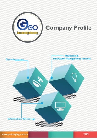
  • 1. Company Profile www.geoimaging.com.cy 2015 Information Tehcnology Geoinformation Research & Innovation management services
  • 2. 2 Geo-informatics Research & Consultancy Contents Research & Consultancy Completed EU & National funded projects Other projects 06 09 Indicative list of projects 06 Running projects as project partner 05 Running projects as coordinator 04 Our services Short profile 03
  • 3. Geo-informatics Research & Consultancy 3 Short profile GeoImaging Ltd [www.geoimaging.com.cy] is a leading SME in Cyprus, estab- lished in 2002 at Nicosia. The company offers scientific and professional solutions in Geo-informatics and IT. It is also active in Research and Development (R&D) pro- grammes, in EU & national funded projects and provides consultations services as well. TheservicesandconsultationsofGeoImagingaretailoredtowardsGeo-informaticsandITareathathelps public and private sector succeed with improving their performance and implementing projects.GeoIm- aging goal is to support its clients and partners in the responsible and successful completion of projects. The products and services span state of the art knowledge and technology from spatial/image in- formation acquisition, processing, analysis to representation and visualisation.The area of projects’ that GeoImaging is acting concerns informatics in the broader extent, i.e. Photogrammetry, Com- puter Vision, Imaging, 3D modelling,Visualisation, GIS, IT & Software Development, Mobile & Web Applications, Databases & Data Mining, Cartography, Remote Sensing, Surveying, Geodesy and GPS. The quality management system of GeoImaging Ltd has been implemented in 2013 and is fully compliant with ISO 9001 standards. Geomatics Information Technology Research www.geoimaging.com.cy
  • 4. 4 Geo-informatics Research & Consultancy Our services Geomatics GIS & Web GIS Services Cartography & Maps Rural Surveying Services Photogrammetric Services - Laser Scanning Image Processing UAV Applications Research & Innovation management services Research Funding Consultation Project and Administrative management InformationTechnology Managing Data and Databases Mobile & Web applications
  • 5. Geo-informatics Research & Consultancy 5 Running projects as coordinator THEME: Horizon 2020 Project acronym: LARA Project full title: “LBS Augmented Reality Assistive System for Utilities Infrastructure Management through Galileo and EGNOS” Grant agreement no: 641460 Timetable: ongoin Website: www.lara-project.eu THEME:Ambient Assisted Living (AAL) Project acronym: SOPHIA Project full title: “AAL project SOPHIA - Senior Occupation after Profession: Habit Intriguing Adults “ Grant agreement no: AAL-2013-6-119 Timetable: ongoin Website: www.sophia-aal.eu Research LARA SOPHIA
  • 6. 6 Geo-informatics Research & Consultancy Running projects as project partner THEME: Life Long Learning Programme (LLP) Project acronym: ATMAPS Project full title: “Specification of symbols used on audio-tactile maps for individuals with blindness” Grant agreement no: 543316-LLP-1-2013-1-GR-KA3-KA3MP Timetable: ongoing Website: www.atmaps.eu THEME: SiS.2012.1.3.3-1 Scientific data: open access, dissemination, preservation and use Scien- tific data: open access, dissemination, preservation and use Marie-Curie Actions Project acronym: RESPONSIBILITY Project full title: “Global Model and Observatory for International Responsible Research and Innova- tion Coordination ” Grant agreement no: 321489 Timetable: ongoing Website: www.responsibility-rri.eu THEME:Ambient Assisted Living (AAL) Project acronym: ELDERS UP! Project full title: “Adaptive system for enabling the elderly collaborative knowledge transference to small companies” Grant agreement no: AAL-2013-6 Timetable: ongoing Website: www.eldersup-aal.eu Completed EU & National funded projects THEME: Research for the benefit of SMEs / Research for SMEs. Project acronym: SCOLIO-SEE Project full title: “3D-image processing system for helping physicians in the diagnosis and monitoring of scoliosis” Grant agreement no: 315217 Timetable: from 10/2012 to 07/2015 Website: www.scolio-see.eu THEME: FP7-ENV-2013- Environment (including climate change) Project acronym: IASON Project full title: “Fostering sustainability and uptake of research results through Networking actvites in Black Sea & Mediterranean areas.” Grant agreement no: 603534 Timetable: from 7/2013 to 05/2015 Website: www.iason-fp7.eu ATMaps RESPONSIBILTY ELDERSUP SCOLIO-SEE IASON
  • 7. Geo-informatics Research & Consultancy 7 THEME: EUROSTARS Project acronym: FORSAT Project full title: “A satellite image processing platform for high resolution forest assessment” Grant agreement no: E!7358 Timetable: from 11/2012 to 10/2014 Website: www.forsat.eu THEME:AMBIENT ASSISTED LIVING JOINT PROGRAMME - ICT for ageing well. Project acronym: T&Tnet Project full title: “Travel &Transport solutions through emotional-social NETworking” Project no: AAL-2011-4-032 Timetable: from 07/2012 to 12/2014 Website: www.ttnet-aal.eu/ THEME: Research for the benefit of SMEs / Research for SMEs. Project acronym: NUTRISTAT Project full title: “Real-tme, in-situ, N, P, K, pH and electrical conducvity soil-analysis system to facili- tate accurate” nutrient management Grant agreement no: 286489 Timetable: from 01/2012 to 12/2013 Website: www.nutristat-project.com THEME: Research for the benefit of SMEs / Research for SMEs. Project acronym: DE-MONTES Project full title: “Deformation Monitoring by High ResolutionTerrestrial Long Range Sensing” Grant agreement no: 285839 Timetable: from 01/2012 to 12/2013 website: www.de-montes.eu/ THEME: Research for the benefit of SMEs / Research for SMEs. Project acronym: Champi-ON Project full title: “Fully automatic system for picking and handling mushrooms for the fresh market: from the growing bed to the cooling storage.” Grant agreement no: 262037 Timetable: from 02/2011 to 01/2013 Website: www.champi-on.eu/ THEME: ENV.2010.4.1.4-1 , Identification and Networking of EO activities in the Balkan area Project acronym: OBSERVE Project full title: “Strengthening and Development of Earth Observation Activities for the Environment in the Balkan Area” Grant agreement no: 265282 Timetable: from 11/2010 to 10/2012 Website: www.observe-fp7.eu CHAMPI-ON OBSERVE NUTRI-STAT FORSAT T&Tnet DE-MONTES
  • 8. 8 Geo-informatics Research & Consultancy THEME:TRANSPORT (including AERONAUTICS) Project acronym: REACT Project full title:“Supporting REseArch on Climate-friendly Transport” Grant agreement no: 233984 Timetable: from 08/2009 to 07/2011 Website: www.react-transport.eu THEME: FP7-SiS-2008-1.2.2.1. Promotion of pan-European and International Awareness of the ethical aspects of Security Technologies Project acronym: ETHICAL Project full title: “Promoting International Debate on Ethical Implications of Data collection, use and retention for Biometric and Medical Applications” Grant agreement no: 230550 Timetable: from 01/2009 to 12/2010 Website: www.ethical-fp7.eu THEME: ICT-2-5.3Virtual Physiological Human Project acronym: RADICAL Project full title: “Road mapping technology for enhancing security to protect medical & genetic data” Grant agreement no: 223965 Timetable: from 07/2008 to 06/2010 SURF-DATA PROGRAMME: Bilateral Cooperation Cyprus – Slovenia Project acronym: SURF-DATA Project full title: “Surface reconstruction from unorganised datasets” ACTION: Information & Communication Technologies Grant agreement no: CY-SLO/0407/11 Timetable: from 12/2007 to 11/2009 Digital cities in Cyprus PROGRAMME: Providing access to international research infrastructures Project acronym: MOST Project full title: “Digital cities in Cyprus: the technology of permanent GPS network stations in serv- ing society” ACTION: - Grant agreement no: ERYEX/0406/02 Timetable: from 09/2006 to 08/2008 MOST SURF-DATA ETHICAL RARICAL REACT
  • 9. Geo-informatics Research & Consultancy 9 Indicative list of projects The following list of projects presents an indicative picture of the projects implemented by the company the last 6 years. Title: Surveing services for the development of mobile network all over the Cyprus Year: 2014 - 2015 Reciepient: CYTA telecom Geoinformatics Projects
  • 10. 10 Geo-informatics Research & Consultancy Title: Survey, Investigation,Assessment, Project Designs for four Monuments 1. Agios Panteleimonas Monastery in Myrtou/Mirtu/Camlibel 2. The Walls between Othello Tower/Citadel and Arsenal Gate both faces 3. Ravelin/Land Gate of the Famagusta Walls 4. Martinengo Bastion of the Famagusta Walls Year: 2014 Title: Topographical survey of the views and streets of the project “Neightborhood of creative companies” of the old town of Nicosia. ” Year: 2014 Reciepient: Nicosia Municipality Title: Topographic mapping, leveling and legal survey activity for land demarcation in Nicosia Year: 2013 Reciepient:The Church of Cyprus Geoimaging was contracted for the topographic mapping, leveling and boundaries definitions for a large area of the Church of Cyprus. The measurements were carried out with ground surveying methodswith the use of 2 GPS and a total station.The field work lasted for 5 days. Electronic drawings, Digital Elevation Model and contour lines were produced.The accuracy of the measurements was approximately 1-3 cm.
  • 11. Geo-informatics Research & Consultancy 11 Title: Leveling and creation of DTM for quarries located in Mitsero and Farmaka – Calculations of volumes Year: 2012 Recipient: Quarries Gennadius Theologous & Sons Ltd Our company was hired to provide the DTM of the 2 quarries in Mitsero and Farmaka and the calculation of the volume.The measurements were carried out with ground surveying methods with the use of 1 GPS.The field work lasted for 2 days. Electronic drawings, Digital Elevation Model and contour lines were produced.AutoCAD Civil 3D was used for the calculation of the volume.The accuracy of the measurements was approximately 1-3 cm. Title: Analytical determination of the Cyprus geoid Year: 2010-2011 Reciepient: Department of Lands &Surveys, Ministry of Interior, Republic of Cyprus Title: Implementation of investments projects in the field of water/wastewater and solid waste in Cyprus, Sur- veying Services for the creation of waste water treatment planes and number of pumping stations Year: 2010 Reciepient: European Commission Title: Topographic mapping and surveying of roads and building facades in the urban areas of: within the walls of Nicosia, Kaimakli and Pallouriotissa Year: 2009-2010 Recipient: Nicosia Municipality Geoimaging was responsible for the high accuracy measurements in a densely populated area.The measurements were carried out with ground surveying methods with the use of 2 GPS and 2 – 7 total stations.The field work lasted for 1.5 month. Electronic drawings Digital Elevation Model were produced. Underground services such as EAC and sewerage canals were merged to the drawings.The accuracy of the measurements was approximately 1-3 cm.
  • 12. 12 Geo-informatics Research & Consultancy Title: Topographic mapping and levelling of the area of the new cemetery of Nicosia Year: 2009-2010 Reciepient: Municipality of Nicosia Title: Topographic mapping, levelling and definition of boundariesof a large piece of land in Dali Year: 2009-2010 Reciepient: Iakovos Photiades Foodstaff suppliers Geoimaging was contracted for the topographic mapping, leveling and boundaries definitions for 2 large plots.The measurements were carried out with ground surveying methods with the use of1 GPS.The field work lasted for 3 days. Electronic drawings, Digital Elevation Model and contour lines were produced.The accuracy of the measurements was approximately 1-3 cm. Title: Topographic Mapping, leveling and production of DTM for a plot in Platres Year: 2009 Recipient: LOIS BUILDERS LTD Geoimaging was contracted for the topographic mapping and leveling for a large plot in the mountainous and dense vegetation areaof Platres.The measurements were carried out with ground surveyingmethods with the use of 2 GPS.The field work lasted for 2 days. Electronic drawings, Digital Elevation Model and contour lines were produced.The accuracy of the measurements was approximately 1-3 cm.
  • 13. Geo-informatics Research & Consultancy 13 Title: Topographic mapping and surveying of central square and adjacentroads in the community Pelendri Year: 2009 Reciepient: Polytia Armos - Architects, Planners, Engineers Title: Topographic mapping, leveling and legal survey activity for land demarcation In Larnaka Year: 2008 Reciepient: Larnaka District Administration Geoimaging was chosen for the topographic mapping, leveling and boundaries definitions for a large plot in Choirokoitia.The measurements were carried out with ground surveying methods with the use of 2 GPS.The field work lasted for 1 day. Electronic drawings, Digital Elevation Model and contour line were produced.The acc uracy of the measurements was approximately 1-3 cm. Title: Aerial Photography and production of photogrammetric products in Agios Amvrosios Limassol Year: 2007 Recipient:Vicerio Holdings This project called for low altitude aerial photography in order to provide detailed drawings for the development of golf course residential complex and hotel. Geoimaging subcontracted airplane from Israel.
  • 14. Title: Aerial Photography and production of photogrammetric products in Agios Amvrosios & Paramali Limassol Year: 2004 Recipient:Aristo Developers For this project Geoimaging produced high accuracy photogrammetry maps, Orthophoto maps DTM and countour lines. Title: Aerial Photography and production of photogrammetric products in Ha Potami Paphos Year: 2002 Recipient:Aristo Developers For this project Geoimaging produced high accuracy photogrammetry maps, Orthophoto maps DTM and countour lines for the study and development of golf course and residential complex.
  • 15. info@geoimaging.com.cy T1: + 357 22 447770 F : + 357 22 374988 6 Georgiou Seferi Street Office 102 1076 Nicosia, Cyprus Contact us Follow us www.facebook.com/geoimaging www.twitter.com/geoimaging www.geoimaging.com.cy