
Recommended
Recommended
More Related Content
More from Matt Stubbs
More from Matt Stubbs (20)
Recently uploaded
Recently uploaded (20)
Big Data LDN 2018: BUILDING AN AIR QUALITY ROUTE APP FOR CITIZENS
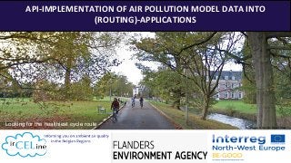
- 1. 1 API-IMPLEMENTATION OF AIR POLLUTION MODEL DATA INTO (ROUTING)-APPLICATIONS Looking for the healthiest cycle route Image © Google Street View
- 5. 5 FUTURE MODEL IMPROVEMENT? Citizens science measurement campaign (20000 samples across Flanders) Further model improvement based on measurements Testing of potential of low-cost sensors Improve definition & modelling of Street Canyons Validation & calibration Use of measurements ‘qualified sensors’ for model improvement © mathworks Improved traffic emission data
- 7. € 8,000,000,000BE Lost work days Sick days Healthcare Agriculture 7 Source: European Commission Intro:Why? Cost of air pollution (economy)
- 8. 12,580BE 467,000EU 8 ● Lung cancer ● Brain damage ● Brain cancer ● Increase in number of asthma exacerbations ● Respiratory problems ● Acute asthma exacerbation ● Decreased lung function ● Cardiovascular problems, Heart attacks (strokes) Intro:Why? Source: European CommissionCost of air pollution (health:deaths) Chronic Acute
- 9. 9 Remark: air pollution climate change E.g. planes: very limited impact on air pollution Air pollution CO2 Traffic (cars, diesel cars, trucks) is by far the most important cause of air pollution exposure to pedestrians and cyclists in Flanders, followed by households (especially wood stoves;less important in summer). Also agriculture and industry contribute to some extent. NO2 , BC , PM2.5 , VOC, ... PM2.5 ,PM10, , … Context Causes of air pollution
- 10. 10 However severe air pollution can cause as serious/severe health effects as smoking, the attitude towards smoking (general accepted publicity ban and banning of smoking in public places) is far different than the attitude towards cars and wood stoves (no restrictions on publicity, as good as no restrictions on use) Sources: (1) https://www.tubefilter.com/2015/06/29/made-man-fiat-defy-media-big-black-bigger-is-better/ (2) http://www.alaskafireplace.com/ (3) https://www.magazine-advertisements.com/marlboro-cigarettes.html (4) Not subjected to copyright (1) (2) (4) (3)
- 11. 11 We can reduce air pollution exposure for cyclists and pedestrians by 1. Smart-design of cycle paths, separated from traffic. 1. Reduce traffic, ban/tax cars, ban/tax wood stoves. 2. Developing an application simulating healthiest route, encouraging people to choose a healthier route alternative. 3. Raising awareness for causes of air pollution. 4. In general , cyclists and pedestrians are recommended to avoid as much as possible ‘city rings’ and car-busy ‘street canyons’. Trajectory measurements of Black carbon in peak hours, May-June 2016, Leuven, Belgium The overview of those measurements confirms that in generally, the city ring is the most polluted, with only some small exceptions, the car-busy ‘Street Canyons’ (very small streets with high buildings). 1 2 3 4 5 (based on data of (Leuven 2030))
- 12. OUR PROCESS 12 WCS Data Exchange Model Rio-IFDM Real_Time chain API Literature Review Data-preparation Data-Analysis Data-validation API Optimization Scientific Publication Demo Application (in cooperation with private sector) API implementation in existing routing applications METHODOLOGY 3 “ end products” - Scientific publication - Demo application - Implementation of API
- 13. 13 Traffic Road (Antwerp, BE) Bicycle Highway (Antwerp, BE) +256%vs. Bicycle highway (measurements) Measurements (mean): 3.38 µg/m3 IFDM annual map 2016 1.41 µg/m3 +6% compared to bicycle highway IFDM OSPM annual map 2016 1.64 µg/m3 +14% compared to bicycle highway OSPM Research Results Measurements (mean) 1.32 µg/m3 IFDM annual map 2016 1.33 µg/m3 OSPM annual map 2016 1.44 µg/m3 IFDM specific period 2017 1.86 µg/m3 +9% compared to bicycle highway IFDM OSPM specific period 2017 2.16 µg/m3 +23% compared to bicycle highway OSPM IFDM specific period 2017 1.70 µg/m3 OSPM specific period 2017 1.76 µg/m3 © Google Street View
- 14. IFDM Real Time wrongly suggests to prefer traffic road in some cases because of serious underestimation of air pollution on high-traffic roads and street canyons, and a simulated difference in air pollution between bicycle highways and traffic roads that is far below the differences of trajectory measurements. If we simulate for 72 randomly selected dates, the healthiest route at 08h, 13h and 17h, the IFDM real time chain suggests that the bicycle highway is the best choice in 70% of the cases and the traffic route 16% of the time. According to OSPM, the bicycle highway is better 100% of the time for BC and NO2, which is also suggested by the measurements and very likely is true. Significant difference in air quality for different route alternatives ? 14 Real Time RIO-IFDM chain not suitable to use for implementation in routing applications Based on t.test
- 15. Comparison with pollutants Left: Difference for pollutants between bicycle highway and traffic road for IFDM annual map (e.g. BC : 6% difference, NO2: 4% difference) Right: same for OSPM (Atmostreet) Map (e.g. BC: 14% difference, NO2 10% difference between traffic road and bicycle highway) Comparison of pollutants annual model maps 15
- 16. 16 ResultsDaily pattern of air pollution concentrations (annual, 2016) Average hourly Black Carbon (BC) concentrations for 2016 of Flanders (brown), a cycle-highway in Antwerp (blue) and a traffic-busy road in Antwerp (yellow). The vertical bars represent the daily average. Model: OSPM-ATMOSTREET static annual hourly maps 16
- 17. 17 Same results if we repeat analysis for other routes at other locations (e.g. Leuven, 3 routes) 1.76µg/m³ 1.70µg/m³ 1.63µg/m³1 2 3 1 2 3
- 18. 18 ➔ Most correlated with traffic than other pollutants including NO2 ➔ (somewhat) More correlated with PM 2.5 than NO2 ➔ BC is most damaging pollutant in terms of health effects CONCLUSIONS BC seems to be most suitable pollutant to use For similar (time, distance) route alternatives, there is in most cases a route with significant lower air pollution concentrations
- 19. Model Evaluation: Overall score based on 5 measures COE Tells something about predictive advantage of model R2 Important insights in the spatial correlation between observations and model FAC2 Tells which % of the modelled value is unacceptable far from the observation RMSE Overall performance measure of how close modelled values are to observed values IOA Average relative error, comparing model deviations with observed deviations from the mean The index of agreement can detect additive and proportional differences in the observed and simulated means and variances 1919 © Rstudio open air package
- 20. 20 ➔ OSPM annual maps always beat IFDM annual maps ➔ Real-time IFDM unsuitable (see higher), real-time OSPM not yet available CONCLUSIONS OSPM annual-hourly maps seem to be by far the best in terms of performance , in all cases (yearly maps of hourly air quality : OSPM 00h, 01h, 02h, 03h, …)
- 21. 21 Evolution of number of cyclists on weekdays during day on counting points (fietstelweek, 2016). Evolution of number of cyclists in weekend during day on counting points (fietstelweek, 2016) Black carbon map of flanders Atmostreet model Annual mean 08h
- 22. 22 End product 1: Scientific Publication Scientifically sound methodology to implement air pollution data in (routing) apps
- 23. 23 End product 2: Demo application Cooperation with existing routing planner or new app based on existing routing API
- 24. 24 End product 3: Implementation of API in many different routing apps and recreational apps (?)
- 25. 25 Only for pedestrians and cyclists, not for cars!!! Applications based on our API:
- 26. 26 Value proposition Financial benefits for the company Quality label, permanent quality control Societal benefits Benefits for individuals ➔ Advertising ➔ Money from customers (e.g. free version with ads, pay version without ads, but same content) ➔ Initial funding from Be-GOOD project (only demo-application) ➔ Cooperation with IRCEL-CELINE guarantees permanent quality control ➔ Cooperation with IRCEL-CELINE provides a kind of ‘quality label’ to the designed application ➔ Reduced Health Care costs, increased productivity, … ➔ (possibly) increased traffic safety, reduction of traffic casualties (indirectly people are suggested to take route with fewer cars) ➔ Acquisition of knowledge ➔ Health benefits: less respiratory problems, less strokes (cardiovascular attacks) (short term), reduced cancer risk (long term) (1) Sources: (2)https://www.rydoze.com/cycling-benefits (2) (4) (4)