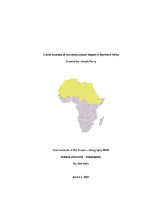
2. Introduction:
The Sahara Desert spans over 9,000,000 km2
of North Africa, and is the second‐largest desert in the
world apart from the continent of Antarctica. Overall it is one of the least populated regions of the
African continent; however, there are several groups of people who have settled and adapted to the
harsh climates of the region. There are seven countries that make up the geographical region of
Northern Africa, they are: Algeria, Egypt, Libya, Morocco, Sudan, Tunisia, and Western Sahara; however,
several other countries can be considered part of this as well because they also have land located within
the Sahara, these countries are: Chad, Djibouti, Ethiopia, Eritrea, Mali, Mauritania, and Niger.
The fourteen countries listed above are the focus of this research paper and I will concentrate on key
factors in the region. These factors include a brief history, human impact, climate data, population data,
and my conclusion, with thoughts on the future of the desert. I have spent a considerable amount of
time compiling various data related to one of the world’s greatest environmental masterpieces. It is my
hope at the conclusion of this document readers will gain a better understanding of the Sahara, and will
have a starting point for further research into the content presented.
Brief History:
Scientists believe the Sahara was formed about seven million years ago; “In the Sahara region, the age
of onset of the desert condition
has been uncertain until now. Here we report on the discovery
of
7,000,000‐year‐old eolian dune deposits from the northern
Chad Basin. This geological archive is the
oldest known evidence
for desert occurrence in the Sahara.” (Schuster 2006) Since its formation the
climate has been relatively unchanged; however the boundary has changed several times over the past
hundred‐thousand years due to climate fluctuations, such as monsoons, and the various ice ages
throughout Earth’s history.
Human Impact:
As with any environmental system humans have the ability to change the course of nature thus affecting
the natural evolution of a species or biome. Recently scientists have begun studying how humans are
affecting the desert and perhaps causing expansion of its boundaries. The process in which a desert
expands either by human influence or climate changes is called ‘desertification’ and is defined as;
“Desertification is the impoverishment of terrestrial ecosystems under the impact of man. It is the
process of deterioration in these ecosystems that can be measured by reduced productivity of desirable
plants, undesirable alterations in the biomass and the diversity of the micro and macro fauna and flora,
accelerated soil deterioration, and increased hazards for human occupancy.” (Goudie 68/2000)
One example of human influence for the expansion of the desert occurred in a study done in 1975 by
Lamprey; he attempted to measure the advance of the Sahara in vegetation zones in the Sudan.
Lamprey’s research revealed the desert did expand by about 90 to 100 kilometers between 1958 and
1975, or an average of 5.5 kilometers per year. (Goudie 69/2000)
4. on the gro
fighting. T
long‐term
grazing pr
give grea
overall re
the right
more hars
Climate D
As you ca
the Sahar
Mediterra
boarding
and less d
presents a
rest of th
1971 and
of the diff
As stated
2000 for t
temperat
July and A
season.
°
5°
10°
15°
20°
25°
30°
35°
ound and in t
The perennial
m, above‐aver
ressure is ver
ter evidence
ecovery perio
circumstance
sh making rec
Data:
an imagine th
ra does not h
anean climat
the south of
dry climate in
a different cli
e country. Th
2000; some
ferent climate
before, this i
the entire reg
ure. As you c
August, wher
Clim
the devastate
l species have
rage rainfall in
ry low due to
to the caus
d being extre
es and amoun
covery more
e climate in t
have the sam
e along their
the desert w
n their savann
imate along t
his climograp
individual clim
e variations in
is an average
gion, some co
can see the te
e June leads
mograph
ed and unreg
e not re‐estab
n the 1950s, t
the absence
ses of desert
emely slow. W
nt of time; ho
difficult, thus
the desert is
me climate in
r coastlines a
ill feature a v
nah areas wh
he Nile River
ph shows the
mographs ca
n the Sahara.
of total prec
ountries with
emperature a
up to the rai
‐ Sahar
enerated veg
blished thems
the late 1960
of permanen
ification bein
We do know
owever, my b
s recovery wil
very dry, hot
all sections.
and further s
very dry/hot c
here vegetatio
basin and de
average yea
n be seen in t
cipitation and
h more desert
and precipita
iny season an
ra Desert
getation 25 ye
selves in spite
0s, and the ea
nt water.” (Go
ng exacerbat
environment
belief is that
ll take many l
t, and windy;
Northern co
south the de
climate to the
on can be see
elta, but has a
arly precipitat
the appendix
d temperature
t areas will fe
tion are at th
nd Septembe
0.00
2.00
4.00
6.00
8.00
10.00
12.00
14.00
16.00
18.00
t (Regio
ears after the
e of several s
arly 1970s, alt
oudie 73/200
ed by huma
tal recovery
desert enviro
lifetimes to b
; however, th
oastal cities a
esert climate
e north, but a
en bordering
a desert clima
tion and tem
x of this repo
es between t
eature less ra
heir peak dur
r is the typica
nal Aver
Average Am
Average Te
e conclusion o
series of years
though in this
00) This study
n activity an
is possible if
onments are
be seen.
he regional ar
nd nations h
begins. Cou
a somewhat c
g the Sahara.
ate throughou
perature bet
rt as a compa
the years 197
ainfall and a h
ring the mont
al end of the
rage)
mount of Rain (
mperature (C°
of the
s with
s area
y does
d the
given
much
rea of
have a
ntries
cooler
Egypt
ut the
tween
arison
71 and
higher
ths of
rainy
(cm)
°)
6.
Another way for showing climate data in the world ecosystems is the Köppen Climate Classification
System. The Köppen system was developed in Germany by a climatologist named Wladimir Köppen
between 1900 and 1936. The Köppen system uses a series of letters to represent various climate types
throughout the world. According to the Köppen system, the Sahara Desert fits into the classification of
BWh: Dry/Arid (Hot) – Low Latitude Desert. (McKnight 2000/212)
Köpper Classification for Sahara Desert
BWh: Dry/Arid (Hot) ‐ Low Latitude Desert
• Evaporation exceeds precipitation
• On average precipitation is less than
half of potential evaporation
• Usually lower latitude, hot desert
climate
• Mean average temperature is over
18C°, frost absent or infrequent winter
• Locations:
• Northern Mexico/Southwestern United
States/Baja California
• Northern Africa/Saudi
Arabia/Iran/Western India
• Central/Western Australia
• Southern and Western Africa
Map adapted from: http://www3.shastacollege.edu/dscollon/images/Maps‐Images/world_climate_map.jpg
7. Population Data:
Population data in the Sahara region is difficult to gather prior to the year 1950; however, there have
been recent additions to the data between 1950 and 2005. Generally throughout the area the
population is made up of a younger generation, specifically under the age of ten years old. The primary
factor for having such a young population is because in less‐developed countries children are seen as
assets because these countries are primarily an agrarian society where young labor forces are essential.
The opposite end of this would be countries like the United States, or European Nations where people
have fewer children because they are a liability (monetarily, physically, etc) until adulthood. The primary
method for obtaining an overall view of population age distribution is through the use of a population
pyramid, which separates people by age group and shows the portion of the population they occupy.
Rubenstein discusses the population pyramid stating, “The shape of a pyramid is determined primarily
by the crude birth rate in the community. A country in state 2 of the demographic transition, with a high
CBR, has a relatively large number of young children, making the base of the population pyramid very
broad. On the other hand, a country in stage 4, with a relatively large number of older people, has a
graph with a wider top that looks more like a rectangle than a pyramid.” (Rubenstein 68/1999)
I have created a population pyramid for the countries of the Sahara Desert region of Northern Africa
being reviewed in this report. The data is from a census done in 2005 by the United States Census and
can be found in the International Data Base (IDB) on their website.
The population pyramids on the next page compare data from what I consider to be more developed
and less developed countries in this region. The two countries being compared are Egypt, which has a
somewhat modern society, and Sudan, which still has a more agricultural society with little industry.
30.00 20.00 10.00 0.00 10.00 20.00 30.00
0 ‐ 4
10 ‐ 14
20 ‐ 24
30 ‐ 34
40 ‐ 44
50 ‐ 54
60 ‐ 64
70 ‐ 74
80 +
Population in Millions
Age of Pupulation
Population Pyramid of Northern Africa 2005Male Female
10.
The final method for population analysis I am going to discuss is the Guttman Scalogram Technique.
According to Trochim, “The purpose of Guttman scaling is to establish a one‐dimensional continuum for
a concept you wish to measure.” (Trochim 2006) The scalogram, in this case, uses socio‐economic
factors commonly associated with more developed countries to determine whether the country is
developed or underdeveloped. I have chosen to use access to clean sanitary sewer systems (SS), gross
domestic product (GDP), and literacy rate (LR) to determine the development status of this region.
Country
% Pop. w/Sanitary
Sewer Access
Per Capita GDP
2006 USD
Literacy Rate
(% above 15yo)
Algeria 90.5% $ 7,700 69.9%
Chad 30.0% $ 1,500 25.7%
Djibouti 41.0% $ 1,000 65.5%
Egypt 70.0% $ 4,200 71.4%
Eritrea 18.5% $ 1,000 56.7%
Ethiopia 11.5% $ 1,000 42.7%
Libya 96.5% $ 12,700 82.6%
Mali 48.5% $ 1,200 19.0%
Mauritania 36.5% $ 2,600 51.2%
Morocco 57.0% $ 4,400 50.7%
Niger 23.5% $ 1,000 14.4%
Sudan 37.0% $ 2,300 61.1%
Tunisia 76.0% $ 8,600 74.3%
Western Sahara n/a n/a n/a
Total Average 49.0% $ 3,785 52.7%
0
50
100
150
200
250
300
0
100
200
300
400
500
600
700
800
1950 ‐ 1955 1970 ‐ 1975 1987 1995 2005 2025 2050
Avg. Population x 10000
Per 1,000 Population
Demographic Transition ‐ Sahara Region of Africa
CBR CDR GR Population
Stage 3Stage 2 Stage 4
11. Scale of Degree of Development ‐ Northern Africa
Country More Developed (1) Less Developed (0)
SS GDP LR SS GDP LR Total
Algeria X X X 3
Chad X X X 0
Djibouti X X X 1
Egypt X X X 3
Eritrea X X X 1
Ethiopia X X X 0
Libya X X X 3
Mali X X X 0
Mauritania X X X 0
Morocco X X X 2
Niger X X X 0
Sudan X X X 1
Tunisia X X X 3
Western Sahara n/a
Source Data: CIA World Fact book https://www.cia.gov/cia/publications/factbook/countrylisting.html
Total numbers range from 0 to 3, where the higher number represents a more developed country.
Algeria, Egypt, Libya, and Tunisia rank as the most developed countries using the criteria surveyed for
this study. These countries have established governmental systems and policies, economic production,
and higher literacy rates, all of which lead to the higher total score. The location of the ‘X’ is determined
by taking a total average of the data in each category; data falling below the average will receive an ‘X’
in the less developed section, whereas data higher than the average will receive an ‘X’ in the more
developed section.
Conclusion:
For all its majesty the Sahara is one of the most brutal climates on Earth; “Do not regret the passing of
the camel and the caravan. The Sahara has changed, but it remains a desert without compromise, the
world in its extreme. There is no place as dry and hot and hostile. There are few places as huge and as
wild.” (Langewiesche Pg. 3/1996)
It is my belief the environment will remain unchanged over the next few decades with only mild
expansion of the desert; however, it should be noted that human influence and/or global warming may
alter the normal progression. The demographic transition shows most of the region just entering stage
4, which will most likely continue to occur over the next 25 years. One of the biggest issues with the
population will be the AIDS epidemic continuing to spread at a high rate in the region unless adequate
measures are taken to control its advance.