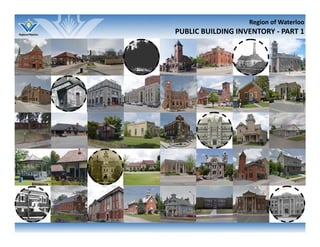
1. Region of Waterloo
PUBLIC BUILDING INVENTORY ‐ PART 1
2.
3. REGIONAL MUNICIPALITY OF WATERLOO MAP …..……………………………….…...…………………………………………….
SECTION ONE: Public Building Inventory Project Introduc on ……………………………………………………….…………
1.1 What is the purpose of this project?..............................................................................................
1.2 What is meant by purpose‐built public buildings?.........................................................................
1.3 What type of public buildings are included?..................................................................................
1.4 How is the inventory organized?....................................................................................................
1.5 Why inventory public buildings?....................................................................................................
1.6 What is the goal of the inventory?.................................................................................................
SECTION TWO: Methodology .………………………………………………………………………………………………………………….
2.1 Inventory …………………..………………………………………………………………...………..…………………………………
2.1.1 Public Buildings ……………………………………………………………..…….…………………………………..
2.1.2 Included Buildings …………………………………………………………….….………………………………….
2.2 Comple ng the Inventory …………………………………………………….………….….……………………………………
SECTION THREE: Analysis of Findings ………………………………………….……………………………………………………………
3.1 Public Building Construc on by Decade ……………………………………………………………………………………
3.2 Public Buildings by Area Municipality ………………………………………………………………………………………..
3.3 Public Buildings by Category ……………………………………………………………………………………………………..
3.4 Public Building Acknowledgment Status ……………………………………………………………………………
SECTION FOUR: Building Profiles …………………………………………………………………………..…………………………………
4.1 Community Mee ng Spaces ……………………………………………………………………………………………………..
4.2 Health, Safety & Security …………………………………………………………………………………………………………..
4.3 Communica ons ……………………………………………………………….………………………………………………………
4.4 Public U li es ………………………………………………………..…………………………………………………………………
4.5 Transporta on …………………………………………………………………………………………………………………………
4.6 Recrea on & Culture ……………………………..……………………………….………………………………………………..
APPENDICES .……………………………………………………………………………………………………………………………………………
Appendix A ‐ Demolished Purpose‐built Public Buildings ………………………………………………………………..
Appendix B ‐ Descrip ons of Official Heritage Acknowledgments ..…………………………………………………
Appendix C ‐ Summary of Findings ……………………………………………..…………………………………………………..
INDEX ………………………………………….……………………………………………………………………………………………………………….
Table of Contents
(Top to bo om) Galt CPR train sta on c.1911; Galt fire sta on c.1910,
courtesy of the Cambridge Archives; Middleton Pumping Sta on
1902, courtesy of the Toronto Public Library.
i
ii
ii
ii
ii
ii
ii
iii
iv
iv
iv
v
v
vii
vii
viii
viii
ix
1
2
16
48
58
86
100
150
151
153
156
170
4. i
Regional Municipality of Waterloo
LEGEND
Area Municipal Boundaries
Provincial Highways
Regional Roads
HESPELER
PRESTON
GALT
5. ii
1.0 Public Building Inventory Project Introduc on
1.0 Public Building Inventory Project Introduc on
The Public Building Inventory project is an ini a ve of the Region of
Waterloo’s Heritage Planning Advisory Commi ee (HPAC), undertaken
between 2009 and 2015.
1.1 What is the purpose of the project?
The purpose of the project is to iden fy cultural heritage resources in the
Region of Waterloo that are purpose‐built public buildings, and to assess
their cultural heritage value. The inventory iden fies public buildings in the
Region, which includes seven area municipali es: the ci es of Kitchener,
Waterloo, and Cambridge, and the Townships of North Dumfries, Woolwich,
Wilmot, and Wellesley.
1.2 What is meant by purpose‐built public buildings?
Purpose‐built public buildings are “structures that are built for the specific
purpose to serve the needs of the public.” For this inventory, public
buildings include structures associated with all levels of government (local,
regional, provincial and federal), as well as public commissions, and
prescribed public bodies.
1.3 What types of public buildings are included?
Purpose‐built public buildings include: courthouses, post offices, city/town/
township halls, water pumping sta ons, water towers, fountains, hydro‐
electric plants and related buildings, train, trolley, and bus sta ons, airports,
community centres, swimming pools, arenas, parks and related buildings,
schools, colleges and universi es, administra ve buildings, fire halls, police
sta ons, libraries, museums, hospitals, and clinics.
Public buildings constructed prior to 1951 have been recorded. Some
excep ons were made for public buildings that were built post‐1950 due to
the significance of their cultural heritage value to the community. Pre‐1951
was chosen as a cut off point as there was a substan al change in growth,
development, and architectural design beginning in the late 1940s to early
1950s.
However, it is important to recognize that public buildings constructed
post‐1950 can possess equal or even stronger cultural heritage value or
significance to a community, indica ng that age does not always factor into
the significance of a place.
1.4 How is the inventory organized?
In this report, seven categories with associated colour codes were developed
to represent the wide range of public building uses, and they include:
Community Mee ng Spaces (red); Health, Safety & Security (grey); Communi‐
ca ons (magenta); Public U li es (yellow); Transporta on (brown); Culture &
Recrea on (green); and Educa on (blue). Due to the vast number of
educa onal buildings inventoried, they have been recorded in a companion
document, Part 2: Educa onal Buildings.
1.5 Why inventory public buildings?
Public buildings were specifically chosen to be inventoried due to the key
role they play, and have played, in the growth, development, and change
that has occurred in the Region of Waterloo’s communi es since the first
se lers arrived from Europe in the early 1800s.
Public buildings are helpful in understanding how a community came to exist,
which ac vi es were perceived with great importance, and which resources
the public was willing to invest in for the be erment of their families, towns
and villages. These buildings are also places that communi es relied on daily.
Preston Public Library, c.1910, courtesy of Cambridge Archives.
6. iii
For many, their first interac on with a public building was a hospital on the
day we were born. For others, it may have been the first day of school, or the
first day we were taken to the local library or community pool.
In addi on, since many purpose‐built public buildings remain in public
ownership, it is hoped that this research will highlight and help to priori ze
the conserva on of the collec ve heritage value contained in these shared
public resources.
1.6 What is the goal of the inventory?
The goal is to iden fy and increase awareness of the cultural heritage value
of exis ng public buildings in the Region of Waterloo, notably the value of
their historic and cultural contribu ons to the development of the Region
and crea on of a broader sense of community.
It is hoped that the Public Building Inventory will provide a more comprehen‐
sive understanding of the evolu on of these structures and the central role
they have played in the func oning of the Region’s communi es.
The informa on provided in the inventory includes general informa on on
221 public buildings. Some entries contain more informa on than others.
Best efforts were made to inventory as many public buildings as possible
constructed prior to 1951. However, there are s ll structures that may be
missing from the inventory or unknown at this me. The inventory will be a
con nuously evolving document, and will be updated as new informa on is
obtained. This construc ve process of con nually upda ng the informa on in
the Public Building Inventory will help to ensure that the final product is as
comprehensive and accurate as possible.
Demolished public buildings were not included to Part 1 or Part 2 of the
Public Building Inventory, but were instead compiled into a list included in
Appendix A: Demolished Purpose‐Built Public Buildings. Refer to Sec on
2.1.2 Included Buildings for more informa on on demolished public
buildings in this inventory.
For more informa on, or to submit any comments, suggested revisions or
addi onal informa on, please email the Region of Waterloo at
planninginfo@regionofwaterloo.ca, or call 519‐575‐4400 and ask for the
Culture Services Division.
Wellesley Fire Shed, n.d.; Wellesley Historic Neighbourhood Study, Wellesley Township Heritage &
Historical Society.
Courtesy of the Cambridge Archives, (le ) c.1922, (right) c.1960.
7. iv
2.0 Methodology
2.0 Methodology
The overall goal of the Public Building Inventory was to iden fy and evaluate
public buildings located in the Region of Waterloo. Research and site visits
were undertaken to inventory and assemble informa on on 221 public
buildings. The resources inventoried provide a balanced and diverse
representa on of purpose‐built public buildings in the Region.
2.1 Inventory
A standardized method for gathering informa on on public buildings was
created and included four categories: general informa on, physical
components, descrip ve details and historical associa ons. The general
informa on compiled on each structure, includes: date of construc on,
name of architect, and original use. If it was available, more detailed
informa on, a map, and photographs were also collected.
The chart on the right defines the categories that were used to organize the
informa on found for each public building.
2.1.1 Public Buildings
As men oned in Sec on 1.0 Public Building Inventory Project Introduc on,
public buildings are structures that were constructed to serve the needs of
the public. These buildings have been grouped into eight categories:
Community Mee ng Spaces: town halls, city halls, council chambers,
community centres, farmers markets, etc.
Health, Safety & Security: forts, military bases, armouries, hospitals,
clinics, police sta ons, fire sta ons, court houses, jails, prisons, bomb
shelters, etc.
Public U li es: Administra ve buildings, public works buildings, public
u li es buildings, water pumping sta ons and associated buildings,
registry offices, hydro‐electric power sta ons and associated buildings,
dams, etc.
Communica ons: post offices, customs houses, radio broadcas ng
sta ons, telephone service buildings, etc.
Transporta on: railway sta ons, trolley sta ons, bus sta ons, airports,
canals, highways, transporta on routes, parking garages, etc.
Culture & Recrea on: Libraries, museums, arenas, swimming pools,
auditoriums, bandstand, parks and associated buildings, etc.
Educa on: schools, colleges, universi es, etc.
Please note that cemeteries, places of worship, and monuments/cenotaphs
are not included in this inventory. Below, Sec on 2.1.2 explains the ra onale
for inclusion and exclusion of public buildings in the inventory.
2.1.2 Included Buildings
8. v
Personnel of the Galt Fire Department; Courtesy of the Cambridge Archives, 1927.
The inventory includes purpose‐built public buildings that were constructed
prior to 1951, regardless of their current use. However, the inventory
typically does not include public buildings that were originally built for
private use and converted to public use or public buildings that have been
demolished. A list of known demolished public buildings is included as an
appendix to this inventory to provide a more complete understanding of the
tradi on of public building construc on in the Region, and also to aid future
researchers (refer to Appendix A: Demolished Purpose‐Built Public Build‐
ings).
Purpose‐built public buildings refer to structures that were constructed for
the specific purpose of serving the public. For example, a building that was
originally a post office and is currently a restaurant would be included, but a
building that was originally built as a house and is now a museum would not
be included in the inventory.
It was determined that cemeteries and places of worship would not be
included in the Inventory as many of these resources have been previously
iden fied and inventoried by other researchers. They were also not included
due to the fact that religious structures are typically built by a community
within the community, and many in the general public do not consider them
public assets. It is also important to note that separate schools or Catholic
schools, which are associated with private/religious organiza ons, were
considered public buildings for the purposes of this inventory as they were,
and con nue to be, funded by public tax dollars and are a ended by a broad
cross sec on of the community. This same ra onale was also used when
adding St. Mary’s Hospital in Kitchener to the inventory even though it was
established by a group of Catholic nuns.
It is important to recognize that throughout the Region of Waterloo’s history,
the public and private spheres have worked together, and in some cases,
were highly intertwined when it came to public u li es and services. This was
especially evident with hydro‐electric power services, water services,
transporta on and health care. Many of these services were ini ally started
by private enterprises, but became so integral to the local community that
they were eventually acquired by the public through the town council.
Many privately owned places, such as hospitals, water pumping sta ons,
railway sta ons and various public parks, were used by the public. In looking
back at the defini on of purpose‐built public buildings, “structures that are
built for the specific purpose to serve the needs of the public,” it was
determined that structures built by a private enterprise with the inten on of
servicing the public should be considered public buildings and included in the
inventory.
2.2 Comple ng the Inventory
The buildings included in the Public Building Inventory were iden fied using a
variety of sources:
Publica ons (newspapers, books)
Area Municipal Heritage Registers and Inventories
Websites
Local historical walking and driving tours
Site plans from the Waterloo Region District School Board
Road maps
Archival images
Local residents and local history experts
Tweedsmuir local history books
9. vi
Preston Public School, 1905; Courtesy of the Toronto Public Library, New Hamburg Hockey Team, 1908; Courtesy of the Township of Wilmot Archives.
Waterloo Historical Society history volumes
Historic maps and aerial images
Local historical socie es
Municipal Heritage Planners and staff
Local history books
Google Maps (www.google.ca)
Primary research was undertaken specifically to iden fy one‐room school‐
houses as many of these structures had not been previously inventoried.
Their iden fica on has contributed to a more complete list of public
buildings. Local heritage exper se, in addi on to the use of maps, archival
research and images were helpful in iden fying and researching each school.
All educa onal structures, including one‐room school houses, have been
inventoried in Part 2.
Another method of research included the collec on of oral histories by local
residents of the Townships, some of whom were current members of the
Region of Waterloo’s Heritage Planning Advisory Commi ee (HPAC). Site
visits to the ci es and townships were made with these HPAC members and
regional staff to photograph sites, as well as to iden fy addi onal public
buildings for inclusion in the inventory.
A list of the sources used to research the inventoried buildings is included
within each individual building entry under the “Sources” heading.
10. vii
3.1 Public Building Construc on by Decade
When looking at the dates of construc on for the buildings iden fied in the
Public Building Inventory, the graphs to the right illustrate two construc on
peaks, one between 1850 and 1859 and the second between 1920 and 1929.
The first peak may be associated with the establishment of Waterloo County
in 1853 and the establishment of the four townships that same decade,
which resulted in a great deal of se lement growth. The second peak may be
a result of the construc on boom that occurred a er WWI. The steep decline
in construc on during the 1930s is likely due to the Great Depression, which
dras cally reduced growth and development in the Region.
It is interes ng to note that the City of Kitchener (then Berlin) began to
construct more public buildings than other area municipali es between 1910
and 1919, then doubled its rate of construc on the following decade from
1920 to 1929, and ul mately constructed the largest number of public
buildings un l 1939.
Please Note: The analysis provided in this report does not include the
following 19 buildings: three pre‐1929 buildings, eight pre‐1951 buildings,
seven post‐1950 buildings, and S.S. #28 Waterloo Township: Victoria School.
Victoria School was not included in the analysis as it was discovered a er the
analysis had been completed. Pre‐1929 and pre‐1951 buildings were
excluded as an exact date of construc on is not known, making it unclear
where in the graph these 11 buildings should be placed. All that is known
about their dates of construc on are that they were built prior to a year, such
as 1929 or 1951. Regarding structures built post‐1950, it was thought that
because the focus of this public building inventory project was on buildings
constructed before 1951, any buildings that were built a er 1950 should be
excluded.
3.0 Analysis of Findings
12. ix
3.4 Public Building Acknowledgment Status
Many of the structures included in the Public Building Inventory possess
different types of acknowledgment or recogni on, either officially or
unofficially. Official acknowledgment included: designa on under Part IV or V
of the Ontario Heritage Act (OHA); lis ng on a Municipal Heritage Register;
recogni on or classifica on by the Federal Heritage Buildings Review Office
(FHBRO) under the Treasury Board Policy on Management of Real Property;
protec on under the Heritage Railway Sta ons Protec on Act (HRSPA); or
the Planning Act as a Cultural Heritage Landscape (CHL); iden fica on as a
Na onal Historic Site (NHS) by Parks Canada; or easements held by the
Ontario Heritage Trust (OHT). Unofficial acknowledgment included
iden fica on: in a walking tour, a city inventory, a CHL study, or as an
honourable men on.
Overall, most of the public buildings (39%) possessed no form of official or
unofficial acknowledgment. However, of those that were recognized, 23%
were designated under Part IV of the OHA, 17% were listed on a Municipal
Heritage Register, 7% were designated under Part V of the OHA, 4% were
iden fied in a city inventory, 4% were iden fied in a CHL study, 2% were
included in a walking tour, 1% were recognized by FHBRO, 1% were protected
under the HRSPA, and 0.4% were each iden fied as a NHS, OHT easement, or
as an honourable men on. Wilmot Township provides a good example of an
honourable men on. When their formerly designated grandstand was
destroyed by fire just months a er it was protected under Part IV of the OHA,
the new grandstand was given an honourable men on on the Township’s
Municipal Heritage Register.
One of the most interes ng observa ons was that Woolwich, Wellesley and
Wilmot Townships currently have very few acknowledged buildings, while
Kitchener and Cambridge possess the most diverse range of acknowledgment
for their public building stock. This finding could be the result of more staff
and financial resources available to the ci es to research, protect and
interpret their built heritage resources.
13. 1
Building Profiles
Map depic ng the loca on of inventoried public buildings in the Region of Waterloo.
Public buildings
included in the
inventory
LEGEND
15.
3
Address: 4805 William Has ngs Line, Crosshill
Date built: 1855
Building use: Township Hall, Community Hall, Place of Worship
Building name(s): Wellesley Township Hall; Township of Wellesley Council
Chambers
Current owner: Township of Wellesley
Acknowledgment
Status:
Designated under Part IV of the Ontario Heritage Act
(1987), By‐law 66‐87
Architect: Unknown
Design/Style: Vernacular Classical Revival Style with its pedimented
gable and turned porch posts. There is also some
coursing on the front façade.
Materials: Rough rubble stone
Building
integrity:
In the summer of 1973, an addi on was made to the
back of the hall, and the original por on of the building
was restored.
Community Mee ng Spaces:
Wellesley Township Hall
James Arteaga, June 2015
16.
4
Associated
people:
‐
Historical
contribu ons:
Council mee ngs in Wellesley Township first began in
Hawkesville in 1852 (loca on unknown) when the Town‐
ship was founded. In 1853, 35 ratepayers pe oned the
Council to move the mee ngs to a more central loca on.
Council agreed and chose Crosshill as the site for a new
Township Hall.
The hall was completed in 1855 and has been used as a
community hall, a place of worship by several denomina‐
ons, and of course, as the council chambers for Wellesley
Township. The current administra ve building for the
Township is located in St. Clements (4639 Lobsinger Line).
The Township Hall in Crosshill is considered to be the
oldest municipal building s ll in use today in the Region of
Waterloo.
Contextual
significance:
The Township Hall is associated with the development of
the municipal government of Wellesley Township. The
building is also associated with the village landscape of
Crosshill, and contributes to the streetscapes of William
Has ngs Line and Hutchison Road.
Maps:
Community Mee ng Spaces:
Wellesley Township Hall
Sources: “Heritage Wellesley: Designated Proper es,” Wellesley Township
Heritage and Historical Society, n.d.
h p://www.wellesleyhistory.org/heritage‐wellesley.html
Parks Canada, “Wellesley Township Hall,” Canada’s Historic Places,
n.d., h p://www.historicplaces.ca/en/rep‐reg/place‐lieu.aspx?
id=9720&pid=0
James Arteaga, June 2015
18.
6
Associated
people:
‐
Historical
contribu ons:
The land on which the former Wilmot Township Hall was origi‐
nally built was purchased from Peter S. and Magdalena Gingerick
who sold it to the District of Wellington Council in 1845.
The site at the corner of Wilmot Centre Road and Bleams Road,
was chosen due to of its geographic loca on in the centre of
Wilmot Township, hence the name Wilmot Centre. Tax revenue
of 75 pounds was used to erect the Township Hall, which was in
use un l 1858.
In 1867, the Hall was sold to William Asmus of New Hamburg for
$80. He moved the building to New Hamburg where it was
converted into a house.
The Oasis in the Centre monument in Wilmot Centre was erect‐
ed on the 150th anniversary of the forma on of Wilmot Town‐
ship in 2000. Its low wall was meant to represent the original
loca on of the old Township Hall's founda on.
A er the Township Hall was sold in 1867, a second Hall was
constructed in Baden by Jacob Beck in 1858 (27 Beck Street)
that was to house the Fi h Division Court of the County of Wa‐
terloo. It was constructed of mber frame and clapboard siding.
In 1967, a er the comple on of the third Township Hall, named
Centennial Hall in Baden (formerly at the corner of Beck Street
and Mill Street), the second Hall was sold and subsequently
moved to its current loca on at the Black Creek Pioneer Village
in Toronto.
Centennial Hall was used un l 1973, when amalgama on took
place under the Region of Waterloo Act, and most of the Town‐
ship departments moved to the old New Hamburg Town Hall
(121 Huron Street). The Township Administra ve Offices re‐
mained there un l 1992 when they were moved to Castle
Kilbride. Centennial Hall was demolished in 2012.
Contextual
significance:
The former Wilmot Township Hall is associated with the devel‐
opment of the municipal government of Wilmot Township and
the landscape of New Hamburg. The building also contributes to
the streetscape of Boullee Street and Jacob Street.
Sources: Fisher, Barry; Fisher, Pat, “Baden Outlook: Notes from the A c‐The
History of Wilmot’s Town Halls,” Vol. 13:6, January 2014, pg. 32‐33.
h p://www.badenoutlook.com/PDFs/Archives/Jan%2014‐2.pdf
HPAC Member, Marg Rowell.
Community Mee ng Spaces:
Wilmot Township Hall (Former)
Maps:
(Le to right) Original loca on, current loca on.
Original loca on of Wilmot Township Hall; Google Street View, May 2015.
19.
7
Address: 56‐58 Cambridge Street, Cambridge (Galt)
[Originally located at 46 Dickson Street, Cambridge]
Date built: 1838
Building use: Township Hall, School, Residence
Building name(s): Dumfries Township Hall, The Ark, Noah’s Ark
Current owner: Private
Acknowledgment
Status:
Designated under Part IV of the Ontario Heritage Act
(1983)
Architect: Alex Scrimger, exterior designer; Duncan Shepherd,
interior designer
Design/Style: Georgian
Materials: Stucco over clapboard
Building
integrity:
The building was moved from its original loca on at the
old Galt City Hall in 1857.
Community Mee ng Spaces:
Dumfries Township Hall (Former)
Google Street View, June 2014
20.
8
Associated
people:
Lord John George Lambton, the earl of Durham, or Lord
Durham for short, was the Bri sh poli cal reformer who
advocated for government reform in Bri sh North America
in his controversial report called, “Durham Report.” It is
said that his first mee ng on government reform in Upper
Canada was held at the Dumfries Township Hall.
Historical
contribu ons:
Originally built on the site of the old Galt Town Hall at 46
Dickson Street, the building, known locally as “The Ark” or
“Noah’s Ark” for the balconies that are no longer part of
the building, remained on the site un l construc on began
on the Galt Town Hall in 1857.The building was sold and
moved to Cambridge Street, and it has since been a private
residence. The land on which it was originally located had
been owned by Donald Fraser as early as 1817.
This was Dumfries Township’s first Township Hall, prior to
the Township’s division into both North Dumfries and
South Dumfries. Early se lers would meet outside the Hall
each January for the annual Township mee ng. The upper
floor, which was only accessible through an outside stair‐
case, housed the Township’s first grammar school (high
school) for two years. This grammar school would later be
known as Galt Collegiate Ins tute.
It is said that the lower storeys were used for shows and
theatrical performances, public mee ngs, and as a general
gathering place for the Township fathers who enacted laws
and regula ons that guided the development of the area.
Contextual
significance:
The Township Hall is associated with the development of
the municipal government in North Dumfries Township.
The building also contributes to the streetscape on
Cambridge Street.
Maps:
Community Mee ng Spaces:
Dumfries Township Hall (Former)
(Le to right) Original loca on, current loca on.
Sources: “Durham Report,” Historica Canada, n.d.
www.thecanadianencyclopedia.ca/en/ar cle/durham‐report/
Taylor, Andrew, “Our Todays and Yesterdays: A History of the
Township of North Dumfries and the Village of Ayr,” North Dumfries
and Ayr Centennial Commi ee, 1970, pg. 41‐43.
21.
9
Address: 46 Dickson Street, Cambridge (Galt)
Date built: 1857; 1858 (official opening)
Building use: Town Hall, City Hall
Building name(s): Galt Town Hall, Cambridge City Hall
Current owner: City of Cambridge
Acknowledgment
Status:
Designated under Part IV of the Ontario Heritage Act
(1982); Received an Ontario Heritage Founda on
easement.
Architect: H.B. Sinclair and R. Burrows, architects; Peter Stokes,
architect (1965 renova on); E.R.A. Architects Inc. (2008
Design/Style: Italianate style with Georgian‐inspired features such as
its projec ng pedimented bays and simple cornice.
Materials: A base and trim in Galt limestone with split fieldstone
used on the upper storeys.
Building
integrity:
The clock tower was added in 1897. In 1965, the City
Hall was renovated according to plans designed by a
well‐known architect specializing in the reclama on of
old Ontario buildings, Peter Stokes.
The City Hall was further altered in 1990 to become the
permanent home of the City of Cambridge Archives. In
2008, the historic City Hall was again renovated and
expanded and linked to the adjoining administra ve
building. It was the first city hall in Canada to achieve
LEED Gold cer fica on.
Community Mee ng Spaces:
Galt Town Hall (Former)
Top: Unknown, 2012; Bo om Le : 1910; Bo om Right: 1902 (Courtesy of the Toronto Public Library)
22.
10
Associated
people:
Architect H.B. Sinclair, originally from Galt, and was credit‐
ed with the Italianate design of the Town Hall and Market.
Sinclair was said to have collaborated with R. Burrows to
construct the building to his original design.
Historical
contribu ons:
The historic Cambridge City Hall is an Italianate public hall and
market built in 1857 and clad in ashlar grey granite. The cost
of the building was £4,650. Construc on was delayed due to
arguments between the architects, Sinclair and Burrows. In
1897, the clock tower was added in celebra on of Queen Vic‐
toria’s Diamond Jubilee.
The site is historically significant for its associa on with the
early development of the Town of Galt, and for its con nued
use as a centre for municipal governance. It has been the site
of local government since 1838 when the Dumfries Township
Hall was built (located at 56‐58 Cambridge Street). By 1856,
Galt had grown into a town and local leaders felt the old
township hall had an outdated appearance. That same year,
the township hall was sold for $130 and moved to its current
loca on. At the opening ceremonies of the new Galt Town
Hall in 1857, a me capsule was buried, yet no trace of the
capsule was found during any of the renova ons.
In 1972 the former Galt Town Hall became City Hall for the
newly amalgamated City of Cambridge. The building was fur‐
ther altered in 1990 to become the permanent home of the
City of Cambridge Archives. And in 2008, the historic City Hall
was again renovated and expanded and linked to the adjoin‐
ing administra ve building. It was the first city hall in Canada
to achieve LEED Gold cer fica on.
Contextual
significance:
The building is associated with the development of local gov‐
ernment in Galt (now Cambridge). It is architecturally signifi‐
cant as an example of a typical town hall built in Ontario dur‐
ing the mid‐19th century. It is considered a landmark by the
local community, and contributes to the streetscape of Dick‐
son Street.
Maps:
Sources Biographical Dic onary of Architects in Canada 1800‐1950,
h p://dic onaryofarchitectsincanada.org
“Cambridge Landmarks,” Cambridge Times, Cambridge Archives and
Cambridge Municipal Heritage Advisory Commi ee.
Dilse, Paul. “A remarkable heritage: Programs and policies for heritage
conserva on in Cambridge, Ontario.” Heritage Cambridge, Architectur‐
al Conservancy of Ontario: Cambridge Branch. 1981. University of
Waterloo, Porter Library.
Heritage Cambridge, “Old Galt Historical Walking Tour, Cambridge,
Ontario,” 1996. Kitchener Public Library, Grace Schmidt Local History
Room.
“Ontario Heritage Proper es Database,” Government of Ontario:
Ministry of Culture, 2004. h p://www.hpd.mcl.gov.on.ca/scripts/
hpdsearch/english/default.asp
Parks Canada, “Cambridge City Hall,” Canada’s Historic Places, n.d.
h p://www.historicplaces.ca/en/rep‐reg/place‐lieu.aspx?
id=7606&pid=0
The City of Cambridge Archives Presents Cambridge’s Historic City Hall
Community Mee ng Spaces:
Galt Town Hall (Former)
23.
11
Address: 61‐63 Spring Street, Cambridge (Hespeler)
Date built: 1860
Building use: Town Hall, Fire Hall, Library, Residence
Building name(s): Hespeler Town Hall, Hespeler Old Town Hall
Current owner: Private
Acknowledgment
Status:
Designated under Part IV of the Ontario Heritage Act.
Architect: Unknown
Design/Style: Vernacular, Georgian influences
Materials: Stone
Building
integrity:
Modified to accommodate conversion to a residence;
wing addi on.
Community Mee ng Spaces:
Hespeler Town Hall (Former)
Associated
people:
The building may have been built/commissioned by
Jacob Hespeler as he constructed the row houses
connected to the building on the east side.
Historical
contribu ons:
This was the original Town Hall in Hespeler, which also
served as the Fire Hall and first library.
Contextual
significance:
The building is associated with the growth and
development of local government in Hespeler (now
Cambridge). It is also associated with the village land‐
scape of Hespeler, and contributes to the streetscape
of Spring Street.
Sources: Heritage Cambridge., “Town of Hespeler: Historical Walking
Tour,” Kitchener Public Library, Grace Schmidt Local History
Room, 1996.
Map
Google Street View, June 2014
24.
12
Address: 11 Tannery Street East, Cambridge (Hespeler)
Date built: 1914
Building use: Town Hall, Fire Hall, Community Centre
Building name(s): Hespeler Town Hall, Hespeler Fire Hall, Hespeler
Heritage Centre
Current owner: City of Cambridge
Acknowledgment
Status:
Designated under the Ontario Heritage Act (2001),
By‐law 194‐01.
Architect: John Evans and Henry G. Fulford (Evans & Fulford),
architects; Grill Brothers, builders
Design/Style: Beaux Arts
Materials: Brown brick
Building
integrity:
Major renova ons were completed in 1976 for the Fire
Hall por on of the building.
Community Mee ng Spaces:
Hespeler Town Hall/Fire Hall (Former)
Google Street View, June 2014
25.
13
Associated
people:
John Evans (1872‐1944), the building architect, was a well
known architect in Galt and spent his professional career
there prac cing from 1910 onward. He worked as a sole
prac oner with the excep on of his collabora on with
Henry G. Fulford on a design for the Hespeler Town Hall.
Another notable building, which Evans was responsible for,
is Manchester Public School in Cambridge (455 Dundas
Street).
Historical
contribu ons:
The building was built in 1914 and designed by John Evans
of the architectural firm Evans and Fulford. The builders
were Grill Brothers. The former Town Hall and Fire Hall
were designed in the Beaux Arts style. This was Hespeler’s
second Town Hall. The first is s ll located at 61‐63 Spring
Street.
A part of the second and final Town Hall in Hespeler is also
the second and current Fire Hall. The building ini ally
housed the: mayor’s office, clerk’s office, police depart‐
ment, jail, taxa on office, board of health, welfare office,
and the council chambers.
Contextual
significance:
The building is associated with the development of
municipal government in Cambridge (now Hespeler), as
well as the development of fire safety in the town.
The building is associated with the town landscape of
Hespeler, and is considered a landmark by the local
community. The building contributes to the streetscape of
Tannery Street East.
Maps:
Community Mee ng Spaces:
Hespeler Town Hall/Fire Hall (Former)
Sources: “Biographical Dic onary of Architects in Canada 1800‐1950,” n.d.
h p://dic onaryofarchitectsincanada.org
Cambridge Landmarks. Cambridge Times. Cambridge Archives and
Cambridge Municipal Heritage Advisory Commi ee
City of Cambridge, “City Departments: Fire Sta ons, Trucks and
Apparatus,” n.d., h p://www.cambridge.ca/cs_firedept/fire‐
sta ons.php?sta on=2&cpid=38&sid=117
Heritage Cambridge (Ont.). “Town of Hespeler: Historical Walking
Tour,” Kitchener Public Library, Grace Schmidt Local History Room,
1996.
Parks Canada, “Hespeler Town Hall,” Canada’s Historic Places, n.d.
h p://www.historicplaces.ca/en/rep‐reg/place‐lieu.aspx?id=1163
4&pid=0
Pike, Roland, “Policing in Waterloo County 1850‐1973,” Waterloo
Historical Society, Vol. 78, 1990, pg. 158‐177.
26.
14
Community Mee ng Spaces:
Cambridge Farmers’ Market
Address: 40 Dickson Street, Cambridge (Galt)
Date built: 1887 (one‐storey building); 1896 (two‐storey building)
Building use: Market Building, Cambridge Farmers’ Market
Building name(s): Cambridge Farmers’ Market
Current owner: City of Cambridge
Acknowledgment
Status:
Designated under Part IV of the Ontario Heritage Act
(1984)
Architect: William Fulton, builder (1887 building); Frederick
Mellish, architect; W. Edmonds, mason; W. & F. A.
Sco , carpenters (1896 building).
Design/Style: Vernacular
Materials: Red (two‐storey por on) and yellow brick (one‐storey
original por on)
Building
integrity:
The building was restored in 2002.
Google Street View, June 2014 Courtesy of the Toronto Public Library, 1902
27.
15
Community Mee ng Spaces:
Cambridge Farmers’ Market
Associated
people:
Frederick Mellish, the building’s architect, was born in Galt
in 1860. Mellish was responsible for many notable
buildings in Galt and the surrounding area, including the
Galt Hospital (1891), the Galt Fire Hall (1898); and the Galt
Carnegie Library (1905).
Historical
contribu ons:
The market building is constructed of two separate build‐
ings, built at different mes. The one storey sec on was
erected in 1887 and was built by mason, William Fulton,
under the supervision of William Graham. The two storey
sec on was built in 1896 and was designed by local archi‐
tect, Frederick Mellish. It was built by W. Edmonds, mason,
and W. & F. A. Sco , carpenters.
The upper floor of the two storey sec on housed the Galt
Public Library un l 1905. Star ng in 1907, the upper floor
served as rehearsal rooms for The Galt Kil e Band. The
Galt Kiwanis Youth Band also used the rooms for rehearsal
from 1949 to 1972. The rooms were converted into munici‐
pal offices in 1978.
Contextual
significance:
The Cambridge Farmers' Market has been in opera on
since c.1830 making it the third oldest market in the
Canada. Since this me, it has remained in the same
loca on and has maintained its reputa on as a true
Farmers' Market.
The building is associated with the growth and develop‐
ment of not only the Town of Galt, but also North Dumfries
Township. The building contributes to the streetscape of
Dickson Street, and is considered a landmark by the local
community.
Maps:
Sources: Corpora on of the City of Cambridge. “City of Cambridge Heritage
Proper es Inventory.” 2006. h p://www.cambridge.ca/related Docs/
2006%20Heritage%20Inventory.pdf
Dilse, Paul. “A remarkable heritage: Programs and policies for heritage
conserva on in Cambridge, ON” Heritage Cambridge, Architectural
Conservancy of Ontario: Cambridge Branch, 1981. University of
Waterloo, Porter Library.
Government of Ontario, Ministry of Culture. “Ontario Heritage
Proper es Database,” 2004. h p://www.hpd.mcl.gov.on.ca/scripts/
hpd search/english/default.asp
Heritage Cambridge, “Old Galt Historical Walking Tour, Cambridge,
Ontario,” 1996. Kitchener Public Library, Grace Schmidt Local History
Room.
Jim Quantrell, Archivist, City of Cambridge Archives www.cambridge.ca
Cambridge Farmers’ Market. Canada’s Historic Places, 2007.
29.
17
Health, Safety & Security:
Freeport Sanatorium
Address: 3570 King Street East, Kitchener (Freeport)
Date built: 1926‐27 (Nurses’ Residence); 1929‐30 (Main Treatment
Building); 1932 (Pump House, Power House and Shed);
1935‐36 (Mens’ Residence); 1938‐39 (Medical Superin‐
tendent’s Residence); Pre‐1951 (Laundry Building)
Building use: Hospital
Building name(s): Freeport Sanatorium, Freeport Hospital, Freeport
Military Hospital, Grand River Hospital at Freeport
Current owner: Grand River Hospital
Acknowledgment
Status:
Listed by the City of Kitchener on the Municipal
Heritage Register; Iden fied as an Ins tu onal Cultural
Heritage Landscape by the City of Kitchener.
Architect: B.A. Jones (architect) and Dunker Company (contractor)
responsible for the main treatment building (also 1950
addi on), the nurses’ residence (also the 1933 and
1940 addi ons), and the medical superintendent’s
residence; Arthur C. Torry, architect of the 1926 nurses’
residence; Arthur H. Sharpe, landscape architect;
Barne & Rieder designed the 1953 east wing addi on
to the nurses’ residence.
Design/Style: Minimalist Georgian Revival (main treatment building);
Colonial style (nurses’ residence )
Materials: Red and yellow brick, concrete and wood
Building
integrity:
Addi ons were made to the nurses’ residence in 1933,
1940 and 1953. Addi ons were also made to the main
treatment centre in 1932, 1937‐38 and 1950. In 1931, a
landscape plan was developed and implemented for
the site. Numerous other buildings have been con‐
structed since the 1950s, with along‐term health care
village constructed in the 1980s and a mental health
expansion in 2010. Top and bo om: Grand River Hospital, n.d.
30.
18
Associated
people:
Arthur H. Sharpe, of Oakville, was the landscape architect
responsible for the design of the hospital grounds. He is
known for his landscape plan of Shoreacres Estate, known
today as Pale a Park in Burlington.
Historical
contribu ons:
The original story of the Freeport Sanatorium began with a
boy in the 20th century who had contracted Tuberculosis.
His parents a ended St. Peter’s Church, where the pastor
built a shelter for the boy and cared for him. As the years
con nued more and more ci zens, both in Waterloo
County and the surrounding area, were suffering from the
illness, known then as Consump on.
An An ‐Consump on League was formed in 1908 to create
awareness about the illness, and to create interest in the
crea on of an ins tu on where these pa ents could be
treated in isola on from the public. A year later, there
were 70 deaths in the County, and a commi ee was
formed to find a suitable site for the proposed sanatorium,
as well as find support from municipali es in the County.
Three years later, in 1911, the Berlin Sanatorium Associa‐
on was formed at St. Peter’s parsonage.
The commi ee had recommended the Benjamin Shantz
property in Freeport as an appropriate site due to its
loca on outside the urban centre of Berlin, its abundance
of fresh air, high eleva on, and a large stone house located
on the 15‐acre lot. Berlin’s Town Council purchased the
land in 1912 and the house was remodeled (now demol‐
ished) to make it suitable for a hospital. However, not long
a er in 1916, the Military Hospital Commission requested
to use the Sanatorium and Convalescent home for its
soldiers who had contracted the illness in the Great War.
Berlin agreed to handover the hospital in an effort to show
their support for the war. (cont’d)
Health, Safety & Security:
Freeport Sanatorium
Google Street View, August 2011
31.
19
Health, Safety & Security:
Freeport Sanatorium
Historical
contribu ons:
The Freeport Military Hospital resided in this loca on un l
1920, when it was deemed unnecessary to have a separate
military sanatorium for soldiers.
The year the Freeport Military Hospital closed, interest in
having a civilian sanatorium was once again sparked.
Efforts to raise funds started almost immediately in the
surrounding communi es of Waterloo County. The
Waterloo County Health Associa on was formed out of
this interest.
In an Editorial included in Kitchener’s “Daily Telegraph,” it
compared the efforts made by the community to erect the
sanatorium to the efforts the local community made in
establishing the House of Industry and Refuge in 1867.
Since the early 1920s, the hospital has seen many addi ons
and changes, beginning with the one‐storey wooden
pavilion erected by the Military Hospital in 1918. This
structure was later demolished in 1929 when the three‐
storey main building was constructed (built by Dunker
Company and designed by B.A. Jones of Kitchener).
That same year, the original farmhouse and the wooden
pavilion were demolished. In 1923, a new two‐storey white
stucco residence was built to replace the old Military
Hospital’s quarters. In 1926, the nurses’ residence was
built as a two‐storey Colonial Style building, with an
addi on constructed in 1933. The two‐storey building was
designed by Arthur C. Torry of Galt.
In the 1940s, a er becoming a successful sanatorium, the
hospital expanded its services to include intensive
preventa ve and diagnos c work in order to eradicate
Tuberculosis from not only Waterloo County, but also the
surrounding areas. (cont’d)
Google Street View, (Top) August 2011; (Bo om) May 2014
32.
20
Historical
contribu ons:
A er this was successful in the 1950s, with the assistance
of chemotherapy treatments, the hospital moved into
other areas of medicine, specifically chronic‐rehabilita ve
care in 1957.
By the late 1980s, major development once again occurred
with the construc on of a complex used for a long‐term
health care village, which is s ll in existence today.
Again in 2010 the hospital was expanded to accommodate
a facility dedicated to mental health treatment.
Contextual
significance:
The Freeport Sanatorium was constructed outside the city
limits of the former Town of Berlin and was considered to
be built on the highest eleva on of any of the 14 similar
medical sites that existed in Ontario.
The hospital is associated with the historic fight against
Tuberculosis not only in the Region of Waterloo, but also in
the Province of Ontario. Today it is a regional healthcare
facility offering specialized services.
Sources: City of Kitchener, The Landplan Collabora ve Ltd, “City of Kitchener
Cultural Heritage Landscape Study,” October 2014, pg. 12.
h p://www.kitchener.ca/en/livinginkitchener/resources/PLAN_ CHL_
STUDY_Report.pdf
Dilse, Paul; Stewart Peter; Robb, George, “Conserva on Ac on Plan
for the Nurses’ Residence Doctor’s Residence and Medical Superinten‐
dent’s Residence at the Freeport Sanatorium Site 3570 King Street
East, Kitchener, Ontario,” Parkin Architects Limited, April 2009.
U ley, William Velores, “A History of Kitchener,” The Chronicle Press,
Waterloo, 1937, pg. 404‐406.
h p://www.ourroots.ca/e/page.aspx?id=1083391
Maps:
Health, Safety & Security:
Freeport Sanatorium
33.
21
Health, Safety & Security:
Kitchener‐Waterloo Hospital (Grand River Hospital)
Address: 835 King Street West, Kitchener
Date built: 1921 (Nurses’ Residence); 1948‐1952 (Hospital)
Building use: Hospital
Building name(s): Kitchener‐Waterloo Hospital, K‐W Hospital, Grand River
Hospital
Current owner: Grand River Hospital
Acknowledgment
Status:
No recogni on
Architect: A Toronto Architecture Firm (1952 hospital).
Design/Style: Wing‐type plan
Materials: Brick
Building
integrity:
In 1942, an addi on was made to the nurses’ residence,
and the School of Nursing in 1964. Since the comple on
of the hospital in 1952, various addi ons and new
buildings have been added, including the 2003 con‐
struc on of the Balsillie Family Building Cancer Centre.
Associated
people:
The hospital is associated with many members of the
community who contributed to the growth and devel‐
opment of the current Grand River Hospital, including:
Mr. Joseph E. Seagram and the Seagram family, Mr.
Jacob Kaufman and the Kaufman family, and more
recently the Balsillie Family.
The cornerstone of the current 1952 building was laid
in 1949 by the Honourable Paul Mar n, Federal
Minister of Health, and at the official opening in 1951,
the Governor General of Canada, Viscount Alexander of
Tunis, cut the ribbon.
Google Street View, Hospital (Top) April 2014, (Bo om) Hospital Complex, May 2015
34.
22
Historical
contribu ons:
Talks for a hospital in both Berlin and Waterloo began
before 1893, but that year, a mee ng was held to discuss
possible sites for a hospital. Mr. Joseph E. Seagram, a
prominent member of the Waterloo community, proposed
to donate his land, called Greenbush, for the erec on of a
hospital as long as the building was constructed free of
debt. It is said that Mr. Seagram could not build his home
on the property a er finding out it was within the bounda‐
ries of Berlin and not his local Waterloo.
Mr. Seagram’s land was a pine grove located between
Kitchener and Waterloo and it comprised part of Mt. Hope
Cemetery. When the land was donated by Mr. Seagram,
the bodies in the exis ng cemetery were moved to the
current Mt. Hope Cemetery.
The corner stone for the hospital was laid in 1894 by Hon.
John M. Gibson, the Ontario Provincial Secretary. In 1899,
an isola on hospital was built for contagious diseases, yet
due to the lack of pa ents with contagious diseases, it had
various other uses, such as a nurses’ residence and offices.
It was located at the corner of Park Street and Green
Street, and was demolished in 1962.
An addi on to the hospital was constructed in 1913, and in
1921 a nurses’ residence was built a er a $25,000 dona on
was bestowed by Mr. Jacob Kaufman, father of A.R. Kauf‐
man. Due to a need for addi onal space, the Sisters of
St. Joseph and the ci zens of the towns of Kitchener and
Waterloo built St. Mary’s Hospital in 1923.
(cont’d)
Health, Safety & Security:
Kitchener‐Waterloo Hospital
Google Street View, (Middle & Bo om) May 2015; (Top) Haysville Tweedsmuir History Book D Pg. 96
36.
24
Health, Safety & Security:
St. Mary’s Hospital
Address: 911 Queen’s Boulevard, Kitchener
Date built: 1924; 1959‐1962
Building use: Hospital
Building name(s): St. Mary’s Hospital, St. Mary’s General Hospital
Current owner: St. Joseph’s Health System
Acknowledgment
Status:
Iden fied as an Ins tu onal Cultural Heritage Land‐
scape by the City of Kitchener.
Architect: Unknown
Design/Style: Ins tu onal
Materials: Red brick
Building
integrity:
A major expansion occurred from 1959 to 1962. In
2008, new clinical and support service space was
constructed.
Google Street View, April 2014
38.
26
Health, Safety & Security:
House of Industry & Refuge Poor House Hospital (Former)
Address: 41 Indiana Street, Kitchener
Date built: c.1860
Building use: Hospital
Building name(s): Poor House Hospital, Pest House
Current owner: Private
Acknowledgment
Status:
No recogni on
Architect: Unknown
Design/Style: Vernacular
Materials: Brick
Building
integrity:
The exterior of the structure has changed li le since it was
first constructed.
Map
Associated
people:
‐
Historical
contribu ons:
The former poor house hospital was built circa 1860
and was used by the Waterloo County House of Indus‐
try & Refuge (1869‐1947) on Frederick St. It served as
the medical centre for the “inmates” that resided in the
House.
Contextual
significance:
The building is associated with the former House of
Industry & Refuge (now demolished). It is likely the last
remaining building associated with the complex. The
building also contributes to the streetscape of Indiana
Street.
Sources: Darryl Bonk, Waterloo Region Genera ons.
Mel Green. Reiko Family Records and Photographs.
Huron Expositor, June 14, 1878. “Huron County Council.”
Google Street View, May 2014
39.
27
Health, Safety & Security:
Berlin Isola on Hospital (Former)
Address: 69 Highland Road East, Kitchener
Date built: 1911‐1912
Building use: Hospital, Residence
Building name(s): Isola on Hospital
Current owner: Private
Acknowledgment
Status:
Iden fied in a city inventory
Architect: Charles Edward Cowan, architect (1855‐1930)
Design/Style: Vernacular with Arts & Cra s influences
Materials: Brick
Building
integrity:
Some addi ons and cladding have been added.
Google Street View, May 2014
40.
28
Associated
people:
‐
Historical
contribu ons:
As a direct response to the increasing popula on of Waterloo
and Berlin and the various contagious diseases that were preva‐
lent, Berlin’s Board of Health first discussed the construc on of
an isola on hospital in 1898, specifically to isolate pa ents with
diphtheria, scarlet fever, consump on, and smallpox.
The first isola on hospital was to be part of the Berlin Waterloo
Hospital and the cost for the new unit was to be divided be‐
tween the two towns. It was originally located at the corner of
Green Street and Park Street, and was demolished in 1962. A boy
named Williamson was the first pa ent admi ed in November
1899.
A er it was decided that a permanent isola on hospital was
required, land was obtained from Waterloo Township to
construct three ‘shacks’ (69, 77 and 89 Highland Rd. E.), on the
outskirts of town. At that me, there was no road, only a rough
laneway, making it quite remote. The first road in the area was
built in 1917, and a er the construc on of St. Mary’s Hospital,
more houses began to be built. It was not un l 1925 that a
proper road was constructed to the isola on hospitals as the
delivery trucks had a difficult me reaching the site.
Throughout the years, the hospitals were used for various other
infec ous diseases, including use during an influenza epidemic in
1918.
In 1944, the isola on hospitals were closed and eventually sold
to private owners. The work being done in these facili es was
moved to the newly built wing at the K‐W Hospital.
Contextual
significance:
The building is associated with the development of health care in
the City of Kitchener, and contributes to the streetscape of
Highland Road East.
Maps:
Health, Safety & Security:
Berlin Isola on Hospital (Former)
Sources: Taylor, Ryan, “The Kitchener Isola on Hospitals,” Waterloo Historical
Society, Vol. 78, 1990, pg. 74‐82
Tompkins, George, “A History of the Kitchener‐Waterloo Hospital,”
Waterloo Historical Society. Vol. 52, 1964, pg. 53‐54.
Ryan Taylor, 1999
42.
30
Associated
people:
‐
Historical
contribu ons:
As a direct response to the increased popula on of
Waterloo and Berlin and the various contagious diseases
that were prevalent, Berlin’s Board of Health first discussed
the construc on of an isola on hospital in 1898, specifical‐
ly to isolate pa ents with diphtheria, scarlet fever,
consump on, and smallpox.
Smallpox became more of a problem than other illnesses
for a me, and so in 1902 a tent was purchased from Wa‐
terloo Township and it was erected on Louis Huchnergard’s
farm as the smallpox hospital. The first pa ent was Milton
Fromm and his a endant was Levi Devi , who was paid $2
a day.
In 1907, an outbreak of smallpox caused great concern in
Berlin and Waterloo and it was thought that a permanent
hospital for smallpox should be built outside of town.
In 1908, various architects were asked for plans for an iso‐
la on hospital, including Charles Knechtel, Charles Edward
Cowan, William Beilstein, and Mr. Macklin. In 1911, it was
decided to build ’three shacks’ (69, 77 and 89 Highland Rd.
E.) with Mr. Cowan’s plans.
The Smallpox Isola on Hospital, as well as the other two
hospitals were built between 1911‐1912. The last smallpox
pa ent was cared for in 1928. In 1940, it was sold a er
being unused for 12 years.
Contextual
significance:
The building is associated with the development of health
care in the City of Kitchener, and it contributes to character
of the Highland Road East streetscape.
Maps:
Health, Safety & Security:
Berlin Isola on Hospital: Smallpox Hospital (Former)
Sources: Taylor, Ryan, “The Kitchener Isola on Hospitals,” Waterloo Historical
Society, Vol. 78, 1990, pg. 74‐82.
Tompkins, George, “A History of the Kitchener‐Waterloo Hospital,”
Waterloo Historical Society. Vol. 52, 1964, pg. 53‐54.
Ryan Taylor, 1999
43.
31
Health, Safety & Security:
Berlin Isola on Hospital: Caretaker’s Residence (Former)
Address: 79 Highland Road East, Kitchener
Date built: 1913
Building use: Caretaker’s Residence, Residence
Building name(s): Caretaker’s Residence
Current owner: Private
Acknowledgment
Status:
Iden fied in a city inventory
Architect: Unknown
Design/Style: Vernacular, Gothic influences
Materials: Yellow brick
Building
integrity:
Few altera ons made.
Google Street view, May 2014
Associated
people:
‐
Historical
contribu ons:
The building was the residence of the family responsi‐
ble for caring for the contagious pa ents at the three
isola on hospitals in the small complex.
Contextual
significance:
The building is associated with the development of
health care in the City of Kitchener, and it contributes
to character of the Highland Road East streetscape.
Sources: Taylor, Ryan. “The Kitchener Isola on Hospitals,” Waterloo
Historical Society, Vol. 78, 1990, pg. 74‐82.
Map
45.
33
Associated
people:
‐
Historical
contribu ons:
As a direct response to the increased popula on of Water‐
loo and Berlin and the various contagious diseases that
were prevalent, Berlin’s Board of Health first discussed the
construc on of an isola on hospital in 1898, specifically to
isolate pa ents with diphtheria, scarlet fever, consump‐
on, and smallpox.
The original isola on hospital was to be part of the Berlin
Waterloo Hospital and the cost for the new unit was to be
divided between the two towns. It was originally located at
the corner of Green Street and Park Street, and was
demolished in 1962. A boy named Williamson was the first
pa ent admi ed in November 1899.
A er the construc on of the three ‘shacks’ (69, 77 and 89
Highland Rd. E.) that were to be Isola on Hospitals in the
early 1910s, various different illnesses were treated here.
In the 1930s, diseases such as spinal meningi s were treat‐
ed in the Isola on Hospitals.
Also, during the days of war, soldiers sta oned in a training
centre in Kitchener (Knollwood Park Armoury), would be
sent to these Isola on Hospitals when they contracted
infec ous diseases, such as measles or mumps.
Eventually, with the steady decline in the need for these
hospitals, and the disinterest from both St. Mary’s and K‐W
Hospital to manage the sites, the three hospitals were sold
in 1944, with all ac vi es being transferred to K‐W
Hospital’s newly built wing.
Contextual
significance:
The building is associated with the development of health
care in the City of Kitchener, and it contributes to character
of the Highland Road East streetscape.
Maps:
Health, Safety & Security:
Berlin Isola on Hospital (Former)
Sources: Taylor, Ryan, “The Kitchener Isola on Hospitals,” Waterloo Historical
Society, Vol. 78, 1990, pg. 74‐82
Tompkins, George, “A History of the Kitchener‐Waterloo Hospital,”
Waterloo Historical Society. Vol. 52, 1964, pg. 53‐54.
Google Street View, April 2009
46.
34
Health, Safety & Security:
Waterloo Isola on Hospital (Former)
Address: 172 Lincoln Road, Waterloo
Date built: 1917
Building use: Hospital, Residence
Building name(s): Waterloo Isola on Hospital
Current owner: Private
Acknowledgment
Status:
Iden fied in a city inventory
Architect: Unknown
Design/Style: Three bay hipped roof frame structure
Materials: Cherry wood floors, concrete deck, clapboard siding
Building
integrity:
The front verandah was removed and the interior
completely changed during the late 1940s early 1950s.
At this me new walls and a new roof were also added
to the building.
Various addi ons were made throughout the years
including a family room and a garage. The old pa ent
rooms were altered and their sizes were changed.
Addi onal renova ons occurred during 1971‐1973, and
in 2014‐2015 the interior and exterior of the old
isola on hospital was once again renovated.
Google Street View, (Top) August 2015; (Bo om) April 2009
47.
35
Associated
people:
‐
Historical
contribu ons:
Following the joint construc on of the Berlin‐Waterloo Hospital
between the twin ci es, it was determined that there was need
to isolate pa ents with communicable diseases. As a result of
disputes related to the cost of jointly building such a place, Berlin
chose to construct isola on hospitals located on Highland Road
East.
Waterloo Town Council received a recommenda on from the
Board of Health in 1909 regarding the need for isola on
hospitals in Waterloo. In September 1909, a lot on Bridgeport
Road, in the outskirts of town, was acquired (loca on unknown).
Around 1916, it was determined by the Town Council that more
space was needed to isolate pa ents, especially those suffering
from smallpox. A lot was purchased on Lexington Road (now
Lincoln Road), which was located on a gravel hill, with gravel pits
surrounding the area. One of these pits was located across the
street from the property and was used as a garbage dump for
the town.
The isola on hospital was built circa 1917, and was a two‐storey
building with four rooms on the main floor, and an a ached
kitchen and bathroom. The caretakers quarters were on the
upper floor with outer stairways leading up to the quarters. The
caretaker would have been responsible for preparing meals,
cleaning, and disinfec ng.
A er WW2, the isola on hospital was no longer needed and the
building was eventually sold in 1947.
A er the building was sold it went through various changes,
including remodeling and the addi on of rooms. By 1973 there
were 13 rooms, an internal staircase, new roof, walls, and an
added garage and family room.
Contextual
significance:
The building is associated with the development of health care in
the City of Waterloo, and it contributes to character of the
streetscape of Lincoln Road.
Maps:
Health, Safety & Security:
Waterloo Isola on Hospital (Former)
Sources: City of Waterloo, “Waterloo Isola on Hospital,” n.d.
Taylor, Ryan, “The Kitchener Isola on Hospitals,” Waterloo Historical
Society, Vol. 78, 1990. Pg. 74‐82
Google Street View, August 2011
48.
36
Address: 73 Queen Street North, Kitchener
Date built: 1852 (Gaol); 1878 (Governor’s House)
Building use: Governor’s House & Gaol, Provincial Offence Court,
office space, public mee ng space
Building name(s): Waterloo County Governor's House & Gaol
Current owner: Regional Municipality of Waterloo
Acknowledgment
Status:
Designated under Part IV of the Ontario Heritage Act
(1981), By‐law 81‐105
Architect: David W. Gingrick, architect (Governor’s House)
Design/Style: The Waterloo County Gaol, a fine example of the Classic
Revival style, was built out of granite, stone and brick
trim. It is the only stone building in the Region built in this
style, incorpora ng brick as a decora ve feature.
The Governor's House was built in the mid‐Victorian
Italian Villa style and is one of the last exis ng houses of
this type in the area. The home reflected the Governor's
respected posi on in the Town of Berlin and features a
four‐storey tower and a Mansard roof.
Materials: Stone, brick
Building
integrity:
A rehabilita on project began in December 1999 and
was completed in December 2001.
Health, Safety & Security:
Waterloo County Governor’s House & Gaol (Former)
James Arteaga, (Top) May 2015; (Bo om) July 2015
49.
37
Associated
people:
Architect David W. Gingerich (1836‐1915) was one of the
first professional architects to prac ce in Waterloo County
from 1860 onward. Catering to the German‐speaking
community in Berlin, he obtained commissions for public,
ins tu onal, commercial and residen al buildings.
Historical
contribu ons:
The Waterloo County Gaol is the oldest exis ng govern‐
ment building in Kitchener and the last remaining original
County building. Built in 1852, the same year that Berlin
was appointed the seat of the County, the building is a
symbol of the judicial independence of the city. In the late
1840s, a compe on was held between Berlin and Galt for
the appointment of the County seat. Berlin, a smaller town
at the me, won, largely due to the dona on of land by
Frederick Gaukel, a local hotel owner, for the construc on
of the gaol. The construc on of the gaol greatly affected
the development of Berlin in the ensuing years.
The Governor's House, added in 1878, was home to the
“Gaoler” and was an integral part of this complex for 100
years.
Contextual
significance:
Both the Waterloo County Jail and the Governor's House
are important in defining the establishment of Waterloo
County. They were both part of the establishment of the
Civic District in Downtown Kitchener, and are associated
with the other civic buildings in the area today, including:
the courthouses, library, police sta on, and the regional
headquarters (successor of Waterloo County).
The Governor's House was built to fit with the exis ng
neighbourhood and to act as a visual barrier between the
surrounding community and the Jail.
Sources “Biographical Dic onary of Architects in Canada 1800‐1950,”
h p://dic onaryofarchitectsincanada.org
“Canadian Inventory of Historic Building: Regional Municipality of
Waterloo,” V5, Grace Schmidt Room of Local History, Kitchener Public
Library, Main Branch, 1987.
“Explore Kitchener’s Kilometer of Culture. Designated Heritage
Property Tour,” City of Kitchener, 2002.
Parks Canada, “Waterloo County Jail and Governor’s House,” Canada’s
Historic Places, n.d., h p://www.historicplaces.ca/en/rep‐reg/place‐
lieu.aspx?id=9216&pid=0
Regional Municipality of Waterloo, www.region.waterloo.on.ca
Maps
Health, Safety & Security:
Waterloo County Governor’s House & Gaol (Former)
50.
38
Address: 1 Valour Place, Cambridge (Galt)
Date built: 1914
Building use: Armouries
Building name(s): Galt Armouries, Colonel J.A. McIntosh DSO Armoury
Current owner: Department of Na onal Defense
Acknowledgment
Status:
Recognized Federal Heritage Building under the
Treasury Board Heritage Buildings Policy (1987)
Architect: David Ewart, architect
Design/Style: Sco sh Baronial style, Tudor‐influenced style with
fortress‐like detailing
Materials: Stone, glazed red brick
Building
Integrity:
The building appears to be well‐preserved.
Health, Safety & Security:
Colonel J.A. McIntosh DSO Armoury
James Arteaga, June 2015
52.
40
Address: 56 Dickson Street, Cambridge (Galt)
Date built: 1898
Building use: Fire Hall, Museum
Building name(s): Galt Fire Department, Cambridge Fire Hall Museum &
Educa on Centre
Current owner: City of Cambridge
Acknowledgment
Status:
Designated under Part IV of Ontario Heritage Act
(1984), By‐law 169‐84
Architect: Frederick Mellish, architect
Design/Style: An excellent example of Romanesque Revival and High
Victorian Italianate architecture. Typical of these styles,
the front façade includes a large gabled dormer, with
pilasters, brackets and den ls. The embossed “GFD,”
for Galt Fire Department, on the pediment above the
main façade contributes to the decora ve nature of the
Hall.
One of the most outstanding features of the hall is the
four‐storey pyramidal‐roofed tower, which is crowned
with ornamental brickwork trim. Also featured on the
tower are four pairs of arcaded windows with original
sashes, one pair per side.
Materials: Red brick and brown sandstone
Building
integrity:
The building is in sound condi on.
Health, Safety & Security:
Galt Fire Department (Former)
James Arteaga, June 2015
54.
42
Address: 318 Duke Street West (formerly Edward St.), Kitchener
Date built: 1913
Building use: Fire Hall
Building name(s): Berlin Fire Hall No. 2, Berlin Fire Sta on No. 2
Current owner: Private owner
Acknowledgment
Status:
Designated under Part IV of the Ontario Heritage Act
(2005), By‐law 2005‐163
Architect: William and Henry Dunker, contractors
Design/Style: Italian Villa with pilasters, voussoirs and corbel details.
Materials: This three‐storey building is constructed of red brick
with a gable roof, and the founda on is ‘ashlar’ plaster
over concrete.
Building
Integrity:
The building has been well‐maintained and is sound
condi on.
Health, Safety & Security:
Berlin Fire Hall No. 2 (Former)
James Arteaga, June 2015 Berlin News Record, November 3, 1913, pg. 1.